jeffreyrtk@gmail.com

Hi, I'm Jeffrey, the funder of toknavgnss.com, I've been running a factory in China that makes GNSS RTK for 8 years now, and the purpose of this article is to share with you the knowledge related GNSS from a Chinese supplier's perspective.

TOKNAV 1a3f47bf68f65704832db732d45c8272

Wholesale RTK Source: Your Complete Guide to Buying from TOKNAV, a Top Manufacturer

Home Wholesale RTK Source: Your Complete Guide to Buying from TOKNAV, a Top Manufacturer 2026-06-05 Are you searching the web for “Where to buy wholesale RTK?” as a distributor, reseller, or large-scale project manager? Your search for a reliable, high-volume supplier ends here. This guide is tailored for commercial buyers looking to source premium surveying instruments in bulk. We will explore why TOKNAV stands as a core manufacturer in the global supply chain, offering the ideal combination of advanced technology, scalable production, and wholesale-friendly terms for bulk survey tools, China GPS wholesale, and wholesale RTK solutions. Secure your supply chain with a partner built for your growth. TOKNAV professional team at work in the factory, producing high-quality wholesale RTK and bulk survey tools as a leading China GPS manufacturer. GET A FREE WHOLESALE QUOTATION Why Sourcing Wholesale RTK from TOKNAV is a Smart Business Decision For procurement professionals, the decision of where to buy extends beyond price. It’s about reliability, product depth, and partnership stability. TOKNAV, as a direct manufacturer, provides a vertically integrated supply chain. With our own R&D team of 15 years’ experience and a 2,500 sqm factory, we control quality and production timelines. This translates to consistent inventory for your business, lower risk of supply disruption, and the ability to fulfill large orders for diverse projects—from construction staking to precision agriculture. Partnering with us means securing a stable source for the high-demand tools your clients need. VIEW OUR FULL PRODUCT CATALOG FOR DISTRIBUTORS Navigate the Market with Confidence: The TOKNAV Bulk Survey Tools Portfolio Your clients have varied needs, and your inventory should meet them all. TOKNAV’s comprehensive range is your one-stop solution. We segment our offerings for clear wholesale bundling: High-Performance RTK (T30/T40/T50 series for premium jobs), Value & Handheld RTK (T5/T10 series for cost-sensitive projects), Professional Base Stations (tBase, NET660i for network building), and Rugged Controllers (PCR series). This structured portfolio allows you to stock efficiently, offer tailored packages, and capture more market segments without managing multiple suppliers, significantly streamlining your procurement and sales process. DOWNLOAD THE BUNDLED KIT PRICING GUIDE Core Product for High Volume: Our Best-Selling Wholesale RTK Models Understanding which models drive volume is key to your purchasing strategy. For mainstream surveying, the T20Pro​ and T10Pro​ are consistently high-demand. They offer the perfect balance of 5W radio, tilt measurement, full GNSS support, and durability at a competitive wholesale price point. For advanced applications, the T30/T40 series​ with laser and camera features cater to the growing digital construction market. For entry-level or educational contracts, the T5Lite​ and T5​ provide reliable, certified accuracy. Focusing your bulk orders on these core models ensures fast inventory turnover and strong customer satisfaction. Comparison chart of TOKNAV wholesale RTK receivers and bulk survey tools for distributors, from entry-level to professional models. REQUEST BEST-SELLER RTK SAMPLES & MOQ Maximizing Your Margin: The Strategic Advantage of China GPS Wholesale Sourcing directly from a top-tier China GPS wholesale manufacturer like TOKNAV is the most effective way to protect and grow your profit margins. By eliminating intermediaries, you gain significant cost advantages. We support this with flexible Minimum Order Quantities (MOQs), tiered pricing for larger volumes, and support for custom branding/OEM inquiries. Our location in Guangzhou, a global logistics hub, ensures efficient shipping worldwide. We handle export documentation, CE/FCC/KC certifications, and can advise on import regulations for your region, making international procurement smooth and predictable. GET CUSTOMIZED OEM/ODM SOLUTIONS INFO Quality Assurance: Protecting Your Investment and Reputation When you buy wholesale, product failure rates directly impact your bottom line and brand. TOKNAV’s manufacturing rigor is your safeguard. Every device undergoes strict testing, adhering to IP65/IP68 dust/waterproof standards, with operating temperatures from -20°C to +60°C and 1.5-meter drop resistance. Our products hold global certifications (CE, FCC, NGS, KC), pre-clearing them for sale in most markets. This commitment to quality means fewer returns, lower warranty costs, and happier end-users for you, ensuring that the tools you sell build a reputation for reliability, not headaches. ACCESS TECHNICAL CERTIFICATES & DOCUMENTS Beyond the Sale: Support That Empowers Your Sales Team A true wholesale partner provides more than boxes. TOKNAV invests in your success with comprehensive reseller support. This includes high-quality marketing assets (product images, videos, brochures), detailed technical specifications, and competitive comparison sheets. We offer product training for your team and can provide after-sales support frameworks. Our products are exported to over 100 countries, and we have experience with various regional CORS networks and protocols, enabling you to confidently address technical questions from your clients and close more deals. APPLY FOR AUTHORIZED DISTRIBUTOR SUPPORT Streamlining Your Purchase: The TOKNAV Wholesale Procurement Process We respect that your time is valuable. Our process for wholesale buyers is designed for efficiency: 1) Initial Inquiry: Contact us with your target products and volumes. 2) Quotation & Agreement: Receive a formal, tiered wholesale quote and discuss terms. 3) Order & Logistics: Confirm order, and we manage packing, export, and shipping documentation. 4) After-Sales: Access our support portal for any post-purchase needs. We communicate clearly in English and are responsive via email, WhatsApp, and video call, ensuring you are informed at every step, from quote to delivery. CONTACT OUR WHOLESALE TEAM NOW Pallets of TOKNAV RTK units ready for global shipping, showcasing capacity for bulk survey tools orders from our China GPS manufacturing hub. Your Next Step to a Profitable Partnership The question of “Where to buy wholesale RTK?” leads to a critical business decision. Choosing TOKNAV means choosing a manufacturing partner committed to your success in the bulk survey tools market. We provide the product depth, quality assurance, margin potential, and support system you need to compete and win. Stop spending time vetting multiple suppliers. Consolidate your sourcing with a single, reliable partner that scales with you. Let’s start a conversation about your specific market needs and how we can help you meet them profitably.Ready to make TOKNAV your primary source for wholesale surveying instruments? Explore our complete GNSS receiver lineup in detail to finalize your product selection and initiate

Wholesale RTK Source: Your Complete Guide to Buying from TOKNAV, a Top Manufacturer Read More »
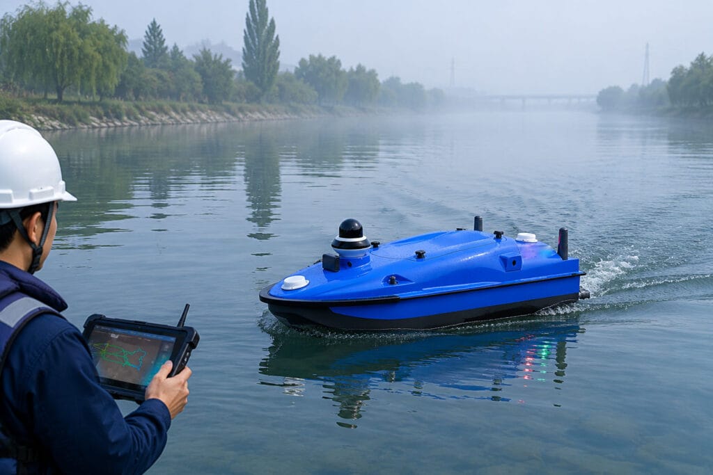
Professional echo sounder working for river surveying and hydrographic survey on field site

Best Echo Sounder for River Surveying: Practical Hydrographic Survey Guide

Home Best Echo Sounder for River Surveying: Practical Hydrographic Survey Guide 2026-06-03 1. Quick Overview: Why Echo Sounders Power River Hydrographic Surveys At Toknav, we know echo sounders are the primary depth-sensing tool in hydrographic surveys, especially for riverbed mapping. In this guide, we break down the latest survey-grade models. We also discuss practical workflows for river surveying. We’ve built a detailed spec comparison table, picked the top 3 echo sounders for river use, and explained how your choice impacts survey accuracy and efficiency. We’ve added clear links and CTAs to help you explore our USV and support services for turnkey solutions. Professional echo sounder working for river surveying and hydrographic survey on field site Hydrographic surveying maps underwater depths, terrain, and hidden obstacles. This ensures navigation safety and supports waterway engineering projects. Rivers and shallow waterways present tricky challenges, including vegetation, turbidity, and shifting depths. That’s why high-frequency 200 kHz echo sounders are our go-to for precise shallow-water detection. Integrated GPS and RTK positioning are also must-haves. They tag every depth reading with accurate geographic coordinates for reliable mapping results. 2. Key Factors to Choose an Echo Sounder for River Surveying Picking a suitable echo sounder makes all the difference for smooth field work. Below are the core factors every river surveyor should check before making a choice. 2.1 Frequency & Signal Penetration High-frequency systems around 200 kHz deliver sharp detail in shallow river water. Lower frequencies (24–33 kHz) cut through murky water but use wider signal beams. Dual-frequency echo sounders combine both strengths, letting you capture clear data no matter if the river is clear or filled with sediment and turbidity. 2.2 Beam Angle Narrow beams (3–5°) capture finer spatial details for precise river mapping. Wider beams (8–20°) cover more ground per ping but reduce detail level. For example, our integrated echo sounder for Tboat USVs uses an 8° beam at 200 kHz, striking a perfect balance between wide coverage and clear survey data for river routes. 2.3 Depth Range Most river surveys only require a 0–100 m depth range. Still, models supporting 200 m or deeper add great flexibility for deep river channels. Our echo sounder covers 0.3–200 m, handling regular shallow rivers and deeper water sections without switching devices. 2.4 Accuracy & Resolution Professional survey-grade echo sounders reach centimeter-level accuracy. Our model offers ±2 cm depth accuracy for highly reliable river data. Most modern devices hit ±0.01 m or 0.1% of measured depth, with 10–20 Hz ping rates boosting data density for fast-flowing river environments. 2.5 Integration & Interface Quality echo sounders support standard NMEA or Ethernet data output, like RS-232 and TCP/IP. This allows for seamless connection with GNSS receivers and survey software. All-in-one portable units that combine echo sounder and GNSS simplify setup. They are perfect for small survey boats working along narrow river sections. Your echo sounder selection directly impacts final bathymetry results. A precise device delivers clear maps, while poor transducer choices can cause data errors or missing terrain features. Get Free Professional Advice | Inquire About Echo Sounder Selection 3. Echo Sounder Spec Comparison for River Surveys We’ve sorted mainstream river survey echo sounders into a clear table below, with specs pulled directly from official product data for your easy reference. Main echo sounder models for river surveying and hydrographic survey specification display Model Frequency Beam Angle Depth Range Accuracy Interface Ideal Use-Case TSBES (Single-beam Echosounder) 200k Hz 8°  0.5m-200m 1cm+0.1%h Lan,RS232(Baudrate9600-230400) For shallow mapping and portable small-boat hydrography. TMBES (Advanced Multibeam Echosounder) 400k Hz 8°  0.2m-150m 2cm+1ppm(RTK)0.6m(SBAS)//1.2m(single point) RS-232 High-resolution 3D mapping in shallow waters; multifunctional surveys from rivers to coastal areas. SDE (Portable Dual Frequency Echo Sounder) 200k Hz & 20k Hz standard 200k Hz: 7°20k Hz: 20° 200k Hz: 0.3m-200m 20k Hz: 0.5m-600m 200 kHz: ±1cm±0.1%D 20 kHz: ±10cm±0.1%D (D is the depth value) 3* RS232, 1* RS485, 1 power supply interface, 1 transducer port and 1 LAN port High frequency for shallow mapping & silt thickness; low frequency for rivers to deep seas. Each model has its own strengths for different river survey scenarios. Check your on-site conditions and working tools to pick the most matched solution for your team. Request Full Datasheets | Get Custom Price Quote 4. Top 3 Recommended Echo Sounders for River Survey Projects After comparing performance, portability and field adaptability, we’ve picked 3 top models tailored for daily river hydrographic survey work. 4.1 TSBES (Single-beam Echosounder) This single-beam sounder is built exclusively for our Tboat USVs, delivering centimeter-level precision for shallow river mapping.Its 8° beam suits narrow river channels well. Built-in GNSS and RTK sync plus noise filters keep data stable even in turbid river water.The plug-and-play design works perfectly with our USVs, cutting down setup time and improving overall safety during long professional survey missions.It stands out for ultra-precise river bathymetry, letting you get detailed underwater terrain with minimal manual operation from your team. 4.2 TMBES (Advanced Multibeam Echosounder) This portable dual-frequency echo sounder comes with built-in data logging, ideal for mobile river survey teams.Running at 400 kHz with a 8° beam, it covers 0.2–150 m depth and maintains ±2cm (±0.1%) accuracy across full ranges.Its compact all-in-one body fits small boats, kayaks and jet skis. Advanced DSP supports 20 Hz ping rate and clear echograms to tell river vegetation apart from real riverbeds.Independent surveyors love this rugged device. It’s easy to deploy, records complete data and connects smoothly with external GPS units for shallow river channel mapping. 4.3 SDE (Portable Dual Frequency Echo Sounder) This dual-channel echo sounder features a wide frequency range from 20 kHz to 200k Hz for flexible field use.Pair it with a 200k Hz transducer for a narrow 20° beam. It supports depths from 0.3m shallow water up to 600m for multi-scene surveys.As a trusted industry workhorse, it reaches 20k Hz ping rate and steady ±0.01 m (±0.1%) accuracy at 200k Hz.Multiple interfaces including RS-232 and Ethernet ensure easy connection with GPS and survey software. It works reliably from narrow rivers to deep waterways.All three models

Best Echo Sounder for River Surveying: Practical Hydrographic Survey Guide Read More »

Southeast Asia USV Distributor Toknav Tboat USV Philippines Client Feedback

Toknav Tboat Series USV: Philippines Client Approved| Southeast Asia Distributor Recruitment

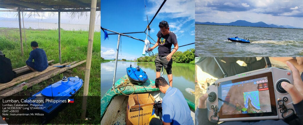
Home Toknav Tboat Series USV: Philippines Client Approved| Southeast Asia Distributor Recruitment 2026-06-03 Why Toknav Tboat USV Leads Southeast Asia Aquatic Survey & Monitoring Southeast Asia has a fast-growing demand for reliable unmanned surface vehicles (USVs) for bathymetry, water quality monitoring, and coastal patrol. Toknav’s Tboat10 and Tboat20 series are tailored to local water conditions, with high automation and strong disturbance resistance. These USVs support full-system RTK positioning and multiple payloads to cover 99% of aquatic operation needs. High-Precision RTK Positioning for Philippine & Southeast Asian Waters Toknav USVs use multi-frequency signal tracking for BDS, GPS, GLONASS, GALILEO, SBAS, and QZSS. The RTK positioning reaches ±8mm horizontal +1ppm and ±15mm vertical +1ppm, ideal for Philippine coastal mapping and river surveying. It ensures stable data collection even in narrow waterways and bridge areas. Rugged Design Adapted to Southeast Asian Coastal & River Conditions Tboat10 uses a double-hull M-type carbon fiber body; Tboat20 adopts a full-curved V-shaped hull. Both have IP67 protection, omnidirectional bumpers, and reinforced bow/keel designs. They resist wind force 3–4 and wave height 2–3, perfect for Southeast Asia’s variable coastal and inland water environments. Tboat10 vs Tboat20: Full-Spec USV Models for Diverse Maritime Tasks Toknav provides two professional USV platforms to match different project scales. Tboat10 is compact and portable for small surveys, while Tboat20 is a heavy-duty model for large-scale, long-duration tasks. Both support hot-swap batteries and one-key control for easy field use. Southeast Asia USV Distributor Toknav Tboat10 Tboat20 USV Parameter Comparison Tboat10 Compact USV: Lightweight & High-Efficiency for Small-Scale Projects Tboat10 has a 980520254mm hull, 7kg hull weight, and 35kg max payload. It runs 3 hours at 2m/s and 7 hours at 1.5m/s per battery set, with a 7m/s top speed. It fits echo sounders, water quality sensors, and 360° night vision cameras for shallow-water survey and sampling in the Philippines. Tboat20 Professional USV: All-In-One Solution for 99% Industry Demands Tboat20 measures 1280580430mm, with 12kg hull weight and 50kg max payload. It carries side-scan sonars, multibeam echo sounders, and ADCP for full-terrain topography and hydrological monitoring. Its 7-hour endurance and 6m/s speed meet large-area coastal and reservoir operations in Southeast Asia. Request USV Distributor Quote Philippines Client Testimonials: Real Visual Feedback & On-Site Performance We have received abundant positive feedback and visual materials from Philippine clients using Tboat USVs. Their reviews confirm the stable performance and high accuracy of our products in local water projects. Southeast Asia USV Distributor Toknav Tboat USV Philippines Client Feedback Philippine bathymetry teams shared photos and videos showing Tboat10’s smooth operation in coastal shallow waters. The RTK positioning delivered consistent depth data with ±1cm +0.1% D accuracy, greatly improving survey efficiency. Clients praised its easy transport and plug-and-use design. Water quality monitoring clients in the Philippines highlighted Tboat20’s reliable sampling and data transmission. The 4G/2.4G communication ensures real-time video and data feedback, even in remote island areas. The obstacle avoidance radar enhances safety in complex water environments. Many Philippine partners noted that Tboat USVs reduce manual risks and cut operational costs by over 40% compared with traditional survey boats. The durable carbon fiber hull requires low maintenance, suiting long-term daily use in Southeast Asia’s humid climate. Client video clips show Tboat USVs completing automatic route planning, breakpoint resume, and one-key return-to-home without manual intervention. These intelligent features make them friendly for new users with limited training. Philippine dealers also recognized the strong market competitiveness of Toknav USVs. The open SDK and expansion platform support customized payload integration, helping local businesses win more government and commercial projects. Partner Benefits: Become a Toknav USV Distributor in Southeast Asia Joining Toknav’s distributor network brings exclusive advantages for Southeast Asia partners. We offer full product training, marketing materials, and after-sales support to help you expand local USV market share. You will get exclusive pricing for Tboat10 and Tboat20 series, plus priority access to product upgrades. Our technical team provides online and on-site training for sales, operation, and maintenance to build your professional service capacity. We share high-intent leads from the Philippines, Indonesia, Malaysia, Thailand, and Vietnam. Co-branded marketing materials, client case studies, and SEO content help you boost local brand exposure and conversion rates. Toknav provides a complete after-sales system, including warranty service, parts supply, and remote troubleshooting. You can focus on sales and client development without worrying about technical support burdens. As a Toknav distributor, you can offer customized USV solutions with RTK, sonar, and water quality modules. This flexibility helps you stand out in Southeast Asia’s growing USV market for survey, environmental protection, and coastal security. Southeast Asia USV Distributor Toknav USV Partner Benefits & Support Get Tboat Series Catalog & Price List How to Join Toknav’s Southeast Asia USV Distributor Network The application process is simple and efficient. We welcome companies with experience in surveying, marine equipment, environmental protection, or engineering to partner with us. First, submit your company profile, business scope, and local market plan via our contact form. Our team will review your application and schedule an online meeting within 3 working days. Next, we provide detailed product training and distributor agreement explanation. You will learn product features, sales points, and market strategies tailored to Southeast Asia and the Philippines. After signing the agreement, you will receive official authorization, marketing resources, and initial inventory support. We help you launch local promotion and convert your first clients quickly. We prioritize long-term cooperation and offer incremental rewards based on sales performance. Top distributors get extra discounts, exclusive regional rights, and joint project opportunities. Contact Toknav for USV Cooperation & Product Details Toknav Tboat series USVs are trusted by Philippine clients for bathymetry, water quality monitoring, and coastal patrol. Their RTK precision, rugged design, and flexible expansion make them the top choice for Southeast Asia aquatic operations. We are actively recruiting dedicated distributors across Southeast Asia to provide reliable USV solutions and capture the booming market demand. Partner with Toknav to share professional products, full support, and stable profit margins. Click to explore our full USV series and submit your distributor inquiry:

Toknav Tboat Series USV: Philippines Client Approved| Southeast Asia Distributor Recruitment Read More »

Satellite-Based PPP Surveying for Remote Areas

Home Satellite-Based PPP Surveying for Remote Areas 2026-05-28 Executive Summary Working in the backcountry with no cell service or survey marks nearby? Precise Point Positioning (PPP) is your solution. Think of it as high-accuracy GPS that doesn’t need a local base station. Instead, your receiver gets correction data straight from satellites or pre-downloaded files. Modern multi-band receivers can use PPP to achieve centimeter-level accuracy. The catch? It takes a few minutes to “warm up.” This guide will walk you through setting up PPP, compare it to other methods, and share tips for successful remote surveys. Understanding Satellite Corrections (PPP) Ever wondered how to get precise locations without a base station? PPP is the clever answer. Unlike traditional RTK that needs a nearby reference receiver, PPP uses precise clock and orbit data from a global network. Your receiver gets this data via a satellite signal or a file you downloaded earlier. It’s perfect for places with no infrastructure. After a short initialization, you can expect 1-5 cm horizontal accuracy. You trade a slightly longer wait at the start for the freedom to work absolutely anywhere. Diagram comparing PPP surveying vs traditional RTK for high-accuracy mapping in remote areas Equipment and Configuration for PPP Surveying Getting PPP right starts with the right gear. Here’s what you’ll need: A PPP-capable GNSS Receiver: Models like the Toknav T5 or T50Pro. They must be multi-frequency to use PPP. A Good Antenna: A quality geodetic antenna minimizes signal reflection errors. Reliable Power: Long-life batteries are a must for all-day remote work. A Solid Tripod: Keeps the antenna perfectly still during the critical startup phase. A Data Collector: A rugged controller or Android device to run your survey app. Before heading out, configure your receiver: update its firmware, set your coordinate system, and input the antenna height. Then, select the ‘PPP’ or ‘RTX’ mode in the settings. If you won’t have a satellite link, remember to download the correction files for your survey dates beforehand. Comparison: PPP vs. “No-Base” RTK Method How It Connects Typical Accuracy Startup Time The Good The Not-So-Good PPP (Satellite) Satellite signal or offline files. ~1-5 cm horizontal, ~5-10 cm vertical. Several minutes. No local base needed! Works globally, even with zero cell service. Slower to start. Needs a clear view of the sky. May require a subscription. RTK (No Local Base) Needs internet (NTRIP) or long-range radio to a distant base. ~1-2 cm horizontal, ~2-4 cm vertical. Seconds to a minute. Extremely fast and accurate when the link works. A proven method. Totally dependent on a stable connection to a base or network. Fails outside coverage. Accuracy, Convergence, and What to Watch Out For PPP is impressively accurate, often hitting 2-5 cm horizontally after it initializes. That’s similar to what you expect from RTK. The key difference is convergence time—that initial wait. It usually takes a few minutes, but sometimes up to 15-20 minutes in challenging spots. The receiver needs this time to lock onto the satellite corrections and resolve ambiguities. A few things can affect your success: Keep it Still: During initialization, don’t move the antenna. Clear Sky View: Avoid trees, cliffs, or buildings that block satellites. Check Settings: A wrong antenna height entry will give wrong coordinates. Use Good Gear: A quality multi-band receiver and antenna make a huge difference. Log Raw Data: Always record raw data (RINEX format) as a backup. This lets you reprocess it later if needed. Troubleshooting Tips for Remote PPP Surveys Ran into a problem? Don’t worry, here are some fixes: Won’t Start?: Confirm you selected the right correction source and that your receiver’s service subscription is active. Poor Accuracy?: Check for signal obstructions. Move to a more open spot. Wrong Coordinates?: Re-enter your antenna height and datum (like WGS84). General Tip: Patience is key. If it’s taking a while, just let the receiver keep working. It will usually get there. By following these steps, you can confidently survey in the most remote locations. PPP trades a bit of initial patience for ultimate freedom. So go ahead, map that uncharted territory! Want to explore more about surveying? Click here: Blog – TOKNAV.  Have field experiences to share? Contact us at info@toknav.cn.

Satellite-Based PPP Surveying for Remote Areas Read More »

A surveying professional uses a high-precision GNSS receiver in the field, with a subtle digital shield overlay symbolizing data compliance and security in intelligent surveying.

Data Compliance in Intelligent Surveying: Storage & Cross-Border Red Lines

Home Data Compliance in Intelligent Surveying: Storage & Cross-Border Red Lines 2026-05-28 A recent industry-shaking event serves as a stark warning.​ In late April 2026, Academician  Chenghu Zhou, a prominent Chinese Academy of Sciences scholar in cartography and GIS, was taken for investigation. Reports suggest potential misconduct in commercializing research in satellite remote sensing and geospatial data. This underscores a critical truth: in surveying, which touches national security, compliance is non-negotiable. When your UAVs, LiDAR, or GNSS receivers collect data, every coordinate and image is sensitive information. Global regulators are tightening controls. A single misstep in data transfer can lead to severe penalties. This guide clarifies the core compliance challenges: storage and cross-border transfer. A surveying professional uses a high-precision GNSS receiver in the field, with a subtle digital shield overlay symbolizing data compliance and security in intelligent surveying. Why Data Compliance is a “Red Line,” Not a Suggestion Geospatial data, especially high-precision surveying data, is linked to national sovereignty and security. Major economies enforce strict rules. China’s Strict Regime China defines data collection by smart vehicles and drones as statutory surveying. Core rules are clear: Mandatory In-Country Storage: All geospatial data must be stored on servers within China. Data cannot flow directly overseas from the moment of creation. Dual Outbound Approval: Providing data abroad requires approval from surveying authorities anda security assessment by cyberspace regulators. The 2026 Satellite Navigation Reference Station rules further tighten this. EU’s GDPR Framework In the EU, data that can identify a person’s location (like precise GPS tracks) is “personal data” under GDPR. Processing requires a lawful basis, data minimization, and respect for individual rights. The Global Trend: Data Sovereignty Nations like South Korea, Russia, and India mandate data localization, requiring storage and processing under local laws. The principle of data sovereignty is now global. The High Cost of Non-Compliance In China, illegal data transfers have led to criminal cases. Exports with non-compliant maps can be seized. In the EU, GDPR fines can reach 4% of global revenue. A Practical Compliance Guide for Buyers & Users You must ensure compliance at every stage of your data’s lifecycle. Step 1: Classify Data Before You Buy Ask your supplier: Data Type: Does the device collect high-precision coordinates, raw point clouds, or HD imagery? This may be classified as sensitive. Default Data Flow: Does data auto-upload to the cloud? Where is that cloud? Can the supplier enable “local-only” storage? Supplier Compliance: Do they understand target market laws? Can they provide a compliant Data Processing Agreement? Step 2: Build a Secure Storage Setup Use Local Servers in China: For operations in China, you must use domestic cloud services (e.g., Alibaba Cloud, Tencent Cloud). Control & Encrypt: Implement strict access controls and end-to-end encryption (like AES-256). Isolate Sensitive Data: Keep geospatial data separate from other business data. Step 3: Plan for Legal Data Transfer (If Needed) If data must go abroad for R&D or collaboration, follow the legal path: From China: Get pre-approval from provincial natural resources authorities for “providing surveying achievements abroad”. If data is “Important Data,” file for a security assessment with the Cyberspace Administration. From the EU: Transfer data only to countries with an EU “adequacy” decision. Otherwise, use Standard Contractual Clauses (SCCs) and assess recipient country laws. Step 4: Manage Internally & Contractually Conduct a DPIA: For projects involving tracking, do a Data Protection Impact Assessment to identify risks. Inform Users (EU): Provide clear privacy notices and get consent if tracking individuals. Hold Suppliers Accountable: Contracts must require compliant data features and assign liability for violations. from Collection and In-Country Storage to the Compliance Checkpoint for Cross-Border Data Transfer. Turn Compliance into Your Competitive Edge Leading suppliers treat compliance as a core feature. Your supplier should offer: “Compliance by Design”: Hardware encryption, configurable local storage, and built-in data anonymization tools. Clear Documentation: Detailed compliance guides, data flow diagrams, and market-specific white papers. Local Support: In-country data hosting or technical teams to help meet local storage rules. Conclusion The Zhou Chenghu case is a reminder: in intelligent surveying, compliance is a measure of reliability. Choosing equipment means choosing a secure, legal data solution. Before you start your next project, ensure your partner has paved a compliant path. Your Action Checklist: Inventory your equipment’s data types and flows. Audit current storage and transfer practices against local laws. Ask suppliers for their compliance specifications. Plan a detailed compliance roadmap for international projects. Embedding compliance into every data action is the only way to operate securely and successfully on the global stage. Do you have insights to share or specific questions about Toknav’s solutions and compliance features? Click the button below to fill out our contact form. We are always eager to connect and learn from your professional experience. We’d Love to Hear From You! For more insights on surveying technology and compliance, visit our blog: https://toknavgnss.com/en/category/blog/

Data Compliance in Intelligent Surveying: Storage & Cross-Border Red Lines Read More »

Best RTK in West Africa: Why TOKNAV GNSS Receivers Dominate the Surveying Landscape

Home Best RTK in West Africa: Why TOKNAV GNSS Receivers Dominate the Surveying Landscape 2026-05-25 For surveyors, engineers, and construction professionals across West Africa, precision is the foundation of every successful project. From mapping the bustling urban landscapes of Lagos to charting remote sites, the demand for reliable, high-accuracy survey tools West Africa​ can trust is critical. TOKNAV emerges as the definitive solution, offering a robust portfolio of GNSS RTK receivers engineered to withstand the region’s unique conditions while delivering centimeter-level accuracy. This article explores why TOKNAV is the preferred partner for precision, focusing on durability, value, and the support of a reliable RTK dealer Lagos​ and beyond. RTK Dealer Lagos: Your Gateway to Unmatched Surveying Precision Lagos is the commercial heartbeat of Nigeria and a major hub for West Africa’s construction and geospatial industries. The city’s dynamic growth demands survey tools West Africa​ that are as resilient as they are precise. As a leading RTK dealer Lagos​ professionals rely on, TOKNAV provides more than just equipment; we offer a partnership built on technical expertise and reliable after-sales support. Our local presence ensures that survey teams have immediate access to genuine parts, firmware updates, and on-the-ground troubleshooting. TOKNAV RTK receiver in use by a surveyor on a construction site inWest Africa, demonstrating durable surveying tools for West Africa. Building Nigeria’s Future with Reliable Technology The Nigerian surveying sector faces distinct challenges: dense urban canyons, humid coastal conditions, and equipment that must travel across diverse terrains. TOKNAV receivers are built for this reality. With magnesium alloy construction and IP68-rated protection, our RTK systems resist dust, water, and physical shocks. Furthermore, our multi-constellation support ensures stable signal acquisition even in partially obstructed environments, a critical feature for urban areas. Ready to equip your team with durable, high-precision RTK? Contact Our Support Team for a Demo Redefining Value for the West African Surveyor The search for effective survey tools West Africa​ often leads to a critical choice: opting for low-cost equipment that fails prematurely or investing in quality that delivers long-term returns. TOKNAV offers superior value—where durability, reduced maintenance, and higher productivity define true cost-effectiveness. Our T5Lite and T5 series provide professional-grade RTK functionality with an economical footprint, making advanced surveying accessible without compromising performance. Why Total Cost of Ownership Matters Most True value is measured over the lifespan of the equipment. A receiver that cannot withstand tough conditions becomes a liability. West Africa’s infrastructure boom requires tools that last. TOKNAV devices feature industrial-grade components, long-life batteries, and proven reliability. This translates directly into fewer project delays, lower operating costs, and a stronger reputation for your business. Get the best performance-per-Naira investment for your projects. Request a Tailored Quote Survey Tools West Africa: Engineered for Regional Demands Selecting the right survey tools West Africa​ requires an understanding of the continent’s specific demands. Projects span from highway construction and mining to agricultural planning. TOKNAV’s product line is curated for this spectrum. Beyond rugged RTK rovers, our NET660 series CORS stations provide the reference network backbone for wide-area precision, ideal for any serious RTK dealer Lagos or regional operation to support. Conquering Environmental and Technical Challenges The West African environment is a rigorous proving ground. High temperatures, dust, humidity, and variable network coverage test equipment limits. TOKNAV receivers are designed with these stressors in mind. An operating temperature range of -20°C to +60°C (extended to -30°C to +65°C for the T50 series) ensures functionality. Built-in 4G modems with wide band support guarantee connectivity for RTK corrections. This combination of physical toughness and communication robustness defines the Best RTK in West Africa. Explore our full range of tools built for West African terrain. The TOKNAV Advantage: Magnesium Alloy Durability & Advanced Anti-Interference At the core of TOKNAV’s suitability for West Africa are two engineering philosophies: extreme durability and signal integrity. The magnesium alloy main body​ used across our receivers provides an optimal strength-to-weight ratio, protecting sensitive components from the bumps and drops inherent in field work. This is a key reason we are considered the Best RTK in West Africa​ for tough jobs. Ensuring Signal Reliability Where It Matters Most Precision is meaningless without consistency. TOKNAV’s anti-interference capabilities stem from a 1408-channel GNSS engine tracking all major global and regional satellite systems simultaneously. This multi-frequency, multi-constellation approach provides redundancy. Advanced filtering algorithms within the processor further clean the signal, delivering the stable, centimeter-accurate positioning needed for critical applications, solidifying our claim to the best survey tools West Africa​ can deploy. A Complete Product Ecosystem for Every Application TOKNAV provides the right tool for every job. From the entry-level T5Lite​ for cadastral work to the advanced T50/Pro​ series with laser and photogrammetry for complex tasks, and the NET660​ CORS series for infrastructure monitoring, we support the full project lifecycle. Partnering with a knowledgeable RTK dealer Lagos​ ensures you get the right model for your specific needs. Identify the ideal receiver for your next project Proven in the Field: TOKNAV’s Growing West African Footprint TOKNAV equipment is already at work across the region, contributing to its development. Our receivers are trusted for land titling, transportation infrastructure, mining, agricultural development, and urban planning. This real-world validation is supported by international certifications and a global presence, proving a standard of quality available locally through our network, including your trusted RTK dealer Lagos. TOKNAV technical support team meeting with clients in West Africa, ensuring reliable service for RTK dealers and surveyors. Your Next Step Towards Unshakeable Precision The quest for the Best RTK in West Africa​ concludes with a decision to prioritize resilience, accuracy, and partnership. TOKNAV offers a durable, intelligent positioning solution. Whether you are an RTK dealer in Lagos​ or a pan-West African contractor in need of reliable survey tools, TOKNAV is your strategic partner. Ready to transform your surveying capabilities with equipment built to last?​ Contact our team or your local dealer for a consultation or demo.https://toknavgnss.com/en/gnss-receiver/ Get Your Free Quote & Expert Consultation Now

Best RTK in West Africa: Why TOKNAV GNSS Receivers Dominate the Surveying Landscape Read More »

What is VRS in Surveying? Wide-Area Network RTK Coverage & Toknav Solution

Home What is VRS in Surveying? Wide-Area Network RTK Coverage & Toknav Solution 2026-05-26 Introduction to VRS (Virtual Reference Station) Defining VRS as the Core of Modern Network RTK VRS in surveying, short for Virtual Reference Station, is the leading Network RTK technology for professional work. It builds a virtual base near your rover via a CORS network. Users get centimeter RTK corrections over 3G/4G/5G, enabling high precision without a local base station. VRS in surveying Virtual Reference Station Network RTK overview Why Traditional Single-Base RTK Limits Your Workflow Traditional RTK relies on one physical base, limiting work to 10–15 km. Errors rise with distance, hurting accuracy. Daily base setup wastes time and labor. Wide-area projects need scalable, stable VRS in surveying Network RTK for consistent results. Network RTK vs VRS vs FKP: Critical Differences What Is Network RTK (NRTK) in Surveying? Network RTK uses linked CORS stations instead of a single base. It models spatial errors across the network to generate corrections for large areas. This supports continuous cm positioning over hundreds of kilometers, the foundation for VRS in surveying, FKP, and MAC services. VRS vs FKP: Which Fits Wide-Area Surveying Better? VRS in surveying creates a unique virtual base per user, sending tailored RTK corrections via two-way communication. It works with standard receivers and excels in dynamic tasks. FKP broadcasts area parameters one-way, simpler but less precise. For accuracy, VRS in surveying leads Network RTK. VRS Advantages Over FKP for Large-Scale Projects VRS in surveying adapts corrections in real time to user location, ensuring steady cm accuracy. It enables seamless regional roaming for mapping, agriculture, and autonomy. FKP lacks user-specific tuning and struggles in complex environments. VRS in surveying delivers reliable, precise Network RTK. How Wide-Area VRS Network RTK Coverage Works CORS Network: The Backbone of VRS Coverage Wide-area VRS in surveying depends on dense CORS networks, like Toknav’s 1,600+ stations in China. Each tracks multi-GNSS (BDS/GPS/GLONASS/GALILEO) and streams data to a central server. Redundant stations ensure continuity, supporting nationwide Network RTK. Data Processing & Virtual Reference Station Generation The central server collects CORS data, models ionospheric/tropospheric errors, and interpolates a virtual station near the user. This virtual base sends RTCM corrections to the rover. The rover calculates precise positions in real time, achieving cm accuracy via VRS in surveying Network RTK. VRS in surveying Virtual Reference Station Network RTK data processing flow VRS Coverage Logic: Seamless Wide-Area Positioning VRS in surveying networks split regions into overlapping cells, each with 3–5 CORS stations. As users move, the system builds new virtual stations, removing single-base limits. This “always-nearby” design enables stable, continuous Network RTK coverage over hundreds of kilometers. Toknav VRS CORS Solution: Hardware, Software & Platform Toknav Company Background & GNSS Expertise Founded in 2019, Toknav (Guangzhou TokSurvey) is a leading Chinese high-precision positioning provider. Its R&D team includes IGS experts, delivering full-stack VRS in surveying hardware and software. Products have CE/NGS/IGS certifications and serve 60+ countries. NET660i GNSS Receiver: Core Hardware for VRS CORS Toknav NET660i is a high-performance GNSS receiver for CORS stations. It has 1,408 super channels, multi-GNSS support, 32G storage, and an IP65 magnesium alloy shell. Built on Linux+Qualcomm, it ensures 24/7 stability for VRS in surveying Network RTK infrastructure. TCA920 Choke Ring Antenna: High-Precision Signal Tracking TCA920 is a mini choke ring antenna for base stations, supporting full-frequency GNSS signals including BDS, GPS, GLONASS, GALILEO, QZSS, and IRNSS. It suppresses multipath strongly, ideal for land, marine, and deformation monitoring in VRS in surveying setups. Self-Developed NTRIP Caster & Monitoring Platform Toknav’s VRS in surveying software includes an independent NTRIP Caster, supporting modern multi-GNSS and high-accuracy real-time processing. The web platform monitors networks, data, and users, handling millions of concurrent Network RTK users. Patented algorithms lead China’s VRS performance. Request a Free VRS CORS Demo & Quote Key Technical Advantages of Toknav VRS Centimeter-Level Accuracy & Low-Latitude Performance Toknav VRS in surveying delivers consistent cm accuracy nationwide, even in low latitudes with active ionospheres. Multi-GNSS processing and refined ionospheric models ensure stability. The Kepler team leads Wuhan University’s IGS Ionospheric Center, ensuring top-tier Network RTK processing. High Stability & Redundant Network Architecture With 1,600+ CORS stations, Toknav provides large-scale, stable VRS in surveying Network RTK. Redundant hardware and distributed servers ensure uptime. Data management, processing, and user services run independently, scaling to support massive concurrent users. Satellite & Ground Fusion Processing (PPP-RTK + Network RTK) Toknav integrates satellite-ground processing, combining Network RTK and PPP-RTK. This boosts coverage and accuracy in remote areas with sparse CORS. The system connects IGS centers, delivering globally consistent high-precision positioning via VRS in surveying. Massive User Capacity & Nationwide Coverage Toknav’s VRS in surveying network covers most of China, serving millions of Network RTK users. It supports surveying, agricultural drones, building monitoring, disaster prevention, lane navigation, and electric vehicles—diverse applications relying on stable VRS. Toknav VRS Application Scenarios & Benefits Government Surveying, Mapping & Municipal Management Governments use Toknav VRS in surveying for geodetic surveys, mapping, and planning. Centimeter accuracy ensures reliable data for infrastructure, land boundaries, and urban builds. 24/7 stable Network RTK supports national geospatial updates. Precision Agriculture & Intelligent Farming Farmers adopt Toknav VRS in surveying for crop drones, autonomous tractors, and soil sampling. Centimeter positioning enables precise seeding, fertilization, and yield tracking. Lower base costs and easy deployment make high-precision agriculture accessible via Network RTK. Transportation, Navigation & Autonomous Driving Toknav VRS in surveying delivers lane-level vehicle positioning for traffic management and autonomy. It provides reliable corrections in urban canyons, highways, and rural areas. High stability and low latency boost safety and efficiency for connected mobility via Network RTK. Deformation Monitoring & Geological Disaster Prevention For dams, bridges, and slopes, Toknav VRS in surveying enables real-time deformation monitoring. Continuous cm tracking detects tiny movements for early warnings. Multi-station redundancy ensures reliability in harsh environments, protecting lives via Network RTK. Network RTK Coverage Success Stories & Global Deployment China National VRS Network: 1,600+ CORS Stations Toknav runs one of China’s largest private VRS in surveying

What is VRS in Surveying? Wide-Area Network RTK Coverage & Toknav Solution Read More »

Smallest RTK Receiver for Survey: Top Toknav Picks for 2026

Home Smallest RTK Receiver for Survey: Top Toknav Picks for 2026 2026-05-16 Pocket RTK GPS: Why Size Matters in Surveying Mini GNSS Receiver Benefits for Field Work Compact survey gear has revolutionized modern surveying. The demand for the smallest RTK receiver for survey is rising, as professionals prioritize portability without sacrificing precision. A reliable pocket RTK GPS eliminates bulk, reducing fatigue during long field days. A well-built mini GNSS receiver fits in pockets or small bags, ideal for tight sites or remote missions. Toknav leads this trend, designing ultra-compact RTK receivers that redefine convenience. For modern field teams, compact survey gear is no longer optional—it’s essential for speed and accuracy. Top Toknav Mini GNSS Receiver Models smallest RTK receiver for survey Toknav T5 T5Lite mini GNSS receiver compact survey gear Toknav T5: Flagship Pocket RTK GPS The Toknav T5 stands as a top mini GNSS receiver for surveyors. Weighing just 630g with 100.5×100.5×72mm dimensions, it’s ultra-portable. Its magnesium alloy build and IP65 rating ensure durability in harsh conditions. The 1408-channel engine supports all GNSS constellations (GPS, BDS, GLONASS, GALILEO). Built-in 4G, Bluetooth, WIFI, and a radio module add versatility. As the flagship pocket RTK GPS, the T5’s 9600mAh battery delivers 16+ hours of runtime, perfect for all-day surveys. It’s the ultimate smallest RTK receiver for survey that doesn’t compromise performance. Get a Quote Now Toknav T5Lite: Budget-Friendly Compact Survey Gear For cost-conscious professionals, the Toknav T5Lite is ideal compact survey gear. At 600g and 100.5×100.5×69mm, it’s even lighter than the T5. It shares the same 1408-channel GNSS engine and multi-constellation support. The IMU module enables 60° tilt measurement with <2cm correction accuracy. Linux OS and 32GB storage ensure smooth operation. IP65 protection and 16+ hour battery life match premium models, making it a top budget pocket RTK GPS. If you need the smallest RTK receiver for survey on a budget, the T5Lite delivers exceptional value. Toknav T50 Series: Palm-Sized High-Tech RTK smallest RTK receiver for survey Toknav T50 series pocket RTK GPS compact survey gear The Toknav T50 series elevates the smallest RTK receiver for survey standard. These palm-sized units (Φ132×83mm, 770g) pack advanced features. The T50 adds a 100m laser module and AR camera for real-time stakeout, with 2.5cm 3D laser error at 5m. T50basic offers core AR and tilt functions, while T50Pro integrates photogrammetry (2–4cm accuracy at 2–15m). All models have IP68 rating, 6500mAh batteries (16+ hours), and 20Hz high-rate positioning. This mini GNSS receiver lineup redefines what pocket RTK GPS can achieve for complex projects. Explore Full Specifications Key Features of Toknav Pocket RTK GPS Receivers Unmatched Portability for Mini GNSS Receiver Toknav prioritizes compactness across all models. The T5Lite (600g) and T5 (630g) are among the lightest professional RTK receivers. The T50 series’ palm-sized design fits easily in one hand. This portability makes them perfect for urban surveys, construction layouts, and agricultural mapping where mobility is critical. No need for heavy tripods or large cases—just grab and go. When you choose the smallest RTK receiver for survey, you gain agility without losing precision. Precision That Rivals Full-Size Survey Gear Size doesn’t compromise accuracy with Toknav compact survey gear. All models deliver RTK accuracy of ±(8mm+1ppm) horizontal and ±(15mm+1ppm) vertical. Static precision reaches ±(2.5mm+1ppm) horizontal. The 1408-channel GNSS engine tracks all major constellations, ensuring reliable positioning in challenging environments like dense forests or urban canyons. IMU tilt correction (up to 60°) maintains accuracy without leveled poles. This pocket RTK GPS lineup proves small size and high precision can coexist. costumer feedback about grass sports field marking Request a Demo Today Rugged Durability for Field Conditions Field surveying demands tough equipment, and Toknav mini GNSS receiver units deliver. T5 and T5Lite feature magnesium alloy bodies with IP65 protection, withstanding dust, rain, and 1.5m drops. T50 series upgrades to IP68, offering full water and dust resistance. Operating temperatures range from -20°C to +60°C (T5/T5Lite) and -30°C to +65°C (T50 series), adapting to extreme climates. These rugged specs ensure reliability in any environment—critical for the smallest RTK receiver for survey that works as hard as you do. Long-Lasting Battery for All-Day Surveys Downtime from dead batteries is a surveyor’s worst enemy. Toknav pocket RTK GPS receivers include high-capacity batteries. T5 and T5Lite use 9600mAh batteries for 16+ hours of typical use, with static mode supporting 24-hour data collection. T50 series uses 6500mAh batteries, also delivering 16+ hours in controller network mode. Fast charging support minimizes downtime, keeping you productive all day. Great compact survey gear keeps you in the field, not at a charger. Advanced Connectivity & Smart Features: Modern surveying requires seamless connectivity, and Toknav compact survey gear excels here. All models include 4G full network access, Bluetooth, WIFI, and integrated radio modules. The radio supports multiple protocols (TRIMTALK, SOUTH, TRANSEOT) for flexible data transmission. Linux OS (ARM Cortex-A7 1.8GHz) enables efficient computing and feature expansion. T50 series adds AR cameras, laser modules, and photogrammetry for advanced workflows. This mini GNSS receiver lineup turns every field task into a streamlined operation. Why Choose Toknav for the Smallest RTK Receiver for Survey Unbeatable Size-to-Performance Ratio Toknav dominates the mini GNSS receiver market with an unbeatable size-to-performance ratio. Competitors often sacrifice features for compactness or vice versa. Toknav’s T5, T5Lite, and T50 series balance ultra-portability with professional-grade precision, durability, and smart features. Whether you need a basic pocket RTK GPS or a high-tech palm-sized unit, Toknav has a model to match your needs. For the smallest RTK receiver for survey, no other brand matches this balance. Versatility for Diverse Survey Applications From construction and land surveying to agriculture and GIS mapping, Toknav compact survey gear adapts to diverse applications. The T5Lite suits budget-focused land surveys. The T5 excels at general construction and topographic surveys. The T50 series shines in complex projects requiring AR stakeout, laser measurement, or photogrammetry. All models support standard NMEA-0183 and RTCM 3.X protocols, ensuring compatibility with existing workflows. One mini GNSS receiver can handle nearly every job site challenge. Contact Our Team for Details Trusted Quality

Smallest RTK Receiver for Survey: Top Toknav Picks for 2026 Read More »

Rugged Android Controller Sale: Top Toknav Handhelds for Surveyors

Home Rugged Android Controller Sale – Best Toknav Handhelds for Cheap Survey Tablet & Android RTK App Use 2026-05-15 Why Choose a Rugged Controller for Surveying Work Surveyors operate in tough outdoor environments, where standard devices fail fast. A rugged controller is built to survive drops, dust, rain, and extreme temperatures. Toknav’s rugged Android devices deliver cheap survey tablet value without sacrificing professional grade quality. These devices run smoothly with any Android RTK app, making them ideal for modern land surveying and GIS tasks. Right now, the rugged android controller sale brings even better value for field professionals. Key Features of Toknav Rugged Android Controllers Surveyors operate in tough outdoor environments, where standard devices fail fast. A rugged controller is built to survive drops, dust, rain, and extreme temperatures. Toknav’s rugged Android devices deliver cheap survey tablet value without sacrificing professional grade quality. These devices run smoothly with any Android RTK app, making them ideal for modern land surveying and GIS tasks. Right now, the rugged android controller sale brings even better value for field professionals. Durability & Environmental Protection Every Toknav rugged controller meets IP68 standards, fully waterproof and dustproof. It can handle 1.2 to 1.5 meter drops onto concrete, common in field work. Operating temperatures range from -20°C to +55°C or higher on select models. This level of protection means your rugged controller works reliably all year, no matter the weather. High-Performance Android Systems Toknav runs on Android 11, 12, or 14, chosen for stability and Android RTK app compatibility. The flagship PCR600 uses Android 14 with a fast 8-core processor. With 4GB RAM and 64GB ROM, multitasking is seamless, even with large GIS datasets. Micro SD expansion up to 512GB supports more data storage on this cheap survey tablet. Toknav TR10 Pro grass sports field marking Sunlight-Readable Displays Field visibility matters most. Sizes range from 5.45 to 5.5 inches, with resolutions up to 1080×1920. 500nit brightness ensures clear viewing in direct sunlight. Gloves and wet hands can operate the touchscreen, a huge advantage for surveyors. The bright outdoor display improves every session with your cheap survey tablet. Long Battery Life for All-Day Surveys A 9000mAh non-removable battery powers 18 to 22 hours of continuous use. Rapid charging gets you back online in three to five hours. All-day field work is possible without midday charging stops. This long battery life makes the rugged controller highly productive for extended survey projects. Toknav Handheld Models: Perfect for Every Survey Need PCR100T – Flagship RTK Measurement Terminal The PCR100T leads the rugged android controller sale lineup. Android 11 and a 5.45-inch sunlight-readable screen deliver reliable performance. Eighteen hours of battery life and IP68 protection suit long shifts. A digital keyboard speeds data entry for surveyors. It is a top-tier rugged controller for complex field tasks. PCR500 – Standard Android 12 Data Controller The PCR500 offers Android 12 and a Qualcomm SM6115 processor. A 5.5-inch 1080P Gorilla Glass display resists scratches and sunlight glare. The full QWERTY keyboard enables fast typing for field notes and coordinates. Twenty-two hours of battery life support full-day missions. It balances cost and power as a solid cheap survey tablet. Get Quote Now costumer feedback about grass sports field marking PCR500 Pro – Built-In GNSS RTK Controller The PCR500 Pro raises precision with integrated GNSS RTK delivering 2cm HRMS accuracy. Android 12 runs on a Qualcomm 662 chip for smooth CAD and map display. The 5.5-inch 1080P screen remains clear in sunlight. At 420g, it is lightweight yet powerful. For high precision projects, it is the best rugged controller with built-in RTK. PCR600 – Smart RTK Data Collector The PCR600 runs Android 14 with a MediaTek G85 8-core processor. It survives 1.5m drops and carries IP68 protection. A 5.5-inch 500nit screen ensures visibility outdoors. A full keyboard plus custom side keys speed workflows. Twenty-two hours of battery life support all-weather field work. It excels as a modern cheap survey tablet for daily surveying. Why Toknav Stands Out for Android RTK App & Survey Work Seamless Android RTK App Compatibility Toknav devices are optimized for Android RTK app performance. Operating systems support all major survey software, ensuring stable RTK fixes in the field. The PCR500 Pro adds internal GNSS RTK for centimeter level positioning without external receivers. GNSS support includes GPS, BDS, and GLONASS. This integration boosts productivity when using your rugged controller. Cost-Effective Cheap Survey Tablet Choice Premium survey controllers often carry high price tags. Toknav changes that by packing professional features into a cheap survey tablet price range. The PCR100T, PCR500, PCR500 Pro, and PCR600 deliver enterprise durability at accessible cost. The ongoing rugged android controller sale makes them even more budget friendly for small firms and solo surveyors. Comprehensive Connectivity Options Field work requires reliable connectivity. Toknav supports 4G LTE, dual band Wi-Fi 2.4G/5G, Bluetooth 5.0, and NFC. Dual Nano SIM slots provide network backup in remote areas. GNSS modules deliver fast, accurate positioning for surveying and GIS mapping. These connections keep your rugged controller online where others fail. Real-World Benefits for Survey Professionals rugged android controller sale, cheap survey tablet, android rtk app, rugged controller for field survey Boosted Field Productivity Long battery life eliminates midday charging breaks. Sunlight-readable screens reduce errors from glare. Fast processors handle large GIS files and Android RTK app tasks smoothly. Physical keyboards speed data entry compared to on-screen keyboards. Every feature is designed to let surveyors finish more work each day with their rugged controller. Reduced Downtime & Maintenance Costs IP68 protection and drop resistance lower repair frequency. Durable components extend device life over years of heavy use. Affordable pricing means lower replacement cost if damage occurs. A cheap survey tablet with rugged build reduces total ownership cost over time. Less downtime means more billable hours for your survey business. Versatility Across Surveying Scenarios Toknav devices adapt to topographic surveys, construction layout, GIS data collection, and asset management. The PCR500 Pro handles high precision projects requiring centimeter accuracy. The PCR600 excels at routine mapping and stakeout work.

Rugged Android Controller Sale: Top Toknav Handhelds for Surveyors Read More »

global dealer

Are You Looking for Surveying and Mapping Business Opportunities? Join Toknav Global Dealer Network

Home Are You Looking for Surveying and Mapping Business Opportunities? Join Toknav Global Dealer Network 2026-05-14 Partner with Toknav – Leading Surveying and Mapping Equipment Manufacturer Are you looking for surveying and mapping business opportunities? The global geospatial and precision positioning industry is growing at an unprecedented rate. High-precision surveying instruments have become core equipment for infrastructure, smart cities, and digital transformation. As a professional surveying and mapping equipment manufacturer, Toknav is now recruiting global distributors to share market dividends. Founded in 2019, Toknav is a high-tech enterprise focusing on R&D, production, and sales of industrial precision measuring and GNSS devices. Our headquarters is in Guangzhou, China, and we have an overseas office in the United States to support global customers with efficient and localized services. We gather a team of senior engineers with rich industry experience, focusing on product innovation and performance improvement. Our products are widely recognized for high accuracy, strong reliability, and easy portability, and have obtained CE certification to meet market access standards in most countries and regions. Inquire Now Toknav surveying and mapping equipment manufacturer dealer authorization certificate Why Toknav Stands Out as a Trusted Surveying and Mapping Equipment Manufacturer Full-range High-performance GNSS & Surveying Equipment Portfolio As a professional surveying and mapping equipment manufacturer, Toknav provides a complete product matrix covering GNSS receivers, CORS base stations, GIS collectors, and field software. Our product line meets the full-scene needs of surveying and mapping projects. RTK series includes economical T5, engineering T10Pro, intelligent T20, professional T30, dual-battery T40, and palm-sized T50. All models support multi-constellation satellite signals and achieve centimeter-level positioning for various survey tasks. CORS receivers such as Net660, Net660i, and Net660i-1U provide stable data support for VRS network services. They feature large storage, multiple communication ports, and long-lasting batteries for 24-hour unattended operation. GIS portable receivers P8, P8Pro, and P8Glo feature compact size, IP67 protection, and IMU tilt measurement. They are ideal for outdoor GIS collection, land investigation, and emergency mapping with high efficiency and stability. We independently develop tSurvey field software and are compatible with Apglos Survey Wizard, FieldGenius, and other mainstream platforms. Good software compatibility improves user experience and enhances product competitiveness. Proven R&D Strength and Stable Product Quality Toknav has strong independent R&D capabilities and continues to launch competitive new products to maintain technological leadership. Our R&D rhythm matches market demand and brings continuous growth momentum to distributors. In 2020, we launched T10Pro engineering RTK; in 2022, Net660 series CORS stations came out; in 2024, T30 series with AR stakeout and laser measurement was released; in 2025, T50 ultra-light RTK and TSL150 laser scanner were launched. Strict quality control runs through the whole production process. Our products use high-quality components and undergo strict testing to ensure stable performance in high or low temperature, humidity, and vibration environments. Most products reach IP67 or IP68 protection level, with long battery life and strong anti-interference ability. They can work stably in field, mountain, waterside, and other harsh environments to meet complex project needs. Wide Application Scenarios Driving Stable Market Demand Toknav surveying and mapping equipment is widely used in many industries with large and stable market demand. Rich application scenarios help distributors achieve year-round business without off-season. Our products are widely used in engineering survey, land mapping, urban planning, road and bridge construction, and other traditional surveying and mapping fields to provide data support for project implementation. They also play an important role in precision agriculture, unmanned vehicles, construction machinery control, deformation monitoring, and other emerging fields. These high-growth segments bring new business space. Deformation monitoring is applicable to landslides, dams, bridges, towers, and slopes. Real-time monitoring and early warning reduce disaster losses and have broad market prospects in water conservancy, mining, and transportation industries. Inquire About Cooperation Toknav and global dealer signing ceremony photo Customized OEM/ODM Solutions for Brand and Market Expansion Toknav provides professional OEM services available for global distributors, brands, and enterprises. We support customized development to help you build exclusive brand products and enhance local competitiveness. We can customize appearance, logo, packaging, function parameters, and software interface according to your needs. Tailored products fit regional market habits and special application requirements. Whether you need GNSS receivers, controllers, software, or complete solutions, we can provide one-stop OEM support. Mature technology and production lines shorten your launch cycle and reduce investment. Our OEM/ODM service covers product design, mold development, sample testing, mass production, and certification. We help you quickly launch products and seize market opportunities. H3: Full-chain Support from Design to Production and After-sales As a surveying and mapping equipment manufacturer, we provide full-chain support for OEM partners. We help you solve technical, production, and after-sales problems in all aspects. We provide complete technical documents, test reports, and certification assistance to help you pass local market access smoothly and reduce compliance risks. Our production team has rich experience and strict quality management to ensure stable supply and consistent quality. We can adjust production capacity according to your order demand. After-sales support includes maintenance training, firmware updates, and technical guidance. We help you provide high-quality after-sales service to end users and enhance brand reputation. Many global partners have achieved rapid brand growth and market expansion through our OEM services available. Stable product quality and support win long-term customer trust. Contact Us for OEM Services Toknav dealer selling surveying and mapping equipment on site Massive Business Opportunities in Surveying, Mapping and Precision Positioning Booming Global Market Demand for Surveying and Mapping Business opportunities in surveying and mapping are expanding driven by global infrastructure construction, smart city construction, and digital transformation. The market maintains steady growth. Countries around the world are increasing investment in transportation, water conservancy, energy, and municipal engineering. These projects generate sustained demand for high precision surveying and mapping equipment. Digital countryside, land rectification, and natural resource investigation also promote the popularization of surveying equipment. The market space is huge and has long term investment value. The development of autonomous driving, UAV, and unmanned ships further expands the application boundary of

Are You Looking for Surveying and Mapping Business Opportunities? Join Toknav Global Dealer Network Read More »

Become TOKNAV global distributors!

With a proven track record in surveying industry, we’re now looking for passionate distributors to join our global success story.