
CORS and VRS Guides

CORS, VRS, RTK base station, network RTK and correction workflow guides for high-precision positioning projects.

RTK base station range comparison

RTK Base Station Range: Radio vs. Network Link – Which Covers Your Needs?

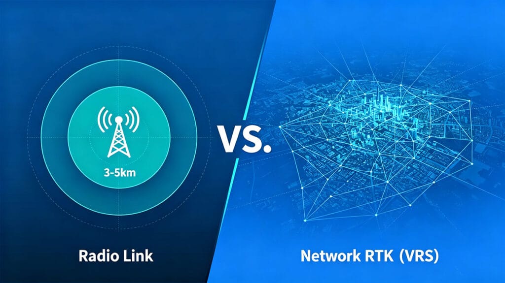
Home RTK Base Station Range: Radio vs. Network Link – Which Covers Your Needs? 2026-06-06 The Reach of Radio: Long Range RTK Capabilities For surveyors and mapping professionals, the base station’s operational range is a critical factor. Traditional RTK setups often rely on a physical radio link between the base and the rover. This method provides a direct, localized, and reliable connection independent of cellular networks. A common benchmark for a robust internal radio is a 3-5km line-of-sight range, a specification that defines true long-range RTK for many field applications. This capability is essential in remote construction sites, large-scale agricultural fields, or undeveloped land where internet connectivity is absent. The appeal lies in its self-contained nature—once the base is set up, the system creates its own positioning bubble, granting teams the freedom to operate within that radius without external dependencies. It’s the classic, proven workhorse for high-precision positioning. RTK base station range comparison: long range RTK radio vs. network coverage Discuss Your Project Needs Pushing the Limits: Understanding RTK Radio Distance The advertised RTK radio distance, such as 3-5km, represents an ideal, line-of-sight scenario. In practice, this range is influenced by terrain, obstacles, and antenna height. Dense urban environments with tall buildings or heavily forested areas can significantly reduce the effective operating radius. The internal radio power of the base station is the key driver behind this distance.Higher-power radios can penetrate mild obstructions better and maintain a stable data link at the edge of the nominal range. For a brand like TOKNAV, whose T50Pro and T40Pro RTK receivers are built for demanding photogrammetry and laser work, a strong, reliable radio link ensures that data integrity is maintained even as rovers move away from the base, preventing costly rework. The Power Within: Internal Radio Power and Its Role Internal radio power is the unsung hero of standalone RTK systems. It determines the signal strength and resilience of the data transmitted from the base to the rover. A unit with robust internal radio power, like those in TOKNAV’s RTK series, ensures a clearer signal at longer distances and in less-than-ideal conditions. This translates directly to field efficiency; surveyors can cover more ground without constantly moving the base station.However, it’s a localized solution. The radio’s coverage is a circle on the map with the base at its center. For projects larger than this circle—such as linear infrastructure projects spanning tens of kilometers or regional surveys—relying solely on radio becomes impractical, requiring multiple base setups or a different approach altogether. The Network Advantage: Unlimited Range with VRS/CORS This is where network solutions like Virtual Reference Station (VRS) or Continuously Operating Reference Stations (CORS) transform RTK operations. Instead of a single, user-deployed base station, the rover connects to a network of permanent, professionally maintained reference stations via cellular internet (4G/5G). Services like TOKNAV’s VRS Solution effectively create a virtual base station at the rover’s location, providing correction data over the internet. The coverage is no longer defined by a 5km radio bubble but by the cellular network’s footprint, which can be regional, national, or even continental. This eliminates the need to set up your own base, removes the range limitation, and is ideal for large-area or urban surveys. Request a Quote for Network Solutions Coverage Face-Off: 5km Radio vs. Continental Network Let’s directly compare the coverage models. A high-power RTK radio system offers a dedicated, secure link up to approximately 5km. Its performance is consistent and unaffected by cellular dead zones, making it a champion in remote locations. The limitation is strictly geographical. In contrast, a network RTK connection provides theoretically unlimited range wherever there is cellular data coverage. It offers incredible convenience for mobile teams and large-scale projects. The trade-off is the dependency on cellular service and potential subscription fees for the correction network. The choice isn’t about which technology is superior, but which is optimal for the specific project environment, scale, and logistical constraints. Choosing Your Tool: When to Use Radio or Network RTK Selecting the right data link is a strategic decision. Use a Long Range RTK radio link when: Toknav RTK receiver utilizing long range RTK radio in the field working in remote mines, quarries, offshore, or rural farmland with no cellular signal; on secure sites where external data connections are prohibited; or for short-duration, localized projects where setting up a single base is simpler and more cost-effective than managing network subscriptions. Opt for a Network RTK (VRS) link when:​ conducting surveys over a large city or a long, linear corridor like a highway or pipeline; working in areas with excellent cellular coverage; managing a fleet of rovers across a wide area; or when operational efficiency gains from not deploying a physical base outweigh the network cost. Toknav’s Toolkit: Solutions for Every Range Requirement TOKNAV’s product portfolio is strategically designed to support both operational paradigms. For traditional, radio-centric long-range RTK, their series of high-performance receivers like the T30 Pro​ (with Integrated Photogrammetry) and the T20Pro​ (Multifunctional Intelligent RTK) are engineered with powerful internal radios. For users looking to establish their own CORS network to blend control and coverage, the NET660i Base Station Receiver​ serves as a robust foundation. For the ultimate in extended range and convenience, leveraging their VRS Solution​ with a network-capable rover provides seamless, wide-area precision without range anxiety, perfect for GIS professionals using devices like the P8 Global. Flowchart: How to choose between RTK radio and network RTK for your base station range needs Get a Range Assessment for Your Equipment The Verdict on RTK Base Station Range There is no universal winner in the debate between radio and network RTK range. The 3-5km radio link provides dependable, self-contained control for defined sites, powered by the internal radio power​ of the base unit. The network link, powered by VRS technology, offers near-unlimited RTK radio distance​ by leveraging cellular infrastructure, redefining what long range RTK​ truly means.The most advanced operations often employ a hybrid approach, using radio for critical, signal-devoid sites and switching to network mode in covered

RTK Base Station Range: Radio vs. Network Link – Which Covers Your Needs? Read More »

What is VRS in Surveying? Wide-Area Network RTK Coverage & Toknav Solution

Home What is VRS in Surveying? Wide-Area Network RTK Coverage & Toknav Solution 2026-05-26 Introduction to VRS (Virtual Reference Station) Defining VRS as the Core of Modern Network RTK VRS in surveying, short for Virtual Reference Station, is the leading Network RTK technology for professional work. It builds a virtual base near your rover via a CORS network. Users get centimeter RTK corrections over 3G/4G/5G, enabling high precision without a local base station. VRS in surveying Virtual Reference Station Network RTK overview Why Traditional Single-Base RTK Limits Your Workflow Traditional RTK relies on one physical base, limiting work to 10–15 km. Errors rise with distance, hurting accuracy. Daily base setup wastes time and labor. Wide-area projects need scalable, stable VRS in surveying Network RTK for consistent results. Network RTK vs VRS vs FKP: Critical Differences What Is Network RTK (NRTK) in Surveying? Network RTK uses linked CORS stations instead of a single base. It models spatial errors across the network to generate corrections for large areas. This supports continuous cm positioning over hundreds of kilometers, the foundation for VRS in surveying, FKP, and MAC services. VRS vs FKP: Which Fits Wide-Area Surveying Better? VRS in surveying creates a unique virtual base per user, sending tailored RTK corrections via two-way communication. It works with standard receivers and excels in dynamic tasks. FKP broadcasts area parameters one-way, simpler but less precise. For accuracy, VRS in surveying leads Network RTK. VRS Advantages Over FKP for Large-Scale Projects VRS in surveying adapts corrections in real time to user location, ensuring steady cm accuracy. It enables seamless regional roaming for mapping, agriculture, and autonomy. FKP lacks user-specific tuning and struggles in complex environments. VRS in surveying delivers reliable, precise Network RTK. How Wide-Area VRS Network RTK Coverage Works CORS Network: The Backbone of VRS Coverage Wide-area VRS in surveying depends on dense CORS networks, like Toknav’s 1,600+ stations in China. Each tracks multi-GNSS (BDS/GPS/GLONASS/GALILEO) and streams data to a central server. Redundant stations ensure continuity, supporting nationwide Network RTK. Data Processing & Virtual Reference Station Generation The central server collects CORS data, models ionospheric/tropospheric errors, and interpolates a virtual station near the user. This virtual base sends RTCM corrections to the rover. The rover calculates precise positions in real time, achieving cm accuracy via VRS in surveying Network RTK. VRS in surveying Virtual Reference Station Network RTK data processing flow VRS Coverage Logic: Seamless Wide-Area Positioning VRS in surveying networks split regions into overlapping cells, each with 3–5 CORS stations. As users move, the system builds new virtual stations, removing single-base limits. This “always-nearby” design enables stable, continuous Network RTK coverage over hundreds of kilometers. Toknav VRS CORS Solution: Hardware, Software & Platform Toknav Company Background & GNSS Expertise Founded in 2019, Toknav (Guangzhou TokSurvey) is a leading Chinese high-precision positioning provider. Its R&D team includes IGS experts, delivering full-stack VRS in surveying hardware and software. Products have CE/NGS/IGS certifications and serve 60+ countries. NET660i GNSS Receiver: Core Hardware for VRS CORS Toknav NET660i is a high-performance GNSS receiver for CORS stations. It has 1,408 super channels, multi-GNSS support, 32G storage, and an IP65 magnesium alloy shell. Built on Linux+Qualcomm, it ensures 24/7 stability for VRS in surveying Network RTK infrastructure. TCA920 Choke Ring Antenna: High-Precision Signal Tracking TCA920 is a mini choke ring antenna for base stations, supporting full-frequency GNSS signals including BDS, GPS, GLONASS, GALILEO, QZSS, and IRNSS. It suppresses multipath strongly, ideal for land, marine, and deformation monitoring in VRS in surveying setups. Self-Developed NTRIP Caster & Monitoring Platform Toknav’s VRS in surveying software includes an independent NTRIP Caster, supporting modern multi-GNSS and high-accuracy real-time processing. The web platform monitors networks, data, and users, handling millions of concurrent Network RTK users. Patented algorithms lead China’s VRS performance. Request a Free VRS CORS Demo & Quote Key Technical Advantages of Toknav VRS Centimeter-Level Accuracy & Low-Latitude Performance Toknav VRS in surveying delivers consistent cm accuracy nationwide, even in low latitudes with active ionospheres. Multi-GNSS processing and refined ionospheric models ensure stability. The Kepler team leads Wuhan University’s IGS Ionospheric Center, ensuring top-tier Network RTK processing. High Stability & Redundant Network Architecture With 1,600+ CORS stations, Toknav provides large-scale, stable VRS in surveying Network RTK. Redundant hardware and distributed servers ensure uptime. Data management, processing, and user services run independently, scaling to support massive concurrent users. Satellite & Ground Fusion Processing (PPP-RTK + Network RTK) Toknav integrates satellite-ground processing, combining Network RTK and PPP-RTK. This boosts coverage and accuracy in remote areas with sparse CORS. The system connects IGS centers, delivering globally consistent high-precision positioning via VRS in surveying. Massive User Capacity & Nationwide Coverage Toknav’s VRS in surveying network covers most of China, serving millions of Network RTK users. It supports surveying, agricultural drones, building monitoring, disaster prevention, lane navigation, and electric vehicles—diverse applications relying on stable VRS. Toknav VRS Application Scenarios & Benefits Government Surveying, Mapping & Municipal Management Governments use Toknav VRS in surveying for geodetic surveys, mapping, and planning. Centimeter accuracy ensures reliable data for infrastructure, land boundaries, and urban builds. 24/7 stable Network RTK supports national geospatial updates. Precision Agriculture & Intelligent Farming Farmers adopt Toknav VRS in surveying for crop drones, autonomous tractors, and soil sampling. Centimeter positioning enables precise seeding, fertilization, and yield tracking. Lower base costs and easy deployment make high-precision agriculture accessible via Network RTK. Transportation, Navigation & Autonomous Driving Toknav VRS in surveying delivers lane-level vehicle positioning for traffic management and autonomy. It provides reliable corrections in urban canyons, highways, and rural areas. High stability and low latency boost safety and efficiency for connected mobility via Network RTK. Deformation Monitoring & Geological Disaster Prevention For dams, bridges, and slopes, Toknav VRS in surveying enables real-time deformation monitoring. Continuous cm tracking detects tiny movements for early warnings. Multi-station redundancy ensures reliability in harsh environments, protecting lives via Network RTK. Network RTK Coverage Success Stories & Global Deployment China National VRS Network: 1,600+ CORS Stations Toknav runs one of China’s largest private VRS in surveying

What is VRS in Surveying? Wide-Area Network RTK Coverage & Toknav Solution Read More »

How to Increase RTK Range: A Complete Guide with Toknav RTK Base Station External Radio

Home How to Increase RTK Range: A Complete Guide with Toknav RTK Base Station External Radio 2026-04-25 In the fields of surveying, construction, agriculture, and geospatial mapping, RTK (Real-Time Kinematic) technology has become indispensable for achieving centimeter-level positioning accuracy. However, many professionals face a common challenge: limited RTK range that restricts workflow efficiency, especially in large-scale projects or remote areas. If you’re struggling with short RTK signal coverage, unstable data transmission, or frequent signal loss, you’re not alone. The key to solving this problem lies in choosing the right supporting equipment—specifically, a high-quality High power UHF radio, optimizing your RTK radio range kit, and understanding the External radio price to balance performance and cost. In this blog, we’ll dive deep into how Toknav’s RTK Base Station External Radio DL8635 addresses these pain points, helping you maximize RTK range effectively and affordably. A quality High power UHF radio is the cornerstone of long-range RTK transmission, and pairing it with a well-equipped RTK radio range kit can further enhance performance, all while considering External radio price for cost-effectiveness. First, let’s clarify why RTK range is often limited. RTK systems rely on a base station to send correction data to a rover, and the distance between them is constrained by the radio’s transmission power, frequency band, environmental interference, and antenna performance. Low-power radios, incompatible protocols, and poor environmental protection often lead to signal attenuation, short transmission distances (often less than 10km), and unstable data links—all of which disrupt project progress. To overcome these limitations, a high-power UHF radio designed specifically for RTK applications is not just an option, but a necessity. Toknav’s DL8635 External Digital Radio is engineered to solve these exact challenges, combining high power, robust design, and user-friendly features to extend RTK range significantly. High Power UHF Radio: The Core of RTK Range Extension When it comes to increasing RTK range, the most critical factor is the radio’s transmission power and frequency band. UHF (Ultra High Frequency) bands—typically 400-470MHz—are ideal for RTK applications because of their superior penetration and anti-interference capabilities compared to VHF bands. Unlike VHF, which performs better in open, unobstructed areas, UHF signals can penetrate buildings, vegetation, and minor terrain obstacles, making them suitable for both urban and outdoor harsh environments. AHigh power UHF radio amplifies the correction data signal, ensuring it travels farther without losing accuracy—a feature that Toknav’s DL8635 excels at. The Toknav DL8635 is a high-power UHF external radio specifically designed for RTK base stations, with adjustable transmit power ranging from 5W to 28W (H/M/L three levels, customizable). This wide power range allows users to adapt to different project scenarios: use low power (5W) for short-distance projects (5-10km) to save energy, medium power (22W) for moderate ranges (10-20km), and high power (28W) for long-distance applications (up to 30km of stable transmission) as specified in its technical specifications. This flexibility is a game-changer for professionals who work across diverse terrains, from flat farmlands to hilly construction sites. Beyond power, the DL8635’s UHF frequency range (410MHz~470MHz) is carefully selected to optimize signal propagation. This frequency band balances long-range transmission with anti-interference performance, ensuring that correction data is sent reliably even in areas with electromagnetic interference (such as near power lines or industrial equipment). The radio’s frequency stability is less than ±1ppm, which minimizes signal drift and ensures consistent data transmission—critical for maintaining RTK’s centimeter-level accuracy over long distances. Additionally, the DL8635 uses GMSK/4FSK modulation, which enhances data transmission efficiency and reduces signal loss, further extending effective range. Another key advantage of the DL8635 as a high-power UHF radio is its compatibility with multiple RTK devices. Thanks to its intelligent serial baud rate identification feature, the radio can automatically recognize the serial baud rate of different RTK base stations and rovers via a radio data cable, enabling plug-and-play connectivity. This eliminates the need for manual configuration, saving time and reducing the risk of setup errors that can compromise signal quality and range. Whether you’re using Toknav’s own RTK equipment or third-party devices, the DL8635 integrates seamlessly, making it a versatile solution for any RTK setup. Toknav DL8635 high-power UHF external radio Optimizing RTK Range with RTK Radio Range Kit While a high-power UHF radio is the foundation of extending RTK range, pairing it with a well-designed RTK radio range kit can further enhance performance and reliability. An RTK radio range kit typically includes complementary components that work with the external radio to minimize signal attenuation, improve signal reception, and ensure consistent operation in harsh conditions. Toknav’s DL8635 is designed to integrate seamlessly with such kits, and here’s how you can optimize your setup: High-Gain Antenna: The antenna is a critical component of any radio system, as it directly impacts signal transmission and reception. The DL8635 features a TNC female connector, which is compatible with high-gain UHF antennas (sold separately as part of the range kit).A high-gain antenna amplifies the radio signal, extending the effective range by up to 20% compared to standard antennas. For example, pairing the DL8635 with a 5dBi high-gain UHF antenna can push the maximum stable range from 30km to 36km in open terrain. Additionally, mounting the antenna at a higher position (such as on a tripod or rooftop) further reduces signal obstruction, as recommended in RTK. Signal Amplifier: For extremely long-range projects (over 30km) or areas with heavy signal interference, adding a signal amplifier to your RTK radio range kit can boost the DL8635’s output power without compromising signal quality. The DL8635’s 9V~16V operating voltage range supports compatibility with most standard signal amplifiers, making it easy to integrate into your existing setup. This is particularly useful for large-scale agricultural surveys or linear projects (such as highways or pipelines) where the base station needs to cover a wide area. Weatherproof Accessories: The DL8635 already features an IP67 protection rating, with a solid magnesium alloy shell that is dust-tight and waterproof (capable of withstanding immersion in 1m of water for 30 minutes). However, adding weatherproof accessories (such as a protective cover or waterproof cable connectors) to your range kit ensures that

How to Increase RTK Range: A Complete Guide with Toknav RTK Base Station External Radio Read More »

Become TOKNAV global distributors!

With a proven track record in surveying industry, we’re now looking for passionate distributors to join our global success story.