
RTK GNSS Guides

Educational RTK and GNSS receiver guides for surveying, mapping, construction and field positioning decisions.

GNSS RTK System Explained: Base & Rover Setup for 99.9%Survey Success

Home GNSS RTK System Explained: Base & Rover Setup for Survey Success 2026-03-12 A complete GNSS RTK system is the backbone of high-precision surveying, enabling surveyors to achieve centimeter-level accuracy in real time. But what exactly is a GNSS RTK system, and how do you set up its core components—the base station and rover—to ensure survey success? As a leading GNSS supplier, TOKNAV offers a comprehensive GNSS RTK system, including a high-quality GNSS base rover kit, designed to simplify setup and deliver reliable results for survey professionals. TOKNAV’s GNSS base rover kit simplifies high-precision surveying for survey professionals. Let’s start with the basics: What are the components of a complete GNSS RTK system? A typical GNSS RTK system consists of three main parts: a base station, a rover (GNSS RTK receiver), and a communication link between them. The base station is a stationary GNSS receiver set up at a known location, while the rover is a portable GNSS RTK receiver used to collect data in the field. The communication link—usually UHF, 4G, or NTRIP—transmits correction data from the base station to the rover, allowing the rover to adjust its satellite readings and deliver precise positioning.Understanding the roles of the base station and rover is crucial for successful RTK surveying. The base station’s primary role is to act as a reference point. It continuously receives signals from GNSS satellites and calculates its own position. Since the base station’s location is known (either from a pre-surveyed point or a national grid coordinate), any errors in the satellite signals are detected and converted into correction data. This correction data is then transmitted to the rover in real time. The rover, which is moving around the survey area, uses this correction data to eliminate errors in its own satellite readings, resulting in centimeter-level accuracy. Real-World Case Study: How Proper Base & Rover Setup Won a Road Survey Project in Southern France Last year, a survey team in southern France faced a tight deadline for a 12km rural road resurvey project. The terrain was a mix of open farmland and treelined sections, with spotty cellular coverage. Initially, they used a basic GNSS receiver without RTK and struggled with meterlevel errors, forcing repeated remeasurements—wasting time and pushing their timeline at risk. After switching to the TOKNAV GNSS base rover kit, they followed best practices to set up a fixed base station on a certified control point with unobstructed sky view (critical for signal accuracy). They used UHF for short-range stretches (where cellular signal was weak) and 4G fallback for longer distances across open farmland. Within hours, the team achieved consistent centimeter-level accuracy, even near tree lines—eliminating rework entirely. The result? They finished the 12-km project two days ahead of schedule, saved labor costs, and secured a follow-up contract for nearby road maintenance surveys. This real example proves: the right base and rover setup turns theoretical precision into measurable field success—even in challenging terrain. TOKNAV’s GNSS RTK system delivered centimeter-level accuracy for a 12-km rural road survey in France, beating the deadline by two days. Step-by-Step Guide to Setting Up Your TOKNAV GNSS Base Rover Kit Setting up a GNSS base rover kit may seem daunting, but with the right guidance, it’s a straightforward process. Follow these steps to ensure accuracy and efficiency for your next survey: Choose a suitable base station location: Select an open area with no obstructions (trees, buildings, power lines) that could block satellite signals. Opt for a stable, level surface to keep the base station stationary—this prevents positional drift that can ruin accuracy. Set up the base station: Mount the base station antenna on a high-quality tripod, ensuring it’s level and securely fastened. Connect the antenna to the base station receiver, then power on the device and allow it to initialize (usually 2–5 minutes). Configure the base station: Enter the known coordinates of your base location (from pre-surveyed control points or national grid data). Select your communication method (UHF, 4G, or NTRIP) and set the transmission frequency—follow TOKNAV’s default settings for optimal performance. Set up the rover: Power on the TOKNAV RTK receiver (rover) and connect it to the same communication link as the base station. Confirm the rover is set to receive correction data—most TOKNAV rovers auto-detect this, simplifying setup. Calibrate and test: Once connected, calibrate the system by collecting data from a known control point. Test accuracy by surveying a small, familiar area and verifying results—this ensures no setup errors before starting your project. Follow TOKNAV’s simple 5-step setup for your GNSS base rover kit to achieve centimeter-level accuracy. Key Communication Options for GNSS RTK Systems Communication options are a critical part of any GNSS RTK system—choosing the right one depends on your survey range and location: UHF: Ideal for short-range surveys (up to 10km). It’s reliable, doesn’t require an internet connection, and works well in remote areas with poor cellular coverage—perfect for rural European surveys. 4G: Best for longer-range surveys. It allows base stations and rovers to communicate over large distances (even in remote regions) and pairs well with TOKNAV’s rovers for seamless correction data transmission. NTRIP: Uses the internet to transmit correction data, ideal for surveyors using national RTK networks (common in Europe) instead of setting up their own base station. TOKNAV’s systems are fully compatible with European NTRIP networks. TOKNAV’s GNSS RTK Setup Best Practices To maximize accuracy and minimize downtime, follow these TOKNAV-recommended best practices: Use a high-quality tripod and antenna mount to keep the base station stable—cheap mounts can cause positional drift. Avoid multipath interference: Choose base station locations free from reflective surfaces (buildings, water, metal structures) that can distort satellite signals. Calibrate regularly: Calibrate the system before each project and after any antenna repositioning to maintain centimeter-level accuracy.Match communication to your area: Use UHF for short ranges, 4G/NTRIP for longer ranges—mixing methods (like UHF with 4G fallback) works well for variable terrain. Prepare for field conditions: Keep spare batteries and a portable charger on hand to avoid downtime—critical for long survey days in

GNSS RTK System Explained: Base & Rover Setup for 99.9%Survey Success Read More »
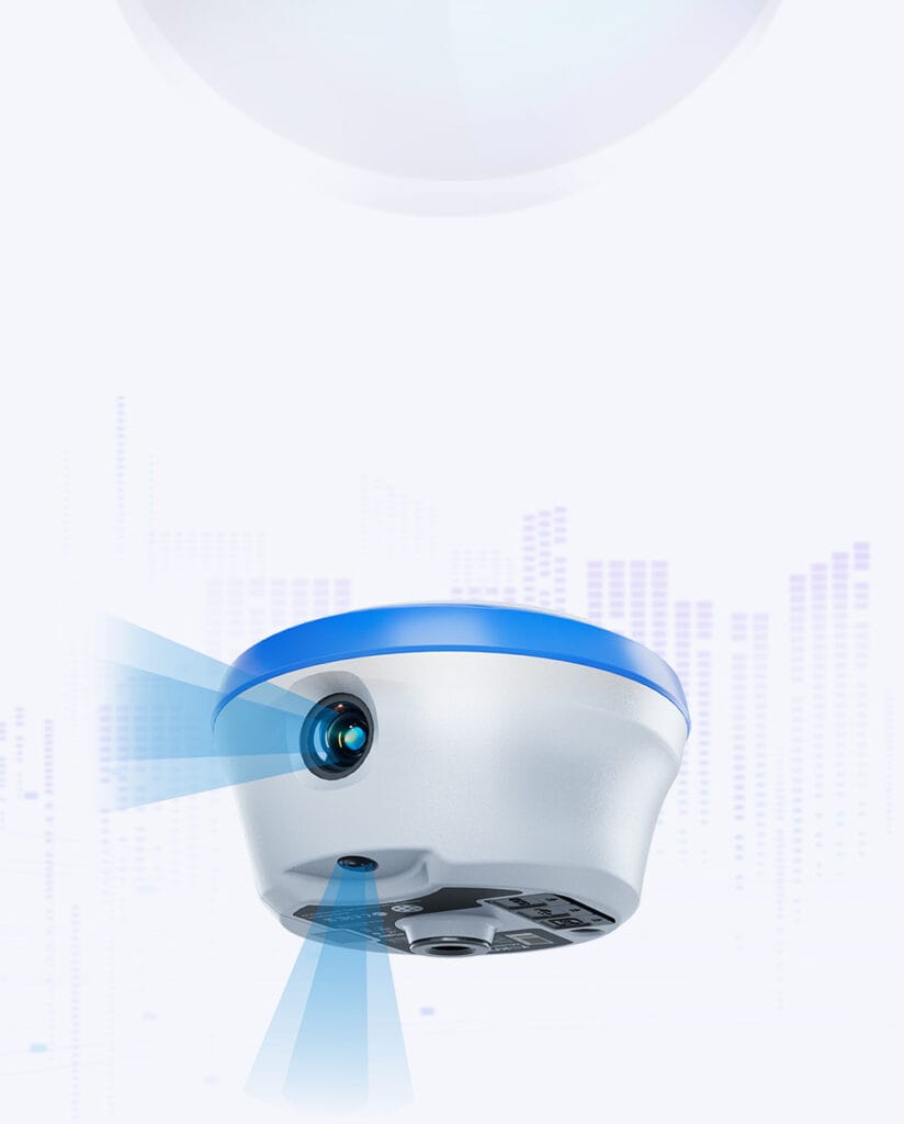
GNSS RTK Receiver: TOKNAV’s 800+ Channels for Unbeatable Surveying Precision

Home GNSS RTK Receiver: The Complete Guide for High‑Precision Surveying 2026-3-5 In the world of professional surveying, accuracy is non-negotiable. Whether you’re mapping construction sites, surveying agricultural land, or conducting topographic surveys, the difference between centimeter-level precision and meter-level approximation can make or break a project. That’s where the GNSS RTK receiver comes in—a powerful tool that has revolutionized high-precision surveying. As a leading GNSS supplier, TOKNAV offers a range of high precision GNSS solutions, including the reliable TOKNAV RTK receiver, designed to meet the demands of European survey professionals. Toknav GNSS Factoy / Company First, let’s break down the basics: What is a GNSS RTK receiver? GNSS (Global Navigation Satellite System) refers to a network of satellites that provide positioning, navigation, and timing data. RTK (Real-Time Kinematic) is a technique that enhances GNSS accuracy by using a base station to correct data in real time. A GNSS RTK receiver works by receiving signals from satellites and combining them with correction data from a base station, delivering centimeter-level accuracy—far superior to standard GNSS receivers. For surveyors, this level of precision is essential for tasks like setting out construction boundaries, mapping land parcels, and monitoring structural deformations. Understanding how RTK surveying works is key to maximizing the value of your GNSS RTK receiver. The process begins with a base station, which is set up at a known location. The base station continuously receives satellite signals and calculates its own position. Any discrepancies between the calculated position and the known position are converted into correction data, which is then transmitted to the rover—your GNSS RTK receiver. The rover uses this correction data to adjust its own satellite readings, eliminating errors and delivering precise, real-time positioning. This seamless collaboration between base and rover is what makes RTK surveying so efficient and reliable. Toknav T30 base+ rover When choosing a GNSS RTK receiver, there are several key specs to consider. First, satellite compatibility: Look for receivers that support multiple GNSS constellations (GPS, GLONASS, Galileo, BeiDou) to ensure reliable signal reception even in challenging environments. Second, accuracy: A high-quality survey GNSS receiver should deliver horizontal accuracy of ±1cm + 1ppm and vertical accuracy of ±2cm + 1ppm. Third, communication options: UHF, 4G, and NTRIP (Networked Transport of RTCM via Internet Protocol) are essential for transmitting correction data quickly and reliably. Battery life, durability (IP rating), and ease of use are also critical factors, especially for field surveyors who work in harsh conditions. The TOKNAV RTK receiver stands out among high precision GNSS solutions for European surveyors. Designed with the EU market in mind, TOKNAV’s RTK receivers are built to meet strict quality and certification standards, ensuring compatibility with European surveying practices. Our receivers support multiple GNSS constellations, offer long battery life (up to 16 hours), and feature a rugged, IP67-rated design that can withstand dust, water, and extreme temperatures. Additionally, TOKNAV’s RTK receivers are compatible with our GNSS base rover kit, creating a complete RTK surveying solution that streamlines fieldwork and improves efficiency. Typical use cases for a GNSS RTK receiver include construction, mapping, and agriculture. In construction, surveyors use RTK receivers to set out foundations, walls, and other structural elements with precise accuracy, reducing errors and avoiding costly rework. In mapping, RTK surveying enables the creation of detailed topographic maps, contour lines, and elevation models, which are essential for urban planning and environmental monitoring. In agriculture, RTK receivers help farmers with precision planting, fertilization, and harvesting, improving crop yields and reducing waste. Customers in the Saudi Arabia region are using the toknav T20Pro GNSS Receiver Let’s address some common FAQs about GNSS RTK receivers.Q: What is the maximum accuracy of a TOKNAV RTK receiver? A: Our receivers deliver horizontal accuracy of ±1cm + 1ppm and vertical accuracy of ±2cm + 1ppm, making them ideal for high-precision surveying tasks. Q: How long does the battery last? A: The TOKNAV RTK receiver has a 6000mAh battery that lasts up to 16 hours of continuous use, with a fast-charging option for quick top-ups.Q: How many satellite channels does it support? A: Our receivers support up to 800+ channels, ensuring reliable signal reception even in urban canyons or dense vegetation. In conclusion, a high-quality GNSS RTK receiver is an essential tool for any professional surveyor looking to achieve centimeter-level accuracy. TOKNAV’s RTK receivers, part of our comprehensive surveying instruments lineup, are designed to meet the needs of European survey professionals, offering reliability, durability, and ease of use. Whether you’re working on a construction site, mapping a remote area, or managing agricultural land, the TOKNAV RTK receiver will help you complete your projects efficiently and accurately. Ready to upgrade your surveying equipment? Visit our RTK product page to learn more about the TOKNAV RTK receiver, or contact our team for personalized advice. Don’t forget to explore our homepage for our full range of high precision GNSS solutions.

GNSS RTK Receiver: TOKNAV’s 800+ Channels for Unbeatable Surveying Precision Read More »

What is GNSS? 1 Simple Guide to Global Navigation Satellite Systems | TOKNAV

Home What is GNSS? A Simple Guide to Global Navigation Satellite Systems | TOKNAV What Is GNSS? GNSS stands for Global Navigation Satellite System. It is a large network of satellites that circle Earth and send location signals down to our devices. You use GNSS every single day without even noticing it—think phone maps, delivery tracking, and even some navigation tools. This guide explains GNSS in simple, easy-to-understand words. We also show you why TOKNAV GNSS receivers are such a great choice for anyone needing reliable positioning. What Does GNSS Stand For? GNSS means Global Navigation Satellite System. Importantly, it is not just one single system. Instead, it includes all the global satellite navigation networks around the world. Many people often confuse GNSS with GPS. To put it simply, GPS is only one small part of the much larger GNSS family. Main GNSS Systems Several different satellite systems work together to make up the GNSS network. First, GPS comes from the United States and is one of the most well-known systems. Next, BDS is China’s own global navigation system, designed for worldwide use. Then, GLONASS is the satellite system from Russia, built to work well in northern areas. Finally, Galileo is a system built by the European Union, focused on high accuracy for everyday users. These systems together improve coverage and accuracy all over the world. How Does GNSS Work? GNSS works in a few simple, easy steps. First, satellites high up in space send out clear signals. A GNSS receiver (like those from TOKNAV) picks up these signals from the satellites. It then measures how long each signal takes to travel from space to the receiver. After that, it uses this time to calculate your exact location on Earth. Most devices need at least four satellites to get a good position. More satellites mean better, more accurate positioning results. Why High Accuracy Matters The GPS on your phone works well for daily tasks like finding a café or driving directions. However, professional jobs need much better precision to get things right. For example, surveyors and farmers need centimeter-level accuracy to do their work properly. Normal phone GPS cannot meet this high need. Special tools like RTK technology help fix signal errors and boost accuracy. A strong, high-quality receiver makes this level of precision possible. Common Uses of GNSS GNSS helps many different industries get their work done every day. First, surveyors use it to measure land boundaries and map areas accurately. Then, farmers use it for smart farming tools to plant and harvest crops more efficiently. Next, ships and planes rely on it to navigate safely across oceans and skies. Also, construction teams use it for precise building plans and layout work. Finally, emergency services use it to find people in need and save lives quickly. Why Choose TOKNAV GNSS Receivers? TOKNAV makes professional GNSS receivers built for real-world use. These receivers support all the major satellite systems, so they get the best possible signal. They provide fast, stable positioning that you can trust. In addition, they offer the centimeter-level accuracy that professionals need. They also work well in tough outdoor environments, like construction sites or remote farms. Moreover, TOKNAV receivers are durable, long-lasting, and easy to use—even for people new to GNSS tools. They fit perfectly for surveying, mapping, and all kinds of field projects. Common GNSS Misunderstandings Many people have wrong ideas about GNSS that can cause confusion. First, GNSS is not the same as GPS—GPS is only one small part of the bigger GNSS network. Second, GNSS works best when used outdoors, because tall buildings or thick trees can block its signals. Third, not all GNSS receivers are equally good. Cheap, low-quality tools often have weak signals and low accuracy. Professional receivers like those from TOKNAV are much more reliable and deliver better results every time. The Future of GNSS GNSS technology keeps getting better and more advanced every year. New satellites are launched regularly, giving stronger and clearer signals to devices on Earth. New software updates also make positioning faster and more precise than ever before. Soon, GNSS will work even better with AI and smart devices. It will power self-driving machines, smart cities, and more advanced tools. To keep up with this future, you need a trusted GNSS partner. TOKNAV keeps making better, more reliable GNSS receivers to meet these new needs. Final Thoughts GNSS is the foundation of modern positioning technology. It helps people work, travel, and create things safely and efficiently every day. Understanding what GNSS is and how it works helps you pick the right tools for your needs. For anyone needing high accuracy, choosing a strong, reliable GNSS receiver is key. TOKNAV GNSS receivers bring the quality and stability that professionals depend on. They are built for real, hard professional work, no matter the environment. Visit toknavgnss.com today to learn more about TOKNAV’s products and how they can help you. SEO Meta Description (Copy Directly for Use) Want to know what GNSS is? This simple guide explains GNSS meaning, how it works, and common uses. Discover why TOKNAV GNSS receivers offer great accuracy for surveying, mapping, and industry.

What is GNSS? 1 Simple Guide to Global Navigation Satellite Systems | TOKNAV Read More »

laser

Toknav T40  & T40Pro RTK: Smart Tools for Easy Surveying

Home Toknav T40 & T40Pro RTK: Smart Tools for Easy Surveying 2026-02-19 Toknav T40 & T40Pro RTK: Smart Tools for Easy Surveyin Surveying work needs tools that are precise and easy to use. Toknav’s T40 series—T40 and T40Pro—hits that sweet spot. These GNSS receivers mix high accuracy with simple, practical features. Whether you need laser measurement (T40) or photogrammetry (T40Pro), they cut down hassle and boost on-site efficiency. Today, we’ll break down their specs, key differences, and why they fit real surveying tasks. 1. What Makes Toknav T40 Series Stand Out? Many RTK receivers are either too complex to learn or not tough enough for daily use. Toknav fixes this with the T40 series. They focus on “no-fuss functionality” for teams that need consistent results, fast. First, both models have a durable magnesium alloy build—light (850g) but IP68-rated to handle rain and drops. Second, they support hot-swappable batteries, so you never stop working to charge. Third, they skip confusing settings: turn them on, connect the controller, and start surveying. Whether you’re staking points or measuring hard-to-reach spots, these RTKs keep work smooth. 2. Core Specs: T40 vs. T40Pro T40 and T40Pro share Toknav’s practical design but serve different needs. Below is a clear breakdown of their key specs. 2.1 Shared Foundation: Precision & Durability Every T40 receiver starts with a strong core, ensuring reliable performance every time. GNSS Support: BDS, GPS, GLONASS, Galileo, QZSS, SBAS; 1408 high-speed channels for fast signal capture. Positioning Accuracy: RTK horizontal ±(8mm+1ppm), vertical ±(15mm+1ppm); <2cm tilt compensation (≤60°). Build: Magnesium alloy body, IP68 protection, 1.5m drop resistance; 850g (without battery) for easy carrying. Battery: 7.2V 3400mAh dual hot-swappable batteries; ≥20 hours of use (controller network mode). 2.2 Key Differences: Laser vs. Photogrammetry Each model adds unique tools to fit specific surveying jobs. T40: Green laser measurement (30m range, ±5mm precision) + laser assist camera. Perfect for quick spot measurements—like checking distances to walls or pipes. T40Pro: Photogrammetry camera (1/2.6-inch sensor, 2-4cm error within 15m). Great for 3D mapping or extracting coordinates from real-world images. Shared Perk: AR stakeout (1920*1080 HD camera) for intuitive, one-shot point staking. 2.3 Control & Practical Features Both RTKs keep operation simple, even for new users. Display: 1.3-inch 240RGB240 LCD panel—clear to read in sunlight. Communication: 410~470MHz radio (1W/2W/5W), Bluetooth, Wi-Fi; supports common protocols like TRIMTALK. Software: Works with Toknav’s easy-to-use controller apps—no complex training needed. 3. How to Choose: T40 or T40Pro? Pick the model that matches your daily tasks: Choose T40 if you need laser measurement. It’s ideal for small-site surveys, utility checks (like pipe distances), or quick stakeouts where you need to “point and measure” fast. Choose T40Pro for photogrammetry. It’s perfect for topographic mapping, construction progress tracking, or jobs where you need to turn photos into precise coordinates. For AR stakeout (like land boundary marking), both work great—T40 adds laser speed, while T40Pro adds image-based flexibility. 4. Why Surveyors Love the T40 Series Beyond specs, these RTKs solve real on-site problems: No Downtime: Hot-swappable batteries mean you can replace a dead battery in seconds—no stopping work. Light & Tough: Easy to carry all day, yet strong enough to handle rain, dust, and accidental drops. Simple to Learn: Intuitive controls let new team members start using them in minutes, not hours. Consistent Accuracy: Tilt compensation and fast RTK initialization (cold start <40s) reduce errors. 5. Conclusion: T40 Series—Surveying Made Easier Toknav T40 and T40Pro aren’t just RTKs—they’re time-savers for busy surveyors. T40 keeps quick measurements fast and simple; T40Pro turns photos into precise data for bigger projects. Both skip the overcomplicated features and focus on what matters: reliability, ease of use, and all-day performance. They fit how you actually work—no more fighting with confusing settings or fragile gear. Quick question: Do you mostly do quick spot measurements or need 3D mapping from photos? Have you ever struggled with RTKs that die mid-job? Drop a comment—I’ll help you pick the right T40 model! For more details or a demo, visit www.toknavgnss.com or email info@toknavgnss.com. Follow us for tips on making surveying faster and easier! Meta description :2026 Toknav T40/T40Pro RTK: Laser/photogrammetry, IP68 durability, hot-swappable batteries & centimeter precision for easy surveying. 2026-02-19 Toknav T40 & T40Pro RTK: Smart Tools for Easy Surveyin

Toknav T40  & T40Pro RTK: Smart Tools for Easy Surveying Read More »

Happy 2026 Spring Festival : Celebrate the Year of the Horse

Home Toknav’s 2026 Spring Festival Update: Celebrate the Year of the Horse 2026-02-15 Toknav welcomes you to celebrate the 2026 Spring Festival.First, this year marks the Year of the Horse, starting on February 17.The holiday stands for family, happiness and fresh starts.The horse also means strength, speed and progress. The Year of the Horse: A Time for Reunion & New Hopes Spring Festival has a long history of more than 4,000 years.Traditionally, families clean houses to welcome good luck.They put up red couplets and enjoy big meals together.Dumplings and fish are popular foods for good wishes.You can see many horse-shaped decorations this year. Also, children enjoy red envelopes with lucky money. Adults chat and share warm moments late into the night. The holiday usually lasts 15 days and ends on March 2. New Year Shopping & Quick Shipping Reminder Buying New Year goods is a fun tradition for everyone.Please note our shipping schedule for Toknav products. We will stop shipping during the festival holiday.All orders will start shipping again on February 24.Logistics teams take a break to spend time with families.Once we return, we will send your packages in order.You can plan your orders safely with this date Toknav’s Vision for the Year of the Horse We take a short break but keep looking forward. Luckily, the horse matches Toknav’s values well. We focus on speed and precision in our positioning tools.These tools help your survey and mapping work greatly.In 2026, we will keep improving our products. and will upgrade GNSS receivers and measuring robots. Toknav  truly thanks you for your strong trust and support. We look forward to more successful projects with you. Warm Wishes from Toknav Toknav sends best wishes to customers around the world.We hope the Year of the Horse brings you good luck.May you reach goals quickly and enjoy happy families.May your work go smoothly and your projects succeed. Thank you for choosing Toknav.Finally, please check the shipping date of February 24.Enjoy the warm and happy time of Spring Festival.Cheers to a great Year of the Horse together!✨

Happy 2026 Spring Festival : Celebrate the Year of the Horse Read More »

Become TOKNAV global distributors!

With a proven track record in surveying industry, we’re now looking for passionate distributors to join our global success story.