
Consider T50 for laser point measurement
Start with T50 when your workflow calls for aiming a green laser at a visible target. Review target visibility, surface conditions and the required measurement distance before choosing the kit.
Select a language to view TOKNAV information.
This resource is available in English.
GNSS RTK RECEIVERS
Choose between two compact RTK receivers by the way you measure points: green-laser measurement on T50, or image-based surveying on T50Pro. Both support IMU tilt measurement and AR stakeout.
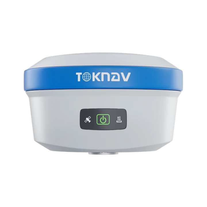

THE PRACTICAL DIFFERENCES
Start with T50 when your workflow calls for aiming a green laser at a visible target. Review target visibility, surface conditions and the required measurement distance before choosing the kit.
Start with T50Pro when your team wants a photogrammetric workflow for measuring points from captured imagery. Confirm the supported capture, processing and field-software procedure.
| Selection point | T50 | T50Pro |
|---|---|---|
| Primary extra measurement workflow | Green-laser measurement with a laser-assist camera | Photogrammetric / image-based survey |
| Published measurement conditions | 100 m laser module range; laser 3D error no more than 2.5 cm within 5 m | Image-survey error 2–4 cm within 2–15 m |
| Measurement camera | Laser-assist camera: 4224 × 3200 | Image-survey camera: 1920 × 1080 |
| Tilt measurement and visual stakeout | IMU tilt measurement and AR stakeout | IMU tilt measurement and AR stakeout |
| GNSS channels | 1892 | 1892 |
| Battery and charging | 7.4 V, 6800 mAh; Type-C / USB PD | 7.4 V, 6800 mAh; Type-C / USB PD |
| Published operating time | 25 h static; 20 h rover, in optimal conditions | 25 h static; 20 h rover, in optimal conditions |
| Size and weight | Ø132 × 83 mm; 770 g as specified | Ø132 × 83 mm; 770 g as specified |
| Protection rating | IP68 | IP68 |
| Correction setup | CORS / NTRIP or a compatible local base and radio setup | CORS / NTRIP or a compatible local base and radio setup |
Swipe to view all columns.
Laser range is not the same as 3D measurement accuracy. The laser and image-survey figures above apply to different methods and distances, so they are not a direct accuracy ranking. Battery life depends on work mode and conditions. Verify the supplied configuration, software and regional radio requirements before ordering.
Specifications checked against the following product documents on 3 November 2026.
COMPLETE YOUR CONFIGURATION
For CORS / NTRIP, confirm service coverage, credentials, mobile connectivity and coordinates. For a local base, specify the base receiver, radio protocol, antenna and power supply.
Plan an RTK + CORS/VRS configuration →Include the receiver quantity, controller, field-software licence, pole, radio, charger, batteries and case. Share any equipment you already own so compatibility can be reviewed.
Review product tests and workflows →SELECTION QUESTIONS
T50 emphasizes green-laser measurement, while T50Pro emphasizes photogrammetry and image-based survey. Both support conventional GNSS RTK work, IMU tilt measurement and AR stakeout. Choose according to the point-measurement procedure your team needs.
No. The T50 datasheet lists a 100 m laser module range, while the separate 3D error statement applies within 5 m. Match the measurement distance and conditions to the specific accuracy statement in the datasheet.
The Pro name does not decide the right workflow. Review T50 for laser point measurement and T50Pro for image-based survey. If your work is mainly conventional RTK collection and stakeout, compare the complete kit, software and support requirements.
Yes. The linked T50 and T50Pro datasheets list AR stakeout as well as IMU tilt measurement. Confirm the controller, field-software version and enabled functions in the proposed configuration.
Both datasheets list RTK NTRIP operation. Confirm local service coverage, login credentials, mobile connectivity, correction formats and the project coordinate system before field use.
Share your country, survey task, typical point conditions, correction source and any controller or software you already use. Include the number of receivers and whether you need a rover-only or base-and-rover kit.
LET’S PLAN YOUR EQUIPMENT
Share your country, application and correction source. We can review the receiver, controller, software and accessories for your work.
Help me choose a receiver