
TOKNAV Showcases High-Precision GNSS & Geospatial Solutions at Geo Week 2026 Denver
2026-02-19
TOKNAV Highlights T50 GNSS RTK, TSR20 LiDAR & Tboat USVs at Geo Week 2026
Denver, CO, February 18, 2026 – TOKNAV, a globally recognized provider of high-precision GNSS (Global Navigation Satellite System) and comprehensive geospatial solutions, successfully concluded a standout participation at Geo Week 2026, a three-day industry flagship event held from February 16 to 18 at the Denver Colorado Convention Center, where the company occupied Booth 1808. As the world’s premier geospatial industry gathering, Geo Week 2026 set new benchmarks this year, attracting over 3,800 registered attendees, 238 exhibitors hailing from 25 different countries across six continents, and boasting the largest exhibit hall in its decades-long history. Aligned perfectly with the event’s core focus on AI integration, uncrewed technology advancement, and 3D geospatial innovation, TOKNAV took center stage by showcasing its flagship T50 GNSS RTK (Real-Time Kinematic) receiver—equipped with industry-leading 100m laser ranging capability—alongside the compact and powerful TSR20 Handheld LiDAR Scanner and the versatile Tboat Series Unmanned Surface Vehicles (USVs). The company’s cutting-edge offerings resonated deeply with attendees, earning strong acclaim and positive feedback from geospatial professionals, surveyors, engineers, and industry leaders from around the globe.
Geo Week 2026 solidified its reputation as the epicenter of geospatial advancement, bringing together a diverse community of industry stakeholders to explore and celebrate the latest trends, technologies, and applications shaping the future of geospatial science. This year’s event was particularly focused on three transformative pillars: AI-embedded spatial data workflows that streamline efficiency and accuracy, the expanding role of uncrewed systems in field operations, and the ongoing evolution of 3D geospatial capture and analysis. In addition to featuring an extensive exhibit hall, Geo Week 2026 offered a rich program of keynotes delivered by industry pioneers, expert panels diving into critical challenges and opportunities, live demonstration zones where attendees could experience new technologies firsthand, and exclusive product previews that offered a glimpse into the next generation of geospatial tools. Every element of the event was designed to drive real-world geospatial innovation, connecting professionals with the solutions they need to tackle complex projects in surveying, mapping, construction, environmental management, and beyond. Notably, the event also highlighted the completion of the U.S. 3DEP (3D Elevation Program), a landmark initiative that provides high-quality 3D elevation data to support a wide range of geospatial applications, further underscoring the industry’s shift toward more detailed and accurate spatial information.
High-Precision GNSS and Geospatial Innovations for Surveying and 3D Reality Capture
TOKNAV’s portfolio of high-precision GNSS and geospatial solutions is strategically aligned with the global geospatial industry’s ongoing shift toward intelligent, long-range, and uncrewed systems—trends that were front and center at Geo Week 2026. The company’s latest product lineup is engineered to deliver exceptional centimeter-level accuracy, reliable performance in even the most challenging field conditions, and streamlined workflows that reduce operational time and costs for professionals across a variety of sectors, including land surveying, aerial mapping, civil construction, and hydrological operations. By combining advanced hardware with intuitive software, TOKNAV’s solutions address the evolving needs of the industry, empowering users to complete projects more efficiently, accurately, and safely than ever before. Whether working in remote rural areas, bustling urban environments, or harsh industrial sites, TOKNAV’s high-precision GNSS and geospatial tools are designed to adapt to diverse use cases, making them a versatile choice for geospatial professionals worldwide.
T50 GNSS RTK: 100m Laser Ranging for Long-Range High-Precision Surveying
The T50 GNSS RTK receiver emerged as a true star of TOKNAV’s booth at Geo Week 2026, perfectly embodying the event’s focus on high-performance field technology with its groundbreaking 100m laser ranging capability—a transformative feature that redefines long-range surveying possibilities. Unlike traditional GNSS devices that require close proximity to target points, the T50’s laser ranging function allows surveyors to capture accurate measurements from up to 100 meters away, eliminating the need to physically access hard-to-reach or hazardous areas such as steep slopes, busy highways, or unstable terrain. This not only enhances safety but also significantly boosts efficiency, reducing the time required to complete large-scale surveying projects. Complementing its laser ranging capability, the T50 is equipped with 1408+ multi-constellation GNSS channels, enabling it to receive signals from all major global satellite systems (including GPS, GLONASS, Galileo, and BeiDou) for enhanced positioning accuracy and reliability, even in environments with limited satellite visibility. The device also features AR (Augmented Reality) real-time stakeout, which overlays digital design data onto the physical environment through a built-in screen, allowing surveyors to quickly and accurately locate stakeout points without the need for additional equipment. Additionally, the T50 supports photogrammetry, enabling users to capture high-resolution images and generate detailed 3D models for further analysis. To ensure uninterrupted operation in the field, the T50 is equipped with dual removable high-capacity batteries that provide all-day power, even during extended surveying sessions. Its IP68 rugged design—meaning it is dust-tight and capable of withstanding submersion in up to 1.5 meters of water for 30 minutes—ensures reliable performance in harsh field conditions, including extreme temperatures, heavy rain, and dusty environments. These features combined make the T50 GNSS RTK a preferred choice for professionals seeking long-range, high-precision GNSS and geospatial solutions that deliver consistent performance in any scenario.
TSR20 Handheld LiDAR Scanner: Lightweight 3D Point Cloud Solution
TOKNAV’s TSR20 Handheld LiDAR Scanner also resonated strongly with Geo Week 2026 attendees, aligning perfectly with the event’s emphasis on 3D reality capture—a critical trend in modern geospatial technology. Weighing only 1.0kg, the TSR20 is one of the lightest handheld LiDAR scanners on the market, making it easy to carry and operate for extended periods without causing user fatigue. Despite its compact size, the device is packed with advanced features, including a high-performance Livox Mid-360 sensor and state-of-the-art SLAM (Simultaneous Localization and Mapping) algorithms that enable it to capture high-precision 3D point clouds with ≤3cm relative accuracy. What sets the TSR20 apart is its ability to perform equally well in both GNSS-enabled and GNSS-denied environments—such as indoor spaces, urban canyons, or dense forests—where traditional GNSS devices often struggle to maintain accuracy. This versatility makes the TSR20 ideal for a wide range of applications, including urban mapping, where it can quickly capture detailed data on buildings, roads, and infrastructure; infrastructure inspection, allowing engineers to assess the condition of bridges, tunnels, and pipelines without the need for expensive and time-consuming manual inspections; and digital twin modeling, a rapidly growing field that requires accurate 3D data to create virtual replicas of physical assets. At Geo Week 2026, TOKNAV’s team conducted live demonstrations of the TSR20, showcasing how easily it can be used to capture 3D data and generate detailed point clouds in real time, impressing attendees with its speed, accuracy, and user-friendliness.
Tboat Series USVs: Unmanned Surface Vehicles for Aquatic Geospatial Operations
The Tboat Series USVs (Unmanned Surface Vehicles), including the Tboat10 and Tboat20 models, rounded out TOKNAV’s impressive product showcase at Geo Week 2026, embodying the event’s focus on uncrewed technology and its application in geospatial operations. Designed as a “one vessel for multi-use” aquatic solution, the Tboat Series delivers exceptional accuracy with a depth measurement precision of ±1 cm + 0.1% D (where D is the measured depth), ensuring reliable data collection even in complex aquatic environments. Equipped with advanced navigation systems and high automation capabilities, the Tboat Series can operate autonomously, following pre-programmed routes to collect data without the need for constant human intervention. This not only reduces labor costs but also enhances safety by eliminating the need for personnel to operate boats in potentially hazardous aquatic conditions, such as rough waters, deep lakes, or contaminated water bodies. The Tboat Series also features strong anti-interference performance, ensuring stable operation even in areas with high electromagnetic interference or heavy vessel traffic. Its versatile design allows it to support a wide range of aquatic geospatial operations, including underwater topographic mapping, which is critical for projects such as dam construction, port development, and environmental monitoring; water quality monitoring, enabling scientists to collect data on water temperature, pH levels, and pollutant concentrations across large water bodies; and hydrological surveys, which help researchers understand water flow patterns, sedimentation, and flood risk. At Geo Week 2026, the Tboat Series drew significant attention from attendees working in coastal management, environmental science, and civil engineering, who recognized its potential to revolutionize aquatic geospatial data collection.
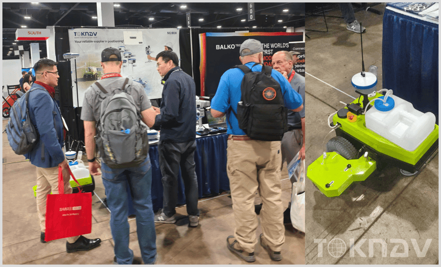
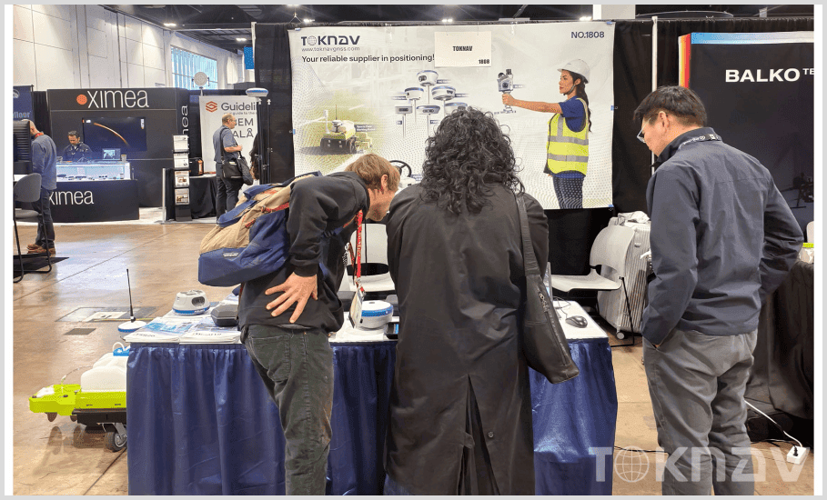
TOKNAV Strengthens Global Partnerships at Geo Week 2026 Denver
Booth 1808 at the Denver Colorado Convention Center became a hub of activity throughout Geo Week 2026, as TOKNAV welcomed hundreds of global geospatial professionals from North America, Europe, Africa, and Oceania. The company’s team of technical experts and sales representatives was on hand to conduct live product demonstrations, walking attendees through the features and capabilities of the T50 GNSS RTK, TSR20 Handheld LiDAR Scanner, and Tboat Series USVs. These demonstrations allowed attendees to see the technology in action, ask questions, and experience firsthand how TOKNAV’s high-precision GNSS and geospatial solutions could address their specific project needs. In addition to live demos, TOKNAV’s team held in-depth discussions with attendees on topics such as AI integration into surveying workflows, the future of uncrewed geospatial systems, and the challenges of collecting high-precision data in complex environments. These conversations not only helped attendees gain a better understanding of TOKNAV’s products but also provided the company with valuable insights into industry needs and emerging trends. As a result of these interactions, TOKNAV secured multiple preliminary cooperation intentions with distributors, engineering firms, and research institutions from around the world, further validating the strong market demand for its high-precision GNSS and geospatial solutions. The success of the event reinforced TOKNAV’s position as a global leader in the geospatial industry and strengthened its commitment to expanding its global footprint.
Visitors to TOKNAV’s booth consistently praised the company’s technological innovations, with particular enthusiasm for the T50 GNSS RTK’s 100m laser ranging advantage, which many noted would significantly improve their field operations. Attendees also recognized TOKNAV’s strong alignment with the industry’s shift toward smarter, longer-range, and uncrewed geospatial tools, commending the company for its forward-thinking approach to product development. Many visitors commented on the user-friendliness of TOKNAV’s solutions, noting that the intuitive design and advanced features made them accessible to both experienced professionals and those new to geospatial technology. Several attendees also expressed interest in future collaborations with TOKNAV, highlighting the company’s reputation for reliability, innovation, and customer support.
A TOKNAV representative shared their thoughts on the company’s participation at Geo Week 2026, stating: “Geo Week is the ultimate stage for the global geospatial industry to converge, innovate, and collaborate. This year’s focus on AI, uncrewed technology, and 3D innovation perfectly matches our R&D direction, and we were thrilled to showcase our latest high-precision GNSS and geospatial solutions to such a diverse and engaged audience. The T50’s 100m laser ranging capability addresses a critical industry need for more efficient, long-range high-precision tools, and the positive feedback we received from attendees reaffirms that we are on the right track. We are proud to have been part of this iconic event, and we look forward to building on the connections and partnerships we established here. Moving forward, TOKNAV will continue advancing AI-integrated and uncrewed geospatial technologies, deepen the global partnerships built at Geo Week 2026, and uphold our core mission: Making positioning more precise and easier for professionals around the world.”