
Best RTK GPS Receiver 2026: Affordable RTK Base and Rover & Professional GNSS Solutions from China Manufacturer
2026-04-20
Best RTK GPS Receiver 2026: Affordable RTK Base and Rover & Top GNSS Solutions for Land Survey, Agriculture & Construction
In 2026, the demand for high-precision positioning technology is booming across land surveying, precision agriculture, and construction industries. As professionals and businesses seek to enhance efficiency, reduce operational costs, and ensure accuracy in every project, the search for reliable, cost-effective GNSS solutions has never been more critical. Whether you’re a land surveyor looking for the Best RTK GPS Receiver 2026, a farmer in need of Affordable RTK Base and Rover kits, or a construction company searching for Affordable GNSS for Land Survey, choosing the right manufacturer and tailored solutions is the foundation of successful project execution. As a leading RTK Receiver Manufacturer China, TOKNAV (www.toknavgnss.com) has emerged as a trusted partner, delivering cutting-edge GNSS products and services that cater to both B2B clients and end-users, with an unwavering focus on accuracy, portability, and cost-effectiveness. With years of industry experience and a team of dedicated engineers, TOKNAV has redefined what high-precision positioning solutions can offer, making advanced technology accessible to professionals across various sectors.
Founded in 2019 by a group of top professional engineers with decades of combined experience in the GNSS and precision measuring industry, TOKNAV is a core brand of Guangzhou TokSurvey Information Technology Co., Ltd. The company specializes in the research, development, production, and sales of industrial precision measuring equipment and GNSS precision measuring devices, with a mission to “Make positioning more precise and easier.” Headquartered in Guangzhou, China, TOKNAV has also established overseas offices in the United States, allowing it to provide timely support and services to global customers. Over the years, TOKNAV has built a solid reputation for reliability, innovation, and customer-centricity, with products that serve diverse sectors—from land surveying and precision agriculture to road construction and deformation monitoring. Below, we break down the most sought-after RTK and GNSS solutions in 2026, tailored to the keywords users search for most, and explain how TOKNAV’s offerings address the unique needs of professionals in each field.
Affordable RTK Base and Rover: TOKNAV’s Cost-Effective, High-Precision Kits
For land surveyors, construction teams, and agricultural professionals, Affordable RTK Base and Rover kits are a game-changer—combining centimeter-level positioning accuracy with budget-friendly pricing that doesn’t compromise on quality. In an industry where precision directly impacts project outcomes and profitability, having access to cost-effective yet reliable RTK solutions is essential. TOKNAV’s RTK series stands out as the ideal choice for these professionals, with a diverse range of options spanning from economical handheld models to high-performance professional-grade systems, all specifically designed to meet the needs of Affordable GNSS for Land Survey and other critical applications. Whether you’re working on a small residential survey, a large-scale construction project, or a sprawling agricultural field, TOKNAV has an RTK solution that fits your budget and performance requirements.
TOKNAV’s T5 Series, an economical handheld RTK receiver, is specifically engineered for small to medium-scale land surveys and entry-level professionals. This compact device offers 1408 channels for reliable signal reception, 32GB of internal storage to store large volumes of survey data, and seamless connectivity via 4G, WIFI, and Bluetooth—ensuring that you can transfer data quickly and stay connected in remote areas. With a positioning accuracy of less than 2cm, the T5 Series delivers the precision needed for most land surveying tasks, all at a price point that makes it accessible to businesses and individuals alike. For more demanding projects that require advanced features, the T30 and T40 Series (multifunctional professional RTKs) are equipped with AR stakeout, laser measurement, and photogrammetry capabilities, allowing professionals to complete complex tasks more efficiently. The palm-sized T50 Series, which weighs only 770g, takes portability to the next level while featuring an integrated IMU and a 100m visualized laser range, making it one of the Best RTK GPS Receiver 2026 options for professionals who need to move quickly across job sites without sacrificing performance.
When it comes to RTK base stations, which are critical for ensuring consistent, accurate positioning across large job sites, TOKNAV’s Net660 and Net660i series deliver exceptional value and performance. The Net660 base station receiver is designed for extended field use, with 32GB of storage to log data over long periods, full-frequency network connectivity to ensure stable signal transmission, and a powerful 13800mAh battery that provides over 24 hours of continuous operation—eliminating the need for frequent recharging and minimizing downtime. A common question among professionals is about RTK Base Station Range, and TOKNAV’s solutions address this concern with a transmission distance of up to 16KM via the 5W radio in the T20 Series, ensuring reliable connectivity even in remote or challenging terrain where signal strength can be inconsistent. For those seeking aRTK Base Rover Kit Price list, TOKNAV offers flexible wholesale options that cater to B2B clients, making it a top choice for Wholesale Surveying Instruments and B2B Surveying Equipment Online. These wholesale options allow businesses to stock high-quality RTK kits at competitive prices, passing on the savings to their own customers while maintaining profitability.
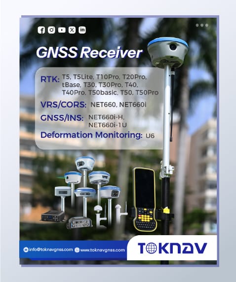
What makes a receiver the Best RTK GPS Receiver 2026? It’s not just about accuracy—it’s a combination of reliability, versatility, ease of use, and adaptability to diverse application scenarios. In today’s fast-paced industries, professionals need equipment that can keep up with their demands, whether they’re working in harsh weather conditions, remote locations, or complex job sites. TOKNAV’s RTK lineup checks all these boxes, with each model tailored to the unique needs of land surveying, agriculture, and construction professionals. From compact handheld devices to robust professional systems, every TOKNAV RTK receiver is built to deliver consistent performance, even in the most challenging environments, making them the top choice for professionals worldwide.
For agricultural professionals looking to enhance productivity and reduce labor costs, Precision Ag RTK Auto Steer and Agriculture RTK Kit for Tractors are essential tools. TOKNAV’s TAG series is specifically designed for precision agriculture, offering innovative solutions that transform how farmers manage their fields. The TAG66 Electric Steering Wheel Autonomous Driving System supports RTK corrections via UHF radio, ensuring precise navigation across fields, and includes a wheel angle sensor mode that is essential for specific farm operations such as planting and harvesting. The TAG88 Automated GNSS Land Leveling System takes precision agriculture to the next level, achieving an operation accuracy of ±2.5cm and supporting 24-hour continuous use—allowing farmers to work around the clock and maximize their productivity. These solutions also address the growing demand for Agriculture Auto Steer RTK Price and Precision Ag RTK Kit Price, offering cost-effective options that make advanced precision agriculture technology accessible to farmers of all sizes. By optimizing resource allocation, reducing waste, and improving crop yields, TOKNAV’s TAG series plays a vital role in advancing agriculture toward greater intelligence, precision, and sustainability.
IMU Tilt Compensation RTK for Faster Survey on Slopes
Much of Argentina’s land is sloped—from vineyards in Mendoza to road construction along mountainous areas. Traditional RTK receivers require surveyors to perfectly level the pole for every measurement, slowing work and increasing fatigue. The TOKNAV T45 eliminates this problem with IMU tilt compensation RTK technology, delivering accurate measurements even when tilted up to 60 degrees. The correction error remains under 2 centimeters, meeting strict accuracy standards for cadastral surveying, construction layout, and infrastructure work. Argentine field crews report reducing field time by 30–40% on sloped projects because they no longer need to stop and level the pole repeatedly. This IMU tilt compensation feature also eliminates “fly points” common with older equipment, ensuring clean, reliable data that imports smoothly into CAD and GIS software. For any team working on uneven ground, this feature alone makes TOKNAV a smarter choice.
IP68 Rugged RTK Receiver for Extreme Environments
Argentina’s climate varies widely, from extreme heat in the northern plains to cold, wet conditions in Patagonia and high-altitude mountain zones. Survey equipment must resist dust, moisture, drops, and temperature changes. Both the T45 receiver and tBase base station feature IP68 rugged RTK receiver construction with a durable magnesium alloy casing. They are fully waterproof, dustproof, and shock-resistant, able to withstand drops from 1.5 meters. The operating temperature range spans from -30°C to +65°C, making them suitable for summer heat and winter cold alike. The TSR20 SLAM scanner shares this rugged build quality, operating reliably from -20°C to +55°C. For Argentine field crews working long days in harsh conditions, this rugged design means less downtime, fewer repairs, and a lower total cost of ownership over time.
TSR20 Handheld SLAM Scanner: 3D Mapping in GNSS-Denied Areas in Argentina
Many Argentine projects require mapping in areas where GNSS signals are weak or unavailable: building interiors, underground parking facilities, tunnels, dense forests, and urban canyons surrounded by tall buildings. This is where the TOKNAV TSR20 handheld SLAM LiDAR scanner becomes indispensable. Designed for SLAM laser scanner performance without relying on satellite signals, the TSR20 captures precise 3D point clouds with or without GNSS. It delivers relative accuracy within 3cm and absolute accuracy within 5cm, making it ideal for architectural surveying, construction verification, infrastructure inspection, historical preservation, and indoor mapping.
Weighing only 1.0kg, the TSR20 is ultra-portable and designed for all-day handheld use across indoor and outdoor sites. It supports three mapping modes: SLAM, RTK-SLAM, and PPK-SLAM, allowing users to switch flexibly between real-time mapping and post-processing workflows. For Argentine architects, engineers, and construction teams, the TSR20 creates detailed 3D models and digital twins that integrate directly with BIM and GIS software. It also includes dual high resolution cameras for synchronized true color texture capture, turning geometric point clouds into realistic, visually accurate 3D models. Whether mapping a building interior in Buenos Aires or a forested area in northern Argentina, the TSR20 performs reliably where traditional GPS tools cannot.
TOKNAV TSR20 SLAM LiDAR Scanner for Argentina 3D Mapping
Real Field Feedback from TOKNAV Authorized Dealer in Argentina
Our authorized TOKNAV authorized dealer in Argentina has deployed T45, tBase, and TSR20 across dozens of real projects: agricultural land surveys in the Pampas, 3D construction mapping in urban areas, slope monitoring in western provinces, and topographic surveys for infrastructure development. The feedback is consistent: TOKNAV outperforms competing brands in signal stability, durability, ease of use, and overall value.
1408 Channel GNSS for Fast Fix in Forests & Urban Canyons
A top complaint among Argentine surveyors is slow or lost RTK fix under tree cover or in dense cities. The T45 and tBase solve this with 1408 channel GNSS capability, tracking every available satellite signal across all frequencies. This full constellation support delivers faster cold starts, quicker RTK initialization, and stronger fix retention even in challenging environments. In field tests in forested zones, the T45 maintained RTK fix at a far higher rate than competing units with fewer channels. For surveyors, farmers, and construction teams, this means faster work, more reliable data, and fewer return trips to the field to repeat measurements.
Full Workflow & Usability That Fits Argentine Field Conditions
TOKNAV does not only provide high-quality hardware—it delivers a complete field-to-finish workflow designed for real-world usability. Every feature is built to make work faster, simpler, and more reliable for professionals in Argentina.
AR Stakeout GPS for Construction Layout Efficiency
Construction teams across Argentina rely on AR stakeout GPS to speed up layout and reduce errors. The T45 includes a built in ultra wide angle camera for AR real time stakeout, allowing operators to see design points overlaid on the real world via the controller screen. This visual guidance cuts down training time, reduces layout mistakes, and speeds up construction layout dramatically. It also includes a precision laser ranging module for accurate distance and height measurements without extra tools. For construction projects of all sizes, this means one device does the work of many, simplifying inventory and boosting crew efficiency.
WebUI Configuration & Type-C Fast Charge for Field Convenience
Both the T45 and tBase support WebUI configuration, allowing users to set up, monitor, and adjust the receiver using any web browser—no special software or controller required. This remote management is extremely useful for base stations deployed in remote areas, as technicians can adjust settings without traveling to the site. The T45 also features Type-C fast charge technology, with long-life battery support for over 16 hours of field use. The tBase base station includes a high-capacity battery for all-day deployment, and the TSR20’s low power design supports extended sessions. For Argentine crews working long days in remote locations, these convenience features eliminate battery anxiety and keep projects on schedule.
TOKNAV T45 AR Stakeout GPS for Argentina Construction Layout
PPK & RTK-SLAM for UAV and Mobile Mapping Projects
Many Argentine surveying projects use drones for aerial mapping. TOKNAV’s ecosystem supports both RTK and PPK workflows, giving teams flexibility based on signal availability. The tBase and T45 provide real-time corrections for drone mapping, while PPK mode delivers high accuracy even in areas with no network coverage. When paired with the TSR20 SLAM scanner, teams can combine aerial drone data with terrestrial 3D LiDAR scans to create full digital twins of sites—from urban buildings to rural infrastructure. The TSR20’s RTK-SLAM mode fuses LiDAR data with GNSS positioning for seamless, geo-referenced 3D models that work perfectly with BIM and GIS tools. This capability is transforming Argentine infrastructure projects, allowing engineers to monitor progress, inspect assets, and manage digital twins with centimeter-level precision.
Where to Buy TOKNAV in Argentina & How to Get Local Support
As TOKNAV’s presence grows across Latin America, local support and reliable sales channels are more important than ever. Our authorized TOKNAV dealer in Argentina provides complete local services: equipment sales, product demos, hands-on training, technical support, warranty service, and repair assistance. This means you never have to navigate complex international support alone.
Authorized TOKNAV Dealer in Argentina: Local Service & Training
Purchasing from an authorized dealer ensures you receive genuine TOKNAV hardware, full factory warranty, and access to local expertise tailored to Argentine surveying regulations and project needs. The Argentina-based dealer offers in-person product demos and field trials, professional training for T45, tBase, and TSR20 operation, local technical support for setup and troubleshooting, fast repair and calibration services, and assistance with CORS and NTRIP setup for network RTK. This local support is invaluable for businesses transitioning to high-precision RTK and SLAM technology, ensuring your team maximizes equipment performance from day one.
Affordable RTK Base and Rover Kit for Any Business Size
TOKNAV is committed to making professional-grade positioning affordable RTK base and rover solutions for businesses of all sizes—from small surveying firms to large construction and agricultural enterprises. The T45 + tBase kit delivers premium performance at a lower cost than premium international brands, without sacrificing accuracy or durability. The TSR20 handheld SLAM scanner also offers an attractive entry point for 3D mapping, making digital twin technology accessible to Argentine companies that previously could not afford high-end LiDAR tools. Flexible purchasing options and bulk discounts make TOKNAV a smart choice for budget-conscious teams that refuse to compromise on quality.
Upgrade Your Workflow with TOKNAV in Argentina
Argentina’s surveying, construction, agriculture, and infrastructure sectors are growing rapidly, and they need positioning tools that match their ambition. Feedback from our authorized dealer confirms: TOKNAV T45 GNSS RTK receiver, tBase base station, and TSR20 handheld SLAM LiDAR scanner deliver the precision, ruggedness, and versatility needed to excel in Argentina’s unique landscape. From centimeter-level RTK surveys in the Pampas to 3D SLAM mapping in urban centers, from slope-side vineyard surveys to large-scale infrastructure monitoring, TOKNAV provides a complete, future-proof solution. With 1408-channel GNSS, IMU tilt compensation, AR stakeout, IP68 ruggedness, and flexible RTK/PPK/SLAM modes, TOKNAV tools solve real local challenges while boosting efficiency, accuracy, and profitability.
If you are ready to upgrade your surveying, mapping, or construction workflow with the best RTK GPS receiver 2026 and innovative SLAM scanning technology, now is the perfect time to join the growing number of Argentine professionals choosing TOKNAV.
Ready to experience TOKNAV’s precision and performance for your Argentine projects? Fill out our official website form now to request a free product demo, detailed pricing, local dealer contact information, or a customized solution quote. Our Argentina based team will respond quickly to help you select the ideal T45, tBase, or TSR20 setup—with full training and local support included. Transform your field workflows today with professional-grade RTK and SLAM technology from TOKNAV!