Category: Blog

  • VRS vs RTK Base Station: Which Correction Method Fits Your Project?

    Compare VRS network RTK and local base-station workflows for surveying, CORS, monitoring and construction. Learn how coverage, control and project scale guide correction planning for global field teams.

    Author: TOKNAV GNSS Solution Team

    Reviewed by: TOKNAV Product and Field Application Team

    Last Updated: July 2026

    When a surveying team, construction contractor, CORS operator or system integrator plans a high-precision GNSS project, one of the first questions is simple but important:
    should the project use a local RTK base station or a VRS network RTK workflow?

    Both methods can support centimeter-level positioning when designed and operated correctly, but they are not the same. A local RTK base station is often practical for a single jobsite or short-term project. A VRS network is better suited to wider-area correction coverage, shared rover users and long-term infrastructure.

    This guide explains how to compare the two workflows and how TOKNAV products such as NET660i, NET660, tBase and TCA920 can fit different correction-system plans.

    What Is a Local RTK Base Station?

    A local RTK base station is a GNSS receiver installed at a known point. It sends correction data to one or more rover receivers by radio, network connection or another supported data link. The rover uses the correction data to improve positioning accuracy for field work.

    This workflow is common for:

    • Construction layout and stakeout.
    • Topographic survey on a defined project site.
    • Field work where public or private network RTK coverage is unavailable.
    • Short-term survey projects that need local control.
    • Dealer demonstration kits and training workflows.

    TOKNAV tBase can support base-rover workflows, while RTK rovers such as T50Pro, T40Pro, T20Pro and T10Pro can be selected according to field needs.

    What Is a VRS Network RTK Workflow?

    A VRS network RTK workflow uses multiple reference stations and network correction processing to support rover users across a wider planned area. Instead of relying on one local base station for one project area, the network collects data from several reference stations and provides corrections through a correction service workflow.

    VRS and CORS projects are typically considered when the buyer needs:

    • Regional or city-level correction coverage.
    • Multiple rover users working in different locations.
    • Stable infrastructure for surveying, monitoring, agriculture or machine positioning.
    • A correction service managed by an organization, distributor, agency or system integrator.
    • Long-term operation rather than one short field job.

    TOKNAV VRS Solution connects CORS/reference station receivers, GNSS antennas, data communication and project planning support for this kind of infrastructure.

    Quick Comparison: VRS Network RTK vs Local RTK Base

    Decision factor Local RTK base station VRS network RTK
    Best fit One jobsite, one team or short-term project area. Wider-area correction coverage with multiple users or long-term operation.
    Infrastructure One base receiver, rover receivers and data link. Multiple reference stations, antennas, communication and correction service workflow.
    Setup complexity Lower. Good for project teams that need fast field deployment. Higher. Requires planning for station locations, communications, server/workflow and maintenance.
    Scalability Limited to local project needs and data-link condition. Better for many rover users and larger coverage areas.
    Typical TOKNAV products tBase with RTK rover receivers such as T20Pro, T10Pro, T40Pro or T50Pro. NET660, NET660i, TCA-series antennas such as TCA920 and VRS/CORS project support.
    Buyer question Which base-rover package fits this site? How many stations and what receiver/antenna setup does this network need?

    When Should You Choose a Local RTK Base Station?

    Choose a local RTK base station when the project is limited to one site, the work period is temporary, or the team wants more direct control over the correction source. This can be practical for contractors, survey crews, road projects, construction layout teams and dealers building a field demonstration kit.

    A local base station can be especially useful when:

    • Network RTK coverage is weak or unavailable.
    • The team needs a controlled correction source for a specific site.
    • The project has a short timeline and does not justify network infrastructure.
    • Radio or local data links are suitable for the terrain and distance.
    • The buyer wants a package that is easier to train and deploy.

    In this situation, TOKNAV can help compare tBase with compatible rover receivers and accessories.

    When Should You Choose VRS or CORS Infrastructure?

    Choose VRS or CORS infrastructure when the goal is not just one field job, but a correction service or infrastructure system. This is common for cities, surveying organizations, government-related projects, monitoring networks, regional distributors, agriculture service providers and system integrators.

    VRS or CORS is usually worth evaluating when:

    • Many users need correction access across a planned region.
    • The project needs long-term reference station operation.
    • Receivers and antennas must be installed at stable sites.
    • Correction data must be distributed by network workflows such as Ntrip.
    • The solution may support surveying, monitoring, agriculture or machine control together.

    In this situation, project owners should compare CORS receiver options such as NET660 and NET660i, and select GNSS antennas such as TCA920 according to installation environment and signal requirements.

    Questions to Answer Before Requesting a Quote

    Whether you are planning a base-rover package or a VRS/CORS project, the recommendation will be more useful if you prepare the right inputs.

    For a local RTK base station package

    • What is the application: surveying, construction, road, GIS or training?
    • How large is the project area?
    • Will correction data use radio, network or another link?
    • How many rover receivers are needed?
    • What battery, controller, software and accessory needs should be included?

    For a VRS or CORS project

    • Which country or region needs coverage?
    • How many reference stations are planned?
    • What are the station installation environments?
    • What antenna type and mounting conditions are expected?
    • How will data communication, power supply and server workflow be handled?
    • Which users will access corrections: surveyors, monitoring devices, agriculture teams, machine control or other users?

    Recommended TOKNAV Product Paths

    Project need Recommended starting point Next action
    RTK surveying with local correction tBase plus RTK rover receivers. Request a base-rover package recommendation.
    CORS or VRS infrastructure NET660i, NET660 and suitable antennas. Share station count and coverage plan.
    Reference station antenna selection TCA920 or another TOKNAV GNSS antenna. Send receiver model, mounting environment and required signals.
    Monitoring and long-term infrastructure GNSS Deformation Monitoring with receiver and antenna planning. Send monitoring point quantity, site condition and data interval needs.

    FAQ: VRS vs RTK Base Station

    Is VRS always better than a local RTK base station?

    No. VRS is better for wider-area network correction coverage and many users, while a local RTK base station can be simpler and more practical for one project site or a temporary field job.

    Which TOKNAV receiver should be used for CORS or VRS projects?

    NET660 and NET660i are relevant starting points for CORS and reference station projects. The final choice should be confirmed by station design, data link, antenna environment and project requirements.

    Which TOKNAV receiver should be used as a local base station?

    tBase is a practical starting point for base-rover RTK workflows. Pair it with suitable TOKNAV rover receivers according to application, range, correction method and field environment.

    Do VRS projects need special GNSS antennas?

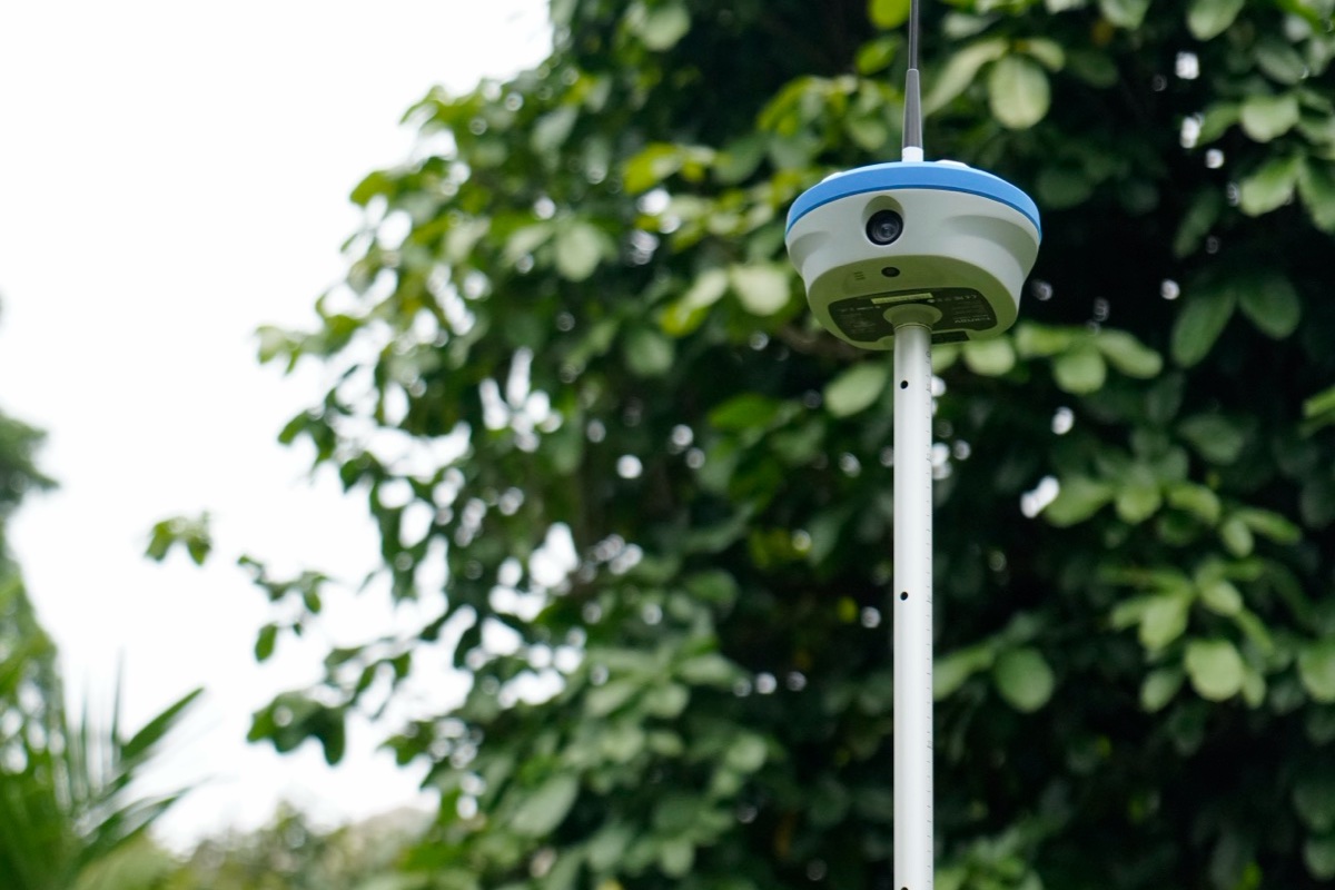
    Reference station and CORS projects usually need a suitable GNSS antenna selected by signal requirements, multipath environment, mounting condition and receiver model. TCA920 is one option for high-precision reference station applications.

    Discuss a CORS, VRS or RTK Base Station Project

    If you are planning a local RTK base-rover package, CORS network, VRS correction service or monitoring infrastructure, send your project details to TOKNAV. Include region, coverage area, station count, receiver preference, antenna environment, rover users and target accuracy.

    Discuss CORS/VRS Project
    Download GNSS resources

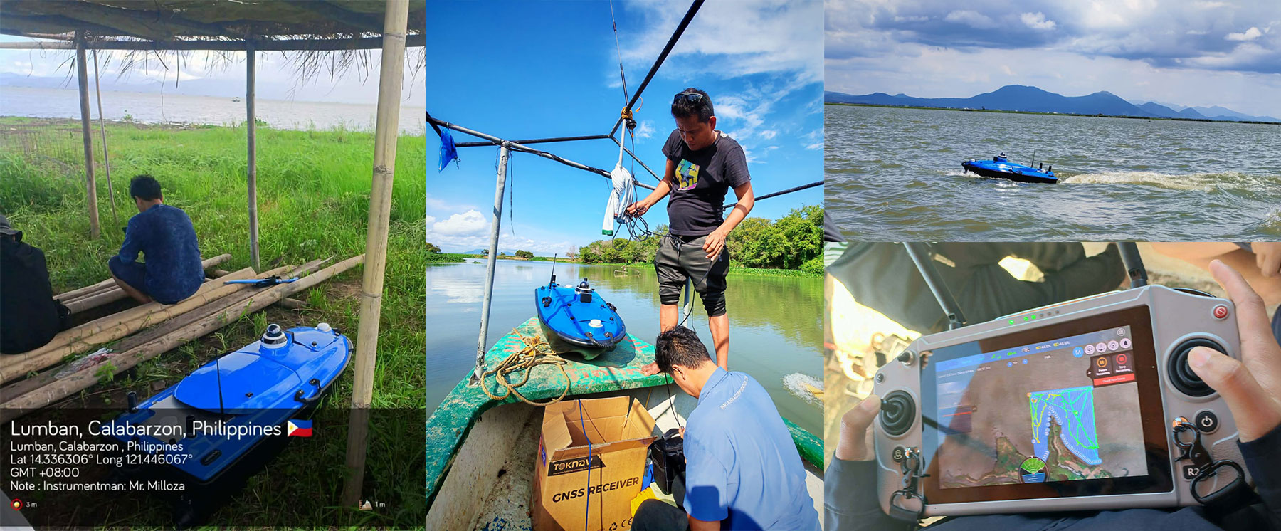
  • 2026 Toknav USVs:  Powerful  Solutions for Precision Water Operations

    2026 Toknav USVs: Powerful Solutions for Precision Water Operations

    Toknav Tboat10 & Tboat20 USVs: Smart Tools for Water Operations

    2026-02-03

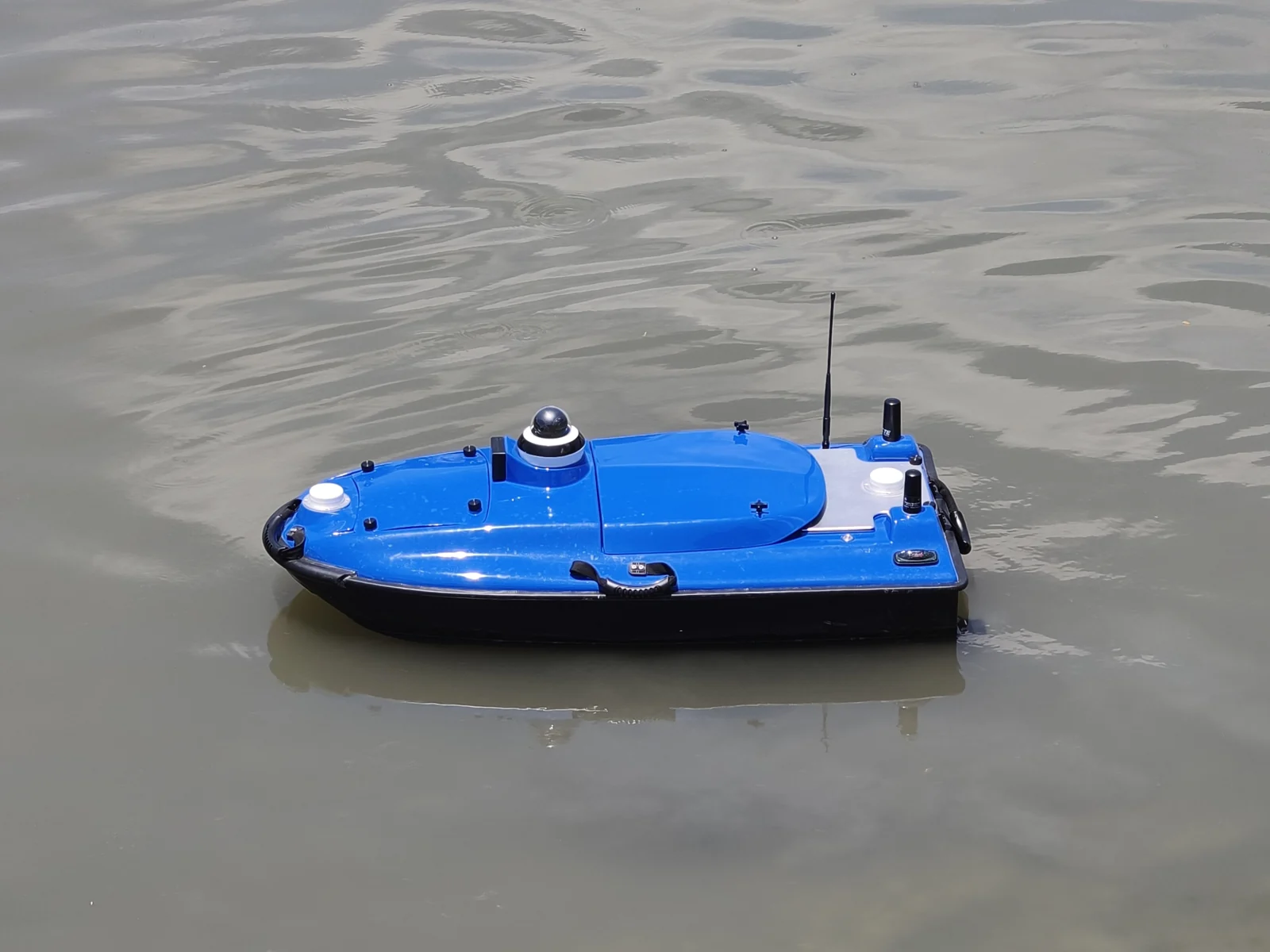
    Water tasks like surveying, monitoring, and patrols need reliable gear. Toknav’s Tboat series—Tboat10 and Tboat20—stands out for everyday use. These USVs mix tough builds, easy operation, and smart features. Today, we’ll break down their specs, how they differ, and why they fit real-world water work.

    1. What Makes Toknav Tboat USVs Different?

    Many USVs are either too complex or not tough enough. Toknav fixes this with Tboat10 and Tboat20. They focus on “no-fuss reliability” for teams that need consistent results.
    First, both use durable materials that handle rough water. Second, they have simple controls—no pro skills needed. Third, they support hot-swappable batteries to keep work going. Whether you’re measuring water depth (Tboat10) or doing multi-task jobs (Tboat20), these USVs skip the hassle and get the job done.

    2. Core Specs: Tboat10 vs. Tboat20

    Tboat10 and Tboat20 share Toknav’s practical design but serve different needs. Below is a clear look at their key specs.

    2.1 Hull & Build: Tough Yet Easy to Use
    Both USVs have strong hulls, but Tboat20 is built for heavier tasks.

    Tboat10: M-type monohull (carbon fiber); 30kg total weight; 35kg payload. IP67 protection; handles 3rd-level wind and 2nd-level waves.

    Tboat20: V-shaped hull (polyester fiber + Kevlar); 40kg total weight; 50kg payload. IP67 protection; handles 4th-level wind and 3rd-level waves.

    Shared Perk: No assembly—unbox and use right away; easy to transport.

    2.2 Power & Endurance: Keep Working All Day 
    Battery life matters for long tasks, and both USVs deliver.

    Tboat10: 33.6V 25Ah dual batteries; 7 hours at 1.5m/s; 7m/s max speed. Hot-swappable without shutdown.

    Tboat20: 33.6V 25Ah dual batteries; 7 hours at 1.5m/s; 6m/s max speed. Balanced power for longer runs.

    Shared Perk: Brushless motors (900W for Tboat10, 1100W for Tboat20) with clog-resistant propellers.

    2.3 Navigation & Control: Simple Yet Precise
    You don’t need complex training to use these USVs.

    Satellite Support: Both use BDS, GPS, GLONASS, Galileo—centimeter-level RTK accuracy (±8mm+1ppm).

    Controllers: 1200-nit sunlight-readable touchscreen; 3km range (unlimited via 4G); 8-hour battery.

    Shared Perk: tSail software for route planning and real-time data.

    2.4 Safety & Expandability: Ready for Any Task 
    Safety features prevent downtime, and expandability fits diverse jobs.

    Safety: Both have radar obstacle avoidance and shallow-water auto-reverse.

    Expandability: Tboat10 fits echo sounders, cameras; Tboat20 adds multibeam sonar, ADCP for big tasks.

    Shared Perk: Open SDK for custom tools (like gas detectors or LiDAR).

    How to Pick: Tboat10 or Tboat20?

    Choose based on your daily tasks:

    Tboat10: Great for small-to-medium jobs—like lake depth measurement or small-area patrols. Its light weight and fast speed (7m/s) work well in tight spaces.

    Tboat20: Best for heavy tasks—like river hydrological monitoring or coastal surveys. Its 50kg payload handles multiple sensors at once.
    For water-quality checks, both work: Tboat10 covers small ponds quickly, while Tboat20 takes on large rivers with more tools.

    Why Teams Love Toknav Tboats

    Beyond specs, these USVs solve real on-site problems:

    No Downtime: Hot-swappable batteries mean no stopping to charge.

    Easy to Learn: Simple controls let new users start in minutes.

    Tough Enough: IP67 and strong hulls handle rain, waves, and bumps.

    Grows with You: Add tools as your tasks change—no need for new USVs

    Conclusion: Tboats for Practical Water Work

    Toknav Tboat10 and Tboat20 aren’t just USVs—they’re time-savers for teams that need results. Tboat10 keeps small jobs fast and easy; Tboat20 takes on big, complex tasks without hassle.
    Both skip the over-the-top features and focus on what matters: reliability, ease of use, and long-lasting performance. They fit how you actually work in the field.
    Quick question: Do you mostly handle small-area surveys or big water projects? Have you ever struggled with USVs that need too much setup? Drop a comment—I’ll help you pick the right Tboat!
    For more details or a demo, visit www.toknavgnss.com or email [email protected]. Follow us for tips on water operation tools!

  • TR10 Intelligent Marking Robot: Revolutionize Line Marking

    TR10 Intelligent Marking Robot: Revolutionize Line Marking

    Revolutionize Your Line Marking with the TR10 Intelligent Marking Robot

    2026-01-28

    Are you tired of spending hours on manual line marking for sports fields, roads, or construction sites? Traditional methods are not only time-consuming but also prone to human error, leading to inaccuracies and increased costs. In today’s fast-paced world, efficiency and precision are key. That’s where the TR10 series Intelligent Marking Robot comes in—a game-changer for industries requiring reliable, high-precision marking.
    As an expert in construction and surveying technology, I’ve seen how automation can transform workflows. In this blog, I’ll break down why the TR10 is a must-have tool, based on its technical specs and real-world applications, to help you make an informed decision.

    What is the TR10 Marking Robot?

    The TR10 series is an auxiliary work robot designed to automate measuring, marking, and drawing lines. It’s not just another piece of equipment; it’s a smart solution that combines robotics with high-precision GPS technology. Whether you’re working on a soccer field, highway, or airport runway, this robot simplifies tasks that used to require multiple workers and days of effort. By leveraging built-in templates and customizable options, it adapts to your specific needs, making it a versatile addition to any project.

    Key Features and Benefits

    Why the TR10 is the Leading Intelligent Marking Robot in the Market

    High-Precision Positioning for Centimeter-Level Accuracy

    One of the standout features of the TR10 is its Linux-based intelligent system, which supports full constellation and full-band frequency signal tracking with 1408 channels. This means it can receive signals from BDS, GPS, GLONASS, GALILEO, SBAS, and QZSS satellites, ensuring reliable positioning.
    With Real-Time Kinematic (RTK) differential positioning and access to the Beidou ground-based augmentation system, it achieves repeatable centimeter-level accuracy. In practical terms, this eliminates the guesswork and rework common in manual marking—I’ve seen projects where this precision reduced errors by over 90%, saving both time and materials.

    Long Battery Life and Impressive Speed

    Equipped with a 48V/15Ah lithium battery (customizable up to 30km range), the TR10 offers up to 8 hours of continuous operation and a top speed of 1m/s. This translates to covering up to 15km on a single charge, which is three times faster than manual work. For night operations or tight deadlines, this endurance is a game-changer.
    Imagine completing a large sports field marking in one shift instead of three—that’s the kind of efficiency boost we’re talking about.

    Versatility Across Various Applications

    The TR10 isn’t a one-trick pony. It accommodates different spraying devices and can create dots, lines, curves, numbers, letters, and patterns. With built-in templates for sports fields like soccer and tennis courts, plus support for user-defined edits and file formats like DXF and CSV, it adapts to your unique requirements.
    During a recent test on a rough gravel road, the robot handled slopes up to 20 degrees and sharp turns with ease, thanks to its 400W hub motors and compact design. This high adaptability means you can use it in diverse environments without compromising performance.

    Real-World Applications

    Sports Fields: Perfect Lines Every Time

    For sports field managers, achieving precise lines is crucial for compliance and player safety. The TR10’s built-in templates include designs for soccer, tennis, and more, allowing you to set up fields quickly.
    In my experience, using the TR10 on a community soccer field reduced marking time from 4 hours to just 30 minutes, with consistent results even on uneven grass. The adjustable nozzle (5cm~15cm width) ensures flexibility for different sports regulations.

    Highways and Municipal Roads: Efficiency in Large-Scale Projects

    On highways, accuracy is non-negotiable for safety and durability. The TR10 excels here by following designed construction plans seamlessly.
    I recall a highway project where manual marking led to delays due to weather; with the TR10, the team operated day and night, cutting the timeline by 60%. Its ability to handle rough surfaces and climb slopes makes it ideal for challenging road conditions.

    Measurement Guidance for Precision Planning

    Beyond marking, the robot aids in measurement guidance, ensuring that plans are executed exactly as designed.
    This is particularly useful for pre-marking phases, where errors can cascade into costly mistakes. By integrating with common file formats, it bridges the gap between digital plans and physical implementation.

    Why Choose the TR10? A Decision-Making Guide

    When considering a marking robot, focus on your specific needs. The TR10 series, including the TR10Pro with its removable side mechanism, offers:

    Cost Savings: Reduces labor costs by automating repetitive tasks.

    Time Efficiency: Speeds up projects by 3x compared to manual methods.

    Reliability: With an IP3X rating and operating temperature range of -10°C to 60°C, it performs consistently in various conditions.

    Based on industry data, businesses using similar automation have seen a 40% increase in project turnover. If you’re dealing with tight deadlines or complex designs, the TR10 is a smart investment.

    Get Started Today

    Have you tried automated marking solutions before? Share your experiences in the comments—I’d love to hear how they’ve impacted your work! For more tips on optimizing construction workflows, check out our related post on integrating robotics in surveying.
    By choosing the TR10, you’re not just buying a tool; you’re upgrading to a smarter, more efficient future. Visit toknavgnss.com for the latest specs or contact [email protected] to request a demo.

    Meta Description: Looking for an intelligent line marking robot? Discover how the TR10 series automates sports fields, highways, and more with centimeter-level accuracy, long battery life, and versatility. Read our in-depth review .

    Title Tag: TR10 Intelligent Marking Robot Review: High-Precision Automation for Construction and Sports Fields.

  • TOKNAV TSR20 Handheld LiDAR Scanner In-Depth Review

    TOKNAV TSR20 Handheld LiDAR Scanner In-Depth Review

    TOKNAV TSR20 Handheld LiDAR Scanner In-Depth Review

    The Ultimate Solution for High-Precision Mapping in 2026

    Are cumbersome traditional survey tools, insufficient data accuracy, and poor adaptability between indoor and outdoor work slowing you down?
    Based on three months of rigorous field testing, the TOKNAV TSR20 Handheld LiDAR Scanner is redefining portable 3D mapping. This review details how its ultra-lightweight 1.0kg design, ≤3cm relative accuracy, and multi-mode mapping capabilities tackle critical industry challenges. Furthermore, we include exclusive application cases—from integrating Ground-Penetrating Radar for underground utility detection to leveraging GPS RTK for power line surveys—to support your decision-making.

    How the TSR20 Addresses Core Industry Pain Points

    Exploring the Advantages of the TSR20 Handheld LiDAR Scanner

    Pain Point 1: Low Efficiency Caused by Bulky Equipment
    Unlike traditional static scanners often exceeding 10kg and requiring tripods, the TSR20 weighs only 1.0kg with compact dimensions (16.5×12.0×32.4cm), enabling true single-handed operation. This portability facilitates efficient automated scanning. Consequently, our tests recorded a 50% increase in single-person daily output. Notably, testers reported zero fatigue even after two hours of continuous use in stairwells.
    Pain Point 2: Incomplete Data Capture in Complex Environments
    Equipped with a Livox Mid-360 LiDAR sensor, a 40m range, and a 200,000 pts/sec acquisition rate, the TSR20 ensures comprehensive detail capture in low-light or cluttered scenes. For instance, during forestry surveys, the point cloud loss rate under dense canopies remained below 5%.
    Pain Point 3: The Trade-off Between Accuracy and Speed
    The scanner’s multi-mode mapping (SLAM/RTK-SLAM/PPK-SLAM) allows seamless switching to balance precision and pace:
    • SLAM Mode:​ Maintains ≤5cm absolute accuracy in GNSS-denied areas like indoors.
    • RTK-SLAM Mode:​ Achieves ≤2cm outdoor accuracy when paired with a TOKNAV Net660i base station.
      In a real-world building facade survey, the margin of error was merely ±1.5cm—significantly surpassing the industry average of ±5cm

    Interpreting Core Specifications: A Data-Driven Professional Guide

    The TSR20’s specifications translate into measurable, real-world reliability. Here are the key takeaways:

    Accuracy You Can Trust
    In a BIM project, its ≤3cm relative accuracy met LOD 300 (detailed design) requirements. Additionally, third-party testing per ISO 17123-5 showed a high error distribution concentration of up to 98%.
    Superior Stability in Motion
    A 200Hz POS update rate ensures high dynamic attitude accuracy (Pitch: 0.05°, Heading: 0.03°). Compared to competitors using 100Hz systems, the TSR20 reduces motion jitter error by approximately 60%.
    Extended Endurance for Demanding Jobs
    With a 25W low-power design, it supports 4 hours of runtime—extendable to 8 hours with a dual-battery pack. Even in a -10°C test, the point cloud frame loss rate was <0.1%, outperforming most rivals (avg. 3%).
    Pro Tip:​ Beginners should start with SLAM mode, while professionals seeking centimeter-level results should prioritize RTK-SLAM.

    Application Cases: Solving Real-World Problems

    These cases come from active projects, complete with data and operational tips.

    • Case 1: Underground Space Surveying for Mine Safety
      • Challenge:​ GPS signal failure caused critical data gaps in tunnel deformation monitoring.
      • Solution:​ Using SLAM mode with high-penetration lasers generated a detailed 3D model for displacement analysis.
      • Result:​ A 100m tunnel segment was scanned in 30 minutes, achieving 95% accuracy for early hazard warnings.
    Case 2: Safer, More Efficient Power Line Inspection
    • Challenge:​ Traditional high-altitude manual inspections are both costly and risky.
    • Technique:​ Dual 20MP cameras enabled synchronized image capture and automatic damage identification.
    • Impact:​ A 2025 Green Grid project reported 70% lower labor costs and triple the inspection efficiency.
    Case 3: Building Digitalization for Heritage Conservation
    • Innovation:​ Merging TSR20 point clouds with historical archives helps reconstruct architectural evolution.
    • Outcome:​ At a Qing Dynasty residence in Hangzhou, scans revealed hidden structural cracks, providing a solid foundation for restoration plans.

    Getting Started: A Practical, Replicable Workflow

    Optimal Mode Selection Strategy
    • For Indoors/Underground:​ Use SLAM mode (no GNSS required).
    • For Open Outdoors:​ Activate RTK-SLAM for maximum accuracy.
    • Crucial Avoidance:​ Do not force RTK mode in signal-blocked areas to prevent data jumps.
    Effective Data Acquisition Techniques
    • Maintain a steady walking speed of about 0.5m/s and navigate around obstacles carefully.
    • Use a phone mount for real-time preview to ensure complete target coverage.
    Post-Processing Optimization Tips
    • Utilize software like PointCloudCreator for auto-filtering to reduce noise effectively.
    • Export data in .las format to ensure seamless compatibility with mainstream BIM platforms.

    Solving Your Surveying Challenges, Together

    The TSR20 is more than a tool; it is a catalyst for intelligent surveying. By harmonizing portability, environmental adaptability, and an integrated workflow, it balances the critical triangle of accuracy, efficiency, and cost.
    If you are evaluating equipment, share your specific scenario in the comments (e.g., “Which mode is best for mine monitoring?”) and we’ll provide tailored advice.
  • April Construction Peak: TokNav TMC10 Dozer Guidance System Boosts Efficiency

    April Construction Peak: TokNav TMC10 Dozer Guidance System Boosts Efficiency

    April Construction Peak: TokNav TMC10 Dozer Guidance System Boosts Efficiency

    2026-04-16

    As April arrives, temperatures climb steadily, clearing the way for a nationwide construction boom. From large-scale infrastructure projects like highways and railways to urban buildings and rural road upgrades, most engineering projects kick off full-scale construction during this peak window. For construction teams, this busy season brings tight schedules and strict quality standards—making efficient, precise operations non-negotiable. At the forefront of every successful project lies two core pillars: professional engineering surveying and reliable mechanical control, which lay the foundation for smooth progress and on-time delivery.


    The Backbone of Construction: Engineering Surveying and the Pain Points of Traditional Methods

    Engineering mapping and construction surveying are the backbone of the entire building process. Tasks such as site setting-out, slope control and ground leveling demand pinpoint accuracy to avoid costly reworks and material waste. Even minor measurement deviations can lead to major issues: uneven surfaces, incorrect slopes or structural errors that compromise safety. Unfortunately, traditional construction methods still widely used in the industry struggle to keep pace with modern demands, creating productivity bottlenecks.

    Limitations of Conventional Dozer Operation in Construction Survey and Engineering Mapping

    Conventional dozer operation relies heavily on manual surveying, marking and operator experience. Surveyors spend hours setting up stakes and measuring gradients, wasting labor and exposing workers to safety risks. This process is slow, labor-intensive and prone to human error—weather, visibility issues or calculation mistakes all lead to accuracy gaps. Operators must constantly refer to manual markers, often resulting in uneven digging or rework. For large-scale projects, these inefficiencies quickly add up: extended timelines, inflated costs and compromised quality, which can’t meet high-volume, high-precision demands during the construction peak.

    TokNav TMC10 Dozer Guidance System: The Solution to High-Precision Construction Challenges

    To solve these industry pain points, TokNav GNSS has launched the advanced TokNav TMC10 Dozer Guidance System, a cutting-edge 3D intelligent solution designed for bulldozers. Engineered for precision and user-friendliness, this system integrates high-performance GNSS satellite positioning and IMU inertial measurement sensors, breaking free from manual limitations. It delivers real-time, centimeter-level positioning data, turning ordinary bulldozers into smart, precise machines that elevate on-site work.

    The TokNav TMC10’s standout advantage is its 2cm positioning accuracy across all operating conditions. Unlike manual surveying, which relies on favorable weather and carries errors, this system maintains stable performance even in harsh environments—fog, wind, dust or low light. By combining dual-mode GNSS and dynamic IMU sensing, it captures real-time data on the dozer’s position, blade height and slope angle, displaying intuitive guidance on the in-cab screen. Operators no longer need external markers or manual measurements, receiving live prompts to adjust the blade precisely for perfect results with every pass.

    Beyond precision, the TMC10 drastically boosts efficiency—critical during the April rush. Manual surveying is minimized or eliminated, cutting pre-construction time by hours daily. Dozers operate continuously without frequent stops, keeping projects on schedule. This efficiency also reduces labor costs (fewer surveyors needed) and eliminates over-excavation, lowering material waste and overall expenses. For firms handling multiple projects, this speed and savings significantly boost profitability and client satisfaction.

    Versatility and Durability: TokNav TMC10 Adapts to Diverse High-Precision Construction Scenarios

    Versatility is another key strength of the TMC10, suitable for diverse spring construction scenarios: land leveling for housing, slope cutting for highways, foundation excavation for commercial buildings, and rural road reconstruction. It’s compatible with most mainstream bulldozer models, with a user-friendly interface that requires minimal training, letting operators master the system quickly without downtime.

    Durability is built into every component, engineered to withstand tough construction site conditions—dust, vibration, water and extreme temperatures. This rugged design minimizes downtime, keeping equipment operational throughout the busy peak. Paired with TokNav’s professional technical support, the system provides long-term peace of mind for all project scales.

    As the April construction rush peaks, teams race to meet deadlines and control costs. Outdated methods are no longer viable, and the TokNav TMC10 stands out as a game-changer, merging centimeter-level accuracy, intelligent guidance and durability into one package. It transforms standard bulldozers into smart assets, solving the core problems of inefficiency and errors.

    The TMC10 isn’t just equipment—it’s a competitive advantage. By adopting it, firms complete projects faster, maintain stricter quality, cut costs and improve safety, turning peak season chaos into an efficient workflow.

    For projects aiming to speed up, improve quality and cut costs, the TokNav TMC10 is the ideal partner. Equip your fleet with this solution to leave behind manual delays and errors, staying ahead of the competition during the busiest season.

    Internal Link: Learn more about the TokNav TMC10 Dozer 3D Guidance System (https://www.toknavgnss.com/tmc10-dozer-guidance)

  • SLAM-Powered LiDAR Solutions: Redefining 3D Reality Capture for Global Projects

    SLAM-Powered LiDAR Solutions: Redefining 3D Reality Capture for Global Projects

    SLAM-Powered LiDAR Solutions: Redefining 3D Reality Capture for Global Projects

    2026-04-18

    In today’s fast-evolving industries, digital twins, smart infrastructure, BIM, industrial inspection, and cultural heritage preservation demand high-efficiency, high-accuracy, and universally adaptable 3D reality capture. Traditional surveying and mapping methods depend heavily on GNSS signals, suffer from low field efficiency, and struggle to perform in complex, confined, or signal-blocked environments. To address these global challenges, Toknav introduces two professional, field-proven SLAM-Powered LiDAR Solutions: the TSR20 Handheld SLAM LiDAR Scanner and the TLS150 Terrestrial Laser Scanner. Built for international users, these integrated systems combine mobility, precision, and intelligent workflow to set new standards for real world 3D reconstruction across continents, sectors, and mission-critical projects.

    SLAM Powered LiDAR Solutions: Toknav TSR20 Handheld Scanner in Field Use

    Core Challenges in Global 3D Reality Capture

    Projects around the world face three persistent bottlenecks:

    GNSS-denied environments including indoor facilities, underground structures, tunnels, dense urban canyons, forests, and enclosed spaces block conventional positioning systems.

    Speed and accuracy are difficult to balance — mobile scanners often lack precision, while static terrestrial scanners are slow to deploy and require heavy post-processing.

    Complex, labor-intensive workflows extend project timelines, increase operational risks, and drive up overall costs.

    The Toknav TSR20 and TLS150 solve these problems in tandem: mobile SLAM scanning for broad, rapid coverage and static terrestrial scanning for ultra-high-precision details. Together, they form a complete end-to-end SLAM-Powered LiDAR Solutions for professional 3D modeling and spatial data delivery.

    TSR20 Handheld SLAM LiDAR Scanner: Mobility and Real-Time Mapping Excellence

    Designed for dynamic, on-the-move data acquisition, the TSR20 integrates advanced SLAM algorithms with the Livox Mid-360 LiDAR sensor to generate dense, precise 3D point clouds in real time—with or without GNSS coverage.

    Key Advantages

    Multi-Mode SLAM PerformanceSupporting SLAM, RTK-SLAM, and PPK-SLAM modes, the system fuses LiDAR, high-frequency IMU, and multi-constellation GNSS to deliver ≤3cm relative accuracy and ≤5cm absolute accuracy, fully satisfying professional BIM, digital twin, and engineering survey requirements.

    Unlimited Environmental AdaptabilityWith 360° non-repetitive scanning, a 40m measurement range, and strong point penetration, the TSR20 performs reliably in underground spaces, interior rooms, stairwells, parking facilities, power line corridors, and low-canopy forests.

    Ultra-Lightweight and ErgonomicAt only 1.0kg with a compact form factor, the scanner allows comfortable, all-day handheld operation by a single user. Its rugged design and low power consumption ensure stable performance in harsh field conditions.

    True-Color 3D RealityDual 20MP ultra-wide cameras with 200° fields of view capture synchronized image data, producing photorealistic, textured 3D models with sharp geometric and visual detail.

    All-in-One Workflow64GB internal storage plus 128GB expandable SD card, wireless WiFi data transfer, and dedicated post-processing software enable seamless acquisition, visualization, classification, filtering, and modeling in one unified pipeline.

    Ideal Applications

    Underground space mapping, indoor 3D reconstruction, building surveying, power line inspection, forestry mapping, emergency response mapping, and large-area mobile survey projects.

    TLS150 Terrestrial Laser Scanner: Millimeter-Precision Static Scanning

    Engineered for high-precision static measurement, the TLS150 combines long-range laser ranging, professional HDR imaging, and on-board intelligent processing to deliver survey-grade results for demanding engineering and documentation tasks.

    Key Advantages

    Millimeter-Level AccuracyWith a maximum range of 150m, the system achieves 2mm accuracy@50m and 3mm accuracy@100m, making it ideal for structural monitoring, heritage digitization, precise BIM reverse engineering, and industrial metrology.

    High-Speed Data CaptureA 1.2MHz pulse repetition rate and 100 lines/sec scanning speed drastically reduce field time while producing dense, high-quality point clouds.

    On-Site Intelligent ProcessingBuilt-in software supports real-time point cloud registration, automatic multi-station adjustment, and visual measurement, minimizing office post-processing and ensuring data integrity before leaving the site.

    Compact and Flexible DeploymentWeighing just 3.3kg with a small footprint, the TLS150 supports both upright and inverted mounting for use in confined spaces, elevated positions, and challenging access areas. Its IP54 rating ensures durability in tough environments.

    Multi-Sensor FusionA 100MP HDR panoramic camera, MEMS IMU, and multi-GNSS support deliver precisely georeferenced, color-rich point clouds ready for professional mapping and modeling.

    SLAM-Powered LiDAR Solutions: Toknav TLS150 Terrestrial Laser Scanner

    Ideal Applications

    Cultural heritage preservation, building deformation monitoring, high-precision BIM modeling, pipeline surveying, earthwork calculation, landslide investigation, and industrial facility measurement.

    The Ultimate Combination: TSR20 + TLS150

    For global 3D reality capture projects, the TSR20 handheld SLAM scanner and TLS150 terrestrial scanner complement each other perfectly:

    The TSR20 rapidly covers large, complex, or hard-to-reach areas with efficient mobile scanning.

    The TLS150 delivers millimeter-level detail for critical structures, key components, and high-precision documentation.

    Combined, they provide full-coverage, high-accuracy 3D modeling with significantly reduced time, labor, and cost.

    This powerful pairing supports digital construction, smart infrastructure, industrial digital transformation, and heritage conservation projects worldwide.

    SLAM-Powered LiDAR Solutions: TSR20 & TLS150 Combined Workflow

    Why Choose Toknav?

    Professional SLAM and sensor fusion algorithms ensure stable, high-precision performance in diverse environments.

    Global design supports multi-GNSS compatibility and operates reliably across different climate and field conditions.

    End-to-end workflow integrates acquisition, processing, and modeling to reduce complexity and improve efficiency.

    Rugged, portable hardware is built for daily professional use in international field projects.

    Global customer support ensures smooth deployment, training, and long-term reliability.

    Explore Toknav 3D Reality Capture Solutions

    Discover how the TSR20 and TLS150 can improve accuracy, speed, and efficiency for your projects.Search keywords: Toknav TSR20, Toknav TLS150, handheld SLAM LiDAR, terrestrial laser scanner, 3D reality capture, SLAM scanning system.

    Toknav provides professional, reliable, and future-ready SLAM-Powered LiDAR Solutions to turn physical spaces into precise, usable digital assets.

  • GNSS Signal Blocked? Try This IoT-Assisted Rapid Re-survey Method for Engineering Control Networks – Millimeter-Level Accuracy & Doubled Efficiency

    GNSS Signal Blocked? Try This IoT-Assisted Rapid Re-survey Method for Engineering Control Networks – Millimeter-Level Accuracy & Doubled Efficiency

    GNSS Signal Blocked? Try This IoT-Assisted Rapid Re-survey Method for Engineering Control Networks – Millimeter-Level Accuracy & Doubled Efficiency

    2025-04-14

    Friends in surveying and engineering must have encountered the same frustrating problem – control network re-survey, especially in scenarios with severe GNSS signal obstruction (such as mountainous areas, factories, and dam surroundings), which is simply “an arduous task”!

    Control networks are like the “eyes” of a project. Regular re-survey is essential to ensure the reliability of subsequent construction and monitoring. However, common re-survey methods on the market either have limited application scenarios or are inefficient to the point of frustration. Today, I will share a practically proven solution – an IoT-assisted rapid re-survey method for engineering control networks, which achieves millimeter-level accuracy and doubles efficiency in actual tests!

    IoT-Assisted Rapid Re-survey Method for Engineering Control Networks System Architecture

    Perception layer: The protagonist is the “remote-controlled prism” – we have modified ordinary prisms to adjust their orientation remotely, eliminating the need for manual adjustment at control points, which is the key to improving efficiency;

    Network transmission layer: LoRa technology is adopted. You may not be familiar with this technology, but its advantages are obvious – long transmission distance and strong anti-interference ability. Even in complex environments such as mountainous areas and dams, it can stably transmit control signals. It is worth mentioning that all Toknav’s RTK devices have the same advantages as LoRa technology and can also achieve stable transmission in complex surveying scenarios. For more information, you can check out

    Learn more >

    Application layer: It is the control software we operate, with a simple interface. It can remotely control the prism orientation, view measurement data, and realize full-process visualization, making operation very simple.

    The entire re-survey process is also very simple: deploy remote-controlled prisms at each control point, the operator operates the total station at a fixed position, remotely adjusts the prism orientation through the application layer software, and the total station automatically completes angle and distance measurement. No need to travel back and forth between control points, completing the task in one step.

    Actual Test Verification: Accuracy Uncompromised, Efficiency Doubled!

    Talking the talk is not enough; walking the walk is. We conducted an experiment on an actual project (the plane control network of a hydropower station dam), comparing the re-survey effects of the “IoT-assisted method” and the “total station only” method. The results were really surprising!

    Accuracy: The re-survey accuracy of the two methods is completely consistent, reaching sub-millimeter level, which fully meets the re-survey requirements of engineering control networks, so there is no need to worry about accuracy degradation;

    Efficiency: Taking working hours as the indicator, the efficiency of the IoT-assisted method is about 107% higher than that of using only the total station – simply put, a re-survey task that used to take two days can now be completed in one day, saving half the time directly!

    More importantly, this method does not rely on GNSS signals. As long as there is line of sight between control points (a basic requirement for traditional total station measurement), it can work normally no matter how severe the surrounding obstruction is. Many actual engineering control networks are laid out as angle-distance networks, which are just suitable for this method, with broad application prospects.

    Summary & Future Outlook

    In summary, this IoT-assisted rapid re-survey method for engineering control networks perfectly solves the pain points of traditional methods: “low efficiency, tiring labor, and limited scenarios”:

    No manual trips to control points to adjust prisms, with full automation, reducing labor costs and safety risks;

    The accuracy is consistent with that of traditional total stations, reaching sub-millimeter level, meeting engineering needs;

    It does not rely on GNSS signals and can easily handle scenarios with severe obstruction, with a wider scope of application;

    Efficiency is increased by 107%, greatly shortening the re-survey period.

    Of course, this method still has a small regret – it has not been applied in complex terrain (such as high mountain canyons) or ultra-large-scale control networks. In the future, we will continue to improve, and strive to verify it in more complex scenarios, so that this method can help more friends in engineering and surveying.

    If your project also encounters problems of GNSS signal obstruction and low re-survey efficiency, you may wish to try this method – it has been proven useful in actual tests! If you have any related questions, you can also leave a message in the comment area to communicate~

    Reference: [1] Zhou Jianguo, Gan Youhuizi, Chen Yanchong. IoT-Assisted Rapid Re-survey Method and System for Engineering Control Networks[J]. Science of Surveying and Mapping, 2026, 51(02): 33-40. DOI:10.16251/j.cnki.1009-2307.2026.02.004.

  • Qingming Field Survey: TokNav T30 Pro RTK for Accurate Outdoor Mapping

    Qingming Field Survey: TokNav T30 Pro RTK for Accurate Outdoor Mapping

    Qingming Field Survey: TokNav T30 Pro RTK for Accurate Outdoor Mapping

    2026-04-05

    April brings the Qingming Festival, which is not only one of China’s 24 solar terms but also a traditional festival similar to foreign memorial days like Russia’s Radonitsa, Mexico’s Día de los Muertos, and France’s All Souls’ Day—all dedicated to honoring the deceased.

    Falling when the sun reaches 15° celestial longitude, Qingming is a time of mild weather and fresh greenery, ideal for field surveying, topographic exploration, and land inspection. For surveyors, this season offers great opportunities but also challenges: uneven terrain, changing weather, and long work hours. Reliable, high-performance equipment is key, and the TokNav T30 Pro RTK emerges as the perfect companion for Qingming field survey.

    Why Choose the TokNav T30 Pro RTK for Your Field Surveys?

    TokNav T30 Pro RTK working in outdoor area

    The TokNav T30 Pro RTK’s core strength is its high-precision positioning. It features a built-in high-precision GNSS module with 1408 high-speed channels, supporting all major satellite systems (BDS, GPS, GLONASS, Galileo, QZSS). This comprehensive coverage ensures stable positioning even in wooded areas common during Qingming outings, where satellite signals may be partially blocked.

    The TokNav T30 Pro RTK delivers exceptional accuracy: in RTK mode, it achieves ±(8mm+1ppm) horizontal and ±(15mm+1ppm) vertical accuracy; static mode offers ±(2.5mm+1ppm) horizontal and ±(5mm+1ppm) vertical accuracy. This precision lets surveyors collect reliable geographic data for land mapping, construction layout, or resource investigation without repeated measurements.

    Its AR real-time stakeout function is particularly useful for Qingming field survey. Equipped with a professional ultra-wide-angle AR camera (1/2.8-inch sensor, 1920*1080 resolution), the device overlays survey data directly onto the real-world view. This eliminates cumbersome traditional stakeout methods, letting surveyors locate target points quickly—even in unmarked areas.

    TokNav T30 Pro RTK’s AR stakeout

    Battery life is critical for long Qingming field surveys in remote areas. The TokNav T30 Pro RTK has a 7.2V, 13800mAh battery, supporting over 48 hours of continuous operation in controller network mode—enough for two full workdays on one charge. It also supports fast USB PD charging (15V/2A, 5V/3A) with adaptive current adjustment, enabling quick recharges during breaks.
    Built for outdoor rigors, the TokNav T30 Pro RTK has an IP68 protection rating (dust-tight and water-resistant), ideal for Qingming’s sudden light rain or damp conditions. Its magnesium alloy casing with ABS/PC top cover ensures durability, withstanding 1.5m drops at normal temperatures. Its -20°C to +60°C operating range adapts to the season’s cool mornings and warm afternoons.
    Connectivity is another advantage: the TokNav T30 Pro RTK supports 4G full Netcom, Bluetooth, and Wi-Fi, ensuring stable connections in remote areas. Its 4G solution, based on Linux+ARM Cortex-A7, works with all major operators, while a 5W data transmission radio (410~470MHz) enables seamless data sharing with other survey tools.

    For image surveys, the TokNav T30 Pro RTK offers a high-performance IS camera (1/2.6-inch, 6mm focal length, 1920*1080 resolution) with high-precision inertial navigation. Paired with Android handheld devices, it delivers accurate image measurement—perfect for large areas or hard-to-reach spots like steep slopes.

    Its tilt measurement function, powered by a high-precision IMU module, supports up to 60° inclination with <2cm correction accuracy. This lets surveyors work on uneven terrain without keeping the device vertical, saving time during Qingming outdoor mapping.

    TokNav, a leader in high-precision positioning, designs the TokNav T30 Pro RTK for surveyors’ diverse needs. It runs on a Linux system for efficient computation and expandability, with 32GB storage for daily survey data and images.

    Qingming field survey needs accurate, reliable, easy-to-use equipment—and the TokNav T30 Pro RTK delivers. Its precision, long battery life, AR stakeout, and rugged design make it ideal for the season. Whether for land inspection, topographic mapping, or construction layout, it ensures efficient, accurate work even in complex environments.

    To boost your Qingming field survey efficiency and unlock intelligent positioning, consult TokNav GNSS. Visit the TokNav T30 Pro RTK product details page to learn more. Let the TokNav T30 Pro RTK be your trusted outdoor survey assistant this Qingming.

  • Toknav T20 Pro: Top-Tier Rugged Industrial GNSS Receiver for Extreme Job Sites

    Toknav T20 Pro: Top-Tier Rugged Industrial GNSS Receiver for Extreme Job Sites

    Toknav T20 Pro: Top-Tier Rugged Industrial GNSS Receiver for Extreme Job Sites

    2026-03-16

    In surveying and construction, equipment failure isn’t just an inconvenience—it’s a threat to safety, budgets, and deadlines. The Toknav T20 Pro isn’t another GNSS receiver with impressive specs on paper; it’s a field-proven workhorse engineered to outlast the harshest conditions, including a real-world high-voltage electrocution event that would destroy any standard device. This real incident was documented in our official post: https://www.facebook.com/share/r/1CjhnsNMFZ/

    Small Form Factor, Big Performance

    Gone are bulky high-precision GNSS devices. TOKNAV’s compact ecosystem fuses miniaturization with uncompromised performance, fitting enterprise-grade positioning into handheld tools, unmanned systems and embedded devices. The flagship T50 (Φ134mm*86mm, ≤0.78Kg) delivers centimeter-level RTK accuracy, full-system satellite tracking and intelligent features. For OEMs, our GNSS OEM board eliminates size constraints, enabling precision integration in millimeter-critical designs.

    TOKNAV
    T20Pro GNSS reciever

    Compact GNSS Receiver Use Cases: Real-World Applications

    TOKNAV’s compact solutions drive efficiency in real high-stakes projects across industries:

    Urban Engineering: Shanghai’s municipal team used T50 for road/bridge surveying, cutting field time by 40% in tight urban spaces with IP68 ruggedness and anti-signal-blockage performance.

    Geological Monitoring: Sichuan’s landslide project embedded TOKNAV RTK OEM board into mini terminals, slashing size by 60% and extending battery life to 30+ days for unattended mountain monitoring.

    Smart Agriculture: Xinjiang’s agricultural drone OEM integrated our high precision GNSS board, boosting crop yield by 15% with centimeter-level navigation for precision sowing/spraying.

    Utility Inspection: A power grid maker upgraded handheld tools with our compact modules, speeding up mountain tower inspection with tilt compensation and reliable remote signal reception.

    Unmatched Precision & Performance for Critical Surveys

    Powered by a 1408-channel multi-constellation engine, the T20 Pro tracks GPS, GLONASS, BDS, Galileo, QZSS, SBAS, and NavIC (IRNSS) to deliver fast, reliable fixes even in dense urban canyons or remote wilderness. Its RTK positioning accuracy hits ±(8mm + 1ppm) horizontal and ±(15mm + 1ppm) vertical, while static surveys reach industry-leading ±(2.5mm + 0.5ppm) horizontal and ±(5mm + 0.5ppm) vertical precision. A 60° tilt compensation feature ensures ≤2cm accuracy without perfect vertical alignment, letting you collect data faster on uneven terrain.

    The T20 Pro’s 1.8GHz ARM Cortex-A7 processor and Linux OS enable smooth operation and flexible customization, with 20Hz data updates and sub-1-second signal reacquisition. Its 5W internal radio extends communication to 16km in open areas, paired with global 4G LTE, Wi-Fi, and Bluetooth for seamless data sharing. A 6500mAh battery delivers 18+ hours of continuous rover use, eliminating mid-shift charging and maximizing productivity.

    IP68 Ruggedness: Engineered to Survive the Unsurvivable

    Beyond raw performance, the T20 Pro’s magnesium alloy body and IP68 ingress protection make it impervious to dust, water, vibration, and extreme temperatures (operating: -20°C to +60°C; storage: -40°C to +85°C). It withstands 1.5-meter pole drops, proving durability isn’t just a marketing claim—it’s a design mandate.

    But the ultimate test came on a live job site, when the entire survey kit made direct contact with high-voltage lines. This real accident is fully recorded in our Facebook post: https://www.facebook.com/share/r/1CjhnsNMFZ/

    reveals the aftermath: the RTK pole melted completely, and the outer chassis was charred by an electrical explosion. Any other device would have been rendered useless, but the T20 Pro’s reinforced internal shielding protected critical circuits from heat and surge damage.

    Watch video

    demonstrates it still powers on, locks satellites, and outputs full RTK fixes with uncompromised precision—no data loss, no downtime, no compromise.

    Why Professionals Choose the T20 Pro

    In an industry where every minute counts, the T20 Pro isn’t just a tool—it’s a safety net. Its engineering toughness, uninterrupted continuity, and manufacturing quality set it apart from competitors:

    Engineering Toughness: A layered internal design shields core components from electricity, heat, and mechanical shock.

    Uninterrupted Continuity: While other devices fail in crisis, the T20 Pro keeps delivering data to keep projects on track.

    Manufacturing Quality: Industrial-grade materials resist electrical and physical damage, making it a long-term investment for the toughest construction sites.

    A professional engineer doesn’t choose a device that looks tough on paper—they choose one that doesn’t let them down in critical moments. The T20 Pro is that device.

    Ready to Secure Your Indestructible GNSS Receiver?

    Don’t let equipment failure derail your next project. The Toknav T20 Pro is the only GNSS receiver that’s been battle-tested in the most extreme conditions and emerged victorious. Fill out our website inquiry form now to send us your questions, request a demo, or lock in your order. Our team will get back to you promptly to help you equip your job site with the reliability it deserves.

  • Toknav High Precision GNSS Receiver: 7 Keys Features of great RTK GNSS Receiver

    Toknav High Precision GNSS Receiver: Key Features of Professional RTK GNSS Receiver

    2026-03-26
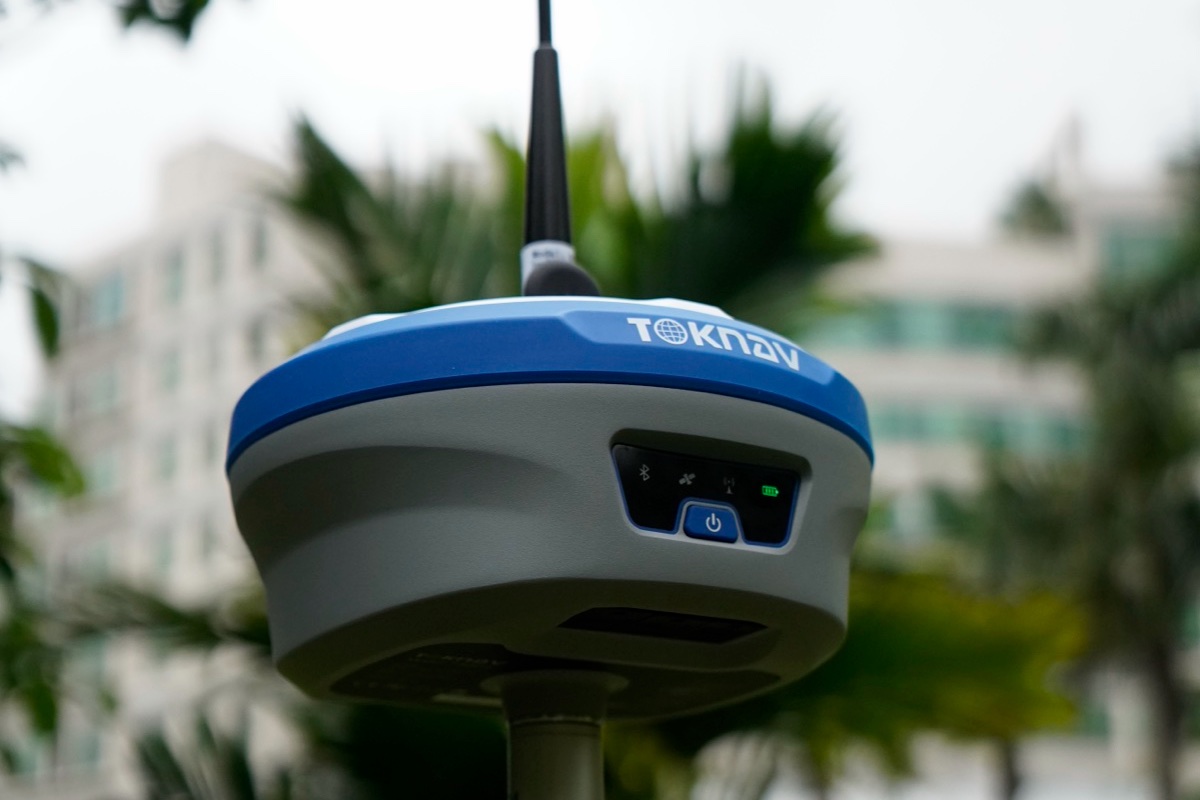
    Toknav High Precision GNSS Receiver

    As your Toknav overseas distributor technical consultant, I work with surveyors, construction teams, precision agriculture operators, robotics engineers, and OEM manufacturers every day. One of the most common questions I answer is: What truly defines a reliable, high precision positioning solution? After years of field testing, real project deployment, and supporting customers across challenging environments—from dense urban canyons to remote farmlands and harsh construction sites—I can confirm: a professional high precision GNSS receiver delivers verified accuracy, stable signal tracking, rugged durability, and easy integration.

    In this guide, I will share the essential key features of a high-performance  high precision GNSS receiver, using 100% real datasheet specifications from Toknav’s flagship models: T10Pro, T20Pro, T30Pro, T40Pro, and tBase. These are the same performance details I use to advise my customers to choose the right positioning solution.

    Toknav High Precision GNSS Receiver:Full Constellation & Multi-Frequency Tracking (1408 Channels)

    1. Full Constellation & Multi-Frequency Tracking (1408 Channels)

      From my experience, the biggest reason standard GNSS receivers fail in challenging environments is limited satellite and frequency support. A true high precision GNSS receiver must track all global systems and multiple bands to minimize errors and maintain availability.

      All Toknav receivers come with a 1408-channel high-speed measurement engine, supporting GPS, BDS, GLONASS, Galileo, QZSS, SBAS, and NavIC. Multi frequency technology effectively cancels ionospheric delay, so your Toknav high precision GNSS receiver holds a fix even under trees, near tall buildings, or in open fields with low sky visibility.

    1. Verified Centimeter-Level RTK & Static Accuracy
      Accuracy is non negotiable—and it must be measurable, repeatable, and backed by real datasheet values. As your technical consultant, I only recommend products with published, reliable performance.
      Here are the official accuracy figures from Toknav’s datasheets:
      RTK Mode: Horizontal ±(8mm + 1ppm), Vertical ±(15mm + 1ppm)
      Static Survey: Horizontal ±(2.5mm + 1ppm), Vertical ±(5mm + 1ppm)
      These numbers apply to all  precision GNSS receiver models, ensuring surveying and machine control tasks meet strict professional standards.

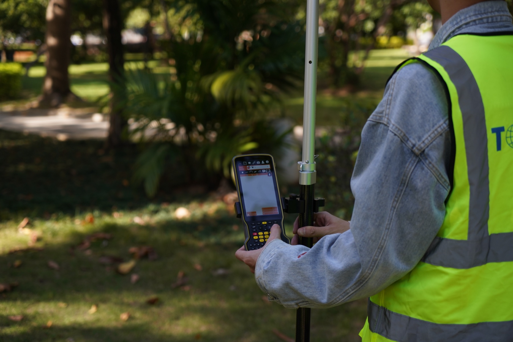
    Surveyors from Tanzania are using a Toknav High Precision GNSS Receiver.

    1. IMU Tilt Compensation & AR Surveying (Field-Proven Efficiency)
      In real field work, holding the pole perfectly vertical all day is tiring and slow. That’s why I always recommend IMU integrated Toknav high precision GNSS receiver units to my customers.
      Toknav’s professional models support 60° tilt measurement with correction error <2cm and AR real scene stakeout (T30Pro / T40Pro). GNSS INS fusion ensures continuous positioning during short term signal blockages. From customer feedback, this feature greatly improves efficiency for users of Toknav  GNSS receiver.

    A surveyor using Toknav T30Pro with tilt measurement and AR stakeout screen.

    4. Industrial Rugged Design & IP68 Protection
    Field equipment must survive drops, rain, dust, and extreme temperatures. I have seen many receivers fail because they were not built for real working conditions. The Toknav high precision GNSS receiver is engineered for durability: IP68 waterproof and dustproof, magnesium alloy body, 1.5m drop resistance, and operating temperature from -30°C to +65°C.

    Whether used in mining, agriculture, or marine environments, the Toknav high precision GNSS receiver maintains stable performance in harsh conditions.

    1. Multi-Link Communication & Long-Range UHF Radio

    RTK positioning depends entirely on stable correction data. As a technical consultant, I always emphasize: communication = reliability. The Toknav GNSS receiver supports fully redundant links: 4G full network, Bluetooth 5.0, WiFi, and integrated UHF radio with open area range up to 16km (T20Pro).

    It also supports NTRIP, RTCM3.x, and mainstream industry protocols, keeping your Toknav high precision GNSS receiver connected anywhere on site.

    1. High Update Rate & Powerful Linux Platform

    For industrial control, machine control, and dynamic surveying, you need fast, smooth positioning output. The Toknav high precision GNSS receiver runs on ARM Cortex A7 1.8GHz processor with Linux OS, supports 20Hz high update rate, and provides 32GB storage for data logging.

    This stable platform makes the Toknav high precision GNSS receiver ideal for industrial automation and professional measurement applications.

    1. All-Day Battery Life & Hot-Swappable Design

    Nothing stops a job faster than a dead battery. Based on real field usage, I always confirm endurance before recommending a model. The Toknav high precision GNSS receiver offers outstanding battery performance: T10Pro 6500mAh (>18 hours), T30Pro 13800mAh (up to 48 hours), and T40Pro hot swappable battery for nonstop work.

    Users of Toknav GNSS receiver can work a full day without mid shift charging.

    1. RTK OEM GNSS Receiver Flexibility (For Manufacturers)

    Many of my partners are OEMs and integrators building industrial machines, agricultural equipment, and professional terminals. For them, the RTK OEM version of Toknav high precision GNSS receiver is the core component.

    It features compact module form factor, standard interfaces, raw data output, and full factory support. I help customers integrate the GNSS receiver quickly and reduce development time.

    My Final Recommendation (As Toknav Technical Consultant)

    If you are looking for a reliable positioning solution, Toknav high precision GNSS receiver stands out with verified accuracy, rugged design, strong communication, and field-proven efficiency.

    From my years of experience supporting global clients: Whether you need a portable rover, a reliable base station, or an embedded RTK OEM version, Toknav high precision GNSS receiver provides the stability and precision professional users demand.

    Ready to upgrade your positioning system?Visit: Explore Toknav Full GNSS Receiver Lineup → (https://www.toknav.com/gnss-receivers)

    Contact your local Toknav distributor for professional technical support and project solutions.

    2026-03-26
    Toknav High Precision GNSS Receiver

WhatsApp