
01
Tilt Measurement
Use IMU-supported tilt measurement to reduce the need to keep the pole perfectly vertical at every point.
GNSS RTK RECEIVER · AR STAKEOUT · IMAGE-BASED SURVEY
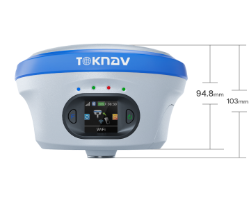
A professional RTK GNSS receiver integrating 1408 channels, IMU tilt measurement, dual imaging cameras, AR stakeout guidance and hot-swappable field power.
For a useful recommendation, include your country, field application and preferred data-link method.
ONE RECEIVER, FOUR FIELD ADVANTAGES
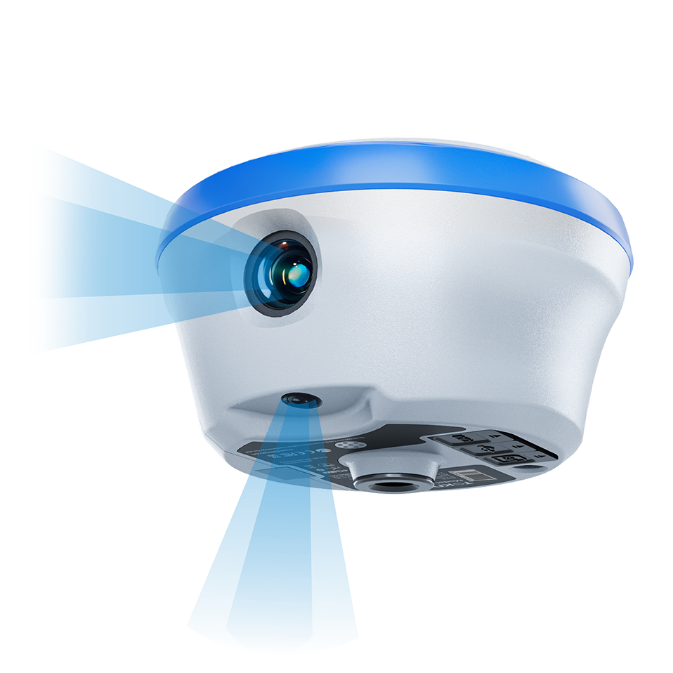
T40Pro is designed around the moments that slow down a professional survey workflow: a tilted pole, a hard-to-reach point, a stakeout target that needs clear orientation, or a battery change in the middle of a job.
Use IMU-supported tilt measurement to reduce the need to keep the pole perfectly vertical at every point.
Combine a high-definition imaging camera with positioning data when a real-world image provides the safer or clearer observation path.
Use the AR camera workflow to orient stakeout guidance in the live field scene through a compatible controller workflow.
Two removable batteries support field replacement with less interruption in field work.
DIFFERENTIATE THE FIELD WORKFLOW
Use imaging-assisted workflows when a point is difficult, unsafe or inefficient to reach directly with a vertical pole.
Guide the next point with a clearer field-view orientation, helping crews understand direction and position faster.
CONFIGURE FOR THE WAY YOU WORK
Select the work mode and data link that suit the project. Final radio, cellular and data-link configuration may vary by region and project requirement.
For field positioning and point collection workflows.
For a project configuration that requires a local correction source.
For static observation workflows and post-processing requirements.
LATEST ENGLISH DOCUMENTS
These are the current English documents selected from the supplied product files by date. Open a document to review it, or save it for your project file.
VERIFIABLE TECHNICAL DATA
Key values below are taken from the supplied T40Pro product information. Confirm the final configuration and scope of supply before purchase.
APPLICATIONS
Use the product, selected accessories and the final configuration to match the workflow rather than treating every project as the same.
Collect field positions and observations for mapping workflows.
Support positioning tasks when a project requires clear, repeatable site guidance.
Document position information for land and property survey workflows.
Work through corridors and infrastructure sites with the selected project setup.
Use the appropriate Rover, Base or Static configuration for the observation plan.
Use imaging-assisted workflows when direct pole positioning is inefficient or impractical.
BUYER QUESTIONS
These answers help define the right technical conversation. They do not replace a project-specific configuration check.
Start a T40Pro enquiryThe quick guide documents Rover, Base and Static work modes. Confirm the controller, software and data-link configuration that matches the project before ordering.
The receiver integrates a positioning module, IMU and imaging camera. In the documented workflow, this supports extracting high-precision coordinates from real-world images. Results depend on distance, field conditions and the specified working method.
The supplied product information specifies two removable 7.2 V, 3400 mAh batteries with hot-swapping support. Actual operating time changes with the selected link, feature use and working environment.
No. Radio settings, cellular coverage and available product configuration may vary by region. Confirm local spectrum rules and the required data-link setup with TOKNAV before purchase or deployment.
Please include your country, application, required work mode, preferred data link and controller or software environment. This lets the first recommendation focus on a usable configuration instead of a generic quote.
PROJECT-READY ENQUIRY
Tell us your country, application, work mode and preferred data link. TOKNAV will help you confirm a practical receiver configuration for your field environment.