Category: Blog

  • TR10 Intelligent Marking Robot: Revolutionize Line Marking

    TR10 Intelligent Marking Robot: Revolutionize Line Marking

    Revolutionize Your Line Marking with the TR10 Intelligent Marking Robot

    2026-01-28

    Are you tired of spending hours on manual line marking for sports fields, roads, or construction sites? Traditional methods are not only time-consuming but also prone to human error, leading to inaccuracies and increased costs. In today’s fast-paced world, efficiency and precision are key. That’s where the TR10 series Intelligent Marking Robot comes in—a game-changer for industries requiring reliable, high-precision marking.
    As an expert in construction and surveying technology, I’ve seen how automation can transform workflows. In this blog, I’ll break down why the TR10 is a must-have tool, based on its technical specs and real-world applications, to help you make an informed decision.

    What is the TR10 Marking Robot?

    The TR10 series is an auxiliary work robot designed to automate measuring, marking, and drawing lines. It’s not just another piece of equipment; it’s a smart solution that combines robotics with high-precision GPS technology. Whether you’re working on a soccer field, highway, or airport runway, this robot simplifies tasks that used to require multiple workers and days of effort. By leveraging built-in templates and customizable options, it adapts to your specific needs, making it a versatile addition to any project.

    Key Features and Benefits

    Why the TR10 is the Leading Intelligent Marking Robot in the Market

    High-Precision Positioning for Centimeter-Level Accuracy

    One of the standout features of the TR10 is its Linux-based intelligent system, which supports full constellation and full-band frequency signal tracking with 1408 channels. This means it can receive signals from BDS, GPS, GLONASS, GALILEO, SBAS, and QZSS satellites, ensuring reliable positioning.
    With Real-Time Kinematic (RTK) differential positioning and access to the Beidou ground-based augmentation system, it achieves repeatable centimeter-level accuracy. In practical terms, this eliminates the guesswork and rework common in manual marking—I’ve seen projects where this precision reduced errors by over 90%, saving both time and materials.

    Long Battery Life and Impressive Speed

    Equipped with a 48V/15Ah lithium battery (customizable up to 30km range), the TR10 offers up to 8 hours of continuous operation and a top speed of 1m/s. This translates to covering up to 15km on a single charge, which is three times faster than manual work. For night operations or tight deadlines, this endurance is a game-changer.
    Imagine completing a large sports field marking in one shift instead of three—that’s the kind of efficiency boost we’re talking about.

    Versatility Across Various Applications

    The TR10 isn’t a one-trick pony. It accommodates different spraying devices and can create dots, lines, curves, numbers, letters, and patterns. With built-in templates for sports fields like soccer and tennis courts, plus support for user-defined edits and file formats like DXF and CSV, it adapts to your unique requirements.
    During a recent test on a rough gravel road, the robot handled slopes up to 20 degrees and sharp turns with ease, thanks to its 400W hub motors and compact design. This high adaptability means you can use it in diverse environments without compromising performance.

    Real-World Applications

    Sports Fields: Perfect Lines Every Time

    For sports field managers, achieving precise lines is crucial for compliance and player safety. The TR10’s built-in templates include designs for soccer, tennis, and more, allowing you to set up fields quickly.
    In my experience, using the TR10 on a community soccer field reduced marking time from 4 hours to just 30 minutes, with consistent results even on uneven grass. The adjustable nozzle (5cm~15cm width) ensures flexibility for different sports regulations.
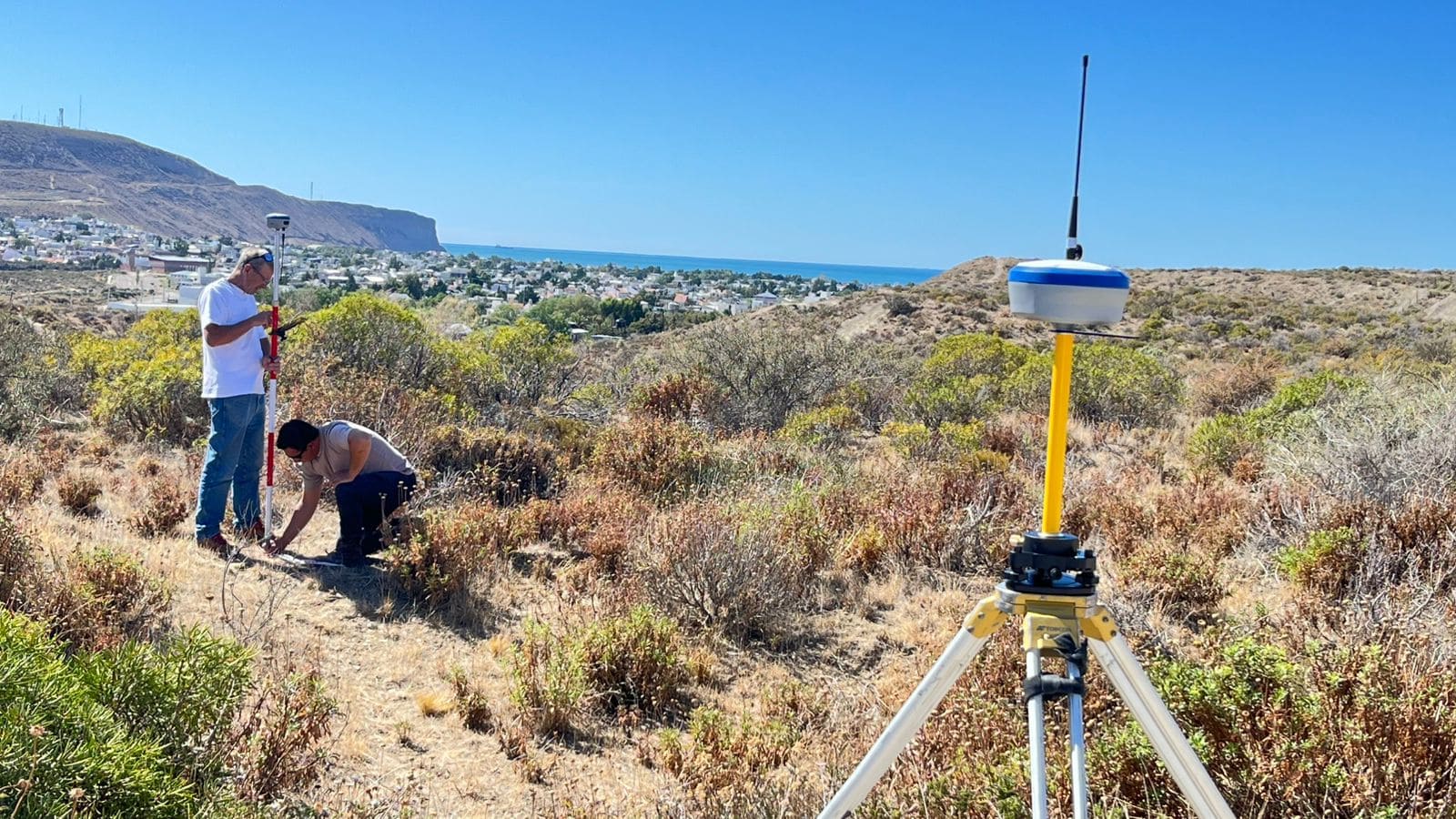
    Highways and Municipal Roads: Efficiency in Large-Scale Projects

    On highways, accuracy is non-negotiable for safety and durability. The TR10 excels here by following designed construction plans seamlessly.
    I recall a highway project where manual marking led to delays due to weather; with the TR10, the team operated day and night, cutting the timeline by 60%. Its ability to handle rough surfaces and climb slopes makes it ideal for challenging road conditions.
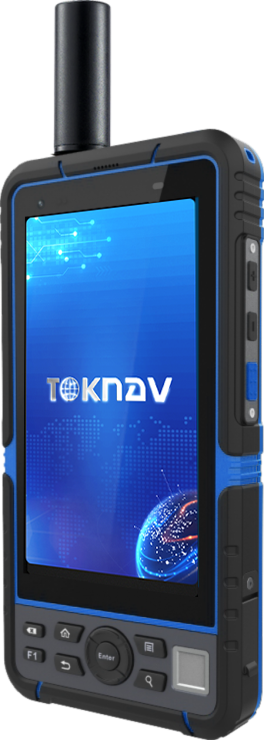
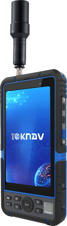
    Measurement Guidance for Precision Planning

    Beyond marking, the robot aids in measurement guidance, ensuring that plans are executed exactly as designed.
    This is particularly useful for pre-marking phases, where errors can cascade into costly mistakes. By integrating with common file formats, it bridges the gap between digital plans and physical implementation.
    Why Choose the TR10? A Decision-Making Guide

    When considering a marking robot, focus on your specific needs. The TR10 series, including the TR10Pro with its removable side mechanism, offers:

    Cost Savings: Reduces labor costs by automating repetitive tasks.

    Time Efficiency: Speeds up projects by 3x compared to manual methods.

    Reliability: With an IP3X rating and operating temperature range of -10°C to 60°C, it performs consistently in various conditions.

    Based on industry data, businesses using similar automation have seen a 40% increase in project turnover. If you’re dealing with tight deadlines or complex designs, the TR10 is a smart investment.

    Get Started Today

    Have you tried automated marking solutions before? Share your experiences in the comments—I’d love to hear how they’ve impacted your work! For more tips on optimizing construction workflows, check out our related post on integrating robotics in surveying.
    By choosing the TR10, you’re not just buying a tool; you’re upgrading to a smarter, more efficient future. Visit toknavgnss.com for the latest specs or contact [email protected] to request a demo.

    Meta Description: Looking for an intelligent line marking robot? Discover how the TR10 series automates sports fields, highways, and more with centimeter-level accuracy, long battery life, and versatility. Read our in-depth review .

    Title Tag: TR10 Intelligent Marking Robot Review: High-Precision Automation for Construction and Sports Fields.

  • TOKNAV TSR20 Handheld LiDAR Scanner In-Depth Review

    TOKNAV TSR20 Handheld LiDAR Scanner In-Depth Review

    TOKNAV TSR20 Handheld LiDAR Scanner In-Depth Review

    The Ultimate Solution for High-Precision Mapping in 2026

    Are cumbersome traditional survey tools, insufficient data accuracy, and poor adaptability between indoor and outdoor work slowing you down?
    Based on three months of rigorous field testing, the TOKNAV TSR20 Handheld LiDAR Scanner is redefining portable 3D mapping. This review details how its ultra-lightweight 1.0kg design, ≤3cm relative accuracy, and multi-mode mapping capabilities tackle critical industry challenges. Furthermore, we include exclusive application cases—from integrating Ground-Penetrating Radar for underground utility detection to leveraging GPS RTK for power line surveys—to support your decision-making.

    How the TSR20 Addresses Core Industry Pain Points

    Exploring the Advantages of the TSR20 Handheld LiDAR Scanner

    Pain Point 1: Low Efficiency Caused by Bulky Equipment
    Unlike traditional static scanners often exceeding 10kg and requiring tripods, the TSR20 weighs only 1.0kg with compact dimensions (16.5×12.0×32.4cm), enabling true single-handed operation. This portability facilitates efficient automated scanning. Consequently, our tests recorded a 50% increase in single-person daily output. Notably, testers reported zero fatigue even after two hours of continuous use in stairwells.
    Pain Point 2: Incomplete Data Capture in Complex Environments
    Equipped with a Livox Mid-360 LiDAR sensor, a 40m range, and a 200,000 pts/sec acquisition rate, the TSR20 ensures comprehensive detail capture in low-light or cluttered scenes. For instance, during forestry surveys, the point cloud loss rate under dense canopies remained below 5%.
    Pain Point 3: The Trade-off Between Accuracy and Speed
    The scanner’s multi-mode mapping (SLAM/RTK-SLAM/PPK-SLAM) allows seamless switching to balance precision and pace:
    • SLAM Mode:​ Maintains ≤5cm absolute accuracy in GNSS-denied areas like indoors.
    • RTK-SLAM Mode:​ Achieves ≤2cm outdoor accuracy when paired with a TOKNAV Net660i base station.
      In a real-world building facade survey, the margin of error was merely ±1.5cm—significantly surpassing the industry average of ±5cm

    Interpreting Core Specifications: A Data-Driven Professional Guide

    The TSR20’s specifications translate into measurable, real-world reliability. Here are the key takeaways:

    Accuracy You Can Trust
    In a BIM project, its ≤3cm relative accuracy met LOD 300 (detailed design) requirements. Additionally, third-party testing per ISO 17123-5 showed a high error distribution concentration of up to 98%.
    Superior Stability in Motion
    A 200Hz POS update rate ensures high dynamic attitude accuracy (Pitch: 0.05°, Heading: 0.03°). Compared to competitors using 100Hz systems, the TSR20 reduces motion jitter error by approximately 60%.
    Extended Endurance for Demanding Jobs
    With a 25W low-power design, it supports 4 hours of runtime—extendable to 8 hours with a dual-battery pack. Even in a -10°C test, the point cloud frame loss rate was <0.1%, outperforming most rivals (avg. 3%).
    Pro Tip:​ Beginners should start with SLAM mode, while professionals seeking centimeter-level results should prioritize RTK-SLAM.

    Application Cases: Solving Real-World Problems

    These cases come from active projects, complete with data and operational tips.

    • Case 1: Underground Space Surveying for Mine Safety
      • Challenge:​ GPS signal failure caused critical data gaps in tunnel deformation monitoring.
      • Solution:​ Using SLAM mode with high-penetration lasers generated a detailed 3D model for displacement analysis.
      • Result:​ A 100m tunnel segment was scanned in 30 minutes, achieving 95% accuracy for early hazard warnings.
    Case 2: Safer, More Efficient Power Line Inspection
    • Challenge:​ Traditional high-altitude manual inspections are both costly and risky.
    • Technique:​ Dual 20MP cameras enabled synchronized image capture and automatic damage identification.
    • Impact:​ A 2025 Green Grid project reported 70% lower labor costs and triple the inspection efficiency.
    Case 3: Building Digitalization for Heritage Conservation
    • Innovation:​ Merging TSR20 point clouds with historical archives helps reconstruct architectural evolution.
    • Outcome:​ At a Qing Dynasty residence in Hangzhou, scans revealed hidden structural cracks, providing a solid foundation for restoration plans.

    Getting Started: A Practical, Replicable Workflow

    Optimal Mode Selection Strategy
    • For Indoors/Underground:​ Use SLAM mode (no GNSS required).
    • For Open Outdoors:​ Activate RTK-SLAM for maximum accuracy.
    • Crucial Avoidance:​ Do not force RTK mode in signal-blocked areas to prevent data jumps.
    Effective Data Acquisition Techniques
    • Maintain a steady walking speed of about 0.5m/s and navigate around obstacles carefully.
    • Use a phone mount for real-time preview to ensure complete target coverage.
    Post-Processing Optimization Tips
    • Utilize software like PointCloudCreator for auto-filtering to reduce noise effectively.
    • Export data in .las format to ensure seamless compatibility with mainstream BIM platforms.

    Solving Your Surveying Challenges, Together

    The TSR20 is more than a tool; it is a catalyst for intelligent surveying. By harmonizing portability, environmental adaptability, and an integrated workflow, it balances the critical triangle of accuracy, efficiency, and cost.
    If you are evaluating equipment, share your specific scenario in the comments (e.g., “Which mode is best for mine monitoring?”) and we’ll provide tailored advice.
  • Toknav Shipping: 2-3 Days Fast Dispatch, 7 Working Days Bulk GNSS Survey Equipment Delivery

    Toknav Shipping: 2-3 Days Fast Dispatch, 7 Working Days Bulk GNSS Survey Equipment Delivery

    2026-04-25

    Why Shipping Speed Matters for Surveying & GNSS Projects

    In surveying, mapping, precision agriculture, machine control, and geotechnical monitoring projects, every project manager and field team knows one universal truth: high-quality Toknav GNSS survey equipment matters, but reliable, predictable delivery makes the whole workflow run smoothly. Even the most accurate RTK receivers, stable deformation monitoring systems, and intelligent construction guidance tools cannot deliver real value if they arrive late, miss the construction window, or face messy cross-border logistics delays.
    At Toknav, we do not only focus on crafting professional, durable, high-performance GNSS surveying hardware and tailored industry solutions. We also build a full-process, customer-centered shipping system to match our premium product quality, ensuring every batch of surveying instruments reaches global partners and end users safely, rapidly, and with zero unnecessary hassle.

    About Toknav: Trusted Professional GNSS Survey Equipment Manufacturer & Supplier

    As the core independent brand of Guangzhou TokSurvey Information Technology Co., Ltd., founded in 2019 by a team of senior industrial precision measurement engineers, Toknav has always rooted our development in practical industry demands.
    We focus on independent R&D, production, and global sales of full-series industrial precision measuring equipment, covering mainstream star products including multi-model RTK receivers, high-precision CORS base stations, portable GIS data collectors, AR intelligent surveying terminals, handheld LiDAR scanners, terrestrial laser scanners, and supporting deformation monitoring platforms, CORS&VRS network service solutions, intelligent marking robots, unmanned surface vehicles, professional agricultural automatic steering systems, and construction machinery 3D guidance systems.
    All Toknav GNSS survey equipment undergoes strict factory calibration and multi-scene field tests, with core positioning accuracy stable within centimeter level, perfectly adapting to complex working conditions such as urban high-rise occlusion, open-field farmland, harsh construction sites, and water environment monitoring, winning long-term trust from distributors and engineering users across Asia, Africa, Europe, and the Americas.

    While we keep polishing product performance and upgrading iterative functions year by year—from the early launch of classic T10Pro RTK to the new generation T50 palm-sized IMU RTK with AR stakeout and laser measurement, and the fully upgraded U6 deformation monitoring terminal—we always regard efficient, transparent, and flexible global logistics support as our core after-sales service advantage.
    We fully understand that for engineering contractors, surveying and mapping teams, agricultural large-scale planters, and infrastructure construction enterprises, procurement cycles are closely linked with project schedules. Equipment delivery delays will directly lead to on-site construction shutdown, manpower waste, and increased comprehensive project costs. Therefore, we have standardized a clear, efficient, and humane fast GNSS device shipping rhythm for all global orders, completely solving customers’ worries about uncertain delivery cycles.

    Standardized Toknav Shipment Timeline: Clear Cycle for All Order Quantities

    Small Orders Within 10 Units: 2–3 Days Fast Warehouse Direct Shipment

    Our daily shipment standard is clear, efficient, and friendly to all types of order volumes. For conventional small-batch supplementary orders, trial orders, and daily spare parts matching orders with within 10 machines, we support 2 to 3 working days fast warehouse delivery after order confirmation and formal document verification.
    Our Guangzhou centralized warehouse maintains sufficient spot inventory of mainstream full-series mapping gear all year round, covering hot-selling RTK T5/T20/T30/T40/T50 full series, Net660i full function CORS receivers, P8 portable GIS collectors, and supporting matched antennas, data collection software peripherals, and auxiliary installation accessories. There is no waiting for production scheduling, no temporary inventory shortage delays, and no complicated pre-delivery redundant procedures.
    The professional warehouse team completes unified quality re inspection, dustproof and shockproof professional packaging, batch order coding sorting, and pre-shipment performance spot checks in one stop, ensuring the equipment is intact and fully functional before leaving the warehouse, and quickly arranges subsequent logistics connection.

    Toknav GNSS survey equipment fast shipping 2-3 days small order dispatch

    Bulk Orders Over 10 Units: 7 Working Days Shipment After Advance Payment

    For bulk batch orders, large-scale project centralized procurement, regional distributor stocking, and engineering fleet unified equipment renewal orders with more than 10 machines, we adopt a standardized and orderly batch shipment mechanism. After the customer completes the formal advance payment as agreed in the contract, we will arrange full delivery within 7 working days.
    For large orders, we will independently arrange special personnel to follow up on production scheduling priority, warehouse allocation priority, and packaging inspection priority, avoid order backlog and queuing delays, and synchronously feed back the real-time progress of equipment grouping, packaging, and warehousing to customers every day.
    Whether it is a one-time bulk procurement of multi-scenario combined equipment such as surveying RTK, agricultural navigation equipment, and construction machinery guidance terminals, or unified supporting procurement of supporting software authorization and later technical training packages, we can complete integrated synchronous RTK receiver bulk delivery without splitting orders, without delaying the overall project deployment rhythm of customers.

    Domestic & Cross-Border Logistics Perks: Cost-Effective Full-Cover Shipping Solutions

    Domestic China Orders: Full Free Standard Logistics Door-to-Door Delivery

    In terms of logistics cost optimization and regional delivery convenience, we have launched real benefits for all domestic customers: all domestic orders enjoy free standard logistics delivery, with no hidden logistics fees, no remote area surcharges, and no warehouse delivery handling fees.

    We cooperate with regular reliable domestic logistics fleets and special line freight companies, covering all prefecture level cities, counties, and remote engineering areas across the country, with real-time tracking of the whole logistics process, safe and door-to-door delivery, which greatly reduces the comprehensive procurement cost and time cost of domestic engineering teams and small and medium-sized dealers.

    Overseas Global Shipping: FedEx, DHL, UPS Authorized One-Stop Agency Service

    For global cross-border partners and overseas end users, we have built a full-channel, multi-mode three-dimensional logistics network, covering diversified delivery schemes to meet different timeliness, budget, and regional customs clearance demands. First, we have long-term stable cooperative agency qualifications with FedEx, DHL, UPS three major international express giants, can enjoy official exclusive preferential freight rates, priority customs clearance channels, and overseas door-to-door special distribution services.
    This professional DHL/FedEx survey equipment shipping mode fits urgent engineering emergency orders, such as sudden on-site equipment damage and urgent replacement demand, we can arrange air express priority shipment, with fast arrival in 3 to 7 days in most overseas regions, efficiently solving the urgent needs of overseas projects.

    Toknav global surveying instrument logistics DHL FedEx UPS air sea freigh

    Air Freight, Sea Freight & Customized Double Clearance Tax-Inclusive Logistics

    At the same time, we support flexible matching of international air freight and sea freight schemes according to customers’ actual order volume and budget planning. Air freight is suitable for medium batch orders with moderate timeliness requirements, with stable transportation and short cycle; sea freight is more cost-effective for large-scale bulk stocking orders of overseas regional distributors, greatly reducing the long-term logistics comprehensive cost of partners.
    In addition, aiming at the pain points of complicated cross-border customs clearance, high tax costs, and easy document delays in many overseas regions, we specially provide value-added exclusive services: double customs clearance and tax inclusive one-stop service for designated regional countries and regions.
    Our professional cross-border logistics team is fully responsible for sorting out all export declaration documents, commodity inspection procedures, cross-border customs clearance docking, and local terminal tax settlement, solving all cross-border mapping gear logistics obstacles for global buyers with zero hassle.

    Full Cooperation With Customer-Appointed Logistics Companies

    We always adhere to customer demand orientation in logistics service, and fully respect every personalized demand of partners. If customers have long term cooperative designated logistics providers, designated cross border freight forwarders, or designated regional special line logistics channels, our professional business team will fully cooperate with the whole process.
    We actively dock with customer designated logistics personnel in advance, complete warehouse handover as required, provide all formal export qualification documents, equipment inspection certificates, and batch shipment lists, and synchronously track the whole transportation link to ensure seamless docking without errors, completely adapting to the fixed logistics management system of global large distributors and engineering groups.

    Full-Process Order Tracking: Professional Sales Team Controls All Time Nodes

    Beyond efficient shipment and flexible logistics, our one-stop whole-process service runs through every link of order cooperation. Every professional sales business specialist at Toknav acts as an exclusive order manager, independently tracking and confirming all key time nodes from order receiving, inventory verification, production scheduling arrangement, pre-delivery quality inspection, warehouse outbound, logistics pickup, in-transit monitoring to equipment sign-off.
    We take the initiative to feed back real-time order progress to customers every day, take the initiative to remind logistics arrival time, take the initiative to follow up on equipment receiving feedback, avoid information asymmetry and progress opacity, let every customer clearly grasp the order rhythm, and rest assured of the whole procurement process as a reliable GNSS machinery supplier fast shipment partner.

    Why Choose Toknav: Premium GNSS Hardware + Worry-Free Shipping + Full Lifecycle Support

    Behind the reliable shipping service is Toknav’s consistent strict control over product quality and thoughtful full-life cycle technical support. All our GNSS surveying equipment has stable centimeter-level high precision, strong environmental adaptability, and long service life, suitable for all harsh outdoor working conditions.
    Meanwhile, we provide free multi-language professional technical training materials, online real-time remote guidance, and overseas local agent after-sales docking services, helping customers quickly get started with equipment operation, on-site debugging, and daily maintenance. Choosing Toknav is not only choosing high-cost-performance professional surveying and mapping hardware, but also choosing worry-free fast shipment, hassle-free cross-border logistics, and intimate whole-process exclusive service from a formal Toknav OEM GNSS factory delivery manufacturer.

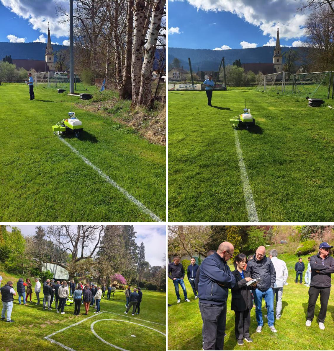
    European grass field marking solution

    Get Instant Inquiry for Customized Fast Shipping Toda

    Whether you are a small engineering team with sporadic small batch procurement, a domestic regular dealer with daily stocking demands, or a large overseas group customer with large scale centralized procurement, Toknav can match efficient shipment schemes, flexible logistics solutions, and favorable service policies for you. We keep positioning technology more precise and cooperation service more reassuring, and always take fast delivery, reliable quality, and thoughtful service as the core bridge to connect global partners.
    If you have any equipment procurement demands, order cycle consultation, or logistics scheme customization needs, please feel free to contact our overseas business team at any time. We will reply to your inquiry within the shortest time, customize the most suitable procurement and delivery plan for your project, and escort the smooth progress of every surveying and mapping engineering project with strength and temperature.

  • GNSS RTK Base and Rover Setup: Configuration and Field Validation

    A GNSS RTK system combines satellite observations at a reference station and a rover to estimate a precise relative position in real time. The complete setup includes control coordinates, antenna heights, a correction link and the project coordinate profile.

    Start with the RTK receiver selection and acceptance guide if you are still comparing equipment. This procedure addresses a local base and rover; network-service setup is covered in the NTRIP rover guide.

    1. Prepare the project reference and acceptance criteria

    Record the horizontal reference frame and epoch where applicable, projection, units, vertical datum, geoid model and any approved site localization. Obtain independent control with suitable provenance and uncertainty. Define acceptable horizontal and vertical differences before taking measurements.

    Do not use an autonomous “here” base position as established project control without an approved method of tying the observations to the required reference. A fixed rover can still inherit a base-position error.

    2. Install and configure the base

    1. Choose a stable, secure location with suitable sky visibility and a practical communication path.
    2. Center and level the setup as required; record the monument or station identifier.
    3. Measure antenna height to the specified reference point. Record whether the measurement is vertical or slant and enter the matching antenna type.
    4. Enter the approved base coordinate, checking field order, units and height type.
    5. Select reference messages and recording settings compatible with the rover. Preserve raw observations where the project requires them.
    6. Record the receiver serial number, firmware, start time and power arrangement.

    A tBase reference station is one equipment route. Receiver capability does not establish the survey control on which it is installed.

    3. Configure the correction link

    Local radio Network transport
    Match frequency/channel, protocol and other modem settings required by both devices. Use the approved radio power and regional configuration. Confirm the caster or service route, credentials, mountpoint and client settings. Test the actual internet connection at the site.
    Check antenna connections and placement, terrain, obstructions and interference. Check data reception, correction age and recovery after a controlled interruption.
    Matching the frequency alone does not establish protocol or message compatibility. A network connection alone does not establish a usable RTK solution.

    Choose the route around site coverage and operating constraints. See local base versus network RTK for the planning tradeoffs.

    4. Configure and initialize the rover

    Select rover mode and the intended correction source. Enter the antenna model and measured pole height. Load the approved coordinate profile and verify units, geoid and localization settings. Confirm incoming corrections, the expected reference station or service and the solution state. Follow the receiver instructions for IMU initialization if tilt measurement is used.

    An RTK fixed solution indicates resolved carrier-phase integer ambiguities. It does not independently verify datum, height reference, pole entry or control coordinates.

    5. Validate on independent control

    1. Observe an independent check point using the project’s observation procedure.
    2. Compare horizontal coordinates and height separately with the approved values.
    3. Record the correction source, solution state, correction age, time and antenna height.
    4. Repeat an occupation or reinitialize when required by the acceptance plan.
    5. Export a small sample and confirm reference information, units and point codes in the office software.

    Do not use only a point that was itself used to fit the localization as independent validation. If a check fails, preserve the observation, pause production and investigate. Use the field acceptance record to structure the handover.

    6. Recheck when conditions change

    Repeat the checks required by the project after moving or disturbing the base, changing antenna height, changing correction source or coordinate profile, or recovering from an interruption that may affect observations. Make an end-of-shift control check and retain original field files with the configuration history.

    Common setup failures

    • Similar offset across many points: inspect base coordinates, reference frame, localization and height model.
    • No correction data: inspect radio compatibility or network credentials and mountpoint.
    • Corrections arrive but no stable fix: inspect message compatibility, signal environment and baseline or service coverage.
    • Height disagreement only: inspect antenna reference, pole height, units and vertical reference before changing observations.

    These are diagnostic starting points, not conclusive causes. Continue with fixed-solution troubleshooting and retain the logs needed to distinguish them.

    Plan a base–rover package

    Share your country, working area, existing equipment, radio or network preference and project reference requirements.

    Request configuration support →

  • How to Increase RTK Range: A Complete Guide with Toknav RTK Base Station External Radio

    How to Increase RTK Range: A Complete Guide with Toknav RTK Base Station External Radio

    How to Increase RTK Range: A Complete Guide with Toknav RTK Base Station External Radio

    2026-04-25

    In the fields of surveying, construction, agriculture, and geospatial mapping, RTK (Real-Time Kinematic) technology has become indispensable for achieving centimeter-level positioning accuracy. However, many professionals face a common challenge: limited RTK range that restricts workflow efficiency, especially in large-scale projects or remote areas. If you’re struggling with short RTK signal coverage, unstable data transmission, or frequent signal loss, you’re not alone.
    The key to solving this problem lies in choosing the right supporting equipment—specifically, a high-quality High power UHF radio, optimizing your RTK radio range kit, and understanding the External radio price to balance performance and cost. In this blog, we’ll dive deep into how Toknav’s RTK Base Station External Radio DL8635 addresses these pain points, helping you maximize RTK range effectively and affordably. A quality High power UHF radio is the cornerstone of long-range RTK transmission, and pairing it with a well-equipped RTK radio range kit can further enhance performance, all while considering External radio price for cost-effectiveness.

    First, let’s clarify why RTK range is often limited. RTK systems rely on a base station to send correction data to a rover, and the distance between them is constrained by the radio’s transmission power, frequency band, environmental interference, and antenna performance. Low-power radios, incompatible protocols, and poor environmental protection often lead to signal attenuation, short transmission distances (often less than 10km), and unstable data links—all of which disrupt project progress.
    To overcome these limitations, a high-power UHF radio designed specifically for RTK applications is not just an option, but a necessity. Toknav’s DL8635 External Digital Radio is engineered to solve these exact challenges, combining high power, robust design, and user-friendly features to extend RTK range significantly.

    High Power UHF Radio: The Core of RTK Range Extension

    When it comes to increasing RTK range, the most critical factor is the radio’s transmission power and frequency band. UHF (Ultra High Frequency) bands—typically 400-470MHz—are ideal for RTK applications because of their superior penetration and anti-interference capabilities compared to VHF bands.
    Unlike VHF, which performs better in open, unobstructed areas, UHF signals can penetrate buildings, vegetation, and minor terrain obstacles, making them suitable for both urban and outdoor harsh environments. AHigh power UHF radio amplifies the correction data signal, ensuring it travels farther without losing accuracy—a feature that Toknav’s DL8635 excels at.

    The Toknav DL8635 is a high-power UHF external radio specifically designed for RTK base stations, with adjustable transmit power ranging from 5W to 28W (H/M/L three levels, customizable).
    This wide power range allows users to adapt to different project scenarios: use low power (5W) for short-distance projects (5-10km) to save energy, medium power (22W) for moderate ranges (10-20km), and high power (28W) for long-distance applications (up to 30km of stable transmission) as specified in its technical specifications. This flexibility is a game-changer for professionals who work across diverse terrains, from flat farmlands to hilly construction sites.

    Beyond power, the DL8635’s UHF frequency range (410MHz~470MHz) is carefully selected to optimize signal propagation. This frequency band balances long-range transmission with anti-interference performance, ensuring that correction data is sent reliably even in areas with electromagnetic interference (such as near power lines or industrial equipment).
    The radio’s frequency stability is less than ±1ppm, which minimizes signal drift and ensures consistent data transmission—critical for maintaining RTK’s centimeter-level accuracy over long distances. Additionally, the DL8635 uses GMSK/4FSK modulation, which enhances data transmission efficiency and reduces signal loss, further extending effective range.

    Another key advantage of the DL8635 as a high-power UHF radio is its compatibility with multiple RTK devices. Thanks to its intelligent serial baud rate identification feature, the radio can automatically recognize the serial baud rate of different RTK base stations and rovers via a radio data cable, enabling plug-and-play connectivity.
    This eliminates the need for manual configuration, saving time and reducing the risk of setup errors that can compromise signal quality and range. Whether you’re using Toknav’s own RTK equipment or third-party devices, the DL8635 integrates seamlessly, making it a versatile solution for any RTK setup.

    Toknav DL8635 high-power UHF external radio

    Optimizing RTK Range with RTK Radio Range Kit

    While a high-power UHF radio is the foundation of extending RTK range, pairing it with a well-designed RTK radio range kit can further enhance performance and reliability. An RTK radio range kit typically includes complementary components that work with the external radio to minimize signal attenuation, improve signal reception, and ensure consistent operation in harsh conditions. Toknav’s DL8635 is designed to integrate seamlessly with such kits, and here’s how you can optimize your setup:

    1. High-Gain Antenna: The antenna is a critical component of any radio system, as it directly impacts signal transmission and reception. The DL8635 features a TNC female connector, which is compatible with high-gain UHF antennas (sold separately as part of the range kit).
      A high-gain antenna amplifies the radio signal, extending the effective range by up to 20% compared to standard antennas. For example, pairing the DL8635 with a 5dBi high-gain UHF antenna can push the maximum stable range from 30km to 36km in open terrain. Additionally, mounting the antenna at a higher position (such as on a tripod or rooftop) further reduces signal obstruction, as recommended in RTK.
    2. Signal Amplifier: For extremely long-range projects (over 30km) or areas with heavy signal interference, adding a signal amplifier to your RTK radio range kit can boost the DL8635’s output power without compromising signal quality. The DL8635’s 9V~16V operating voltage range supports compatibility with most standard signal amplifiers, making it easy to integrate into your existing setup. This is particularly useful for large-scale agricultural surveys or linear projects (such as highways or pipelines) where the base station needs to cover a wide area.
    3. Weatherproof Accessories: The DL8635 already features an IP67 protection rating, with a solid magnesium alloy shell that is dust-tight and waterproof (capable of withstanding immersion in 1m of water for 30 minutes). However, adding weatherproof accessories (such as a protective cover or waterproof cable connectors) to your range kit ensures that the radio remains operational in extreme weather conditions—rain, snow, dust, or high humidity—which can otherwise degrade signal performance.
      This is especially important for outdoor projects in remote areas where equipment maintenance is challenging.
    4. Backup Power Supply: A reliable power supply is essential for continuous RTK operation, as power interruptions can cause signal loss and data gaps. Including a backup battery (compatible with the DL8635’s 9V~16V operating voltage) in your RTK radio range kit ensures that the radio remains powered even if the main power source fails. The DL8635’s low power consumption (2W in sleep state, 35W~78W in transmit mode depending on power level) means that a backup battery can provide extended operation time, keeping your RTK system running smoothly throughout the workday.

    By combining the DL8635 high-power UHF radio with these range kit components, you can create a robust, long-range RTK system that meets the demands of even the most challenging projects. Toknav also offers custom RTK radio range kit configurations, tailored to your specific project needs, ensuring that you get the maximum possible range without unnecessary costs. This customization also helps in balancing External radio price by letting you choose only the components you need, avoiding overspending on unused features.

    Toknav DL8635 Specifications

    Practical Tips to Maximize RTK Range with Toknav DL8635

    In addition to using a high-power UHF radio and optimizing your RTK radio range kit, there are several practical tips you can follow to further increase RTK range and improve signal stability with the Toknav DL8635:
    1. Choose the Right Power Level: Adjust the DL8635’s transmit power based on your project’s range requirements. For short distances (5-10km), use the low-power (5W) setting to save energy. For medium to long distances (10-30km), switch to medium (22W) or high (28W) power. Avoid using high power unnecessarily, as it can increase power consumption and may cause interference with other radio devices.
    2. Select the Optimal Channel: The DL8635 supports up to 32 programmable channels (12.5KHz/25KHz channel width), allowing you to choose a channel with minimal interference. Use the radio’s diagnostic reporting software (accessible via the mobile app) to monitor channel activity and select the clearest channel for your project. This is particularly important in urban or industrial areas where radio interference is common.
    3. Optimize Base Station Placement: The location of your RTK base station has a significant impact on signal range. Place the base station in an open area, away from buildings, trees, and other obstacles that can block or reflect the radio signal.
    Elevating the base station (e.g., on a tripod or rooftop) can also extend the radio’s line of sight, increasing range by up to 30% as per RTK. Avoid placing the base station near power lines or other sources of electromagnetic interference, as this can degrade signal quality.
    4. Use the Repeater Mode: The DL8635 supports multiple operating modes, including base, repeater, and network repeater. In repeater mode, the radio receives correction data from the base station, buffers it, and transmits it further to the rover—effectively extending the range beyond the base station’s direct transmission limit.
    This is ideal for large-scale projects where the rover needs to operate far from the base station (e.g., over 30km) or in areas with terrain obstacles.
    5. Regularly Maintain the Radio: To ensure consistent performance, regularly inspect the DL8635 for damage, clean the antenna connector, and update the firmware via the mobile app. Check the battery level (if using a portable power supply) and replace it as needed to avoid power interruptions.
    Regular maintenance not only extends the radio’s lifespan but also ensures that it operates at peak performance, maximizing RTK range.

    Toknav DL8635 Application Scenarios

    Why Toknav DL8635 Stands Out for RTK Range Extension

    In a market saturated with external radios for RTK applications, the Toknav DL8635 stands out for its unique combination of power, versatility, and affordability. Here’s a summary of why it’s the ideal choice for professionals looking to increase RTK range:

    • High-Power UHF Performance: 5W~28W adjustable transmit power and 410MHz~470MHz UHF frequency range deliver stable transmission up to 30km, making it suitable for long-range projects.
    • Robust and Durable Design: IP67 protection rating and solid magnesium alloy shell ensure reliable operation in harsh outdoor environments, from -40℃ to +65℃ operating temperature.
    • User-Friendly Features: Intelligent serial baud rate identification (plug-and-play), Bluetooth mobile app control, and diagnostic reporting software make setup and operation simple, even for non-technical users.
    • Multi-Protocol Compatibility: Works seamlessly with ETALK, TRIMTALK™, TRIMMARK™3, Transparent-EOT, and SATEL® protocols, ensuring compatibility with most RTK devices.
    • Competitive Price Point: Offers exceptional value for money, with no hidden costs and flexible pricing options to suit different budgets.

    Conclusion

    Increasing RTK range is essential for improving workflow efficiency, reducing downtime, and completing large-scale projects on time and within budget. By investing in a High power UHF radio like the Toknav DL8635, optimizing your RTK radio range kit, and understanding the External radio price to balance performance and cost, you can overcome the limitations of traditional RTK systems and achieve reliable, long-range centimeter-level positioning.
    Every component, from the High power UHF radio to the RTK radio range kit, plays a role in extending range, and choosing a cost-effective option like the DL8635 ensures you get the best value for your External radio price investment.

    The Toknav DL8635 is more than just an external radio—it’s a comprehensive solution designed to meet the unique needs of RTK professionals. Its high power, robust design, user-friendly features, and competitive price make it the ideal choice for surveyors, construction workers, agricultural professionals, and anyone who relies on RTK technology for accurate positioning. Whether you’re working on a small residential survey or a large-scale infrastructure project, the DL8635 will help you extend RTK range, improve signal stability, and take your projects to the next level.

    If you’re ready to increase your RTK range and optimize your workflow, contact Toknav or your local authorized dealer today to learn more about the DL8635 External Digital Radio, get a personalized quote, and explore custom RTK radio range kit configurations. With Toknav’s expertise and the DL8635’s performance, you can tackle even the most challenging RTK projects with confidence.

    send an inquiry

  • GNSS RTK Receiver Guide: Model Comparison, Setup and Field Checks

    GNSS RTK Receiver Guide: Model Comparison, Setup and Field Checks

    Choose an RTK receiver around the work it must complete: direct pole observations, laser points, image-based measurements or a stationary correction source. Then validate the complete receiver, controller, correction service and coordinate workflow on site.

    RTK receiver model comparison: T40, T40Pro, T50Pro and tBase

    These are selected current TOKNAV models, not the entire range. The table compares documented working roles rather than ranking receivers by channel count. Open each product record for its current datasheet and available configuration.

    Model Workflow to evaluate Documented distinction Confirm before ordering
    T40 Pole surveying with visual laser point measurement and AR stakeout Laser measurement workflow; dual removable batteries with hot swapping Laser working conditions, target surface, supported controller and point-validation procedure
    T40Pro Image-based survey, IMU tilt measurement and AR stakeout Dual imaging cameras; dual removable batteries; documented rover, base and static modes Image capture geometry, software processing and the required correction link
    T50Pro Compact photogrammetric RTK and AR stakeout Palm-sized receiver; published 6500 mAh battery Image workflow, daily power plan and controller compatibility
    tBase A dedicated local GNSS reference station Concurrent network and radio links; published 13800 mAh battery Base control, radio protocol and frequency, power setting and rover compatibility

    Product records reviewed on October 21, 2026. T40 uses laser point measurement; T40Pro and T50Pro describe image-based measurement. These functions are not interchangeable. Battery capacity is not a like-for-like runtime comparison: radio power, network mode, cameras and temperature change operating time.

    Which receiver should a survey team shortlist?

    • Direct pole work: start with correction access, field software, ergonomics and export requirements. A camera is not a substitute for a working coordinate setup.
    • Hard-to-reach points: compare the laser or image workflow against representative targets. Ask for a sample dataset and independent checks, not only a demonstration video.
    • Long field shifts: compare the complete battery-change and charging plan in the intended work mode.
    • Multiple rovers: establish the correction source, communications and common coordinate profile before choosing the rover mix.

    Base and rover configuration

    A local base observes satellites at an established antenna position and sends reference information to a moving receiver. Incorrect base coordinates can shift all rover positions even when the rover reports an RTK fixed solution.

    1. Agree the project datum, projection, units, height reference and independent control.
    2. Install the base securely; enter its verified coordinate and antenna height using the documented measurement method.
    3. Match the correction messages and radio settings, or configure an approved network transport.
    4. Configure the rover antenna height, coordinate profile and recording criteria.
    5. Observe independent control and export a test file before collecting production points.

    Follow the step-by-step base and rover setup guide. For sites with suitable service coverage, compare VRS network RTK with a local base.

    CORS and NTRIP compatibility: test the complete chain

    CORS refers to continuously operating reference stations. NTRIP is a method of transporting GNSS data over the internet; a successful login alone does not prove that the rover can use the stream or that its coordinates match the project.

    • Service: coverage, subscription, caster host, port and permitted mountpoint.
    • Client: supported NTRIP version, authentication and connection security requirements in the receiver or controller.
    • Corrections: exact RTCM messages, constellation support, firmware and update rate—not just the label “RTCM 3”.
    • Network mode: determine whether the selected service needs a rover GGA position and verify that it is being sent.
    • Reference: provider datum and epoch, project transformation and geoid or height model.

    Use the NTRIP connection and validation guide and CORS/VRS commissioning checklist. Confirm compatibility for the exact model, firmware and provider; do not assume universal network support.

    RTK field acceptance: what should pass before production?

    Agree numerical tolerances, observation duration, repeat checks and the acceptance authority before the test. Record both results and failures. “Fixed” is a solution status, not a project acceptance certificate.

    Check Evidence to retain Action when outside the agreed limit
    Independent horizontal and vertical control Point ID, reference coordinate, observed coordinate, horizontal difference and signed height difference Pause production; investigate reference, antenna height and observation conditions
    Correction continuity and recovery Source, correction age, solution state, interruption and recovery timestamps Mark affected observations for review; recheck control after reconnection
    Repeat occupation Independent reoccupation after reinitialization as required by the project Investigate disagreement rather than averaging unexplained offsets
    Office handover Original observations, coordinate profile, codes, units and a readable sample export Resolve export or reference issues before expanding the survey

    The field-workflow and acceptance checklist expands these records for T40Pro. If the fix is unstable, use the RTK fixed-solution troubleshooting guide.

    Common buyer questions

    Does a higher channel count guarantee better project accuracy?

    No. Signal environment, reference control, correction compatibility and observation procedure remain part of the result. Validate the proposed configuration against the required deliverable.

    Can a mixed-brand base and rover work together?

    Possibly, when the actual correction messages, radio transport and firmware are compatible. Demonstrate the intended combination on control before accepting it.

    Request an RTK configuration review

    Send your country, survey task, candidate models, correction provider or base arrangement, controller/software and required deliverable. Include the acceptance tolerances if already specified.

    Discuss an RTK configuration →

  • Find Your RTK Partner in Europe: Toknav GNSS Solutions with Local Support

    Find Your RTK Partner in Europe: Toknav GNSS Solutions with Local Support

    Find Your RTK Partner in Europe: Toknav GNSS Solutions with Local Support

    2026-04-25

    Looking for a Reliable GNSS RTK Manufacturer in Europe? Explore Toknav’s Range of High-Precision Receivers, CORS & Software. Compare RTK Brands, Suppliers, and Pricing with Local Expertise.

    When professionals in surveying, construction, agriculture, and autonomous systems ask “Who makes RTK in Europe?”, they’re often looking for reliable, high-precision GNSS solutions that combine cutting-edge technology with local support. Europe boasts a diverse ecosystem of GNSS RTK manufacturers, suppliers, and distributors, each offering unique strengths. As a leading high-end GNSS brand with a growing European presence, Toknav provides an exceptional alternative that combines global innovation with localized partnership networks.

    The European RTK Manufacturing Landscape

    Europe is home to several established GNSS RTK manufacturers, each serving specific market segments with specialized solutions.
    Septentrio, based in Leuven, Belgium, has been a prominent player since 2000, specializing in high-precision GNSS receivers with strong anti-jamming and anti-spoofing capabilities . Their technology supports industrial automation, GeoScience, infrastructure, and unmanned vehicle applications, with over 10,000 receivers deployed worldwide.
    Kindhelm, a Finnish high-tech company, offers rugged RTK GNSS receivers with dual-antenna heading and integrated IMU for full pose estimation . Their products are designed for harsh environments like agriculture and mobile work machines, featuring solutions for autonomous vehicles on land and air.
    Bynav Technology has made significant inroads into the European market, recently showcasing advanced RTK-based positioning solutions at Xponential Europe 2026 in Düsseldorf, Germany . Their self-developed chips and core algorithms support full constellations including BeiDou, GPS, Galileo, and GLONASS.
    In the UK market, several specialized suppliers serve different segments. Chronos Technology Ltd has over 30 years of experience designing and installing GNSS systems for military and industrial customers . Sampson Technology serves as the exclusive distributor for Racelogic LabSat in multiple European countries , while Hemisphere GNSS products are distributed through Saderet Ltd across Europe .
    CHC Navigation UK provides global navigation satellite system real-time kinematic positioning products and solutions , and KOREC Group stands as Trimble’s largest distributor of positioning solutions in the UK and Ireland .

    RTK Pricing Considerations in Europe

    When evaluating RTK solutions, pricing varies significantly based on hardware capabilities, subscription services, and support levels. European RTK correction services typically range from subscription-based models to hardware-centric pricing structures.
    Premium correction services like Premium Positioning’s Annual RTK Premium subscription start at £780 annually, offering <1.5 cm accuracy across 25+ European countries with 2,000+ base stations . Point One Navigation offers Virtual RTK at approximately $500 annually per license for ~10 cm accuracy, and True RTK at $1,500 annually for 1-3 cm precision . Regional providers like RTK Premium in Romania offer services starting at 800 RON for 12 months .
    It’s important to note that while European manufacturers offer premium solutions, they often come with corresponding price points. This creates opportunities for value-driven alternatives that maintain quality while offering competitive pricing.

    Toknav: Your Strategic GNSS RTK Partner in Europe

    As a high-end GNSS brand owned by Guangzhou Toksurvey Information Technology Co., Ltd., Toknav brings a compelling proposition to the European market. Since our establishment, we’ve achieved rapid growth at a pace well above the industry average, built on accuracy, reliability, and portability.

    Toknav T-Series high-precision GNSS RTK receivers for surveying and construction in Europe.

    Comprehensive Product Portfolio

    Toknav offers a complete ecosystem of GNSS solutions:
    GNSS Receivers: Our T-Series RTK receivers range from the palm-sized T50Pro with photogrammetry capabilities to the professional-grade T20Pro multifunctional intelligent RTK. The T40Pro features hot-swappable battery technology, while the T30Pro integrates photogrammetry and AR stakeout functionality.
    CORS Solutions: The NET660 series provides robust base station receivers for system construction, with the NET660i-H offering positioning and orientation capabilities for unmanned vehicles.
    Rugged & GIS Equipment: From the PCR100T flagship RTK measurement control terminal to the portable P8/P8Pro series, we offer solutions for every field application.
    Antenna Systems: Our TCA, TSA, and THA series antennas deliver optimal signal reception across multiple constellations and frequencies.
    Software Solutions: tSurvey engineering surveying software, tSurvey2.0 industrial surveying software, FieldGenius for easy data collection, and Apglos as the ultimate land survey app. Specialized Solutions: We extend beyond traditional surveying with precision agriculture systems (TAG66 electric steering wheel autonomous driving, TAG88 automated GNSS land leveling), machine control (TMC10 dozer 3D guidance, TMC20 excavator guidance), unmanned surface vehicles, and handheld LiDAR scanners.

    European Market Advantages

    Localized Support Network: Toknav maintains distributor networks across Europe, ensuring prompt technical support, training, and service. Our local agents understand regional requirements, regulations, and application specifics.
    Competitive Value Proposition: We deliver premium performance at accessible price points, making high-precision GNSS technology available to a broader range of professionals and organizations.
    Rapid Innovation Cycle: Our product development timeline demonstrates consistent innovation, with multiple major launches annually since 2022, including the T50 Series, T40 Series, marking robots, and unmanned surface vehicles.
    Global Expertise, Local Implementation: While headquartered in Guangzhou, China, we’ve built a global team with deep understanding of European technical standards, certification requirements, and application needs.

    Why Choose Toknav as Your RTK Solution Provider?

    Proven Track Record: Today, Toknav maintains a distributor network in over 100 countries and serves users across more than 120 countries and regions worldwide. Our products have been delivered to thousands of satisfied customers globally.
    Application Versatility: From traditional surveying and construction to emerging applications in precision agriculture, unmanned systems, deformation monitoring, and digital construction, our solutions adapt to diverse European market needs.
    Technology Leadership: We continuously invest in R&D, resulting in innovations like AR stakeout capabilities, integrated photogrammetry, hot-swappable battery systems, and advanced antenna designs.
    Quality Assurance: Built on accuracy, reliability, and portability, every Toknav product undergoes rigorous testing to ensure performance in demanding European environments.
    Comprehensive Support: Beyond hardware, we provide software solutions, training materials, and technical documentation in multiple languages to support our European partners and end-users.

    Partner with Toknav: Become Our European Distributor

    The European GNSS market presents significant growth opportunities, particularly as industries embrace digital transformation, automation, and precision technologies. Toknav is actively expanding its European distribution network and seeking qualified partners who share our commitment to quality and innovation.

    Toknav local support and distributor partnership meeting for GNSS solutions in Europe.

    Distribution Advantages:

    • Competitive pricing structures with healthy margins
    • Comprehensive product training and technical support
    • Marketing materials and co-branding opportunities
    • Access to our full product ecosystem
    • Regional exclusivity opportunities for qualified partners

    Ideal Partner Profile:

    • Experience in surveying, construction, agriculture, or related fields
    • Established customer relationships in your territory
    • Technical capability to support GNSS products
    • Commitment to customer service excellence
    • Vision for growth in precision positioning markets

    Support for Distributors:

    • Regular product updates and new launch information
    • Technical training sessions and certification programs
    • Marketing collateral and digital assets
    • Joint participation in trade shows and industry events
    • Dedicated account management and support

    The Future of RTK in Europe
    The European RTK market continues to evolve with several key trends:

    Integration with Autonomous Systems: As Europe advances in autonomous vehicles, drones, and robotic systems, the demand for reliable, centimeter-accurate positioning grows exponentially.
    Precision Agriculture Expansion: European farmers increasingly adopt GNSS-guided equipment for planting, spraying, and harvesting, driving demand for affordable, reliable RTK solutions.
    Infrastructure Digitalization: Major infrastructure projects across Europe require precise positioning for construction, monitoring, and maintenance.
    Regulatory Developments: Evolving European GNSS infrastructure and standards create both challenges and opportunities for technology providers.

    Toknav is positioned to address these trends with our comprehensive product portfolio, continuous innovation, and commitment to European market success.

    Conclusion: Your Trusted GNSS RTK Partner
    When asking “Who makes RTK in Europe?”, professionals now have a compelling new answer: Toknav. With our combination of technological innovation, product reliability, competitive pricing, and growing European support network, we offer a viable alternative to established European brands.

    Contact Us

    Whether you’re a surveying professional needing reliable field equipment, a construction company implementing digital workflows, an agricultural enterprise pursuing precision farming, or a technology integrator developing autonomous systems, Toknav provides solutions that balance performance, durability, and value.

    Our expanding network of European agents ensures you receive localized support while benefiting from our global R&D capabilities and manufacturing expertise. As we continue to grow our European presence, we invite potential distributors and partners to join us in bringing high-quality, affordable GNSS solutions to markets across the continent.

    For professionals seeking reliable RTK solutions with European support and global innovation, Toknav represents the future of precision positioning. Contact us today to learn how our products and partnership opportunities can support your business growth in the dynamic European GNSS market.

    Explore our complete product range at www.toknavgnss.com and discover why professionals across Europe are choosing Toknav as their GNSS RTK partner.

  • What is GNSS? 1 Simple Guide to Global Navigation Satellite Systems | TOKNAV

    What is GNSS? 1 Simple Guide to Global Navigation Satellite Systems | TOKNAV

    What is GNSS? A Simple Guide to Global Navigation Satellite Systems | TOKNAV

    What Is GNSS?

    GNSS stands for Global Navigation Satellite System. It is a large network of satellites that circle Earth and send location signals down to our devices. You use GNSS every single day without even noticing it—think phone maps, delivery tracking, and even some navigation tools. This guide explains GNSS in simple, easy-to-understand words. We also show you why TOKNAV GNSS receivers are such a great choice for anyone needing reliable positioning.

    What Does GNSS Stand For?

    GNSS means Global Navigation Satellite System. Importantly, it is not just one single system. Instead, it includes all the global satellite navigation networks around the world. Many people often confuse GNSS with GPS. To put it simply, GPS is only one small part of the much larger GNSS family.

    Main GNSS Systems

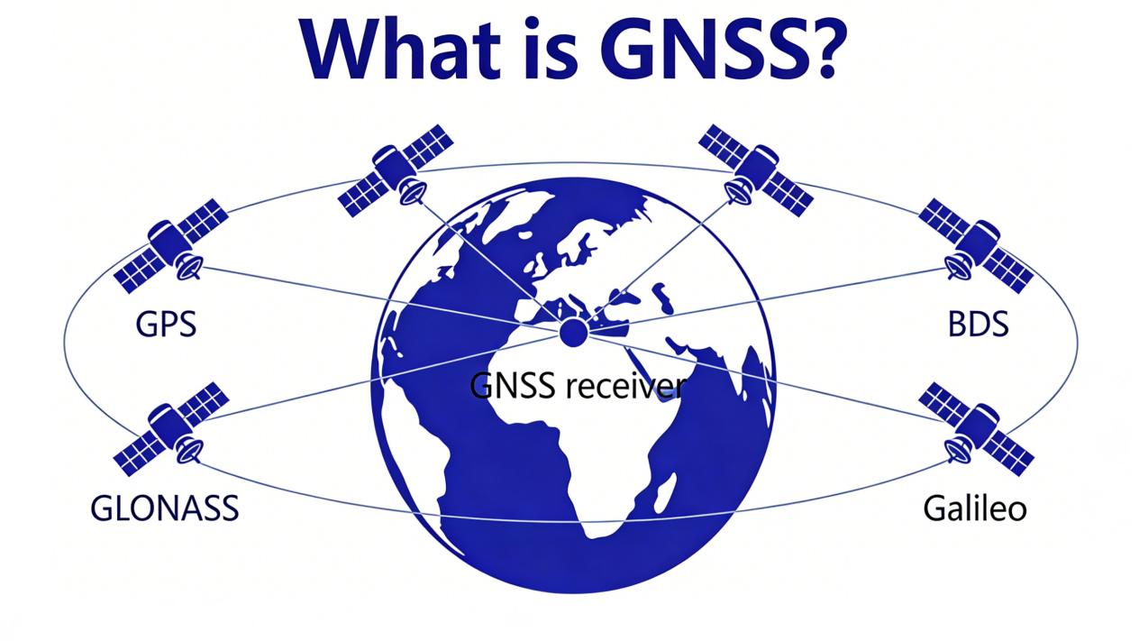
    Several different satellite systems work together to make up the GNSS network. First, GPS comes from the United States and is one of the most well-known systems. Next, BDS is China’s own global navigation system, designed for worldwide use. Then, GLONASS is the satellite system from Russia, built to work well in northern areas. Finally, Galileo is a system built by the European Union, focused on high accuracy for everyday users. These systems together improve coverage and accuracy all over the world.

    How Does GNSS Work?

    GNSS works in a few simple, easy steps. First, satellites high up in space send out clear signals. A GNSS receiver (like those from TOKNAV) picks up these signals from the satellites. It then measures how long each signal takes to travel from space to the receiver. After that, it uses this time to calculate your exact location on Earth. Most devices need at least four satellites to get a good position. More satellites mean better, more accurate positioning results.

    Why High Accuracy Matters

    The GPS on your phone works well for daily tasks like finding a café or driving directions. However, professional jobs need much better precision to get things right. For example, surveyors and farmers need centimeter-level accuracy to do their work properly. Normal phone GPS cannot meet this high need. Special tools like RTK technology help fix signal errors and boost accuracy. A strong, high-quality receiver makes this level of precision possible.

    Common Uses of GNSS

    GNSS helps many different industries get their work done every day. First, surveyors use it to measure land boundaries and map areas accurately. Then, farmers use it for smart farming tools to plant and harvest crops more efficiently. Next, ships and planes rely on it to navigate safely across oceans and skies. Also, construction teams use it for precise building plans and layout work. Finally, emergency services use it to find people in need and save lives quickly.

    Why Choose TOKNAV GNSS Receivers?

    TOKNAV makes professional GNSS receivers built for real-world use. These receivers support all the major satellite systems, so they get the best possible signal. They provide fast, stable positioning that you can trust. In addition, they offer the centimeter-level accuracy that professionals need. They also work well in tough outdoor environments, like construction sites or remote farms. Moreover, TOKNAV receivers are durable, long-lasting, and easy to use—even for people new to GNSS tools. They fit perfectly for surveying, mapping, and all kinds of field projects.

    Common GNSS Misunderstandings

    Many people have wrong ideas about GNSS that can cause confusion. First, GNSS is not the same as GPS—GPS is only one small part of the bigger GNSS network. Second, GNSS works best when used outdoors, because tall buildings or thick trees can block its signals. Third, not all GNSS receivers are equally good. Cheap, low-quality tools often have weak signals and low accuracy. Professional receivers like those from TOKNAV are much more reliable and deliver better results every time.

    The Future of GNSS

    GNSS technology keeps getting better and more advanced every year. New satellites are launched regularly, giving stronger and clearer signals to devices on Earth. New software updates also make positioning faster and more precise than ever before. Soon, GNSS will work even better with AI and smart devices. It will power self-driving machines, smart cities, and more advanced tools. To keep up with this future, you need a trusted GNSS partner. TOKNAV keeps making better, more reliable GNSS receivers to meet these new needs.

    Final Thoughts

    GNSS is the foundation of modern positioning technology. It helps people work, travel, and create things safely and efficiently every day. Understanding what GNSS is and how it works helps you pick the right tools for your needs. For anyone needing high accuracy, choosing a strong, reliable GNSS receiver is key. TOKNAV GNSS receivers bring the quality and stability that professionals depend on. They are built for real, hard professional work, no matter the environment. Visit toknavgnss.com today to learn more about TOKNAV’s products and how they can help you.

    SEO Meta Description (Copy Directly for Use)

    Want to know what GNSS is? This simple guide explains GNSS meaning, how it works, and common uses. Discover why TOKNAV GNSS receivers offer great accuracy for surveying, mapping, and industry.
  • Grass Sports Field Marking: How Toknav TR10 Pro Transforms Efficiency and Precision Globally

    Grass Sports Field Marking: How Toknav TR10 Pro Transforms Efficiency and Precision Globally

    Grass Sports Field Marking: How Toknav TR10 Pro Transforms Efficiency and Precision Globally

    2026-04-25

    If you’re a sports facility manager, groundskeeper, or event organizer, you know firsthand that grass sports field marking isn’t just a “check-the-box” task—it’s the backbone of a safe, fair, and professional athletic space. Whether you’re tending to a community soccer pitch where kids learn to play, a professional tennis court hosting local tournaments, or a school sports field bustling with daily activity, precise, long-lasting marking makes all the difference for athletes and spectators alike. But let’s be honest: traditional grass marking methods have been holding us back for far too long—inefficient, error-prone, and costly, leaving you stuck balancing quality and productivity. That’s where the Toknav TR10 Pro Intelligent Marking Robot steps in—a game-changer that’s revolutionizing grass sports field marking across the globe, from Serbia to Australia, France, and is now taking Europe by storm with its unbeatable performance.

    We’re breaking down the real challenges of grass field marking (the ones you deal with every day!), how the TR10 Pro solves them, its proven success in countries around the world, and why it’s become the top pick for facility managers and dealers looking to make their jobs easier. We’ll also dive into its awesome features, real-world success stories.

    The Challenges of Traditional Grass Sports Field Marking (We’ve Been There!)

    Grass fields are tricky—way trickier than asphalt or concrete. They’re uneven, they wear down fast, and you need a marking solution that’s precise and gentle enough not to damage the turf. Let’s face it: traditional methods—manual chalk lines, hand-held sprayers, or clunky mechanical tools—just don’t cut it. They lead to headaches, wasted time, and even lost revenue, and we’re willing to bet you’ve dealt with more than one of these pain points:

    First up: accuracy. We all know international sports groups like FIFA (soccer), ITF (tennis), and World Athletics (track and field) have super strict rules for line width, spacing, and placement. For example, a soccer field’s touchline needs to be exactly 12 centimeters wide, and a tennis court’s baseline can only be off by 3 millimeters—otherwise, your field might not be approved for official games. Manual marking relies on human guesswork and basic measuring tools, which means mistakes happen. Even a tiny error can mean rescheduling games, paying fines, or losing trust with your athletes and community.

    Then there’s efficiency (or lack thereof). A standard 11-a-side soccer field has over 346 meters of marking—and manual methods can take 2-3 people an entire day to finish. That’s not just more labor costs; it’s less time your field is available for games, practices, or rentals. If you’re running a busy facility, that downtime can feel like a major roadblock.

    Durability is another big issue. Grass grows fast, and traditional marking materials like chalk or basic paint fade or wash away after a rainstorm—meaning you’re re-marking constantly. That’s more time, more money, and inconsistent lines that can confuse athletes (and even lead to injuries). Plus, heavy equipment or harsh chemicals from manual marking can damage your turf, leading to costly repairs and a shorter field lifespan.

    And let’s not forget adaptability. Grass fields come in all shapes and sizes—from small community pitches to large professional stadiums—and you might need custom markings for different sports or events. Manual tools struggle with complex curves, logos, or custom designs, limiting what your facility can offer.

    Toknav TR10 Pro grass sports field marking

    Introducing the Toknav TR10 Pro: Your New Grass Marking BFF

    The Toknav TR10 Pro Intelligent Marking Robot was built specifically to fix the frustrations of grass sports field marking. It combines cutting-edge tech, a tough yet gentle design, and user-friendly features to deliver precise, efficient, and long-lasting results—every single time. As part of Toknav’s trusted TR10 series, it’s engineered for outdoor use, with a focus on grass surfaces, making it perfect for sports facilities of all sizes. Let’s break down why it’s become a favorite for facility managers worldwide:

    1. Centimeter-Level Precision (No More Fines or Rescheduling!)

    The TR10 Pro comes with a Linux Intelligent System that tracks signals from every major satellite constellation (BDS, GPS, GLONASS, GALILEO, SBAS, QZSS) with 1408 channels—so it never loses its way. Add in Real-Time Kinematic (RTK) differential positioning and access to the Beidou ground-based augmentation system, and you get reliable, repeatable centimeter-level accuracy. That’s way better than the strictest international sports standards, so you can mark lines, curves, and symbols exactly as required—no more mistakes, no more rescheduling, and no more fines.

    Whether you’re marking a soccer field’s penalty area, a tennis court’s service line, or a track’s lane markers, the TR10 Pro delivers consistent results that pass official inspections with flying colors. For you, that means less stress, a better reputation, and more time to focus on what matters: keeping your facility running smoothly.

    2. Tough Enough for Rough Grass (But Gentle on Turf)

    We know grass fields aren’t perfect—uneven terrain, bumps, gravel patches, you name it. The TR10 Pro is built to handle it all. With its compact design and two 400W hub motors, it glides over rough grass, climbs slopes up to 20 degrees, and even makes 0° in-place turns—so no corner of your field is out of reach.

    Best of all, it’s lightweight (only 39.3kg!) and operates gently, so it won’t damage your turf. If you prioritize keeping your grass healthy (which we know you do), this is a game-changer. It cuts down on costly turf repairs and extends your field’s lifespan—saving you money in the long run. Whether you’re marking a perfectly maintained professional stadium or a community pitch with a few bumps, the TR10 Pro gets the job done without breaking a sweat.

    3. Saves Time and Money (Hello, More Free Time!)

    Let’s talk efficiency—this is where the TR10 Pro really shines. With a top speed of 1m/s (3.6km/h) and 24/7 operation, it’s three times faster than manual marking. That standard soccer field that used to take 2-3 people a full day? The TR10 Pro can finish it in just a few hours—freeing up your team to focus on other important tasks, like turf maintenance or event prep.

    It also comes with a 48V/7.5Ah lithium battery that lasts up to 8 hours straight, and you can even customize the battery for a maximum range of 30km. That means you can mark multiple fields in a single day without stopping to recharge. Plus, the 10L hopper means fewer refills—so you can keep marking without interruptions.

    For facility managers, this translates to big cost savings: less labor, less downtime, and more field availability. More availability means more rentals, more events, and more revenue—win-win!

    costumer feedback about grass sports field marking

    4. Versatile Enough for Every Grass Sport

    Whether you’re marking soccer, tennis, rugby, lacrosse, baseball, or track and field, the TR10 Pro has you covered. It comes with an adjustable side nozzle (5cm~15cm), so you can control line width perfectly for any sport. The software has built-in templates for all standard sports fields—soccer pitches, tennis courts, running tracks—and it’s so easy to set up, you can start marking in minutes.

    Need custom markings? No problem. The TR10 Pro supports user-defined editing and template importing, so you can create unique logos, numbers, letters, or curves. It also works with DXF and CSV files, so you can import your own designs and bring them to life seamlessly. This versatility is perfect for facilities that host multiple sports or want to add branding to their fields for events or tournaments.

    5. So Easy to Use, Anyone Can Do It

    You don’t need to be a tech expert to operate the TR10 Pro. It comes with an Android tablet controller with a simple, intuitive interface—no confusing buttons or complicated menus. The built-in sports field models and custom editing tools make it easy to set up, and you don’t need any specialized training. Even staff with no technical experience can start using it in minutes. That means no costly training programs, no learning curve headaches, and more time to get things done.

    TR10 Pro’s Global Success: Trusted by Facilities Just Like Yours

    The TR10 Pro isn’t just a “nice-to-have”—it’s a proven solution that’s already making waves in countries around the world. Facility managers just like you have chosen the TR10 Pro for its reliability, precision, and ease of use, with strong adoption in Serbia, Australia, France, and beyond as part of our global footprint. Its consistent performance and user-friendly design have made it a top choice for facilities looking to streamline their marking processes.

    TR10 Pro’s European Push: A Resounding Success

    Building on its success in Serbia, Australia, and France, the TR10 Pro has recently made a strong push into the European market—and the response has been nothing short of amazing. The European sports equipment market is growing fast, and the TR10 Pro is quickly becoming the go-to solution for grass sports field marking, thanks to its compliance with local standards and unbeatable performance.

    Over the past few months, Toknav has been focusing on bringing the TR10 Pro to more European facilities—and the response has been amazing. The European sports equipment market is growing fast, and the TR10 Pro is quickly becoming the go-to solution for grass sports field marking.

    One of the biggest reasons for its success? It meets Europe’s strict safety and environmental standards. The TR10 Pro uses eco-friendly marking materials (like latex paint and titanium white slurry) that are safe for grass, athletes, and the planet—perfect for facilities looking to go green. Its energy-efficient design and long battery life also reduce carbon emissions, making it a sustainable choice.

    European grass field marking solution

    Another win: it adapts to Europe’s diverse sports landscape. Whether you’re marking soccer fields in the UK, tennis courts in Spain, or rugby pitches in France, the TR10 Pro handles it all. Plus, Toknav has local support teams in Europe—with dedicated contacts for Europe, North & South America (Tel & WhatsApp: +1 (323) 847-7713,Ian) and Asia, Africa & Oceania (Tel & WhatsApp: +86 139 2607 5986, Jeffrey)—so you always get timely help when you need it.

    To date, more and more European sports facilities use the TR10 Pro, and 98% of them are satisfied. Facility managers consistently say it’s saved them time and money, improved their field quality, and made their jobs easier. As Europe’s sports market grows, the TR10 Pro is on track to become the standard for grass field marking across the continent.

    Why the TR10 Pro Is Right for You

    Whether you’re a facility manager tired of manual marking headaches, a dealer looking for a high-demand product, or an event organizer needing reliable marking for tournaments, the Toknav TR10 Pro is your solution. Here’s why it stands out from the crowd:
    Proven Performance: Trusted by facilities in Serbia, Australia, France, and across Europe—these are real facilities with real results.

    Centimeter-Level Precision: Meets all international sports standards, so you never have to worry about errors or fines.

    Efficiency and Cost Savings: Three times faster than manual marking, with less labor and downtime—more money in your pocket.

    Adaptability: Handles rough grass, slopes, and custom markings—perfect for any grass sports facility.

    User-Friendly Design: No tech expertise or training needed—anyone on your team can use it.

    Global Support: Local support teams worldwide, so you’re never alone if you need help.

    Join Our Network: Become a TR10 Pro Dealer or Client Today

    The TR10 Pro isn’t just a product—it’s a business opportunity. As more facilities look for efficient, precise grass marking solutions, becoming a Toknav TR10 Pro dealer lets you tap into a growing market with huge profit potential. Whether you’re a sports equipment distributor, a facility maintenance company, or an entrepreneur looking to expand, the TR10 Pro gives you a competitive edge.

    If you’re a facility manager, investing in the TR10 Pro is an investment in your facility’s success. It cuts labor costs, eliminates errors, and extends your field’s lifespan—delivering a strong return on investment. You’ll have more time, more revenue, and happier athletes and community members.

    Ready to make your life easier? Fill out our inquiry form today to learn more about the TR10 Pro, request a demo, or apply to become a dealer. Our team will get back to you within 24 hours—we’re here to answer your questions and help you get started. Don’t miss out on transforming your grass field marking (and your business!). 

    Learn More >

    Let’s Chat: What’s Your Grass Marking Pain Point?

    We’ve covered a lot today, but let’s circle back to you—because every facility is unique, and we want to hear your story. Are you tired of spending hours marking fields manually? Frustrated with inconsistent lines or frequent re-marking? Or maybe you’re a dealer looking for a product that your clients will love?

    The Toknav TR10 Pro was built to solve the real problems that facility managers face every day. It’s not just a robot—it’s a tool that saves you time, money, and stress, so you can focus on what you do best: creating a great sports experience for your community.

    We want to hear from you! Drop a comment below and tell us: What’s your biggest grass field marking challenge? Have you tried an intelligent marking robot before? If you’re already using the TR10 Pro, share your success story—we’d love to celebrate with you.

    And if you’re ready to take the next step, visit toknavgnss.com to learn more, or shoot us an email at [email protected]—we’re here to help. Remember, precise, efficient grass marking isn’t just about compliance—it’s about creating a safe, fair, and fun space for athletes of all levels. With the TR10 Pro, you can do that and more. 

    Learn More >

    Upgrade Your Workflow with TOKNAV in Argentina

    Argentina’s surveying, construction, agriculture, and infrastructure sectors are growing rapidly, and they need positioning tools that match their ambition. Feedback from our authorized dealer confirms: TOKNAV T45 GNSS RTK receiver, tBase base station, and TSR20 handheld SLAM LiDAR scanner deliver the precision, ruggedness, and versatility needed to excel in Argentina’s unique landscape. From centimeter-level RTK surveys in the Pampas to 3D SLAM mapping in urban centers, from slope-side vineyard surveys to large-scale infrastructure monitoring, TOKNAV provides a complete, future-proof solution. With 1408-channel GNSS, IMU tilt compensation, AR stakeout, IP68 ruggedness, and flexible RTK/PPK/SLAM modes, TOKNAV tools solve real local challenges while boosting efficiency, accuracy, and profitability.

    If you are ready to upgrade your surveying, mapping, or construction workflow with the best RTK GPS receiver 2026 and innovative SLAM scanning technology, now is the perfect time to join the growing number of Argentine professionals choosing TOKNAV.

    Ready to experience TOKNAV’s precision and performance for your Argentine projects? Fill out our official website form now to request a free product demo, detailed pricing, local dealer contact information, or a customized solution quote. Our Argentinabased team will respond quickly to help you select the ideal T45, tBase, or TSR20 setup—with full training and local support included. Transform your field workflows today with professional-grade RTK and SLAM technology from TOKNAV!

  • Toknav T40  & T40Pro RTK: Smart Tools for Easy Surveying

    Toknav T40  & T40Pro RTK: Smart Tools for Easy Surveying

    Toknav T40 & T40Pro RTK: Smart Tools for Easy Surveying

    2026-02-19

    Toknav T40 & T40Pro RTK: Smart Tools for Easy Surveyin

    Surveying work needs tools that are precise and easy to use. Toknav’s T40 series—T40 and T40Pro—hits that sweet spot. These GNSS receivers mix high accuracy with simple, practical features. Whether you need laser measurement (T40) or photogrammetry (T40Pro), they cut down hassle and boost on-site efficiency. Today, we’ll break down their specs, key differences, and why they fit real surveying tasks.

    1. What Makes Toknav T40 Series Stand Out?

    Many RTK receivers are either too complex to learn or not tough enough for daily use. Toknav fixes this with the T40 series. They focus on “no-fuss functionality” for teams that need consistent results, fast.

    First, both models have a durable magnesium alloy build—light (850g) but IP68-rated to handle rain and drops. Second, they support hot-swappable batteries, so you never stop working to charge. Third, they skip confusing settings: turn them on, connect the controller, and start surveying. Whether you’re staking points or measuring hard-to-reach spots, these RTKs keep work smooth.

    2. Core Specs: T40 vs. T40Pro

    T40 and T40Pro share Toknav’s practical design but serve different needs. Below is a clear breakdown of their key specs.

    2.1 Shared Foundation: Precision & Durability

    Every T40 receiver starts with a strong core, ensuring reliable performance every time.

    GNSS Support: BDS, GPS, GLONASS, Galileo, QZSS, SBAS; 1408 high-speed channels for fast signal capture.

    Positioning Accuracy: RTK horizontal ±(8mm+1ppm), vertical ±(15mm+1ppm); <2cm tilt compensation (≤60°).

    Build: Magnesium alloy body, IP68 protection, 1.5m drop resistance; 850g (without battery) for easy carrying.

    Battery: 7.2V 3400mAh dual hot-swappable batteries; ≥20 hours of use (controller network mode).

    2.2 Key Differences: Laser vs. Photogrammetry

    Each model adds unique tools to fit specific surveying jobs.

    T40: Green laser measurement (30m range, ±5mm precision) + laser assist camera. Perfect for quick spot measurements—like checking distances to walls or pipes.

    T40Pro: Photogrammetry camera (1/2.6-inch sensor, 2-4cm error within 15m). Great for 3D mapping or extracting coordinates from real-world images.

    Shared Perk: AR stakeout (1920*1080 HD camera) for intuitive, one-shot point staking.

    2.3 Control & Practical Features

    Both RTKs keep operation simple, even for new users.

    Display: 1.3-inch 240RGB240 LCD panel—clear to read in sunlight.

    Communication: 410~470MHz radio (1W/2W/5W), Bluetooth, Wi-Fi; supports common protocols like TRIMTALK.

    Software: Works with Toknav’s easy-to-use controller apps—no complex training needed.

    3. How to Choose: T40 or T40Pro?

    Pick the model that matches your daily tasks:

    Choose T40 if you need laser measurement. It’s ideal for small-site surveys, utility checks (like pipe distances), or quick stakeouts where you need to “point and measure” fast.

    Choose T40Pro for photogrammetry. It’s perfect for topographic mapping, construction progress tracking, or jobs where you need to turn photos into precise coordinates.

    For AR stakeout (like land boundary marking), both work great—T40 adds laser speed, while T40Pro adds image-based flexibility.

    4. Why Surveyors Love the T40 Series

    Beyond specs, these RTKs solve real on-site problems:

    No Downtime: Hot-swappable batteries mean you can replace a dead battery in seconds—no stopping work.

    Light & Tough: Easy to carry all day, yet strong enough to handle rain, dust, and accidental drops.

    Simple to Learn: Intuitive controls let new team members start using them in minutes, not hours.

    Consistent Accuracy: Tilt compensation and fast RTK initialization (cold start <40s) reduce errors.

    5. Conclusion: T40 Series—Surveying Made Easier

    Toknav T40 and T40Pro aren’t just RTKs—they’re time-savers for busy surveyors. T40 keeps quick measurements fast and simple; T40Pro turns photos into precise data for bigger projects.

    Both skip the overcomplicated features and focus on what matters: reliability, ease of use, and all-day performance. They fit how you actually work—no more fighting with confusing settings or fragile gear.

    Quick question: Do you mostly do quick spot measurements or need 3D mapping from photos? Have you ever struggled with RTKs that die mid-job? Drop a comment—I’ll help you pick the right T40 model!

    For more details or a demo, visit www.toknavgnss.com or email [email protected]. Follow us for tips on making surveying faster and easier!

    Meta description :2026 Toknav T40/T40Pro RTK: Laser/photogrammetry, IP68 durability, hot-swappable batteries & centimeter precision for easy surveying.

    2026-02-19

    Toknav T40 & T40Pro RTK: Smart Tools for Easy Surveyin

WhatsApp