
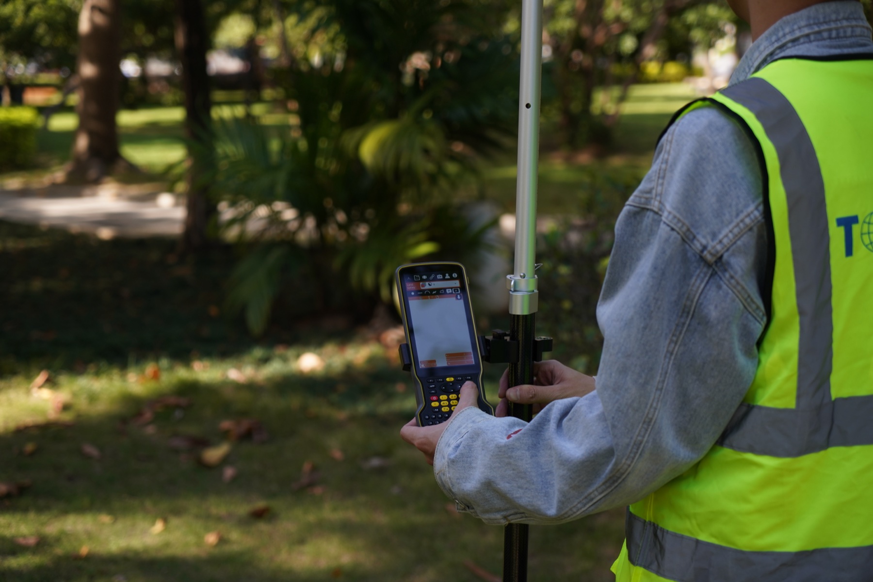
GNSS data collection is more than recording field coordinates. The reliability and reusability of a dataset depend on a controlled relationship among the required deliverable, positioning method, field application, coordinate reference, connectivity, operator procedure and quality review. The receiver or rugged device is one component of this operational system.
Define the map, register or decision that the project must deliver. Then select the workflow that produces the required data consistently, rather than evaluating device specifications in isolation.
Define the required deliverable before selecting equipment
“Field mapping” can mean a tree inventory, utility asset register, construction as-built, environmental observation, parcel review, drainage survey or a control-related task. These jobs may all use GNSS, but their data structure, accuracy requirement, field interface and quality checks are different. A sound procurement conversation starts with the output: points, lines, polygons, attributes, photos, documents, inspection forms or a combination.
Write down the accuracy or tolerance required by the project owner, the coordinate reference and vertical context, the field application, expected file or synchronization path, operator count and working conditions. Those details reveal whether the team needs a rugged handheld, a controller plus external receiver, a local base, network corrections or a simpler data-capture method. They also keep the supplier evaluation focused on the operational requirement.
Select the positioning method within the data design
The appropriate positioning method follows the deliverable. Some inspection and asset workflows can use a lower-accuracy location when the record is meant to identify an area or a feature for later review. Survey-grade mapping, construction, utility and control-related work may require a defined RTK or other correction workflow. Do not use a generic phrase such as “high accuracy” in place of a documented project tolerance and check process.
When RTK is needed, define the correction path early: local base and radio, network RTK, CORS/VRS service or another approved arrangement. Consider coverage, terrain, mobile-data reliability, number of users, project control and how a crew will record an interruption. The VRS vs. RTK Base Station guide is a useful starting point for that choice. A connection status alone is not a quality plan; the project still needs an accepted validation procedure.
Confirm application and device compatibility before procurement
In many GIS projects, the field app is already selected. That makes compatibility a pre-purchase requirement, not an issue to discover after delivery. List the application, operating system, version, required data formats, positioning-input method, offline behavior, photo/form requirements and synchronization path. Then verify the exact intended combination with both the application owner and equipment supplier.
A rugged GIS handheld may be used on its own, or it may work with an external GNSS receiver. A controller-plus-receiver workflow may suit another team. Neither pattern is automatically better. The chosen path must support the field app, correction method, power plan, mounting, connection method and operator routine. Explore the TOKNAV Rugged & GIS range and GNSS receiver range as category starting points.
Establish a repeatable field procedure
1. Prepare and release the job package
Before leaving, load approved maps, forms, feature codes, instructions and coordinate settings. Confirm the team knows which features require a check, which attributes are mandatory and what to do when a site condition does not match the plan. If control is part of the project, make the control-check procedure visible in the job instructions.
2. Establish and record the positioning method
Connect the device or receiver to the planned positioning source. Record the status indicators and any correction source that the project requires. If a crew changes correction source, profile or coordinate context, treat that as a project event to document—not a silent setting change. The separate NTRIP setup guide covers the internet-correction delivery path in more detail.
3. Capture features to the defined procedure
Consistency matters as much as equipment. Define how long to occupy a point when needed, how to trace lines and polygons, how to name photos, which attribute values are valid and how to record exceptions. A clear rule helps a later reviewer distinguish a missing record from a deliberate field decision. It also reduces variation between crews and shifts.
4. Complete field quality control before leaving the site
Review a sample of attributes, photos, feature geometry, duplicate records and position status while a return visit is still possible. If the job relies on known control or a defined check shot, complete it using the approved procedure. The goal is to identify data needing correction before delivery.
5. Synchronize data with a handover record
Use the project’s approved upload, versioning and review route. Record information that a downstream GIS, survey or project team needs to interpret the work: collection date, field team, coordinate context, correction source if relevant, application version, exceptions and unresolved items. This short record can be more valuable than a screenshot because it explains the conditions behind the data.
Apply a focused configuration-selection checklist
Use this checklist when evaluating a rugged handheld, controller or external GNSS-supported configuration:
- Required data types, accuracy/tolerance and coordinate context.
- Field application, operating system, connectivity and synchronization requirements.
- Correction method, coverage and validation process where applicable.
- Screen, gloves, daylight, battery, charging, mounting and accessory needs.
- Camera, barcode, rangefinder, external antenna or other peripheral requirements.
- Offline collection, data security, support, training and country-specific service needs.
The objective is not to buy the most complex configuration. It is to choose the simplest supportable workflow that meets the data, positioning and field-use requirement. For custom integrations, also document whether the buyer needs a single unit, a multi-user rollout or a combined hardware-and-software process. The TOKNAV software path can help frame the broader field-to-office discussion, while final compatibility must always be checked for the selected project.
FAQ
Does every GIS project need RTK?
No. The required positioning method depends on the deliverable and project tolerance. Choose and document the method before field collection begins.
Can a rugged device work with an external GNSS receiver?
Some combinations can, but the exact device, operating system, application and connection method must be verified before procurement.
What should a buyer send for a workflow recommendation?
Share the field application, data types, accuracy requirement, coordinate context, correction method, users, environment, country and preferred deployment timeline.
Plan the field-to-office implementation
If you are preparing a GIS, asset-collection or RTK field-mapping rollout, share the project checklist with TOKNAV. The discussion can focus on the device category, positioning path, application compatibility and deployment questions to resolve before implementation.