
01⌁
Full-system, multi-frequency GNSS
The 1408-channel receiver tracks the GPS, GLONASS, BDS, Galileo, QZSS, SBAS and NavIC signals listed in the current T40 datasheet.
GNSS RTK RECEIVER
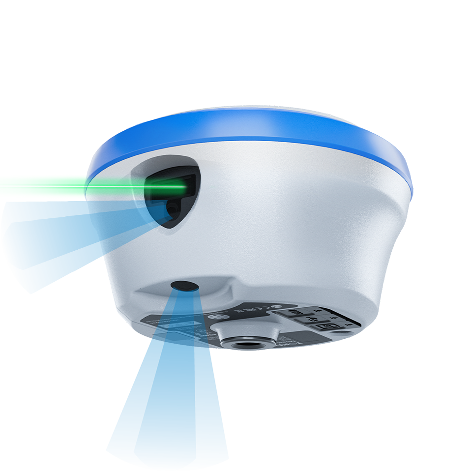
T40 is a laser dual-camera GNSS RTK receiver that integrates a 1408-channel positioning module, high-precision IMU, AR camera and millimetre-grade laser ranging. It supports high-precision positioning, tilt measurement, AR real-world stakeout and visualized laser point measurement for professional field workflows.
For a useful recommendation, include your country, project application and any required integration.
T40 CAPABILITIES
Every statement below is matched to the current supplied T40 GNSS Receiver Datasheet dated 2026-09-04.
The 1408-channel receiver tracks the GPS, GLONASS, BDS, Galileo, QZSS, SBAS and NavIC signals listed in the current T40 datasheet.
The integrated high-precision IMU provides real-time tilt compensation; the datasheet specifies less than 2 cm tilt compensation within 60°.
A dedicated AR camera supports real-world stakeout. Published AR stakeout accuracy is horizontal ±(8 mm + 1 ppm) and vertical ±(15 mm + 1 ppm).
The 30 m Class 3R green-laser module and laser-assist camera support point-and-measure work, with no more than 2.5 cm 3D error within 5 m.
Two removable 7.2 V, 3400 mAh batteries can be changed without interrupting operation. The stated endurance is over 20 hours in controller network mode.
FIELD WORKFLOW
The steps below explain the operating decision path. Project procedures, safety requirements and final acceptance criteria remain the responsibility of the project team.
Confirm the coordinate reference, correction service and applicable radio or mobile-data requirements before field work.
Use the documented GNSS, IMU, laser or imaging function only where it matches the point condition and project procedure.
Check the result in the selected field software and retain the project record required for delivery.
PRODUCT DOCUMENTATION
Available product documents are listed in the downloads section where supplied.
Contact TOKNAV to confirm the configuration required for your project.
Confirm detailed values, scope of supply, required options and regional availability with TOKNAV for your project.
CONFIGURE FOR THE PROJECT
A model name is only the starting point. A useful configuration considers the work method, output, integration, country of use and available supporting equipment.
Define the project task and operating environment before selecting accessories or options.
Review compatibility with any receiver, controller, software, vessel, machine or workflow already in use.
Send the destination country and project requirement for a focused product recommendation.
LATEST ENGLISH DOCUMENTS
The T40 Datasheet dated 2026-09-04 is the current source for the published technical specifications on this page.
VERIFIED TECHNICAL SPECIFICATIONS
Values are transcribed from the supplied T40 GNSS Receiver Datasheet dated 2026-09-04. Confirm the final configuration and regional radio requirements before ordering.
DOCUMENTATION & PRODUCT RECORD
The product wording and specifications on this page are maintained against the identified current source file.
APPLICATION PATHS
These application paths help identify the relevant field workflow and the next product discussion.
Discuss the Topographic survey workflow and the role of T40 in the intended project.
Discuss the Construction layout workflow and the role of T40 in the intended project.
Discuss the Control-point measurement workflow and the role of T40 in the intended project.
Discuss the Cadastral and infrastructure survey workflow and the role of T40 in the intended project.
BUYER QUESTIONS
These answers follow the current product document and identify the points to confirm for a project-specific T40 configuration.
Start a T40 enquiryT40 combines GNSS RTK positioning, IMU tilt measurement, AR real-world stakeout and visualized laser point measurement for professional survey workflows.
The current T40 datasheet specifies a 30 m Class 3R laser module, precision of ±(5 mm + 100 × 10⁻⁶ × D), and no more than 2.5 cm 3D error within 5 m.
Yes. The receiver uses two removable 7.2 V, 3400 mAh batteries and supports hot swapping without interrupting operation. The stated endurance is over 20 hours in controller network mode.
No. Radio, network bands, enabled functions and area-code restrictions can vary. Confirm the final configuration and destination-market suitability with TOKNAV before purchase or deployment.
PROJECT ENQUIRY
Share the location, application, expected workflow and existing system. TOKNAV can help move from the product record to a project-ready configuration discussion.