jeffreyrtk@gmail.com

مرحبًا، أنا جيفري، ممول موقع toknavgnss.com، أدير مصنعًا في الصين يصنع GNSS RTK منذ 8 سنوات حتى الآن، والغرض من هذا المقال هو مشاركتكم المعرفة المتعلقة بنظام GNSS من منظور المورد الصيني.

TOKNAV 1a3f47bf68f65704832db732d45c8272

إشارة GNSS محجوبة؟ جرب هذه الطريقة السريعة لإعادة المسح السريع بمساعدة إنترنت الأشياء لشبكات التحكم الهندسية - دقة على مستوى المليمتر وكفاءة مضاعفة

Home GNSS Signal Blocked? Try This IoT-Assisted Rapid Re-survey Method for Engineering Control Networks – Millimeter-Level Accuracy & Doubled Efficiency 2025-04-14 Friends in surveying and engineering must have encountered the same frustrating problem – control network re-survey, especially in scenarios with severe GNSS signal obstruction (such as mountainous areas, factories, and dam surroundings), which is simply “an arduous task”! Control networks are like the “eyes” of a project. Regular re-survey is essential to ensure the reliability of subsequent construction and monitoring. However, common re-survey methods on the market either have limited application scenarios or are inefficient to the point of frustration. Today, I will share a practically proven solution – an IoT-assisted rapid re-survey method for engineering control networks, which achieves millimeter-level accuracy and doubles efficiency in actual tests! IoT-Assisted Rapid Re-survey Method for Engineering Control Networks System Architecture Perception layer: The protagonist is the “remote-controlled prism” – we have modified ordinary prisms to adjust their orientation remotely, eliminating the need for manual adjustment at control points, which is the key to improving efficiency; Network transmission layer: LoRa technology is adopted. You may not be familiar with this technology, but its advantages are obvious – long transmission distance and strong anti-interference ability. Even in complex environments such as mountainous areas and dams, it can stably transmit control signals. It is worth mentioning that all Toknav’s RTK devices have the same advantages as LoRa technology and can also achieve stable transmission in complex surveying scenarios. For more information, you can check out Learn more > Application layer: It is the control software we operate, with a simple interface. It can remotely control the prism orientation, view measurement data, and realize full-process visualization, making operation very simple. The entire re-survey process is also very simple: deploy remote-controlled prisms at each control point, the operator operates the total station at a fixed position, remotely adjusts the prism orientation through the application layer software, and the total station automatically completes angle and distance measurement. No need to travel back and forth between control points, completing the task in one step. Actual Test Verification: Accuracy Uncompromised, Efficiency Doubled! Talking the talk is not enough; walking the walk is. We conducted an experiment on an actual project (the plane control network of a hydropower station dam), comparing the re-survey effects of the “IoT-assisted method” and the “total station only” method. The results were really surprising! Accuracy: The re-survey accuracy of the two methods is completely consistent, reaching sub-millimeter level, which fully meets the re-survey requirements of engineering control networks, so there is no need to worry about accuracy degradation; Efficiency: Taking working hours as the indicator, the efficiency of the IoT-assisted method is about 107% higher than that of using only the total station – simply put, a re-survey task that used to take two days can now be completed in one day, saving half the time directly! More importantly, this method does not rely on GNSS signals. As long as there is line of sight between control points (a basic requirement for traditional total station measurement), it can work normally no matter how severe the surrounding obstruction is. Many actual engineering control networks are laid out as angle-distance networks, which are just suitable for this method, with broad application prospects. Summary & Future Outlook In summary, this IoT-assisted rapid re-survey method for engineering control networks perfectly solves the pain points of traditional methods: “low efficiency, tiring labor, and limited scenarios”: No manual trips to control points to adjust prisms, with full automation, reducing labor costs and safety risks; The accuracy is consistent with that of traditional total stations, reaching sub-millimeter level, meeting engineering needs; It does not rely on GNSS signals and can easily handle scenarios with severe obstruction, with a wider scope of application; Efficiency is increased by 107%, greatly shortening the re-survey period. Of course, this method still has a small regret – it has not been applied in complex terrain (such as high mountain canyons) or ultra-large-scale control networks. In the future, we will continue to improve, and strive to verify it in more complex scenarios, so that this method can help more friends in engineering and surveying. If your project also encounters problems of GNSS signal obstruction and low re-survey efficiency, you may wish to try this method – it has been proven useful in actual tests! If you have any related questions, you can also leave a message in the comment area to communicate~ Reference: [1] Zhou Jianguo, Gan Youhuizi, Chen Yanchong. IoT-Assisted Rapid Re-survey Method and System for Engineering Control Networks[J]. Science of Surveying and Mapping, 2026, 51(02): 33-40. DOI:10.16251/j.cnki.1009-2307.2026.02.004.
إشارة GNSS محجوبة؟ جرب هذه الطريقة السريعة لإعادة المسح السريع بمساعدة إنترنت الأشياء لشبكات التحكم الهندسية - دقة على مستوى المليمتر وكفاءة مضاعفة قراءة المزيد »

TOKNAV 2026 GEO week 卡片

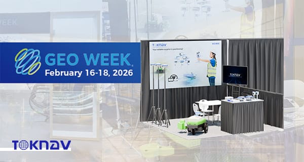
TOKNAV تعرض حلولاً عالية الدقة للأنظمة العالمية لسواتل الملاحة والحلول الجغرافية المكانية في أسبوع جيو 2026 في دنفر

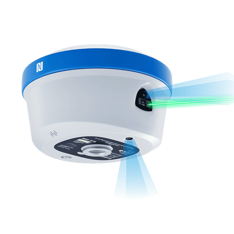
Home TOKNAV Showcases High-Precision GNSS & Geospatial Solutions at Geo Week 2026 Denver 2026-02-19 TOKNAV Highlights T50 GNSS RTK, TSR20 LiDAR & Tboat USVs at Geo Week 2026 Denver, CO, February 18, 2026 – TOKNAV, a globally recognized provider of high-precision GNSS (Global Navigation Satellite System) and comprehensive geospatial solutions, successfully concluded a standout participation at Geo Week 2026, a three-day industry flagship event held from February 16 to 18 at the Denver Colorado Convention Center, where the company occupied Booth 1808. As the world’s premier geospatial industry gathering, Geo Week 2026 set new benchmarks this year, attracting over 3,800 registered attendees, 238 exhibitors hailing from 25 different countries across six continents, and boasting the largest exhibit hall in its decades-long history. Aligned perfectly with the event’s core focus on AI integration, uncrewed technology advancement, and 3D geospatial innovation, TOKNAV took center stage by showcasing its flagship T50 GNSS RTK (Real-Time Kinematic) receiver—equipped with industry-leading 100m laser ranging capability—alongside the compact and powerful TSR20 Handheld LiDAR Scanner and the versatile Tboat Series Unmanned Surface Vehicles (USVs). The company’s cutting-edge offerings resonated deeply with attendees, earning strong acclaim and positive feedback from geospatial professionals, surveyors, engineers, and industry leaders from around the globe.Geo Week 2026 solidified its reputation as the epicenter of geospatial advancement, bringing together a diverse community of industry stakeholders to explore and celebrate the latest trends, technologies, and applications shaping the future of geospatial science. This year’s event was particularly focused on three transformative pillars: AI-embedded spatial data workflows that streamline efficiency and accuracy, the expanding role of uncrewed systems in field operations, and the ongoing evolution of 3D geospatial capture and analysis. In addition to featuring an extensive exhibit hall, Geo Week 2026 offered a rich program of keynotes delivered by industry pioneers, expert panels diving into critical challenges and opportunities, live demonstration zones where attendees could experience new technologies firsthand, and exclusive product previews that offered a glimpse into the next generation of geospatial tools. Every element of the event was designed to drive real-world geospatial innovation, connecting professionals with the solutions they need to tackle complex projects in surveying, mapping, construction, environmental management, and beyond. Notably, the event also highlighted the completion of the U.S. 3DEP (3D Elevation Program), a landmark initiative that provides high-quality 3D elevation data to support a wide range of geospatial applications, further underscoring the industry’s shift toward more detailed and accurate spatial information. High-Precision GNSS and Geospatial Innovations for Surveying and 3D Reality Capture TOKNAV’s portfolio of high-precision GNSS and geospatial solutions is strategically aligned with the global geospatial industry’s ongoing shift toward intelligent, long-range, and uncrewed systems—trends that were front and center at Geo Week 2026. The company’s latest product lineup is engineered to deliver exceptional centimeter-level accuracy, reliable performance in even the most challenging field conditions, and streamlined workflows that reduce operational time and costs for professionals across a variety of sectors, including land surveying, aerial mapping, civil construction, and hydrological operations. By combining advanced hardware with intuitive software, TOKNAV’s solutions address the evolving needs of the industry, empowering users to complete projects more efficiently, accurately, and safely than ever before. Whether working in remote rural areas, bustling urban environments, or harsh industrial sites, TOKNAV’s high-precision GNSS and geospatial tools are designed to adapt to diverse use cases, making them a versatile choice for geospatial professionals worldwide. T50 GNSS RTK: 100m Laser Ranging for Long-Range High-Precision Surveying The T50 GNSS RTK receiver emerged as a true star of TOKNAV’s booth at Geo Week 2026, perfectly embodying the event’s focus on high-performance field technology with its groundbreaking 100m laser ranging capability—a transformative feature that redefines long-range surveying possibilities. Unlike traditional GNSS devices that require close proximity to target points, the T50’s laser ranging function allows surveyors to capture accurate measurements from up to 100 meters away, eliminating the need to physically access hard-to-reach or hazardous areas such as steep slopes, busy highways, or unstable terrain. This not only enhances safety but also significantly boosts efficiency, reducing the time required to complete large-scale surveying projects. Complementing its laser ranging capability, the T50 is equipped with 1408+ multi-constellation GNSS channels, enabling it to receive signals from all major global satellite systems (including GPS, GLONASS, Galileo, and BeiDou) for enhanced positioning accuracy and reliability, even in environments with limited satellite visibility. The device also features AR (Augmented Reality) real-time stakeout, which overlays digital design data onto the physical environment through a built-in screen, allowing surveyors to quickly and accurately locate stakeout points without the need for additional equipment. Additionally, the T50 supports photogrammetry, enabling users to capture high-resolution images and generate detailed 3D models for further analysis. To ensure uninterrupted operation in the field, the T50 is equipped with dual removable high-capacity batteries that provide all-day power, even during extended surveying sessions. Its IP68 rugged design—meaning it is dust-tight and capable of withstanding submersion in up to 1.5 meters of water for 30 minutes—ensures reliable performance in harsh field conditions, including extreme temperatures, heavy rain, and dusty environments. These features combined make the T50 GNSS RTK a preferred choice for professionals seeking long-range, high-precision GNSS and geospatial solutions that deliver consistent performance in any scenario. TSR20 Handheld LiDAR Scanner: Lightweight 3D Point Cloud Solution TOKNAV’s TSR20 Handheld LiDAR Scanner also resonated strongly with Geo Week 2026 attendees, aligning perfectly with the event’s emphasis on 3D reality capture—a critical trend in modern geospatial technology. Weighing only 1.0kg, the TSR20 is one of the lightest handheld LiDAR scanners on the market, making it easy to carry and operate for extended periods without causing user fatigue. Despite its compact size, the device is packed with advanced features, including a high-performance Livox Mid-360 sensor and state-of-the-art SLAM (Simultaneous Localization and Mapping) algorithms that enable it to capture high-precision 3D point clouds with ≤3cm relative accuracy. What sets the TSR20 apart is its ability to perform equally well in both GNSS-enabled and GNSS-denied environments—such as indoor spaces, urban canyons, or dense forests—where traditional GNSS devices often

TOKNAV تعرض حلولاً عالية الدقة للأنظمة العالمية لسواتل الملاحة والحلول الجغرافية المكانية في أسبوع جيو 2026 في دنفر قراءة المزيد »

TOKNAV 架站卡片

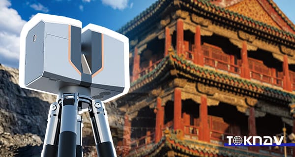
الماسح الضوئي الليزري الأرضي TSL150: دقة 2 مم، 3.3 كجم، دقة نقل 3.3 كجم، عدم تأخير المكتب

Home TSL150 Terrestrial Laser Scanner: 2mm Precision, 3.3kg Portability, Zero Office Delay 2026-04-05 TOKNAV Launches TSL150 Terrestrial Laser Scanner Globally Guangzhou, China – March 12, 2026 – TOKNAV today announced the global launch of a groundbreaking terrestrial laser scanner that redefines industry standards by merging survey-grade accuracy with unprecedented portability. This innovative device delivers 2mm precision at 50 meters in an ultra-compact design weighing just 3.3kg, shattering the long-standing trade-off between performance and mobility that has constrained surveyors for years. Engineered for field efficiency and real-time data validation, this scanner eliminates the need for heavy, cumbersome equipment while maintaining professional-grade results, setting a new benchmark for mobile, high-precision 3D reality capture across surveying, mapping, and construction sectors. Why Surveyors Choose This Game-Changing Scanner Crafted to address the daily challenges faced by surveyors, mappers, and BIM data collectors, this scanner combines ultra-high accuracy, lightweight portability, and streamlined on-site workflows. Its design directly targets pain points like time-consuming rework, costly office delays, and inefficient field operations, enabling teams to accelerate project delivery without compromising on quality. For professionals who often work in remote or hard-to-reach locations, its portability and reliability have quickly made it a top choice for modern surveying projects. True Field Autonomy & Single-Person Efficiency A key highlight of this scanner is its true field autonomy, powered by integrated real-time point cloud registration and automatic multi-station leveling with dual-axis tilt compensation. This feature allows survey teams to validate data quality on-site before leaving the job, eliminating the risk of costly rework and ensuring that every scan meets project requirements the first time. Weighing only 3.3kg and equipped with dual hot-swappable batteries, the device supports fast deployment and all-day operation—whether used upright at ground level for large-scale site scans or inverted for detailed ceiling measurements in indoor projects. Notably, the entire workflow, from setup to data capture, can be completed by a single operator, drastically reducing labor costs and improving overall field efficiency. Survey-Grade Accuracy & Immediate Photorealistic Deliverables When it comes to performance, the scanner delivers uncompromising survey-grade results: 2mm accuracy (1σ) at 50m, 3mm (1σ) at 100m, and a maximum scanning range of 150m. Its impressive scan speed of 100 lines per second and 1.2MHz pulse rate ensures that dense, detailed point clouds are captured quickly without sacrificing precision—critical for large-scale projects where time is of the essence. Paired with 100MP HDR panoramic imaging and exposure bracketing, the scanner produces photorealistic colorized point clouds that are ready for instant integration into BIM and GIS platforms, eliminating time-consuming post-processing delays and streamlining the path from data capture to project delivery. All-Condition Reliability for Real-World Survey Projects Built to withstand the rigors of real-world fieldwork, the scanner features an IP54-rated sealed design that protects against dust and water splashes, enabling reliable operation in temperatures ranging from -20°C to +50°C. It supports multi-GNSS compatibility (including BDS, GPS, GLONASS, GALILEO, QZSS, NavIC, and SBAS) and a built-in MEMS IMU, ensuring stable and precise georeferencing even in challenging environments with limited satellite visibility. With 1TB of internal SSD storage and 256GB of external expansion capacity, the device handles large datasets seamlessly without interruptions. Its compact dimensions (216mm × 168mm × 105mm) allow deployment in confined spaces, such as narrow construction sites or historic buildings, and elevated positions where traditional, bulkier scanners cannot reach. TSL150 Availability & Global Support from TOKNAV Designed, manufactured, and supported at TOKNAV’s quality-controlled facility in Guangzhou, this scanner reflects the brand’s commitment to being the world’s most reliable geospatial measurement partner. It is available now through TOKNAV and its authorized global dealers, complete with a lightweight carbon fiber tripod and a full-featured field software suite that simplifies setup, data capture, and on-site validation.About TOKNAVBased in Guangzhou, TOKNAV designs, builds, and supports professional GNSS and laser scanning solutions with strict quality control. The company is committed to becoming the world’s most reliable geospatial partner, delivering consistent quality, innovative products, and exceptional service to every customer worldwide.Contact: info@toknavgnss.com | www.toknavgnss.com

الماسح الضوئي الليزري الأرضي TSL150: دقة 2 مم، 3.3 كجم، دقة نقل 3.3 كجم، عدم تأخير المكتب قراءة المزيد »

معدات المسح الهيدروغرافي TOKNAV في التشغيل الميداني لرسم الخرائط المائية الدقيقة 

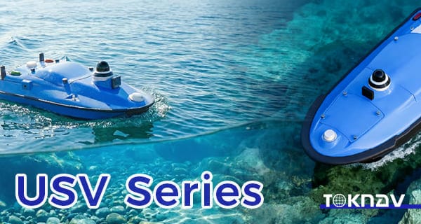
مركبات سطحية غير مأهولة من سلسلة Tboat لعمليات المسح المائي الذكية

Home Tboat Series Unmanned Surface Vehicles for Intelligent Water Survey Operation 2026-03-18 TOKNAV Launches Tboat10 & Tboat20 Unmanned Surface Vehicles In the era of rapid intelligent technology development, hydrographic survey and water operation are undergoing profound transformation. Traditional methods, relying heavily on manual operation and conventional vessels, face low efficiency, high labor costs, poor safety in complex waters, and unstable data accuracy. To address these pain points, TOKNAV Information Technology Co., Ltd., a leader in intelligent marine and geospatial technology, officially launches the Tboat Series Unmanned Surface Vehicles. This new series includes two professional models: Tboat10 and Tboat20, tailored to different application scenarios. Focused on modern hydrographic survey and intelligent water operations, the Tboat Series Unmanned Surface Vehicles integrate high-precision GNSS positioning, stable autonomous navigation, and flexible sensor integration, providing efficient, reliable data collection for rivers, lakes, reservoirs, coastal areas, and other complex water bodies. The launch enriches TOKNAV’s product matrix and marks its progress in unmanned surface vehicle technology, helping users improve operational efficiency and data accuracy in water survey, environmental monitoring, and water engineering projects. The Tboat Series Unmanned Surface Vehicles are designed to break traditional survey limitations, combining advanced hardware and intelligent software for full-process autonomous operation, reducing manual intervention and enhancing safety. As global urbanization and environmental protection advance, demand for intelligent water survey grows, and the Tboat Series Unmanned Surface Vehicles will drive the industry’s digital and intelligent transformation. Tboat10: Compact USV for Efficient Survey in Complex Waters The Tboat10 is a compact, highly maneuverable model in the Tboat Series Unmanned Surface Vehicles, designed for efficient surveys in narrow rivers, small-to-medium lakes, and reservoirs. Unlike large vessels, its 1.2m length and 0.6m width let it navigate narrow channels, shallow waters, and vegetation-dense areas. This compact design also enables easy transport (fit for standard SUVs) and deployment within 15 minutes, boosting field flexibility and emergency response. To ensure stable navigation, the Tboat10 features an optimized M-type hydrodynamic hull, refined through thousands of simulations and trials to reduce resistance, enhance stability, and minimize wave-induced oscillation—critical for high-accuracy tasks like shallow-water bathymetry and narrow-river water quality monitoring. The Tboat Series Unmanned Surface Vehicles’ Tboat10 model adopts a hidden-impeller pump-jet propulsion system, avoiding entanglement with aquatic debris (a common traditional vessel issue) and reducing harm to aquatic life, making it eco-friendly. This system also offers low noise and high efficiency, with simple maintenance: regular impeller cleaning and pipeline checks, no complex disassembly. Power supply is key to the Tboat Series Unmanned Surface Vehicles’ performance. The Tboat10 uses a 900W high-torque brushless DC motor, ensuring stable navigation in shallow or fast-flowing waters. It is equipped with two 33.6V hot-swappable 20Ah lithium batteries; the hot-swappable design allows 30-second battery replacement without shutdown, ensuring continuous operation. Under normal conditions, dual batteries support 8-10 hours of work and a 20km survey range, meeting daily small-to-medium water area needs. An intelligent battery management system monitors power, temperature, and voltage in real time, preventing overcharging, over-discharging, and short-circuiting. Safety is prioritized in the Tboat Series Unmanned Surface Vehicles: the Tboat10 has a double-layer bow (high-strength plastic outer, reinforced aluminum alloy inner) to absorb collision impacts, protecting internal components. It includes a water ingress alarm (triggering alerts and automatic return-to-home), an ultrasonic/machine vision obstacle avoidance system, and multi-scenario automatic return-to-home (low battery, signal loss, manual activation). A 360° HD camera transmits real-time images to the control terminal, enhancing safety. In practice, the Tboat10 outperforms manual methods: in a suburban shallow river survey, it boosted efficiency by over 3x with higher accuracy; in reservoir water quality monitoring, it collected real-time pH, dissolved oxygen, and turbidity data for background analysis. Tboat20: Professional Multi-Purpose USV for Large-Scale Hydrographic Missions The Tboat20’s propulsion and power systems are upgraded for long-distance operations: a dual 1500W motor propulsion system provides strong power, even in rough conditions. Four 33.6V high-capacity lithium batteries (total 80Ah) support 12-15 hours of continuous work and a 50km survey range. A dedicated fast charger enables full charging in 4 hours, and a solar auxiliary charging system extends endurance, reducing external power dependence. The Tboat Series Unmanned Surface Vehicles’ Tboat20 is equipped with an advanced autonomous navigation system, using multi-sensor fusion (GNSS, inertial navigation, electronic compass) for centimeter-level positioning. It supports waypoint, track, and manual remote control navigation modes, with a remote monitoring system enabling real-time data transmission, parameter adjustment, and fault diagnosis. In practice, the Tboat20 excels in large-scale projects: in a coastal city’s 100-square-kilometer mapping project, it reduced labor costs by over 60% and survey time by over 40% compared to traditional methods, providing accurate data for coastal development. In offshore environmental monitoring, it collected long-term water quality and ecological data for policy formulation. The Tboat20, another model in the Tboat Series Unmanned Surface Vehicles, is a professional-grade USV for large-scale, long-distance, high-intensity surveys, suitable for coastal mapping, offshore environmental monitoring, and other high-payload, long-endurance tasks. Its 50kg maximum payload allows flexible integration of advanced equipment: a high-precision multibeam echo sounder for large-area bathymetry, a side-scan sonar for underwater target detection, an ADCP system for flow velocity/rate measurement, and environmental sensors for water quality, temperature, and salinity data. The Tboat Series Unmanned Surface Vehicles’ Tboat20 features a reinforced composite hull (high-strength FRP and carbon fiber), offering high strength, corrosion resistance, impact resistance, and light weight. It withstands level 6 winds and 1.5m waves, operating normally in coastal and large-lake environments, with a streamlined shape reducing resistance and improving stability. Modular Design & Flexible Applications for Intelligent Water Operations Both Tboat10 and Tboat20 in the Tboat Series Unmanned Surface Vehicles adopt a modular expansion design, based on diverse user and scenario needs, enabling flexible configuration of sensors, payloads, and functional modules for multi-purpose use and improved cost-effectiveness. The Tboat Series Unmanned Surface Vehicles’ modular design has three core aspects: sensor, payload, and functional modularization. Sensor modularization includes standard interfaces compatible with mainstream survey sensors (bathymetric, water quality, current, imaging), allowing quick installation/replacement without modifying the vessel. For example, a multibeam echo sounder for bathymetry or a water

مركبات سطحية غير مأهولة من سلسلة Tboat لعمليات المسح المائي الذكية قراءة المزيد »

TokNav T30 Pro RTK يعمل في المنطقة الخارجية

تشينغمينغ للمسح الميداني TokNav T30 Pro RTK لرسم الخرائط الدقيقة في الهواء الطلق

Home Qingming Field Survey: TokNav T30 Pro RTK for Accurate Outdoor Mapping 2026-04-05 April brings the Qingming Festival, which is not only one of China’s 24 solar terms but also a traditional festival similar to foreign memorial days like Russia’s Radonitsa, Mexico’s Día de los Muertos, and France’s All Souls’ Day—all dedicated to honoring the deceased. Falling when the sun reaches 15° celestial longitude, Qingming is a time of mild weather and fresh greenery, ideal for field surveying, topographic exploration, and land inspection. For surveyors, this season offers great opportunities but also challenges: uneven terrain, changing weather, and long work hours. Reliable, high-performance equipment is key, and the TokNav T30 Pro RTK emerges as the perfect companion for Qingming field survey. Why Choose the TokNav T30 Pro RTK for Your Field Surveys? TokNav T30 Pro RTK working in outdoor area The TokNav T30 Pro RTK’s core strength is its high-precision positioning. It features a built-in high-precision GNSS module with 1408 high-speed channels, supporting all major satellite systems (BDS, GPS, GLONASS, Galileo, QZSS). This comprehensive coverage ensures stable positioning even in wooded areas common during Qingming outings, where satellite signals may be partially blocked. The TokNav T30 Pro RTK delivers exceptional accuracy: in RTK mode, it achieves ±(8mm+1ppm) horizontal and ±(15mm+1ppm) vertical accuracy; static mode offers ±(2.5mm+1ppm) horizontal and ±(5mm+1ppm) vertical accuracy. This precision lets surveyors collect reliable geographic data for land mapping, construction layout, or resource investigation without repeated measurements. Its AR real-time stakeout function is particularly useful for Qingming field survey. Equipped with a professional ultra-wide-angle AR camera (1/2.8-inch sensor, 1920*1080 resolution), the device overlays survey data directly onto the real-world view. This eliminates cumbersome traditional stakeout methods, letting surveyors locate target points quickly—even in unmarked areas. TokNav T30 Pro RTK’s AR stakeout Battery life is critical for long Qingming field surveys in remote areas. The TokNav T30 Pro RTK has a 7.2V, 13800mAh battery, supporting over 48 hours of continuous operation in controller network mode—enough for two full workdays on one charge. It also supports fast USB PD charging (15V/2A, 5V/3A) with adaptive current adjustment, enabling quick recharges during breaks.Built for outdoor rigors, the TokNav T30 Pro RTK has an IP68 protection rating (dust-tight and water-resistant), ideal for Qingming’s sudden light rain or damp conditions. Its magnesium alloy casing with ABS/PC top cover ensures durability, withstanding 1.5m drops at normal temperatures. Its -20°C to +60°C operating range adapts to the season’s cool mornings and warm afternoons.Connectivity is another advantage: the TokNav T30 Pro RTK supports 4G full Netcom, Bluetooth, and Wi-Fi, ensuring stable connections in remote areas. Its 4G solution, based on Linux+ARM Cortex-A7, works with all major operators, while a 5W data transmission radio (410~470MHz) enables seamless data sharing with other survey tools. For image surveys, the TokNav T30 Pro RTK offers a high-performance IS camera (1/2.6-inch, 6mm focal length, 1920*1080 resolution) with high-precision inertial navigation. Paired with Android handheld devices, it delivers accurate image measurement—perfect for large areas or hard-to-reach spots like steep slopes. Its tilt measurement function, powered by a high-precision IMU module, supports up to 60° inclination with <2cm correction accuracy. This lets surveyors work on uneven terrain without keeping the device vertical, saving time during Qingming outdoor mapping. TokNav, a leader in high-precision positioning, designs the TokNav T30 Pro RTK for surveyors’ diverse needs. It runs on a Linux system for efficient computation and expandability, with 32GB storage for daily survey data and images. Qingming field survey needs accurate, reliable, easy-to-use equipment—and the TokNav T30 Pro RTK delivers. Its precision, long battery life, AR stakeout, and rugged design make it ideal for the season. Whether for land inspection, topographic mapping, or construction layout, it ensures efficient, accurate work even in complex environments. To boost your Qingming field survey efficiency and unlock intelligent positioning, consult TokNav GNSS. Visit the TokNav T30 Pro RTK product details page to learn more. Let the TokNav T30 Pro RTK be your trusted outdoor survey assistant this Qingming.

تشينغمينغ للمسح الميداني TokNav T30 Pro RTK لرسم الخرائط الدقيقة في الهواء الطلق قراءة المزيد »

Toknav T20 Pro: جهاز استقبال GNSS الصناعي المتين من الدرجة الأولى لمواقع العمل القاسية

الصفحة الرئيسية Toknav T20 Pro: جهاز استقبال GNSS صناعي متين من الدرجة الأولى لمواقع العمل القاسية 16 مارس 2026 في مجالي المسح والبناء، لا يُعد تعطل المعدات مجرد إزعاج — بل يمثل تهديدًا للسلامة والميزانيات والمواعيد النهائية. جهاز Toknav T20 Pro ليس مجرد جهاز استقبال GNSS آخر يتمتع بمواصفات مثيرة للإعجاب على الورق؛ بل هو جهاز قوي أثبت كفاءته في الميدان، وصُمم ليتحمل أقسى الظروف، بما في ذلك حادثة صعق كهربائي حقيقية بجهد عالٍ كانت ستدمر أي جهاز قياسي. تم توثيق هذا الحادث الحقيقي في منشورنا الرسمي: https://www.facebook.com/share/r/1CjhnsNMFZ/ حجم صغير، أداء كبير لقد ولت أيام أجهزة GNSS الضخمة عالية الدقة. يجمع النظام البيئي المدمج من TOKNAV بين التصميم المصغر والأداء الذي لا يقبل المساومة، مما يتيح دمج تقنية تحديد المواقع على مستوى المؤسسات في الأدوات المحمولة والأنظمة غير المأهولة والأجهزة المدمجة. يوفر الجهاز الرائد T50 (Φ134 مم × 86 مم، ≤0.78 كجم) دقة RTK بمستوى السنتيمتر، وتتبعًا كاملًا عبر الأقمار الصناعية، وميزات ذكية. بالنسبة لمصنعي المعدات الأصلية (OEM)، تعمل لوحة GNSS الخاصة بنا على التخلص من قيود الحجم، مما يتيح التكامل الدقيق في التصميمات التي تتطلب دقة بالمليمتر. جهاز استقبال GNSS TOKNAV T20Pro حالات استخدام جهاز استقبال GNSS المدمج: التطبيقات العملية: تعمل حلول TOKNAV المدمجة على تعزيز الكفاءة في المشاريع الحقيقية عالية المخاطر عبر مختلف القطاعات: الهندسة الحضرية: استخدم فريق بلدية شنغهاي جهاز T50 لمسح الطرق والجسور، مما أدى إلى تقليل وقت العمل الميداني بنسبة 40% في المساحات الحضرية الضيقة بفضل متانة IP68 وأداء مقاومة حجب الإشارة. المراقبة الجيولوجية: قام مشروع الانهيارات الأرضية في سيتشوان بدمج لوحة TOKNAV RTK OEM في محطات طرفية صغيرة، مما أدى إلى تقليص الحجم بنسبة 60% وإطالة عمر البطارية إلى أكثر من 30 يومًا من أجل المراقبة الجبلية غير المراقبة. الزراعة الذكية: قامت شركة تصنيع الطائرات بدون طيار الزراعية في شينجيانغ بدمج لوحة GNSS عالية الدقة الخاصة بنا، مما أدى إلى زيادة غلة المحاصيل بنسبة 15% بفضل الملاحة بدقة تصل إلى مستوى السنتيمتر من أجل البذر/الرش الدقيق. فحص المرافق: قامت إحدى شركات تصنيع شبكات الطاقة بتحديث أدواتها المحمولة باستخدام وحداتنا المدمجة، مما أدى إلى تسريع عملية فحص الأبراج الجبلية بفضل تعويض الميل واستقبال الإشارات عن بُعد بشكل موثوق. دقة وأداء لا مثيل لهما للمسوحات الحرجة مدعومًا بمحرك متعدد الأقمار الصناعية مكون من 1408 قناة، يتتبع جهاز T20 Pro أنظمة GPS وGLONASS وBDS و وGalileo وQZSS وSBAS وNavIC (IRNSS) لتقديم تحديدات سريعة وموثوقة حتى في الأودية الحضرية المكتظة أو المناطق البرية النائية. تصل دقة تحديد المواقع RTK إلى ±(8 مم + 1 جزء في المليون) أفقيًا و±(15 مم + 1 جزء في المليون) رأسيًا، بينما تصل المسوحات الثابتة إلى دقة رائدة في الصناعة تبلغ ±(2.5 مم + 0.5 جزء في المليون) أفقيًا و±(5 مم + 0.5 جزء في المليون) رأسيًا. تضمن ميزة تعويض الميل بزاوية 60° دقة ≤2 سم دون الحاجة إلى محاذاة رأسية مثالية، مما يتيح لك جمع البيانات بشكل أسرع على التضاريس غير المستوية. يتيح معالج ARM Cortex-A7 بسرعة 1.8 جيجاهرتز ونظام التشغيل Linux في جهاز T20 Pro تشغيلًا سلسًا وتخصيصًا مرنًا، مع تحديثات للبيانات بمعدل 20 هرتز وإعادة اكتساب الإشارة في أقل من ثانية واحدة. يعمل الراديو الداخلي بقدرة 5 واط على توسيع نطاق الاتصال إلى 16 كم في المناطق المفتوحة، إلى جانب شبكات 4G LTE العالمية وWi-Fi وBluetooth لمشاركة البيانات بسلاسة. توفر البطارية بسعة 6500 مللي أمبير في الساعة أكثر من 18 ساعة من الاستخدام المتواصل للجهاز المتنقل، مما يلغي الحاجة إلى الشحن أثناء نوبة العمل ويزيد الإنتاجية إلى أقصى حد. متانة IP68: مصمم لتحمل ما لا يمكن تحمله: بالإضافة إلى الأداء الفائق، فإن هيكل T20 Pro المصنوع من سبائك المغنيسيوم ومستوى الحماية IP68 يجعله مقاومًا للغبار والماء والاهتزازات ودرجات الحرارة القصوى (التشغيل: من -20 درجة مئوية إلى +60 درجة مئوية؛ التخزين: من -40 درجة مئوية إلى +85 درجة مئوية). كما يتحمل السقوط من ارتفاع 1.5 متر، مما يثبت أن المتانة ليست مجرد ادعاء تسويقي — بل هي مبدأ أساسي في التصميم. لكن الاختبار النهائي جاء في موقع عمل حقيقي، عندما لامست مجموعة أدوات المسح بأكملها خطوط الجهد العالي مباشرةً. تم تسجيل هذا الحادث الحقيقي بالكامل في منشورنا على فيسبوك: https://www.facebook.com/share/r/1CjhnsNMFZ/ الذي يكشف عن عواقب الحادث: ذاب عمود RTK تمامًا، وتحول الهيكل الخارجي إلى رماد جراء انفجار كهربائي. كان أي جهاز آخر سيصبح عديم الفائدة، لكن الدرع الداخلي المقوى لجهاز T20 Pro حما الدوائر الحيوية من أضرار الحرارة والاندفاعات الكهربائية. https://toknavgnss.com/wp-content/uploads/2026/03/يُظهر مقطع فيديو WeChat 2026-03-25_163113_949.mp4 أنه لا يزال يعمل، ويقوم بتحديد موقع الأقمار الصناعية، ويقدم إحداثيات RTK كاملة بدقة لا تضاهى — دون فقدان للبيانات، ودون توقف، ودون أي تنازلات. لماذا يختار المحترفون جهاز T20 Pro؟ في صناعة تُعد فيها كل دقيقة مهمة، لا يُعد جهاز T20 Pro مجرد أداة — بل هو شبكة أمان. إن متانته الهندسية، واستمراريته دون انقطاع، وجودة تصنيعه هي ما تميزه عن المنافسين: المتانة الهندسية: تصميم داخلي متعدد الطبقات يحمي المكونات الأساسية من الكهرباء والحرارة والصدمات الميكانيكية. الاستمرارية دون انقطاع: بينما تفشل الأجهزة الأخرى في الأزمات، يواصل جهاز T20 Pro تقديم البيانات للحفاظ على سير المشاريع على المسار الصحيح. جودة التصنيع: مواد ذات مستوى صناعي تقاوم الأضرار الكهربائية والمادية، مما يجعله استثمارًا طويل الأمد لأصعب مواقع البناء. المهندس المحترف لا يختار جهازًا يبدو متينًا على الورق — بل يختار الجهاز الذي لا يخيب ظنه في اللحظات الحاسمة. جهاز T20 Pro هو ذلك الجهاز. هل أنت مستعد للحصول على جهاز استقبال GNSS الذي لا يُقهر؟ لا تدع تعطل المعدات يعرقل مشروعك القادم. يُعد Toknav T20 Pro جهاز استقبال GNSS الوحيد الذي خضع لاختبارات قاسية في أقسى الظروف وخرج منها منتصراً. املأ نموذج الاستفسار على موقعنا الإلكتروني الآن لإرسال أسئلتك إلينا، أو طلب عرض توضيحي، أو تأكيد طلبك. سيتواصل معك فريقنا على الفور لمساعدتك في تزويد موقع عملك بالموثوقية التي يستحقها.

Toknav T20 Pro: جهاز استقبال GNSS الصناعي المتين من الدرجة الأولى لمواقع العمل القاسية قراءة المزيد »

جهاز استقبال GNSS عالي الدقة من Toknav

جهاز استقبال GNSS عالي الدقة من Toknav: 7 ميزات رئيسية لجهاز استقبال RTK GNSS الرائع

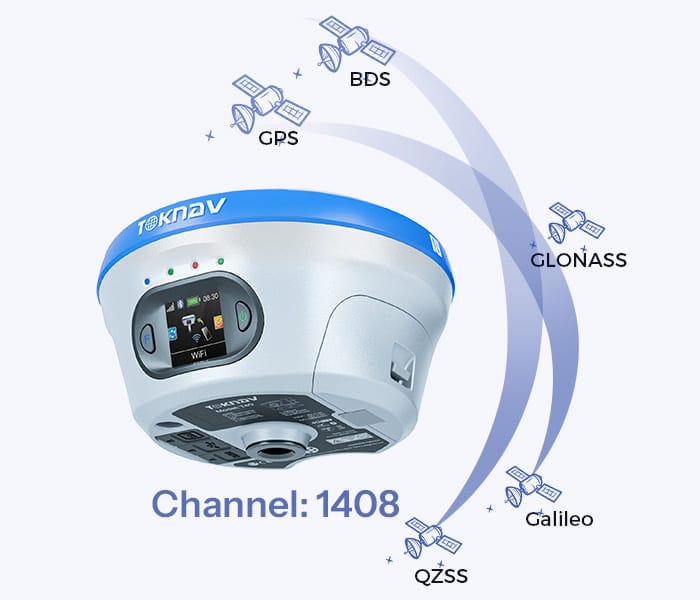
Home Toknav High Precision GNSS Receiver: Key Features of Professional RTK GNSS Receiver 2026-03-26 Toknav High Precision GNSS Receiver As your Toknav overseas distributor technical consultant, I work with surveyors, construction teams, precision agriculture operators, robotics engineers, and OEM manufacturers every day. One of the most common questions I answer is: What truly defines a reliable, high precision positioning solution? After years of field testing, real project deployment, and supporting customers across challenging environments—from dense urban canyons to remote farmlands and harsh construction sites—I can confirm: a professional high precision GNSS receiver delivers verified accuracy, stable signal tracking, rugged durability, and easy integration. In this guide, I will share the essential key features of a high-performance  high precision GNSS receiver, using 100% real datasheet specifications from Toknav’s flagship models: T10Pro, T20Pro, T30Pro, T40Pro, and tBase. These are the same performance details I use to advise my customers to choose the right positioning solution. Toknav High Precision GNSS Receiver:Full Constellation & Multi-Frequency Tracking (1408 Channels) Full Constellation & Multi-Frequency Tracking (1408 Channels) From my experience, the biggest reason standard GNSS receivers fail in challenging environments is limited satellite and frequency support. A true high precision GNSS receiver must track all global systems and multiple bands to minimize errors and maintain availability. All Toknav receivers come with a 1408-channel high-speed measurement engine, supporting GPS, BDS, GLONASS, Galileo, QZSS, SBAS, and NavIC. Multi frequency technology effectively cancels ionospheric delay, so your Toknav high precision GNSS receiver holds a fix even under trees, near tall buildings, or in open fields with low sky visibility. Verified Centimeter-Level RTK & Static AccuracyAccuracy is non negotiable—and it must be measurable, repeatable, and backed by real datasheet values. As your technical consultant, I only recommend products with published, reliable performance.Here are the official accuracy figures from Toknav’s datasheets:RTK Mode: Horizontal ±(8mm + 1ppm), Vertical ±(15mm + 1ppm)Static Survey: Horizontal ±(2.5mm + 1ppm), Vertical ±(5mm + 1ppm)These numbers apply to all  precision GNSS receiver models, ensuring surveying and machine control tasks meet strict professional standards. Surveyors from Tanzania are using a Toknav High Precision GNSS Receiver. IMU Tilt Compensation & AR Surveying (Field-Proven Efficiency)In real field work, holding the pole perfectly vertical all day is tiring and slow. That’s why I always recommend IMU integrated Toknav high precision GNSS receiver units to my customers.Toknav’s professional models support 60° tilt measurement with correction error <2cm and AR real scene stakeout (T30Pro / T40Pro). GNSS INS fusion ensures continuous positioning during short term signal blockages. From customer feedback, this feature greatly improves efficiency for users of Toknav  GNSS receiver. A surveyor using Toknav T30Pro with tilt measurement and AR stakeout screen. 4. Industrial Rugged Design & IP68 ProtectionField equipment must survive drops, rain, dust, and extreme temperatures. I have seen many receivers fail because they were not built for real working conditions. The Toknav high precision GNSS receiver is engineered for durability: IP68 waterproof and dustproof, magnesium alloy body, 1.5m drop resistance, and operating temperature from -30°C to +65°C. Whether used in mining, agriculture, or marine environments, the Toknav high precision GNSS receiver maintains stable performance in harsh conditions. Multi-Link Communication & Long-Range UHF Radio RTK positioning depends entirely on stable correction data. As a technical consultant, I always emphasize: communication = reliability. The Toknav GNSS receiver supports fully redundant links: 4G full network, Bluetooth 5.0, WiFi, and integrated UHF radio with open area range up to 16km (T20Pro). It also supports NTRIP, RTCM3.x, and mainstream industry protocols, keeping your Toknav high precision GNSS receiver connected anywhere on site. High Update Rate & Powerful Linux Platform For industrial control, machine control, and dynamic surveying, you need fast, smooth positioning output. The Toknav high precision GNSS receiver runs on ARM Cortex A7 1.8GHz processor with Linux OS, supports 20Hz high update rate, and provides 32GB storage for data logging. This stable platform makes the Toknav high precision GNSS receiver ideal for industrial automation and professional measurement applications. All-Day Battery Life & Hot-Swappable Design Nothing stops a job faster than a dead battery. Based on real field usage, I always confirm endurance before recommending a model. The Toknav high precision GNSS receiver offers outstanding battery performance: T10Pro 6500mAh (>18 hours), T30Pro 13800mAh (up to 48 hours), and T40Pro hot swappable battery for nonstop work. Users of Toknav GNSS receiver can work a full day without mid shift charging. RTK OEM GNSS Receiver Flexibility (For Manufacturers) Many of my partners are OEMs and integrators building industrial machines, agricultural equipment, and professional terminals. For them, the RTK OEM version of Toknav high precision GNSS receiver is the core component. It features compact module form factor, standard interfaces, raw data output, and full factory support. I help customers integrate the GNSS receiver quickly and reduce development time. My Final Recommendation (As Toknav Technical Consultant) If you are looking for a reliable positioning solution, Toknav high precision GNSS receiver stands out with verified accuracy, rugged design, strong communication, and field-proven efficiency. From my years of experience supporting global clients: Whether you need a portable rover, a reliable base station, or an embedded RTK OEM version, Toknav high precision GNSS receiver provides the stability and precision professional users demand. Ready to upgrade your positioning system?Visit: Explore Toknav Full GNSS Receiver Lineup → (https://www.toknav.com/gnss-receivers) Contact your local Toknav distributor for professional technical support and project solutions. 2026-03-26 Toknav High Precision GNSS Receiver

جهاز استقبال GNSS عالي الدقة من Toknav: 7 ميزات رئيسية لجهاز استقبال RTK GNSS الرائع قراءة المزيد »

جهاز الاستقبال T50 GNSS

جهاز استقبال GNSS صغير الحجم ولوحة تصنيع المعدات الأصلية: تصميم مصغر عالي الدقة

الصفحة الرئيسية: جهاز استقبال GNSS صغير الحجم ولوحة OEM: تصميم مصغر عالي الدقة 16 مارس 2026 جهاز استقبال GNSS صغير الحجم ولوحة OEM في قطاع تحديد المواقع بدقة، يشهد الطلب على حلول أجهزة استقبال GNSS صغيرة الحجم ولوحات OEM عالية الأداء نمواً متسارعاً. تعيد TOKNAV تعريف تحديد المواقع المدمج من خلال أحجام صغيرة للغاية، وأداء RTK من الدرجة الصناعية، ودعم كامل لمجموعات الأقمار الصناعية المتعددة، وإمكانيات اتصال متنوعة. توفر لوحات GNSS عالية الدقة وأجهزة الاستقبال المدمجة الخاصة بنا دقة من الدرجة الاحترافية، مما يمكّن المصنعين والمستخدمين النهائيين من التمتع بتميز في تحديد المواقع مع توفير المساحة. حجم صغير، أداء كبير لقد ولت أيام أجهزة GNSS الضخمة عالية الدقة. يجمع النظام البيئي المدمج من TOKNAV بين التصميم المصغر والأداء الذي لا يقبل المساومة، مما يتيح دمج تحديد المواقع على مستوى المؤسسات في الأدوات المحمولة والأنظمة غير المأهولة والأجهزة المدمجة. يوفر الجهاز الرائد T50 (Φ134 مم × 86 مم، ≤0.78 كجم) دقة RTK بمستوى السنتيمتر، وتتبعًا كاملًا للأقمار الصناعية، وميزات ذكية. بالنسبة لمصنعي المعدات الأصلية (OEM)، تزيل لوحة GNSS الخاصة بنا القيود المتعلقة بالحجم، مما يتيح التكامل الدقيق في التصميمات التي تتطلب دقة بالمليمتر. حالات استخدام مستقبل GNSS المدمج: التطبيقات العملية: تعمل حلول TOKNAV المدمجة على تعزيز الكفاءة في المشاريع الحقيقية عالية المخاطر عبر مختلف القطاعات: الهندسة الحضرية: استخدم فريق بلدية شنغهاي جهاز T50 لمسح الطرق والجسور، مما أدى إلى تقليل وقت العمل الميداني بنسبة 40% في المساحات الحضرية الضيقة بفضل متانة IP68 وأداء مقاومة حجب الإشارة. المراقبة الجيولوجية: قام مشروع الانهيارات الأرضية في سيتشوان بدمج لوحة TOKNAV RTK OEM في محطات طرفية صغيرة، مما أدى إلى تقليص الحجم بنسبة 60% وإطالة عمر البطارية إلى أكثر من 30 يومًا من أجل المراقبة الجبلية غير المراقبة. الزراعة الذكية: قامت شركة تصنيع الطائرات بدون طيار الزراعية في شينجيانغ بدمج لوحة GNSS عالية الدقة الخاصة بنا، مما أدى إلى زيادة غلة المحاصيل بنسبة 15% بفضل الملاحة بدقة تصل إلى مستوى السنتيمتر من أجل البذر/الرش الدقيق. فحص المرافق: قامت إحدى شركات تصنيع شبكات الكهرباء بتحديث أدواتها المحمولة باستخدام وحداتنا المدمجة، مما أدى إلى تسريع عملية فحص الأبراج الجبلية بفضل تعويض الميل واستقبال الإشارات عن بُعد بشكل موثوق. خطوة إلى الأمام في مهمة TOKNAV: المزايا التقنية للوحة GNSS المخصصة لمصنعي المعدات الأصلية (OEM) صُممت لوحة RTK المخصصة لمصنعي المعدات الأصلية (OEM) من TOKNAV ولوحات GNSS عالية الدقة للتكامل السلس، حيث تعمل على منصة Linux+ARM Cortex-A7 لضمان كفاءة الحوسبة ووظائف قابلة للتوسع. تدعم الوحدة ذات 1408 قناة إشارات جميع الأنظمة الفضائية (BDS/GPS/GLONASS/Galileo/QZSS/SBAS/NavIC)، مما يضمن تحديد المواقع دون انقطاع في الأودية الحضرية والغابات والمناطق النائية. تتناسب المتانة من الدرجة الصناعية IP68، والتشغيل في درجات حرارة تتراوح بين -30 درجة مئوية و+65 درجة مئوية، والاتصال متعدد الاستخدامات (4G/Bluetooth/WIFI/الراديو) مع البيئات القاسية، بينما تعمل ميزات تعويض الميل المدمجة مسبقًا، ووضع العلامات باستخدام الواقع المعزز (AR)، والقياس بالليزر على خفض تكاليف التطوير للمصنعين. خطوة إلى الأمام في مهمة TOKNAV: مواصفات لوحة GNSS عالية الدقة. الدقة هي أساس لوحاتنا المخصصة لمصنعي المعدات الأصلية (OEM)، مع مواصفات رائدة في الصناعة: دقة RTK (أفقيًا: ±(8 مم + 1 جزء في المليون)، رأسيًا: ±(15 مم + 1 جزء في المليون))؛ دقة الوضع الثابت (أفقيًا: ±(2.5 مم + 1 جزء في المليون)، عموديًا: ±(5 مم + 1 جزء في المليون))؛ إعادة اكتساب الإشارة في أقل من 1 ثانية، وتهيئة RTK في أقل من 10 ثوانٍ، وتردد تحديد المواقع 20 هرتز. توفر أجهزة ARM Cortex-A7/Linux، وسعة تخزين 8 جيجابايت، وبطارية 7.4 فولت سعة 6500 مللي أمبير في الساعة (تعمل لأكثر من 16 ساعة)، أداءً مستقرًا، مع غلاف من سبائك المغنيسيوم، ومقاومة السقوط من ارتفاع 1.5 متر، وحماية IP68 لضمان الموثوقية في البيئات القاسية. دليل التكامل لمصنعي الأجهزة تعمل TOKNAV على تبسيط تكامل لوحات GNSS عالية الدقة وأجهزة الاستقبال المدمجة للمصنعين، من خلال بروتوكولات موحدة (NMEA-0183/RTCM3.X) وواجهات عالمية تقضي على حواجز التوافق. العملية: اختيار الوحدات المخصصة → الاستفادة من الوثائق الفنية لتكوين الأجهزة/المعلمات → تنشيط الميزات الأساسية. تدعم منصة Linux الخاصة بنا التخصيص، مع دعم فني مخصص لإعداد البرامج الثابتة وتصحيح الأخطاء والتحسين. يمكنك الوصول إلى الموارد الكاملة على صفحة OEM / الوحدات النمطية الخاصة بنا. مجموعة وحدات TOKNAV تغطي مجموعتنا جميع احتياجات تحديد المواقع عالية الدقة: جهاز الاستقبال المحمول T50 للمسح الميداني، ومجموعة متنوعة من خيارات لوحات GNSS OEM ولوحات RTK OEM بأشكال ومستويات متنوعة. يتميز كل منتج بمعايير التصغير والدقة الاحترافية والمتانة القوية والاتصال السلس، مع نظام سياج إلكتروني لضمان الامتثال للمعايير الإقليمية ودعم كامل من الشركة المصنعة للتحديثات والصيانة. الخلاصة والدعوة إلى العمل يجمع جهاز الاستقبال GNSS الصغير الحجم ولوحة GNSS OEM من TOKNAV بين التصميم المصغر والهندسة عالية الأداء، مما يكسر الأسطورة القائلة بأن الحجم الصغير يعني دقة منخفضة. نحن نقدم دقة RTK بمستوى السنتيمتر، وموثوقية متعددة الأقمار الصناعية، ومتانة صناعية للتصميمات ذات المساحة المحدودة. سواء كنت متخصصًا ميدانيًا أو مبتكرًا في مجال تصنيع المعدات الأصلية (OEM)، فإن TOKNAV لديها حلول تحديد المواقع المصممة خصيصًا لك. هل أنت مستعد لتعزيز قدراتك في تحديد المواقع؟ تفضل بزيارة صفحة منتجاتنا لتصفح مجموعتنا، وتنزيل المواصفات، والتواصل مع فريقنا من أجل التكامل المخصص — عزز ابتكاراتك بفضل تميز TOKNAV في مجال GNSS المدمج عالي الدقة.

جهاز استقبال GNSS صغير الحجم ولوحة تصنيع المعدات الأصلية: تصميم مصغر عالي الدقة قراءة المزيد »

معدات المسح الهيدروغرافي TOKNAV في التشغيل الميداني لرسم الخرائط المائية الدقيقة 

معدات المسح الهيدروغرافي TOKNAV :7 طرق لرفع مستوى نجاحك في رسم الخرائط

الصفحة الرئيسية لمعدات المسح الهيدروغرافي من TOKNAV: حلول احترافية لرسم الخرائط تحت الماء بدقة 16 مارس 2026 مقدمة: القيمة الأساسية للمسح الهيدروغرافي والمعدات: يُعد المسح الهيدروغرافي تخصصًا جغرافيًا مكانيًا حيويًا يركز على رسم خرائط للمعالم تحت الماء — بما في ذلك أعماق المياه، وتضاريس قاع البحر، والعوائق المغمورة، وخطوط الساحل، والبيانات البيئية المائية. وهي بمثابة الركيزة الأساسية للملاحة البحرية الآمنة، وبناء البنية التحتية الساحلية، والهندسة البحرية، والرصد البيئي، وأعمال التجريف، واستكشاف الموارد البحرية. وبدون بيانات هيدروغرافية دقيقة، تواجه العمليات البحرية مخاطر جسيمة مثل جنوح السفن، والأضرار الهيكلية، وانعدام الكفاءة، مما يجعل معدات المسح الهيدروغرافي الموثوقة أمرًا لا غنى عنه للمشاريع الحديثة المتعلقة بالممرات المائية والمشاريع البحرية.وعلى عكس المسح البري، يتم إجراء المسح الهيدروغرافي في بيئات مائية ديناميكية، مما يتطلب أدوات متينة وعالية الدقة ومقاومة للتعرض للماء وتداخل الأمواج والظروف المائية المتغيرة. وقد تطور المسح الهيدروغرافي الحديث من عمل يدوي كثيف العمالة إلى أنظمة آلية ذكية، حيث توفر المعدات الأساسية بيانات دقيقة لرسم الخرائط تحت الماء في الوقت الفعلي. يقدم هذا الدليل تفصيلاً لمعدات المسح الهيدروغرافي الرئيسية، ويوضح تفاصيل حلول TOKNAV المدمجة مع المركبات غير المأهولة (USV) من طراز Tboat10/Tboat20، ويحدد قواعد الامتثال الأوروبية، ويستعرض سير العمل الكامل للمشروع، وكل ذلك يركز على معدات ذات مستوى احترافي وجاهزة للاستخدام الميداني. معدات المسح الهيدروغرافي من TOKNAV قيد التشغيل الميداني لرسم خرائط مائية دقيقة المعدات الأساسية للمسح الهيدروغرافي وتطبيقات TOKNAV 1. المركبات السطحية غير المأهولة (USV) للمسح البحري: تُعد المركبات السطحية غير المأهولة (USV) من سلسلة Tboat10 وTboat20 من TOKNAV نقطة تحول في مجال المسح الهيدروغرافي، حيث تقضي على مخاطر السفن المأهولة وتعزز الكفاءة والمرونة والسلامة. تُعدّ مركبتا Tboat10 وTboat20 من TOKNAV حاملات مسح مصممة خصيصًا لهذا الغرض، حيث تبحران في المياه الضحلة والقنوات الضيقة والسواحل الخطرة والمناطق النائية التي يتعذر الوصول إليها بالقوارب المأهولة، مع هياكل متينة مصممة خصيصًا لأعمال المسح الاحترافية. تتميز Tboat10 بهيكل M خفيف الوزن مصنوع من ألياف الكربون (وزن الهيكل 7 كجم، الوزن الإجمالي 30 كجم) مع حمولة تبلغ 35 كجم، وحماية ضد الاصطدام، وبطاريتين مزدوجتين قابلتين للتبديل السريع، مما يوفر قدرة على العمل لمدة 7 ساعات عند السرعة المنخفضة، وسرعة قصوى تبلغ 7 م/ث، واستقرارًا في التيارات العرضية التي تبلغ سرعتها 4 م/ث — وهو ما يجعلها مثالية للمسوحات الصغيرة في المياه الضحلة. يستخدم Tboat20 هيكلًا على شكل حرف V متينًا مصنوعًا من ألياف الكربون والبوليستر/الكيفلار (مقاوم للماء بمعيار IP67، إجمالي الوزن 40 كجم) مع حمولة تبلغ 50 كجم، ومحركين مزدوجين بقدرة 1100 واط، واستمرارية تشغيل مماثلة تبلغ 7 ساعات، وهو مصمم للمشاريع الكبيرة في المياه الساحلية أو البحرية مع مقاومة أقوى للأمواج.يدعم كلا الطرازين التتبع عبر الأقمار الصناعية متعددة الأنظمة (BDS، GPS، GLONASS، Galileo)، ونظام تجنب العوائق بالرادار، والرجوع التلقائي في المياه الضحلة، وبرنامج التحكم tSail لتخطيط المسار. وهما يقللان من تكاليف الوقود والعمالة، مما يتيح القيام بمهام طويلة دون انقطاع لجمع بيانات متسقة للمسوحات في الموانئ والأنهار والمناطق البحرية، مما يجعلهما من الأصول الأساسية للمسوحات الهيدروغرافية. 2. جهاز قياس العمق بالصدى: قياس العمق عالي الدقة جهاز قياس العمق بالصدى هو الأداة الأساسية لاستشعار العمق في معدات المسح الهيدروغرافي، حيث يستخدم الموجات الصوتية لحساب عمق المياه عبر انعكاس قاع البحر. وعند استخدامه مع المركبات غير المأهولة (USV) من TOKNAV، فإنه يوفر دقة رائدة في الصناعة: تردد 200 كيلوهرتز، زاوية الحزمة 8° (Tboat10)/5°±1° (Tboat20)، نطاق الكشف 0.15-200 متر، دقة قياس العمق 8 مم، ودقة ±1 سم + 0.11 TP3TD. وهي تعمل على تصفية الضوضاء البيئية، وتتزامن مع إحداثيات GNSS، وتعمل بطاقة تتراوح بين 9 و28 فولت (استهلاك 5-10 واط)، وتعمل بشكل موثوق في المياه العكرة، وهي مكون أساسي لا غنى عنه في المجموعة. 3. مستقبل GNSS RTK: نواة تحديد المواقع بدقة السنتيمتر الصورة الداعمة 2: رسم تخطيطي لمستقبل TOKNAV GNSS RTK، يبرز الهوائيات المزدوجة، واستقبال الأقمار الصناعية، ووصلات التفاضل مع المحطة الأساسية؛ تعليق على الصورة: “جهاز استقبال GNSS RTK من TOKNAV – نواة تحديد المواقع بدقة السنتيمتر لمعدات المسح الهيدروغرافي” توفر تقنية GNSS RTK تحديد المواقع بدقة السنتيمتر، وهو أمر بالغ الأهمية لرسم الخرائط الدقيقة تحت الماء. يتفوق نظام RTK المدمج من TOKNAV على أجهزة الاستقبال القياسية، حيث يصحح أخطاء الأقمار الصناعية والغلاف الجوي لتحقيق تحديد مواقع مستقر في المياه المعقدة. ويتميز بدقة RTK تبلغ ±8 مم (أفقيًا)/±15 مم (رأسيًا)، وتشغيل سريع في أقل من 30 ثانية، وتهيئة في أقل من 5 ثوانٍ، وهوائيات مزدوجة لاستقبال إشارة ثابتة في المناطق التي تحجب فيها الرؤية عن السماء. كما يربط بيانات العمق بالإحداثيات الدقيقة، مما يدعم رسم الخرائط الهيدروغرافية عالية الدقة المتوافقة مع المعايير. جهاز استقبال TOKNAV GNSS RTK – نواة تحديد المواقع بدقة تصل إلى السنتيمتر لمعدات المسح الهيدروغرافي قم بتكوين مجموعة أدوات مسح هيدروغرافي احترافية قم بتكوين مجموعة مخصصة من خلال مطابقة المعدات مع حجم المشروع والبيئة: اختر Tboat10 للمسوحات الداخلية الصغيرة، وTboat20 للمشاريع البحرية الكبيرة. ادمج أجهزة قياس العمق المعايرة من المصنع وأجهزة استقبال RTK لتحقيق توافق سلس، وأضف وحدات اتصال 4G/2.4G، وبطاريات بعيدة المدى ذات عمر طويل، وعلب حماية بمعيار IP67 للظروف القاسية. يُسهّل تصميم TOKNAV الذي يعمل بمجرد التوصيل عملية النشر، ويقوم البرنامج المخصص بتحويل البيانات الأولية إلى خرائط قابلة للتطبيق ونماذج ثلاثية الأبعاد، مما يزيل فجوات التوافق ويعزز الكفاءة. دليل تجميع مجموعة معدات المسح الهيدروغرافي الكاملة من TOKNAV حلول المسح الهيدروغرافي المتكاملة من TOKNAV حل معدات المسح الهيدروغرافي المتكامل من TOKNAV لمشاريع رسم خرائط المياه العملية توفر TOKNAV حلول مسح هيدروغرافي متكاملة تمامًا وجاهزة للتشغيل فور التوصيل، حيث تدمج المركبات غير المأهولة (USVs) وأجهزة قياس العمق وأجهزة استقبال RTK في سير عمل موحد. تقلل هذه الأنظمة، التي تمت معايرتها وتهيئتها مسبقًا، من وقت النشر وتكاليف التدريب، بفضل ميزات ذكية مثل التحكم بلمسة واحدة والبطاريات القابلة للتبديل السريع لضمان التشغيل دون انقطاع. تتوافق معدات TOKNAV مع المعايير العالمية وتدعمها خدمات الدعم الاحترافية، مما يساعد الفرق على تقديم بيانات عالية الجودة ومتوافقة مع المعايير بكفاءة، مما يجعلها خيارًا موثوقًا به لمتخصصي المسح في جميع أنحاء العالم. الامتثال للمعايير الأوروبية تلتزم المشاريع الهيدروغرافية الأوروبية بمعايير قياس الأعماق الصارمة IHO S-44، وقواعد السلامة البحرية للاتحاد الأوروبي، والتوجيهات البيئية، التي تتطلب تحديد المواقع بدقة تصل إلى السنتيمتر، وقياسًا عالي الدقة، وتصميمًا ذو تأثير منخفض على البيئة. تفي معدات المسح الهيدروغرافي من TOKNAV بهذه المعايير بل وتتجاوزها: تتمتع أجهزة الاستقبال RTK بدقة معتمدة، وتخضع أجهزة قياس العمق الصوتي لمعايرة صارمة، وتتميز المركبات غير المأهولة (USVs) من طراز Tboat بمقاومة الماء وفقًا لمعيار IP67، وانخفاض مستوى الضوضاء، واستخدام مواد صديقة للبيئة. يضمن الامتثال الكامل الموافقة السلسة على المشروع ويتجنب إعادة العمل المكلفة في عمليات المسح الأوروبية. سير عمل المسح الهيدروغرافي الكامل 1. التخطيط المسبق للمسح: تحديد نطاق المشروع ومنطقة المسح ومتطلبات الدقة؛ واختيار معدات المسح الهيدروغرافي من TOKNAV (Tboat10 للمشاريع الصغيرة، وTboat20 للمشاريع واسعة النطاق)؛ ومعايرة نظام GNSS RTK وجهاز قياس العمق بالصدى؛ وبرمجة مسارات المركبة البحرية غير المأهولة (USV) عبر برنامج tSail. 2. النشر الميداني وجمع البيانات: إطلاق المركبة البحرية غير المأهولة (USV) من TOKNAV، وتفعيل الوضع الذاتي؛ وجمع بيانات العمق في الوقت الفعلي عبر جهاز قياس العمق بالصدى ونظام تحديد المواقع RTK؛ ومراقبة العمليات عبر كاميرا الرؤية الليلية بزاوية 360 درجة وجهاز التحكم عن بُعد (شاشة قابلة للقراءة تحت ضوء الشمس بدقة 1200 نيت). 3. معالجة البيانات والتحقق من صحتها: نقل البيانات الأولية إلى برنامج TOKNAV؛ تصفية التشويش، وتصحيح مستويات المد والجزر، ودمج مجموعات البيانات؛ التحقق من مطابقتها لمعايير IHO S-44 ومعايير الاتحاد الأوروبي لضمان توافق بيانات معدات المسح الهيدروغرافي. 4. التقارير والنتائج: إنشاء خرائط هيدروغرافية عالية الدقة، ونماذج ثلاثية الأبعاد لقاع البحر، وخرائط خطوط العمق؛ وتجميع تقارير الامتثال ووثائق المشروع لتقديمها للعميل. سير عمل مشروع المسح الهيدروغرافي من TOKNAV باستخدام معدات المسح الهيدروغرافي الاحترافية الخلاصة تُعد معدات المسح الهيدروغرافي عالية الأداء العمود الفقري لرسم الخرائط الدقيقة تحت الماء، وتضع حلول TOKNAV المتكاملة التي تضم المركبة غير المأهولة (USV) وجهاز قياس العمق بالصدى وحلول RTK معيارًا صناعيًا. بفضل المواصفات الموثوقة، والتصميم المتين، والتوافق مع معايير الاتحاد الأوروبي، تعزز هذه المعدات السلامة، وتخفض التكاليف، وتضمن جمع البيانات بشكل متسق لجميع المشاريع المائية. قم بترقية مجموعة أدوات المسح الخاصة بك باستخدام حلول TOKNAV التي أثبتت كفاءتها ميدانيًا — تفضل بزيارة صفحة الحلول الخاصة بنا لاستكشاف سلسلة Tboat، أو طلب عرض أسعار، أو الاستشارة

معدات المسح الهيدروغرافي TOKNAV :7 طرق لرفع مستوى نجاحك في رسم الخرائط قراءة المزيد »

زورق مسح قوي غير مأهول: 70% مسح هيدروغرافي أسرع مع زورق المسح الهيدروغرافي الأمريكي

Home Unmanned Survey Boat: Efficient Hydrographic Survey with USV 2026-03-14 Unmanned Survey Boat: Efficient Hydrographic Survey with USV Hydrographic surveying is the core foundation of marine engineering, water conservancy construction, port operation and environmental monitoring, but traditional manual survey methods have long restricted industry efficiency. Manual small vessel surveying exposes staff to extreme weather, rough water and shallow reef risks, with a 30% higher safety hazard rate in complex waters; manual operation efficiency is only 1/4 of unmanned equipment, and labor, vessel maintenance and depreciation costs account for over 60% of the total project budget. Meanwhile, large manual vessels cannot access waters shallower than 0.5m, leaving 20%-35% of key survey areas uncovered. Nowadays, unmanned survey boats have become the optimal replacement for manual methods, and TOKNAV’s hydrographic survey USV relies on high-precision performance and intelligent design, becoming the first choice for efficient marine and inland water survey projects. Core Advantages of Unmanned Survey Boats Compared with manual hydrographic survey, marine USV for survey has four irreplaceable core advantages, solving industry pain points with data-backed efficiency and safety: 1. Zero On-Site Risk, 100% Personnel Safety Unmanned survey boats realize full remote control, keeping surveyors ashore to avoid drowning, capsizing and collision risks. Even in level 5 wind offshore waters or narrow inland tributaries, the USV can complete tasks independently, reducing safety accidents to zero and cutting equipment loss caused by misoperation by 90%. 2. 70% Higher Efficiency, Shortened Project Cycle TOKNAV unmanned survey boats support 6-7 hours of continuous operation at 1.5m/s economical speed, with a maximum speed of 7m/s. Equipped with intelligent route planning, it covers 15km² water areas in 8 hours, completing manual 5-day tasks in 1.5 days, improving overall survey efficiency by over 70% and compressing project cycles effectively. 3. 40% Cost Reduction, Optimized Budget Traditional manual survey needs professional vessels and full-time crews, with annual maintenance costs exceeding $8000. TOKNAV USV features low power consumption and minimal maintenance, eliminating labor costs and reducing vessel depreciation, cutting total survey costs by over 40% for long-term projects without sacrificing data accuracy. 4. Ultra-Shallow Draft, Full-Coverage Survey Manual vessels fail to navigate waters shallower than 0.5m, while TOKNAV Tboat10 has an 8.5cm ultra-shallow draft, Tboat20 a 10cm draft, smoothly accessing shallow lakes, tidal flats and port shallow areas. It realizes 100% full-coverage survey, eliminating blind spots in restricted water environments. High-Precision Positioning: USV + GNSS RTK Working Principle High-precision hydrographic survey relies on centimeter-level positioning, and TOKNAV unmanned survey boat integrates advanced GNSS RTK technology to lock data accuracy. The USV is equipped with dual multi-frequency GNSS antennas, supporting BDS, GPS, GLONASS and GALILEO full-system tracking, with RTK horizontal accuracy of ±8mm +1ppm and vertical accuracy of ±15mm +1ppm. Paired with 0.01m resolution echo sounders, the USV synchronizes positioning and underwater topographic data in real time, collecting 120 sets of data per second. Even in signal-shielded bridge areas, the built-in inertial navigation maintains stable operation, ensuring continuous and reliable data output for high-precision survey reports. TOKNAV Unmanned Survey Boat: Core Technical Features TOKNAV Tboat10 and Tboat20 series hydrographic survey USV are tailored for survey scenarios, with hard-core data to support efficient work: Tboat10 adopts carbon fiber hull with 35kg payload, Tboat20 uses composite hull with 50kg payload and IP67 waterproof rating; dual lithium batteries support hot-swap, 3 hours at 2m/s and 7 hours at 1.5m/s endurance; 0.1-20m radar obstacle avoidance, tSail software supports one-key route planning and homing, realizing easy intelligent operation. Image Caption: TOKNAV USV Core Parameter & Hull Structure Detail Display – Present the close-up of the USV reinforced hull, anti-collision strips and battery compartment, and list key technical parameters in a visual form for quick reading. Wide Applications of TOKNAV Marine USV for Survey TOKNAV unmanned survey boats adapt to diversified survey scenarios, covering core industry demands with practical performance: Dredging Survey: Monitor water depth changes before and after dredging, control error within ±0.02m, ensure construction compliance; Lake & Reservoir Survey: Conduct topographic and sedimentation survey for 10km²+ water areas, support long-term ecological monitoring; Port & Waterway Monitoring: Daily channel patrol, obstacle detection, guarantee 24/7 navigation safety; Underwater Terrain Mapping: Cooperate with sonar equipment to draw high-precision underwater topographic maps for engineering construction. Practical Case: Inland River Hydrographic Survey A water conservancy bureau needed to survey a 15km² inland river with 0.1-0.3m shallow sections. Manual vessels couldn’t access shallow areas, and the 5-day planned cycle was tight. After deploying TOKNAV Tboat10, the 8.5cm draft navigated all waters smoothly; the USV operated continuously for 6 hours, collecting 50000+ valid data sets with centimeter-level accuracy. The project was completed in 1.5 days, with 100% coverage and zero safety risks, providing reliable data for river management. Conclusion & Call to Action Unmanned survey boats have revolutionized hydrographic surveying, replacing manual methods with safety, efficiency and cost advantages. TOKNAV unmanned survey boat series integrates high-precision positioning, intelligent control and strong adaptability, meeting all-round demands of marine and inland water survey. For dredging, lake survey, port monitoring and other projects, TOKNAV USV delivers efficient and accurate survey services. Explore more models: Check Out TOKNAV USV Series TBoat10 Unmanned Surface Vehicle.PDF TBoat20 Unmanned Surface Vehicle.PDF Contact TOKNAV now to upgrade your survey workflow, and enjoy smarter, more precise hydrographic survey solutions! Send an Inquiry

زورق مسح قوي غير مأهول: 70% مسح هيدروغرافي أسرع مع زورق المسح الهيدروغرافي الأمريكي قراءة المزيد »

TOKNAV هي علامة تجارية راقية للأنظمة العالمية لسواتل الملاحة مملوكة لشركة قوانغتشو توكسيرفي لتكنولوجيا المعلومات المحدودة.
جميع الحقوق محفوظة © 2025 شركة قوانغتشو توك سورفي لتكنولوجيا المعلومات المحدودة سياسة الخصوصية

كن من موزعي TOKNAV العالميين!

نحن نبحث الآن عن موزعين متحمسين للانضمام إلى قصة نجاحنا العالمية بفضل سجلنا الحافل في مجال المسح.