GNSS Industry Watch

Latest surveying, positioning and geospatial updates

Daily refreshed headlines from trusted industry publishers, with direct links to the original source.

TOKNAV YouTube

Newest videos from TOKNAV

Automatically follows the latest uploads from the TOKNAV YouTube channel.

Certifications and Compliance

TOKNAV certification, compliance and quality-management news for GNSS receivers and positioning products.

TOKNAV 架站卡片

الماسح الضوئي الليزري الأرضي TSL150: دقة 2 مم، 3.3 كجم، دقة نقل 3.3 كجم، عدم تأخير المكتب

Home TSL150 Terrestrial Laser Scanner: 2mm Precision, 3.3kg Portability, Zero Office Delay 2026-04-05 TOKNAV Launches TSL150 Terrestrial Laser Scanner Globally Guangzhou, China – March 12, 2026 – TOKNAV today announced the global launch of a groundbreaking terrestrial laser scanner that redefines industry standards by merging survey-grade accuracy with unprecedented portability. This innovative device delivers 2mm precision at 50 meters in an ultra-compact design weighing just 3.3kg, shattering the long-standing trade-off between performance and mobility that has constrained surveyors for years. Engineered for field efficiency and real-time data validation, this scanner eliminates the need for heavy, cumbersome equipment while maintaining professional-grade results, setting a new benchmark for mobile, high-precision 3D reality capture across surveying, mapping, and construction sectors. Why Surveyors Choose This Game-Changing Scanner Crafted to address the daily challenges faced by surveyors, mappers, and BIM data collectors, this scanner combines ultra-high accuracy, lightweight portability, and streamlined on-site workflows. Its design directly targets pain points like time-consuming rework, costly office delays, and inefficient field operations, enabling teams to accelerate project delivery without compromising on quality. For professionals who often work in remote or hard-to-reach locations, its portability and reliability have quickly made it a top choice for modern surveying projects. True Field Autonomy & Single-Person Efficiency A key highlight of this scanner is its true field autonomy, powered by integrated real-time point cloud registration and automatic multi-station leveling with dual-axis tilt compensation. This feature allows survey teams to validate data quality on-site before leaving the job, eliminating the risk of costly rework and ensuring that every scan meets project requirements the first time. Weighing only 3.3kg and equipped with dual hot-swappable batteries, the device supports fast deployment and all-day operation—whether used upright at ground level for large-scale site scans or inverted for detailed ceiling measurements in indoor projects. Notably, the entire workflow, from setup to data capture, can be completed by a single operator, drastically reducing labor costs and improving overall field efficiency. Survey-Grade Accuracy & Immediate Photorealistic Deliverables When it comes to performance, the scanner delivers uncompromising survey-grade results: 2mm accuracy (1σ) at 50m, 3mm (1σ) at 100m, and a maximum scanning range of 150m. Its impressive scan speed of 100 lines per second and 1.2MHz pulse rate ensures that dense, detailed point clouds are captured quickly without sacrificing precision—critical for large-scale projects where time is of the essence. Paired with 100MP HDR panoramic imaging and exposure bracketing, the scanner produces photorealistic colorized point clouds that are ready for instant integration into BIM and GIS platforms, eliminating time-consuming post-processing delays and streamlining the path from data capture to project delivery. All-Condition Reliability for Real-World Survey Projects Built to withstand the rigors of real-world fieldwork, the scanner features an IP54-rated sealed design that protects against dust and water splashes, enabling reliable operation in temperatures ranging from -20°C to +50°C. It supports multi-GNSS compatibility (including BDS, GPS, GLONASS, GALILEO, QZSS, NavIC, and SBAS) and a built-in MEMS IMU, ensuring stable and precise georeferencing even in challenging environments with limited satellite visibility. With 1TB of internal SSD storage and 256GB of external expansion capacity, the device handles large datasets seamlessly without interruptions. Its compact dimensions (216mm × 168mm × 105mm) allow deployment in confined spaces, such as narrow construction sites or historic buildings, and elevated positions where traditional, bulkier scanners cannot reach. TSL150 Availability & Global Support from TOKNAV Designed, manufactured, and supported at TOKNAV’s quality-controlled facility in Guangzhou, this scanner reflects the brand’s commitment to being the world’s most reliable geospatial measurement partner. It is available now through TOKNAV and its authorized global dealers, complete with a lightweight carbon fiber tripod and a full-featured field software suite that simplifies setup, data capture, and on-site validation.About TOKNAVBased in Guangzhou, TOKNAV designs, builds, and supports professional GNSS and laser scanning solutions with strict quality control. The company is committed to becoming the world’s most reliable geospatial partner, delivering consistent quality, innovative products, and exceptional service to every customer worldwide.Contact: info@toknavgnss.com | www.toknavgnss.com
الماسح الضوئي الليزري الأرضي TSL150: دقة 2 مم، 3.3 كجم، دقة نقل 3.3 كجم، عدم تأخير المكتب قراءة المزيد »

معدات المسح الهيدروغرافي TOKNAV في التشغيل الميداني لرسم الخرائط المائية الدقيقة 

مركبات سطحية غير مأهولة من سلسلة Tboat لعمليات المسح المائي الذكية

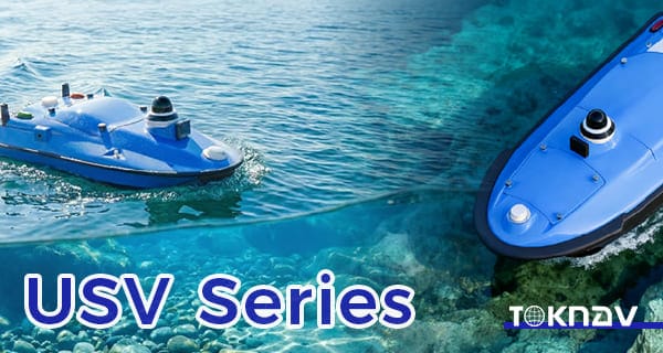
Home Tboat Series Unmanned Surface Vehicles for Intelligent Water Survey Operation 2026-03-18 TOKNAV Launches Tboat10 & Tboat20 Unmanned Surface Vehicles In the era of rapid intelligent technology development, hydrographic survey and water operation are undergoing profound transformation. Traditional methods, relying heavily on manual operation and conventional vessels, face low efficiency, high labor costs, poor safety in complex waters, and unstable data accuracy. To address these pain points, TOKNAV Information Technology Co., Ltd., a leader in intelligent marine and geospatial technology, officially launches the Tboat Series Unmanned Surface Vehicles. This new series includes two professional models: Tboat10 and Tboat20, tailored to different application scenarios. Focused on modern hydrographic survey and intelligent water operations, the Tboat Series Unmanned Surface Vehicles integrate high-precision GNSS positioning, stable autonomous navigation, and flexible sensor integration, providing efficient, reliable data collection for rivers, lakes, reservoirs, coastal areas, and other complex water bodies. The launch enriches TOKNAV’s product matrix and marks its progress in unmanned surface vehicle technology, helping users improve operational efficiency and data accuracy in water survey, environmental monitoring, and water engineering projects. The Tboat Series Unmanned Surface Vehicles are designed to break traditional survey limitations, combining advanced hardware and intelligent software for full-process autonomous operation, reducing manual intervention and enhancing safety. As global urbanization and environmental protection advance, demand for intelligent water survey grows, and the Tboat Series Unmanned Surface Vehicles will drive the industry’s digital and intelligent transformation. Tboat10: Compact USV for Efficient Survey in Complex Waters The Tboat10 is a compact, highly maneuverable model in the Tboat Series Unmanned Surface Vehicles, designed for efficient surveys in narrow rivers, small-to-medium lakes, and reservoirs. Unlike large vessels, its 1.2m length and 0.6m width let it navigate narrow channels, shallow waters, and vegetation-dense areas. This compact design also enables easy transport (fit for standard SUVs) and deployment within 15 minutes, boosting field flexibility and emergency response. To ensure stable navigation, the Tboat10 features an optimized M-type hydrodynamic hull, refined through thousands of simulations and trials to reduce resistance, enhance stability, and minimize wave-induced oscillation—critical for high-accuracy tasks like shallow-water bathymetry and narrow-river water quality monitoring. The Tboat Series Unmanned Surface Vehicles’ Tboat10 model adopts a hidden-impeller pump-jet propulsion system, avoiding entanglement with aquatic debris (a common traditional vessel issue) and reducing harm to aquatic life, making it eco-friendly. This system also offers low noise and high efficiency, with simple maintenance: regular impeller cleaning and pipeline checks, no complex disassembly. Power supply is key to the Tboat Series Unmanned Surface Vehicles’ performance. The Tboat10 uses a 900W high-torque brushless DC motor, ensuring stable navigation in shallow or fast-flowing waters. It is equipped with two 33.6V hot-swappable 20Ah lithium batteries; the hot-swappable design allows 30-second battery replacement without shutdown, ensuring continuous operation. Under normal conditions, dual batteries support 8-10 hours of work and a 20km survey range, meeting daily small-to-medium water area needs. An intelligent battery management system monitors power, temperature, and voltage in real time, preventing overcharging, over-discharging, and short-circuiting. Safety is prioritized in the Tboat Series Unmanned Surface Vehicles: the Tboat10 has a double-layer bow (high-strength plastic outer, reinforced aluminum alloy inner) to absorb collision impacts, protecting internal components. It includes a water ingress alarm (triggering alerts and automatic return-to-home), an ultrasonic/machine vision obstacle avoidance system, and multi-scenario automatic return-to-home (low battery, signal loss, manual activation). A 360° HD camera transmits real-time images to the control terminal, enhancing safety. In practice, the Tboat10 outperforms manual methods: in a suburban shallow river survey, it boosted efficiency by over 3x with higher accuracy; in reservoir water quality monitoring, it collected real-time pH, dissolved oxygen, and turbidity data for background analysis. Tboat20: Professional Multi-Purpose USV for Large-Scale Hydrographic Missions The Tboat20’s propulsion and power systems are upgraded for long-distance operations: a dual 1500W motor propulsion system provides strong power, even in rough conditions. Four 33.6V high-capacity lithium batteries (total 80Ah) support 12-15 hours of continuous work and a 50km survey range. A dedicated fast charger enables full charging in 4 hours, and a solar auxiliary charging system extends endurance, reducing external power dependence. The Tboat Series Unmanned Surface Vehicles’ Tboat20 is equipped with an advanced autonomous navigation system, using multi-sensor fusion (GNSS, inertial navigation, electronic compass) for centimeter-level positioning. It supports waypoint, track, and manual remote control navigation modes, with a remote monitoring system enabling real-time data transmission, parameter adjustment, and fault diagnosis. In practice, the Tboat20 excels in large-scale projects: in a coastal city’s 100-square-kilometer mapping project, it reduced labor costs by over 60% and survey time by over 40% compared to traditional methods, providing accurate data for coastal development. In offshore environmental monitoring, it collected long-term water quality and ecological data for policy formulation. The Tboat20, another model in the Tboat Series Unmanned Surface Vehicles, is a professional-grade USV for large-scale, long-distance, high-intensity surveys, suitable for coastal mapping, offshore environmental monitoring, and other high-payload, long-endurance tasks. Its 50kg maximum payload allows flexible integration of advanced equipment: a high-precision multibeam echo sounder for large-area bathymetry, a side-scan sonar for underwater target detection, an ADCP system for flow velocity/rate measurement, and environmental sensors for water quality, temperature, and salinity data. The Tboat Series Unmanned Surface Vehicles’ Tboat20 features a reinforced composite hull (high-strength FRP and carbon fiber), offering high strength, corrosion resistance, impact resistance, and light weight. It withstands level 6 winds and 1.5m waves, operating normally in coastal and large-lake environments, with a streamlined shape reducing resistance and improving stability. Modular Design & Flexible Applications for Intelligent Water Operations Both Tboat10 and Tboat20 in the Tboat Series Unmanned Surface Vehicles adopt a modular expansion design, based on diverse user and scenario needs, enabling flexible configuration of sensors, payloads, and functional modules for multi-purpose use and improved cost-effectiveness. The Tboat Series Unmanned Surface Vehicles’ modular design has three core aspects: sensor, payload, and functional modularization. Sensor modularization includes standard interfaces compatible with mainstream survey sensors (bathymetric, water quality, current, imaging), allowing quick installation/replacement without modifying the vessel. For example, a multibeam echo sounder for bathymetry or a water

مركبات سطحية غير مأهولة من سلسلة Tboat لعمليات المسح المائي الذكية قراءة المزيد »

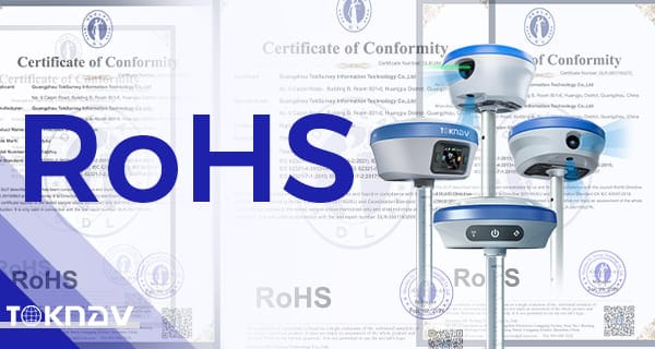
شهادة RoHS

شهادة RoHS

الصفحة الرئيسية: “TOKNAV‘ تتبنى مبادئ الاستدامة البيئية: سلسلة منتجاتها الكاملة تحصل على شهادة RoHS 27 يناير 2026 الموقع: قوانغتشو، الصين تفخر شركة TOKNAV، الرائدة في مجال الابتكار في تكنولوجيا الملاحة عالية الدقة، بالإعلان عن إنجاز هام في مسيرتها في مجال التصنيع وضمان الجودة: فقد حصلت سلسلة منتجات TOKNAV بالكامل بنجاح على شهادة RoHS (تقييد استخدام المواد الخطرة). تؤكد هذه الشهادة أن أجهزة استقبال GNSS وأنظمة تحديد المواقع البصرية والأجهزة ذات الصلة من TOKNAV تتوافق تمامًا مع توجيه الاتحاد الأوروبي 2011/65/EU وتعديلاته. كما أنها تثبت خلو منتجاتنا من المستويات الخطرة من المواد مثل الرصاص (Pb)، والزئبق (Hg)، والكادميوم (Cd)، والكروم سداسي التكافؤ (CrVI)، ومثبطات اللهب. أهمية ذلك: ما وراء الامتثال بالنسبة لشركة TOKNAV، لا يمثل معيار RoHS مجرد بند تنظيمي يجب تحقيقه؛ بل هو شهادة على ركائزنا الأساسية الثلاث: 1. الوصول غير المقيد إلى الأسواق العالمية يُعد تحقيق الامتثال لمعيار RoHS جواز سفرًا حاسمًا لدخول الاتحاد الأوروبي والأسواق الدولية الخاضعة للتنظيم الأخرى. وهو يطمئن شركاءنا وموزعينا العالميين إلى أن منتجات TOKNAV يمكن استيرادها وبيعها دون عوائق قانونية، مما يضمن سلسلة توريد سلسة. 2. سلامة المنتج وصحة المستخدم يتعامل مستخدمونا — المساحون والمهندسون والفنيون الميدانيون — مع أجهزتنا يوميًا. من خلال التخلص من المعادن الثقيلة السامة من مكوناتنا الداخلية، والأغلفة، وعمليات اللحام، نضمن أن التعامل مع معدات TOKNAV آمن لعملائنا وأكثر أمانًا لفرق التصنيع على خطوط التجميع لدينا. 3. المسؤولية البيئية (ESG) في ظل التشديد المتزايد على قطاع التكنولوجيا فيما يتعلق بالنفايات الإلكترونية، تتخذ TOKNAV موقفًا استباقيًا. من خلال الالتزام بمعايير التصنيع الصديقة للبيئة اليوم، فإننا نحد من الأثر البيئي لمنتجاتنا في نهاية دورة حياتها، مما يساهم في إيجاد نظام بيئي مستدام. فهم شهادة RoHS وأهميتها كلمة من الإدارة ’الابتكار في TOKNAV لا يقتصر على الدقة والخوارزميات فحسب؛ بل يتعلق بالمسؤولية. إن حصولنا على شهادة RoHS لخط منتجاتنا بالكامل يبرهن على التزامنا بـ”التكنولوجيا الخضراء». نريد أن يعلم عملاؤنا أنهم عندما يختارون TOKNAV، فإنهم يختارون شريكًا يهتم بالجودة والسلامة وكوكب الأرض.”  إيان تشينغ، مدير التسويق التطلع إلى المستقبل: في أعقاب حصولنا مؤخرًا على شهادة ISO 9001، يعزز الامتثال لمعايير RoHS مكانة TOKNAV كشركة تصنيع ناضجة وعالمية المستوى ومستعدة للمنافسة على الساحة العالمية. ونظل ملتزمين بتقديم حلول عالية الدقة تتميز بالمتانة والموثوقية والسلامة البيئية.   لمزيد من المعلومات حول مواصفات منتجاتنا المتوافقة مع المعايير، يرجى الاتصال بفريق الدعم لدينا.

شهادة RoHS قراءة المزيد »

TOKNAV T10Pro NGS Certification

TOKNAV T10Pro: اجتاز بنجاح شهادة الهيئة الوطنية للمسح الجيوديسي لتقديم دقة فائقة في المسح الجيوديسي

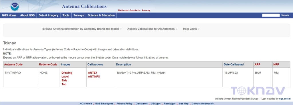
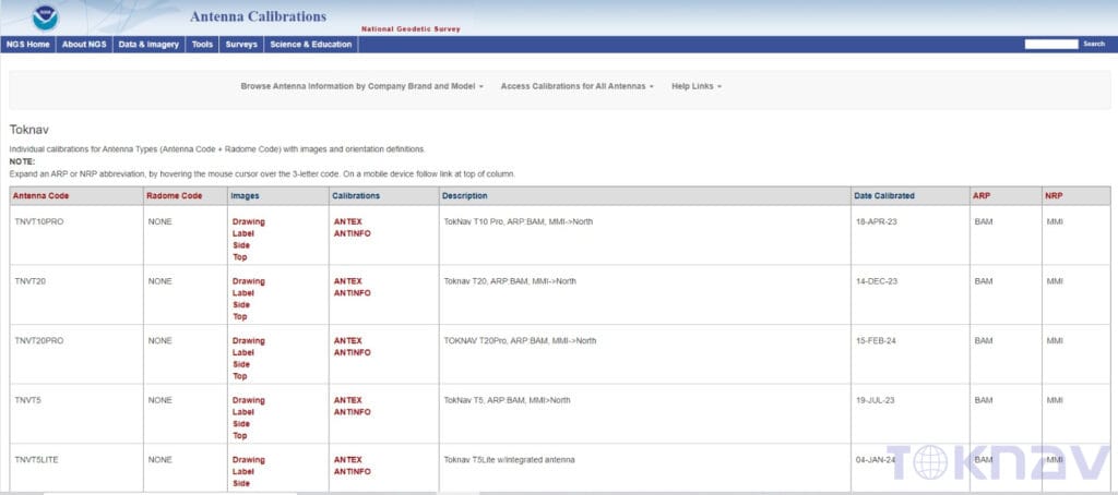
Home The NGS test results of TOKNAV T10Pro passed and published online The TOKNAV T10Pro NGS Certification demonstrates exceptional capabilities in NGS testing. Understanding the Importance of NGS Certification Achieving the TOKNAV T10Pro NGS Certification is crucial for ensuring top-tier performance in navigation technology. The NGS certification process is rigorous, requiring GNSS receivers to meet stringent standards for accuracy and reliability. This certification is vital for professionals in geodetic surveying, as it ensures that their equipment is of the highest quality. When surveyors use devices with NGS certification, they can trust the precision of their measurements. Such trust is crucial for important tasks like land surveying, construction, and infrastructure development. The successful passing of the TOKNAV T10Pro NGS Certification underscores its reliability and quality. This certification reassures users that they are equipped with a dependable tool for their surveying needs. Moreover, the TOKNAV T10Pro NGS Certification sets a standard for excellence in the industry, reflecting its importance in today’s competitive market. This certification is vital for professionals in geodetic surveying, ensuring that their tools meet high industry benchmarks. When surveyors utilize devices with NGS certification, they can trust the precision of their measurements. This trust is critical for various tasks, such as land surveying, construction, and infrastructure projects. The successful passing of the TOKNAV T10Pro NGS Certification not only affirms its quality but also gives users assurance in its reliability for surveying applications. Thus, the TOKNAV T10Pro NGS Certification highlights its significance in a competitive landscape. This certification is vital for professionals in geodetic surveying, as it ensures that their equipment is of the highest quality. When surveyors use devices with NGS certification, they can trust the precision of their measurements. Such trust is crucial for important tasks like land surveying, construction, and infrastructure development. The successful passing of the TOKNAV T10Pro NGS Certification underscores its reliability and quality. This certification reassures users that they are equipped with a dependable tool for their surveying needs. Moreover, the TOKNAV T10Pro NGS Certification sets a standard for excellence in the industry, reflecting its importance in today’s competitive market. Recently, the TOKNAV T10Pro GNSS receiver achieved NGS certification in the United States. It also published the T10Pro antenna calibration data on the NGS official website. This progress allows for seamless compatibility with any receiver and integration with mainstream post-processing software. Consequently, the T10Pro has established itself as a mature product in both geodetic and engineering surveying applications. It also published T10Pro antenna calibration data on the NGS official website. This advancement ensures seamless compatibility with any receiver and integration with leading post-processing software. Consequently, the T10Pro has matured into a reliable choice for geodetic and engineering surveying applications. It also published the T10Pro antenna calibration data on the NGS official website. This progress allows for seamless compatibility with any receiver and integration with mainstream post-processing software. Consequently, the T10Pro has established itself as a mature product in both geodetic and engineering surveying applications. This development is especially important given the rising demand for high-precision GNSS solutions across various sectors. These include agriculture, forestry, and environmental monitoring. The T10Pro’s compatibility with mainstream post-processing software simplifies surveyor workflows and improves data accuracy. Additionally, its integration with other technologies, such as GIS and mapping software, makes it a valuable asset in multi-disciplinary projects. By being compatible with mainstream post-processing software, the T10Pro simplifies workflows for surveyors. This compatibility also enhances data accuracy and integrity. Moreover, its ease of integration with GIS and mapping software makes the T10Pro an essential tool for multidisciplinary projects. These include agriculture, forestry, and environmental monitoring. The T10Pro’s compatibility with mainstream post-processing software simplifies surveyor workflows and improves data accuracy. Additionally, its integration with other technologies, such as GIS and mapping software, makes it a valuable asset in multi-disciplinary projects. NGS stands for National Geodetic Survey, a U.S. federal agency responsible for defining and managing the national coordinate system. NGS also provides crucial applications for transportation, communications, mapping, engineering, and science. Due to its long-standing history and strict testing standards, NGS antenna certification has become the industry benchmark for high-precision standards. The TOKNAV T10Pro GNSS receiver’s successful NGS certification signifies a marked improvement in the quality of TOKNAV products. It enables our company to deliver more thoughtful and higher-quality services to customers. This enhancement significantly boosts the competitiveness of our products in the international market. Obtaining NGS certification also demonstrates a commitment to continuous improvement and innovation in geodetic surveying. With evolving technology, the criteria for certification can change, requiring devices like the TOKNAV T10Pro to adapt accordingly.

TOKNAV T10Pro: اجتاز بنجاح شهادة الهيئة الوطنية للمسح الجيوديسي لتقديم دقة فائقة في المسح الجيوديسي قراءة المزيد »

TOKNAV T10Pro تحصل على شهادة CE

حصول TOKNAV T10Pro على شهادة CE: فتح المبيعات الأوروبية وضمان الجودة العالمية

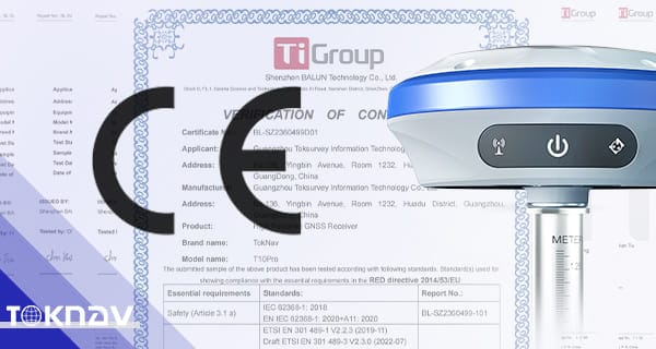
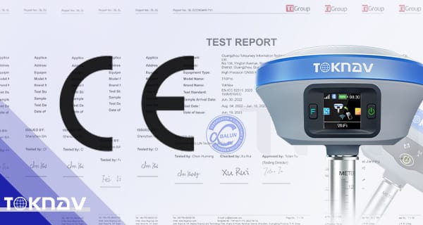
Home TOKNAV T10Pro Earns CE Certification: Unlock European Sales & Global Quality Assurance 2022-11-09 TOKNAV T10Pro Earns CE Certification: Unlock European Sales & Global Quality Assurance We’re thrilled to share exciting news about the TOKNAV T10Pro. In November 2022, this advanced positioning solution successfully earned CE safety certification—a critical milestone that accelerates our global expansion and enables full sales access across all European Union countries.  What the CE Mark Means for TOKNAV T10Pro  The CE mark is a non-negotiable safety certification for the European market, serving as proof that a product meets strict EU regulations governing health, safety, and environmental protection at every stage of production. For the TOKNAV T10Pro, this certification confirms full compliance, reinforcing customer trust in the product’s uncompromising quality and safety standards. TOKNAV T10Pro CE certification for European sales The Rigorous CE Testing Process for TOKNAV T10Pro   Achieving CE certification requires passing two foundational tests: the Low Voltage Directive (LVD) and Electromagnetic Compatibility (EMC). The TOKNAV T10Pro series excelled in all required assessments, earning the official CE mark that approves its sale in Europe and other global markets that recognize this standard.   A Milestone for Quality and Global Growth   This CE certification is a major achievement for TOKNAV, underscoring our unwavering commitment to delivering high-quality, safe positioning solutions. Recognized worldwide, the CE mark helps us overcome international trade barriers, speed up market entry, and elevate our brand’s global competitiveness.   TOKNAV’s Ongoing Commitment to Excellence   The CE-certified TOKNAV T10Pro strengthens customer confidence in its reliability and performance. Moving forward, TOKNAV will continue to prioritize innovation and premium quality, delivering trusted positioning solutions for global users.

حصول TOKNAV T10Pro على شهادة CE: فتح المبيعات الأوروبية وضمان الجودة العالمية قراءة المزيد »

IGS test -T10Pro & T5

TOKNAV T10Pro و T5 يجتازان اختبار IGS 2023 بنجاح الارتقاء بمعايير تحديد المواقع الدقيقة للأنظمة العالمية لسواتل الملاحة

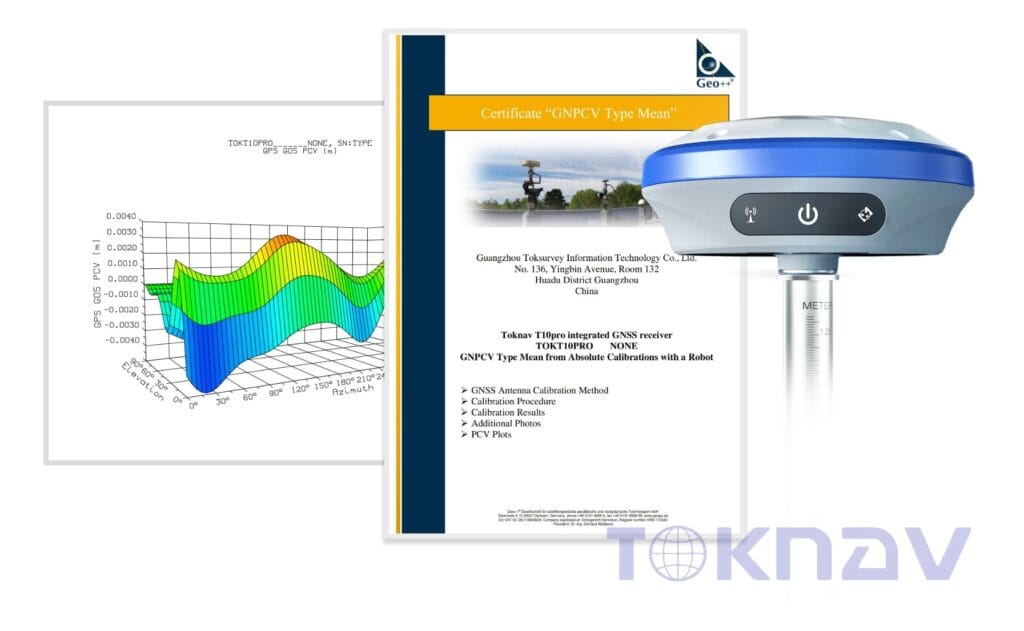
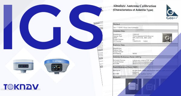
Home TOKNAV T10Pro & T5 Successfully Pass IGS Test 2023: Elevating Precision GNSS Positioning Standards 2023-06-07 Thanks to the hard work of all TOKNAV staff, we are thrilled to announce that TOKNAV T10Pro and T5 successfully passed the IGS test in June 2023—a major milestone for our precision GNSS positioning solutions.  What is IGS Certification and Its Value for GNSS Receivers  IGS certification enables seamless interoperability between receivers from different manufacturers during joint measurements. For example, it supports the setup of national control networks in China, facilitates static data collection, and enables nationwide millimeter-level coordinate calculations. When processing static data, IGS-certified antennas simplify cross-brand collaboration and ensure more accurate positioning results. Why IGS Certification is Critical for High-Precision Positioning  In high-precision GPS data processing, the phase center deviation and phase center variation (PCV) of receivers and satellite antennas directly impact positioning accuracy. These factors can introduce several centimeters of error in precise single-point positioning, and over ten centimeters in elevation measurements. For high-precision baseline calculations—especially longer baselines—they can also cause centimeter-level deviations, making antenna measurement a key indicator of RTK performance and a prerequisite for centimeter- or millimeter-level accuracy. IGS test -T10Pro & T5 An Overview of the IGS Organization The International GNSS Service (IGS) was established in 1993 by the International Association of Geodesy (IAG) and began official operations in 1994 to support geodesy and geodynamics research. Expanding its scope to include Russia’s GLONASS, China’s BDS, and the EU’s Galileo system, it was officially renamed the International GNSS Service on March 14, 2005.   Comprising satellite tracking stations, data centers, and analysis centers, the IGS delivers near-real-time high-precision GNSS data products online, serving diverse scientific research and engineering fields. With over 200 global member organizations, the IGS facilitates data sharing to advance high-precision GNSS applications. The Significance of TOKNAV T10Pro & T5 Passing the IGS Test  Passing the IGS test brings two key advantages to the TOKNAV T10Pro and T5:  Enhanced interoperability, enabling seamless collaboration with receivers from other brands in joint measurement projects. Validation of product excellence, demonstrating TOKNAV’s commitment to delivering high-quality, reliable GNSS solutions to global customers.  Moving forward, TOKNAV will continue to prioritize innovation, delivering high-quality, cost-effective products and services to our overseas customers in the precision positioning industry. TOKNAV T10Pro IGS certified GNSS receiver

TOKNAV T10Pro و T5 يجتازان اختبار IGS 2023 بنجاح الارتقاء بمعايير تحديد المواقع الدقيقة للأنظمة العالمية لسواتل الملاحة قراءة المزيد »

جهازي TOKNAV T10Pro وT20Pro يحصلان على شهادة FCC لعام 2023

T10Pro، T20Pro FCC

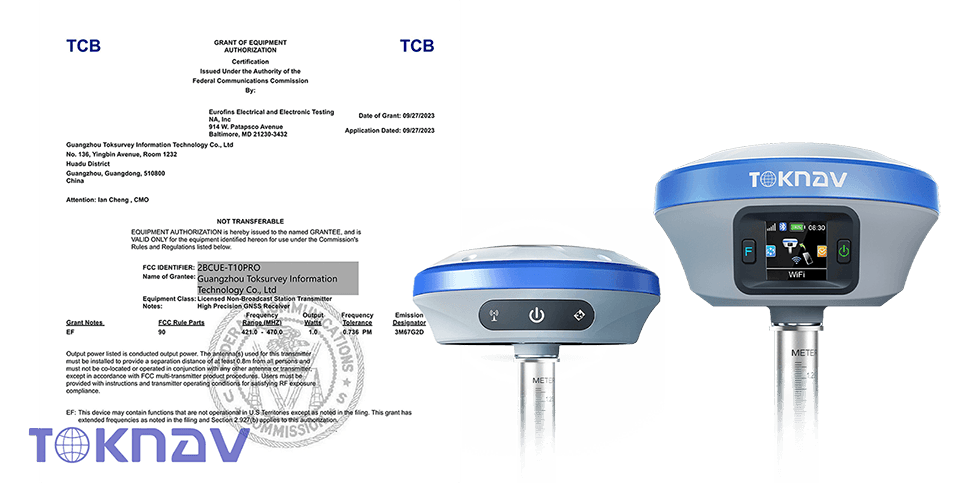
Home TOKNAV T10Pro & T20Pro Secure FCC Certification 2023: Unlocking U.S. Market Access for Premium GNSS Receivers 2023-09-06 TOKNAV T10Pro & T20Pro Secure FCC Certification 2023: Unlocking U.S. Market Access for Premium GNSS Receivers We are excited to share that the TOKNAV T10Pro and T20Pro GNSS receivers have successfully obtained Federal Communications Commission (FCC) certification in the United States. This achievement marks another important step in TOKNAV’s global growth journey and reflects our ongoing commitment to delivering reliable, high-quality GNSS solutions to customers around the world. High-Performance GNSS Solutions Designed for professional surveying and geospatial applications, the T10Pro and T20Pro provide reliable, high-precision positioning with advanced signal tracking and RTK technology. Whether working in open fields, urban environments, or other challenging conditions, users can count on stable centimeter-level accuracy and dependable performance. The FCC certification further reinforces the quality, safety, and reliability of these products, giving our customers even greater confidence when choosing TOKNAV solutions for their projects. What is FCC Certification? The Federal Communications Commission (FCC) is an independent U.S. government agency responsible for regulating communications and electronic devices within the United States. Similar to CE compliance requirements in Europe, FCC certification is required for many electronic and wireless products entering the U.S. market. It helps ensure that products meet strict technical standards, operate safely, and do not cause harmful interference to other communications systems. For manufacturers and customers alike, FCC certification serves as a recognized mark of quality, safety, and regulatory compliance. The Importance of FCC Certification for TOKNAV Achieving FCC certification is more than just meeting regulatory requirements—it reflects our commitment to product quality, reliability, and customer trust. To obtain this certification, TOKNAV’s R&D team worked closely with Eurofins testing engineers and successfully completed all required evaluations to secure FCC certification. This collaboration highlights the company’s commitment to quality, ensuring that every aspect of the product meets stringent safety regulations. Standards for FCC-Certified TOKNAV GNSS Receivers For the T10Pro and T20Pro, FCC certification confirms that the products meet the technical requirements necessary for legal sale and operation in the United States. More importantly, it gives customers additional confidence that the receivers have been independently tested and verified to meet recognized standards for quality, safety, and reliability. This certification reflects our commitment to delivering products that professionals can trust in the field every day. FCC Certification: A Key Milestone for Global Expansion As global demand for high-precision GNSS solutions continues to grow, TOKNAV remains committed to enhancing product standards, with a strong focus on safety, quality, and technical support. By delivering reliable and innovative solutions, we aim to strengthen customer confidence and expand our presence in international markets. Following the successful acquisition of CE certification for the European market, obtaining FCC certification further demonstrates TOKNAV’s compliance with international standards and strengthens its credibility in the United States. This milestone opens new opportunities for global expansion and reinforces TOKNAV’s position as a trusted Chinese brand in the geospatial industry. Driven by a deep understanding of customer needs and a commitment to continuous innovation, TOKNAV will continue developing products and solutions tailored to evolving market demands worldwide. Future Outlook As we continue expanding globally, TOKNAV will keep investing in innovation, product development, and customer success. With both CE and FCC certifications now in place, we are better positioned than ever to bring advanced GNSS technologies to a wider global audience and support surveying professionals with reliable, efficient, and easy-to-use solutions. Thank you for being part of the TOKNAV journey. We look forward to growing together and creating even greater value for our customers and partners in the years ahead.

T10Pro، T20Pro FCC قراءة المزيد »

سلسلة TOKNAV T20

حصلت سلسلة TOKNAV T20 على شهادة CE

Home TOKNAV T20 Series Achieve CE Certification, Ensuring Quality and Compliance 2023-10-08 TOKNAV T20 Series Achieve CE Certification, Ensuring Quality and Compliance October 8, 2023 | Guangzhou, China TOKNAV is pleased to announce that its T20 Series GNSS receivers have successfully obtained CE certification, marking an important milestone in the company’s commitment to quality, safety, and international market development. The certification confirms that the T20 Series complies with relevant European Union requirements for product safety, environmental protection, and performance, enabling the products to be marketed and sold throughout the European Economic Area (EEA). A New Milestone in TOKNAV’s Global Growth Achieving CE certification represents another important step in TOKNAV’s global growth journey. As one of the most recognized conformity marks in Europe, CE certification demonstrates that the T20 Series meets strict European standards for safety, health, environmental protection, and consumer protection. This achievement reflects TOKNAV’s ongoing commitment to delivering reliable, high-quality products that meet the expectations of customers worldwide. What CE Certification Means for Customers CE certification is a widely recognized conformity mark within the European market. It demonstrates that a product meets applicable EU directives and regulations covering safety, health, environmental protection, and consumer interests. For TOKNAV customers, CE certification provides additional confidence that the T20 Series has been independently evaluated and verified to meet internationally recognized standards. Innovation and Quality at the Core Innovation and quality have always been central to TOKNAV’s product development philosophy. The successful certification of the T20 Series reflects the company’s continuous investment in research, engineering, and quality management. Designed for professional users, the T20 Series delivers reliable performance while meeting stringent European requirements for safety, performance, and environmental responsibility. CMO’s Comment on the Certification Commenting on the achievement, Ian Cheng, Chief Marketing Officer of TOKNAV, said: “We are pleased to receive CE certification for the T20 Series. This achievement reflects our commitment to delivering products that meet internationally recognized standards for quality, safety, and reliability. We look forward to providing even greater value to customers across Europe and around the world.” Looking Ahead As TOKNAV continues to expand internationally, the company remains focused on innovation, product excellence, and customer success. With CE certification now secured, TOKNAV is well positioned to strengthen its presence in European markets and continue delivering reliable, efficient, and cost-effective GNSS solutions to professionals worldwide. We would like to thank our customers, partners, and distributors for their continued trust and support as we take this important step forward.

حصلت سلسلة TOKNAV T20 على شهادة CE قراءة المزيد »

جهاز TOKNAV T5Lite T20Pro معتمد من IGS

شهادة TOKNAV T5Lite وT20Pro المعتمدة من IGS | معلم التكنولوجيا الجغرافية المكانية 2023

الصفحة الرئيسية: اجتياز اختبار IGS لأجهزة TOKNAV T5Lite و T20Pro في ديسمبر 2023 2023-12-20 TOKNAV T5Lite و T20Pro الحاصلة على شهادة IGS | إنجاز بارز في مجال التكنولوجيا الجغرافية المكانية لعام 2023 كجزء من التزامنا بالتميز، نعتقد أنه من الضروري تقديم نظرة ثاقبة حول كيفية تحقيقنا لهذا الإنجاز البارز. كانت عملية الاعتماد شاملة، وتطلبت إجراء اختبارات صارمة والتحقق من مطابقة تقنياتنا للمعايير الدولية. في مجال التكنولوجيا الجغرافية المكانية سريع التطور، يمثل طرح جهازي TOKNAV T5Lite وT20Pro المعتمدين من IGS لحظة حاسمة. فهذه الأجهزة لا تعزز قدرات المتخصصين فحسب، بل تضع أيضًا معيارًا جديدًا للأداء في هذا القطاع. توفر الابتكارات التي تقدمها TOKNAV للمستخدمين أدوات تدمج التكنولوجيا المتقدمة في التطبيقات العملية. ويأتي إطلاق طرازي T5Lite وT20Pro في وقت يزداد فيه الطلب على الدقة في البيانات الجغرافية المكانية أكثر من أي وقت مضى. مع تطبيقات تتراوح من التخطيط الحضري إلى مراقبة البيئة، تستمر الحاجة إلى حلول جغرافية مكانية موثوقة ودقيقة في النمو. تظل TOKNAV في طليعة هذا الاتجاه، مما يضمن أن منتجاتنا تلبي أعلى معايير التميز. ديسمبر 2023 – تُعد شركة TOKNAV Technology رائدة في مجال التكنولوجيا الجغرافية المكانية. ونعلن بفخر حصول أحدث منتجاتنا، T5Lite وT20Pro، على شهادة IGS. ويأتي هذا الإنجاز في أعقاب النجاح الذي حققته طرازي T5 وT10Pro، اللذين حظيا بإشادة واسعة النطاق وفتحا آفاقًا جديدة لشركة TOKNAV في سوق البيانات الجغرافية المكانية. أجرى فريقنا تجارب عديدة، لضمان تحسين كل جانب من جوانب T5Lite وT20Pro من حيث الأداء. وقد أبرزت هذه الاختبارات القدرات المتقدمة لمنتجاتنا، خاصةً من حيث الدقة والموثوقية، وهما عاملان بالغا الأهمية في التطبيقات الجغرافية المكانية. على سبيل المثال، يمكن لمخططي المدن الاستفادة من قدرات T5Lite وT20Pro لجمع البيانات التي توجه تطوير البنية التحتية. وفي الحالات التي تكون فيها مراقبة البيئة أمرًا بالغ الأهمية، يمكن لهذه الأجهزة مساعدة الباحثين في تتبع التغيرات في استخدام الأراضي، والغطاء النباتي، وأنماط الطقس. وتعد تعددية استخدامات هذه الأدوات دليلاً على التزام TOKNAV بالابتكار. علاوة على ذلك، يتيح دمج واجهات سهلة الاستخدام للمهنيين من مختلف المجالات الاستفادة من هذه الأجهزة بفعالية. تتوفر برامج التدريب والموارد بسهولة لضمان تمكن المستخدمين من تحقيق أقصى استفادة من إمكانات T5Lite وT20Pro، مما يمهد الطريق لجمع البيانات وتحليلها بشكل أفضل عبر مختلف القطاعات. البناء على النجاح: حصول T5Lite وT20Pro على شهادة IGS بناءً على هذا النجاح، حصلت T5Lite وT20Pro الآن على شهادة IGS. ويُعد هذا إنجازًا هامًّا لشركة TOKNAV. علاوة على ذلك، يعكس هذا الإنجاز العمل الدؤوب الذي بذلته شركتنا بأكملها، ويُظهر تفانينا في السعي المستمر للتحسين. ماذا تعني شهادة IGS لشركة TOKNAV يُثبت حصول T5Lite وT20Pro على شهادة IGS التزامنا الثابت بالتميز، ويؤكد سعيَنا الدؤوب نحو الابتكار. نظرة عامة على IGS ودورها تتمتع الجمعية الجغرافية المكانية الدولية (IGS) بمكانة مرموقة في المجتمع الجغرافي المكاني. وتعد شهادة IGS معيارًا للمنتجات عالية الجودة. التزام TOKNAV بالمضي قدمًا في الوقت الذي تحتفل فيه TOKNAV بالحصول على شهادتي IGS، نؤكد من جديد التزامنا.وسنواصل تخطي حدود الابتكار في مجال الجغرافيا المكانية. منتجات TOKNAV T5Lite وT20Pro الحاصلة على شهادة IGS بالإضافة إلى التحسينات التقنية، ركزنا أيضًا على ملاحظات المستخدمين، التي لعبت دورًا حاسمًا في تحسين منتجاتنا. من خلال التعاون مع خبراء في هذا المجال، قمنا بتخصيص T5Lite و T20Pro لتلبية الاحتياجات المحددة للمتخصصين في المجال الجغرافي المكاني. نحن ندرك أن المشهد الجغرافي المكاني يتطور باستمرار، ومعه تتطور متطلبات عملائنا. لذلك، قمنا بدمج أحدث التطورات التكنولوجية في T5Lite وT20Pro، لضمان بقائهما في طليعة التكنولوجيا الجغرافية المكانية. ولا يمكن التقليل من أهمية شهادة IGS، فهي لا تقتصر على إثبات جودة منتجاتنا فحسب، بل تعزز أيضًا ثقة العملاء في علامتنا التجارية. في السوق التنافسية الحالية، يمنحنا الحصول على شهادة IGS ميزة واضحة. علاوة على ذلك، تفتح هذه الشهادة آفاقًا جديدة للتعاون مع الشركات والمؤسسات الرائدة الأخرى في قطاع الجغرافيا المكانية. فهي تتيح لنا المشاركة في مشاريع مشتركة وأبحاث يمكنها دفع تقنيتنا إلى الأمام. يُعد مجتمع IGS نظامًا بيئيًا غنيًّا يضم محترفين وباحثين وقادة في هذا المجال. إن الاعتراف بنا ضمن هذا المجتمع يعزز مصداقيتنا ويضعنا في مكانة قادة الفكر في مجال التكنولوجيا الجغرافية المكانية. علاوة على ذلك، فإن التزامنا بالاستدامة يتوافق تمامًا مع أهداف IGS. نحن ملتزمون بتقليل أثرنا البيئي إلى أدنى حد ممكن مع تعظيم كفاءة وفعالية منتجاتنا. يضمن تركيزنا على الممارسات المستدامة أننا، مع ابتكارنا ونمونا، نساهم أيضًا بشكل إيجابي في كوكبنا ومجتمعنا. ولإلقاء الضوء على التكنولوجيا الكامنة وراء T5Lite وT20Pro، قمنا بتطبيق خوارزميات متطورة تعزز دقة جمع البيانات ومعالجتها. تتيح هذه الخوارزميات تحليل البيانات في الوقت الفعلي، وهو أمر بالغ الأهمية للعديد من التطبيقات في مجال التكنولوجيا الجغرافية المكانية. علاوة على ذلك، تسهل واجهاتنا سهلة الاستخدام على المتخصصين التعامل مع تعقيدات البيانات الجغرافية المكانية. ومن خلال الاختبارات المستمرة مع المستخدمين، حرصنا على أن تلبي تصميماتنا توقعات واحتياجات المستخدمين النهائيين. وبالنظر إلى المستقبل، تتضمن خارطة طريقنا خططًا لمزيد من التحسينات وإدخال ميزات جديدة تستجيب للمتطلبات المتغيرة باستمرار في مجال الجغرافيا المكانية. ومع نجاحنا في الحصول على شهادة اعتماد IGS لـ T5Lite و T20Pro، فإننا متفائلون بمستقبلنا ومتحمسون لاستكشاف الأسواق والفرص الجديدة التي تنتظرنا. في الختام، يمثل حصول TOKNAV T5Lite وT20Pro على شهادة IGS خطوة مهمة إلى الأمام في مهمتنا لتقديم حلول تكنولوجية جغرافية مكانية عالية الجودة. ونظل ملتزمين بالابتكار والجودة ورضا العملاء. رحلتنا لا تنتهي هنا؛ سنواصل تخطي الحدود وتعزيز التعاون والمساهمة في تقدم التقنيات الجغرافية المكانية في جميع أنحاء العالم. ندعو عملائنا وشركاءنا والمجتمع الجغرافي المكاني للانضمام إلينا في هذه الرحلة المثيرة نحو الابتكار والتميز في مجال التكنولوجيا الجغرافية المكانية. تذكروا أنكم، باختياركم منتجات TOKNAV T5Lite وT20Pro المعتمدة من IGS، تختارون حلولاً متطورة تضع معايير جديدة في صناعة الجغرافيا المكانية. ونحن نتطلع إلى المستقبل، فإن آثار اعتماد IGS تتجاوز مجرد التحقق من صحة المنتج؛ فهي تعزز ثقة العملاء في عروض TOKNAV. عندما يختار العملاء أجهزة TOKNAV T5Lite وT20Pro الحاصلة على شهادة IGS، فإنهم يستثمرون في تقنية خضعت لاختبارات صارمة وتفي بالمعايير الدولية. ويمكن لهذه الطبقة الإضافية من الضمان أن تسهم بشكل كبير في

شهادة TOKNAV T5Lite وT20Pro المعتمدة من IGS | معلم التكنولوجيا الجغرافية المكانية 2023 قراءة المزيد »

شهادات NGS الخاصة بـ T5lite و T20Pro

شهادات T5lite T20Pro NGS | أجهزة استقبال TOKNAV GNSS تفي بمعايير NGS

Home T5lite and T20Pro Earn NGS Certificates 2024-01-09 T5lite T20Pro NGS Certificates TOKNAV is a top tech company in the GNSS industry.We design and build high-quality GNSS receivers.From the start, we focus on product performance and quality.Today, we own many Beidou patents.We lead the domestic market in positioning technology.Recently, TOKNAV shared great news.Our T5lite and T20Pro both won NGS certification. What NGS Certification Means This achievement shows our products meet high industry standards.Also, it proves our focus on strong and stable performance.Official teams tested the devices carefully.They checked function, reliability and safety rules.  Products Meet All NGS Requirements  The test results are very positive.Clearly, T5lite and T20Pro pass all NGS rules.Experts studied every part of the two products.They offer advanced tech and easy-to-use design.Furthermore, beta users gave strong positive feedback.  Value of the NGS Approval  NGS certification recognizes TOKNAV’s hard work.Moreover, it makes our products more reliable worldwide.It helps build trust between TOKNAV and customers.Finally, it supports our growth in the global market.  TOKNAV’s Continuous Effort  TOKNAV keeps working on high-quality navigation products.We listen closely to user feedback.We improve products to serve customers better.If you need more details, please contact us directly.

شهادات T5lite T20Pro NGS | أجهزة استقبال TOKNAV GNSS تفي بمعايير NGS قراءة المزيد »

TOKNAV هي علامة تجارية راقية للأنظمة العالمية لسواتل الملاحة مملوكة لشركة قوانغتشو توكسيرفي لتكنولوجيا المعلومات المحدودة.
جميع الحقوق محفوظة © 2025 شركة قوانغتشو توك سورفي لتكنولوجيا المعلومات المحدودة سياسة الخصوصية

كن من موزعي TOKNAV العالميين!

نحن نبحث الآن عن موزعين متحمسين للانضمام إلى قصة نجاحنا العالمية بفضل سجلنا الحافل في مجال المسح.