jeffreyrtk@gmail.com

Hallo, ich bin Jeffrey, der Gründer von toknavgnss.com. Ich leite seit 8 Jahren eine Fabrik in China, die GNSS RTK herstellt, und der Zweck dieses Artikels ist es, mit Ihnen das Wissen über GNSS aus der Sicht eines chinesischen Lieferanten zu teilen.

TOKNAV 1a3f47bf68f65704832db732d45c8272

GNSS-Signal blockiert? Versuchen Sie diese IoT-gestützte Methode zur schnellen Neuvermessung für technische Kontrollnetze - Genauigkeit im Millimeterbereich und doppelte Effizienz

Home GNSS Signal Blocked? Try This IoT-Assisted Rapid Re-survey Method for Engineering Control Networks – Millimeter-Level Accuracy & Doubled Efficiency 2025-04-14 Friends in surveying and engineering must have encountered the same frustrating problem – control network re-survey, especially in scenarios with severe GNSS signal obstruction (such as mountainous areas, factories, and dam surroundings), which is simply “an arduous task”! Control networks are like the “eyes” of a project. Regular re-survey is essential to ensure the reliability of subsequent construction and monitoring. However, common re-survey methods on the market either have limited application scenarios or are inefficient to the point of frustration. Today, I will share a practically proven solution – an IoT-assisted rapid re-survey method for engineering control networks, which achieves millimeter-level accuracy and doubles efficiency in actual tests! IoT-Assisted Rapid Re-survey Method for Engineering Control Networks System Architecture Perception layer: The protagonist is the “remote-controlled prism” – we have modified ordinary prisms to adjust their orientation remotely, eliminating the need for manual adjustment at control points, which is the key to improving efficiency; Network transmission layer: LoRa technology is adopted. You may not be familiar with this technology, but its advantages are obvious – long transmission distance and strong anti-interference ability. Even in complex environments such as mountainous areas and dams, it can stably transmit control signals. It is worth mentioning that all Toknav’s RTK devices have the same advantages as LoRa technology and can also achieve stable transmission in complex surveying scenarios. For more information, you can check out Learn more > Application layer: It is the control software we operate, with a simple interface. It can remotely control the prism orientation, view measurement data, and realize full-process visualization, making operation very simple. The entire re-survey process is also very simple: deploy remote-controlled prisms at each control point, the operator operates the total station at a fixed position, remotely adjusts the prism orientation through the application layer software, and the total station automatically completes angle and distance measurement. No need to travel back and forth between control points, completing the task in one step. Actual Test Verification: Accuracy Uncompromised, Efficiency Doubled! Talking the talk is not enough; walking the walk is. We conducted an experiment on an actual project (the plane control network of a hydropower station dam), comparing the re-survey effects of the “IoT-assisted method” and the “total station only” method. The results were really surprising! Accuracy: The re-survey accuracy of the two methods is completely consistent, reaching sub-millimeter level, which fully meets the re-survey requirements of engineering control networks, so there is no need to worry about accuracy degradation; Efficiency: Taking working hours as the indicator, the efficiency of the IoT-assisted method is about 107% higher than that of using only the total station – simply put, a re-survey task that used to take two days can now be completed in one day, saving half the time directly! More importantly, this method does not rely on GNSS signals. As long as there is line of sight between control points (a basic requirement for traditional total station measurement), it can work normally no matter how severe the surrounding obstruction is. Many actual engineering control networks are laid out as angle-distance networks, which are just suitable for this method, with broad application prospects. Summary & Future Outlook In summary, this IoT-assisted rapid re-survey method for engineering control networks perfectly solves the pain points of traditional methods: “low efficiency, tiring labor, and limited scenarios”: No manual trips to control points to adjust prisms, with full automation, reducing labor costs and safety risks; The accuracy is consistent with that of traditional total stations, reaching sub-millimeter level, meeting engineering needs; It does not rely on GNSS signals and can easily handle scenarios with severe obstruction, with a wider scope of application; Efficiency is increased by 107%, greatly shortening the re-survey period. Of course, this method still has a small regret – it has not been applied in complex terrain (such as high mountain canyons) or ultra-large-scale control networks. In the future, we will continue to improve, and strive to verify it in more complex scenarios, so that this method can help more friends in engineering and surveying. If your project also encounters problems of GNSS signal obstruction and low re-survey efficiency, you may wish to try this method – it has been proven useful in actual tests! If you have any related questions, you can also leave a message in the comment area to communicate~ Reference: [1] Zhou Jianguo, Gan Youhuizi, Chen Yanchong. IoT-Assisted Rapid Re-survey Method and System for Engineering Control Networks[J]. Science of Surveying and Mapping, 2026, 51(02): 33-40. DOI:10.16251/j.cnki.1009-2307.2026.02.004.
GNSS-Signal blockiert? Versuchen Sie diese IoT-gestützte Methode zur schnellen Neuvermessung für technische Kontrollnetze - Genauigkeit im Millimeterbereich und doppelte Effizienz Weiterlesen »

TOKNAV 2026 GEO week 卡片

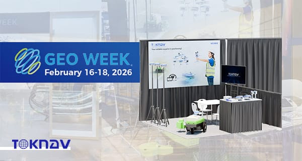
TOKNAV präsentiert hochpräzise GNSS- und Geospatial-Lösungen auf der Geo Week 2026 Denver

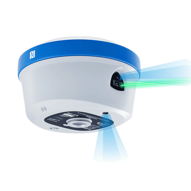
Home TOKNAV Showcases High-Precision GNSS & Geospatial Solutions at Geo Week 2026 Denver 2026-02-19 TOKNAV Highlights T50 GNSS RTK, TSR20 LiDAR & Tboat USVs at Geo Week 2026 Denver, CO, February 18, 2026 – TOKNAV, a globally recognized provider of high-precision GNSS (Global Navigation Satellite System) and comprehensive geospatial solutions, successfully concluded a standout participation at Geo Week 2026, a three-day industry flagship event held from February 16 to 18 at the Denver Colorado Convention Center, where the company occupied Booth 1808. As the world’s premier geospatial industry gathering, Geo Week 2026 set new benchmarks this year, attracting over 3,800 registered attendees, 238 exhibitors hailing from 25 different countries across six continents, and boasting the largest exhibit hall in its decades-long history. Aligned perfectly with the event’s core focus on AI integration, uncrewed technology advancement, and 3D geospatial innovation, TOKNAV took center stage by showcasing its flagship T50 GNSS RTK (Real-Time Kinematic) receiver—equipped with industry-leading 100m laser ranging capability—alongside the compact and powerful TSR20 Handheld LiDAR Scanner and the versatile Tboat Series Unmanned Surface Vehicles (USVs). The company’s cutting-edge offerings resonated deeply with attendees, earning strong acclaim and positive feedback from geospatial professionals, surveyors, engineers, and industry leaders from around the globe.Geo Week 2026 solidified its reputation as the epicenter of geospatial advancement, bringing together a diverse community of industry stakeholders to explore and celebrate the latest trends, technologies, and applications shaping the future of geospatial science. This year’s event was particularly focused on three transformative pillars: AI-embedded spatial data workflows that streamline efficiency and accuracy, the expanding role of uncrewed systems in field operations, and the ongoing evolution of 3D geospatial capture and analysis. In addition to featuring an extensive exhibit hall, Geo Week 2026 offered a rich program of keynotes delivered by industry pioneers, expert panels diving into critical challenges and opportunities, live demonstration zones where attendees could experience new technologies firsthand, and exclusive product previews that offered a glimpse into the next generation of geospatial tools. Every element of the event was designed to drive real-world geospatial innovation, connecting professionals with the solutions they need to tackle complex projects in surveying, mapping, construction, environmental management, and beyond. Notably, the event also highlighted the completion of the U.S. 3DEP (3D Elevation Program), a landmark initiative that provides high-quality 3D elevation data to support a wide range of geospatial applications, further underscoring the industry’s shift toward more detailed and accurate spatial information. High-Precision GNSS and Geospatial Innovations for Surveying and 3D Reality Capture TOKNAV’s portfolio of high-precision GNSS and geospatial solutions is strategically aligned with the global geospatial industry’s ongoing shift toward intelligent, long-range, and uncrewed systems—trends that were front and center at Geo Week 2026. The company’s latest product lineup is engineered to deliver exceptional centimeter-level accuracy, reliable performance in even the most challenging field conditions, and streamlined workflows that reduce operational time and costs for professionals across a variety of sectors, including land surveying, aerial mapping, civil construction, and hydrological operations. By combining advanced hardware with intuitive software, TOKNAV’s solutions address the evolving needs of the industry, empowering users to complete projects more efficiently, accurately, and safely than ever before. Whether working in remote rural areas, bustling urban environments, or harsh industrial sites, TOKNAV’s high-precision GNSS and geospatial tools are designed to adapt to diverse use cases, making them a versatile choice for geospatial professionals worldwide. T50 GNSS RTK: 100m Laser Ranging for Long-Range High-Precision Surveying The T50 GNSS RTK receiver emerged as a true star of TOKNAV’s booth at Geo Week 2026, perfectly embodying the event’s focus on high-performance field technology with its groundbreaking 100m laser ranging capability—a transformative feature that redefines long-range surveying possibilities. Unlike traditional GNSS devices that require close proximity to target points, the T50’s laser ranging function allows surveyors to capture accurate measurements from up to 100 meters away, eliminating the need to physically access hard-to-reach or hazardous areas such as steep slopes, busy highways, or unstable terrain. This not only enhances safety but also significantly boosts efficiency, reducing the time required to complete large-scale surveying projects. Complementing its laser ranging capability, the T50 is equipped with 1408+ multi-constellation GNSS channels, enabling it to receive signals from all major global satellite systems (including GPS, GLONASS, Galileo, and BeiDou) for enhanced positioning accuracy and reliability, even in environments with limited satellite visibility. The device also features AR (Augmented Reality) real-time stakeout, which overlays digital design data onto the physical environment through a built-in screen, allowing surveyors to quickly and accurately locate stakeout points without the need for additional equipment. Additionally, the T50 supports photogrammetry, enabling users to capture high-resolution images and generate detailed 3D models for further analysis. To ensure uninterrupted operation in the field, the T50 is equipped with dual removable high-capacity batteries that provide all-day power, even during extended surveying sessions. Its IP68 rugged design—meaning it is dust-tight and capable of withstanding submersion in up to 1.5 meters of water for 30 minutes—ensures reliable performance in harsh field conditions, including extreme temperatures, heavy rain, and dusty environments. These features combined make the T50 GNSS RTK a preferred choice for professionals seeking long-range, high-precision GNSS and geospatial solutions that deliver consistent performance in any scenario. TSR20 Handheld LiDAR Scanner: Lightweight 3D Point Cloud Solution TOKNAV’s TSR20 Handheld LiDAR Scanner also resonated strongly with Geo Week 2026 attendees, aligning perfectly with the event’s emphasis on 3D reality capture—a critical trend in modern geospatial technology. Weighing only 1.0kg, the TSR20 is one of the lightest handheld LiDAR scanners on the market, making it easy to carry and operate for extended periods without causing user fatigue. Despite its compact size, the device is packed with advanced features, including a high-performance Livox Mid-360 sensor and state-of-the-art SLAM (Simultaneous Localization and Mapping) algorithms that enable it to capture high-precision 3D point clouds with ≤3cm relative accuracy. What sets the TSR20 apart is its ability to perform equally well in both GNSS-enabled and GNSS-denied environments—such as indoor spaces, urban canyons, or dense forests—where traditional GNSS devices often

TOKNAV präsentiert hochpräzise GNSS- und Geospatial-Lösungen auf der Geo Week 2026 Denver Weiterlesen »

TOKNAV 架站卡片

TSL150 Terrestrischer Laserscanner: 2 mm Präzision, 3,3 kg Tragbarkeit, keine Verzögerung im Büro

Home TSL150 Terrestrial Laser Scanner: 2mm Precision, 3.3kg Portability, Zero Office Delay 2026-04-05 TOKNAV Launches TSL150 Terrestrial Laser Scanner Globally Guangzhou, China – March 12, 2026 – TOKNAV today announced the global launch of a groundbreaking terrestrial laser scanner that redefines industry standards by merging survey-grade accuracy with unprecedented portability. This innovative device delivers 2mm precision at 50 meters in an ultra-compact design weighing just 3.3kg, shattering the long-standing trade-off between performance and mobility that has constrained surveyors for years. Engineered for field efficiency and real-time data validation, this scanner eliminates the need for heavy, cumbersome equipment while maintaining professional-grade results, setting a new benchmark for mobile, high-precision 3D reality capture across surveying, mapping, and construction sectors. Why Surveyors Choose This Game-Changing Scanner Crafted to address the daily challenges faced by surveyors, mappers, and BIM data collectors, this scanner combines ultra-high accuracy, lightweight portability, and streamlined on-site workflows. Its design directly targets pain points like time-consuming rework, costly office delays, and inefficient field operations, enabling teams to accelerate project delivery without compromising on quality. For professionals who often work in remote or hard-to-reach locations, its portability and reliability have quickly made it a top choice for modern surveying projects. True Field Autonomy & Single-Person Efficiency A key highlight of this scanner is its true field autonomy, powered by integrated real-time point cloud registration and automatic multi-station leveling with dual-axis tilt compensation. This feature allows survey teams to validate data quality on-site before leaving the job, eliminating the risk of costly rework and ensuring that every scan meets project requirements the first time. Weighing only 3.3kg and equipped with dual hot-swappable batteries, the device supports fast deployment and all-day operation—whether used upright at ground level for large-scale site scans or inverted for detailed ceiling measurements in indoor projects. Notably, the entire workflow, from setup to data capture, can be completed by a single operator, drastically reducing labor costs and improving overall field efficiency. Survey-Grade Accuracy & Immediate Photorealistic Deliverables When it comes to performance, the scanner delivers uncompromising survey-grade results: 2mm accuracy (1σ) at 50m, 3mm (1σ) at 100m, and a maximum scanning range of 150m. Its impressive scan speed of 100 lines per second and 1.2MHz pulse rate ensures that dense, detailed point clouds are captured quickly without sacrificing precision—critical for large-scale projects where time is of the essence. Paired with 100MP HDR panoramic imaging and exposure bracketing, the scanner produces photorealistic colorized point clouds that are ready for instant integration into BIM and GIS platforms, eliminating time-consuming post-processing delays and streamlining the path from data capture to project delivery. All-Condition Reliability for Real-World Survey Projects Built to withstand the rigors of real-world fieldwork, the scanner features an IP54-rated sealed design that protects against dust and water splashes, enabling reliable operation in temperatures ranging from -20°C to +50°C. It supports multi-GNSS compatibility (including BDS, GPS, GLONASS, GALILEO, QZSS, NavIC, and SBAS) and a built-in MEMS IMU, ensuring stable and precise georeferencing even in challenging environments with limited satellite visibility. With 1TB of internal SSD storage and 256GB of external expansion capacity, the device handles large datasets seamlessly without interruptions. Its compact dimensions (216mm × 168mm × 105mm) allow deployment in confined spaces, such as narrow construction sites or historic buildings, and elevated positions where traditional, bulkier scanners cannot reach. TSL150 Availability & Global Support from TOKNAV Designed, manufactured, and supported at TOKNAV’s quality-controlled facility in Guangzhou, this scanner reflects the brand’s commitment to being the world’s most reliable geospatial measurement partner. It is available now through TOKNAV and its authorized global dealers, complete with a lightweight carbon fiber tripod and a full-featured field software suite that simplifies setup, data capture, and on-site validation.About TOKNAVBased in Guangzhou, TOKNAV designs, builds, and supports professional GNSS and laser scanning solutions with strict quality control. The company is committed to becoming the world’s most reliable geospatial partner, delivering consistent quality, innovative products, and exceptional service to every customer worldwide.Contact: info@toknavgnss.com | www.toknavgnss.com

TSL150 Terrestrischer Laserscanner: 2 mm Präzision, 3,3 kg Tragbarkeit, keine Verzögerung im Büro Weiterlesen »

TOKNAV hydrographische Vermessungsgeräte im Feldeinsatz für präzise Gewässerkartierung 

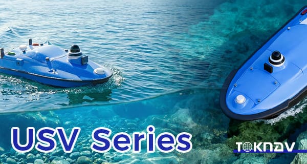
Unbemannte Oberflächenfahrzeuge der Tboat-Serie für intelligente Wasservermessung

Home Tboat Series Unmanned Surface Vehicles for Intelligent Water Survey Operation 2026-03-18 TOKNAV Launches Tboat10 & Tboat20 Unmanned Surface Vehicles In the era of rapid intelligent technology development, hydrographic survey and water operation are undergoing profound transformation. Traditional methods, relying heavily on manual operation and conventional vessels, face low efficiency, high labor costs, poor safety in complex waters, and unstable data accuracy. To address these pain points, TOKNAV Information Technology Co., Ltd., a leader in intelligent marine and geospatial technology, officially launches the Tboat Series Unmanned Surface Vehicles. This new series includes two professional models: Tboat10 and Tboat20, tailored to different application scenarios. Focused on modern hydrographic survey and intelligent water operations, the Tboat Series Unmanned Surface Vehicles integrate high-precision GNSS positioning, stable autonomous navigation, and flexible sensor integration, providing efficient, reliable data collection for rivers, lakes, reservoirs, coastal areas, and other complex water bodies. The launch enriches TOKNAV’s product matrix and marks its progress in unmanned surface vehicle technology, helping users improve operational efficiency and data accuracy in water survey, environmental monitoring, and water engineering projects. The Tboat Series Unmanned Surface Vehicles are designed to break traditional survey limitations, combining advanced hardware and intelligent software for full-process autonomous operation, reducing manual intervention and enhancing safety. As global urbanization and environmental protection advance, demand for intelligent water survey grows, and the Tboat Series Unmanned Surface Vehicles will drive the industry’s digital and intelligent transformation. Tboat10: Compact USV for Efficient Survey in Complex Waters The Tboat10 is a compact, highly maneuverable model in the Tboat Series Unmanned Surface Vehicles, designed for efficient surveys in narrow rivers, small-to-medium lakes, and reservoirs. Unlike large vessels, its 1.2m length and 0.6m width let it navigate narrow channels, shallow waters, and vegetation-dense areas. This compact design also enables easy transport (fit for standard SUVs) and deployment within 15 minutes, boosting field flexibility and emergency response. To ensure stable navigation, the Tboat10 features an optimized M-type hydrodynamic hull, refined through thousands of simulations and trials to reduce resistance, enhance stability, and minimize wave-induced oscillation—critical for high-accuracy tasks like shallow-water bathymetry and narrow-river water quality monitoring. The Tboat Series Unmanned Surface Vehicles’ Tboat10 model adopts a hidden-impeller pump-jet propulsion system, avoiding entanglement with aquatic debris (a common traditional vessel issue) and reducing harm to aquatic life, making it eco-friendly. This system also offers low noise and high efficiency, with simple maintenance: regular impeller cleaning and pipeline checks, no complex disassembly. Power supply is key to the Tboat Series Unmanned Surface Vehicles’ performance. The Tboat10 uses a 900W high-torque brushless DC motor, ensuring stable navigation in shallow or fast-flowing waters. It is equipped with two 33.6V hot-swappable 20Ah lithium batteries; the hot-swappable design allows 30-second battery replacement without shutdown, ensuring continuous operation. Under normal conditions, dual batteries support 8-10 hours of work and a 20km survey range, meeting daily small-to-medium water area needs. An intelligent battery management system monitors power, temperature, and voltage in real time, preventing overcharging, over-discharging, and short-circuiting. Safety is prioritized in the Tboat Series Unmanned Surface Vehicles: the Tboat10 has a double-layer bow (high-strength plastic outer, reinforced aluminum alloy inner) to absorb collision impacts, protecting internal components. It includes a water ingress alarm (triggering alerts and automatic return-to-home), an ultrasonic/machine vision obstacle avoidance system, and multi-scenario automatic return-to-home (low battery, signal loss, manual activation). A 360° HD camera transmits real-time images to the control terminal, enhancing safety. In practice, the Tboat10 outperforms manual methods: in a suburban shallow river survey, it boosted efficiency by over 3x with higher accuracy; in reservoir water quality monitoring, it collected real-time pH, dissolved oxygen, and turbidity data for background analysis. Tboat20: Professional Multi-Purpose USV for Large-Scale Hydrographic Missions The Tboat20’s propulsion and power systems are upgraded for long-distance operations: a dual 1500W motor propulsion system provides strong power, even in rough conditions. Four 33.6V high-capacity lithium batteries (total 80Ah) support 12-15 hours of continuous work and a 50km survey range. A dedicated fast charger enables full charging in 4 hours, and a solar auxiliary charging system extends endurance, reducing external power dependence. The Tboat Series Unmanned Surface Vehicles’ Tboat20 is equipped with an advanced autonomous navigation system, using multi-sensor fusion (GNSS, inertial navigation, electronic compass) for centimeter-level positioning. It supports waypoint, track, and manual remote control navigation modes, with a remote monitoring system enabling real-time data transmission, parameter adjustment, and fault diagnosis. In practice, the Tboat20 excels in large-scale projects: in a coastal city’s 100-square-kilometer mapping project, it reduced labor costs by over 60% and survey time by over 40% compared to traditional methods, providing accurate data for coastal development. In offshore environmental monitoring, it collected long-term water quality and ecological data for policy formulation. The Tboat20, another model in the Tboat Series Unmanned Surface Vehicles, is a professional-grade USV for large-scale, long-distance, high-intensity surveys, suitable for coastal mapping, offshore environmental monitoring, and other high-payload, long-endurance tasks. Its 50kg maximum payload allows flexible integration of advanced equipment: a high-precision multibeam echo sounder for large-area bathymetry, a side-scan sonar for underwater target detection, an ADCP system for flow velocity/rate measurement, and environmental sensors for water quality, temperature, and salinity data. The Tboat Series Unmanned Surface Vehicles’ Tboat20 features a reinforced composite hull (high-strength FRP and carbon fiber), offering high strength, corrosion resistance, impact resistance, and light weight. It withstands level 6 winds and 1.5m waves, operating normally in coastal and large-lake environments, with a streamlined shape reducing resistance and improving stability. Modular Design & Flexible Applications for Intelligent Water Operations Both Tboat10 and Tboat20 in the Tboat Series Unmanned Surface Vehicles adopt a modular expansion design, based on diverse user and scenario needs, enabling flexible configuration of sensors, payloads, and functional modules for multi-purpose use and improved cost-effectiveness. The Tboat Series Unmanned Surface Vehicles’ modular design has three core aspects: sensor, payload, and functional modularization. Sensor modularization includes standard interfaces compatible with mainstream survey sensors (bathymetric, water quality, current, imaging), allowing quick installation/replacement without modifying the vessel. For example, a multibeam echo sounder for bathymetry or a water

Unbemannte Oberflächenfahrzeuge der Tboat-Serie für intelligente Wasservermessung Weiterlesen »

TokNav T30 Pro RTK im Einsatz im Außenbereich

Qingming Feldvermessung: TokNav T30 Pro RTK für exakte Kartierung im Freien

Home Qingming Field Survey: TokNav T30 Pro RTK for Accurate Outdoor Mapping 2026-04-05 April brings the Qingming Festival, which is not only one of China’s 24 solar terms but also a traditional festival similar to foreign memorial days like Russia’s Radonitsa, Mexico’s Día de los Muertos, and France’s All Souls’ Day—all dedicated to honoring the deceased. Falling when the sun reaches 15° celestial longitude, Qingming is a time of mild weather and fresh greenery, ideal for field surveying, topographic exploration, and land inspection. For surveyors, this season offers great opportunities but also challenges: uneven terrain, changing weather, and long work hours. Reliable, high-performance equipment is key, and the TokNav T30 Pro RTK emerges as the perfect companion for Qingming field survey. Why Choose the TokNav T30 Pro RTK for Your Field Surveys? TokNav T30 Pro RTK working in outdoor area The TokNav T30 Pro RTK’s core strength is its high-precision positioning. It features a built-in high-precision GNSS module with 1408 high-speed channels, supporting all major satellite systems (BDS, GPS, GLONASS, Galileo, QZSS). This comprehensive coverage ensures stable positioning even in wooded areas common during Qingming outings, where satellite signals may be partially blocked. The TokNav T30 Pro RTK delivers exceptional accuracy: in RTK mode, it achieves ±(8mm+1ppm) horizontal and ±(15mm+1ppm) vertical accuracy; static mode offers ±(2.5mm+1ppm) horizontal and ±(5mm+1ppm) vertical accuracy. This precision lets surveyors collect reliable geographic data for land mapping, construction layout, or resource investigation without repeated measurements. Its AR real-time stakeout function is particularly useful for Qingming field survey. Equipped with a professional ultra-wide-angle AR camera (1/2.8-inch sensor, 1920*1080 resolution), the device overlays survey data directly onto the real-world view. This eliminates cumbersome traditional stakeout methods, letting surveyors locate target points quickly—even in unmarked areas. TokNav T30 Pro RTK’s AR stakeout Battery life is critical for long Qingming field surveys in remote areas. The TokNav T30 Pro RTK has a 7.2V, 13800mAh battery, supporting over 48 hours of continuous operation in controller network mode—enough for two full workdays on one charge. It also supports fast USB PD charging (15V/2A, 5V/3A) with adaptive current adjustment, enabling quick recharges during breaks.Built for outdoor rigors, the TokNav T30 Pro RTK has an IP68 protection rating (dust-tight and water-resistant), ideal for Qingming’s sudden light rain or damp conditions. Its magnesium alloy casing with ABS/PC top cover ensures durability, withstanding 1.5m drops at normal temperatures. Its -20°C to +60°C operating range adapts to the season’s cool mornings and warm afternoons.Connectivity is another advantage: the TokNav T30 Pro RTK supports 4G full Netcom, Bluetooth, and Wi-Fi, ensuring stable connections in remote areas. Its 4G solution, based on Linux+ARM Cortex-A7, works with all major operators, while a 5W data transmission radio (410~470MHz) enables seamless data sharing with other survey tools. For image surveys, the TokNav T30 Pro RTK offers a high-performance IS camera (1/2.6-inch, 6mm focal length, 1920*1080 resolution) with high-precision inertial navigation. Paired with Android handheld devices, it delivers accurate image measurement—perfect for large areas or hard-to-reach spots like steep slopes. Its tilt measurement function, powered by a high-precision IMU module, supports up to 60° inclination with <2cm correction accuracy. This lets surveyors work on uneven terrain without keeping the device vertical, saving time during Qingming outdoor mapping. TokNav, a leader in high-precision positioning, designs the TokNav T30 Pro RTK for surveyors’ diverse needs. It runs on a Linux system for efficient computation and expandability, with 32GB storage for daily survey data and images. Qingming field survey needs accurate, reliable, easy-to-use equipment—and the TokNav T30 Pro RTK delivers. Its precision, long battery life, AR stakeout, and rugged design make it ideal for the season. Whether for land inspection, topographic mapping, or construction layout, it ensures efficient, accurate work even in complex environments. To boost your Qingming field survey efficiency and unlock intelligent positioning, consult TokNav GNSS. Visit the TokNav T30 Pro RTK product details page to learn more. Let the TokNav T30 Pro RTK be your trusted outdoor survey assistant this Qingming.

Qingming Feldvermessung: TokNav T30 Pro RTK für exakte Kartierung im Freien Weiterlesen »

Toknav T20 Pro: Robuster Industrie-GNSS-Empfänger der Spitzenklasse für extreme Baustellen

Home Toknav T20 Pro: Top-Tier Rugged Industrial GNSS Receiver for Extreme Job Sites 2026-03-16 In surveying and construction, equipment failure isn’t just an inconvenience—it’s a threat to safety, budgets, and deadlines. The Toknav T20 Pro isn’t another GNSS receiver with impressive specs on paper; it’s a field-proven workhorse engineered to outlast the harshest conditions, including a real-world high-voltage electrocution event that would destroy any standard device. This real incident was documented in our official post: https://www.facebook.com/share/r/1CjhnsNMFZ/ Small Form Factor, Big Performance Gone are bulky high-precision GNSS devices. TOKNAV’s compact ecosystem fuses miniaturization with uncompromised performance, fitting enterprise-grade positioning into handheld tools, unmanned systems and embedded devices. The flagship T50 (Φ134mm*86mm, ≤0.78Kg) delivers centimeter-level RTK accuracy, full-system satellite tracking and intelligent features. For OEMs, our GNSS OEM board eliminates size constraints, enabling precision integration in millimeter-critical designs. TOKNAV T20Pro GNSS reciever Compact GNSS Receiver Use Cases: Real-World Applications TOKNAV’s compact solutions drive efficiency in real high-stakes projects across industries: Urban Engineering: Shanghai’s municipal team used T50 for road/bridge surveying, cutting field time by 40% in tight urban spaces with IP68 ruggedness and anti-signal-blockage performance. Geological Monitoring: Sichuan’s landslide project embedded TOKNAV RTK OEM board into mini terminals, slashing size by 60% and extending battery life to 30+ days for unattended mountain monitoring. Smart Agriculture: Xinjiang’s agricultural drone OEM integrated our high precision GNSS board, boosting crop yield by 15% with centimeter-level navigation for precision sowing/spraying. Utility Inspection: A power grid maker upgraded handheld tools with our compact modules, speeding up mountain tower inspection with tilt compensation and reliable remote signal reception. Unmatched Precision & Performance for Critical Surveys Powered by a 1408-channel multi-constellation engine, the T20 Pro tracks GPS, GLONASS, BDS, Galileo, QZSS, SBAS, and NavIC (IRNSS) to deliver fast, reliable fixes even in dense urban canyons or remote wilderness. Its RTK positioning accuracy hits ±(8mm + 1ppm) horizontal and ±(15mm + 1ppm) vertical, while static surveys reach industry-leading ±(2.5mm + 0.5ppm) horizontal and ±(5mm + 0.5ppm) vertical precision. A 60° tilt compensation feature ensures ≤2cm accuracy without perfect vertical alignment, letting you collect data faster on uneven terrain. The T20 Pro’s 1.8GHz ARM Cortex-A7 processor and Linux OS enable smooth operation and flexible customization, with 20Hz data updates and sub-1-second signal reacquisition. Its 5W internal radio extends communication to 16km in open areas, paired with global 4G LTE, Wi-Fi, and Bluetooth for seamless data sharing. A 6500mAh battery delivers 18+ hours of continuous rover use, eliminating mid-shift charging and maximizing productivity. IP68 Ruggedness: Engineered to Survive the Unsurvivable Beyond raw performance, the T20 Pro’s magnesium alloy body and IP68 ingress protection make it impervious to dust, water, vibration, and extreme temperatures (operating: -20°C to +60°C; storage: -40°C to +85°C). It withstands 1.5-meter pole drops, proving durability isn’t just a marketing claim—it’s a design mandate. But the ultimate test came on a live job site, when the entire survey kit made direct contact with high-voltage lines. This real accident is fully recorded in our Facebook post: https://www.facebook.com/share/r/1CjhnsNMFZ/ reveals the aftermath: the RTK pole melted completely, and the outer chassis was charred by an electrical explosion. Any other device would have been rendered useless, but the T20 Pro’s reinforced internal shielding protected critical circuits from heat and surge damage. https://toknavgnss.com/wp-content/uploads/2026/03/微信视频2026-03-25_163113_949.mp4 demonstrates it still powers on, locks satellites, and outputs full RTK fixes with uncompromised precision—no data loss, no downtime, no compromise. Why Professionals Choose the T20 Pro In an industry where every minute counts, the T20 Pro isn’t just a tool—it’s a safety net. Its engineering toughness, uninterrupted continuity, and manufacturing quality set it apart from competitors: Engineering Toughness: A layered internal design shields core components from electricity, heat, and mechanical shock. Uninterrupted Continuity: While other devices fail in crisis, the T20 Pro keeps delivering data to keep projects on track. Manufacturing Quality: Industrial-grade materials resist electrical and physical damage, making it a long-term investment for the toughest construction sites. A professional engineer doesn’t choose a device that looks tough on paper—they choose one that doesn’t let them down in critical moments. The T20 Pro is that device. Ready to Secure Your Indestructible GNSS Receiver? Don’t let equipment failure derail your next project. The Toknav T20 Pro is the only GNSS receiver that’s been battle-tested in the most extreme conditions and emerged victorious. Fill out our website inquiry form now to send us your questions, request a demo, or lock in your order. Our team will get back to you promptly to help you equip your job site with the reliability it deserves.

Toknav T20 Pro: Robuster Industrie-GNSS-Empfänger der Spitzenklasse für extreme Baustellen Weiterlesen »

Toknav-Hochpräzisions-GNSS-Empfänger

Toknav Hochpräzisions-GNSS-Empfänger: Die 7 wichtigsten Merkmale eines hervorragenden RTK-GNSS-Empfängers

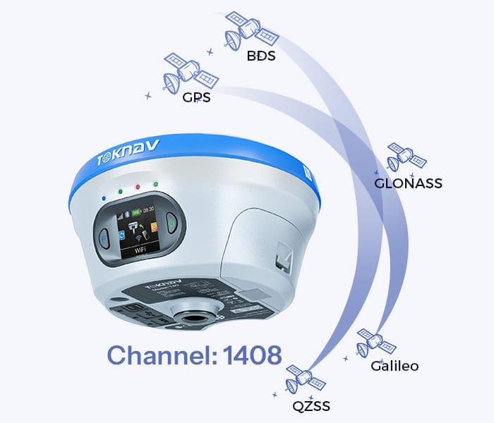
Home Toknav High Precision GNSS Receiver: Key Features of Professional RTK GNSS Receiver 2026-03-26 Toknav High Precision GNSS Receiver As your Toknav overseas distributor technical consultant, I work with surveyors, construction teams, precision agriculture operators, robotics engineers, and OEM manufacturers every day. One of the most common questions I answer is: What truly defines a reliable, high precision positioning solution? After years of field testing, real project deployment, and supporting customers across challenging environments—from dense urban canyons to remote farmlands and harsh construction sites—I can confirm: a professional high precision GNSS receiver delivers verified accuracy, stable signal tracking, rugged durability, and easy integration. In this guide, I will share the essential key features of a high-performance  high precision GNSS receiver, using 100% real datasheet specifications from Toknav’s flagship models: T10Pro, T20Pro, T30Pro, T40Pro, and tBase. These are the same performance details I use to advise my customers to choose the right positioning solution. Toknav High Precision GNSS Receiver:Full Constellation & Multi-Frequency Tracking (1408 Channels) Full Constellation & Multi-Frequency Tracking (1408 Channels) From my experience, the biggest reason standard GNSS receivers fail in challenging environments is limited satellite and frequency support. A true high precision GNSS receiver must track all global systems and multiple bands to minimize errors and maintain availability. All Toknav receivers come with a 1408-channel high-speed measurement engine, supporting GPS, BDS, GLONASS, Galileo, QZSS, SBAS, and NavIC. Multi frequency technology effectively cancels ionospheric delay, so your Toknav high precision GNSS receiver holds a fix even under trees, near tall buildings, or in open fields with low sky visibility. Verified Centimeter-Level RTK & Static AccuracyAccuracy is non negotiable—and it must be measurable, repeatable, and backed by real datasheet values. As your technical consultant, I only recommend products with published, reliable performance.Here are the official accuracy figures from Toknav’s datasheets:RTK Mode: Horizontal ±(8mm + 1ppm), Vertical ±(15mm + 1ppm)Static Survey: Horizontal ±(2.5mm + 1ppm), Vertical ±(5mm + 1ppm)These numbers apply to all  precision GNSS receiver models, ensuring surveying and machine control tasks meet strict professional standards. Surveyors from Tanzania are using a Toknav High Precision GNSS Receiver. IMU Tilt Compensation & AR Surveying (Field-Proven Efficiency)In real field work, holding the pole perfectly vertical all day is tiring and slow. That’s why I always recommend IMU integrated Toknav high precision GNSS receiver units to my customers.Toknav’s professional models support 60° tilt measurement with correction error <2cm and AR real scene stakeout (T30Pro / T40Pro). GNSS INS fusion ensures continuous positioning during short term signal blockages. From customer feedback, this feature greatly improves efficiency for users of Toknav  GNSS receiver. A surveyor using Toknav T30Pro with tilt measurement and AR stakeout screen. 4. Industrial Rugged Design & IP68 ProtectionField equipment must survive drops, rain, dust, and extreme temperatures. I have seen many receivers fail because they were not built for real working conditions. The Toknav high precision GNSS receiver is engineered for durability: IP68 waterproof and dustproof, magnesium alloy body, 1.5m drop resistance, and operating temperature from -30°C to +65°C. Whether used in mining, agriculture, or marine environments, the Toknav high precision GNSS receiver maintains stable performance in harsh conditions. Multi-Link Communication & Long-Range UHF Radio RTK positioning depends entirely on stable correction data. As a technical consultant, I always emphasize: communication = reliability. The Toknav GNSS receiver supports fully redundant links: 4G full network, Bluetooth 5.0, WiFi, and integrated UHF radio with open area range up to 16km (T20Pro). It also supports NTRIP, RTCM3.x, and mainstream industry protocols, keeping your Toknav high precision GNSS receiver connected anywhere on site. High Update Rate & Powerful Linux Platform For industrial control, machine control, and dynamic surveying, you need fast, smooth positioning output. The Toknav high precision GNSS receiver runs on ARM Cortex A7 1.8GHz processor with Linux OS, supports 20Hz high update rate, and provides 32GB storage for data logging. This stable platform makes the Toknav high precision GNSS receiver ideal for industrial automation and professional measurement applications. All-Day Battery Life & Hot-Swappable Design Nothing stops a job faster than a dead battery. Based on real field usage, I always confirm endurance before recommending a model. The Toknav high precision GNSS receiver offers outstanding battery performance: T10Pro 6500mAh (>18 hours), T30Pro 13800mAh (up to 48 hours), and T40Pro hot swappable battery for nonstop work. Users of Toknav GNSS receiver can work a full day without mid shift charging. RTK OEM GNSS Receiver Flexibility (For Manufacturers) Many of my partners are OEMs and integrators building industrial machines, agricultural equipment, and professional terminals. For them, the RTK OEM version of Toknav high precision GNSS receiver is the core component. It features compact module form factor, standard interfaces, raw data output, and full factory support. I help customers integrate the GNSS receiver quickly and reduce development time. My Final Recommendation (As Toknav Technical Consultant) If you are looking for a reliable positioning solution, Toknav high precision GNSS receiver stands out with verified accuracy, rugged design, strong communication, and field-proven efficiency. From my years of experience supporting global clients: Whether you need a portable rover, a reliable base station, or an embedded RTK OEM version, Toknav high precision GNSS receiver provides the stability and precision professional users demand. Ready to upgrade your positioning system?Visit: Explore Toknav Full GNSS Receiver Lineup → (https://www.toknav.com/gnss-receivers) Contact your local Toknav distributor for professional technical support and project solutions. 2026-03-26 Toknav High Precision GNSS Receiver

Toknav Hochpräzisions-GNSS-Empfänger: Die 7 wichtigsten Merkmale eines hervorragenden RTK-GNSS-Empfängers Weiterlesen »

T50 GNSS-Empfänger

Kompakter GNSS-Empfänger und OEM-Karte: Miniatur-Hochpräzisionsdesign

Startseite Kompakter GNSS-Empfänger & OEM-Platine: Hochpräzises Miniaturdesign 16.03.2026 Kompakter GNSS-Empfänger & OEM-Platine In der Präzisionsortungsbranche steigt die Nachfrage nach kompakten GNSS-Empfängern und leistungsstarken GNSS-OEM-Platinenlösungen rasant an. TOKNAV definiert kompakte Positionierung neu – mit ultrakleinen Formfaktoren, RTK-Leistung in Industriequalität, vollständiger Unterstützung mehrerer Konstellationen und vielseitigen Anschlussmöglichkeiten. Unsere hochpräzisen GNSS-Platinen und kompakten Empfänger bieten professionelle Präzision und ermöglichen Herstellern und Endnutzern eine platzsparende Positionierung auf höchstem Niveau. Kleiner Formfaktor, große Leistung Vorbei sind die Zeiten sperriger, hochpräziser GNSS-Geräte. Das kompakte Ökosystem von TOKNAV verbindet Miniaturisierung mit kompromissloser Leistung und integriert Positionierung auf Unternehmensniveau in Handgeräte, unbemannte Systeme und eingebettete Geräte. Das Flaggschiff T50 (Φ134 mm × 86 mm, ≤ 0,78 kg) bietet RTK-Genauigkeit im Zentimeterbereich, Satellitenverfolgung im gesamten System und intelligente Funktionen. Für OEMs beseitigt unsere GNSS-OEM-Platine Größenbeschränkungen und ermöglicht eine präzise Integration in Designs, bei denen es auf Millimeter ankommt. Anwendungsbeispiele für kompakte GNSS-Empfänger: Anwendungen in der Praxis: Die kompakten Lösungen von TOKNAV steigern die Effizienz in realen, hochkritischen Projekten branchenübergreifend: Stadtbau: Das städtische Team von Shanghai setzte den T50 für die Vermessung von Straßen und Brücken ein und verkürzte die Arbeitszeit vor Ort um 40% in beengten städtischen Räumen – dank IP68-Zertifizierung und Schutz vor Signalblockaden. Geologische Überwachung: Im Rahmen eines Erdrutschprojekts in Sichuan wurde die TOKNAV RTK-OEM-Karte in Mini-Terminals eingebaut, wodurch die Größe um 60% reduziert und die Akkulaufzeit für die unbeaufsichtigte Bergüberwachung auf über 30 Tage verlängert wurde. Intelligente Landwirtschaft: Ein OEM-Hersteller von Agrardrohnen aus Xinjiang integrierte unsere hochpräzise GNSS-Karte und steigerte den Ernteertrag um 15% durch zentimetergenaue Navigation für präzises Säen und Sprühen. Inspektion von Versorgungsnetzen: Ein Hersteller von Stromnetzen rüstete seine Handgeräte mit unseren kompakten Modulen auf und beschleunigte so die Inspektion von Bergmasten durch Neigungskompensation und zuverlässigen Fernsignalempfang. Ein Schritt vorwärts in der Mission von TOKNAV – Technische Vorteile der GNSS-OEM-Boards Die RTK-OEM-Boards und hochpräzisen GNSS-Boards von TOKNAV sind für eine nahtlose Integration ausgelegt und laufen auf einer Linux+ARM-Cortex-A7-Plattform, die effiziente Rechenleistung und skalierbare Funktionalität bietet. Das Modul mit 1.408 Kanälen unterstützt Signale aller Konstellationen (BDS/GPS/GLONASS/Galileo/QZSS/SBAS/NavIC) und gewährleistet so eine unterbrechungsfreie Positionsbestimmung in städtischen Schluchten, Wäldern und abgelegenen Gebieten. Die für den industriellen Einsatz geeignete Schutzklasse IP68, der Betriebsbereich von -30 °C bis +65 °C und vielseitige Konnektivitätsoptionen (4G/Bluetooth/WLAN/Funk) eignen sich für raue Umgebungen, während vorintegrierte Neigungskompensation, AR-Absteckung und Lasermessung die Entwicklungskosten für Hersteller senken. Ein Schritt vorwärts in der Mission von TOKNAV – Spezifikationen der hochpräzisen GNSS-Karte Präzision ist das Fundament unserer OEM-Karten mit branchenführenden Spezifikationen: RTK-Genauigkeit (horizontal: ±(8 mm + 1 ppm), vertikal: ±(15 mm + 1 ppm)); Genauigkeit im statischen Modus (horizontal: ±(2,5 mm + 1 ppm), vertikal: ±(5 mm + 1 ppm)); Wiedererfassung in <1 s, RTK-Initialisierung in <10 s und eine Positionsbestimmungsfrequenz von 20 Hz. Die ARM Cortex-A7/Linux-Hardware, 8 GB Speicher und ein 7,4-V-Akku mit 6500 mAh (über 16 Stunden Betriebszeit) sorgen für stabile Leistung. Das Gehäuse aus Magnesiumlegierung, die Fallfestigkeit bis zu 1,5 m und die Schutzart IP68 gewährleisten Zuverlässigkeit auch unter extremen Umgebungsbedingungen. Integrationsleitfaden für Gerätehersteller TOKNAV vereinfacht die Integration von hochpräzisen GNSS-Boards und kompakten Empfängern für Hersteller durch standardisierte Protokolle (NMEA-0183/RTCM3.X) und universelle Schnittstellen, die Kompatibilitätsbarrieren beseitigen. Der Prozess: Auswahl maßgeschneiderter Module → Nutzung der technischen Dokumentation zur Hardware-/Parameterkonfiguration → Aktivierung der Kernfunktionen. Unsere Linux-Plattform unterstützt die individuelle Anpassung und bietet dedizierten technischen Support für die Firmware-Einrichtung, Fehlerbehebung und Optimierung. Alle Ressourcen finden Sie auf unserer OEM-/Modul-Seite. TOKNAV-Modulpalette Unser Angebot deckt alle Anforderungen an hochpräzise Positionsbestimmung ab: den tragbaren Empfänger T50 für Vermessungen im Gelände sowie eine vielfältige Auswahl an GNSS-OEM-Platinen und RTK-OEM-Platinen in verschiedenen Formfaktoren und Leistungsklassen. Jedes Produkt erfüllt die Standards für Miniaturisierung, professionelle Genauigkeit, robuste Haltbarkeit und nahtlose Konnektivität und verfügt über ein elektronisches Zaunsystem zur Einhaltung regionaler Vorschriften sowie umfassenden Hersteller-Support für Updates und Wartung. Fazit & Aufruf zum Handeln Die kompakten GNSS-Empfänger und GNSS-OEM-Boards von TOKNAV verbinden Miniaturdesign mit leistungsstarker Technik und widerlegen damit den Mythos, dass geringe Größe mit Einbußen bei der Präzision einhergeht. Wir bieten RTK-Genauigkeit im Zentimeterbereich, Zuverlässigkeit durch Unterstützung mehrerer Konstellationen und industrielle Robustheit für Anwendungen mit begrenztem Platzangebot. Ob Sie nun im Außendienst tätig sind oder als OEM-Innovator arbeiten – TOKNAV bietet maßgeschneiderte Positionierungslösungen. Sind Sie bereit, Ihre Positionierungsfähigkeiten auf ein neues Niveau zu heben? Besuchen Sie unsere Produktseite, um unser Sortiment zu entdecken, technische Daten herunterzuladen und sich mit unserem Team bezüglich einer maßgeschneiderten Integration in Verbindung zu setzen – treiben Sie Ihre Innovation mit der kompakten, hochpräzisen GNSS-Exzellenz von TOKNAV voran.

Kompakter GNSS-Empfänger und OEM-Karte: Miniatur-Hochpräzisionsdesign Weiterlesen »

TOKNAV hydrographische Vermessungsgeräte im Feldeinsatz für präzise Gewässerkartierung 

TOKNAV Hydrographische Vermessungsgeräte :7 Wege zu mehr Erfolg bei der Kartierung

Startseite TOKNAV Hydrographische Vermessungsgeräte: Professionelle Lösungen für präzise Unterwasserkartierung 16.03.2026 Einleitung: Kernwert der hydrografischen Vermessung und der entsprechenden Ausrüstung Die hydrografische Vermessung ist ein unverzichtbarer Bereich der Geodatenwissenschaft, der sich auf die Kartierung von Unterwassermerkmalen konzentriert – darunter Wassertiefen, Meeresbodentopografie, unter Wasser liegende Hindernisse, Küstenlinien und Daten zur aquatischen Umwelt. Sie dient als grundlegende Säule für die sichere Schifffahrt, den Bau von Küsteninfrastruktur, den Offshore-Ingenieurbau, die Umweltüberwachung, Baggerarbeiten und die Erkundung mariner Ressourcen. Ohne präzise hydrografische Daten sind maritime Operationen mit erheblichen Risiken wie dem Auflaufen von Schiffen, strukturellen Schäden und Ineffizienz behaftet, weshalb zuverlässige hydrografische Vermessungsgeräte für moderne Wasserstraßen- und Meeresprojekte unverzichtbar sind.Im Gegensatz zur Landvermessung findet die hydrografische Vermessung in dynamischen aquatischen Umgebungen statt und erfordert robuste, hochpräzise Werkzeuge, die gegen Wassereinwirkung, Wellenbeeinträchtigungen und wechselnde Wasserbedingungen beständig sind. Die moderne hydrografische Vermessung hat sich von manueller, arbeitsintensiver Arbeit zu intelligenten automatisierten Systemen entwickelt, wobei die Kernausrüstung genaue Echtzeit-Daten zur Unterwasserkartierung liefert. Dieser Leitfaden stellt die wichtigsten Geräte für die hydrografische Vermessung vor, beschreibt die in USVs integrierten Lösungen Tboat10/Tboat20 von TOKNAV im Detail, erläutert die europäischen Vorschriften und führt durch den gesamten Projektablauf – alles mit Schwerpunkt auf professionellen, einsatzbereiten Geräten. Hydrografische Vermessungsgeräte von TOKNAV im Feldeinsatz für präzise Gewässerkartierung Wichtige Ausrüstung für die hydrografische Vermessung und TOKNAV-Anwendungen 1. USV für die Meeresvermessung: Die unbemannten Oberflächenfahrzeuge (USVs) der TOKNAV Tboat10- und Tboat20-Serie stellen einen Durchbruch in der hydrografischen Vermessung dar, da sie die Risiken bemannter Schiffe beseitigen und Effizienz, Flexibilität und Sicherheit steigern. Die Tboat10 und Tboat20 von TOKNAV sind speziell für Vermessungszwecke entwickelte Trägerfahrzeuge, die in seichten Gewässern, engen Kanälen, an gefährlichen Küsten und in abgelegenen Gebieten navigieren, die für bemannte Boote unzugänglich sind. Sie verfügen über eine robuste Bauweise, die auf professionelle Vermessungsarbeiten zugeschnitten ist. Das Tboat10 verfügt über einen leichten M-Rumpf aus Kohlefaser (7 kg Rumpf, 30 kg Gesamtgewicht) mit 35 kg Nutzlast, Kollisionsschutz und zwei im laufenden Betrieb austauschbaren Akkus. Es bietet eine Betriebsdauer von 7 Stunden bei niedriger Geschwindigkeit, eine Höchstgeschwindigkeit von 7 m/s und Stabilität bei Querströmungen von 4 m/s – ideal für kleine Vermessungen in flachen Gewässern. Das Tboat20 verfügt über einen robusten V-Rumpf aus Polyester, Carbonfaser und Kevlar (wasserdicht nach IP67, 40 kg Gesamtgewicht) mit einer Nutzlast von 50 kg, zwei 1100-W-Motoren und einer entsprechenden Betriebsdauer von 7 Stunden. Es wurde für große Offshore- und Küstenprojekte mit höherer Wellenbeständigkeit entwickelt.Beide Modelle unterstützen die Satellitenortung über mehrere Konstellationen (BDS, GPS, GLONASS, Galileo), Radar-Hindernisvermeidung, automatischen Rückwärtsgang in seichtem Wasser sowie die tSail-Steuerungssoftware zur Routenplanung. Sie senken Kraftstoff- und Arbeitskosten und ermöglichen unterbrechungsfreie Langzeitmissionen zur Erfassung konsistenter Daten für Hafen-, Fluss- und Offshore-Vermessungen, was sie zu zentralen Bestandteilen der hydrografischen Vermessung macht. 2. Echolot: Hochpräzise Tiefenmessung Das Echolot ist das wichtigste Instrument zur Tiefenmessung in der hydrografischen Vermessungsausrüstung und nutzt Schallwellen, um die Wassertiefe anhand der Reflexion am Meeresboden zu berechnen. In Kombination mit den USVs von TOKNAV liefert es branchenführende Präzision: 200 kHz Frequenz, 8° Strahlwinkel (Tboat10)/5°±1° (Tboat20), 0,15–200 m Erfassungsbereich, 8 mm Tiefenauflösung und eine Genauigkeit von ±1 cm + 0,11 TP3TD. Es filtert Umgebungsrauschen heraus, synchronisiert sich mit GNSS-Koordinaten, wird mit 9–28 V betrieben (Leistungsaufnahme 5–10 W) und arbeitet zuverlässig in trübem Wasser – ein unverzichtbarer Bestandteil der Ausrüstung. 3. GNSS-RTK-Empfänger: Kernkomponente für zentimetergenaue Positionsbestimmung Begleitbild 2: Schematische Darstellung des TOKNAV-GNSS-RTK-Empfängers mit Hervorhebung der beiden Antennen, des Satellitenempfangs und der differentiellen Verbindungen zur Basisstation; Bildunterschrift: “TOKNAV GNSS-RTK-Empfänger – Kernkomponente für die zentimetergenaue Positionsbestimmung bei hydrografischen Vermessungsgeräten” Die GNSS-RTK-Technologie ermöglicht eine zentimetergenaue Positionsbestimmung, die für die präzise Unterwasserkartierung entscheidend ist. Das integrierte RTK-System von TOKNAV übertrifft Standardempfänger und korrigiert Satelliten- und atmosphärische Fehler für eine stabile Positionsbestimmung in komplexen Gewässern. Es bietet eine RTK-Genauigkeit von ±8 mm (horizontal)/±15 mm (vertikal), einen schnellen Start in <30 s, eine Initialisierung in <5 s sowie zwei Antennen für einen stabilen Signalempfang in Bereichen mit eingeschränkter Sicht zum Himmel. Es verknüpft Tiefendaten mit präzisen Koordinaten und unterstützt so die normkonforme, hochgenaue hydrografische Kartierung. TOKNAV GNSS-RTK-Empfänger – zentimetergenauer Positionierungskern für hydrografische Vermessungsgeräte Stellen Sie ein professionelles hydrografisches Vermessungsset zusammen Stellen Sie ein maßgeschneidertes Set zusammen, indem Sie die Ausrüstung an den Projektumfang und die Umgebung anpassen: Wählen Sie Tboat10 für kleine Vermessungen im Binnenland, Tboat20 für große Offshore-Projekte. Integrieren Sie werkseitig kalibrierte Echolote und RTK-Empfänger für nahtlose Kompatibilität, fügen Sie 4G/2,4-GHz-Kommunikationsmodule, langlebige externe Akkus und IP67-Gehäuse für raue Umgebungsbedingungen hinzu. Das Plug-and-Play-Design von TOKNAV vereinfacht die Inbetriebnahme, und die spezielle Software wandelt Rohdaten in verwertbare Karten und 3D-Modelle um, wodurch Kompatibilitätsprobleme beseitigt und die Effizienz gesteigert werden. Vollständige Montageanleitung für das TOKNAV-Ausrüstungsset zur hydrografischen Vermessung Integrierte Lösungen von TOKNAV für hydrografische Vermessungen Integrierte Lösung von TOKNAV für hydrografische Vermessungen für praktische Gewässerkartierungsprojekte TOKNAV bietet vollständig integrierte Plug-and-Play-Lösungen für hydrografische Vermessungen, die USVs, Echolote und RTK-Empfänger in einem einheitlichen Arbeitsablauf vereinen. Die vorkalibrierten und vorkonfigurierten Systeme verkürzen die Einsatzzeit und senken die Schulungskosten – dank intelligenter Funktionen wie One-Touch-Steuerung und Hot-Swap-Akkus für einen unterbrechungsfreien Betrieb. Die Geräte von TOKNAV entsprechen globalen Standards und werden durch professionellen Support unterstützt. Sie helfen Teams dabei, hochwertige und normkonforme Daten effizient zu liefern, was sie zu einer bewährten Wahl für Vermessungsprofis weltweit macht. Europäische Konformität und Normen Europäische hydrografische Projekte unterliegen den strengen bathymetrischen IHO-S-44-Normen, den EU-Vorschriften zur Sicherheit im Seeverkehr sowie Umweltrichtlinien, die eine zentimetergenaue Positionierung, hochauflösende Messungen und ein umweltfreundliches Design erfordern. Die hydrografischen Vermessungsgeräte von TOKNAV erfüllen und übertreffen diese Standards: RTK-Empfänger weisen zertifizierte Präzision auf, Echolote durchlaufen strenge Kalibrierungen, und die Tboat-USVs zeichnen sich durch Wasserdichtigkeit nach IP67, geringe Geräuschentwicklung und umweltfreundliche Materialien aus. Die vollständige Konformität gewährleistet eine reibungslose Projektgenehmigung und vermeidet kostspielige Nacharbeiten bei europäischen Vermessungen. Kompletter Arbeitsablauf für hydrografische Vermessungen 1. Planung vor der Vermessung: Projektumfang, Vermessungsgebiet und Genauigkeitsanforderungen definieren; hydrografische Vermessungsgeräte von TOKNAV auswählen (Tboat10 für kleine Projekte, Tboat20 für groß angelegte Projekte); GNSS-RTK und Echolot kalibrieren; USV-Routen über die tSail-Software programmieren. 2. Einsatz vor Ort und Datenerfassung: Zu Wasser lassen des TOKNAV-USV, Aktivieren des autonomen Modus; Erfassen von Echtzeit-Tiefendaten mittels Echolot und RTK-Positionierung; Überwachen des Betriebs über eine 360°-Nachtsichtkamera und eine Fernsteuerung (1200-nit-Display, auch bei Sonneneinstrahlung gut lesbar). 3. Datenverarbeitung und -validierung: Übertragung der Rohdaten in die TOKNAV-Software; Filterung von Störsignalen, Korrektur der Gezeitenstände und Integration der Datensätze; Validierung gemäß IHO S-44 und EU-Standards, um die Konformität der Daten der hydrografischen Vermessungsausrüstung sicherzustellen. 4. Berichterstellung und Ergebnisse: Erstellen Sie hochpräzise hydrografische Karten, 3D-Meeresbodenmodelle und Tiefenkonturkarten; erstellen Sie Konformitätsberichte und Projektdokumentation zur Vorlage beim Kunden. TOKNAV-Projektablauf für hydrografische Vermessungen mit professioneller Ausrüstung – Fazit Hochleistungsfähige hydrografische Vermessungsausrüstung ist das Rückgrat präziser Unterwasserkartierung, und die integrierten USV-, Echolot- und RTK-Lösungen von TOKNAV setzen den Branchenmaßstab. Mit zuverlässigen technischen Daten, robuster Bauweise und EU-konformem Design erhöht diese Ausrüstung die Sicherheit, senkt die Kosten und gewährleistet eine konsistente Datenerfassung für alle aquatischen Projekte. Erweitern Sie Ihr Vermessungs-Toolkit mit den praxiserprobten Lösungen von TOKNAV – besuchen Sie unsere Lösungsseite, um die Tboat-Serie zu entdecken, ein Angebot anzufordern oder sich beraten zu lassen

TOKNAV Hydrographische Vermessungsgeräte :7 Wege zu mehr Erfolg bei der Kartierung Weiterlesen »

Leistungsstarkes unbemanntes Vermessungsboot: 70% Schnellere hydrographische Vermessung mit USV

Home Unmanned Survey Boat: Efficient Hydrographic Survey with USV 2026-03-14 Unmanned Survey Boat: Efficient Hydrographic Survey with USV Hydrographic surveying is the core foundation of marine engineering, water conservancy construction, port operation and environmental monitoring, but traditional manual survey methods have long restricted industry efficiency. Manual small vessel surveying exposes staff to extreme weather, rough water and shallow reef risks, with a 30% higher safety hazard rate in complex waters; manual operation efficiency is only 1/4 of unmanned equipment, and labor, vessel maintenance and depreciation costs account for over 60% of the total project budget. Meanwhile, large manual vessels cannot access waters shallower than 0.5m, leaving 20%-35% of key survey areas uncovered. Nowadays, unmanned survey boats have become the optimal replacement for manual methods, and TOKNAV’s hydrographic survey USV relies on high-precision performance and intelligent design, becoming the first choice for efficient marine and inland water survey projects. Core Advantages of Unmanned Survey Boats Compared with manual hydrographic survey, marine USV for survey has four irreplaceable core advantages, solving industry pain points with data-backed efficiency and safety: 1. Zero On-Site Risk, 100% Personnel Safety Unmanned survey boats realize full remote control, keeping surveyors ashore to avoid drowning, capsizing and collision risks. Even in level 5 wind offshore waters or narrow inland tributaries, the USV can complete tasks independently, reducing safety accidents to zero and cutting equipment loss caused by misoperation by 90%. 2. 70% Higher Efficiency, Shortened Project Cycle TOKNAV unmanned survey boats support 6-7 hours of continuous operation at 1.5m/s economical speed, with a maximum speed of 7m/s. Equipped with intelligent route planning, it covers 15km² water areas in 8 hours, completing manual 5-day tasks in 1.5 days, improving overall survey efficiency by over 70% and compressing project cycles effectively. 3. 40% Cost Reduction, Optimized Budget Traditional manual survey needs professional vessels and full-time crews, with annual maintenance costs exceeding $8000. TOKNAV USV features low power consumption and minimal maintenance, eliminating labor costs and reducing vessel depreciation, cutting total survey costs by over 40% for long-term projects without sacrificing data accuracy. 4. Ultra-Shallow Draft, Full-Coverage Survey Manual vessels fail to navigate waters shallower than 0.5m, while TOKNAV Tboat10 has an 8.5cm ultra-shallow draft, Tboat20 a 10cm draft, smoothly accessing shallow lakes, tidal flats and port shallow areas. It realizes 100% full-coverage survey, eliminating blind spots in restricted water environments. High-Precision Positioning: USV + GNSS RTK Working Principle High-precision hydrographic survey relies on centimeter-level positioning, and TOKNAV unmanned survey boat integrates advanced GNSS RTK technology to lock data accuracy. The USV is equipped with dual multi-frequency GNSS antennas, supporting BDS, GPS, GLONASS and GALILEO full-system tracking, with RTK horizontal accuracy of ±8mm +1ppm and vertical accuracy of ±15mm +1ppm. Paired with 0.01m resolution echo sounders, the USV synchronizes positioning and underwater topographic data in real time, collecting 120 sets of data per second. Even in signal-shielded bridge areas, the built-in inertial navigation maintains stable operation, ensuring continuous and reliable data output for high-precision survey reports. TOKNAV Unmanned Survey Boat: Core Technical Features TOKNAV Tboat10 and Tboat20 series hydrographic survey USV are tailored for survey scenarios, with hard-core data to support efficient work: Tboat10 adopts carbon fiber hull with 35kg payload, Tboat20 uses composite hull with 50kg payload and IP67 waterproof rating; dual lithium batteries support hot-swap, 3 hours at 2m/s and 7 hours at 1.5m/s endurance; 0.1-20m radar obstacle avoidance, tSail software supports one-key route planning and homing, realizing easy intelligent operation. Image Caption: TOKNAV USV Core Parameter & Hull Structure Detail Display – Present the close-up of the USV reinforced hull, anti-collision strips and battery compartment, and list key technical parameters in a visual form for quick reading. Wide Applications of TOKNAV Marine USV for Survey TOKNAV unmanned survey boats adapt to diversified survey scenarios, covering core industry demands with practical performance: Dredging Survey: Monitor water depth changes before and after dredging, control error within ±0.02m, ensure construction compliance; Lake & Reservoir Survey: Conduct topographic and sedimentation survey for 10km²+ water areas, support long-term ecological monitoring; Port & Waterway Monitoring: Daily channel patrol, obstacle detection, guarantee 24/7 navigation safety; Underwater Terrain Mapping: Cooperate with sonar equipment to draw high-precision underwater topographic maps for engineering construction. Practical Case: Inland River Hydrographic Survey A water conservancy bureau needed to survey a 15km² inland river with 0.1-0.3m shallow sections. Manual vessels couldn’t access shallow areas, and the 5-day planned cycle was tight. After deploying TOKNAV Tboat10, the 8.5cm draft navigated all waters smoothly; the USV operated continuously for 6 hours, collecting 50000+ valid data sets with centimeter-level accuracy. The project was completed in 1.5 days, with 100% coverage and zero safety risks, providing reliable data for river management. Conclusion & Call to Action Unmanned survey boats have revolutionized hydrographic surveying, replacing manual methods with safety, efficiency and cost advantages. TOKNAV unmanned survey boat series integrates high-precision positioning, intelligent control and strong adaptability, meeting all-round demands of marine and inland water survey. For dredging, lake survey, port monitoring and other projects, TOKNAV USV delivers efficient and accurate survey services. Explore more models: Check Out TOKNAV USV Series TBoat10 Unmanned Surface Vehicle.PDF TBoat20 Unmanned Surface Vehicle.PDF Contact TOKNAV now to upgrade your survey workflow, and enjoy smarter, more precise hydrographic survey solutions! Send an Inquiry

Leistungsstarkes unbemanntes Vermessungsboot: 70% Schnellere hydrographische Vermessung mit USV Weiterlesen »

Werden Sie TOKNAV-Vertriebspartner weltweit!

Mit einer bewährten Erfolgsbilanz in der Vermessungsbranche suchen wir jetzt nach leidenschaftlichen Vertriebsmitarbeitern, die an unserer globalen Erfolgsgeschichte teilhaben möchten.