jeffreyrtk@gmail.com

مرحبًا، أنا جيفري، ممول موقع toknavgnss.com، أدير مصنعًا في الصين يصنع GNSS RTK منذ 8 سنوات حتى الآن، والغرض من هذا المقال هو مشاركتكم المعرفة المتعلقة بنظام GNSS من منظور المورد الصيني.

TOKNAV 1a3f47bf68f65704832db732d45c8272
TOKNAV TCA920 GNSS antenna for CORS reference station projects

GNSS Antenna Selection Guide for RTK, CORS and Monitoring

Antenna Selection GNSS Antenna Selection Guide for RTK, CORS and Monitoring The GNSS antenna is a critical part of RTK rover, base station, CORS, VRS and deformation monitoring projects. Use this guide to compare signal support, installation environment, multipath risk, mounting, cable length and receiver compatibility. Request antenna support View GNSS antennas Author: TOKNAV GNSS Solution Team Reviewed by: TOKNAV Product and Field Application Team Last Updated: July 2026 Download the GNSS Antenna PDF Checklist Get a printable antenna selection checklist for receiver compatibility, signal support, mounting, multipath risk, cable planning and fixed-station installation. Name Company Email Country Project note Website Send me the PDF checklist By submitting, you agree that TOKNAV can contact you about this resource and related project support. A receiver can only work with the signal quality it receives. In open field RTK, the antenna choice affects setup stability and repeatability. In CORS, VRS and deformation monitoring projects, antenna installation can affect long-term data quality, multipath behavior and maintenance risk. This guide helps buyers compare antennas for projects using TOKNAV GNSS receivers, CORS receivers such as NET660i, base station workflows and reference station antennas such as TCA920. 1. Match the Antenna to the Application Application Antenna priority Related page RTK rover surveying Portable installation, stable signal reception, compatibility with receiver workflow. GNSS Receiver Local RTK base station Clear sky view, stable mount, cable plan and signal reliability for the project area. VRS vs RTK Base Station CORS or VRS station Permanent mounting, multipath suppression, weather exposure, grounding and maintenance access. CORS Station Checklist Deformation monitoring Stable installation, repeatable signal environment, protected cable routing and reliable data continuity. Monitoring Guide 2. Check Signal, Mounting and Multipath Conditions Signal requirements Confirm receiver model and supported constellations/frequencies. Confirm whether the project needs RTK, CORS, VRS, monitoring or mixed use. Check whether future receiver upgrades should be supported. Installation environment Open sky visibility and possible obstructions. Nearby metal, walls, water, machinery or reflective surfaces. Wind, rain, dust, cable exposure and maintenance access. Cable and accessory plan Cable length, connector type and protection method. Mounting pole, monument, enclosure and grounding. Lightning protection and service replacement plan. 3. When to Consider a Choke Ring Antenna Choke ring antennas are commonly considered for fixed reference station, CORS, VRS and high-precision monitoring projects because they are designed to help reduce multipath effects in demanding installation environments. Consider a choke ring antenna such as TCA920 when the project involves a permanent or semi-permanent station, high-value correction data, long-term observation, or an environment where reflected signals may affect data quality. TCA920 is a relevant option for fixed reference station, CORS, VRS and monitoring projects where multipath control and stable signal reception are important. 4. Information to Send for Antenna Recommendation Receiver model and project type. Country, installation environment and site photos. Mounting method, cable length and enclosure requirements. Required signals, data workflow and accuracy target. Whether the antenna is for rover, base station, CORS, VRS or monitoring use. Internal Planning Links Download antenna PDFs View GNSS case studies Plan VRS infrastructure Ask TOKNAV for antenna selection FAQ: GNSS Antenna Selection Is the antenna as important as the GNSS receiver? Yes. The antenna affects the signal quality received by the system, especially in reference station, CORS, VRS and monitoring projects where long-term stability matters. When should I use TCA920? TCA920 is a relevant option to evaluate for reference station, CORS, VRS and monitoring installations where multipath suppression and stable receiving performance are important. What information is needed to recommend an antenna? Send the receiver model, project type, installation photos, mounting method, cable length, required signals and accuracy target. Can one antenna fit all projects? No. Rover, base station, CORS and monitoring projects have different installation and signal requirements. The antenna should match the workflow and environment. Request GNSS Antenna Selection Support Send your receiver model, project type, site photos, cable plan and required signals. TOKNAV can help compare antenna and accessory options for your GNSS workflow. Contact TOKNAV View TCA920

GNSS Antenna Selection Guide for RTK, CORS and Monitoring قراءة المزيد »

GNSS Deformation Monitoring Guide for Dams, Slopes, Mines and Bridges

Monitoring Guide GNSS Deformation Monitoring Guide for Dams, Slopes, Mines and Bridges This guide helps project owners, monitoring integrators and survey teams define a GNSS deformation monitoring project before choosing receivers, antennas, communication, power and reporting workflows. Request monitoring plan View monitoring solution Author: TOKNAV GNSS Solution Team Reviewed by: TOKNAV Product and Field Application Team Last Updated: July 2026 Download the GNSS Monitoring PDF Checklist Get a printable deformation monitoring checklist for point layout, reference points, accuracy targets, power, communication, reporting and quotation preparation. Name Company Email Country Project note Website Send me the PDF checklist By submitting, you agree that TOKNAV can contact you about this resource and related project support. GNSS deformation monitoring is used when a project needs continuous or repeated observation of movement trends. It can support dams, slopes, mines, bridges, buildings, tailings reservoirs and construction sites where small displacement changes matter for engineering judgment and risk management. A successful monitoring project starts before hardware selection. Teams should first define the object, monitoring points, reference point, required accuracy, data interval, power supply, communication and reporting workflow. Then they can compare NET660i, GNSS antennas, U6 monitoring devices and related solution components. Monitoring proposals should connect field conditions, point layout, receiver and antenna planning, data workflow and reporting needs. 1. Define the Monitoring Objective Object type Dam, reservoir or water infrastructure. Slope, landslide, mine or tailings site. Bridge, building or construction structure. Long-term reference or infrastructure monitoring network. Movement question Is the object stable or moving? Which direction and rate matter? What threshold needs attention? Who receives reports or alerts? Project constraints Power supply and weather exposure. Communication coverage and data access. Installation safety and maintenance access. Budget, phase plan and expansion needs. 2. Plan Monitoring Points and Reference Points Monitoring points should represent the critical movement zones. Reference points should be stable enough to support comparison and trend evaluation. Before requesting a proposal, prepare a simple point map with photos, approximate coordinates and installation notes. Mark each monitoring point and explain why it matters. Identify at least one suitable reference point or reference station concept. Record sky visibility and possible obstructions near each point. Confirm mounting surface, cable route, enclosure and maintenance access. Separate required accuracy from reporting frequency; both affect system design. 3. Choose Receiver, Antenna and Communication Components Project need Design question Related TOKNAV path Stable GNSS data Does the point need permanent high-precision GNSS observation? NET660i or appropriate GNSS receiver planning Signal quality Is the antenna installed near structures, slopes, water or reflective surfaces? GNSS Antenna Selection Guide Reference workflow Will the project use local base, CORS, VRS or another correction source? CORS Station Setup Checklist Data and alerts What data interval, reporting output and warning workflow are required? GNSS Deformation Monitoring Solution 4. Monitoring Project Checklist Send these details to TOKNAV Country, project type and monitored object. Number of monitoring points and reference points. Required accuracy, data interval and reporting frequency. Site photos, approximate layout and installation constraints. Power source, communication method and maintenance access. Do not leave these undefined Whether exact alarm thresholds are required. Who owns installation, maintenance and data review. How long data must be stored and exported. Whether the system must expand to more points later. Which claims can be publicly used in a case study. Related Case and Resource Links GNSS Monitoring Case Studies Download monitoring resources Compare GNSS receivers VRS and CORS infrastructure FAQ: GNSS Deformation Monitoring What sites can use GNSS deformation monitoring? GNSS deformation monitoring can support dams, slopes, mines, bridges, buildings, tailings reservoirs and other sites where long-term movement trends must be observed. How many monitoring points are needed? The number depends on the monitored object, risk zones, required resolution and reporting plan. A simple point map helps TOKNAV recommend a practical configuration. Can monitoring use CORS or VRS infrastructure? Some monitoring projects can connect with reference station, CORS or VRS workflows. The best design depends on site layout, accuracy target and communication conditions. What information is needed before quotation? Prepare country, object type, point quantity, accuracy target, data interval, power supply, communication method, site photos and reporting requirements. Request a GNSS Monitoring Solution Plan Share your monitoring object, point quantity, country, site photos, data interval and accuracy target. TOKNAV can help prepare a receiver, antenna, communication and reporting configuration. Contact TOKNAV View case studies

GNSS Deformation Monitoring Guide for Dams, Slopes, Mines and Bridges قراءة المزيد »

TOKNAV CORS and VRS reference station network workflow

CORS Station Setup Checklist for GNSS Reference Networks

CORS / Reference Station CORS Station Setup Checklist for GNSS Reference Networks Use this checklist when planning a GNSS CORS station, VRS reference network or permanent RTK correction site. It covers the site, receiver, antenna, power, communication, testing and maintenance details that should be confirmed before quotation and installation. Request CORS configuration View VRS Solution Author: TOKNAV GNSS Solution Team Reviewed by: TOKNAV Product and Field Application Team Last Updated: July 2026 Download the CORS/VRS PDF Checklist Get a printable CORS and VRS station planning checklist for site selection, receiver and antenna choice, power, communication, testing and maintenance handover. Name Company Email Country Project note Website Send me the PDF checklist By submitting, you agree that TOKNAV can contact you about this resource and related project support. A good CORS station is not only a receiver on a roof. For reliable network RTK, VRS, monitoring or reference-station operation, the project team must control the station environment, antenna installation, data communication, power continuity and maintenance workflow. This checklist is written for survey organizations, distributors, system integrators and infrastructure owners comparing products such as NET660i, NET660, tBase and TCA920. NET660i is a compact starting point for CORS, reference station and augmentation-system planning. NET660 supports reference station infrastructure where stable GNSS data output and network workflow matter. 1. Confirm the CORS Station Purpose Project role Single permanent reference station for local RTK users. Multi-station CORS network for city or regional correction coverage. VRS network RTK service for multiple rover users. Reference data source for monitoring, agriculture or machine control. Buyer inputs to collect Country or region, coverage area and expected rover users. Station quantity and whether the network will expand later. Expected correction method, data format and service workflow. Target applications: surveying, construction, monitoring, agriculture or mixed use. 2. Select a Stable Station Site Site selection is the first technical filter. A receiver with strong tracking still needs an installation point with clear sky visibility and a stable monument or mounting structure. Choose a location with open sky view and limited obstruction above the antenna. Avoid reflective surfaces, metal structures, walls, large machinery and high-voltage interference where possible. Confirm that the mounting point is stable and not affected by vibration or building movement. Check access for maintenance, cable routing, grounding and weather protection. Document the site with photos, coordinates, elevation, nearby obstacles and planned cable length. 3. Choose Receiver and Antenna Configuration Component Selection question TOKNAV starting point CORS receiver Does the project need permanent reference station operation, network communication and stable GNSS data output? NET660i or NET660 Base station receiver Is this a local base-rover workflow rather than a permanent CORS network? tBase GNSS antenna Does the site need multipath suppression and stable reference station signal reception? TCA920 or another suitable TOKNAV GNSS antenna Accessories What cable, mounting, lightning protection, enclosure and power accessories are required? Resource Center and project recommendation 4. Power, Communication and Data Workflow Checklist Power Main AC or DC power source. Backup power or UPS requirement. Grounding and lightning protection plan. Power stability during storms, outages or remote operation. Communication Ethernet, cellular, WiFi or other data link availability. Static IP, server access or Ntrip workflow requirements. SIM card, router, antenna and signal strength if cellular is used. Remote management and troubleshooting access. Data Required data format and correction service workflow. Sampling rate and storage requirements. Monitoring dashboard or control center needs. Rover user access and account management plan. 5. Installation Acceptance Checklist Receiver firmware, settings, station name and coordinates are documented. Antenna mounting is stable, level, protected and photographed. Cables are weather protected, labeled and routed safely. Power supply and backup plan are tested. Communication uptime is tested under normal operating conditions. Correction data output is checked with a rover or downstream workflow. Station logs, photos and maintenance notes are stored for handover. Internal Planning Links VRS vs RTK Base Station GNSS Antenna Selection Guide Compare GNSS Receivers View Case Studies FAQ: CORS Station Setup Which receiver should I start with for a CORS station? NET660i and NET660 are relevant starting points for CORS and reference station projects. The final selection should confirm station role, communication, data output and environment. Does a CORS station need a choke ring antenna? Many reference station projects benefit from an antenna designed for stable signal reception and multipath suppression. TCA920 is one TOKNAV option to evaluate for this role. What details should I send before asking for a quote? Send country, coverage area, station count, installation photos, power condition, communication plan, receiver preference, antenna environment and expected rover users. How is this different from a local RTK base station? A local RTK base station usually supports one project or jobsite. A CORS or VRS network is planned for permanent reference data, broader coverage and multiple users. Request CORS Station Configuration Support Send your country, station quantity, coverage target, antenna environment, power condition and communication plan. TOKNAV can help compare receiver, antenna and accessory options. Contact TOKNAV Download resources

CORS Station Setup Checklist for GNSS Reference Networks قراءة المزيد »

TOKNAV CORS and VRS reference station network workflow

VRS vs RTK Base Station: Which Correction Method Fits Your Project?

GNSS Correction Guide VRS vs RTK Base Station: Which Correction Method Fits Your Project? Compare VRS network RTK and local RTK base station workflows for surveying, CORS, monitoring and construction projects, with practical product paths for NET660i, NET660, tBase and GNSS antennas. Discuss CORS/VRS Project Download GNSS resources Author: TOKNAV GNSS Solution Team. Reviewed by TOKNAV Product and Field Application Team. Last updated: July 2026. When a surveying team, construction contractor, CORS operator or system integrator plans a high-precision GNSS project, one of the first questions is simple but important: should the project use a local RTK base station or a VRS network RTK workflow? Both methods can support centimeter-level positioning when designed and operated correctly, but they are not the same. A local RTK base station is often practical for a single jobsite or short-term project. A VRS network is better suited to wider-area correction coverage, shared rover users and long-term infrastructure. Local RTK base workflows usually start with one base receiver and one or more rover receivers. VRS and CORS workflows use multiple reference stations and correction distribution for wider coverage. What Is a Local RTK Base Station? A local RTK base station is a GNSS receiver installed at a known point. It sends correction data to one or more rover receivers by radio, network connection or another supported data link. The rover uses the correction data to improve positioning accuracy for field work. Common Applications Construction layout and stakeout. Topographic survey on a defined project site. Field work where public or private network RTK coverage is unavailable. Short-term survey projects that need local control. Dealer demonstration kits and training workflows. TOKNAV Product Path TOKNAV tBase can support base-rover workflows, while RTK rovers such as T50Pro, T40Pro, T20Pro and T10Pro can be selected according to field needs. What Is a VRS Network RTK Workflow? A VRS network RTK workflow uses multiple reference stations and network correction processing to support rover users across a wider planned area. Instead of relying on one local base station for one project area, the network collects data from several reference stations and provides corrections through a correction service workflow. Best-Fit Projects Regional or city-level correction coverage. Multiple rover users working in different locations. Stable infrastructure for surveying, monitoring, agriculture or machine positioning. A correction service managed by an organization, distributor, agency or system integrator. Long-term operation rather than one short field job. TOKNAV Product Path TOKNAV VRS Solution connects CORS/reference station receivers, GNSS antennas, data communication and project planning support for this kind of infrastructure. Quick Comparison: VRS Network RTK vs Local RTK Base Decision factor Local RTK base station VRS network RTK Best fit One jobsite, one team or short-term project area. Wider-area correction coverage with multiple users or long-term operation. Infrastructure One base receiver, rover receivers and data link. Multiple reference stations, antennas, communication and correction service workflow. Setup complexity Lower. Good for project teams that need fast field deployment. Higher. Requires planning for station locations, communications, server/workflow and maintenance. Scalability Limited to local project needs and data-link condition. Better for many rover users and larger coverage areas. Typical TOKNAV products tBase with RTK rover receivers such as T20Pro, T10Pro, T40Pro or T50Pro. NET660, NET660i, TCA-series antennas such as TCA920 and VRS/CORS project support. When Should You Choose Each Method? Choose a Local RTK Base Station When The project is limited to one site. The work period is temporary. Network RTK coverage is weak or unavailable. The team needs direct control over the correction source. The buyer wants a package that is easier to train and deploy. Choose VRS or CORS Infrastructure When Many users need correction access across a planned region. The project needs long-term reference station operation. Correction data must be distributed by network workflows such as Ntrip. The solution may support surveying, monitoring, agriculture or machine control together. The buyer is building a correction service or infrastructure system. Questions to Answer Before Requesting a Quote For a Local RTK Base Station Package What is the application: surveying, construction, road, GIS or training? How large is the project area? Will correction data use radio, network or another link? How many rover receivers are needed? What battery, controller, software and accessory needs should be included? For a VRS or CORS Project Which country or region needs coverage? How many reference stations are planned? What are the station installation environments? What antenna type and mounting conditions are expected? How will data communication, power supply and server workflow be handled? Recommended TOKNAV Product Paths Project need Recommended starting point Next action RTK surveying with local correction tBase plus RTK rover receivers. Request a base-rover package recommendation. CORS or VRS infrastructure NET660i, NET660 and suitable antennas. Share station count and coverage plan. Reference station antenna selection TCA920 or another TOKNAV GNSS antenna. Send receiver model, mounting environment and required signals. Monitoring and long-term infrastructure GNSS Deformation Monitoring with receiver and antenna planning. Send monitoring point quantity, site condition and data interval needs. Next Planning Resources After comparing VRS network RTK and a local RTK base station, use these resources to move from correction method selection to station design, antenna selection, proof review and inquiry preparation. CORS Station Setup Checklist GNSS Antenna Selection Guide GNSS Deformation Monitoring Guide TOKNAV Case Studies Resource Center Contact TOKNAV FAQ: VRS vs RTK Base Station Is VRS always better than a local RTK base station? No. VRS is better for wider-area network correction coverage and many users, while a local RTK base station can be simpler and more practical for one project site or a temporary field job. Which TOKNAV receiver should be used for CORS or VRS projects? NET660 and NET660i are relevant starting points for CORS and reference station projects. The final choice should be confirmed by station design, data link, antenna environment and project requirements. Which TOKNAV receiver should be used as a local base station? tBase is a practical starting point for base-rover RTK workflows. Pair it with suitable TOKNAV rover receivers according

VRS vs RTK Base Station: Which Correction Method Fits Your Project? قراءة المزيد »

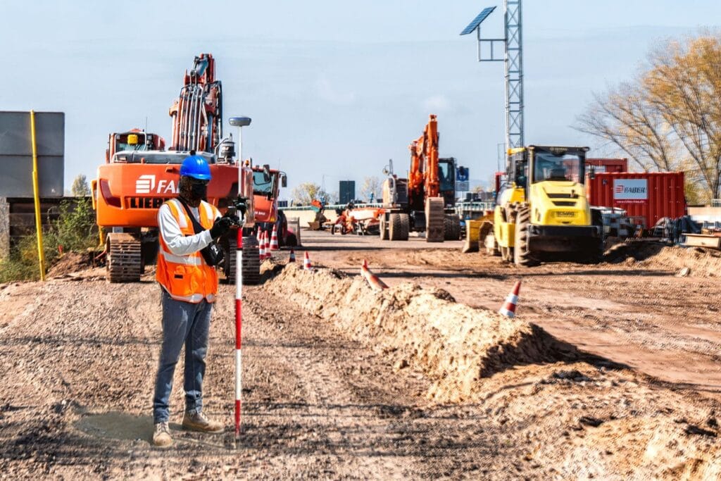
TOKNAV GNSS field application case study

TOKNAV Case Studies

Case Studies TOKNAV GNSS Case Studies: CORS, Monitoring, USV and Robots Real-world and publicly usable TOKNAV application stories for CORS/VRS planning, deformation monitoring, sports field marking robots, hydrographic survey, agriculture and machine control. Each case summarizes the country or buyer context, equipment, workflow, buyer result and next step for similar projects. Request a similar solution View resource center Customer names are kept anonymous unless already approved for public use. Where a public customer name or exact site is not approved, the case is presented as an application case with buyer context, equipment path and verifiable planning outcome instead of invented names or unsupported claims. Priority Application Cases France: RTK Base-Rover Road Resurvey Country: France Industry: Road surveying and engineering resurvey Equipment: TOKNAV GNSS base-rover kit, RTK rover workflow, UHF plus 4G fallback communication Challenge: A rural road resurvey team faced a tight deadline, mixed open farmland and tree-lined sections, and unstable cellular coverage. Workflow: The team set a fixed base station on a certified control point with open sky view, then used UHF where cellular coverage was weak and 4G fallback across open sections. Result: The team achieved consistent centimeter-level accuracy, avoided rework and finished the 12 km road project two days ahead of schedule. Read the source application story Philippines: Tboat USV Hydrographic Survey and Monitoring Country: Philippines Industry: Hydrographic survey, bathymetry and water quality monitoring Equipment: Tboat10, Tboat20, RTK positioning, echo sounder and water-quality payload options Challenge: Local teams needed safer and more repeatable water survey workflows for coastal shallow water, rivers and remote island conditions. Workflow: Tboat USVs supported automatic route planning, real-time video/data feedback, RTK positioning and flexible payload integration for survey and monitoring tasks. Result: Philippine users reported stable field performance, accurate depth data, easier transport and lower manual risk compared with traditional boat-based workflows. Read the source application story RTK and GNSS field cases should connect product setup, communication method and measurable project result. Monitoring and infrastructure cases should document site condition, point layout, data workflow and reporting needs. CORS/VRS Infrastructure: Reference Station Planning Case Country: Project country to be confirmed by buyer Industry: CORS, VRS, reference station and network RTK infrastructure Equipment: NET660, NET660i, tBase, TCA920 and station accessories Challenge: Buyers often request a CORS/VRS quote before confirming station count, antenna environment, communication, power and expected rover users. Workflow: TOKNAV first collects country, coverage area, station quantity, receiver preference, antenna environment and data communication plan. Result: A clearer station plan helps the buyer compare receiver, antenna, server/workflow and maintenance requirements before procurement. Use the CORS station setup checklist Deformation Monitoring: Dam, Slope and Infrastructure Planning Case Country: Buyer-defined infrastructure site Industry: GNSS deformation monitoring for dams, slopes, mines, bridges and buildings Equipment: NET660i, TCA920, monitoring devices, power and communication components Challenge: Monitoring buyers need to define point quantity, reference points, accuracy target, data interval, power, communication and alert workflow before hardware selection. Workflow: TOKNAV uses a project intake checklist to connect site photos, point layout and reporting requirements with receiver, antenna and communication planning. Result: The buyer can move from a broad monitoring request to a clearer bill of materials and integration discussion. Use the monitoring planning guide Sports Field Marking Robot: Soccer and Multi-Sport Venue Case Country: Venue or contractor market to be confirmed by buyer Industry: Sports facility construction, campus maintenance and field line marking Equipment: TR10Pro sports field marking robot with GNSS/RTK positioning and digital field templates Challenge: Venues and contractors need repeatable soccer, football, lacrosse, baseball and custom training layouts with less manual measuring and rework. Workflow: Operators choose a field template, confirm site conditions, prepare paint and RTK correction, then run a repeatable robotic marking path. Result: Facilities can standardize line marking quality and make multi-field preparation more predictable. View the TR10Pro field marking robot Agriculture and Machine Control: Field Leveling and Guidance Case Country: Farm, contractor or dealer market to be confirmed by buyer Industry: Precision agriculture, land leveling, dozer guidance and excavator guidance Equipment: TAG66, TAG88, TMC10, TMC20 and compatible GNSS receiver workflows Challenge: Dealers and project teams need to match steering, land leveling or machine control hardware with vehicle type, worksite condition and accuracy target. Workflow: TOKNAV collects crop or operation type, machine model, field or construction environment, correction method and expected deployment quantity. Result: Buyers receive a clearer product path before quotation instead of comparing unrelated agriculture and construction positioning products. View GNSS land leveling Additional Public Proof Story China, Hangzhou: Heritage Building Digitalization and Crack Discovery Country: China Industry: Heritage conservation, building digitalization and 3D mapping Equipment: TOKNAV TSR20 handheld LiDAR scanner with SLAM / RTK-SLAM workflows Challenge: A Qing Dynasty residence in Hangzhou required detailed digital documentation to support restoration planning. Workflow: TSR20 point clouds were combined with historical archive information to reconstruct building evolution and inspect structural details. Result: The scan revealed hidden structural cracks and provided a data foundation for restoration planning. Read the source application story Need to Turn a Project Into a Case Study? Best fit: Projects with approved photos, site context, product list and measurable result. Useful evidence: Field photos, screenshots, point layout, route map, survey output, monitoring graph or acceptance notes. Publishing rule: TOKNAV can keep customer names anonymous unless public approval is available. Submit a project for case study support Case Study Comparison Case Country Industry Equipment Buyer result RTK road resurvey France Road surveying GNSS base-rover kit, RTK rover, UHF/4G workflow Centimeter-level accuracy and 12 km project completed two days ahead of schedule. Tboat hydrographic survey Philippines Hydrographic survey and water monitoring Tboat10, Tboat20, RTK positioning and payload integration Stable field performance, safer water survey workflow and easier daily deployment. Heritage building digitalization China Heritage conservation and 3D mapping TSR20 handheld LiDAR scanner Hidden cracks identified and restoration planning supported by point cloud data. CORS/VRS station planning Buyer-defined Reference station infrastructure NET660, NET660i, tBase, TCA920 Clearer receiver, antenna, communication and maintenance plan before quotation. Deformation monitoring planning Buyer-defined Dams, slopes, mines, bridges and buildings NET660i, TCA920, monitoring devices Monitoring points, accuracy, data interval

TOKNAV Case Studies قراءة المزيد »

TOKNAV T50Pro GNSS receiver for RTK surveying resources

TOKNAV Resource Center

Resource Center TOKNAV GNSS Receiver Datasheets, Brochures and Buying Resources Download TOKNAV brochures, product datasheets, solution documents and buyer checklists for RTK surveying, CORS/VRS infrastructure, GNSS antennas, deformation monitoring, rugged GIS and positioning solution projects. Request model recommendation Compare GNSS receivers If you are comparing models or preparing a project quotation, send your application, country, required accuracy, correction method and target product family to TOKNAV for model selection support. Implementation Guides and Project Checklists Use these high-intent guides before requesting a quote. The CORS/VRS, deformation monitoring and GNSS antenna guides now include PDF checklist request forms so the sales team can follow up with the right project context. CORS Station Setup Checklist Plan a reference station from site selection through receiver, antenna, power, communication, installation and maintenance. Includes a gated downloadable PDF checklist. Open the CORS checklist and PDF request form GNSS Deformation Monitoring Guide Prepare monitoring points, reference points, receivers, antennas, data intervals, power and reporting workflows for infrastructure projects. Includes a gated downloadable PDF checklist. Open the monitoring guide and PDF request form GNSS Antenna Selection Guide Compare antenna choices for RTK rover, base station, CORS/VRS and long-term monitoring installations. Includes a gated downloadable PDF checklist. Open the antenna guide and PDF request form TOKNAV Case Studies Review country, industry, equipment, workflow and result examples before preparing a similar GNSS, RTK, USV or LiDAR project. View case studies GNSS Receiver Brochures and Datasheets Start here if you need RTK rover receivers, base station receivers, CORS receivers or a complete receiver package for surveying and construction workflows. GNSS Receiver Brochure T50Pro GNSS Receiver PDF T40Pro GNSS Receiver PDF T20Pro GNSS Receiver PDF T10Pro GNSS Receiver PDF NET660i CORS GNSS Receiver PDF NET660 GNSS Receiver PDF tBase GNSS Base Station Receiver PDF Solution Documents CORS, VRS and Monitoring These resources help project owners, distributors and system integrators prepare reference station, correction service and monitoring projects. Solution Brochure VRS Solution page CORS Station Setup Checklist GNSS Deformation Monitoring page GNSS Deformation Monitoring Guide Agriculture, Machine Control and USV Use these pages when the project involves land leveling, dozer guidance, unmanned surface vehicles or machine positioning workflows. GNSS Land Leveling Solution Machine Control Solution Unmanned Surface Vehicle Solution VRS and CORS solution resources for correction service planning. Field application resources for surveying, monitoring and infrastructure projects. GNSS Antennas, Accessories and Field Collection GNSS Antennas GNSS Antennas Brochure TCA920 Choke Ring GNSS Antenna PDF GNSS Antenna Selection Guide GNSS Antenna category Accessories Accessories category Accessories Brochure Rugged GIS Rugged and GIS Brochure P8/P8Pro Portable RTK Receiver PDF Rugged and GIS category Buyer Checklists RTK Receiver Selection Application: surveying, construction, GIS, agriculture, machine control or monitoring. Required accuracy and correction method: local base, radio, network RTK, VRS, PPP or other workflow. Field environment: urban, open field, mountain, mine, road, dam, bridge or campus. Preferred features: IMU tilt, visual measurement, radio, 4G, battery life, rugged body or lightweight design. CORS/VRS Project Country or region and planned coverage area. Station quantity, receiver model preference and antenna installation environment. Data communication plan, power supply condition and server or platform requirements. Expected rover users, accuracy target and project timeline. Monitoring Project Object to monitor: dam, slope, mine, bridge, building, tailings reservoir or construction site. Number of monitoring points and reference points. Accuracy target, data interval and reporting or alert requirements. Power supply, communication condition and installation environment. FAQ Which TOKNAV document should I download first? For general RTK receiver selection, start with the GNSS Receiver Brochure. For CORS, VRS or monitoring projects, also download the Solution Brochure, NET660i PDF and a relevant GNSS antenna document. Can TOKNAV recommend a product package after I send project details? Yes. Share your application, region, accuracy target, correction method, field environment and preferred product family so TOKNAV can recommend a receiver, antenna, software and accessory package. Are the PDFs enough for a distributor quotation? The PDFs are a good first step. Distributor or wholesale buyers should also include target market, sales channel, expected product demand, support needs and active project information. Do CORS and deformation monitoring projects need custom configuration? Yes. CORS, VRS and monitoring projects should be planned around station count, installation environment, communication, power, target accuracy and long-term maintenance requirements. Request a Recommendation Send your project type, country, required accuracy, correction method and target product family to TOKNAV. The team can help compare models, prepare documents and recommend a suitable package. Contact TOKNAV Distributor cooperation

TOKNAV Resource Center قراءة المزيد »

TOKNAV toknav tr10pro sports field marking robot set

Sports Field Marking Robot for the 2026 Soccer Boom: How TR10Pro Helps Venues Mark Better Lines, Faster

See how TOKNAV TR10Pro sports field marking robot helps soccer clubs, contractors, schools, and venue operators mark precise pitch lines faster during the 2026 soccer boom.

Sports Field Marking Robot for the 2026 Soccer Boom: How TR10Pro Helps Venues Mark Better Lines, Faster قراءة المزيد »

روبوت رسم الخطوط TR10Pro

روبوت رسم الخطوط TR10Pro يحصل على هيكل أبيض جديد: ما يجب أن يعرفه المشترون

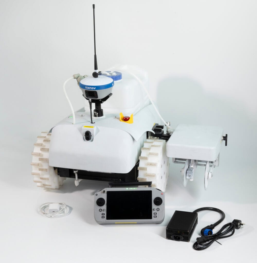
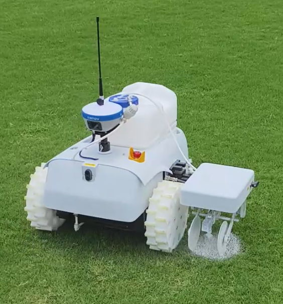
الصفحة الرئيسية: روبوت رسم الخطوط TR10Pro يحصل على هيكل أبيض جديد: ما يجب أن يعرفه المشترون 19 يونيو 2026 قامت شركة TOKNAV بتحديث المظهر الخارجي لروبوت رسم الخطوط TR10Pro. كانت النسخة السابقة تتميز بهيكل أخضر، بينما تستخدم النسخة المحدثة الآن هيكلاً أبيض ناصعًا. بالنسبة للموزعين في الخارج، ومقاولي الملاعب الرياضية، ومقدمي خدمات الطرق البلدية، ومشتري المشاريع، فإن هذا الأمر يتعدى مجرد تغيير بسيط في اللون. يمنح الهيكل الأبيض الجديد روبوت TR10Pro صورة منتج أكثر نقاءً وهوية بصرية أكثر تقنية. كما أنه يخلق توافقًا أقوى مع نظام العلامة التجارية GNSS الأزرق والأبيض لشركة TOKNAV. يظل TR10Pro في مكانته كحل آلي لروبوت رسم الخطوط من أجل القياس والرسم وأتمتة الملاعب المساعدة. وهو مصمم للمستخدمين الذين يحتاجون إلى رسم خطوط متكرر وموجه بنظام GNSS في الملاعب الرياضية والطرق والأسطح البلدية والمشاريع المتعلقة بممرات الهبوط. يشرح هذا المقال ما الذي تغير، وما الذي بقي على حاله، وما الذي يجب على المشترين من قطاع الأعمال (B2B) التحقق منه قبل طلب أحدث ورقة بيانات أو عرض أسعار. هل تخطط لشراء روبوت لرسم الخطوط؟ أرسل تطبيقك، وبلدك، ونوع السطح، والكمية المستهدفة حتى تتمكن TOKNAV من التوصية بتكوين TR10Pro المناسب. أرسل متطلباتك الخاصة بوضع العلامات لماذا غيرت TOKNAV لون TR10Pro من الأخضر إلى الأبيض استكشاف ميزات وفوائد روبوت وضع العلامات TR10Pro بالنسبة للمعدات الصناعية، لا يقتصر دور اللون على كونه عنصرًا زخرفيًا فحسب؛ بل يؤثر أيضًا على كيفية التعرف على المنتج في الصور ومقاطع الفيديو والمواد التدريبية والمعارض وكتالوجات الموزعين. كان الهيكل الأخضر القديم لـ TR10Pro يجعل من السهل التعرف على الروبوت، خاصة في المواقع الميدانية. ومع ذلك، مع استمرار TOKNAV في تقديم منتجاتها من أنظمة الملاحة عبر الأقمار الصناعية (GNSS) وأجهزة الاستقبال والحلول المتكاملة تحت نمط علامة تجارية باللونين الأزرق والأبيض، يمنح الهيكل الأبيض الجديد روبوت رسم الخطوط لغة بصرية أكثر توحيدًا. كما يساعد الهيكل الأبيض على إظهار المنتج بمظهر أنظف في المواد التسويقية. غالبًا ما يتم تقييم آلة رسم الخطوط الروبوتية قبل أن يراها المشتري شخصيًا. وعادةً ما يقارن المستوردون والمقاولون صور المنتج ومقاطع الفيديو التوضيحية وصحائف البيانات وحزم عروض الأسعار. يمكن أن يسهل الهيكل الخارجي الأبيض عرض تفاصيل المنتج والعجلات وآليات الفوهات وتصميم الخزان ومواضع تركيب جهاز الاستقبال بوضوح أكبر في الصور التسويقية. وهذا أمر مهم لشركاء TOKNAV، الذين قد يحتاجون إلى صور المنتج لاستخدامها في موقع إلكتروني، أو لافتة معرض تجاري، أو كتالوج على WhatsApp، أو منشور على LinkedIn، أو وثيقة مناقصة. يُعد الهيكل الأبيض المُحدَّث لطراز TR10Pro أسهل في الدمج مع عناصر العلامة التجارية الزرقاء وخلفيات الصفحات المحايدة، مما يساعد الشركاء على إنشاء محتوى مبيعات أكثر احترافية دون الحاجة إلى تعديل مكثف للصور. مقارنة بين الهيكل الأخضر القديم والهيكل الأبيض الجديد النقطة الهيكل الأخضر القديم الهيكل الأبيض الجديد الهوية البصرية رؤية قوية في الميدان ومظهر عملي للمعدات. مظهر أنظف وأكثر تقنية وأقرب إلى العلامة التجارية الزرقاء-البيضاء لشركة TOKNAV. عرض الموقع الإلكتروني: يعمل جيدًا في المشاهد الخارجية، لكنه قد يبدو أقل تناسقًا مع صفحات أجهزة استقبال GNSS. أكثر ملاءمة لصفحات المنتجات، والصفحات المقصودة، والكتالوجات، والإعلانات المدفوعة. التسويق عبر الموزعين: سهل التعرف عليه، لكنه قد يتطلب المزيد من تعديلات التصميم. أسهل في الاستخدام مع التخطيطات باللونين الأبيض والأزرق، والرسوم البيانية المقارنة، وصفحات الاستفسار. تصور المشتري: عملي وموجه للميدان. أكثر أناقة وحداثة واحترافية للمشتريات بين الشركات (B2B). الغرض الأساسي: وضع علامات الخطوط الآلي الموجه بنظام GNSS. وضع علامات الخطوط الآلي الموجه بنظام GNSS. يجب التحقق من التكوين النهائي باستخدام أحدث ورقة بيانات. كتلة الصور المقترحة في Elementor: مقارنة بين الهيكل القديم والجديد الهيكل الأخضر السابق الهيكل الأبيض المحدث ما يبقى كما هو: سير عمل وضع العلامات الموجه بنظام RTK النقطة الأهم للمشترين بسيطة: المظهر الخارجي الأبيض الجديد هو تحديث لمظهر المنتج، وليس سببًا لتجاهل سير العمل الأساسي لوضع العلامات. لا يزال جهاز TR10Pro يُروَّج له باعتباره حلاً آليًّا لرسم الخطوط بتوجيه من نظام GNSS لمهام رسم الخطوط التي تتطلب التكرار وتقليل العمل اليدوي وتنفيذ التخطيط بشكل متسق. استنادًا إلى مواد منتجات سلسلة TOKNAV TR10، تم بناء هذا الحل حول تحديد المواقع عالي الدقة باستخدام نظام GNSS وتنفيذ عملية رسم الخطوط آليًّا. يدعم النظام وضع العلامات الخطية للملاعب الرياضية والطرق السريعة والطرق البلدية والسيناريوهات المتعلقة بممرات المطارات. وقد صُمم لمساعدة المستخدمين على استيراد أو إعداد ملفات وضع العلامات، واتباع الخطوط المخطط لها، وإكمال مهام وضع العلامات مع تقليل أعمال القياس اليدوي وتخطيط الحبال. في المناقشات النموذجية حول المشاريع، يجب على المشترين التأكد من أحدث التكوينات قبل تقديم الطلب. تشمل النقاط المهمة تكوين جهاز الاستقبال، وطريقة التصحيح، وتنسيقات استيراد الملفات المدعومة، ونوع الطلاء، وعرض العلامات، وبيئة العمل، وتكوين البطارية، واحتياجات التدريب المحلية، وقطع الغيار. بالنسبة للطلبات الدولية بين الشركات (B2B)، يعتبر هذا الفحص مهمًا بشكل خاص لأن الدول المختلفة قد تستخدم خدمات تصحيح مختلفة، وظروف ميدانية متنوعة، وعادات تشغيل متباينة. النقاط الرئيسية للمنتج التي يسأل عنها المشترون عادةً: وضع العلامات الموجهة بنظام GNSS: مصمم للتخطيط والوضع الآلي للعلامات بناءً على تحديد المواقع عالي الدقة. نطاق التطبيق: مناسب للملاعب الرياضية، والطرق السريعة، والطرق البلدية، وإعداد العلامات المتعلقة بممرات الهبوط. سير عمل القوالب والملفات: يدعم قوالب وضع العلامات المدمجة وسير عمل ملفات المشاريع الشائعة وفقًا لمواد سلسلة TR10. آلية وضع العلامات: مصممة لوضع علامات الخطوط الميدانية مع متطلبات وضع علامات قابلة للتعديل حسب التكوين. ملاءمة المشتريات بين الشركات (B2B): مناسب للمقاولين والموزعين وشركات خدمات المنشآت الرياضية ومقدمي خدمات الأشغال العامة. لماذا يهم الهيكل الأبيض للمشترين في قطاع B2B غالبًا ما تُباع روبوتات رسم الخطوط بناءً على الثقة. يرغب المشترون في معرفة ما إذا كان المورد يفهم التشغيل الميداني، وما إذا كان من السهل شرح طريقة عمل الروبوت للمشغلين، وما إذا كانت صورة المنتج احترافية بما يكفي للسوق المحلي للموزع. يدعم الهيكل الأبيض الجديد عملية بناء الثقة هذه بعدة طرق عملية. أولًا، يبدو المنتج أكثر اتساقًا مع أجهزة استقبال GNSS من TOKNAV، التي تستخدم بالفعل اللونين الأزرق والأبيض كإشارة بصرية أساسية. وهذا أمر مهم عندما يتم تقديم TR10Pro كجزء من مجموعة حلول GNSS أكبر بدلاً من كونه روبوتًا مستقلًا. ثانيًا، يوفر الهيكل الأبيض خلفية أفضل لإبراز التفاصيل مثل الخزان، وهيكل العجلات، ومنطقة الفوهة، وحامل جهاز الاستقبال. ثالثًا، يحسّن مظهر صفحات المبيعات وصفحات الهبوط الإعلانية المدفوعة، حيث يمكن للصور الواضحة للمنتج تحسين الانطباع الأول قبل أن يقرأ المشتري المواصفات. بالنسبة للموزعين، يمكن أن يقلل هذا من العقبات. فمن الأسهل تكييف صورة المنتج الأكثر وضوحًا مع الأسواق المختلفة، بما في ذلك مواد المبيعات باللغات الإنجليزية والإسبانية والفرنسية والعربية والروسية والألمانية. كما أنها تعمل بشكل أفضل في جداول المقارنة، والنوافذ المنبثقة للاستفسار، وملفات PDF الخاصة بعروض الأسعار، والرسومات المستخدمة في أجنحة المعارض التجارية. سيناريوهات تطبيق جهاز TR10Pro المحدث لوضع علامات الملاعب الرياضية تُعد الملاعب الرياضية واحدة من أكثر حالات الاستخدام بديهيةً لوضع العلامات الآلية. يحتاج مشغلو الملاعب إلى تخطيطات قابلة للتكرار، وحدود واضحة، وإعادة طلاء فعالة. إن

روبوت رسم الخطوط TR10Pro يحصل على هيكل أبيض جديد: ما يجب أن يعرفه المشترون قراءة المزيد »

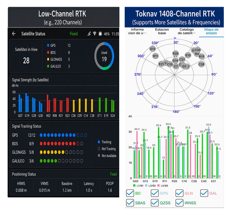
مقارنة عدد قنوات RTK بين أجهزة الاستقبال التي تعمل بنظام GNSS ذي 1400 قناة وأجهزة الاستقبال المزودة بشريحة RTK مدمجة في نظام التشغيل (SOC)

مزايا القنوات 1408: أداء RTK فائق لنظام GNSS الحديث متعدد المجموعات

الصفحة الرئيسية مزايا 1408 قناة: أداء RTK فائق لنظام GNSS الحديث متعدد الأقمار الصناعية 11 يونيو 2026 مزايا 1408 قناة من Toknav مزايا 1408 قناة: لماذا تتصدر مجموعة Toknav الكاملة من أجهزة RTK مجال تحديد المواقع عبر أنظمة GNSS متعددة الأقمار الصناعية 1. معلومات أساسية عن عدد قنوات RTK في أجهزة استقبال GNSS 1.1 ما هي قناة RTK ووظيفتها الأساسية تعمل كل قناة RTK كوصلة إشارة مستقلة لالتقاط إشارات الأقمار الصناعية وفك تشفيرها ومعالجتها. يرسل القمر الصناعي القياسي لنظام GNSS إشارات بترددات متعددة، وتتطلب كل إشارة قناة مخصصة. ويحدد العدد الإجمالي لقنوات RTK بشكل مباشر عدد إشارات الأقمار الصناعية التي يمكن لجهاز الاستقبال تتبعها في الوقت الحقيقي وبشكل متزامن. مقارنة عدد قنوات RTK بين أجهزة الاستقبال التي تعمل بنظام GNSS ذي 1400 قناة وأجهزة الاستقبال المزودة بشريحة SOC RTK 1.2 عيوب أجهزة RTK التقليدية ذات القنوات القليلة لا تحتوي معظم وحدات RTK من الجيل القديم سوى على 100 إلى 600 قناة. وهي لا تستطيع سوى تتبع عدد قليل من الأقمار الصناعية من مجموعات محدودة. في المناطق المحجوبة مثل الوديان الحضرية أو الغابات الكثيفة، تفشل هذه الأجهزة في جمع إشارات كافية، مما يؤدي إلى بطء البحث وفقدان تحديد المواقع RTK المتكرر في مواقع العمل. 1.3 كيفية ارتباط عدد القنوات بتشغيل GNSS متعدد المجموعات الساتلية تجمع أنظمة GNSS الحديثة بين GPS وBeiDou وGalileo وGLONASS وQZSS وSBAS. تعمل مئات الأقمار الصناعية وإشارات الترددات المتنوعة في الفضاء. ولا يمكن لنظام RTK ذي القنوات المنخفضة الاستفادة الكاملة من هذه الموارد، مما يجعله عنق زجاجة أمام مهام تحديد المواقع الحديثة عالية الكفاءة. 2. لماذا تعد القنوات التي يزيد عددها عن 1400 قناة أمرًا لا غنى عنه لنظام GNSS RTK الاحترافي: 2.1 التوسع متعدد المجموعات الفضائية يدفع الطلب على السعة العالية للقنوات تستمر مجموعات GNSS العالمية في التوسع مع إطلاق أقمار صناعية جديدة وإشارات تردد مطورة كل عام. وهذا يفسر بوضوح لماذا تطورت تقنية GNSS ذات 1400 قناة من ميزة متقدمة إلى متطلب قياسي لمعدات المسح وتحديد المواقع الاحترافية في جميع أنحاء العالم. 2.2 1408 قناة: تغطية كاملة لجميع إشارات GNSS السائدة تدعم قنوات Toknav البالغ عددها 1408 قناة التتبع الكامل لجميع المجموعات والإشارات متعددة الترددات. وعلى عكس أنظمة RTK متوسطة المدى التي تتراوح قنواتها بين 800 و1200 قناة، فإنها لا تتجاهل أبدًا الإشارات الضعيفة التي لا تزال ذات قيمة. وهي تعمل على تعظيم موارد الأقمار الصناعية لوضع الأساس لتحديد المواقع بشكل مستقر في السيناريوهات المعقدة. 2.3 مقاومة قوية للتداخل وقدرة عالية على التكيف في تصميم 1408 قناة: يعد الحجب الإشاري والتداخل متعدد المسارات أمرًا شائعًا في مناطق البناء والمناطق الجبلية. تلتقط القنوات الـ 1408 إشارات الأقمار الصناعية المتناثرة التي تفوتها الأجهزة ذات القنوات المنخفضة. كما أنه يحسن التوزيع الهندسي للأقمار الصناعية لتقليل أخطاء تحديد المواقع وتعزيز الموثوقية الإجمالية. 2.4 القيمة على المدى الطويل: جاهز لمواكبة تحديثات GNSS المستقبلية ستستمر أنظمة إشارات الأقمار الصناعية في التطور خلال العقد القادم. يمكن لنظام RTK ذي 1408 قناة التكيف مع إشارات الأقمار الصناعية الجديدة دون الحاجة إلى استبدال الأجهزة. وهو يساعد المستخدمين على تجنب التحديثات المتكررة للمعدات ويقلل من تكاليف التشغيل طويلة الأجل لفرق الهندسة. احصل على ورقة البيانات الفنية وعرض الأسعار لنظام RTK ذي 1408 قناة 3. رقاقة SOC RTK من Toknav: القوة الأساسية التي تدعم 1408 قناة كاملة 3.1 تعريف ومزايا رقاقة SOC RTK المدمجة من Toknav تزود Toknav جميع منتجات RTK برقاقة SOC RTK عالية الأداء مطورة ذاتيًا. تدمج رقاقة النظام على رقاقة (SOC) هذه الواجهة الأمامية للترددات اللاسلكية (RF) والنطاق الأساسي ومحرك الملاحة والمعالج في وحدة واحدة، لتحل محل مجموعات الرقائق المنفصلة الضخمة المستخدمة في أجهزة استقبال RTK التقليدية. 3.2 كيف تحل رقاقة SOC RTK مشكلة ازدحام البيانات متعدد القنوات غالبًا ما تعاني الرقائق المنفصلة من تأخير البيانات وازدحامها عند تشغيل مئات القنوات. تتبنى رقاقة SOC RTK من Toknav بنية دوائر وخوارزميات مُحسّنة. وهي توزع مهام معالجة الإشارات بالتساوي عبر 1408 قناة للحفاظ على تشغيل بزمن انتقال منخفض للغاية. 3.3 كفاءة استهلاك الطاقة في رقاقة SOC RTK للأجهزة المحمولة التي تعمل بتقنية RTK تتطلب أجهزة RTK المحمولة باليد مثل T5 وT5Lite ساعات عمل طويلة في الهواء الطلق. يقلل التصميم منخفض استهلاك الطاقة لشريحة SOC RTK من Toknav من استهلاك الطاقة أثناء التشغيل بكامل القنوات. يحصل المستخدمون على عمر بطارية أطول دون التضحية بأداء القنوات الـ 1408. 3.4 الاستقرار العالي لشريحة SOC RTK للاستخدام لفترات طويلة لمحطات القاعدة بالنسبة لمحطات القاعدة RTK من سلسلتي tBase وNET660 التي تعمل على مدار الساعة طوال أيام الأسبوع، توفر شريحة SOC RTK تشغيلًا مستمرًا ومستقرًا. وهي تدعم إخراج الإشارات متعددة القنوات على المدى الطويل إلى الوحدات المتنقلة، مما يضمن نقلًا متسقًا للإشارات لشبكات CORS واسعة النطاق. المكون الأساسي لشريحة SOC RTK يدعم 1400 قناة GNSS وعددًا كبيرًا من قنوات RTK 4. اكتساب أسرع للأقمار الصناعية وتحديد موقع RTK: الميزة الأكثر وضوحًا لـ 1408 قناة 4.1 سرعة بحث كاملة ومُسرعة عن الأقمار الصناعية يعد اكتساب الأقمار الصناعية الخطوة الأولى في جميع سير عمل RTK. تقوم قنوات Toknav البالغ عددها 1408 قناة بمسح الإشارات من جميع المجموعات الفضائية بالتوازي، بدلاً من المسح مجموعةً تلو الأخرى. تثبت الاختبارات الميدانية أنها تكمل البحث الكامل عن الأقمار الصناعية بشكل أسرع بكثير من أجهزة استقبال RTK التقليدية ذات القنوات المنخفضة. 4.2 تقصير وقت تقارب حل التثبيت RTK يشير التثبيت RTK إلى تحديد المواقع بدقة عالية بمستوى السنتيمتر. تجمع القنوات الـ 1408 كميات هائلة من البيانات الصالحة من الأقمار الصناعية لخوارزميات تحديد المواقع. تعمل العينات الغنية من الإشارات على تسريع عملية حساب البيانات، مما يقلل بشكل كبير من الوقت اللازم للحصول على حل ثابت RTK مستقر. 4.3 إعادة التقاط سريعة بعد انقطاع مؤقت للإشارة غالبًا ما تتعرض البيئات الميدانية لانقطاع مفاجئ للإشارة بسبب المباني أو الأشجار. تحتاج أجهزة RTK ذات القنوات القليلة إلى عشرات الثواني لإعادة البحث عن الأقمار الصناعية. أما قنوات Toknav البالغ عددها 1408 قناة، فتستمر في الاتصال بالأقمار الصناعية الاحتياطية وتستعيد تحديد الموقع RTK في غضون ثوانٍ لتجنب انقطاع العمل. 4.4 مقارنة الأداء: 1408 قناة مقابل نظام RTK العادي ذي القنوات القليلة يستغرق نظام RTK القياسي الذي يتراوح عدد قنواته بين 200 و500 قناة من 60 إلى 90 ثانية لإنهاء عملية البحث وتحديد الموقع. أما نظام RTK من Toknav ذو 1408 قناة فيحتاج فقط من 20 إلى 35 ثانية لإتمام العملية نفسها. تؤدي هذه الفجوة في الكفاءة إلى زيادة مباشرة في الإنتاجية اليومية لفرق المسح ورسم الخرائط. اختبار ميداني لنظام RTK GNSS ذي 1400 قناة مع عدد كبير من قنوات RTK وشريحة SOC RTK 5. خط إنتاج Toknav الكامل لنظام RTK: كل طراز مزود بـ 1408 قناة GNSS 5.1 سلسلة RTK المحمولة والاقتصادية تعتمد جميع طرازات RTK المحمولة خفيفة الوزن على 1408 قناة، بما في ذلك طراز T5Lite الاقتصادي، وطراز T5 المحمول، وطراز T10Pro المطابق للمعايير الهندسية. توفر هذه الطرز بحثًا وتحديدًا سريعين لمهام تخطيط الأراضي والمسح الريفي وقياسات البناء الأساسية. 5.2 سلسلة RTK المتطورة المزودة بالليزر والواقع المعزز (AR) والتصوير المساحي: تدمج الطرز متوسطة إلى عالية المستوى T30 وT40 وT50 وإصداراتها Pro ميزات قياس المسافات بالليزر والكاميرات المزدوجة ووظائف تحديد المواقع بالواقع المعزز (AR). حتى مع الوحدات الإضافية، تحتفظ هذه الطرز بـ 1408 قناة كاملة، مما يحافظ على سرعة تحديد المواقع الأساسية دون تغيير. 5.3 محطة قاعدية احترافية وRTK مخصص لنظام CORS تدعم محطة القاعدة الاحترافية tBase RTK وسلسلة NET660 المخصصة لبناء نظام CORS 1408 قناة بالكامل. بالنسبة للمحطات الأساسية الثابتة، تضمن القنوات الوفيرة تغطية إشارة مستقرة للعديد من الوحدات المتنقلة في المشاريع الهندسية الكبيرة. 5.4 نظام RTK الخاص بالطائرات بدون طيار والمركبات غير المأهولة والملاحة كما تدعم كل من NET660i-H (تحديد المواقع والتوجيه) وNET660i-1U (المركبات غير المأهولة) 1408 قناة. في الطائرات بدون طيار

مزايا القنوات 1408: أداء RTK فائق لنظام GNSS الحديث متعدد المجموعات قراءة المزيد »

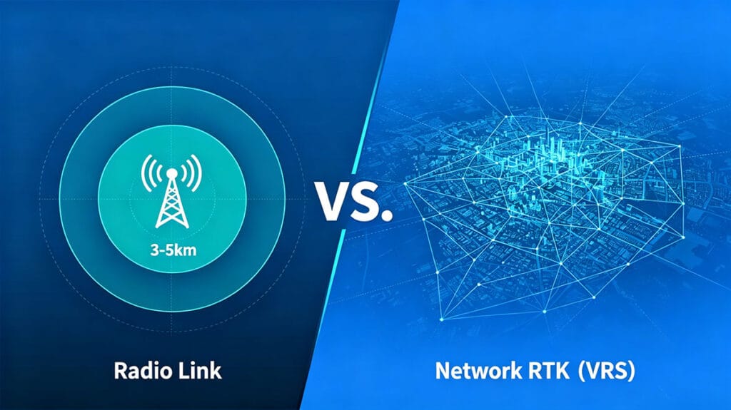
مقارنة نطاق محطات RTK الأساسية

نطاق المحطة القاعدية RTK: الراديو مقابل وصلة الشبكة - أيهما يغطي احتياجاتك؟

الصفحة الرئيسية: نطاق محطة RTK الأساسية: الاتصال اللاسلكي مقابل الاتصال عبر الشبكة – أيهما يلبي احتياجاتك؟ 2026-06-06 مدى الاتصال اللاسلكي: قدرات RTK طويلة المدى بالنسبة للمساحين ومتخصصي رسم الخرائط، يُعد نطاق تشغيل المحطة الأساسية عاملاً حاسماً. غالبًا ما تعتمد إعدادات RTK التقليدية على وصلة لاسلكية مادية بين المحطة الأساسية ووحدة الروفر. توفر هذه الطريقة اتصالاً مباشرًا ومحليًّا وموثوقًا به، مستقلاً عن شبكات الهاتف الخلوي. يُعد نطاق الرؤية المباشرة الذي يتراوح بين 3 و5 كيلومترات معيارًا شائعًا لقوة الإرسال اللاسلكي الداخلي، وهي مواصفة تحدد نظام RTK طويل المدى الحقيقي للعديد من التطبيقات الميدانية. تعد هذه القدرة أساسية في مواقع البناء النائية، أو الحقول الزراعية واسعة النطاق، أو الأراضي غير المطورة التي لا تتوفر فيها اتصال بالإنترنت. ويكمن جاذبيتها في طبيعتها المستقلة — فبمجرد إعداد المحطة الأساسية، ينشئ النظام فقاعة تحديد المواقع الخاصة به، مما يمنح الفرق حرية العمل ضمن هذا النطاق دون الاعتماد على عوامل خارجية. إنها الأداة الأساسية الكلاسيكية والمثبتة الفعالية لتحديد المواقع بدقة عالية. مقارنة نطاق محطة RTK الأساسية: راديو RTK طويل المدى مقابل تغطية الشبكة ناقش احتياجات مشروعك تجاوز الحدود: فهم مسافة راديو RTK تمثل مسافة راديو RTK المعلن عنها، مثل 3-5 كم، سيناريوًّا مثاليًّا في خط الرؤية المباشر. في الواقع، يتأثر هذا النطاق بالتضاريس والعوائق وارتفاع الهوائي. يمكن للبيئات الحضرية المكتظة بالمباني الشاهقة أو المناطق ذات الغابات الكثيفة أن تقلل بشكل كبير من نطاق التشغيل الفعلي. تعد قوة الإرسال الداخلية للمحطة الأساسية العامل الرئيسي وراء هذه المسافة؛ حيث يمكن لأجهزة الراديو ذات الطاقة الأعلى اختراق العوائق الخفيفة بشكل أفضل والحفاظ على اتصال بيانات مستقر عند حدود النطاق الاسمي. بالنسبة لعلامة تجارية مثل TOKNAV، التي صُممت أجهزة الاستقبال RTK T50Pro وT40Pro الخاصة بها لأعمال التصوير المساحي والليزر الصعبة، يضمن الاتصال اللاسلكي القوي والموثوق الحفاظ على سلامة البيانات حتى عندما تبتعد المركبات المتنقلة عن المحطة الأساسية، مما يمنع إعادة العمل المكلفة. القوة الكامنة: قوة الإرسال اللاسلكي الداخلية ودورها تُعد قوة الإرسال اللاسلكي الداخلية البطل المجهول لأنظمة RTK المستقلة. فهي تحدد قوة الإشارة ومرونة البيانات المرسلة من المحطة الأساسية إلى المركبة المتنقلة. تضمن الوحدة المزودة بطاقة لاسلكية داخلية قوية، مثل تلك الموجودة في سلسلة RTK من TOKNAV، إشارة أوضح على مسافات أطول وفي ظروف غير مثالية. وهذا يترجم مباشرة إلى كفاءة ميدانية؛ حيث يمكن للمساحين تغطية مساحة أكبر دون الحاجة إلى تحريك المحطة الأساسية باستمرار. ومع ذلك، فهي حل محلي. تكون تغطية الراديو على شكل دائرة على الخريطة تكون المحطة الأساسية في مركزها. بالنسبة للمشاريع الأكبر من هذه الدائرة — مثل مشاريع البنية التحتية الخطية التي تمتد لعشرات الكيلومترات أو عمليات المسح الإقليمية — يصبح الاعتماد على الراديو وحده غير عملي، مما يتطلب إعداد عدة محطات أساسية أو اتباع نهج مختلف تمامًا. ميزة الشبكة: نطاق غير محدود مع VRS/CORS هنا تكمن قدرة حلول الشبكات مثل المحطة المرجعية الافتراضية (VRS) أو المحطات المرجعية العاملة بشكل مستمر (CORS) على تحويل عمليات RTK. بدلاً من محطة قاعدية واحدة ينشرها المستخدم، يتصل جهاز الروفر بشبكة من المحطات المرجعية الدائمة التي تخضع لصيانة احترافية عبر الإنترنت الخلوي (4G/5G). تعمل خدمات مثل حل VRS من TOKNAV على إنشاء محطة قاعدية افتراضية بشكل فعال في موقع جهاز الروفر، مما يوفر بيانات التصحيح عبر الإنترنت. لم تعد التغطية محددة بنطاق لاسلكي يبلغ 5 كيلومترات، بل أصبحت محددة بنطاق تغطية الشبكة الخلوية، الذي يمكن أن يكون إقليميًا أو وطنيًا أو حتى قاريًا. وهذا يلغي الحاجة إلى إنشاء محطة قاعدية خاصة بك، ويزيل قيود المدى، ويعد مثاليًا للمسوحات التي تغطي مساحات واسعة أو المسوحات الحضرية. اطلب عرض أسعار لحلول الشبكات مقارنة التغطية: الراديو الذي يبلغ نطاقه 5 كم مقابل الشبكة القارية دعونا نقارن نماذج التغطية مباشرةً. يوفر نظام الراديو RTK عالي الطاقة وصلة مخصصة وآمنة تصل إلى حوالي 5 كم. ويتميز أدائه بالثبات ولا يتأثر بالمناطق الخالية من التغطية الخلوية، مما يجعله الخيار الأمثل في المواقع النائية. القيود هنا جغرافية بحتة. في المقابل، يوفر اتصال RTK عبر الشبكة نطاقًا غير محدود نظريًّا أينما كانت هناك تغطية بيانات شبكات الهاتف الخلوي. وهو يوفر راحة لا تصدق للفرق المتنقلة والمشاريع واسعة النطاق. المقابل هو الاعتماد على خدمة الهاتف الخلوي ورسوم الاشتراك المحتملة لشبكة التصحيح. لا يتعلق الاختيار بأي التقنيات هي الأفضل، بل بأيها هو الأمثل لبيئة المشروع المحددة وحجمه وقيوده اللوجستية. اختيار أداتك: متى تستخدم الراديو أو شبكة RTK يعد اختيار وصلة البيانات المناسبة قرارًا استراتيجيًا. استخدم وصلة راديو RTK طويلة المدى في الحالات التالية: جهاز استقبال Toknav RTK الذي يستخدم رابط لاسلكي RTK طويل المدى في الميدان، للعمل في المناجم النائية أو المحاجر أو المناطق البحرية أو الأراضي الزراعية الريفية التي لا توجد بها إشارة خلوية؛ أو في المواقع الآمنة التي يُحظر فيها الاتصال الخارجي بالبيانات؛ أو للمشاريع المحلية قصيرة الأمد التي يكون فيها إنشاء قاعدة واحدة أبسط وأكثر فعالية من حيث التكلفة مقارنة بإدارة اشتراكات الشبكة. اختر وصلة RTK عبر الشبكة (VRS) في الحالات التالية:​ إجراء المسوحات فوق مدينة كبيرة أو ممر طويل وخطي مثل الطريق السريع أو خط الأنابيب؛ أو العمل في مناطق تتمتع بتغطية خلوية ممتازة؛ أو إدارة أسطول من المركبات المتنقلة عبر منطقة واسعة؛ أو عندما تفوق المكاسب في الكفاءة التشغيلية الناتجة عن عدم نشر محطة قاعدية مادية تكلفة الشبكة. مجموعة أدوات Toknav: حلول لكل متطلبات المدى تم تصميم مجموعة منتجات TOKNAV بشكل استراتيجي لدعم كلا النموذجين التشغيليين. بالنسبة لنظام RTK التقليدي طويل المدى الذي يعتمد على الراديو، تم تصميم سلسلة أجهزة الاستقبال عالية الأداء مثل T30 Pro (مع التصوير المساحي المدمج) وT20Pro (RTK الذكي متعدد الوظائف) بأجهزة راديو داخلية قوية. بالنسبة للمستخدمين الذين يتطلعون إلى إنشاء شبكة CORS خاصة بهم للجمع بين التحكم والتغطية، يُعد جهاز الاستقبال المحوري NET660i Base Station Receiver أساسًا قويًا. وللحصول على أقصى درجات النطاق الموسع والراحة، فإن الاستفادة من حل VRS​ مع جهاز متنقل مزود بقدرات شبكية توفر دقة سلسة على نطاق واسع دون القلق بشأن النطاق، وهو مثالي لمتخصصي نظم المعلومات الجغرافية (GIS) الذين يستخدمون أجهزة مثل P8 Global. مخطط تدفقي: كيفية الاختيار بين RTK اللاسلكي وRTK الشبكي لتلبية احتياجات نطاق محطتك الأساسية احصل على تقييم النطاق لمعداتك الحكم النهائي بشأن نطاق محطة RTK الأساسية لا يوجد فائز عالمي في الجدل الدائر حول نطاق RTK اللاسلكي مقابل نطاق RTK الشبكي. يوفر الرابط اللاسلكي الذي يتراوح مداه بين 3 و5 كيلومترات تحكمًا موثوقًا ومستقلًا للمواقع المحددة، مدعومًا بالطاقة اللاسلكية الداخلية للوحدة الأساسية. أما الرابط الشبكي، المدعوم بتقنية VRS، فيوفر مسافة لاسلكية شبه غير محدودة لنظام RTK من خلال الاستفادة من البنية التحتية للهاتف الخلوي، مما يعيد تعريف المعنى الحقيقي لنظام RTK طويل المدى.غالبًا ما تستخدم العمليات الأكثر تقدمًا نهجًا هجينًا، حيث يتم استخدام الراديو للمواقع الحرجة التي تفتقر إلى الإشارة، والتحول إلى وضع الشبكة في المناطق التي تغطيها الشبكة

نطاق المحطة القاعدية RTK: الراديو مقابل وصلة الشبكة - أيهما يغطي احتياجاتك؟ قراءة المزيد »

TOKNAV هي علامة تجارية راقية للأنظمة العالمية لسواتل الملاحة مملوكة لشركة قوانغتشو توكسيرفي لتكنولوجيا المعلومات المحدودة.
جميع الحقوق محفوظة © 2025 شركة قوانغتشو توك سورفي لتكنولوجيا المعلومات المحدودة سياسة الخصوصية

كن من موزعي TOKNAV العالميين!

نحن نبحث الآن عن موزعين متحمسين للانضمام إلى قصة نجاحنا العالمية بفضل سجلنا الحافل في مجال المسح.