tSurvey2.0
Industrial Surveying Software
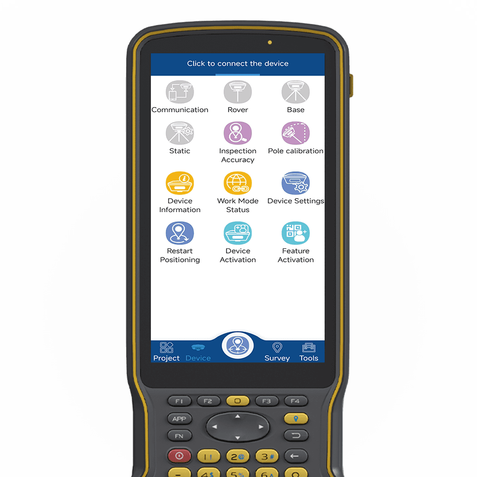
tSurvey 2.0 is a powerful engineering measurement software developed by TOKNAV. It supports multiple languages and powerful measurement functions. With a variety of coordinates system and projection methods, it empower users to work with convenience and precision wherever they are.

tSurvey2.0
Industrial Surveying Software
tSurvey 2.0 is a professional and powerful engineering measurement software independently developed by TOKNAV. It supports multiple global languages and integrates comprehensive and powerful field measurement functions. With built-in a variety of common coordinate systems and flexible projection methods, it fully empowers users to work with great convenience and high precision no matter where their survey tasks are located.
Multi-language
tSurvey 2.0 is a professional and powerful engineering measurement software independently developed by TOKNAV. It supports multiple global languages and integrates comprehensive and powerful field measurement functions. With built-in a variety of common coordinate systems and flexible projection methods, it fully empowers users to work with great convenience and high precision no matter where their survey tasks are located.
tSurvey 2.0 is a professional and powerful engineering measurement software independently developed by TOKNAV. It supports multiple global languages and integrates comprehensive and powerful field measurement functions. With built-in a variety of common coordinate systems and flexible projection methods, it fully empowers users to work with great convenience and high precision no matter where their survey tasks are located.
Optimized Coordinate Transformation
tSurvey 2.0 is a professional and powerful engineering measurement software independently developed by TOKNAV. It supports multiple global languages and integrates comprehensive and powerful field measurement functions. With built-in a variety of common coordinate systems and flexible projection methods, it fully empowers users to work with great convenience and high precision no matter where their survey tasks are located.
tSurvey 2.0 is a professional and powerful engineering measurement software independently developed by TOKNAV. It supports multiple global languages and integrates comprehensive and powerful field measurement functions. With built-in a variety of common coordinate systems and flexible projection methods, it fully empowers users to work with great convenience and high precision no matter where their survey tasks are located.
CORS Services Accessible
tSurvey 2.0 is a professional and powerful engineering measurement software independently developed by TOKNAV. It supports multiple global languages and integrates comprehensive and powerful field measurement functions. With built-in a variety of common coordinate systems and flexible projection methods, it fully empowers users to work with great convenience and high precision no matter where their survey tasks are located.
tSurvey 2.0 is a professional and powerful engineering measurement software independently developed by TOKNAV. It supports multiple global languages and integrates comprehensive and powerful field measurement functions. With built-in a variety of common coordinate systems and flexible projection methods, it fully empowers users to work with great convenience and high precision no matter where their survey tasks are located.
Efficient CAD Toolkit
tSurvey 2.0 is a professional and powerful engineering measurement software independently developed by TOKNAV. It supports multiple global languages and integrates comprehensive and powerful field measurement functions. With built-in a variety of common coordinate systems and flexible projection methods, it fully empowers users to work with great convenience and high precision no matter where their survey tasks are located.
tSurvey 2.0 is a professional and powerful engineering measurement software independently developed by TOKNAV. It supports multiple global languages and integrates comprehensive and powerful field measurement functions. With built-in a variety of common coordinate systems and flexible projection methods, it fully empowers users to work with great convenience and high precision no matter where their survey tasks are located.
Related Contents