GNSS Industry Watch

Latest surveying, positioning and geospatial updates

Daily refreshed headlines from trusted industry publishers, with direct links to the original source.

TOKNAV YouTube

Newest videos from TOKNAV

Automatically follows the latest uploads from the TOKNAV YouTube channel.

Product Updates

TOKNAV product launch, feature, receiver, robot, USV and technology update news.

TOKNAV Unleashes T50 Series GNSS Receivers

GNSS-приемники серии T50

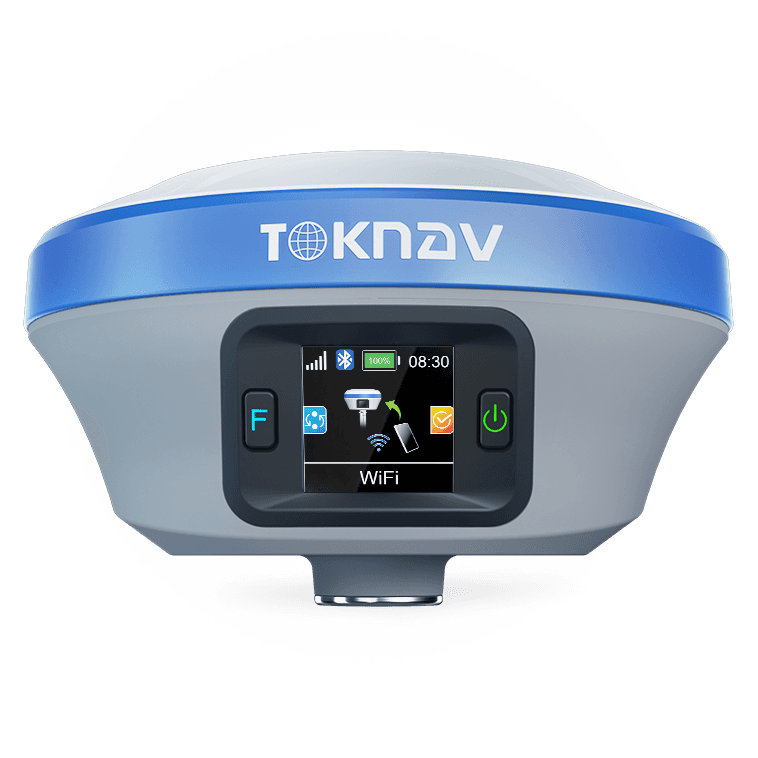
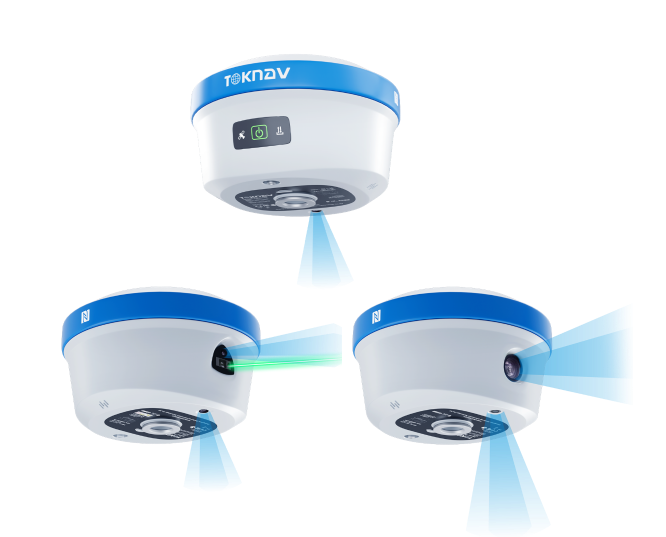
Home TOKNAV Unleashes T50 Series GNSS Receivers — Laser, Photogrammetry or AR: Your Workflow, Your Choice 2025-12-20 TOKNAV Unleashes T50 Series GNSS Receivers — Laser, Photogrammetry or AR: Your Workflow, Your Choice Guangzhou, China – TOKNAV today announced the global launch of its T50-series palm RTK line, giving surveyors three distinct field super-powers in a 770 g package measuring just 132 mm in diameter and 83 mm in height. T50 – 100 m green-laser module lets users capture remote or overhead points in seconds, no prism, no extra crew. A dedicated 4224×3200 laser-assist camera ensures precise targeting even on difficult surfaces, delivering ≤2.5 cm 3D error within 5 m range. T50Pro – combines a 1/2.6-inch ultra-wide photogrammetry camera with AR real-time stake-out for image-rich, tilt-correct layouts. Photogrammetric results generate in one second with 2–4 cm accuracy between 2–15 m, creating measurable visual documentation of as-built conditions while simultaneously navigating to design coordinates. T50basic – delivers the same AR live stake-out and 60° tilt immunity at an entry-level value, maintaining the series’ 1408-channel full-constellation architecture. All models share full-constellation tracking (GPS, GLONASS, BDS, Galileo, QZSS, SBAS, NavIC), IP68 magnesium body and 16-hour endurance. Built for Real-World Constraints The T50 series runs on an open Linux+ARM Cortex-A7 platform, allowing stable integration with existing field software ecosystems rather than locking users into closed environments. By embedding high-precision IMU tilt compensation (accurate to <2 cm within 60°) across the line, the series eliminates “fly points” in RTK measurement while allowing surveyors to work safely around obstacles without leveling the pole. This shifts complex point capture—whether overhead infrastructure with the T50 laser or blind corners with the T50Pro camera—from two-person operations to single-person workflows. Designed, built and supported from our quality-controlled factory in Guangzhou, Toknav is committed to becoming the world’s most reliable GNSS supplier—good quality, good products, good service, every shipment, every time. The T50 series is available now through TOKNAV and authorized dealers worldwide. Contact: info@toknavgnss.com | www.toknavgnss.comEurope/Americas: +1 (323) 847-7713Asia/Africa/Oceania: +86 139 2607 5986

GNSS-приемники серии T50 Читать далее »

T20 и T20Pro

TOKNAV запускает T20 и T20Pro: Революционные GNSS-приемники дальнего радиуса действия

Home TOKNAV Launches T20 & T20Pro: Revolutionary Long-Range GNSS Receivers Set New Performance Benchmark 2023-13-09 TOKNAV Launches T20 & T20Pro Guangzhou, China – TOKNAV, a leading provider of precision GNSS solutions, has officially launched its new TOKNAV T20 and T20Pro receivers. These cutting-edge models set a fresh benchmark for performance, connectivity, and reliability in professional field operations.  Unmatched Long-Range Communication for TOKNAV T20 Series  The TOKNAV T20 series features a powerful built-in 5W radio, enabling an exceptional transmission range of up to 16km in open areas. Integrated 4G connectivity ensures seamless data transfer, allowing users to access real-time correction services and base stations directly on-site with consistent reliability. TOKNAV T20Pro long-range GNSS receiver Long-Lasting Battery Power for Extended Fieldwork  Beyond connectivity, the TOKNAV T20 and T20Pro are equipped with a high-capacity 7.4V, 6500mAh battery. This robust power supply supports uninterrupted operation throughout long workdays, eliminating frequent charging interruptions and boosting professional confidence in extended field projects.  Proven Real-World Performance of TOKNAV T20Pro  Global customers have already praised the TOKNAV T20Pro’s exceptional capabilities. It reliably delivers RTK corrections over the full 16km distance, maintaining precise positioning even in challenging environments. A Chilean customer noted: “By pairing an external radio with the NTRIP method, we achieved corrections over 100km without a local base station—ultimately, the TOKNAV T20Pro’s advanced technology delivers remarkable results when used responsibly.”  Rugged IP68 Design for Harsh Environments  The TOKNAV T20 series is built to withstand extreme conditions, boasting an IP68 waterproof and dustproof rating. This rugged construction ensures superior durability and consistent performance, making it ideal for the harshest job sites across industries.  TOKNAV’s Vision for Accessible Precision  Ian Cheng, Chief Marketing Officer at TOKNAV, stated: “Our mission is to deliver user-friendly, high-value precision solutions for every professional. The TOKNAV T20 and T20Pro offer an exceptional choice for users seeking a premium RTK receiver, combining compelling performance with competitive pricing.” T20 Pro GNSS Receiver Accurate Battery Level Strong Market Reception for TOKNAV T20 Series  TOKNAV released the TOKNAV T20 and T20Pro on Wednesday, May 10th, 2023. Since launch, the series has generated significant interest from surveying, construction, and geospatial professionals seeking advanced, reliable GNSS tools.

TOKNAV запускает T20 и T20Pro: Революционные GNSS-приемники дальнего радиуса действия Читать далее »

Функция PPP системы GNSS TOKNAV

TOKNAV GNSS PPP Feature | Полная линейка приемников с точным позиционированием точек

Главная TOKNAV внедряет функцию PPP во всю линейку своих GNSS-приемников 03.06.2024 TOKNAV GNSS — функция PPP | Полная линейка приемников с функцией точного точечного позиционирования Компания TOKNAV всегда была в авангарде технологических достижений и инноваций в области глобальных навигационных спутниковых систем (GNSS). С внедрением функции PPP мы устанавливаем новый стандарт точности в приложениях для определения местоположения. Эта новая возможность имеет решающее значение для профессионалов, чья работа зависит от точной информации о местоположении. Данное обновление позволит пользователям получить доступ к передовым технологиям, что обеспечит им конкурентоспособность в своих отраслях. Мы понимаем, что точность имеет первостепенное значение, и новая прошивка поможет повысить производительность всех устройств TOKNAV. TOKNAV является лидером в области технологий точного позиционирования. Мы гордимся тем, что добавили функцию точного точечного позиционирования (PPP) во все наши GNSS-приемники.Это крупное обновление обеспечивает каждое устройство TOKNAV новейшей версией прошивки. Оно повышает производительность и устанавливает новые стандарты точности и надежности. Кроме того, оно отлично подходит для широкого спектра задач в различных отраслях. Добавление этой функции отражает наше стремление улучшить пользовательский опыт и повысить операционную эффективность. В различных секторах — будь то сельское хозяйство, строительство или геодезия — точное позиционирование может существенно повлиять на результаты работы. Внедряя функцию PPP, TOKNAV стремится предоставить пользователям инструменты, обеспечивающие максимальный уровень точности. PPP и RTK: сравнительный обзор. Функция GNSS PPP от TOKNAV: революция в области точного позиционирования. Развитие технологий GNSS продолжает определять способы работы различных отраслей. Благодаря новейшим достижениям пользователи могут рассчитывать на улучшение не только точности, но и скорости, а также надёжности. Функция PPP разработана с учётом разнообразных потребностей различных отраслей, что делает её универсальным решением для всех. Понимание различий между PPP и RTK помогает выбрать подходящий инструмент. Каждая из этих технологий обладает уникальными преимуществами для задач позиционирования. Что такое PPP? PPP работает автономно по всему миру. Она использует спутниковые данные для определения местоположения с точностью до сантиметра и не нуждается в локальных базовых станциях для работы. Это обеспечивает гибкость использования в любой точке земного шара. Однако первоначальная настройка может занять больше времени. Что такое RTK? RTK демонстрирует наилучшие результаты там, где имеются локальные базовые станции. Она обеспечивает быстрое определение координат в режиме реального времени с точностью до сантиметра. Её главным преимуществом является быстрая настройка. При этом следует отметить, что она не может работать за пределами зоны действия базовой станции. Понимание принципов работы как PPP, так и RTK имеет решающее значение для выбора подходящей системы для конкретных задач. Например, в сельском хозяйстве, где точность GPS может влиять на урожайность, использование подходящей системы позиционирования может привести к повышению производительности и эффективности. Кроме того, PPP особенно выгодно для применения в отдаленных районах, где использование систем RTK может быть невозможно из-за отсутствия базовых станций. Такая гибкость обеспечивает более широкую доступность и использование технологии GNSS в различных географических регионах. Ключевые различия между PPP и RTK Зависимость от базовых станций RTK требует наличия близлежащих базовых станций для получения дифференциальных данных. В отличие от этого, PPP работает автономно по всему миру. Радиус действия RTK работает только там, где базовые станции обеспечивают покрытие территории. PPP, однако, обеспечивает возможность глобального позиционирования. Скорость инициализации: RTK быстро вступает в рабочее состояние. PPP может потребовать дополнительного времени для обработки спутниковых данных. Наилучшие сценарии применения: RTK отлично подходит для быстрого и точного позиционирования в зонах покрытия. PPP идеально подходит для широкомасштабных проектов, особенно в отсутствие базовых станций. Базовые станции играют решающую роль в работе систем RTK. Чёткое понимание инфраструктуры, доступной в вашем регионе, поможет вам сделать осознанный выбор между PPP и RTK. Например, для строительных проектов, реализуемых в городских условиях, RTK может оказаться более выгодным решением благодаря наличию местных базовых станций, обеспечивающих быструю и надёжную передачу данных. С другой стороны, автономный характер технологии PPP является преимуществом в крупномасштабных проектах, таких как землеустройство в сельских или малоразвитых районах, позволяя обеспечить обширный охват без необходимости создания дополнительной инфраструктуры. Внедрение инноваций с помощью функции PPP Добавление технологии PPP в нашу линейку продукции укрепляет приверженность TOKNAV инновациям. Она становится стандартной функцией в ключевых моделях. К этим моделям относятся T5, T5Lite, T10Pro, T20Pro, T30, T30Pro и P8 Global. Технология PPP — это большой шаг вперёд в области GNSS. Более того, она обеспечивает пользователям непревзойдённую точность и простоту эксплуатации. Повышение точности в различных сферах Обновление PPP — это больше, чем просто техническое усовершенствование. Оно кардинально меняет ситуацию для профессионалов отрасли. Оно преобразует работу геодезистов, фермеров и операторов беспилотных транспортных средств. Оно также помогает специалистам в сфере строительства и мониторинга деформаций. Пользователи получают точность на уровне сантиметров без дополнительной инфраструктуры. Это позволяет им браться за проекты с большей уверенностью и оперативностью. Внедрение функции PPP также кардинально меняет правила игры в сфере эксплуатации беспилотных транспортных средств. В таких отраслях, как сельское хозяйство, автономность и точность, обеспечиваемые PPP, позволяют фермерам оптимизировать свои операции и значительно сократить затраты. Благодаря точному позиционированию такие задачи, как посадка, внесение удобрений и уборка урожая, могут выполняться более эффективно. Аналогичным образом, для геодезистов доступ к точности на уровне сантиметра без необходимости сложных настроек или дополнительной инфраструктуры позволяет быстрее завершать проекты и повышать производительность. Последствия внедрения этой технологии огромны и носят трансформационный характер. Обращение руководства TOKNAV Директор по маркетингу TOKNAV поделился своим воодушевлением по поводу новой функции. “Мы рады предоставить PPP нашим уважаемым клиентам”, — сказал он. “Это обновление не просто улучшает наши продукты. Оно помогает пользователям достигать большего с меньшими ресурсами”.Он добавил: ’PPP демонстрирует наше стремление раздвигать границы технологий GNSS». О компании TOKNAV Рассматривая историю развития TOKNAV более подробно, важно подчеркнуть, что движущей силой нашего роста всегда было стремление к инновациям и совершенству. Начиная с скромных истоков в Гуанчжоу и вплоть до того, как мы стали лидером в отрасли GNSS, мы всегда уделяли особое внимание предоставлению высококачественных и надёжных решений, отвечающих меняющимся потребностям наших клиентов. Инвестируя в исследования и разработки, мы гарантируем, что наши продукты остаются передовыми, позволяя пользователям в полной мере воспользоваться достижениями в области технологий GNSS. Эта приверженность не только способствует достижению целей наших клиентов, но и формирует культуру постоянного совершенствования внутри нашей организации. Компания TOKNAV начала свою деятельность в Гуанчжоу, Китай, и быстро разрослась. Сегодня это авторитетный бренд в сфере GNSS-технологий. У нас есть международные представительства в США, и мы обслуживаем клиентов по всему миру. Мы специализируемся на производстве высокопроизводительных RTK-устройств. Эти инструменты сочетают в себе точное позиционирование

TOKNAV GNSS PPP Feature | Полная линейка приемников с точным позиционированием точек Читать далее »

Продукция TOKNAV для управления станками

Оборудование для управления машинами TOKNAV | TMC10 и TMC20 для точных землеройных работ

Home TOKNAV Launches New Machine Control Product Line: Empowering Earthmoving with Precision and Innovation As a pioneer in smart construction technology, TOKNAV is proud to unveil its latest machine control product line—engineered to enhance productivity, accuracy, and efficiency in modern earthmoving operations. Designed specifically for excavators and bulldozers, this new lineup reflects TOKNAV’s commitment to innovation and our deep understanding of on-site challenges. Our products are not just tools; they are integral components of a comprehensive strategy to optimize construction workflows, reduce costs, and increase project profitability. In today’s rapidly evolving construction landscape, precision and efficiency are paramount. TOKNAV recognizes this need and has introduced an innovative product line that sets new standards in machine control technology. With increasing demands on construction sites for speed and accuracy, our latest offerings are designed to meet these challenges head-on. In this blog post, we will delve into the features and advantages of the TMC10 and TMC20, exploring how they can transform your earthmoving operations. TOKNAV Machine Control Products: Revolutionizing Earthmoving Efficiency This announcement marks a significant milestone not just for TOKNAV but for the entire earthmoving industry. As we launch the TMC10 and TMC20, we are committed to providing solutions that offer unmatched performance, durability, and ease of use, ensuring our clients can tackle even the most challenging projects with confidence. Introducing TMC20: Excavator Guidance System The TMC20 is TOKNAV’s cutting-edge solution for excavators, providing real-time positioning, depth control, and bucket guidance with centimeter-level accuracy. By integrating high-precision GNSS and an intuitive interface, the TMC20 reduces over-digging, rework, and fuel waste—delivering faster completion times and higher jobsite profitability. With features tailored to various applications, the TMC20 can be utilized for trenching, leveling, or digging foundations. Each bucket movement is optimized, ensuring efficiency in every task. The TMC20 is TOKNAV’s cutting-edge solution for excavators, providing real-time positioning, depth control, and bucket guidance with centimeter-level accuracy. By integrating high-precision GNSS and an intuitive interface, the TMC20 reduces over-digging, rework, and fuel waste—delivering faster completion times and higher jobsite profitability. Beyond its technical specifications, it enhances operator confidence, allowing them to focus on strategic decisions rather than manual adjustments. Whether you’re trenching, leveling, or digging foundations, TMC20 ensures that every bucket movement is optimized. Its rugged tablet interface, advanced sensors, and plug-and-play compatibility make it ideal for both retrofitted and new machines, providing versatility and ease of use. In addition to our innovative technology, we pride ourselves on our commitment to sustainability. The TMC10 and TMC20 systems are designed to minimize fuel consumption and reduce emissions, aligning with global efforts to promote environmentally friendly construction practices. By optimizing workflow and reducing waste, we contribute to a more sustainable future in earthmoving. Introducing TMC10: Dozer 3D Guidance System For bulldozers, the TMC10 3D guidance system brings unparalleled control to grading operations. It is engineered to provide clear visual feedback and real-time blade position data that operators can trust. This level of detail enables teams to execute complex designs with confidence—achieving smoother surfaces and eliminating manual staking. The integration of advanced technology means that operators can adjust their approach on the fly, making it easier to adapt to changing site conditions. Furthermore, we understand the importance of continuous improvement. Our engineering team is dedicated to gathering feedback from users and regularly updates our systems to meet evolving industry demands. This commitment to innovation ensures that when you choose TOKNAV, you are investing in technology that not only meets today’s needs but also anticipates tomorrow’s challenges. For bulldozers, the TMC10 3D guidance system brings unparalleled control to grading operations. With clear visual feedback and real-time blade position data, operators can execute complex designs with confidence—achieving smoother surfaces and eliminating manual staking. The TMC10 empowers teams to work faster and smarter, especially in large-scale construction sites, mining projects, and infrastructure development. Its seamless integration with GNSS positioning and TOKNAV’s robust control unit ensures reliability even in the toughest working conditions. The system’s adaptability allows it to function well across various types of terrain, making it a valuable asset on any job site. Smarter Machines. Stronger Results. TOKNAV’s new product line marks a major step forward in automated machine control for heavy equipment. From excavators to bulldozers, our solutions are designed to put more power in the hands of operators—boosting performance while reducing operating costs. Our technology is not just about machines; it’s about creating smarter workflows that enhance efficiency across all project stages. TOKNAV’s new product line marks a major step forward in automated machine control for heavy equipment. From excavators to bulldozers, our solutions are designed to put more power in the hands of operators—boosting performance while reducing operating costs. With field-proven reliability, user-friendly systems, and global support, TOKNAV continues to drive the digital transformation of earthmoving industries. We are not just selling a product; we are offering a partnership in innovation, providing training and support to ensure every operator is equipped with the knowledge to leverage our technology effectively. Ready to Build Smarter? Discover the Next Generation of Machine Control with TOKNAV, and elevate your earthmoving projects to new heights. Finally, the integration of our systems with existing machinery means that you don’t need to invest in entirely new fleets to benefit from advanced technology. TOKNAV’s TMC10 and TMC20 can be retrofitted to many models, making it a cost-effective solution for businesses looking to enhance their equipment without undergoing massive overhauls.

Оборудование для управления машинами TOKNAV | TMC10 и TMC20 для точных землеройных работ Читать далее »

Продукт для точного земледелия TOKNAV

Продукция точного сельского хозяйства TOKNAV | TAG66 &TAG88 GNSS управление техникой

Home TOKNAV Unveils New Product Line for Precision Agriculture and Machinery Control 2025-05-09 TOKNAV Precision Agriculture Products | TAG66 & TAG88 GNSS Machinery Control Guangzhou, May 2025 – TOKNAV Information Technology Co., Ltd., a leading innovator in high-precision positioning technology, is proud to officially launch a brand-new product line centered on precision agriculture and intelligent machinery control. This milestone launch represents a pivotal leap forward in the integration of cutting-edge satellite positioning systems, advanced automation technologies, and intelligent equipment management solutions, solidifying TOKNAV’s position as a key player in driving the digital transformation of agricultural and construction sectors worldwide. The newly unveiled product line features four core products tailored to meet the evolving needs of modern agricultural and machinery operations: the TAG66 Electric Steering Wheel Autonomous Driving System and the TAG88 Automated GNSS Land Leveling System. These solutions are meticulously designed to address the growing global demand for smarter, more efficient, and cost-effective field operations across agriculture, construction, and related infrastructure projects. At the heart of TOKNAV’s new product lineup is the seamless fusion of BeiDou Global Navigation Satellite System (GNSS) technology, state-of-the-art real-time control systems, and user-friendly intelligent terminals. This integration delivers a comprehensive, end-to-end solution that automates core field tasks including precise land leveling, standardized crop cultivation, and efficient machinery operation. By harnessing the power of BeiDou’s robust satellite network and TOKNAV’s proprietary control algorithms, the systems eliminate inefficiencies associated with manual operation and pave the way for fully automated, high-precision field management. Smarter Operations with Centimeter-Level Precision A standout feature of the new product line is its industry-leading centimeter-level positioning accuracy, a game-changer for agricultural and machinery operations. This exceptional precision not only elevates the overall quality and accuracy of field tasks but also significantly reduces human-induced errors, minimizes resource waste, and lowers long-term operational costs for businesses. The TAG66 Electric Steering Wheel Autonomous Driving System stands out as a flexible and adaptable solution for modernizing standard agricultural vehicles. Equipped with advanced autonomous driving capabilities, this system seamlessly upgrades conventional tractors, harvesters, and sprayers into smart, automated machinery. It supports multiple work modes, including fixed-speed navigation, path planning, and automatic course correction, optimizing efficiency in a wide range of agricultural tasks—from precise sowing and uniform pesticide spraying to high-throughput harvesting. Notably, the TAG66 eliminates the need for additional wheel angle sensors, streamlining hardware installation and reducing maintenance complexity for users. Complementing the TAG66 is the TAG88 Automated GNSS Land Leveling System, an all-weather solution designed for uninterrupted 24-hour operation. Boasting an impressive ±2.5 cm precision rating, this system ensures flawless terrain leveling regardless of weather conditions, whether under bright sunlight, heavy rain, or low-light environments. With a broad 30 km coverage radius and robust multi-machine coordination functionality, the TAG88 is ideally suited for large-scale farmland development, large construction sites, and complex terrain remodeling projects, enabling teams to achieve consistent, high-quality leveling results at scale. Smart, Integrated Solutions for the Field TOKNAV’s new product line goes beyond delivering state-of-the-art hardware; it offers a fully integrated, intelligent ecosystem tailored to the unique demands of field operations. Each system in the lineup combines high-performance intelligent displays, powerful multi-core controllers, and a suite of smart features including real-time remote data upload, live equipment monitoring, and seamless multi-machine collaboration. Designed with practical usability in mind, the systems feature plug-and-play installation capabilities, allowing users to set up and deploy the equipment quickly without extensive technical expertise. Intuitive, user-centric interfaces ensure that operators of all skill levels can master the systems with minimal training, while rugged, durable construction enables the equipment to withstand harsh field environments—from dusty farmlands to extreme temperature construction sites. This focus on durability and ease of use reduces training time and ongoing maintenance needs, empowering agricultural and construction teams to expand their operations rapidly and efficiently. Raising the Bar in Precision Automation The launch of this new product line underscores TOKNAV’s unwavering commitment to developing practical, high-precision automation solutions that drive tangible value for its customers. By leveraging smart control technology and real-time accuracy monitoring, the new systems enable agricultural and construction operators to boost overall productivity, streamline resource allocation, and cut operational costs significantly. Moreover, the long-term benefits of these solutions extend beyond immediate efficiency gains, as they support sustainable field management practices, reduce environmental impact, and lay a foundation for consistent, high-quality project outcomes. For agricultural businesses, the systems translate to higher crop yields through precise planting and cultivation, while construction teams benefit from faster, more accurate site preparation. In both sectors, the integration of TOKNAV’s technology fosters safer working conditions by reducing manual labor in high-risk tasks and improving overall operational transparency through real-time data insights.   About TOKNAV Information Technology Co., Ltd  TOKNAV Information Technology Co., Ltd is a specialized enterprise focusing on high-precision positioning technology and intelligent machinery control solutions. Committed to driving innovation and reliability in the industry, TOKNAV combines advanced technological research with practical application needs to deliver tailored solutions for professionals in agriculture, surveying, infrastructure construction, and related fields. With a global team of technical experts and a customer-centric philosophy, TOKNAV continues to push the boundaries of precision automation, empowering businesses to achieve higher efficiency and better results. For more information about TOKNAV and its comprehensive product portfolio, visit www.toknavgnss.com.

Продукция точного сельского хозяйства TOKNAV | TAG66 &TAG88 GNSS управление техникой Читать далее »

TOKNAV - это высококлассный бренд GNSS, принадлежащий компании Guangzhou Toksurvey Information Technology Co.
Copyright © 2025 Guangzhou TokSurvey Information Technology Co.,ltd | Политика конфиденциальности

Станьте глобальными дистрибьюторами TOKNAV!

Имея солидный опыт работы в геодезической отрасли, мы ищем увлеченных дистрибьюторов, которые присоединятся к нашей глобальной истории успеха.