jeffreyrtk@gmail.com

Здравствуйте, меня зовут Джеффри, я основатель сайта toknavgnss.com. Уже 8 лет я управляю фабрикой в Китае, производящей GNSS RTK, и цель этой статьи — поделиться с вами знаниями о GNSS с точки зрения китайского поставщика.

TOKNAV 1a3f47bf68f65704832db732d45c8272
ArcGIS 10.8.2

Конец жизни ArcGIS 10.8.2: Что нужно знать перед выходом на пенсию

Home ArcGIS 10.8.2 End of Life: What You Need to Know 2026-02-12 If you use ArcGIS Desktop, please note this important update.First, ArcGIS 10.8.2 is the final version of ArcMap and ArcGIS Engine.It will reach end of life on March 1, 2026.This change affects all users of older ArcGIS tools. Therefore, you must plan early to avoid risks and work interruptions. In this guide, we’ll explain what ArcGIS 10.8.2’s end of life means for you. We’ll also cover why Esri is phasing out this version and how to smoothly migrate from ArcGIS 10.8.2 to ArcGIS Pro. What Does ArcGIS 10.8.2 End of Life Actually Mean? First, let’s clarify what “end of life” means for ArcGIS 10.8.2. Esri uses a set schedule for product life cycles. Starting March 1, 2026, it will stop all support for ArcGIS 10.8.2—including ArcMap and ArcGIS Engine. This locks in the ArcGIS 10.8.2 EOL milestone. After this date, you’ll no longer get these critical updates: Software updates or patches: Esri will not fix security holes, bugs, or compatibility issues with new operating systems. Notably, software updates already stopped in February 2024 when the product entered the mature support phase. Technical support: You won’t get phone, chat, or online help from Esri for ArcGIS 10.8.2 problems. New environment certifications: The software won’t be tested for use with new Windows versions, databases, or other tools. Over time, this will create compatibility issues. Important note: You can keep using ArcGIS 10.8.2 after March 2026 if you have a valid license. However, this exposes your workflows to unnecessary risks—especially if you handle sensitive geospatial data. That’s why moving from ArcGIS 10.8.2 to ArcGIS Pro before the ArcGIS 10.8.2 support end is so important. ArcGIS 10.8.2’s retirement ties into Esri’s move to modern, cloud-connected GIS tools. ArcMap and ArcGIS Engine were built for a time when most work happened on desktop computers. Now, Esri focuses fully on ArcGIS Pro. This advanced platform meets today’s GIS needs . This ArcGIS migration aligns with industry trends, such as subscription-based licensing, web GIS integration, and team collaboration—features older tools can’t match. Additionally, ArcGIS 10.8.2 lacks support for new technologies. These include BIM/CAD integration, advanced 3D mapping, and seamless team collaboration—all standard in ArcGIS Pro. By retiring older versions, Esri can focus on improving modern GIS tools to help users work faster and more flexibly. The Recommended Replacement: ArcGIS Pro Esri strongly suggests all ArcGIS 10.8.2 users move to ArcGIS Pro. This next-generation desktop GIS tool builds on ArcMap’s features while adding powerful new ones . Best of all, ArcGIS Pro is included in your existing ArcGIS Desktop license. This means no extra cost for current users looking to complete their ArcGIS 10.8.2 to ArcGIS Pro migration. Key Benefits of ArcGIS Pro ArcGIS Pro offers several advantages over ArcGIS 10.8.2, including: Simple, user-friendly interface: It uses a ribbon design (like Microsoft Office or Autodesk tools). This organizes tools into logical groups, reduces clutter, and simplifies workflows. Tools appear when you need them, so you don’t have to enable multiple extensions manually. Project-focused organization: Unlike ArcMap’s .mxd files (which only support one layout), ArcGIS Pro uses .aprx project files. These store multiple layouts, maps, and resources, making it easier to manage complex projects. You can even import existing .mxd files directly to speed up migration. Seamless integration: It connects easily with ArcGIS Online and ArcGIS Enterprise. It also supports BIM data and CAD workflows—critical for AEC firms and enterprise teams. Flexible licensing: ArcGIS Pro works with named user, single use, and concurrent use licenses. It adapts to how your team operates. For existing perpetual license holders, Esri provides steps to convert entitlements for permanent access. Regular updates: New features, security improvements, and compatibility updates are released often. This ensures your GIS tools stay useful and up to date. Step-by-Step Guide to Migrating to ArcGIS Pro Migrating doesn’t have to disrupt your work. With careful planning, you can move from ArcGIS 10.8.2 to ArcGIS Pro smoothly and cut down on downtime. Follow these GIS migration guide steps: Assess Your Current Workflows Start by writing down your current ArcGIS 10.8.2 workflows. Include custom scripts, add-ons, third-party tools, and data sources. Identify any user schema geodatabases—ArcGIS 10.8.2 can’t upgrade these. You’ll need to combine this data into one geodatabase before migrating. Prepare Your Licenses Make sure your ArcGIS License Manager is up to date. You need version 2021.1 or later for ArcGIS 10.8.2. For ArcGIS Pro, convert your existing Desktop license entitlements to the right authorization type. Esri provides detailed instructions for this process. If you use concurrent use licenses, return any borrowed licenses before starting the migration. This prevents licensing issues during the switch. Test Migration in a Sandbox Before moving production workflows, set up a test environment. This lets you avoid risks when you make the full switch. Here’s what to test: Import .mxd files into ArcGIS Pro. Check layouts, symbology, and data connections to ensure they work. Test custom scripts and tools. Most ArcPy scripts work with ArcGIS Pro, but you may need small adjustments. Verify data integrity. This is especially important for geodatabases that need consolidation. These steps are key for a successful ArcGIS 10.8.2 EOL transition. Train Your Team ArcGIS Pro builds on ArcMap’s core ideas, but its interface and workflows are different. Use Esri’s free training resources to help your team adapt quickly. These include webinars, tutorials, and user guides. Execute the Migration Once testing is done, move production data and workflows in phases. This avoids major disruptions. ArcGIS 10.8.2 works with ArcGIS Enterprise 10.9.1, so you can run both tools side by side during the transition. Just make sure to install the 10.8.2 setup for all ArcGIS products on the same machine. After migration, uninstall ArcGIS 10.8.2 to free up resources and reduce security risks. Understanding the Role of ArcGIS in Modern GIS Solutions Common FAQs About ArcGIS 10.8.2 Retirement Q: Will my ArcGIS 10.8.2 custom apps still work after March 2026? Yes, custom apps built with ArcGIS Engine or ArcObjects

Конец жизни ArcGIS 10.8.2: Что нужно знать перед выходом на пенсию Читать далее »

Toknav USVs -Tbaot10

2026 USVs Toknav: Мощные решения для точных операций на воде

Home Toknav Tboat10 & Tboat20 USVs: Smart Tools for Water Operations 2026-02-03 Water tasks like surveying, monitoring, and patrols need reliable gear. Toknav’s Tboat series—Tboat10 and Tboat20—stands out for everyday use. These USVs mix tough builds, easy operation, and smart features. Today, we’ll break down their specs, how they differ, and why they fit real-world water work. 1. Why Choose Toknav USVs for Your Operations? Many USVs are either too complex or not tough enough. Toknav fixes this with Tboat10 and Tboat20. They focus on “no-fuss reliability” for teams that need consistent results. First, both use durable materials that handle rough water. Second, they have simple controls—no pro skills needed. Third, they support hot-swappable batteries to keep work going. Whether you’re measuring water depth (Tboat10) or doing multi-task jobs (Tboat20), these USVs skip the hassle and get the job done. 2. Core Specs: Tboat10 vs. Tboat20 Tboat10 and Tboat20 share Toknav’s practical design but serve different needs. Below is a clear look at their key specs. 2.1 Hull & Build: Tough Yet Easy to UseBoth USVs have strong hulls, but Tboat20 is built for heavier tasks. Tboat10: M-type monohull (carbon fiber); 30kg total weight; 35kg payload. IP67 protection; handles 3rd-level wind and 2nd-level waves. Tboat20: V-shaped hull (polyester fiber + Kevlar); 40kg total weight; 50kg payload. IP67 protection; handles 4th-level wind and 3rd-level waves. Shared Perk: No assembly—unbox and use right away; easy to transport. 2.2 Power & Endurance: Keep Working All Day Battery life matters for long tasks, and both USVs deliver. Tboat10: 33.6V 25Ah dual batteries; 7 hours at 1.5m/s; 7m/s max speed. Hot-swappable without shutdown. Tboat20: 33.6V 25Ah dual batteries; 7 hours at 1.5m/s; 6m/s max speed. Balanced power for longer runs. Shared Perk: Brushless motors (900W for Tboat10, 1100W for Tboat20) with clog-resistant propellers. 2.3 Navigation & Control: Simple Yet PreciseYou don’t need complex training to use these USVs. Satellite Support: Both use BDS, GPS, GLONASS, Galileo—centimeter-level RTK accuracy (±8mm+1ppm). Controllers: 1200-nit sunlight-readable touchscreen; 3km range (unlimited via 4G); 8-hour battery. Shared Perk: tSail software for route planning and real-time data. 2.4 Safety & Expandability: Ready for Any Task Safety features prevent downtime, and expandability fits diverse jobs. Safety: Both have radar obstacle avoidance and shallow-water auto-reverse. Expandability: Tboat10 fits echo sounders, cameras; Tboat20 adds multibeam sonar, ADCP for big tasks. Shared Perk: Open SDK for custom tools (like gas detectors or LiDAR). How to Pick: Tboat10 or Tboat20? Choose based on your daily tasks: Tboat10: Great for small-to-medium jobs—like lake depth measurement or small-area patrols. Its light weight and fast speed (7m/s) work well in tight spaces. Tboat20: Best for heavy tasks—like river hydrological monitoring or coastal surveys. Its 50kg payload handles multiple sensors at once. For water-quality checks, both work: Tboat10 covers small ponds quickly, while Tboat20 takes on large rivers with more tools. Why Teams Love Toknav Tboats Beyond specs, these USVs solve real on-site problems: No Downtime: Hot-swappable batteries mean no stopping to charge. Easy to Learn: Simple controls let new users start in minutes. Tough Enough: IP67 and strong hulls handle rain, waves, and bumps. Grows with You: Add tools as your tasks change—no need for new USVs Conclusion: Tboats for Practical Water Work Toknav Tboat10 and Tboat20 aren’t just USVs—they’re time-savers for teams that need results. Tboat10 keeps small jobs fast and easy; Tboat20 takes on big, complex tasks without hassle.Both skip the over-the-top features and focus on what matters: reliability, ease of use, and long-lasting performance. They fit how you actually work in the field. Quick question: Do you mostly handle small-area surveys or big water projects? Have you ever struggled with USVs that need too much setup? Drop a comment—I’ll help you pick the right Tboat! For more details or a demo, visit www.toknavgnss.com or email info@toknavgnss.com. Follow us for tips on water operation tools!

2026 USVs Toknav: Мощные решения для точных операций на воде Читать далее »

интеллектуальный робот для нанесения маркировки

Интеллектуальный маркировочный робот TR10: Революция в маркировке линий

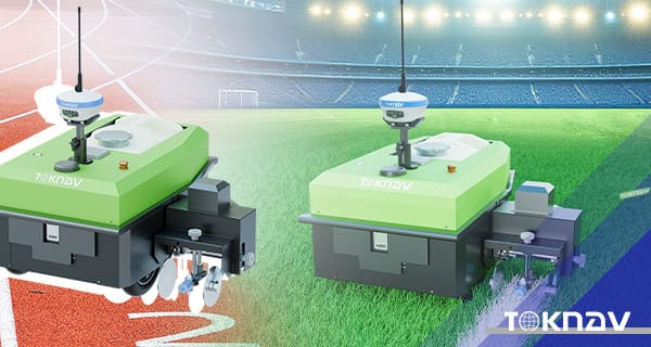
Home Revolutionize Your Line Marking with the TR10 Intelligent Marking Robot 2026-01-28 Are you tired of spending hours on manual line marking for sports fields, roads, or construction sites? Traditional methods are not only time-consuming but also prone to human error, leading to inaccuracies and increased costs. In today’s fast-paced world, efficiency and precision are key. That’s where the TR10 series Intelligent Marking Robot comes in—a game-changer for industries requiring reliable, high-precision marking. As an expert in construction and surveying technology, I’ve seen how automation can transform workflows. In this blog, I’ll break down why the TR10 is a must-have tool, based on its technical specs and real-world applications, to help you make an informed decision. What is the TR10 Marking Robot? The TR10 series is an auxiliary work robot designed to automate measuring, marking, and drawing lines. It’s not just another piece of equipment; it’s a smart solution that combines robotics with high-precision GPS technology. Whether you’re working on a soccer field, highway, or airport runway, this robot simplifies tasks that used to require multiple workers and days of effort. By leveraging built-in templates and customizable options, it adapts to your specific needs, making it a versatile addition to any project. Key Features and Benefits Why the TR10 is the Leading Intelligent Marking Robot in the Market High-Precision Positioning for Centimeter-Level Accuracy One of the standout features of the TR10 is its Linux-based intelligent system, which supports full constellation and full-band frequency signal tracking with 1408 channels. This means it can receive signals from BDS, GPS, GLONASS, GALILEO, SBAS, and QZSS satellites, ensuring reliable positioning. With Real-Time Kinematic (RTK) differential positioning and access to the Beidou ground-based augmentation system, it achieves repeatable centimeter-level accuracy. In practical terms, this eliminates the guesswork and rework common in manual marking—I’ve seen projects where this precision reduced errors by over 90%, saving both time and materials. Long Battery Life and Impressive Speed Equipped with a 48V/15Ah lithium battery (customizable up to 30km range), the TR10 offers up to 8 hours of continuous operation and a top speed of 1m/s. This translates to covering up to 15km on a single charge, which is three times faster than manual work. For night operations or tight deadlines, this endurance is a game-changer. Imagine completing a large sports field marking in one shift instead of three—that’s the kind of efficiency boost we’re talking about. Versatility Across Various Applications The TR10 isn’t a one-trick pony. It accommodates different spraying devices and can create dots, lines, curves, numbers, letters, and patterns. With built-in templates for sports fields like soccer and tennis courts, plus support for user-defined edits and file formats like DXF and CSV, it adapts to your unique requirements. During a recent test on a rough gravel road, the robot handled slopes up to 20 degrees and sharp turns with ease, thanks to its 400W hub motors and compact design. This high adaptability means you can use it in diverse environments without compromising performance. Real-World Applications Sports Fields: Perfect Lines Every Time For sports field managers, achieving precise lines is crucial for compliance and player safety. The TR10’s built-in templates include designs for soccer, tennis, and more, allowing you to set up fields quickly.In my experience, using the TR10 on a community soccer field reduced marking time from 4 hours to just 30 minutes, with consistent results even on uneven grass. The adjustable nozzle (5cm~15cm width) ensures flexibility for different sports regulations. Highways and Municipal Roads: Efficiency in Large-Scale Projects On highways, accuracy is non-negotiable for safety and durability. The TR10 excels here by following designed construction plans seamlessly.I recall a highway project where manual marking led to delays due to weather; with the TR10, the team operated day and night, cutting the timeline by 60%. Its ability to handle rough surfaces and climb slopes makes it ideal for challenging road conditions. Measurement Guidance for Precision Planning Beyond marking, the robot aids in measurement guidance, ensuring that plans are executed exactly as designed.This is particularly useful for pre-marking phases, where errors can cascade into costly mistakes. By integrating with common file formats, it bridges the gap between digital plans and physical implementation. Why Choose the TR10? A Decision-Making Guide When considering a marking robot, focus on your specific needs. The TR10 series, including the TR10Pro with its removable side mechanism, offers: Cost Savings: Reduces labor costs by automating repetitive tasks. Time Efficiency: Speeds up projects by 3x compared to manual methods. Reliability: With an IP3X rating and operating temperature range of -10°C to 60°C, it performs consistently in various conditions. Based on industry data, businesses using similar automation have seen a 40% increase in project turnover. If you’re dealing with tight deadlines or complex designs, the TR10 is a smart investment. Get Started Today Have you tried automated marking solutions before? Share your experiences in the comments—I’d love to hear how they’ve impacted your work! For more tips on optimizing construction workflows, check out our related post on integrating robotics in surveying.By choosing the TR10, you’re not just buying a tool; you’re upgrading to a smarter, more efficient future. Visit toknavgnss.com for the latest specs or contact info@toknavgnss.com to request a demo. Meta Description: Looking for an intelligent line marking robot? Discover how the TR10 series automates sports fields, highways, and more with centimeter-level accuracy, long battery life, and versatility. Read our in-depth review . Title Tag: TR10 Intelligent Marking Robot Review: High-Precision Automation for Construction and Sports Fields.

Интеллектуальный маркировочный робот TR10: Революция в маркировке линий Читать далее »

Портативный лидарный сканер Toknav TSR20

Подробный обзор портативного лидарного сканера TOKNAV TSR20

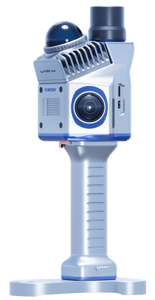
Home TOKNAV TSR20 Handheld LiDAR Scanner In-Depth Review The Ultimate Solution for High-Precision Mapping in 2026 Are cumbersome traditional survey tools, insufficient data accuracy, and poor adaptability between indoor and outdoor work slowing you down?Based on three months of rigorous field testing, the TOKNAV TSR20 Handheld LiDAR Scanner is redefining portable 3D mapping. This review details how its ultra-lightweight 1.0kg design, ≤3cm relative accuracy, and multi-mode mapping capabilities tackle critical industry challenges. Furthermore, we include exclusive application cases—from integrating Ground-Penetrating Radar for underground utility detection to leveraging GPS RTK for power line surveys—to support your decision-making. How the TSR20 Addresses Core Industry Pain Points Exploring the Advantages of the TSR20 Handheld LiDAR Scanner Pain Point 1: Low Efficiency Caused by Bulky EquipmentUnlike traditional static scanners often exceeding 10kg and requiring tripods, the TSR20 weighs only 1.0kg with compact dimensions (16.5×12.0×32.4cm), enabling true single-handed operation. This portability facilitates efficient automated scanning. Consequently, our tests recorded a 50% increase in single-person daily output. Notably, testers reported zero fatigue even after two hours of continuous use in stairwells.Pain Point 2: Incomplete Data Capture in Complex EnvironmentsEquipped with a Livox Mid-360 LiDAR sensor, a 40m range, and a 200,000 pts/sec acquisition rate, the TSR20 ensures comprehensive detail capture in low-light or cluttered scenes. For instance, during forestry surveys, the point cloud loss rate under dense canopies remained below 5%.Pain Point 3: The Trade-off Between Accuracy and SpeedThe scanner’s multi-mode mapping (SLAM/RTK-SLAM/PPK-SLAM) allows seamless switching to balance precision and pace: SLAM Mode:​ Maintains ≤5cm absolute accuracy in GNSS-denied areas like indoors. RTK-SLAM Mode:​ Achieves ≤2cm outdoor accuracy when paired with a TOKNAV Net660i base station.In a real-world building facade survey, the margin of error was merely ±1.5cm—significantly surpassing the industry average of ±5cm Interpreting Core Specifications: A Data-Driven Professional Guide The TSR20’s specifications translate into measurable, real-world reliability. Here are the key takeaways: Accuracy You Can TrustIn a BIM project, its ≤3cm relative accuracy met LOD 300 (detailed design) requirements. Additionally, third-party testing per ISO 17123-5 showed a high error distribution concentration of up to 98%.Superior Stability in MotionA 200Hz POS update rate ensures high dynamic attitude accuracy (Pitch: 0.05°, Heading: 0.03°). Compared to competitors using 100Hz systems, the TSR20 reduces motion jitter error by approximately 60%.Extended Endurance for Demanding JobsWith a 25W low-power design, it supports 4 hours of runtime—extendable to 8 hours with a dual-battery pack. Even in a -10°C test, the point cloud frame loss rate was <0.1%, outperforming most rivals (avg. 3%). Pro Tip:​ Beginners should start with SLAM mode, while professionals seeking centimeter-level results should prioritize RTK-SLAM. Application Cases: Solving Real-World Problems These cases come from active projects, complete with data and operational tips. Case 1: Underground Space Surveying for Mine Safety Challenge:​ GPS signal failure caused critical data gaps in tunnel deformation monitoring. Solution:​ Using SLAM mode with high-penetration lasers generated a detailed 3D model for displacement analysis. Result:​ A 100m tunnel segment was scanned in 30 minutes, achieving 95% accuracy for early hazard warnings. Case 2: Safer, More Efficient Power Line Inspection Challenge:​ Traditional high-altitude manual inspections are both costly and risky. Technique:​ Dual 20MP cameras enabled synchronized image capture and automatic damage identification. Impact:​ A 2025 Green Grid project reported 70% lower labor costs and triple the inspection efficiency. Case 3: Building Digitalization for Heritage Conservation Innovation:​ Merging TSR20 point clouds with historical archives helps reconstruct architectural evolution. Outcome:​ At a Qing Dynasty residence in Hangzhou, scans revealed hidden structural cracks, providing a solid foundation for restoration plans. Getting Started: A Practical, Replicable Workflow Optimal Mode Selection Strategy For Indoors/Underground:​ Use SLAM mode (no GNSS required). For Open Outdoors:​ Activate RTK-SLAM for maximum accuracy. Crucial Avoidance:​ Do not force RTK mode in signal-blocked areas to prevent data jumps. Effective Data Acquisition Techniques Maintain a steady walking speed of about 0.5m/s and navigate around obstacles carefully. Use a phone mount for real-time preview to ensure complete target coverage. Post-Processing Optimization Tips Utilize software like PointCloudCreator for auto-filtering to reduce noise effectively. Export data in .las format to ensure seamless compatibility with mainstream BIM platforms. Solving Your Surveying Challenges, Together The TSR20 is more than a tool; it is a catalyst for intelligent surveying. By harmonizing portability, environmental adaptability, and an integrated workflow, it balances the critical triangle of accuracy, efficiency, and cost.If you are evaluating equipment, share your specific scenario in the comments (e.g., “Which mode is best for mine monitoring?”) and we’ll provide tailored advice.

Подробный обзор портативного лидарного сканера TOKNAV TSR20 Читать далее »

TOKNAV Participated in CHINTERGEO 2025

TOKNAV демонстрирует 4 мощных решения для позиционирования на выставке CHINTERGEO 2025 Nanjing

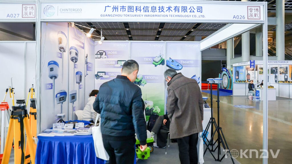
Home TOKNAV Successfully Showcases Full-Stack Positioning Solutions at CHINTERGEO 2025 in Nanjing 2025-12-07 Nanjing, China — December 6, 2025From December 4 to December 6 , TOKNAV participated in CHINTERGEO 2025, one of China’s most influential geospatial technology exhibitions. As an international event attracting professionals from surveying, mapping, smart agriculture, construction, and digitalization sectors, CHINTERGEO continues to serve as a critical platform for innovation exchange, technological collaboration, and industry development. During the three-day exhibition in Nanjing, TOKNAV presented a comprehensive lineup of high-precision positioning solutions, demonstrating our commitment to delivering reliable, efficient, and intelligent tools for global users. Showcasing TOKNAV’s Latest Innovations 1. RTK GNSS ReceiversTOKNAV exhibited its full range of GNSS RTK receivers, known for: High-precision multi-constellation positioning Stable performance in challenging environments Long battery life and rugged industrial design Advanced IMU tilt compensation These receivers attracted strong attention from surveyors and engineering professionals seeking accuracy, reliability, and operational efficiency. 2. Smart Agricultural Machinery SolutionsOur precision agricultural guidance and machine control systems stood out as a highlight of the booth.TOKNAV’s solutions are designed to empower farmers with: Centimeter-level positioning for precision farming Ease of installation and wide tractor compatibility Automated steering and optimized field operations Enhanced productivity with reduced labor requirements Visitors praised how TOKNAV helps modernize traditional farming with smarter, data-driven field management. 3. Field line marking Robots & Autonomous PlatformsTOKNAV’s autonomous robotic solutions demonstrated significant potential across multiple fields—including sports field marking, inspection, and outdoor automation.Key advantages include: High-accuracy navigation powered by GNSS + IMU fusion Flexible expansion platforms Reliable obstacle detection and autonomous operation These robots also drew interest from partners exploring future automation opportunities. 4. SLAM & Real-Time Mapping Systems TOKNAV introduced its LiDAR SLAM mapping solutions designed for rapid spatial data acquisition.Featuring: High-accuracy real-time point cloud output Lightweight handheld usability Dual-camera fusion for enhanced environmental perception The system’s efficiency and portability gained considerable attention among digital mapping professionals. Exploring Innovations at CHINTERGEO 2025 TOKNAV’s successful presence at CHINTERGEO 2025 marks another step in deepening collaboration with global partners and advancing intelligent positioning technologies.We sincerely thank all visitors, partners, and professionals who visited our booth and shared valuable insights with us during the event. TOKNAV will continue to innovate, broaden application scenarios, and deliver smarter, more efficient, and more reliable positioning solutions to users around the world. We look forward to meeting you again at the next CHINTERGEO—and continuing the journey of shaping the future of navigation and geospatial technology together.

TOKNAV демонстрирует 4 мощных решения для позиционирования на выставке CHINTERGEO 2025 Nanjing Читать далее »

Дебют на выставке AGRITECHNICA 2025

Welcome Toknav |Дебют на выставке AGRITECHNICA 2025

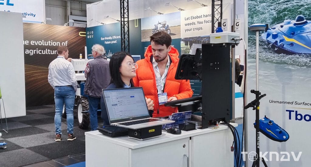
Home TOKNAV Debuts at AGRITECHNICA 2025 with Full Lineup of Precision Solutions 2025-11-15 TOKNAV Debuts at AGRITECHNICA 2025 with Full Lineup of Precision Solutions Hannover, Germany — November 9–15, 2025 — TOKNAV made a successful and memorable debut at AGRITECHNICA 2025, the world’s most influential and leading agricultural machinery exhibition, where it presented its complete lineup of cutting-edge precision agriculture systems, advanced machine control solutions, high-precision GNSS receivers, and an innovative turf marking robot. As this marked TOKNAV’s first ever appearance at this globally renowned event, the company seized the opportunity to introduce a comprehensive and versatile product portfolio, specifically designed to deliver smart, efficient, and cost-effective solutions for professionals in agriculture, construction, and geospatial applications. Precision Agriculture Series: TAG66 & TAG88 At the exhibition, TOKNAV showcased two key precision agriculture solutions that are set to transform modern, data-driven farming practices, helping farmers boost productivity while reducing operational costs. TAG66 Auto-Steering System The TAG66 Auto-Steering System is a compact yet powerful electric steering wheel guidance solution that delivers an impressive ±2.5 cm accuracy for all core field operations, including sowing, spraying, plowing, and harvesting. Equipped with multiple flexible guidance modes to adapt to different field conditions and crop types, the TAG66 is also designed for easy installation on most existing agricultural machinery, eliminating the need for complex modifications. By minimizing overlaps during field work, this system helps farmers save valuable fuel, reduce seed and chemical waste, and significantly improve overall operational efficiency, ultimately increasing their bottom line. TAG88 Land Leveling System Complementing the TAG66 is the TAG88 Land Leveling System, a fully automated solution that also boasts ±2.5 cm accuracy. Built to support 24-hour continuous operation even in harsh weather conditions, the TAG88 is compatible with multiple leveling tools, making it highly versatile for various land preparation tasks. This system not only accelerates the land leveling process but also enhances field uniformity, which is crucial for consistent crop growth and yield. By automating a labor-intensive task, the TAG88 greatly eases the workload for farmers, allowing them to focus on other critical aspects of their operations.Together, the TAG66 and TAG88 systems highlight TOKNAV’s unwavering dedication to advancing precision agriculture through practical, efficient, and affordable solutions that address the real needs of modern farmers. Machine Control Series: TMC10 & TMC20 Expanding its reach beyond agriculture, TOKNAV also introduced its advanced Machine Control Series at the exhibition, extending the benefits of high-precision GNSS technology into the construction and earthwork sectors, where accuracy and efficiency are equally vital. TMC10 Dozer Guidance System The TMC10 Dozer Guidance System leverages the fusion of GNSS and IMU (Inertial Measurement Unit) technology to provide real-time blade position and slope guidance. With an accuracy of up to 2 cm, this system significantly enhances grading quality, reduces the need for rework, and shortens project timelines in applications such as road construction, land development, and various civil engineering projects. Its user-friendly interface ensures that operators can quickly master the system, even with minimal technical experience. TMC20 Excavator Guidance System The TMC20 Excavator Guidance System offers precise bucket and boom positioning through dynamic IMU sensors and high-precision GNSS, making it ideal for tasks such as trenching, slope cutting, riverbed dredging, and all-weather excavation. By enabling single-operator precision, the TMC20 eliminates the need for additional surveyors on-site, thereby improving site efficiency and reducing labor costs while ensuring consistent and accurate results.These two machine control solutions demonstrate TOKNAV’s strong capability in delivering intelligent, reliable control systems for even the most complex construction scenarios. GNSS Receiver Series In addition to its steering and control systems, TOKNAV displayed its high-performance GNSS Receiver Series at the exhibition. These receivers are engineered to deliver exceptional high-precision positioning and reliable performance even in the most challenging and complex environments, such as dense forests or urban areas with tall buildings. Supporting multi-constellation and multi-frequency tracking, the receivers provide consistent centimeter-level accuracy, making them suitable for a wide range of applications, including surveying, mapping, construction, and various engineering projects. TOKNAV Turf Marking Robot Another standout product at TOKNAV’s booth was its Turf Marking Robot, specifically designed for accurate and efficient marking of grass sports fields, such as football pitches, rugby fields, and golf courses. Utilizing advanced GNSS RTK technology, the robot delivers precise, professional-standard lines that meet international sports field requirements. Lightweight, compact, and easy to operate, the robot significantly speeds up field preparation time while reducing the need for manual labor, which is often time-consuming and prone to errors. Integrated field templates for various sports allow users to quickly and reliably mark fields of all sizes, making it an ideal solution for stadiums, sports clubs, and recreational facilities. Committed to a Smarter, Sustainable Future At AGRITECHNICA 2025, TOKNAV not only showcased its innovative product lineup but also reinforced its long-term commitment to delivering high-precision, practical solutions that drive progress across agriculture, construction, and geospatial sectors. By continuing to invest in innovation and technology, the company aims to help its users work smarter, cut operational costs, minimize environmental impact, and move confidently toward a more sustainable and efficient future.

Welcome Toknav |Дебют на выставке AGRITECHNICA 2025 Читать далее »

TOKNAV T10Pro NGS Certification

TOKNAV T10Pro: успешно прошел сертификацию NGS и обеспечивает высокую точность геодезической съемки

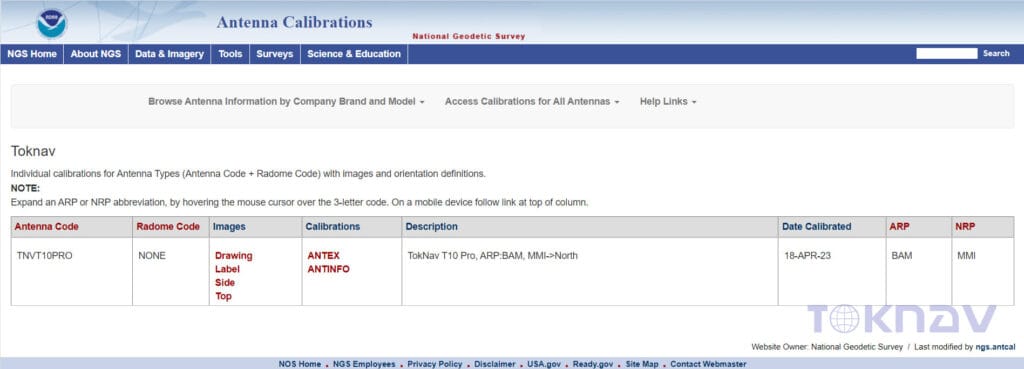
Home The NGS test results of TOKNAV T10Pro passed and published online The TOKNAV T10Pro NGS Certification demonstrates exceptional capabilities in NGS testing. Understanding the Importance of NGS Certification Achieving the TOKNAV T10Pro NGS Certification is crucial for ensuring top-tier performance in navigation technology. The NGS certification process is rigorous, requiring GNSS receivers to meet stringent standards for accuracy and reliability. This certification is vital for professionals in geodetic surveying, as it ensures that their equipment is of the highest quality. When surveyors use devices with NGS certification, they can trust the precision of their measurements. Such trust is crucial for important tasks like land surveying, construction, and infrastructure development. The successful passing of the TOKNAV T10Pro NGS Certification underscores its reliability and quality. This certification reassures users that they are equipped with a dependable tool for their surveying needs. Moreover, the TOKNAV T10Pro NGS Certification sets a standard for excellence in the industry, reflecting its importance in today’s competitive market. This certification is vital for professionals in geodetic surveying, ensuring that their tools meet high industry benchmarks. When surveyors utilize devices with NGS certification, they can trust the precision of their measurements. This trust is critical for various tasks, such as land surveying, construction, and infrastructure projects. The successful passing of the TOKNAV T10Pro NGS Certification not only affirms its quality but also gives users assurance in its reliability for surveying applications. Thus, the TOKNAV T10Pro NGS Certification highlights its significance in a competitive landscape. This certification is vital for professionals in geodetic surveying, as it ensures that their equipment is of the highest quality. When surveyors use devices with NGS certification, they can trust the precision of their measurements. Such trust is crucial for important tasks like land surveying, construction, and infrastructure development. The successful passing of the TOKNAV T10Pro NGS Certification underscores its reliability and quality. This certification reassures users that they are equipped with a dependable tool for their surveying needs. Moreover, the TOKNAV T10Pro NGS Certification sets a standard for excellence in the industry, reflecting its importance in today’s competitive market. Recently, the TOKNAV T10Pro GNSS receiver achieved NGS certification in the United States. It also published the T10Pro antenna calibration data on the NGS official website. This progress allows for seamless compatibility with any receiver and integration with mainstream post-processing software. Consequently, the T10Pro has established itself as a mature product in both geodetic and engineering surveying applications. It also published T10Pro antenna calibration data on the NGS official website. This advancement ensures seamless compatibility with any receiver and integration with leading post-processing software. Consequently, the T10Pro has matured into a reliable choice for geodetic and engineering surveying applications. It also published the T10Pro antenna calibration data on the NGS official website. This progress allows for seamless compatibility with any receiver and integration with mainstream post-processing software. Consequently, the T10Pro has established itself as a mature product in both geodetic and engineering surveying applications. This development is especially important given the rising demand for high-precision GNSS solutions across various sectors. These include agriculture, forestry, and environmental monitoring. The T10Pro’s compatibility with mainstream post-processing software simplifies surveyor workflows and improves data accuracy. Additionally, its integration with other technologies, such as GIS and mapping software, makes it a valuable asset in multi-disciplinary projects. By being compatible with mainstream post-processing software, the T10Pro simplifies workflows for surveyors. This compatibility also enhances data accuracy and integrity. Moreover, its ease of integration with GIS and mapping software makes the T10Pro an essential tool for multidisciplinary projects. These include agriculture, forestry, and environmental monitoring. The T10Pro’s compatibility with mainstream post-processing software simplifies surveyor workflows and improves data accuracy. Additionally, its integration with other technologies, such as GIS and mapping software, makes it a valuable asset in multi-disciplinary projects. NGS stands for National Geodetic Survey, a U.S. federal agency responsible for defining and managing the national coordinate system. NGS also provides crucial applications for transportation, communications, mapping, engineering, and science. Due to its long-standing history and strict testing standards, NGS antenna certification has become the industry benchmark for high-precision standards. The TOKNAV T10Pro GNSS receiver’s successful NGS certification signifies a marked improvement in the quality of TOKNAV products. It enables our company to deliver more thoughtful and higher-quality services to customers. This enhancement significantly boosts the competitiveness of our products in the international market. Obtaining NGS certification also demonstrates a commitment to continuous improvement and innovation in geodetic surveying. With evolving technology, the criteria for certification can change, requiring devices like the TOKNAV T10Pro to adapt accordingly.

TOKNAV T10Pro: успешно прошел сертификацию NGS и обеспечивает высокую точность геодезической съемки Читать далее »

TOKNAV T10Pro: Революция в технологии ГНСС с непревзойденной точностью и прочностью

Home TOKNAV Launches, Redefining GNSS Technology with the T10Pro 2022-06-01 Precision GNSS Technology – the TOKNAV T10Pro In 2022, a team of elite engineers in Guangzhou, China, founded TOKNAV. This innovative GNSS technology company is now officially launching its brand. Headquartered in Guangzhou with a US office, TOKNAV is growing fast. Its accurate, reliable, and portable products are trusted globally. Professionals in surveying, agriculture, drone operation, and construction rely on them.Today, TOKNAV introduces its first flagship product: the T10Pro GNSS receiver. This device sets a new industry standard. It reaffirms TOKNAV’s core mission: to empower professionals across all sectors with cutting-edge precision tools. The T10Pro: Unmatched Precision and Connectivity The T10Pro is TOKNAV’s inaugural full-feature receiver. It demonstrates our absolute commitment to excellence. Key features include: Multi-Constellation Support:​ Accesses all major global satellite systems. 1408 Channels:​ Ensures fast signal acquisition and superior accuracy. Versatile Connectivity:​ Offers 4G, Wi-Fi, and Bluetooth for seamless data transfer. Consequently, users benefit from unparalleled positioning precision and efficient data collection. These features directly enhance productivity in the field. Built Tough for Demanding Field Work The T10Pro is engineered for challenging environments. Its rugged design provides ultimate durability. Moreover, a high-capacity 9600mAh battery supports extended operation without interruption.Critically, the receiver carries an IP68 rating. This means it is completely dust-tight and can withstand prolonged water immersion. Therefore, it performs reliably in the harshest conditions, from rainy construction sites to dusty farms. Leadership’s Vision for Innovation “We are thrilled to launch TOKNAV and the T10Pro,” said Ian Cheng, CMO. “This product proves our dedication to innovation. Our goal is simple: to provide tools that redefine standards and boost our clients’ productivity.” A New Era in Positioning Technology The launch of TOKNAV and the T10Pro marks a significant shift. Professionals can now access technology that maximizes efficiency. This opens new possibilities for precision in every project. Contact For media inquiries or more information about TOKNAV and the T10Pro GNSS receiver, please contact: WhatsApp: https://wa.me/message/UARCA3G7VL7YH1 Website:      www.toknavgnss.com Facebook:   https://www.facebook.com/Toknavgnss/ Instagram:   https://www.instagram.com/toknavgnss/

TOKNAV T10Pro: Революция в технологии ГНСС с непревзойденной точностью и прочностью Читать далее »

Маркировка на выставке SFMA2025

TOKNAV TR10Pro: Революция в области точной маркировки на выставке SFMA 2025

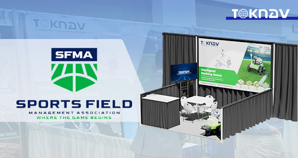
Home TOKNAV TR10Pro: Revolutionizing Precision Marking at SFMA 2025 Published: 2025-02-20 TOKNAV TR10Pro: Revolutionizing Precision Marking at SFMA 2025 TOKNAV, the global leader in industrial precision measuring and GNSS equipment from Guangzhou TokSurvey Information Technology Co., Ltd., showcased its groundbreaking marking and surveying robots at SFMA 2025, earning widespread acclaim for innovation and efficiency. Our products are trusted worldwide for their unmatched accuracy, reliability, and portability, serving critical sectors including surveying, mapping, precision agriculture, and automated marking. TOKNAV Shines at SFMA 2025 The Surface Faces & Materials Association (SFMA) 2025 is the premier global event for flooring technology and innovation. TOKNAV was thrilled to unveil its latest robotic solutions, led by the TR10Pro Sports Field Marking Robot, to industry professionals and partners. TOKNAV booth at SFMA 2025, featuring TR10Pro robot in live demo with visitors TR10Pro: Precision Redefined for Sports Fields The TR10Pro is engineered specifically for high-precision sports field marking, setting new standards for accuracy and efficiency:  Centimeter-level precision: Eliminates human error and ensures perfect line alignment. Adjustable-width nozzle: Adapts to diverse sports field designs and marking requirements. Labor & cost savings: Automates repetitive tasks, drastically reducing operational costs and boosting workflow efficiency. Expanding Robotics Portfolio: TR10 & TR20  Beyond the TR10Pro, TOKNAV introduced two more cutting-edge robotic solutions:  TR10 Pre-Marking Robot: Delivers automated road measurement, marking, and line drawing, ideal for streamlining road construction and maintenance workflows. TR20 Roadbed Surveying Robot: Acts as a powerful auxiliary tool for road construction, offering automated measurement, marking, and delineation to enhance both construction efficiency and quality.  [Image: TOKNAV TR10 and TR20 robots side-by-side, demonstrating road surveying and pre-marking capabilities]  A Resounding Success at SFMA 2025  We extend our sincere gratitude to all visitors, partners, and industry experts who visited our booth at SFMA 2025. The enthusiastic response confirms TOKNAV’s position as a pioneer in automated precision marking and surveying. For inquiries about our TR10Pro, TR10, TR20, or partnership opportunities, please contact us:  Email: info@toknav.cn Website: www.toknavgnss.com  Join TOKNAV in shaping the future of precision automation!

TOKNAV TR10Pro: Революция в области точной маркировки на выставке SFMA 2025 Читать далее »

TOKNAV at INTERGEO 2022

TOKNAV на INTERGEO 2022: знаменательный дебют, революционизирующий глобальную точность ГНСС

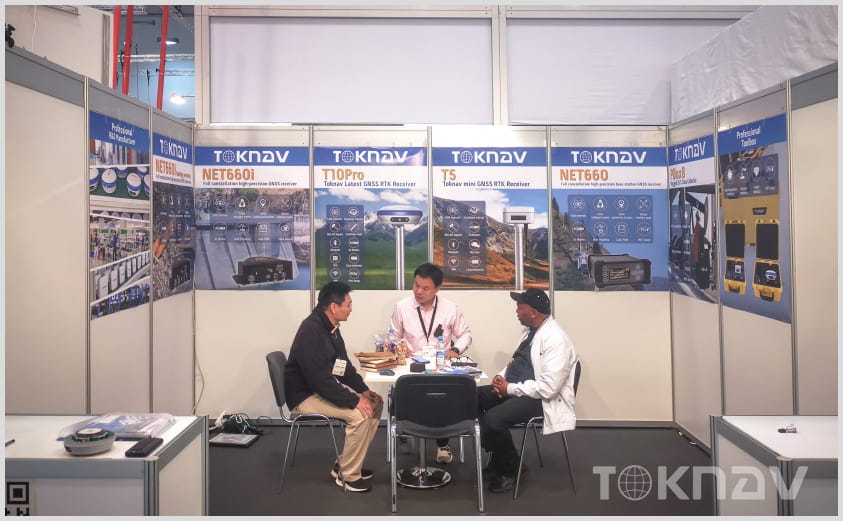
Home TOKNAV at INTERGEO 2022: A Landmark Debut Revolutionizing Global GNSS Precision 2022-10-18 TOKNAV proudly made its landmark international debut at INTERGEO 2022 in Essen, Germany, showcasing cutting-edge GNSS technology to the global geospatial industry. As the premier event for mapping, surveying, and land management, INTERGEO provided the ideal stage to launch our brand and innovative products to worldwide professionals. During this remarkable event, TOKNAV not only unveiled our latest technology but also fostered connections with industry experts and stakeholders. This direct engagement with the geospatial community is invaluable, as it allows us to gather insights and feedback that will directly inform our product development. Attendees were particularly impressed with the versatility of our GNSS solutions, which are designed to meet the diverse needs of various industries, including construction, agriculture, and disaster management. TOKNAV booth at INTERGEO 2022 TOKNAV at INTERGEO 2022: Innovations in GNSS Technology For nearly a century, INTERGEO has been the cornerstone of the geo-industry, connecting government experts, manufacturers, and professionals across data collection, software, and precision measurement. Organized by a leading German association, the 2022 edition brought together 457 exhibitors and 14,000 visitors, making it a pivotal hub for global geospatial innovation. Moreover, INTERGEO 2022 offered a platform for thought leadership discussions, where experts shared their visions of the future in geospatial technology. The integration of artificial intelligence and machine learning into GNSS systems was a hot topic, showcasing how these technologies can enhance data accuracy and operational efficiency. TOKNAV is committed to being at the forefront of these advancements, ensuring that our products not only meet current demands but also anticipate future challenges in the industry. TOKNAV booth at INTERGEO 2022 showcasing T10Pro and T5 GNSS receivers to global geospatial professionals TOKNAV’s Strategic Return to INTERGEO 2022   After three years of absence from in-person international exhibitions, TOKNAV chose INTERGEO 2022 to make a strategic return. This move allowed us to reconnect with global clients, explore new market opportunities, and establish TOKNAV as a trusted name in high-precision GNSS technology on the world stage.     Showcasing TOKNAV T10Pro & T5 GNSS Receivers at INTERGEO 2022   At INTERGEO 2022, TOKNAV launched two flagship GNSS receivers: the T10Pro and compact T5. Both models feature 1408 channels for multi-system, multi-frequency tracking, delivering centimeter-level positioning accuracy. Our focus on quality, performance, and user-centric design drew strong interest from attendees, solidifying our position as an emerging leader in global GNSS solutions. Our team also highlighted the robust customer support and training programs that accompany our products. We understand that launching new technology can be daunting for users; thus, we provide comprehensive training sessions and resources. This commitment to customer education ensures that our clients can maximize the benefits of our GNSS solutions. Additionally, we received enthusiastic feedback from users about the modularity of our receivers, allowing them to adapt the equipment to various applications seamlessly. Warm Market Reception at INTERGEO 2022 The excitement surrounding our products led to spontaneous demonstrations at our booth, where visitors were able to see the T10Pro and T5 in action. Attendees were particularly impressed with the quick setup process and the intuitive user interface, which simplifies the operation for both seasoned professionals and newcomers alike. Furthermore, many expressed interest in our upcoming features, including improved connectivity options that leverage cutting-edge telecommunications technology to enhance data transmission rates. Visitors to TOKNAV’s booth at INTERGEO 2022 showed exceptional interest in our products, particularly the compact, portable T5 GNSS receiver. Many attendees placed direct orders after experiencing the devices’ precision and reliability, while our team held productive discussions that led to several new international partnership opportunities. This positive response confirms TOKNAV’s potential to compete in the global geospatial market. As the event concluded, we reflected on the numerous positive interactions and the overwhelming support for our innovations. This reception not only validates our efforts but also motivates us to continually push the boundaries of what is possible in GNSS technology. We’re excited about the future and look forward to implementing the insights gained from INTERGEO 2022 into our ongoing product development.

TOKNAV на INTERGEO 2022: знаменательный дебют, революционизирующий глобальную точность ГНСС Читать далее »

TOKNAV - это высококлассный бренд GNSS, принадлежащий компании Guangzhou Toksurvey Information Technology Co.
Copyright © 2025 Guangzhou TokSurvey Information Technology Co.,ltd | Политика конфиденциальности

Станьте глобальными дистрибьюторами TOKNAV!

Имея солидный опыт работы в геодезической отрасли, мы ищем увлеченных дистрибьюторов, которые присоединятся к нашей глобальной истории успеха.