jeffreyrtk@gmail.com

Здравствуйте, меня зовут Джеффри, я основатель сайта toknavgnss.com. Уже 8 лет я управляю фабрикой в Китае, производящей GNSS RTK, и цель этой статьи — поделиться с вами знаниями о GNSS с точки зрения китайского поставщика.

TOKNAV 1a3f47bf68f65704832db732d45c8272

Что определяет промышленный класс ГНСС? Надежные RTK GPS, сверхмощные ГНСС и инструменты для наружной съемки

Home What Defines Industrial Grade GNSS? Rugged RTK GPS, Heavy Duty GNSS & Outdoor Survey Tools 2026-04-25 What Makes GNSS Truly Industrial Grade? Industrial grade GNSS is not just about precision. It is built to survive harsh field conditions while delivering consistent RTK performance. For surveyors, construction teams, and geospatial professionals, rugged RTK GPS, heavy duty GNSS, and reliable outdoor survey tools must resist water, dust, drops, and extreme temperatures. Toknav designs its receivers around these three non-negotiable pillars: IP68 waterproof/dustproof, 1.5m drop resistance, and ultra-wide operating temperature. This blog explains how these features define real industrial quality. Core Standards of Industrial Grade GNSS Durability That Outlasts Harsh Environments True industrial grade GNSS must operate reliably where consumer devices fail. It needs full sealing against dust and water, physical shock resistance, and stable performance across extreme temperatures. These features are not optional—they are mandatory for heavy duty GNSS used daily in construction, mining, mapping, and precision agriculture. Precision Meets PersistenceIndustrial GNSS combines centimeter-level RTK accuracy with 24/7 resilience. Whether used as rugged RTK GPS for stakeout or static outdoor survey tools, it must maintain fixed solutions in rain, snow, heat, or vibration. Toknav receivers deliver ±(8mm + 1ppm) horizontal RTK accuracy without compromising toughness. Pillar 1 – IP68 Rating: Fully Waterproof & Dustproof Industrial Protection IP68 Explained – Zero Intrusion, Maximum Reliability IP68 is the highest standard for portable industrial electronics. It means 100% dust tight and submersible in water under defined pressure and time. For field crews, this eliminates downtime from rain, mud, splashes, or accidental immersion. Why IP68 Matters for Outdoor Survey Tools Jobsites expose gear to blowing dust, flooding, mud, and salt spray. Lower ratings like IP65 or IP67 only resist splashes or short immersion. Toknav’s IP68 rugged RTK GPS keeps working through storms and floods, protecting internal modules and extending service life. Toknav IP68 Implementation All Toknav high end models including T10Pro, T20Pro, T30 series, T40 series, T50 series, and NET660 series use IP68 rated magnesium alloy casings. They meet strict industrial sealing standards and are certified CE, FCC, KC, and NGS for global use. This makes them trusted heavy duty GNSS for survey and monitoring worldwide. Industrial Grade GNSS Rugged RTK GPS Heavy Duty Outdoor Survey Tools IP68 Pillar 2 – 1.5m Drop Resistance: Built for Rough Handling Industrial Strength Shock Protection Field work involves drops, knocks, pole falls, and transport vibration. A single drop can break consumer grade GNSS. Industrial receivers need structured shock absorption and reinforced housing. Toknav Drop-Tested Rugged RTK GPS Jobsites expose gear to blowing dust, flooding, mud, and salt spray. Lower ratings like IP65 or IP67 only resist splashes or short immersion. Toknav’s IP68 rugged RTK GPS keeps working through storms and floods, protecting internal modules and extending service life. Drop Resistance for Heavy Duty GNSS Workflows Whether climbing, hiking, or moving across rough terrain, users cannot avoid accidents. Toknav’s shock-proof design ensures outdoor survey tools stay functional even after repeated drops. This is industrial-grade confidence. Industrial Grade GNSS Rugged RTK GPS Heavy Duty Outdoor Survey Tools IP68 Pillar 3 – Ultra-Wide Temperature: Perform in Freezing & Scorching Heat Temperature Stability Defines Industrial Grade Performance Electronics struggle in extreme cold or heat. Consumer GNSS may shut down, lose signal, or suffer battery failure. Industrial heavy duty GNSS must maintain function across wide thermal ranges. Toknav Wide-Temp Specifications Most Toknav receivers operate from -20°C to +60°C. The T50 series extends this to -30°C to +65°C, and NET660i series supports -40°C to +85°C for CORS and remote monitoring. Storage temperature reaches -40°C to +85°C across flagship lines. H3: Reliability for Year-Round Outdoor Survey Tools From Arctic winters to desert summers, Toknav GNSS works uninterrupted. Thermal stability ensures consistent RTK tracking, IMU tilt survey, and data logging. This makes it ideal for rugged RTK GPS in global field applications. Industrial Grade GNSS Outdoor Survey Tools Wide Temperature Rugged RTK GPS How Toknav Merges Ruggedness & High Performance 1408 Channels & Full Constellation Tracking Toknav receivers support GPS, GLONASS, Galileo, BDS, QZSS, SBAS, and NavIC. With 1408 tracking channels, they maintain fast lock and stable RTK fix even in challenging environments. IMU Tilt Survey (60°) Integrated IMU enables tilt compensation up to 60°, so users collect accurate data without perfect leveling. This boosts efficiency for outdoor survey tools in steep or blocked areas. H4: Long Battery Life & Fast Charging Batteries support 16–48 hours of field use. Fast charging via USB PD and adaptive power management reduces downtime. Hot swappable batteries in T40 series keep crews working continuously. Integrated 4G, WiFi, Bluetooth & Radio Built-in 4G full netcom, WiFi, Bluetooth, and high-power radio (up to 5W) ensure strong data links. Radio range exceeds 16km in open areas, ideal for rugged RTK GPS base-rover setups. Applications – Where Toknav Industrial GNSS Excels Construction & Engineering Survey IP68, drop resistance, and wide temperature make Toknav perfect for layout, excavation, and machine control. Heavy duty GNSS performs reliably on busy, dusty, and wet construction sites. H3: Mining & Geological Survey Harsh mining conditions demand extreme durability. Toknav receivers resist dust, vibration, and impact while delivering high precision positioning for mapping and monitoring. H3: Deformation Monitoring & CORS Networks NET660 series with IP68 and  40°C to +85°C operation provides stable reference data. They are ideal for long term structural monitoring and CORS base station applications. Precision Agriculture & Autonomous Systems Wide temperature and rugged sealing support agricultural machinery control, unmanned vehicles, and smart farming. Rugged RTK GPS ensures consistent positioning in all weather. Utilities, Forestry & Environmental Survey From power lines to forests, field crews face unpredictable conditions. Toknav outdoor survey tools keep working in rain, snow, heat, and rough terrain. Why Choose Toknav Industrial Grade GNSS? Verified Industrial Durability IP68, 1.5m drop resistance, and wide-temperature performance are fully tested and certified. Toknav does not compromise on build quality. High Precision RTK Performance Centimeter-level accuracy, 1408 channels, and IMU tilt survey make Toknav competitive with premium brands—at better value. True Heavy Duty Design Magnesium alloy casing, reinforced

Что определяет промышленный класс ГНСС? Надежные RTK GPS, сверхмощные ГНСС и инструменты для наружной съемки Читать далее »

Чествование невоспетых героев точности: Дань уважения работникам геодезии и картографии в День труда 2026 года + Toknav Official Holiday Arrangement

Home Honoring the Unsung Heroes of Precision: 2026 Labor Day tribute to surveying workers+ Toknav Official Holiday Arrangement 2026-04-25 Introduction: Why Surveying Professionals Deserve Our Deepest Respect This Labor Day If you stop to think about it, every road, every bridge, and every new urban community all starts with one essential job: professional surveying and mapping. Behind every clear coordinate and every solid engineering benchmark, there are hardworking surveying crew members working tirelessly outdoors. They face tough weather, walk long distances across rough ground, and stay on-site all year round. Simply put, they build the invisible foundation for every construction project we rely on. Labor Day isn’t just a long weekend to relax. It’s our chance to say thank you to every hardworking person who shows up, stays focused, and gets the job done well. Especially in the surveying industry, reliable field workers keep every project safe and accurate. In this warm holiday blog, we want to sincerely honor all global surveying and mapping frontline workers. We’ll also share Toknav’s official 2026 May Day holiday schedule, so all clients, partners, and survey teams can easily plan construction, orders, and technical support in advance. The Silent Dedication of Surveying and Mapping Frontline Workers: Guarding Precision with Persistence Working in all terrains, never afraid of harsh working conditions Let’s be real, office work is comfortable, but surveying work is completely different. Most surveyors spend almost all their working hours outside in the field. They climb hills, walk through muddy land, stand beside busy roads, and work on crowded construction sites every single day. No matter if it’s burning hot summer or cold windy winter, they carry survey gear, check points, collect data, and finish every measurement task on time, no excuses. Thanks to their careful repeated checks, many hidden construction risks and geological dangers are found early before problems happen. Every step they take makes construction safer, steadier, and more standard. They never chase attention or praise. They just quietly do their best to keep cities stable and projects reliable. This Labor Day, the whole Toknav team wants to send our warmest thanks and deepest respect to every frontline surveyor around the world. 2026 Labor Day tribute to surveying workers working with Toknav high-precision GNSS surveying equipment Bearing heavy responsibilities, holding precision as the core professional bottom line In surveying work, there is simply no room for mistakes. Even a tiny coordinate error can cause big rework, safety risks, and costly project losses. That’s why frontline surveyors always stay serious, patient, and focused. They double-check data, calibrate instruments many times, and record every detail carefully. Precision is not just a rule for them, it’s their daily work habit. From large highway and bridge projects to farmland surveys, city planning, and geological safety monitoring, surveyors are always the first on-site and the last to leave. With their professional skills, they lock in precise spatial data, support every construction stage, and quietly protect the safety of urban development. Truly, they are the unseen guardians behind every infrastructure project. Low-key dedication, worthy of the most sincere Labor Day praise If you work in engineering, you know it well: surveying workers are often the quiet, unsung heroes of the whole industry. No cozy offices, no air conditioning, just sun, wind, rain, and long outdoor walks every day. But think about it, without their hard work, we would have no safe roads, no standard buildings, and no complete geographic information systems at all. Labor Day is here to celebrate every ordinary person who works hard and stays dedicated. This year, we want to shine a special light on surveying frontline workers across the globe. Thank you for your patience, your strong work ethic, and your commitment to precision. Your hard work truly makes the whole industry better. How High-Quality GNSS Surveying Tools Empower Frontline Surveying Workers Efficiently We respect every laborer’s effort, and we also believe good tools should make tough field work easier. Old traditional survey tools are heavy, slow, and easy to be disturbed by bad weather or complex terrain. They make field workers more tired and waste valuable time. Luckily, modern GNSS high-precision technology has changed everything, making daily survey work faster, simpler, and much more efficient. Today’s professional GNSS survey devices offer real-time centimeter-level accuracy, stable all-weather satellite signals, and fast cloud data sharing. They work perfectly in mountains, forests, wetlands, and crowded city areas with tall buildings. Good surveying gear lowers fatigue, cuts working time, and keeps data highly accurate. Honestly, reliable GNSS tools are the best partner every field surveyor can have. Toknav: Always Empower Global Surveying Teams with Reliable GNSS Precision Solutions At Toknav, we truly understand how hard frontline surveyors work, so we always deliver reliable high-precision GNSS surveying equipment to support them. We are a friendly, professional global supplier focused entirely on high-precision GNSS positioning, Toknav GNSS RTK receiver development, and complete professional mapping positioning solution packages. For years, we have stood side by side with survey teams, engineering companies, and mapping institutions worldwide. Our goal is simple: create durable, easy-to-use, affordable GNSS equipment and provide caring, reliable technical support to lighten your field workload while optimizing every detail for real surveying scenarios. costumer feedback about grass sports field marking Every Toknav GNSS product is carefully developed and strictly tested under real harsh outdoor conditions. Our full range of RTK receivers, CORS base stations, data controllers, antennas, and survey accessories all hold CE and FCC international certifications. They feature strong anti-interference, long-lasting batteries, and steady performance, perfectly matching your all-day outdoor survey routines. Our popular T30, T40, and T50 RTK series come with practical smart functions: laser ranging, AR visual stakeout, full-system satellite reception, and smart cloud data management. With horizontal accuracy up to ±8mm and vertical accuracy up to ±15mm, these devices easily meet strict standards for railways, bridges, water conservancy, and land survey projects. Also, our self-developed tBase CORS station runs non-stop to build stable local positioning networks for large-area surveys. The built-in PPP autonomous

Чествование невоспетых героев точности: Дань уважения работникам геодезии и картографии в День труда 2026 года + Toknav Official Holiday Arrangement Читать далее »

Доставка Toknav: 2-3 дня быстрая отправка, 7 рабочих дней доставка крупногабаритного оборудования для GNSS-съемки

Home Toknav Shipping: 2-3 Days Fast Dispatch, 7 Working Days Bulk GNSS Survey Equipment Delivery 2026-04-25 Why Shipping Speed Matters for Surveying & GNSS Projects In surveying, mapping, precision agriculture, machine control, and geotechnical monitoring projects, every project manager and field team knows one universal truth: high-quality Toknav GNSS survey equipment matters. Reliable, predictable delivery makes the whole workflow run smoothly. Even the most accurate RTK receivers, stable deformation monitoring systems, and intelligent construction guidance tools cannot deliver real value if they arrive late. At Toknav, we do not only focus on crafting professional, durable, high-performance GNSS surveying hardware and tailored industry solutions. We also build a full-process, customer-centered shipping system to match our premium product quality, ensuring every batch of surveying instruments reaches global partners and end users safely, rapidly, and with zero unnecessary hassle. About Toknav: Trusted Professional GNSS Survey Equipment Manufacturer & Supplier As the core independent brand of Guangzhou TokSurvey Information Technology Co., Ltd., founded in 2019 by a team of senior industrial precision measurement engineers, Toknav has always rooted our development in practical industry demands. We focus on independent R&D, production, and global sales of full-series industrial precision measuring equipment. Our offerings cover mainstream star products including multi-model RTK receivers, high-precision CORS base stations, portable GIS data collectors, AR intelligent surveying terminals, handheld LiDAR scanners, and terrestrial laser scanners. All Toknav GNSS survey equipment undergoes strict factory calibration and multi-scene field tests, ensuring core positioning accuracy stable within centimeter level, adapting to complex working conditions such as urban high-rise occlusion, open-field farmland, and harsh construction sites. This has won long-term trust from distributors and engineering users across Asia, Africa, Europe, and the Americas. While we keep polishing product performance and upgrading iterative functions year by year—from the early launch of classic T10Pro RTK to the new generation T50 palm-sized IMU RTK—we always regard efficient, transparent, and flexible global logistics support as our core after-sales service advantage. We understand that for engineering contractors and surveying teams, procurement cycles are closely linked with project schedules. Equipment delivery delays will lead to on-site construction shutdown. Therefore, we have standardized a clear, efficient, and humane fast GNSS device shipping rhythm for all global orders. Standardized Toknav Shipment Timeline: Clear Cycle for All Order Quantities Small Orders Within 10 Units: 2–3 Days Fast Warehouse Direct Shipment Our daily shipment standard is clear and efficient for all types of order volumes. For small-batch supplementary orders, we support 2 to 3 working days fast warehouse delivery after order confirmation. Our Guangzhou centralized warehouse maintains sufficient spot inventory of mainstream full-series mapping gear all year round, covering hot-selling RTK T5/T20/T30/T40/T50 full series. There is no waiting for production scheduling or temporary inventory shortage delays. The professional warehouse team manages quality re-inspection, dustproof packaging, and performance spot checks, ensuring the equipment is intact and fully functional before leaving the warehouse. Toknav GNSS survey equipment fast shipping 2-3 days small order dispatch Bulk Orders Over 10 Units: 7 Working Days Shipment After Advance Payment For bulk orders, we adopt a standardized batch shipment mechanism. After the customer completes the formal advance payment, we will arrange full delivery within 7 working days. For large orders, we independently arrange special personnel to ensure production scheduling priority and packaging inspection priority. We avoid order backlog and queuing delays, feeding back the real-time progress to customers every day. Whether it is a one-time bulk procurement or unified supporting procurement, we can complete integrated synchronous RTK receiver bulk delivery without splitting orders. Domestic & Cross-Border Logistics Perks: Cost-Effective Full-Cover Shipping Solutions Domestic China Orders: Full Free Standard Logistics Door-to-Door Delivery For all domestic customers, we have launched real benefits: all domestic orders enjoy free standard logistics delivery, with no hidden logistics fees. We cooperate with reliable logistics fleets, covering all prefecture level cities and remote areas. This greatly reduces the comprehensive procurement cost and time cost for domestic engineering teams. Overseas Global Shipping: FedEx, DHL, UPS Authorized One-Stop Agency Service For global cross-border partners, we have built a full-channel, multi-mode logistics network. We enjoy exclusive preferential freight rates and priority customs clearance channels with FedEx, DHL, and UPS. This professional shipping mode fits urgent engineering emergency orders, arranging air express priority shipment, with fast arrival in 3 to 7 days in most overseas regions. Toknav global surveying instrument logistics DHL FedEx UPS air sea freigh Air Freight, Sea Freight & Customized Double Clearance Tax-Inclusive Logistics We support flexible matching of international air freight and sea freight schemes. Air freight is suitable for medium batch orders, while sea freight is cost-effective for large-scale bulk stocking orders. We also provide exclusive services for cross-border customs clearance, ensuring smooth logistics for global buyers. Full Cooperation With Customer-Appointed Logistics Companies We fully respect every personalized demand of partners. If customers have designated logistics providers, our professional team will fully cooperate throughout the process. We actively track the whole transportation link to ensure seamless docking without errors. Full-Process Order Tracking: Professional Sales Team Controls All Time Nodes Beyond efficient shipment, our one-stop service runs through every link of order cooperation. Every professional sales business specialist at Toknav acts as an exclusive order manager, tracking all key time nodes. We provide real-time order progress updates to customers every day, ensuring clarity throughout the procurement process. Why Choose Toknav: Premium GNSS Hardware + Worry-Free Shipping + Full Lifecycle Support Behind the reliable shipping service is Toknav’s strict control over product quality and full-life cycle technical support. All our GNSS surveying equipment has stable centimeter-level high precision and is suitable for harsh outdoor conditions. We also provide free multi-language professional technical training materials and online remote guidance, helping customers quickly get started with equipment operation. European grass field marking solution Get Instant Inquiry for Customized Fast Shipping Toda Whether you are a small engineering team or a large overseas group customer, Toknav can match efficient shipment schemes and flexible logistics solutions. If you have any equipment procurement demands or logistics scheme customization needs, please feel free to

Доставка Toknav: 2-3 дня быстрая отправка, 7 рабочих дней доставка крупногабаритного оборудования для GNSS-съемки Читать далее »

Как увеличить дальность действия RTK: Полное руководство с внешним радио Toknav RTK Base Station

Home How to Increase RTK Range: A Complete Guide with Toknav RTK Base Station External Radio 2026-04-25 In the fields of surveying, construction, agriculture, and geospatial mapping, RTK (Real-Time Kinematic) technology has become indispensable for achieving centimeter-level positioning accuracy. However, many professionals face a common challenge: limited RTK range that restricts workflow efficiency, especially in large-scale projects or remote areas. If you’re struggling with short RTK signal coverage, unstable data transmission, or frequent signal loss, you’re not alone. The key to solving this problem lies in choosing the right supporting equipment—specifically, a high-quality High power UHF radio, optimizing your RTK radio range kit, and understanding the External radio price to balance performance and cost. In this blog, we’ll dive deep into how Toknav’s RTK Base Station External Radio DL8635 addresses these pain points, helping you maximize RTK range effectively and affordably. A quality High power UHF radio is the cornerstone of long-range RTK transmission, and pairing it with a well-equipped RTK radio range kit can further enhance performance, all while considering External radio price for cost-effectiveness. First, let’s clarify why RTK range is often limited. RTK systems rely on a base station to send correction data to a rover, and the distance between them is constrained by the radio’s transmission power, frequency band, environmental interference, and antenna performance. Low-power radios, incompatible protocols, and poor environmental protection often lead to signal attenuation, short transmission distances (often less than 10km), and unstable data links—all of which disrupt project progress. To overcome these limitations, a high-power UHF radio designed specifically for RTK applications is not just an option, but a necessity. Toknav’s DL8635 External Digital Radio is engineered to solve these exact challenges, combining high power, robust design, and user-friendly features to extend RTK range significantly. High Power UHF Radio: The Core of RTK Range Extension When it comes to increasing RTK range, the most critical factor is the radio’s transmission power and frequency band. UHF (Ultra High Frequency) bands—typically 400-470MHz—are ideal for RTK applications because of their superior penetration and anti-interference capabilities compared to VHF bands. Unlike VHF, which performs better in open, unobstructed areas, UHF signals can penetrate buildings, vegetation, and minor terrain obstacles, making them suitable for both urban and outdoor harsh environments. AHigh power UHF radio amplifies the correction data signal, ensuring it travels farther without losing accuracy—a feature that Toknav’s DL8635 excels at. The Toknav DL8635 is a high-power UHF external radio specifically designed for RTK base stations, with adjustable transmit power ranging from 5W to 28W (H/M/L three levels, customizable). This wide power range allows users to adapt to different project scenarios: use low power (5W) for short-distance projects (5-10km) to save energy, medium power (22W) for moderate ranges (10-20km), and high power (28W) for long-distance applications (up to 30km of stable transmission) as specified in its technical specifications. This flexibility is a game-changer for professionals who work across diverse terrains, from flat farmlands to hilly construction sites. Beyond power, the DL8635’s UHF frequency range (410MHz~470MHz) is carefully selected to optimize signal propagation. This frequency band balances long-range transmission with anti-interference performance, ensuring that correction data is sent reliably even in areas with electromagnetic interference (such as near power lines or industrial equipment). The radio’s frequency stability is less than ±1ppm, which minimizes signal drift and ensures consistent data transmission—critical for maintaining RTK’s centimeter-level accuracy over long distances. Additionally, the DL8635 uses GMSK/4FSK modulation, which enhances data transmission efficiency and reduces signal loss, further extending effective range. Another key advantage of the DL8635 as a high-power UHF radio is its compatibility with multiple RTK devices. Thanks to its intelligent serial baud rate identification feature, the radio can automatically recognize the serial baud rate of different RTK base stations and rovers via a radio data cable, enabling plug-and-play connectivity. This eliminates the need for manual configuration, saving time and reducing the risk of setup errors that can compromise signal quality and range. Whether you’re using Toknav’s own RTK equipment or third-party devices, the DL8635 integrates seamlessly, making it a versatile solution for any RTK setup. Toknav DL8635 high-power UHF external radio Optimizing RTK Range with RTK Radio Range Kit While a high-power UHF radio is the foundation of extending RTK range, pairing it with a well-designed RTK radio range kit can further enhance performance and reliability. An RTK radio range kit typically includes complementary components that work with the external radio to minimize signal attenuation, improve signal reception, and ensure consistent operation in harsh conditions. Toknav’s DL8635 is designed to integrate seamlessly with such kits, and here’s how you can optimize your setup: High-Gain Antenna: The antenna is a critical component of any radio system, as it directly impacts signal transmission and reception. The DL8635 features a TNC female connector, which is compatible with high-gain UHF antennas (sold separately as part of the range kit).A high-gain antenna amplifies the radio signal, extending the effective range by up to 20% compared to standard antennas. For example, pairing the DL8635 with a 5dBi high-gain UHF antenna can push the maximum stable range from 30km to 36km in open terrain. Additionally, mounting the antenna at a higher position (such as on a tripod or rooftop) further reduces signal obstruction, as recommended in RTK. Signal Amplifier: For extremely long-range projects (over 30km) or areas with heavy signal interference, adding a signal amplifier to your RTK radio range kit can boost the DL8635’s output power without compromising signal quality. The DL8635’s 9V~16V operating voltage range supports compatibility with most standard signal amplifiers, making it easy to integrate into your existing setup. This is particularly useful for large-scale agricultural surveys or linear projects (such as highways or pipelines) where the base station needs to cover a wide area. Weatherproof Accessories: The DL8635 already features an IP67 protection rating, with a solid magnesium alloy shell that is dust-tight and waterproof (capable of withstanding immersion in 1m of water for 30 minutes). However, adding weatherproof accessories (such as a protective cover or waterproof cable connectors) to your range kit ensures that

Как увеличить дальность действия RTK: Полное руководство с внешним радио Toknav RTK Base Station Читать далее »

gnss rtk manufacturer

Найдите своего партнера по RTK в Европе: Решения Toknav GNSS с местной поддержкой

Home Find Your RTK Partner in Europe: Toknav GNSS Solutions with Local Support 2026-04-25 Looking for a Reliable GNSS RTK Manufacturer in Europe? Explore Toknav’s Range of High-Precision Receivers, CORS & Software. Compare RTK Brands, Suppliers, and Pricing with Local Expertise. When professionals in surveying, construction, agriculture, and autonomous systems ask “Who makes RTK in Europe?”, they’re looking for reliable, high-precision GNSS solutions. These combine cutting-edge technology with local support. Europe boasts a diverse ecosystem of GNSS RTK manufacturers, suppliers, and distributors, each offering unique strengths. As a leading high-end GNSS brand with a growing European presence, Toknav provides an exceptional alternative. We combine global innovation with localized partnership networks. The European RTK Manufacturing Landscape Europe is home to several established GNSS RTK manufacturers, each serving specific market segments with specialized solutions. Septentrio, based in Leuven, Belgium, has been a prominent player since 2000. They specialize in high-precision GNSS receivers with strong anti-jamming and anti-spoofing capabilities. Their technology supports industrial automation, GeoScience, infrastructure, and unmanned vehicle applications, with over 10,000 receivers deployed worldwide. Kindhelm, a Finnish high-tech company, offers rugged RTK GNSS receivers. These feature dual-antenna heading and integrated IMU for full pose estimation, designed for harsh environments like agriculture and mobile work machines. Bynav Technology has made significant inroads into the European market. They recently showcased advanced RTK-based positioning solutions at Xponential Europe 2026 in Düsseldorf, Germany. Their self-developed chips and core algorithms support full constellations including BeiDou, GPS, Galileo, and GLONASS. In the UK market, several specialized suppliers serve different segments. Chronos Technology Ltd has over 30 years of experience designing and installing GNSS systems for military and industrial customers. Sampson Technology serves as the exclusive distributor for Racelogic LabSat in multiple European countries, while Hemisphere GNSS products are distributed through Saderet Ltd across Europe. CHC Navigation UK provides global navigation satellite system real-time kinematic positioning products and solutions. KOREC Group stands as Trimble’s largest distributor of positioning solutions in the UK and Ireland. RTK Pricing Considerations in Europe When evaluating RTK solutions, pricing varies significantly based on hardware capabilities, subscription services, and support levels. European RTK correction services typically range from subscription-based models to hardware-centric pricing structures. Premium correction services like Premium Positioning’s Annual RTK Premium subscription start at £780 annually. This offers

Найдите своего партнера по RTK в Европе: Решения Toknav GNSS с местной поддержкой Читать далее »

разметка травяных спортивных полей

Разметка спортивных полей на траве: как Toknav TR10 Pro повышает эффективность и точность во всем мире

Home Grass Sports Field Marking: How Toknav TR10 Pro Transforms Efficiency and Precision Globally 2026-04-25 If you’re a sports facility manager, groundskeeper, or event organizer, you know firsthand that grass sports field marking isn’t just a “check-the-box” task—it’s the backbone of a safe, fair, and professional athletic space. Whether you’re tending to a community soccer pitch where kids learn to play, a professional tennis court hosting local tournaments, or a school sports field bustling with daily activity, precise, long-lasting marking makes all the difference for athletes and spectators alike. But let’s be honest: traditional grass marking methods have been holding us back for far too long—inefficient, error-prone, and costly, leaving you stuck balancing quality and productivity. That’s where the Toknav TR10 Pro Intelligent Marking Robot steps in—a game-changer that’s revolutionizing grass sports field marking across the globe, from Serbia to Australia, France, and is now taking Europe by storm with its unbeatable performance. We’re breaking down the real challenges of grass field marking (the ones you deal with every day!), how the TR10 Pro solves them, its proven success in countries around the world, and why it’s become the top pick for facility managers and dealers looking to make their jobs easier. We’ll also dive into its awesome features, real-world success stories. The Challenges of Traditional Grass Sports Field Marking (We’ve Been There!) Grass fields are tricky—way trickier than asphalt or concrete. They’re uneven, they wear down fast, and you need a marking solution that’s precise and gentle enough not to damage the turf. Let’s face it: traditional methods—manual chalk lines, hand-held sprayers, or clunky mechanical tools—just don’t cut it. They lead to headaches, wasted time, and even lost revenue, and we’re willing to bet you’ve dealt with more than one of these pain points: First up: accuracy. We all know international sports groups like FIFA (soccer), ITF (tennis), and World Athletics (track and field) have super strict rules for line width, spacing, and placement. For example, a soccer field’s touchline needs to be exactly 12 centimeters wide, and a tennis court’s baseline can only be off by 3 millimeters—otherwise, your field might not be approved for official games. Manual marking relies on human guesswork and basic measuring tools, which means mistakes happen. Even a tiny error can mean rescheduling games, paying fines, or losing trust with your athletes and community. Then there’s efficiency (or lack thereof). A standard 11-a-side soccer field has over 346 meters of marking—and manual methods can take 2-3 people an entire day to finish. That’s not just more labor costs; it’s less time your field is available for games, practices, or rentals. If you’re running a busy facility, that downtime can feel like a major roadblock. Durability is another big issue. Grass grows fast, and traditional marking materials like chalk or basic paint fade or wash away after a rainstorm—meaning you’re re-marking constantly. That’s more time, more money, and inconsistent lines that can confuse athletes (and even lead to injuries). Plus, heavy equipment or harsh chemicals from manual marking can damage your turf, leading to costly repairs and a shorter field lifespan. And let’s not forget adaptability. Grass fields come in all shapes and sizes—from small community pitches to large professional stadiums—and you might need custom markings for different sports or events. Manual tools struggle with complex curves, logos, or custom designs, limiting what your facility can offer. Toknav TR10 Pro grass sports field marking Introducing the Toknav TR10 Pro: Your New Grass Marking BFF The Toknav TR10 Pro Intelligent Marking Robot was built specifically to fix the frustrations of grass sports field marking. It combines cutting-edge tech, a tough yet gentle design, and user-friendly features to deliver precise, efficient, and long-lasting results—every single time. As part of Toknav’s trusted TR10 series, it’s engineered for outdoor use, with a focus on grass surfaces, making it perfect for sports facilities of all sizes. Let’s break down why it’s become a favorite for facility managers worldwide: 1. Centimeter-Level Precision (No More Fines or Rescheduling!) The TR10 Pro comes with a Linux Intelligent System that tracks signals from every major satellite constellation (BDS, GPS, GLONASS, GALILEO, SBAS, QZSS) with 1408 channels—so it never loses its way. Add in Real-Time Kinematic (RTK) differential positioning and access to the Beidou ground-based augmentation system, and you get reliable, repeatable centimeter-level accuracy. That’s way better than the strictest international sports standards, so you can mark lines, curves, and symbols exactly as required—no more mistakes, no more rescheduling, and no more fines. Whether you’re marking a soccer field’s penalty area, a tennis court’s service line, or a track’s lane markers, the TR10 Pro delivers consistent results that pass official inspections with flying colors. For you, that means less stress, a better reputation, and more time to focus on what matters: keeping your facility running smoothly. 2. Tough Enough for Rough Grass (But Gentle on Turf) We know grass fields aren’t perfect—uneven terrain, bumps, gravel patches, you name it. The TR10 Pro is built to handle it all. With its compact design and two 400W hub motors, it glides over rough grass, climbs slopes up to 20 degrees, and even makes 0° in-place turns—so no corner of your field is out of reach. Best of all, it’s lightweight (only 39.3kg!) and operates gently, so it won’t damage your turf. If you prioritize keeping your grass healthy (which we know you do), this is a game-changer. It cuts down on costly turf repairs and extends your field’s lifespan—saving you money in the long run. Whether you’re marking a perfectly maintained professional stadium or a community pitch with a few bumps, the TR10 Pro gets the job done without breaking a sweat. 3. Saves Time and Money (Hello, More Free Time!) Let’s talk efficiency—this is where the TR10 Pro really shines. With a top speed of 1m/s (3.6km/h) and 24/7 operation, it’s three times faster than manual marking. That standard soccer field that used to take 2-3 people a full day? The TR10 Pro can

Разметка спортивных полей на траве: как Toknav TR10 Pro повышает эффективность и точность во всем мире Читать далее »

Лучшие решения в области RTK и SLAM 2026

Лучший RTK-приемник GPS 2026 года: доступные базовые и роверные станции RTK, а также профессиональные GNSS-решения от китайского производителя

Home Best RTK GPS Receiver 2026: Affordable RTK Base and Rover & Professional GNSS Solutions from China Manufacturer 2026-04-20 Best RTK GPS Receiver 2026: Affordable RTK Base and Rover & Top GNSS Solutions for Land Survey, Agriculture & Construction In 2026, the demand for high-precision positioning technology is booming across land surveying, precision agriculture, and construction industries. As professionals and businesses seek to enhance efficiency, reduce operational costs, and ensure accuracy in every project, the search for reliable, cost-effective GNSS solutions has never been more critical. Whether you’re a land surveyor looking for the Best RTK GPS Receiver 2026, a farmer in need of Affordable RTK Base and Rover kits, or a construction company searching for Affordable GNSS for Land Survey, choosing the right manufacturer and tailored solutions is the foundation of successful project execution. As a leading RTK Receiver Manufacturer China, TOKNAV (www.toknavgnss.com) has emerged as a trusted partner, delivering cutting-edge GNSS products and services that cater to both B2B clients and end-users, with an unwavering focus on accuracy, portability, and cost-effectiveness. With years of industry experience and a team of dedicated engineers, TOKNAV has redefined what high-precision positioning solutions can offer, making advanced technology accessible to professionals across various sectors. Founded in 2019 by a group of top professional engineers with decades of combined experience in the GNSS and precision measuring industry, TOKNAV is a core brand of Guangzhou TokSurvey Information Technology Co., Ltd. The company specializes in the research, development, production, and sales of industrial precision measuring equipment and GNSS precision measuring devices, with a mission to “Make positioning more precise and easier.” Headquartered in Guangzhou, China, TOKNAV has also established overseas offices in the United States, allowing it to provide timely support and services to global customers. Over the years, TOKNAV has built a solid reputation for reliability, innovation, and customer-centricity, with products that serve diverse sectors—from land surveying and precision agriculture to road construction and deformation monitoring. Below, we break down the most sought-after RTK and GNSS solutions in 2026, tailored to the keywords users search for most, and explain how TOKNAV’s offerings address the unique needs of professionals in each field. https://www.youtube.com/watch?v=vjkEJjXf3gY&t=16s Affordable RTK Base and Rover: TOKNAV’s Cost-Effective, High-Precision Kits For land surveyors, construction teams, and agricultural professionals, Affordable RTK Base and Rover kits are a game-changer—combining centimeter-level positioning accuracy with budget-friendly pricing that doesn’t compromise on quality. In an industry where precision directly impacts project outcomes and profitability, having access to cost-effective yet reliable RTK solutions is essential. TOKNAV’s RTK series stands out as the ideal choice for these professionals, with a diverse range of options spanning from economical handheld models to high-performance professional-grade systems, all specifically designed to meet the needs of Affordable GNSS for Land Survey and other critical applications. Whether you’re working on a small residential survey, a large-scale construction project, or a sprawling agricultural field, TOKNAV has an RTK solution that fits your budget and performance requirements. TOKNAV’s T5 Series, an economical handheld RTK receiver, is specifically engineered for small to medium-scale land surveys and entry-level professionals. This compact device offers 1408 channels for reliable signal reception, 32GB of internal storage to store large volumes of survey data, and seamless connectivity via 4G, WIFI, and Bluetooth—ensuring that you can transfer data quickly and stay connected in remote areas. With a positioning accuracy of less than 2cm, the T5 Series delivers the precision needed for most land surveying tasks, all at a price point that makes it accessible to businesses and individuals alike. For more demanding projects that require advanced features, the T30 and T40 Series (multifunctional professional RTKs) are equipped with AR stakeout, laser measurement, and photogrammetry capabilities, allowing professionals to complete complex tasks more efficiently. The palm-sized T50 Series, which weighs only 770g, takes portability to the next level while featuring an integrated IMU and a 100m visualized laser range, making it one of the Best RTK GPS Receiver 2026 options for professionals who need to move quickly across job sites without sacrificing performance.When it comes to RTK base stations, which are critical for ensuring consistent, accurate positioning across large job sites, TOKNAV’s Net660 and Net660i series deliver exceptional value and performance. The Net660 base station receiver is designed for extended field use, with 32GB of storage to log data over long periods, full-frequency network connectivity to ensure stable signal transmission, and a powerful 13800mAh battery that provides over 24 hours of continuous operation—eliminating the need for frequent recharging and minimizing downtime. A common question among professionals is about RTK Base Station Range, and TOKNAV’s solutions address this concern with a transmission distance of up to 16KM via the 5W radio in the T20 Series, ensuring reliable connectivity even in remote or challenging terrain where signal strength can be inconsistent. For those seeking aRTK Base Rover Kit Price list, TOKNAV offers flexible wholesale options that cater to B2B clients, making it a top choice for Wholesale Surveying Instruments and B2B Surveying Equipment Online. These wholesale options allow businesses to stock high-quality RTK kits at competitive prices, passing on the savings to their own customers while maintaining profitability. Learn More > Learn More > What makes a receiver the Best RTK GPS Receiver 2026? It’s not just about accuracy—it’s a combination of reliability, versatility, ease of use, and adaptability to diverse application scenarios. In today’s fast-paced industries, professionals need equipment that can keep up with their demands, whether they’re working in harsh weather conditions, remote locations, or complex job sites. TOKNAV’s RTK lineup checks all these boxes, with each model tailored to the unique needs of land surveying, agriculture, and construction professionals. From compact handheld devices to robust professional systems, every TOKNAV RTK receiver is built to deliver consistent performance, even in the most challenging environments, making them the top choice for professionals worldwide. For agricultural professionals looking to enhance productivity and reduce labor costs, Precision Ag RTK Auto Steer and Agriculture RTK Kit for Tractors are essential tools. TOKNAV’s TAG series is specifically designed for precision

Лучший RTK-приемник GPS 2026 года: доступные базовые и роверные станции RTK, а также профессиональные GNSS-решения от китайского производителя Читать далее »

Лучшие решения в области RTK и SLAM 2026

Решения TOKNAV RTK и SLAM обеспечивают успех геодезических работ в Аргентине - tBase, T45 и TSR20 в полевых условиях

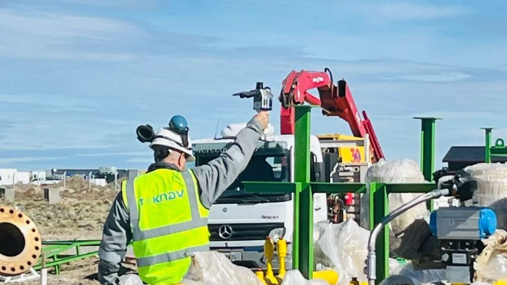
Главная: Решения TOKNAV RTK и SLAM обеспечивают успех геодезических работ в Аргентине – tBase, полевые испытания T45 и TSR20 20.04.2026 Аргентина — страна с невероятным географическим разнообразием: от плодородных равнин Пампы до изрезанных склонов Анд, от густых лесов на севере до таких городских центров, как Буэнос-Айрес, и от крупномасштабного сельского хозяйства до крупных строительных и инфраструктурных проектов. Для геодезистов, инженеров, руководителей строительных проектов и сельскохозяйственных бригад по всей Аргентине надёжное высокоточное оборудование для позиционирования не просто полезно — оно просто необходимо. Командам нужны инструменты, обеспечивающие точность на уровне сантиметров, надёжно работающие под пологом деревьев или в городских каньонах, выдерживающие суровые погодные условия и вписывающиеся в реальные рабочие процессы. Сегодня мы с гордостью делимся реальными отзывами, фотографиями и видеорезультатами от нашего официального дилера TOKNAV в Аргентине, который внедрил флагманские продукты TOKNAV: базовую станцию GNSS tBase, многофункциональный RTK-приемник T45 и портативный SLAM-сканер LiDAR TSR20. Эти инструменты ежедневно доказывают свою эффективность в рамках аргентинских проектов и быстро становятся лучшим выбором для профессионалов, которые хотят получить лучшее, что могут предложить технологии RTK и SLAM в 2026 году, не переплачивая за международные цены. Почему TOKNAV — лучший выбор для аргентинских геодезистов и строительных бригад Откройте для себя лучшие решения RTK и SLAM 2026 для ваших проектов TOKNAV — мировой лидер в области высокоточных решений GNSS, RTK, и SLAM, разработанных специально для профессиональной геодезии, строительства, точного земледелия, инспекции инфраструктуры и создания цифровых двойников. В отличие от GPS-устройств потребительского класса, TOKNAV производит оборудование промышленного уровня с поддержкой отслеживания спутников всех группировок, расширенной интеграцией инерциальной измерительной системы (IMU) и многорежимной обработкой данных. Для аргентинских пользователей это означает стабильность там, где другие приемники дают сбой: под густым пологом леса, на крутых склонах, в запыленных строительных зонах и в условиях меняющейся погоды. Сочетание RTK-приемника T45, базовой станции tBase и SLAM-сканера TSR20 создает полный комплексный рабочий процесс позиционирования, охватывающий любые задачи — от статических контрольных съемок и топографического картирования до 3D-сканирования реальной среды и разбивки строительных объектов. Аргентинские специалисты отмечают меньшее количество провалов сигнала, более быстрое получение координат, более длительное время работы от аккумулятора и более простое управление по сравнению с конкурирующими брендами, которыми они пользовались ранее. Для небольших геодезических фирм, крупных строительных компаний, сельскохозяйственных предприятий и государственных проектов TOKNAV обеспечивает производительность и ценность, идеально соответствующие местным потребностям. Продукты TOKNAV RTK: комплект базового станции и ровера T45 и tBase для высокоточных работ Когда команды в Аргентине ищут лучший RTK-приемник GPS 2026 года, они уделяют первостепенное внимание трем обязательным характеристикам: проверенной точности, прочной конструкции и стабильному приему сигнала в сложных условиях. Доступный по цене комплект базового и роверного приемоприемников TOKNAV T45 и tBase отвечает всем этим требованиям. Созданный для профессионального использования, T45 представляет собой портативный и мощный GNSS RTK-приемник, работающий на высокопроизводительной платформе Linux и оснащенный системой слежения за 1408 каналами GNSS. Такое большое количество каналов обеспечивает сверхбыстрый захват спутников и стабильное слежение даже в густых лесах, городских каньонах или горных районах, где сигналы часто слабые или заблокированы. Для аргентинских геодезистов, работающих в отдаленных районах или на сложной местности, это означает меньше перерывов, более быстрое получение фиксированных RTK-решений и более продуктивные часы работы в полевых условиях. Лучший RTK-приемник GPS 2026 года для разнообразного рельефа Аргентины Лучший RTK-приемник GPS 2026 года должен надежно работать в условиях разнообразного ландшафта Аргентины, и T45 полностью соответствует этим требованиям. Он поддерживает полное многоконстелляционное слежение: GPS, ГЛОНАСС, Galileo, BeiDou и другие глобальные спутниковые системы. Такое полное покрытие гарантирует, что приемник сможет зафиксировать сигналы независимо от того, куда приведет его работа. Профессиональная базовая станция GNSS tBase создана для стабильного дифференциального покрытия на больших расстояниях. Благодаря мощному встроенному радиомодулю она обеспечивает стабильную связь на больших расстояниях — идеальное решение для обширных сельскохозяйственных полей, дорожного строительства, геодезических работ в горнодобывающей промышленности и инфраструктурных проектов, характерных для Аргентины. Вместе T45 и tBase образуют полный комплект базовой станции и ровера RTK, поддерживающий как УВЧ-связь, так и подключение к сетям 4G с использованием протоколов NTRIP и CORS. Такая конструкция с двумя каналами связи обеспечивает постоянные RTK-поправки даже в сельских районах с ограниченным доступом к Интернету, что является важным преимуществом для команд, работающих вдали от городских центров. Комплект RTK “база-ровер” TOKNAV T45 и tBase в Аргентине: RTK с компенсацией наклона по данным IMU для ускорения съемки на склонах Большая часть территории Аргентины имеет наклонный рельеф — от виноградников в Мендосе до дорожного строительства в горных районах. Традиционные RTK-приемники требуют от геодезистов идеального выравнивания штатива при каждом измерении, что замедляет работу и увеличивает утомляемость. TOKNAV T45 устраняет эту проблему благодаря технологии RTK с компенсацией наклона по данным IMU, обеспечивая точные измерения даже при наклоне до 60 градусов. Погрешность коррекции остается ниже 2 сантиметров, что соответствует строгим стандартам точности для кадастровой съемки, разбивки строительных объектов и работ по созданию инфраструктуры. Аргентинские полевые бригады отмечают сокращение времени работы на местности на 30–40% при выполнении работ на наклонных участках, поскольку им больше не нужно постоянно останавливаться и выравнивать штатив. Эта функция компенсации наклона с помощью IMU также устраняет «летучие точки», характерные для устаревшего оборудования, обеспечивая чистые и надежные данные, которые без проблем импортируются в программное обеспечение CAD и GIS. Для любой команды, работающей на неровной местности, уже одна только эта функция делает TOKNAV более разумным выбором. Упрочненный RTK-приемник с защитой IP68 для экстремальных условий Климат Аргентины сильно варьируется: от сильной жары на северных равнинах до холодных и влажных условий в Патагонии и высокогорных зонах. Геодезическое оборудование должно быть устойчиво к воздействию пыли, влаги, падений и перепадов температуры. Как приемник T45, так и базовая станция tBase имеют прочную конструкцию RTK-приемника класса защиты IP68 с надежным корпусом из магниевого сплава. Они полностью водонепроницаемы, пыленепроницаемы и ударопрочны, способны выдерживать падения с высоты 1,5 метра. Диапазон рабочих температур составляет от -30 °C до +65 °C, что позволяет использовать их как в летнюю жару, так и в зимнюю стужу. Сканер TSR20 SLAM также отличается такой же прочной конструкцией и надежно работает в диапазоне температур от -20 °C до +55 °C. Для аргентинских полевых бригад, работающих долгими днями в суровых условиях, такая прочная конструкция означает меньше простоев, меньше ремонтов и более низкую совокупную стоимость владения в долгосрочной перспективе. Портативный сканер TSR20 SLAM: 3D-картографирование в зонах Аргентины с отсутствием GNSS-сигналов Многие аргентинские проекты требуют картографирования в зонах, где сигналы GNSS слабые или отсутствуют: внутри зданий, на подземных парковках, в туннелях, густых лесах и городских каньонах, окруженных высотными зданиями. Именно здесь ручной лидарный сканер TOKNAV TSR20 с технологией SLAM становится незаменимым. Разработанный для обеспечения производительности лазерного сканера SLAM без использования спутниковых сигналов, TSR20 собирает точные 3D-облака точек

Решения TOKNAV RTK и SLAM обеспечивают успех геодезических работ в Аргентине - tBase, T45 и TSR20 в полевых условиях Читать далее »

Апрельский пик строительства: Система наведения бульдозера TokNav TMC10 повышает эффективность работы

Главная Страница Апрельский пик строительного сезона: система наведения бульдозеров TokNav TMC10 повышает эффективность 16.04.2026 С наступлением апреля температура неуклонно растет, создавая условия для строительного бума по всей стране. От крупномасштабных инфраструктурных проектов, таких как строительство автомагистралей и железных дорог, до городского строительства и модернизации сельских дорог — в этот пиковый период большинство инженерных проектов вступает в стадию полномасштабного строительства. Для строительных бригад этот напряженный сезон сопряжен с жесткими графиками и строгими стандартами качества, что делает эффективную и точную работу обязательным условием. В основе каждого успешного проекта лежат два основных компонента: профессиональная инженерно-геодезическая съемка и надежное механическое управление, которые закладывают фундамент для плавного хода работ и своевременного завершения проекта. Основа строительства: инженерно-геодезическая съемка и слабые места традиционных методов Инженерное картирование и строительная съемка являются основой всего строительного процесса. Такие задачи, как разбивка строительной площадки, контроль уклонов и выравнивание грунта, требуют высочайшей точности, чтобы избежать дорогостоящих переделок и потерь материалов. Даже незначительные отклонения в измерениях могут привести к серьезным проблемам: неровным поверхностям, неправильным уклонам или конструктивным ошибкам, ставящим под угрозу безопасность. К сожалению, традиционные методы строительства, по-прежнему широко используемые в отрасли, с трудом поспевают за современными требованиями, создавая узкие места в производительности. Ограничения традиционной эксплуатации бульдозеров при строительной съемке и инженерной картографии Традиционная эксплуатация бульдозеров в значительной степени зависит от ручной съемки, разметки и опыта оператора. Геодезисты тратят часы на установку кольев и измерение уклонов, что приводит к потере трудоресурсов и подвергает работников рискам для безопасности. Этот процесс является медленным, трудоемким и подверженным человеческим ошибкам — погодные условия, проблемы с видимостью или ошибки в расчетах приводят к снижению точности. Операторы вынуждены постоянно ориентироваться на ручные отметки, что зачастую приводит к неравномерной выемке грунта или необходимости переделок. В случае крупномасштабных проектов эти неэффективности быстро накапливаются: затягиваются сроки, растут затраты и снижается качество, что не позволяет удовлетворить требования к большим объемам работ и высокой точности в пиковый период строительства. Система наведения бульдозера TokNav TMC10: решение задач высокоточного строительства Чтобы устранить эти проблемы отрасли, компания TokNav GNSS выпустила передовую систему наведения бульдозера TokNav TMC10 — инновационное интеллектуальное 3D-решение, разработанное специально для бульдозеров. Разработанная с учетом требований к точности и удобству использования, эта система объединяет высокопроизводительное спутниковое позиционирование GNSS и инерциальные датчики IMU, избавляя операторов от ограничений ручного управления. Она предоставляет данные о местоположении в реальном времени с точностью до сантиметра, превращая обычные бульдозеры в интеллектуальные и точные машины, которые повышают эффективность работ на строительной площадке. Главное преимущество TokNav TMC10 — точность позиционирования 2 см в любых условиях эксплуатации. В отличие от ручной съемки, которая зависит от благоприятных погодных условий и сопряжена с погрешностями, эта система сохраняет стабильную работу даже в суровых условиях — в тумане, при ветре, в пыли или при слабом освещении. Благодаря сочетанию двухрежимной системы GNSS и динамического датчика IMU система собирает данные в режиме реального времени о положении бульдозера, высоте отвала и угле наклона, отображая интуитивно понятные указания на экране в кабине. Операторам больше не нужны внешние маркеры или ручные измерения: они получают подсказки в режиме реального времени, позволяющие точно регулировать отвал для достижения идеальных результатов при каждом проходе. Помимо точности, система TMC10 значительно повышает эффективность — что особенно важно во время апрельского пика работ. Ручная съемка сводится к минимуму или полностью исключается, что сокращает время подготовки к строительству на несколько часов ежедневно. Бульдозеры работают непрерывно без частых остановок, что позволяет выполнять проекты в срок. Такая эффективность также снижает затраты на рабочую силу (требуется меньше геодезистов) и исключает избыточную выемку грунта, сокращая отходы материалов и общие расходы. Для компаний, реализующих несколько проектов одновременно, такая скорость и экономия значительно повышают рентабельность и удовлетворенность клиентов. Универсальность и долговечность: TokNav TMC10 адаптируется к разнообразным сценариям высокоточных строительных работ Универсальность — ещё одно ключевое преимущество TMC10, подходящего для разнообразных весенних строительных сценариев: выравнивание земельных участков под жилищное строительство, выемка грунта на склонах для автомагистралей, выемка грунта под фундаменты коммерческих зданий и реконструкция сельских дорог. Система совместима с большинством популярных моделей бульдозеров и оснащена удобным интерфейсом, не требующим длительного обучения, что позволяет операторам быстро освоить систему без простоев. Каждый компонент отличается прочностью и рассчитан на работу в суровых условиях строительной площадки — в условиях пыли, вибрации, воздействия воды и экстремальных температур. Такая прочная конструкция сводит к минимуму простои, обеспечивая работоспособность оборудования в самый напряжённый период. В сочетании с профессиональной технической поддержкой TokNav система обеспечивает долгосрочную уверенность в работе для проектов любого масштаба. По мере того как в апреле строительный пик достигает своего апогея, бригады спешат уложиться в сроки и контролировать затраты. Устаревшие методы больше не работают, и TokNav TMC10 выделяется как революционное решение, объединяющее в одном устройстве точность до сантиметра, интеллектуальное управление и надежность. Оно превращает стандартные бульдозеры в ’умные» активы, решая основные проблемы неэффективности и ошибок. TMC10 — это не просто оборудование, а конкурентное преимущество. Внедряя его, компании быстрее завершают проекты, обеспечивают более высокое качество, сокращают затраты и повышают безопасность, превращая хаос пикового сезона в эффективный рабочий процесс. Для проектов, направленных на ускорение работ, повышение качества и сокращение затрат, TokNav TMC10 является идеальным партнером. Оснастите свой парк этим решением, чтобы избавиться от задержек и ошибок, связанных с ручным управлением, и опередить конкурентов в самый напряжённый сезон. Внутренняя ссылка: Узнайте больше о системе 3D-наведения TokNav TMC10 Dozer (https://www.toknavgnss.com/tmc10-dozer-guidance)

Апрельский пик строительства: Система наведения бульдозера TokNav TMC10 повышает эффективность работы Читать далее »

Лидарные решения с поддержкой SLAM: Переосмысление захвата 3D-реальности для глобальных проектов

Главная. Решения на базе LiDAR с технологией SLAM: Новый подход к 3D-сканированию реальности для глобальных проектов 18.04.2026 В условиях быстро развивающихся отраслей промышленности такие области, как цифровые двойники, «умная» инфраструктура, BIM, промышленный мониторинг и сохранение культурного наследия, требуют высокоэффективного, высокоточного и универсального 3D-сканирования реальности. Традиционные методы геодезии и картографирования в значительной степени зависят от сигналов GNSS, характеризуются низкой эффективностью в полевых условиях и с трудом работают в сложных, ограниченных или заблокированных для приема сигнала средах. Для решения этих глобальных задач компания Toknav представляет два профессиональных, проверенных в полевых условиях решения на базе SLAM и LiDAR: портативный сканер TSR20 с технологией SLAM и наземный лазерный сканер TSL150. Созданные для пользователей по всему миру, эти интегрированные системы сочетают в себе мобильность, точность и интеллектуальный рабочий процесс, устанавливая новые стандарты реконструкции реального мира в 3D на всех континентах, в различных отраслях и в проектах, критически важных для выполнения задач. Решения на базе LiDAR с технологией SLAM: портативный сканер Toknav TSR20 в полевых условиях Основные вызовы в глобальной 3D-съемке реальности Проекты по всему миру сталкиваются с тремя постоянными препятствиями: среды, недоступные для GNSS, включая внутренние помещения, подземные сооружения, туннели, густозастроенные городские каньоны, леса и закрытые пространства, блокируют работу традиционных систем позиционирования. Сложно найти баланс между скоростью и точностью — мобильным сканерам часто не хватает точности, в то время как стационарные наземные сканеры медленно развертываются и требуют трудоемкой постобработки. Сложные и трудоемкие рабочие процессы удлиняют сроки реализации проектов, увеличивают операционные риски и повышают общие затраты. Устройства Toknav TSR20 и TSL150 совместно решают эти проблемы: мобильное сканирование с технологией SLAM обеспечивает широкий и быстрый охват, а стационарное наземное сканирование — сверхвысокую точность деталей. Вместе они образуют комплексное решение на базе технологии SLAM с использованием LiDAR для профессионального 3D-моделирования и предоставления пространственных данных. Портативный сканер SLAM LiDAR TSR20: Мобильность и превосходство в картографировании в реальном времени Разработанный для динамического сбора данных в движении, TSR20 объединяет передовые алгоритмы SLAM с датчиком Livox Mid-360 LiDAR для генерации плотных и точных облаков точек 3D в реальном времени — как с покрытием GNSS, так и без него. Ключевые преимущества: многорежимная работа SLAM. Поддерживая режимы SLAM, RTK-SLAM и PPK-SLAM, система объединяет данные LiDAR, высокочастотного инерциального измерителя (IMU) и многоконстелляционного GNSS, обеспечивая относительную точность ≤3 см и абсолютную точность ≤5 см, что полностью соответствует профессиональным требованиям BIM, цифровых двойников и инженерных съёмок. Неограниченная адаптивность к окружающей среде Благодаря 360° сканированию без повторений, дальности измерения 40 м и высокой проникающей способности точек, TSR20 надежно работает в подземных пространствах, внутренних помещениях, лестничных клетках, парковках, коридорах линий электропередач и лесах с низким пологом. Сверхлегкий и эргономичный. Благодаря весу всего 1,0 кг и компактной конструкции сканер позволяет одному пользователю комфортно работать с ним в ручном режиме в течение всего дня. Его прочная конструкция и низкое энергопотребление обеспечивают стабильную работу в суровых полевых условиях. Реалистичное 3D-изображение в естественных цветах: две сверхширокоугольные камеры по 20 Мп с углом обзора 200° синхронно фиксируют изображения, создавая фотореалистичные текстурированные 3D-модели с четкими геометрическими и визуальными деталями. Комплексный рабочий процесс: 64 ГБ встроенной памяти плюс SD-карта объемом 128 ГБ с возможностью расширения, беспроводная передача данных по Wi-Fi и специализированное программное обеспечение для постобработки обеспечивают бесперебойный сбор, визуализацию, классификацию, фильтрацию и моделирование в рамках единого рабочего процесса. Идеальные области применения: картографирование подземных пространств, 3D-реконструкция интерьеров, обследование зданий, осмотр линий электропередач, картографирование лесных массивов, картографирование для экстренных служб и проекты мобильной съемки больших территорий. Наземный лазерный сканер TSL150: статическое сканирование с миллиметровой точностью Разработанный для высокоточных статических измерений, TSL150 сочетает в себе лазерную дальномерную съемку на большие расстояния, профессиональную HDR-съемку и встроенную интеллектуальную обработку данных, обеспечивая результаты геодезического уровня для сложных инженерных и документационных задач. Ключевые преимущества Точность на уровне миллиметров При максимальной дальности 150 м система обеспечивает точность 2 мм на расстоянии 50 м и 3 мм на расстоянии 100 м, что делает её идеальным решением для мониторинга конструкций, оцифровки объектов культурного наследия, точного реверс-инжиниринга BIM и промышленной метрологии. Высокоскоростной сбор данных Частота повторения импульсов 1,2 МГц и скорость сканирования 100 линий/сек. значительно сокращают время работы в полевых условиях, обеспечивая при этом получение плотных облаков точек высокого качества. Интеллектуальная обработка данных на месте: встроенное программное обеспечение поддерживает регистрацию облаков точек в реальном времени, автоматическую многостанционную настройку и визуальные измерения, что сводит к минимуму объем постобработки в офисе и гарантирует целостность данных ещё до завершения работ на объекте. Компактность и гибкость развертывания. Веся всего 3,3 кг и занимая мало места, TSL150 поддерживает как вертикальную, так и перевернутую установку для использования в ограниченных пространствах, на возвышенностях и в труднодоступных местах. Степень защиты IP54 гарантирует долговечность в суровых условиях эксплуатации. Объединение данных с нескольких датчиков: Панорамная камера с разрешением 100 МП и поддержкой HDR, MEMS-инерциальная измерительная система (IMU) и поддержка нескольких систем GNSS обеспечивают получение облаков точек с точной геопривязкой и насыщенной цветовой гаммой, готовых для профессионального картографирования и моделирования. Лидарные решения на базе SLAM: наземный лазерный сканер Toknav TSL150. Идеальные области применения: сохранение культурного наследия, мониторинг деформаций зданий, высокоточное BIM-моделирование, съемка трубопроводов, расчет земляных работ, исследование оползней и измерение промышленных объектов. Идеальное сочетание: TSR20 + TSL150. Для глобальных проектов по 3D-сканированию реального мира портативный сканер TSR20 с технологией SLAM и наземный сканер TSL150 идеально дополняют друг друга: TSR20 быстро охватывает обширные, сложные или труднодоступные участки благодаря эффективному мобильному сканированию. TSL150 обеспечивает детализацию с точностью до миллиметра для критически важных конструкций, ключевых компонентов и высокоточной документации. В сочетании они обеспечивают полное покрытие и высокоточное 3D-моделирование со значительным сокращением времени, трудозатрат и затрат. Это мощное сочетание поддерживает проекты в области цифрового строительства, «умной» инфраструктуры, цифровой трансформации промышленности и сохранения культурного наследия по всему миру. Решения на базе LiDAR с технологией SLAM: комбинированный рабочий процесс TSR20 и TSL150 Почему стоит выбрать Toknav? Профессиональные алгоритмы SLAM и объединения данных с датчиков обеспечивают стабильную и высокоточную работу в самых разных условиях. Глобальная конструкция обеспечивает совместимость с несколькими системами GNSS и надёжную работу в различных климатических условиях и на местности. Сквозной рабочий процесс объединяет сбор данных, обработку и моделирование, что снижает сложность и повышает эффективность. Прочное и портативное оборудование создано для ежедневного профессионального использования в международных полевых проектах. Глобальная служба поддержки клиентов обеспечивает беспроблемное внедрение, обучение и долгосрочную надежность. Ознакомьтесь с решениями Toknav для 3D-запечатления реальности. Узнайте, как TSR20 и TSL150 могут повысить точность, скорость и эффективность ваших проектов. Ключевые слова для поиска: Toknav TSR20, Toknav TSL150, портативный LiDAR с технологией SLAM, наземный лазерный сканер, 3D-захват реальности, система сканирования SLAM. Toknav предоставляет профессиональные, надёжные и перспективные решения на базе LiDAR с технологией SLAM, позволяющие преобразовывать физические пространства в точные и готовые к использованию цифровые ресурсы.

Лидарные решения с поддержкой SLAM: Переосмысление захвата 3D-реальности для глобальных проектов Читать далее »

TOKNAV - это высококлассный бренд GNSS, принадлежащий компании Guangzhou Toksurvey Information Technology Co.
Copyright © 2025 Guangzhou TokSurvey Information Technology Co.,ltd | Политика конфиденциальности

Станьте глобальными дистрибьюторами TOKNAV!

Имея солидный опыт работы в геодезической отрасли, мы ищем увлеченных дистрибьюторов, которые присоединятся к нашей глобальной истории успеха.