GNSS Industry Watch

Latest surveying, positioning and geospatial updates

Daily refreshed headlines from trusted industry publishers, with direct links to the original source.

TOKNAV YouTube

Newest videos from TOKNAV

Automatically follows the latest uploads from the TOKNAV YouTube channel.

Company News

TOKNAV company announcements, brand updates and corporate milestones.

TOKNAV T10Pro : Révolutionner la technologie GNSS avec une précision inégalée et une robustesse à toute épreuve

Accueil : TOKNAV se lance et redéfinit la technologie GNSS avec le T10Pro 01/06/2022 Technologie GNSS de précision – le TOKNAV T10Pro En 2022, une équipe d’ingénieurs d’élite basée à Guangzhou, en Chine, a fondé TOKNAV. Cette entreprise innovante spécialisée dans la technologie GNSS lance aujourd’hui officiellement sa marque. Basée à Guangzhou et disposant d’un bureau aux États-Unis, TOKNAV connaît une croissance rapide. Ses produits précis, fiables et portables bénéficient d’une confiance mondiale. Les professionnels de la topographie, de l’agriculture, de l’exploitation de drones et de la construction s’appuient sur eux. Aujourd’hui, TOKNAV présente son premier produit phare : le récepteur GNSS T10Pro. Cet appareil établit une nouvelle référence dans le secteur. Il réaffirme la mission fondamentale de TOKNAV : donner aux professionnels de tous les secteurs les moyens d’agir grâce à des outils de précision de pointe. Le T10Pro : une précision et une connectivité inégalées Le T10Pro est le tout premier récepteur complet de TOKNAV. Il témoigne de notre engagement absolu envers l’excellence. Parmi ses principales caractéristiques, on peut citer : Prise en charge multi-constellation :​ Accès à tous les principaux systèmes satellitaires mondiaux. 1 408 canaux :​ Garantit une acquisition rapide du signal et une précision supérieure. Connectivité polyvalente :​ Offre la 4G, le Wi-Fi et le Bluetooth pour un transfert de données fluide. Les utilisateurs bénéficient ainsi d’une précision de positionnement inégalée et d’une collecte de données efficace. Ces fonctionnalités améliorent directement la productivité sur le terrain. Conçu pour résister aux conditions de terrain exigeantes Le T10Pro est conçu pour les environnements difficiles. Sa conception robuste offre une durabilité optimale. De plus, une batterie haute capacité de 9 600 mAh permet un fonctionnement prolongé sans interruption. Élément essentiel : le récepteur est certifié IP68. Cela signifie qu’il est totalement étanche à la poussière et qu’il peut résister à une immersion prolongée dans l’eau. Il fonctionne donc de manière fiable dans les conditions les plus difficiles, des chantiers de construction pluvieux aux exploitations agricoles poussiéreuses. La vision de la direction en matière d’innovation “ Nous sommes ravis de lancer TOKNAV et le T10Pro ”, a déclaré Ian Cheng, directeur marketing. “ Ce produit témoigne de notre engagement en faveur de l’innovation. Notre objectif est simple : fournir des outils qui redéfinissent les normes et stimulent la productivité de nos clients. ’ Une nouvelle ère dans la technologie de positionnement Le lancement de TOKNAV et du T10Pro marque un tournant majeur. Les professionnels ont désormais accès à une technologie qui optimise leur efficacité. Cela ouvre de nouvelles perspectives en matière de précision pour chaque projet. Contact Pour toute demande de presse ou pour plus d’informations sur TOKNAV et le récepteur GNSS T10Pro, veuillez contacter : WhatsApp : https://wa.me/message/UARCA3G7VL7YH1 Site web : www.toknavgnss.com Facebook : https://www.facebook.com/Toknavgnss/ Instagram : https://www.instagram.com/toknavgnss/

TOKNAV T10Pro : Révolutionner la technologie GNSS avec une précision inégalée et une robustesse à toute épreuve Lire la suite »

P8 et P8Pro

Accueil : Toknav dévoile des appareils de précision à la pointe de la technologie : présentation des modèles P8 et P8Pro 12 décembre 2023, Guangzhou — TokNav Information Technology Co., Ltd, pionnier des technologies de mesure de précision, est fier de présenter ses dernières merveilles : les modèles P8 et P8Pro. Ces appareils à la pointe de la technologie illustrent l’engagement sans faille de Toknav à révolutionner le secteur de la mesure de précision, en offrant aux professionnels une précision et une efficacité inégalées. Présentation du P8 : la précision redéfinie avec une portabilité inégalée Équipé d’un système matériel robuste intégrant les processeurs ESP32 et ASR ARM, notre appareil fonctionne de manière fluide sur la plateforme FreeRTOS. Offrant un suivi GNSS précis avec prise en charge des systèmes GPS, GLONASS, BDS, GALILEO et QZSS, notre système assure une communication de données fiable via la 4G et le Bluetooth, avec une fréquence de mise à jour rapide de 5 Hz. Protégé par un boîtier conforme à la norme IP67, il garantit un fonctionnement ininterrompu pendant plus de 8 heures. Le P8 représente également une avancée considérable en matière de mesure de précision. Avec son design élégant et ergonomique, le P8 allie à la perfection style et fonctionnalité. Équipé du processeur avancé UM960, cet appareil établit une nouvelle référence en matière de performances, en fournissant des résultats rapides et précis dans une multitude d’applications. La clé des capacités du P8 réside dans sa prise en charge révolutionnaire de plusieurs constellations, assurant un suivi complet sur l’ensemble des constellations de satellites et des fréquences. Cette avancée technologique garantit une précision ininterrompue, permettant aux professionnels de compter sur le P8 pour obtenir des données précises et à jour dans n’importe quel scénario. Une portabilité inégalée Conscient de l’importance de la praticité dans un monde en constante évolution, le P8 a été méticuleusement conçu pour être compact et léger. Les professionnels peuvent ainsi transporter l’appareil sans effort, bénéficiant d’une flexibilité optimale sans compromis sur la précision. Vous pouvez désormais bénéficier d’une précision optimale lors de vos déplacements, que ce soit pour effectuer des levés sur un chantier de construction ou mener des recherches géospatiales. Ian Cheng, directeur marketing de TokNav, a fait part de son enthousiasme concernant ces nouveaux modèles. ’ Chez TokNav, nous nous engageons à repousser les limites de la technologie de mesure de précision. Les modèles P8 et P8Pro témoignent de notre engagement envers l’excellence, l’innovation et notre volonté de fournir aux professionnels des outils qui redéfinissent ce qui est possible. “ À propos de Toknav Information Technology Co., Ltd : Toknav Information Technology Co., Ltd est un pionnier dans le domaine des solutions de mesure de précision, engagé à faire progresser la norme mondiale grâce à l’innovation et à l’excellence technologique. Rendez-vous sur www.toknav.cn pour obtenir des informations détaillées sur leurs fonctionnalités, leurs caractéristiques techniques et la manière dont ces produits peuvent transformer votre travail. Contact Pour toute demande de presse ou pour plus d’informations sur TOKNAV et le récepteur GNSS P8, veuillez contacter : WhatsApp : https://wa.me/message/UARCA3G7VL7YH1 Site web : www.toknavgnss.com Facebook : https://www.facebook.com/Toknavgnss/ Instagram : https://www.instagram.com/toknavgnss/

P8 et P8Pro Lire la suite »

Récepteur GNSS Toknav P8Global

TOKNAV P8Récepteur GNSS mondial - Technologie PPP avancée pour une précision au centimètre près

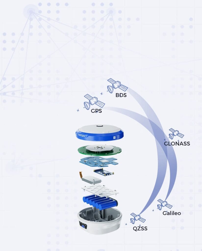
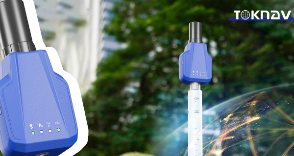
Home TOKNAV Launches P8Global GNSS Receiver with Advanced PPP Tech 2024-05-09 TOKNAV P8Global GNSS Receiver Guangzhou, May 2024 — TOKNAV proudly launches the new P8Global GNSS receiver. Notably, it brings ultra-high precision for field measurement work. It hits centimeter-level accuracy without any base station or CORS station. This revolutionary approach simplifies fieldwork, allowing for more efficient data collection and reduced downtime. It differs from the P8 and P8Pro, ditching 4G and radio reliance. Moreover, it delivers far better signal tracking and data processing, which is crucial for applications like road construction and power line surveying. This innovation solidifies TOKNAV’s reputation as a leader in precision technology, enabling professionals to achieve outstanding results in their projects. P8Global: A New Standard for Precision Measurement For more information on the TOKNAV P8Global GNSS Receiver, including its specifications and features, please visit our website. P8Global sets a new bar for GNSS receivers on the market. It outperforms ordinary receivers and its P8, P8Pro predecessors in all aspects. Key to its edge is full-band 4G connectivity for stable signal coverage. Additionally, it uses Precise Point Positioning (PPP) technology. This tech cuts out the need for traditional base stations entirely. Naturally, it becomes a top pick for all high-precision measurement tasks. To illustrate the capability of the P8Global, consider the case of a recent infrastructure project where accuracy was paramount. Surveyors were able to use the P8Global to collect data on a challenging terrain where traditional GNSS receivers struggled. The real-time data processing allowed for immediate adjustments to be made on-site, ultimately saving time and resources while ensuring the project’s specifications were met. This example showcases not only the product’s reliability but also its potential to transform the surveying process in various industries. Understanding the Features of the TOKNAV P8Global GNSS Receiver Unbeatable Accuracy and Smart Integration P8Global combines tough hardware with the FreeRTOS intelligent system to ensure seamless operation. This results in smooth performance under all field conditions, whether in dense urban environments or remote rural areas. Additionally, it supports all major global satellite constellations, including GPS, GLONASS, Galileo, and BeiDou. This multi-constellation support increases the reliability of the positioning, providing professionals the peace of mind they need. Thanks to PPP, it stably maintains centimeter-level positioning accuracy continuously throughout the workday. Traditional GNSS tools require base station connections for high precision, which can pose logistical challenges. However, with the P8Global, users benefit from a more flexible and efficient workflow. It employs global reference station networks to generate correction data, which is then sent directly to the receiver via satellite, ensuring uninterrupted service even in remote locations. Upgraded Connectivity Features P8Global comes with 4G CAT4 and Bluetooth functions. Through cloud servers, users can monitor and configure it remotely. Unlike the P8 and P8Pro, it uses full-band 4G for connectivity. This is a huge advantage for wider and more stable signal access. Workers can manage the device and get data from anywhere. It greatly reduces the need for on-site operation and checks. Remote alerts and adjustments also boost work efficiency, saving time and resources. For instance, during a recent project involving the mapping of a new highway, the ability to connect via 4G CAT4 allowed the team to upload data in real-time, facilitating immediate feedback from project managers. This capability not only streamlined communication but also resulted in quicker decision-making processes, which are critical in time-sensitive infrastructure projects. By minimizing the need for on-site operations, the P8Global significantly enhances team productivity and reduces operational costs. Lightweight and Tough Design P8Global only weighs 141 grams and has an 1800mAh long-life battery. This impressive battery life allows the device to work for extended periods in the field without the constant need for recharging. Its light weight and low power use make it highly portable, ensuring that field technicians can carry it comfortably throughout long workdays. Furthermore, it has a magnesium alloy shell and meets IP67 protection standards, ensuring that it can withstand harsh weather conditions and rough handling. It’s far more durable than ordinary GNSS receivers, providing reassurance to users that it can withstand the rigors of daily field use. This tough design keeps it safe from dust, water, and impact, making it an ideal tool for professionals who work in adverse environments. Redefining Precision Measurement Possibilities The P8Global GNSS Receiver is not just a tool; it represents a shift in how precision measurement can enhance workflow and project execution. For example, consider the impact on environmental surveys where precision is crucial to ensure compliance with regulations. The P8Global aids in reducing errors during data collection, which not only saves time but also minimizes the need for rework due to inaccuracies. As such, it empowers professionals to focus more on analysis and decision-making rather than spending excessive time on measuring and re-measuring. In conclusion, the TOKNAV P8Global GNSS Receiver not only meets the demands of precision measurement but exceeds them, offering features that support a wide range of applications across various industries. Its advanced technology, robust design, and user-friendly integration make it the ideal choice for professionals aiming to enhance accuracy in their work. As the industry continues to evolve, tools like the P8Global will be essential for maintaining high standards of quality and efficiency in measurement processes. P8Global is a perfect example of TOKNAV’s tech innovation and quality. It gives professionals a tool that redefines precision measurement work. Ideal for infrastructure building and detailed field surveying, it’s the best choice for industry pros. They can count on its top performance and stable reliability at all times. Its advanced functions and tough design make it stand out in the market. It offers unbeatable accuracy, connectivity, portability, and durability all in one. About TOKNAV Information Technology Co., Ltd TOKNAV leads the way in precision measurement solutions worldwide. Constantly innovating, the company pushes the boundaries of technology to set new global industry standards. All its products are built for the highest accuracy and reliability, ensuring they become essential tools for professionals in various fields including construction, agriculture, and environmental science.

TOKNAV P8Récepteur GNSS mondial - Technologie PPP avancée pour une précision au centimètre près Lire la suite »

Toknav TR10

Toknav TR10 - Robot de prémarquage de ligne de précision pour l'ingénierie routière et les levés topographiques

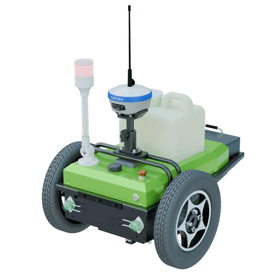
Home Revolutionizing Line Premarking with the Toknav TR10 2024-09-04 Toknav TR10 | Precision Line Premarking Robot for Road Engineering & Surveying In road engineering and surveying, precise, efficient line marking is often hard to achieve. Outdated manual methods are slow, inaccurate, and hard to set up.This is especially true on rough ground or in bad weather. Moreover, the industry needs a better solution—one that’s fast, very accurate, and easy to use.It should boost work speed while cutting costs. This is where the Toknav TR10 comes in. Toknav TR10: A Groundbreaking Line-Marking Solution The Toknav TR10 is a new solution that changes the game. It redefines efficiency, accuracy, and flexibility for line-marking tasks.We built it with top-tier tech and a user-friendly design. Additionally, it has many features that make it perfect for surveying and road engineering pros. The Toknav TR10 is not just a tool; it’s a comprehensive solution designed to tackle the challenges of modern road engineering and surveying. With its state-of-the-art technology, the TR10 enhances not only the quality of line marking but also the overall efficiency of projects. In a world where time and precision are paramount, this robot stands out by offering features that save time while ensuring superior accuracy. Faster Setup and Operation The TR10 makes setup easy and quick. Its simple software interface gets you working fast. Furthermore, the robot’s max speed is 2 meters per second.This lets it cover large areas quickly. It also has in-place steering with a 0° minimum turning radius.This means it can move precisely even in tight spaces. The TR10 uses a 24V/20Ah lithium battery.On a full charge, it can go up to 15 kilometers. It also only takes four hours to charge to 95%. In addition to its swift setup, the TR10 provides intuitive controls that require minimal training. Users can quickly familiarize themselves with the interface, allowing teams to start projects without extensive onboarding. This user-centric approach is particularly beneficial for companies that operate in high-pressure environments where time is money. Sharper Precision When it comes to marking accuracy, the TR10 is the best in the industry. It has an advanced GNSS module.This module works with GPS, GLONASS, BDS, GALILEO, and QZSS systems. It achieves RTK positioning with great accuracy.Horizontal accuracy hits ±8mm + 1ppm. Vertical accuracy reaches ±15mm + 1ppm. Notably, its tilt compensation keeps this precision.It works even on slopes up to 20 degrees. This ensures straight, error-free lines with a margin of less than 2cm. Accuracy is vital in line marking, especially when working on complex projects involving various stakeholders. The TR10’s GNSS module ensures that even the most intricate designs are executed flawlessly. For instance, when marking a new highway or a complex intersection, the precision offered by the Toknav TR10 can significantly reduce the need for rework, saving both time and resources. Advanced Capabilities for Maximum Productivity The TR10 combines smart features with practical flexibility. It has a one-click drawing import tool.This tool lets you easily use pre-designed plans. It also supports different marking styles.These include dots, lines, curves, numbers, and letters. Overall, this boosts productivity for every project. Moreover, the TR10’s ability to import drawing files directly means teams can work off existing plans, reducing the risk of errors that can come from manual entry. Imagine a scenario where urban planners need to mark multiple lanes with different patterns; the TR10 can easily adapt to these requirements, making it an invaluable asset for any project manager. Built to Excel in Challenging Conditions The TR10 is made for tough environments. It has a strong design that weighs 28kg (at 85% payload).It also has two 200W hub motors. These let it handle rough terrain while staying accurate. Additionally, it has a 7.5L paint hopper.This hopper works with latex and titanium white liquid. It adapts easily to different project needs. The TR10 also performs well in extreme temperatures.It works reliably from -10°C to 60°C. Its IP3X rating ensures consistent use in all field conditions. Built for durability, the TR10 excels even in harsh conditions, making it suitable for diverse climates and terrains. Its robust construction and high-performance components ensure that it can withstand the rigors of outdoor work, which is especially beneficial for long-term projects that may span various seasons. Your Partner in Precision Marking What sets the TR10 apart from other line-marking solutions is its integration of cutting-edge technology with practical utility. Its advanced sensors and user-friendly interface work in tandem, allowing for real-time adjustments during operation. This adaptability is crucial for line marking in dynamic environments, such as during road construction when unexpected changes can occur. The TR10 is made to meet the needs of modern marking pros. It offers a faster, sharper, smarter way to do precision marking.With unbeatable accuracy, ease of use, and durability, the TR10 sets a new industry standard. Moreover, it’s your go-to tool for every marking task. Discover the Future of Marking with TR10 Experience how Toknav is driving innovation. We’re leading the way in positioning and surveying technology.Choose the TR10, and revolutionize your line premarking process today. Furthermore, as the demand for eco-friendly solutions increases, the TR10’s efficient use of materials and energy aligns perfectly with sustainable practices. The ability to minimize waste during the marking process not only conserves resources but also enhances the overall environmentally friendly profile of road projects. In conclusion, the Toknav TR10 is more than just a marking robot; it represents a significant leap forward in the technology available to road engineers and surveyors. By combining speed, precision, and adaptability, it addresses the long-standing challenges faced by professionals in the field. As we look towards the future of road engineering, the TR10 embodies the innovations that will shape efficient and effective line marking practices.

Toknav TR10 - Robot de prémarquage de ligne de précision pour l'ingénierie routière et les levés topographiques Lire la suite »

TOKNAV T30 et T30Pro : Précision inégalée avec AR Stakeout pour les professionnels du géospatial et de la construction

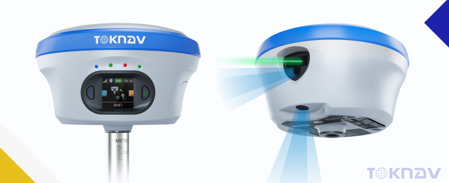
Home TOKNAV T30 & T30Pro GNSS Receivers: Unmatched Precision with AR Stakeout for Geospatial & Construction Professionals Published: 2024-09-02 | Category: GNSS Technology, Surveying Innovation Guangzhou, November 2024 — TOKNAV, a global leader in precision measurement tools, is proud to announce the launch of its latest flagship GNSS receivers: the T30 and T30Pro. These cutting-edge devices embody TOKNAV’s unwavering commitment to precision, reliability, and user-centric design, setting new industry benchmarks for speed, accuracy, and operational efficiency across infrastructure, construction, and land development projects. Shared Features: Ultra-Fast Precision & AR Stakeout Both the T30 and T30Pro are engineered with advanced processing technology, enabling ultra-fast real-time GNSS calculations that deliver centimeter-level positioning data. This accelerated processing drastically reduces field wait times and amplifies workflow efficiency, making them ideal for projects with tight deadlines.Key shared features include:  Blazing Speed: Instant GNSS data calculation eliminates delays during on-site operations, keeping projects on track. Industry-Leading Accuracy: ±8mm horizontal and ±15mm vertical accuracy guarantees precise measurements for every task. 1408 Multi-Channel Support: Full multi-system, multi-frequency GNSS tracking ensures reliable signal coverage even in complex, challenging environments. AR Stakeout System: An integrated augmented reality (AR) real-time stakeout tool overlays stakeout points directly onto the physical world, simplifying site layout and boundary marking while boosting operational accuracy. TOKNAV T30 & T30Pro T30Pro: Advanced Photogrammetry & 3D Imaging The T30Pro elevates performance with specialized photogrammetry capabilities, featuring high-resolution image capture to generate detailed 3D models and orthophotos. This makes it an indispensable tool for topographic mapping, infrastructure documentation, and complex geospatial projects that demand multi-dimensional data insights. Close-up of T30Pro camera module T30: Laser Measurement Innovation  Designed for versatility, the T30 integrates centimeter-level laser measurement functionality, enabling precise field measurements in hard-to-reach locations—such as points across rivers or beneath structures. This feature extends TOKNAV’s mission to make high-precision surveying accessible and efficient for professionals worldwide. T30 GNSS Reciever demostrating laser measurement capability Seamless Connectivity & Rugged Durability Both receivers offer seamless 4G, Bluetooth, and Wi-Fi connectivity, empowering remote data monitoring and access from any location. Built to withstand the harshest field conditions, they feature an IP68-rated magnesium alloy casing and a 13800mAh high-capacity battery that delivers up to 48 hours of continuous operation. At just 1.5 kg, their lightweight design ensures portability for extended field assignments, perfectly balancing power, durability, and ease of use. Redefining Professional Surveying The T30 and T30Pro represent TOKNAV’s dedication to pushing the boundaries of precision, speed, and innovation. By combining ultra-fast GNSS computation, intuitive AR stakeout, and specialized features like photogrammetry (T30Pro) and laser measurement (T30), these receivers redefine what’s possible in fieldwork, giving construction, land management, and infrastructure professionals a decisive competitive edge. About TOKNAV TOKNAV is dedicated to advancing geospatial technology, setting new standards for accuracy, speed, and reliability in precision measurement tools. Trusted by professionals worldwide, TOKNAV delivers innovative, high-performance solutions that drive efficiency and excellence across industries. For more information on the T30, T30Pro, and other offerings, visit www.toknavgnss.com or contact us at info@toknav.cn.

TOKNAV T30 et T30Pro : Précision inégalée avec AR Stakeout pour les professionnels du géospatial et de la construction Lire la suite »

TOKNAV tBase GNSS Receiver

TOKNAV tBase GNSS Receiver | 12+ Hours Long Battery Life High Precision

Home TOKNAV Unveils tBase GNSS Receiver: Over 12 Hours of Unmatched Battery Life for Robust Applications 2024-09-02 TOKNAV tBase GNSS Receiver | 12+ Hours Long Battery Life and High Precision for Professionals Guangzhou, November 2024— TOKNAV proudly announces the launch of the tBase GNSS receiver, a high-precision positioning device that redefines battery performance. With over 12 hours of continuous operation, the tBase sets a new industry standard, giving professionals unprecedented freedom in the field. This receiver is particularly beneficial for land surveying, agriculture, and construction, where reliable positioning is critical. Reliable Battery Performance: A Game Changer The tBase features a powerful 13800mAh battery, providing reliable performance for long-duration surveying and monitoring tasks. For instance, in remote locations, surveyors can utilize the tBase GNSS receiver for extensive mapping projects without interruptions. Users can focus on their work without worrying about power issues, even in extreme weather conditions. This long-lasting battery ensures that professionals can complete their tasks efficiently, making it an essential tool for those in the field. Comprehensive GNSS Support: Unmatched Accuracy This receiver supports all major global satellite navigation systems—BeiDou, GPS, GLONASS, Galileo, and QZSS—ensuring accurate positioning wherever you are. Powered by a Linux+ARM Cortex-A7 platform, it offers high efficiency and scalability to meet evolving work demands. By integrating multiple GNSS systems, users can achieve enhanced accuracy and reliability, making it suitable for various applications, including precision agriculture and geological surveying. Robust and Durable Design: Built for the Elements Designed to IP68 standards and housed in a robust magnesium alloy casing, the tBase ensures durability in harsh environments. Integrated VPN support enables remote configuration for flexible operation in complex settings. Additionally, it includes an electronic fence system and area code restrictions for compliant use, crucial for applications requiring strict adherence to geographical boundaries. This robust design ensures that the tBase can withstand the rigors of outdoor use, making it a reliable choice for professionals in challenging environments. About TOKNAV: Innovating Precision Positioning TOKNAV is a leading provider of high-precision positioning solutions, dedicated to delivering reliable and accurate positioning services through innovative technology. Our products are engineered to deliver unmatched accuracy and reliability, making them essential tools for professionals across various industries. As we continue to push the boundaries of technology, we remain focused on providing dependable, cutting-edge positioning services to meet the needs of our global customers. Our commitment to innovation ensures that our customers receive the most advanced solutions available, enabling them to achieve their objectives effectively.

TOKNAV tBase GNSS Receiver | 12+ Hours Long Battery Life High Precision Lire la suite »

Toknav turf marking robot

Robot de marquage de gazon TOKNAV - Précision GNSS RTK pour les terrains de sport

Home Say Hello to TOKNAV Turf Marking Robot! 2025-01-07 TOKNAV Turf Marking Robot | GNSS RTK Precision for Sports Fields With a strong foundation in cutting-edge technology, TOKNAV introduced our first linemarking robot—a solution specifically designed for long road pre-marking tasks. This milestone set the stage for our continued innovation. This earlier model transformed highway pre-marking by streamlining processes, cutting down on manual effort, and boosting efficiency for large-scale applications. Its user-friendly design and reliable performance made it a go-to tool for achieving accurate markings on standard road surfaces. Building on this foundation, we’re proud to introduce the TOKNAV Turf Marking Robot, an advanced solution tailored for grass sports fields. With the same commitment to precision, speed, and efficiency, the Turf Marking Robot offers enhanced features, making field preparation faster and easier than ever before. Whether you’re maintaining a professional stadium or a local sports facility, this innovative robot is designed to make your job easier, faster, and more precise. Superb Precision Equipped with the GNSS RTK technology, this robot marks lines with pinpoint accuracy, ensuring your fields always look perfect. No more uneven or misaligned lines—just smooth, sharp markings every time. Speed and Efficiency Traditional manual marking can take hours for a full-size soccer pitch, but with the 1m/s marking speed, you’ll breeze through field preparation. A task that might have taken an entire morning can now be completed in less than half an hour. Light and Easy to Handle At only 35KG, this robot is incredibly easy to maneuver. Whether you’re working on a huge field or a smaller one, it’s designed to move seamlessly with minimal effort. Smart Field Templates for Effortless Marking With its integrated sports field templates, the TOKNAV Line Marking Robot is designed to simplify the marking process. From soccer fields to multi-purpose grounds, it ensures clear, accurate lines that meet professional standards. Upgrade Your Game with TOKNAV. It’s time to leave the hassle of traditional marking methods behind and embrace the ease and precision of the TOKNAV Turf Marking Robot. Faster, smarter, and built to perform, it’s the perfect partner for creating professional grass sports fields.

Robot de marquage de gazon TOKNAV - Précision GNSS RTK pour les terrains de sport Lire la suite »

TOKNAV T40 T40Pro GNSS Receivers

TOKNAV T40 & T40Pro Récepteurs GNSS - Batterie interchangeable & Relevé laser visuel

Home TOKNAV Unveils the T40 and T40 Pro GNSS Receivers: Elevating Precision Surveying with Swappable Batteries and Visual Laser Technology 2025-05-06 TOKNAV T40 & T40Pro GNSS Receivers | Swappable Battery & Visual Laser Surveying The importance of high precision in surveying cannot be overstated. Professionals in the field require tools that not only meet but exceed current standards of accuracy and reliability. The Toknav T40 and T40Pro GNSS receivers have been developed with feedback from industry experts, ensuring that they meet the needs of modern surveyors. TOKNAV leads innovation in high-precision geospatial tech. We’re proud to launch our new GNSS receivers, the T40 and T40Pro.These next-gen devices meet surveyors’ changing needs. They combine top-tier positioning features with user-focused upgrades.Notably, they include hot-swappable batteries and laser visual technology. This blend boosts usability for geospatial pros. Key Upgrades: Swappable Batteries for Better Field Efficiency The T40 series builds on the success of earlier models. It makes big jumps in function and work efficiency.A key upgrade is the dual removable battery system. Users can change batteries without turning off the device.This cuts down on downtime and greatly boosts field productivity. It solves a common pain point for on-site work. Laser Visualization: Clear Precision in Real Time Another major upgrade is laser visualization. Users can see laser measurement points clearly on the controller screen.This feature ends guesswork for real-time precision. It links digital coordinates to the real world visibly.Furthermore, it boosts accuracy and gives users more confidence in the field. Every measurement feels tangible and reliable. Moreover, these devices are engineered with user experience in mind, featuring intuitive interfaces and easy-to-navigate menus. Surveyors can spend less time learning how to use the equipment and more time focusing on their actual work. This shift increases overall productivity and satisfaction among users. T40: Precision with Laser Dual-Camera and AR In the realm of geospatial technology, the T40’s laser dual-camera system is particularly noteworthy. This system not only provides accurate measurements but also allows for real-time data visualization, significantly reducing the chances of error during surveying operations. The integration of augmented reality with laser technology is a game-changer, giving users the ability to visualize their measurements directly on-site. The Toknav T40 features a sophisticated laser dual-camera system designed for high-precision applications. This system offers millimeter-grade laser ranging accuracy (≤2.5 cm within a 5 m distance), making it ideal for precise surveying tasks.In addition to laser ranging, it includes high-definition augmented reality (AR) staking capabilities, allowing for real-world accuracy that enhances the user experience. This device is engineered to support full-system, multi-frequency GNSS reception, which is essential for varied surveying tasks.The T40 is compatible with multiple GNSS systems including GPS, GLONASS, BDS, Galileo, QZSS, SBAS, and NavIC, ensuring broad applicability. With an impressive 1408 channels, it guarantees robust signal reception even in challenging environments.Its tough magnesium-aluminum body and IP68 protection rating offer exceptional durability, allowing it to withstand harsh field conditions without compromising performance. This rugged design makes it suitable for use in diverse environments, from urban settings to remote terrains. T40Pro: Photogrammetry-Ready Survey Tool For the T40Pro, the photogrammetry-ready features enhance its versatility even further. This model is designed to accommodate a wider range of surveying tasks, from traditional land surveying to advanced imaging for construction projects. The ability to capture high-definition images along with precise coordinates allows for comprehensive data collection and analysis. The T40Pro takes geospatial work to the next level. It adds photogrammetric survey features for more versatility.It captures high-def images with a large-sensor system. It then pulls precise coordinates from these images.Like the T40, it has AR staking, IMU-based tilt measurement, and multi-frequency GNSS support.Specifically, it is optimized for image-based surveys. It suits professionals needing advanced visual data. As surveying technology evolves, so does the necessity for tools that can adapt to various conditions and requirements. The T40Pro, with its enhanced capabilities, empowers professionals to tackle more complex projects efficiently, making it an essential tool for anyone serious about precision in surveying. Redefining Surveying Efficiency with the T40 Series Additionally, the advancements in the T40 series are not only about technology but also about enhancing workflow. By integrating features such as hot-swappable batteries, users can maintain productivity levels without the interruptions typically associated with battery changes. This is particularly beneficial during extensive fieldwork where time and efficiency are critical. With the T40 series, TOKNAV aims to set new standards. It delivers high-precision tools that are easy to use.These tools are durable and ready for future needs. They work well in tight urban spaces or large topographic mapping projects.Laser visibility, long battery life, and multi-sensor fusion offer unbeatable reliability. They also improve the user experience. Get More Information For details, visit www.toknav.cn. Alternatively, contact us at info@toknav.cn. Thank You for Your Interest We appreciate everyone who visited our booth at SFMA 2025. We value your attention and curiosity.If you want to learn more or explore partnerships, please reach out to us. Contact Information info@toknav.cn | www.toknavgnss.com Join TOKNAV in Shaping the Future Work with us to redefine precision marking and surveying. TOKNAV’s innovative solutions lead the way. In conclusion, the TOKNAV T40 and T40Pro GNSS Receivers represent a significant leap forward in surveying technology. With their combination of innovative features, reliability, and ease of use, they are set to redefine how professionals approach their work. The careful consideration of user feedback in the design process ensures these devices meet the real-world challenges faced by surveyors today. As we continue to move toward a future where precision and efficiency are paramount, the TOKNAV T40 T40Pro GNSS Receivers stand out as leaders in their field. By investing in these advanced tools, surveyors can enhance their capabilities and remain competitive in an increasingly demanding industry. For further information regarding the features and applications of the TOKNAV T40 T40Pro GNSS Receivers, potential users are encouraged to research and reach out directly to TOKNAV for personalized consultations and demonstrations. Ultimately, the investment in the TOKNAV T40 T40Pro GNSS Receivers is not merely a purchase; it is a commitment

TOKNAV T40 & T40Pro Récepteurs GNSS - Batterie interchangeable & Relevé laser visuel Lire la suite »

Devenez distributeurs TOKNAV dans le monde entier !

Forts d'une expérience reconnue dans le secteur de la topographie, nous recherchons aujourd'hui des distributeurs passionnés pour rejoindre notre succès mondial.