GNSS Industry Watch

Latest surveying, positioning and geospatial updates

Daily refreshed headlines from trusted industry publishers, with direct links to the original source.

TOKNAV YouTube

Newest videos from TOKNAV

Automatically follows the latest uploads from the TOKNAV YouTube channel.

Company News

TOKNAV company announcements, brand updates and corporate milestones.

TOKNAV T10Pro: إحداث ثورة في تكنولوجيا GNSS مع دقة لا مثيل لها ومتانة لا مثيل لها

Home TOKNAV Launches, Redefining GNSS Technology with the T10Pro 2022-06-01 Precision GNSS Technology – the TOKNAV T10Pro In 2022, a team of elite engineers in Guangzhou, China, founded TOKNAV. This innovative GNSS technology company is now officially launching its brand. Headquartered in Guangzhou with a US office, TOKNAV is growing fast. Its accurate, reliable, and portable products are trusted globally. Professionals in surveying, agriculture, drone operation, and construction rely on them.Today, TOKNAV introduces its first flagship product: the T10Pro GNSS receiver. This device sets a new industry standard. It reaffirms TOKNAV’s core mission: to empower professionals across all sectors with cutting-edge precision tools. The T10Pro: Unmatched Precision and Connectivity The T10Pro is TOKNAV’s inaugural full-feature receiver. It demonstrates our absolute commitment to excellence. Key features include: Multi-Constellation Support:​ Accesses all major global satellite systems. 1408 Channels:​ Ensures fast signal acquisition and superior accuracy. Versatile Connectivity:​ Offers 4G, Wi-Fi, and Bluetooth for seamless data transfer. Consequently, users benefit from unparalleled positioning precision and efficient data collection. These features directly enhance productivity in the field. Built Tough for Demanding Field Work The T10Pro is engineered for challenging environments. Its rugged design provides ultimate durability. Moreover, a high-capacity 9600mAh battery supports extended operation without interruption.Critically, the receiver carries an IP68 rating. This means it is completely dust-tight and can withstand prolonged water immersion. Therefore, it performs reliably in the harshest conditions, from rainy construction sites to dusty farms. Leadership’s Vision for Innovation “We are thrilled to launch TOKNAV and the T10Pro,” said Ian Cheng, CMO. “This product proves our dedication to innovation. Our goal is simple: to provide tools that redefine standards and boost our clients’ productivity.” A New Era in Positioning Technology The launch of TOKNAV and the T10Pro marks a significant shift. Professionals can now access technology that maximizes efficiency. This opens new possibilities for precision in every project. Contact For media inquiries or more information about TOKNAV and the T10Pro GNSS receiver, please contact: WhatsApp: https://wa.me/message/UARCA3G7VL7YH1 Website:      www.toknavgnss.com Facebook:   https://www.facebook.com/Toknavgnss/ Instagram:   https://www.instagram.com/toknavgnss/

TOKNAV T10Pro: إحداث ثورة في تكنولوجيا GNSS مع دقة لا مثيل لها ومتانة لا مثيل لها قراءة المزيد »

P8 و P8Pro

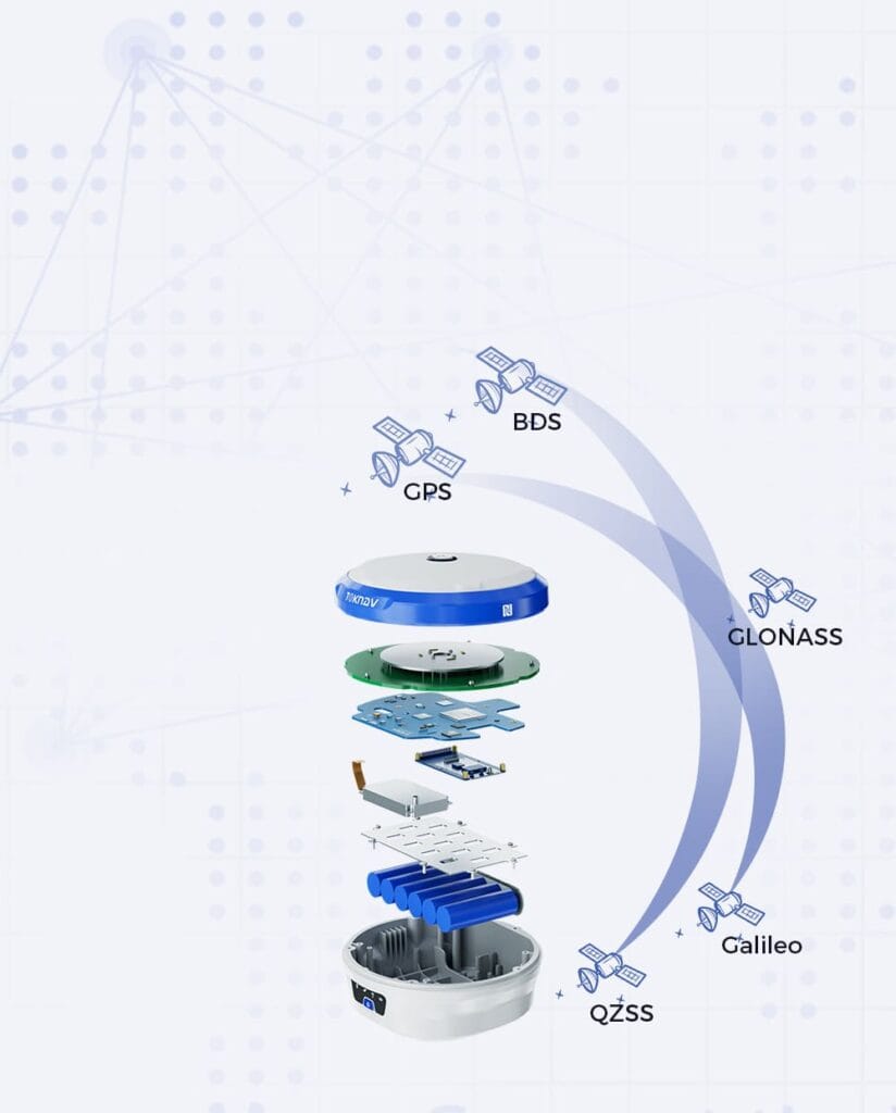
Home Toknav Unveils Cutting-Edge Precision Devices: Introducing P8 and P8Pro 2023-12-12 Guangzhou, December, 2023 — TokNav Information Technology Co., Ltd, a pioneer in precision measurement technology, proudly presents its latest marvels: the P8 and P8Pro. These state-of-the-art devices exemplify Toknav’s unwavering commitment to revolutionizing the precision measurement industry, empowering professionals with unmatched accuracy and efficiency. Introducing P8: Precision Redefined with Unparalleled Portability Equipped with a robust hardware system featuring ESP32 and ASR ARM, our device operates seamlessly on the FreeRTOS platform. Offering precise GNSS tracking with support for GPS, GLONASS, BDS, GALILEO, and QZSS, our system ensures reliable data communication through 4G and Bluetooth with a rapid 5Hz update frequency. Encased in an IP67-rated protective shell, it guarantees uninterrupted operation for over 8 hours. The P8 also represents a monumental leap forward in precision measurement. With a sleek and ergonomic design, the P8 seamlessly blends style and functionality. Powered by the advanced UM960, this device sets a new standard for performance, delivering swift and precise results across a myriad of applications. Key to the P8’s capabilities is its groundbreaking multi-constellation support, ensuring comprehensive tracking across all satellite constellations and frequencies. This technological breakthrough guarantees uninterrupted precision, allowing professionals to rely on the P8 for accurate and up-to-date data in any scenario. Unrivaled Portability Recognizing the importance of convenience in the fast-paced world, the P8 is meticulously designed to be compact and lightweight. This ensures professionals can carry the device effortlessly, providing ultimate flexibility without compromising on accuracy. Now, you can achieve precision on the go, whether you are surveying a construction site or conducting geospatial research. Ian Cheng, CMO of TokNav, shared his enthusiasm for the new releases. “At TokNav, we are committed to pushing the boundaries of precision measurement technology. The P8 and P8Pro are a testament to our dedication to excellence, innovation, and providing professionals with tools that redefine what’s possible.” About Toknav Information Technology Co., Ltd: Toknav Information Technology Co., Ltd is a trailblazer in precision measurement solutions, committed to advancing the global standard through innovation and technological excellence. Visit www.toknav.cn for in-depth information about their features, specifications, and how they can transform your work. Contact For media inquiries or more information about TOKNAV and the P8 GNSS receiver, please contact: WhatsApp: https://wa.me/message/UARCA3G7VL7YH1 Website:      www.toknavgnss.com Facebook:   https://www.facebook.com/Toknavgnss/ Instagram:   https://www.instagram.com/toknavgnss/

P8 و P8Pro قراءة المزيد »

جهاز استقبال GNSS Toknav P8Global

TOKNAV P8Global GNSS Receiver | تقنية PPP المتقدمة لدقة سنتيمترية

الصفحة الرئيسية: «TOKNAV» تطلق جهاز استقبال GNSS «P8Global» المزود بتقنية PPP المتقدمة 9 مايو 2024 جهاز استقبال GNSS «P8Global» من «TOKNAV» قوانغتشو، مايو 2024 — تفخر شركة «TOKNAV» بإطلاق جهاز استقبال GNSS الجديد «P8Global». والجدير بالذكر أنه يوفر دقة فائقة لأعمال القياس الميدانية. فهو يحقق دقة تصل إلى مستوى السنتيمتر دون الحاجة إلى أي محطة أساسية أو محطة CORS. ويبسط هذا النهج الثوري العمل الميداني، مما يتيح جمع البيانات بكفاءة أكبر وتقليل وقت التعطل. ويختلف هذا الجهاز عن طرازي P8 وP8Pro، حيث يتخلى عن الاعتماد على شبكات 4G والراديو. علاوة على ذلك، يوفر الجهاز تتبعًا للإشارات ومعالجة للبيانات أفضل بكثير، وهو أمر بالغ الأهمية لتطبيقات مثل إنشاء الطرق ومسح خطوط الكهرباء. يعزز هذا الابتكار سمعة TOKNAV كشركة رائدة في مجال التكنولوجيا الدقيقة، مما يمكّن المحترفين من تحقيق نتائج متميزة في مشاريعهم. P8Global: معيار جديد للقياس الدقيق لمزيد من المعلومات حول جهاز استقبال GNSS TOKNAV P8Global، بما في ذلك مواصفاته وميزاته، يرجى زيارة موقعنا الإلكتروني. يضع جهاز P8Global معيارًا جديدًا لأجهزة استقبال GNSS في السوق. فهو يتفوق في الأداء على أجهزة الاستقبال العادية وعلى سابقيه من طرازي P8 وP8Pro من جميع النواحي. ويكمن سر تفوقه في اتصال 4G كامل النطاق لتغطية إشارة مستقرة. بالإضافة إلى ذلك، يستخدم تقنية تحديد المواقع الدقيق (PPP). هذه التقنية تلغي الحاجة إلى المحطات الأساسية التقليدية تمامًا. وبطبيعة الحال، يصبح هذا الجهاز الخيار الأمثل لجميع مهام القياس عالية الدقة. لتوضيح قدرات جهاز P8Global، لنأخذ مثالاً على مشروع بنية تحتية تم تنفيذه مؤخرًا حيث كانت الدقة أمرًا بالغ الأهمية. فقد تمكن المساحون من استخدام جهاز P8Global لجمع البيانات في تضاريس صعبة واجهت فيها أجهزة استقبال GNSS التقليدية صعوبات كبيرة. وقد أتاحت معالجة البيانات في الوقت الفعلي إجراء تعديلات فورية في الموقع، مما أدى في النهاية إلى توفير الوقت والموارد مع ضمان تلبية مواصفات المشروع. لا يسلط هذا المثال الضوء على موثوقية المنتج فحسب، بل يبرز أيضًا قدرته على إحداث تحول في عملية المسح في مختلف الصناعات. فهم ميزات جهاز استقبال GNSS TOKNAV P8Global: دقة لا تضاهى وتكامل ذكي يجمع جهاز P8Global بين الأجهزة المتينة ونظام FreeRTOS الذكي لضمان التشغيل السلس. وينتج عن ذلك أداء سلس في جميع الظروف الميدانية، سواء في البيئات الحضرية المكتظة أو المناطق الريفية النائية. بالإضافة إلى ذلك، يدعم الجهاز جميع مجموعات الأقمار الصناعية العالمية الرئيسية، بما في ذلك GPS وGLONASS وGalileo وBeiDou. ويزيد هذا الدعم المتعدد للمجموعات من موثوقية تحديد المواقع، مما يوفر للمهنيين راحة البال التي يحتاجون إليها. وبفضل تقنية PPP، يحافظ الجهاز بشكل مستمر على دقة تحديد المواقع بمستوى السنتيمتر طوال يوم العمل. تتطلب أدوات GNSS التقليدية اتصالات بمحطات أساسية لتحقيق دقة عالية، مما قد يشكل تحديات لوجستية. ومع ذلك، مع جهاز P8Global، يستفيد المستخدمون من سير عمل أكثر مرونة وكفاءة. فهو يستخدم شبكات محطات مرجعية عالمية لتوليد بيانات التصحيح، والتي يتم إرسالها بعد ذلك مباشرةً إلى جهاز الاستقبال عبر الأقمار الصناعية، مما يضمن خدمة غير منقطعة حتى في المواقع النائية. ميزات اتصال مطورة يأتي جهاز P8Global مزودًا بوظائف 4G CAT4 وBluetooth. ومن خلال الخوادم السحابية، يمكن للمستخدمين مراقبة الجهاز وتهيئته عن بُعد. وعلى عكس طرازي P8 وP8Pro، يستخدم هذا الجهاز شبكة 4G كاملة النطاق للاتصال. وتعد هذه ميزة كبيرة للحصول على وصول أوسع وأكثر استقرارًا للإشارة. يمكن للعاملين إدارة الجهاز والحصول على البيانات من أي مكان. وهذا يقلل بشكل كبير من الحاجة إلى التشغيل والفحوصات في الموقع. كما أن التنبيهات والتعديلات عن بُعد تعزز كفاءة العمل، مما يوفر الوقت والموارد. على سبيل المثال، خلال مشروع حديث تضمن رسم خرائط لطريق سريع جديد، سمحت القدرة على الاتصال عبر شبكة 4G CAT4 للفريق بتحميل البيانات في الوقت الفعلي، مما سهّل الحصول على ردود فعل فورية من مديري المشروع. لم تؤد هذه القدرة إلى تبسيط الاتصالات فحسب، بل أسفرت أيضًا عن تسريع عمليات اتخاذ القرار، وهو أمر بالغ الأهمية في مشاريع البنية التحتية التي تتطلب سرعة في التنفيذ. من خلال تقليل الحاجة إلى العمليات الميدانية إلى أدنى حد، يعزز جهاز P8Global إنتاجية الفريق بشكل كبير ويقلل من التكاليف التشغيلية. تصميم خفيف الوزن ومتين يزن جهاز P8Global 141 جرامًا فقط ويحتوي على بطارية طويلة العمر بسعة 1800 مللي أمبير في الساعة. تتيح هذه المدة الرائعة لعمر البطارية للجهاز العمل لفترات طويلة في الميدان دون الحاجة المستمرة إلى إعادة الشحن. ويجعله وزنه الخفيف واستهلاكه المنخفض للطاقة سهل الحمل للغاية، مما يضمن للفنيين الميدانيين حمله براحة طوال أيام العمل الطويلة. علاوة على ذلك، يتميز الجهاز بهيكل من سبائك المغنيسيوم ويستوفي معايير الحماية IP67، مما يضمن قدرته على تحمل الظروف الجوية القاسية والاستخدام الخشن. وهو أكثر متانة بكثير من أجهزة استقبال GNSS العادية، مما يمنح المستخدمين الثقة في قدرته على تحمل قسوة الاستخدام الميداني اليومي. ويحمي هذا التصميم المتين الجهاز من الغبار والماء والصدمات، مما يجعله أداة مثالية للمهنيين الذين يعملون في بيئات قاسية. إعادة تعريف إمكانيات القياس الدقيق جهاز استقبال GNSS P8Global ليس مجرد أداة؛ بل يمثل تحولًا في الكيفية التي يمكن بها للقياس الدقيق تحسين سير العمل وتنفيذ المشاريع. على سبيل المثال، انظر إلى تأثيره على المسوحات البيئية حيث تعد الدقة أمرًا حاسمًا لضمان الامتثال للوائح. يساعد جهاز P8Global في تقليل الأخطاء أثناء جمع البيانات، مما لا يوفر الوقت فحسب، بل يقلل أيضًا من الحاجة إلى إعادة العمل بسبب عدم الدقة. وبالتالي، فإنه يمكّن المحترفين من التركيز بشكل أكبر على التحليل واتخاذ القرارات بدلاً من قضاء وقت مفرط في القياس وإعادة القياس. في الختام، لا يقتصر جهاز استقبال GNSS TOKNAV P8Global على تلبية متطلبات القياس الدقيق فحسب، بل يتجاوزها، حيث يقدم ميزات تدعم مجموعة واسعة من التطبيقات عبر مختلف القطاعات. إن تقنيته المتطورة وتصميمه القوي وتكامله السهل الاستخدام تجعله الخيار المثالي للمهنيين الذين يهدفون إلى تعزيز الدقة في عملهم. مع استمرار تطور القطاع، ستصبح أدوات مثل P8Global ضرورية للحفاظ على معايير عالية من الجودة والكفاءة في عمليات القياس. ويُعد P8Global مثالاً مثاليًّا على الابتكار التكنولوجي والجودة التي تتميز بها TOKNAV. فهو يوفر للمهنيين أداة تعيد تعريف أعمال القياس الدقيق. وهي مثالية لبناء البنية التحتية والمسح الميداني التفصيلي، مما يجعلها الخيار الأفضل للمحترفين في هذا المجال. يمكنهم الاعتماد على أدائها الفائق وموثوقيتها الثابتة في جميع الأوقات. وتتميز في السوق بفضل وظائفها المتطورة وتصميمها المتين. فهي توفر دقة لا تضاهى، وقدرة على الاتصال، وسهولة الحمل، والمتانة، كل ذلك في جهاز واحد. نبذة عن شركة TOKNAV Information Technology Co., Ltd: تتصدر TOKNAV مجال حلول القياس الدقيق على مستوى العالم. ومن خلال الابتكار المستمر، تعمل الشركة على توسيع حدود التكنولوجيا لوضع معايير صناعية عالمية جديدة. تم تصميم جميع منتجاتها لتحقيق أعلى مستويات الدقة والموثوقية، مما يضمن أن تصبح أدوات أساسية للمهنيين في مختلف المجالات، بما في ذلك البناء والزراعة وعلوم البيئة.

TOKNAV P8Global GNSS Receiver | تقنية PPP المتقدمة لدقة سنتيمترية قراءة المزيد »

Toknav TR10

Toknav TR10 | روبوت دقيق لرسم الخطوط المسبقة في هندسة الطرق والمسح

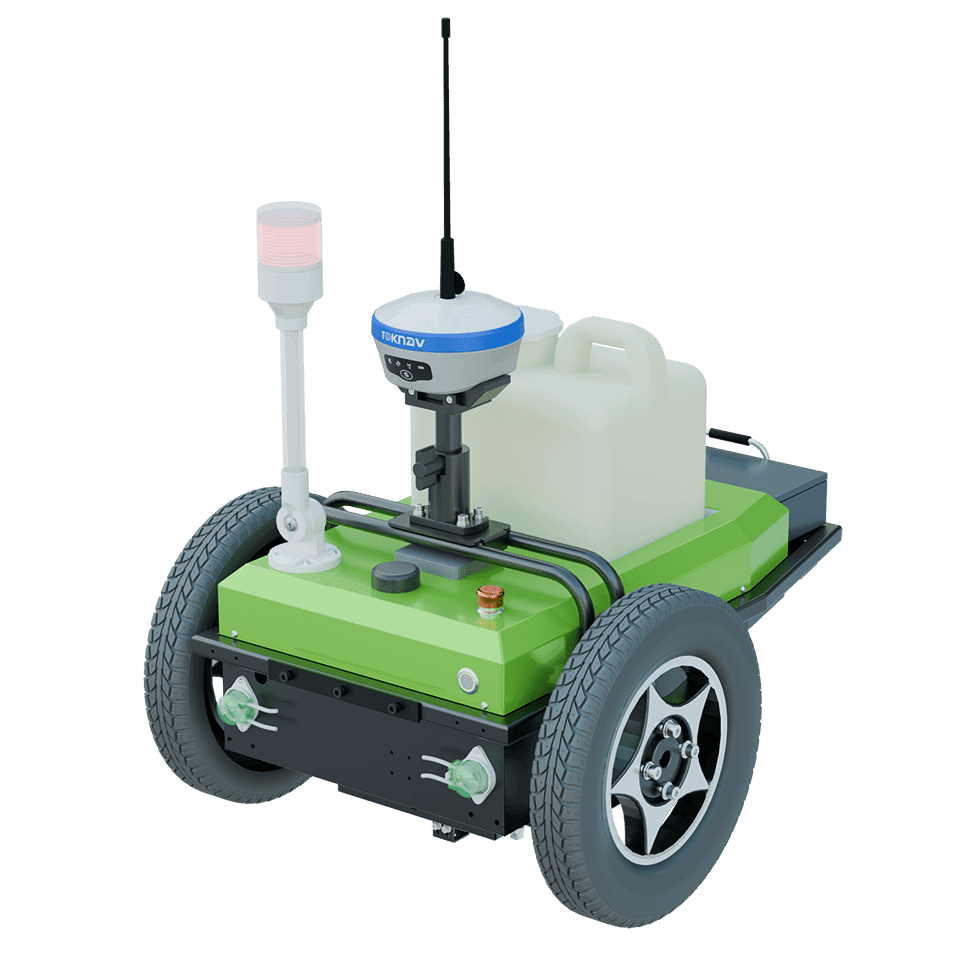
الصفحة الرئيسية: ثورة في مجال وضع العلامات المسبقة للخطوط باستخدام Toknav TR10 2024-09-04 Toknav TR10 | روبوت دقيق لوضع العلامات المسبقة للخطوط في هندسة الطرق والمسح غالبًا ما يصعب تحقيق دقة وكفاءة في وضع علامات الخطوط في مجال هندسة الطرق والمسح. فالطرق اليدوية القديمة بطيئة وغير دقيقة ويصعب إعدادها، وهذا ينطبق بشكل خاص على الأراضي الوعرة أو في الأحوال الجوية السيئة. علاوة على ذلك، تحتاج الصناعة إلى حل أفضل — حل سريع ودقيق للغاية وسهل الاستخدام. يجب أن يعزز سرعة العمل مع خفض التكاليف. وهنا يأتي دور Toknav TR10. Toknav TR10: حل رائد لرسم الخطوط يُعد Toknav TR10 حلاً جديدًا يُغير قواعد اللعبة. فهو يعيد تعريف الكفاءة والدقة والمرونة في مهام رسم الخطوط.لقد صممناه باستخدام أحدث التقنيات وتصميم سهل الاستخدام. بالإضافة إلى ذلك، يتمتع بالعديد من الميزات التي تجعله مثاليًّا لمحترفي المسح وهندسة الطرق. Toknav TR10 ليس مجرد أداة؛ إنه حل شامل مصمم لمواجهة تحديات هندسة الطرق والمسح الحديثة. بفضل تقنيته المتطورة، لا يعزز TR10 جودة رسم الخطوط فحسب، بل يعزز أيضًا الكفاءة الإجمالية للمشاريع. في عالم يُعد فيه الوقت والدقة أمرين بالغي الأهمية، يبرز هذا الروبوت من خلال تقديم ميزات توفر الوقت مع ضمان دقة فائقة. إعداد وتشغيل أسرع: يجعل جهاز TR10 عملية الإعداد سهلة وسريعة. وتتيح واجهة البرنامج البسيطة بدء العمل بسرعة. علاوة على ذلك، تبلغ السرعة القصوى للروبوت 2 متر في الثانية، مما يتيح له تغطية مساحات واسعة بسرعة. كما أنه مزود بنظام توجيه في المكان بنصف قطر دوران أدنى يبلغ 0 درجة، مما يعني أنه يمكنه التحرك بدقة حتى في المساحات الضيقة. يستخدم TR10 بطارية ليثيوم بجهد 24 فولت وسعة 20 أمبير/ساعة. وعند الشحن الكامل، يمكنه قطع مسافة تصل إلى 15 كيلومترًا. كما لا يستغرق شحنه حتى 95% سوى أربع ساعات. وبالإضافة إلى سرعة إعداده، يوفر TR10 أدوات تحكم بديهية لا تتطلب سوى الحد الأدنى من التدريب. يمكن للمستخدمين التعرف بسرعة على الواجهة، مما يتيح للفرق بدء المشاريع دون الحاجة إلى تدريب مكثف. ويعد هذا النهج الذي يركز على المستخدم مفيدًا بشكل خاص للشركات التي تعمل في بيئات عالية الضغط حيث الوقت هو المال. دقة فائقة: عندما يتعلق الأمر بدقة وضع العلامات، فإن جهاز TR10 هو الأفضل في الصناعة. فهو مزود بوحدة GNSS متطورة.تعمل هذه الوحدة مع أنظمة GPS وGLONASS وBDS وGALILEO وQZSS. وهي تحقق تحديد المواقع بتقنية RTK بدقة فائقة؛ حيث تصل الدقة الأفقية إلى ±8 مم + 1 جزء في المليون، بينما تصل الدقة الرأسية إلى ±15 مم + 1 جزء في المليون. والجدير بالذكر أن ميزة تعويض الميل تحافظ على هذه الدقة.وهي تعمل حتى على المنحدرات التي تصل زاويتها إلى 20 درجة. وهذا يضمن خطوطًا مستقيمة وخالية من الأخطاء بهامش أقل من 2 سم. تعد الدقة أمرًا حيويًا في وضع علامات الخطوط، خاصةً عند العمل في مشاريع معقدة تضم أطرافًا معنية متنوعة. تضمن وحدة GNSS في جهاز TR10 تنفيذ حتى أكثر التصاميم تعقيدًا بشكل لا تشوبه شائبة. على سبيل المثال، عند رسم خطوط طريق سريع جديد أو تقاطع معقد، يمكن للدقة التي يوفرها جهاز Toknav TR10 أن تقلل بشكل كبير من الحاجة إلى إعادة العمل، مما يوفر الوقت والموارد على حد سواء. قدرات متقدمة لتحقيق أقصى قدر من الإنتاجية يجمع جهاز TR10 بين الميزات الذكية والمرونة العملية. فهو مزود بأداة لاستيراد الرسومات بنقرة واحدة.تتيح لك هذه الأداة استخدام المخططات المصممة مسبقًا بسهولة. كما أنها تدعم أنماط رسم مختلفة، تشمل النقاط والخطوط والمنحنيات والأرقام والحروف. وبشكل عام، يعزز ذلك الإنتاجية في كل مشروع. علاوة على ذلك، فإن قدرة جهاز TR10 على استيراد ملفات الرسومات مباشرةً تعني أن الفرق يمكنها العمل بناءً على المخططات الموجودة، مما يقلل من مخاطر الأخطاء التي قد تنشأ عن الإدخال اليدوي. تخيل سيناريو يحتاج فيه مخططو المدن إلى وضع علامات على مسارات متعددة بأنماط مختلفة؛ يمكن لـ TR10 التكيف بسهولة مع هذه المتطلبات، مما يجعله أداة لا غنى عنها لأي مدير مشروع. مصمم للتفوق في الظروف الصعبة تم تصميم TR10 للعمل في البيئات القاسية. يتميز بتصميم قوي يزن 28 كجم (عند حمولة 85%)، كما أنه مزود بمحركين محوريين بقوة 200 واط لكل منهما. تتيح هذه الميزات له التعامل مع التضاريس الوعرة مع الحفاظ على الدقة. بالإضافة إلى ذلك، يحتوي على خزان طلاء سعة 7.5 لتر، ويعمل هذا الخزان مع سائل اللاتكس وأبيض التيتانيوم. وهي تتكيف بسهولة مع احتياجات المشاريع المختلفة. كما يقدم جهاز TR10 أداءً جيدًا في درجات الحرارة القصوى، حيث يعمل بشكل موثوق في نطاق درجات الحرارة من -10 درجة مئوية إلى 60 درجة مئوية. ويضمن تصنيف IP3X الخاص به الاستخدام المتسق في جميع الظروف الميدانية. صُمم جهاز TR10 ليتسم بالمتانة، وهو يتفوق حتى في الظروف القاسية، مما يجعله مناسبًا لمختلف الأحوال المناخية والتضاريس. يضمن هيكلها القوي ومكوناتها عالية الأداء قدرتها على تحمل قسوة العمل في الهواء الطلق، وهو ما يعد مفيدًا بشكل خاص للمشاريع طويلة الأجل التي قد تمتد عبر مواسم مختلفة. شريكك في وضع العلامات بدقة ما يميز جهاز TR10 عن حلول وضع خطوط العلامات الأخرى هو دمجه بين التكنولوجيا المتطورة والفائدة العملية. تعمل مستشعراته المتطورة وواجهته سهلة الاستخدام جنبًا إلى جنب، مما يتيح إجراء تعديلات في الوقت الفعلي أثناء التشغيل. وتعد هذه القدرة على التكيف أمرًا بالغ الأهمية لرسم الخطوط في البيئات الديناميكية، مثل أثناء إنشاء الطرق حيث قد تحدث تغييرات غير متوقعة. صُمم جهاز TR10 لتلبية احتياجات محترفي رسم الخطوط المعاصرين. فهو يوفر طريقة أسرع وأكثر دقة وذكاءً للقيام بعملية رسم الخطوط بدقة.بفضل دقته التي لا تضاهى وسهولة استخدامه ومتانته، يضع جهاز TR10 معيارًا جديدًا في هذا المجال. علاوة على ذلك، فهو أداتك المثالية لكل مهام رسم الخطوط. اكتشف مستقبل رسم الخطوط مع جهاز TR10. جرب كيف تقود شركة Toknav عجلة الابتكار. نحن رواد في مجال تكنولوجيا تحديد المواقع والمسح. اختر TR10، وأحدث ثورة في عملية وضع العلامات المسبقة للخطوط اليوم. علاوة على ذلك، مع تزايد الطلب على الحلول الصديقة للبيئة، يتوافق الاستخدام الفعال للمواد والطاقة في TR10 تمامًا مع الممارسات المستدامة. إن القدرة على تقليل النفايات إلى الحد الأدنى أثناء عملية وضع العلامات لا تساهم فقط في الحفاظ على الموارد، بل تعزز أيضًا المظهر العام الصديق للبيئة لمشاريع الطرق. وخلاصة القول، إن Toknav TR10 هو أكثر من مجرد روبوت لوضع العلامات؛ فهو يمثل قفزة كبيرة إلى الأمام في التكنولوجيا المتاحة لمهندسي الطرق ومساحي الأراضي. من خلال الجمع بين السرعة والدقة والقدرة على التكيف، فإنه يعالج التحديات التي طالما واجهها المتخصصون في هذا المجال. وبينما نتطلع إلى مستقبل هندسة الطرق، يجسد جهاز TR10 الابتكارات التي ستشكل ممارسات فعالة وكفؤة لرسم خطوط الطرق.

Toknav TR10 | روبوت دقيق لرسم الخطوط المسبقة في هندسة الطرق والمسح قراءة المزيد »

TOKNAV T30 وT30Pro: دقة منقطعة النظير مع خاصية الاستطلاع بالواقع المعزز لمحترفي الجغرافيا المكانية والبناء

Home TOKNAV T30 & T30Pro GNSS Receivers: Unmatched Precision with AR Stakeout for Geospatial & Construction Professionals Published: 2024-09-02 | Category: GNSS Technology, Surveying Innovation Guangzhou, November 2024 — TOKNAV, a global leader in precision measurement tools, is proud to announce the launch of its latest flagship GNSS receivers: the T30 and T30Pro. These cutting-edge devices embody TOKNAV’s unwavering commitment to precision, reliability, and user-centric design, setting new industry benchmarks for speed, accuracy, and operational efficiency across infrastructure, construction, and land development projects. Shared Features: Ultra-Fast Precision & AR Stakeout Both the T30 and T30Pro are engineered with advanced processing technology, enabling ultra-fast real-time GNSS calculations that deliver centimeter-level positioning data. This accelerated processing drastically reduces field wait times and amplifies workflow efficiency, making them ideal for projects with tight deadlines.Key shared features include:  Blazing Speed: Instant GNSS data calculation eliminates delays during on-site operations, keeping projects on track. Industry-Leading Accuracy: ±8mm horizontal and ±15mm vertical accuracy guarantees precise measurements for every task. 1408 Multi-Channel Support: Full multi-system, multi-frequency GNSS tracking ensures reliable signal coverage even in complex, challenging environments. AR Stakeout System: An integrated augmented reality (AR) real-time stakeout tool overlays stakeout points directly onto the physical world, simplifying site layout and boundary marking while boosting operational accuracy. TOKNAV T30 & T30Pro T30Pro: Advanced Photogrammetry & 3D Imaging The T30Pro elevates performance with specialized photogrammetry capabilities, featuring high-resolution image capture to generate detailed 3D models and orthophotos. This makes it an indispensable tool for topographic mapping, infrastructure documentation, and complex geospatial projects that demand multi-dimensional data insights. Close-up of T30Pro camera module T30: Laser Measurement Innovation  Designed for versatility, the T30 integrates centimeter-level laser measurement functionality, enabling precise field measurements in hard-to-reach locations—such as points across rivers or beneath structures. This feature extends TOKNAV’s mission to make high-precision surveying accessible and efficient for professionals worldwide. T30 GNSS Reciever demostrating laser measurement capability Seamless Connectivity & Rugged Durability Both receivers offer seamless 4G, Bluetooth, and Wi-Fi connectivity, empowering remote data monitoring and access from any location. Built to withstand the harshest field conditions, they feature an IP68-rated magnesium alloy casing and a 13800mAh high-capacity battery that delivers up to 48 hours of continuous operation. At just 1.5 kg, their lightweight design ensures portability for extended field assignments, perfectly balancing power, durability, and ease of use. Redefining Professional Surveying The T30 and T30Pro represent TOKNAV’s dedication to pushing the boundaries of precision, speed, and innovation. By combining ultra-fast GNSS computation, intuitive AR stakeout, and specialized features like photogrammetry (T30Pro) and laser measurement (T30), these receivers redefine what’s possible in fieldwork, giving construction, land management, and infrastructure professionals a decisive competitive edge. About TOKNAV TOKNAV is dedicated to advancing geospatial technology, setting new standards for accuracy, speed, and reliability in precision measurement tools. Trusted by professionals worldwide, TOKNAV delivers innovative, high-performance solutions that drive efficiency and excellence across industries. For more information on the T30, T30Pro, and other offerings, visit www.toknavgnss.com or contact us at info@toknav.cn.

TOKNAV T30 وT30Pro: دقة منقطعة النظير مع خاصية الاستطلاع بالواقع المعزز لمحترفي الجغرافيا المكانية والبناء قراءة المزيد »

TOKNAV tBase GNSS Receiver

جهاز استقبال TOKNAV tBase TBase GNSS | 12+ ساعة عمر بطارية طويل ودقة عالية

Home TOKNAV Unveils tBase GNSS Receiver: Over 12 Hours of Unmatched Battery Life for Robust Applications 2024-09-02 TOKNAV tBase GNSS Receiver | 12+ Hours Long Battery Life and High Precision for Professionals Guangzhou, November 2024— TOKNAV proudly announces the launch of the tBase GNSS receiver, a high-precision positioning device that redefines battery performance. With over 12 hours of continuous operation, the tBase sets a new industry standard, giving professionals unprecedented freedom in the field. This receiver is particularly beneficial for land surveying, agriculture, and construction, where reliable positioning is critical. Reliable Battery Performance: A Game Changer The tBase features a powerful 13800mAh battery, providing reliable performance for long-duration surveying and monitoring tasks. For instance, in remote locations, surveyors can utilize the tBase GNSS receiver for extensive mapping projects without interruptions. Users can focus on their work without worrying about power issues, even in extreme weather conditions. This long-lasting battery ensures that professionals can complete their tasks efficiently, making it an essential tool for those in the field. Comprehensive GNSS Support: Unmatched Accuracy This receiver supports all major global satellite navigation systems—BeiDou, GPS, GLONASS, Galileo, and QZSS—ensuring accurate positioning wherever you are. Powered by a Linux+ARM Cortex-A7 platform, it offers high efficiency and scalability to meet evolving work demands. By integrating multiple GNSS systems, users can achieve enhanced accuracy and reliability, making it suitable for various applications, including precision agriculture and geological surveying. Robust and Durable Design: Built for the Elements Designed to IP68 standards and housed in a robust magnesium alloy casing, the tBase ensures durability in harsh environments. Integrated VPN support enables remote configuration for flexible operation in complex settings. Additionally, it includes an electronic fence system and area code restrictions for compliant use, crucial for applications requiring strict adherence to geographical boundaries. This robust design ensures that the tBase can withstand the rigors of outdoor use, making it a reliable choice for professionals in challenging environments. About TOKNAV: Innovating Precision Positioning TOKNAV is a leading provider of high-precision positioning solutions, dedicated to delivering reliable and accurate positioning services through innovative technology. Our products are engineered to deliver unmatched accuracy and reliability, making them essential tools for professionals across various industries. As we continue to push the boundaries of technology, we remain focused on providing dependable, cutting-edge positioning services to meet the needs of our global customers. Our commitment to innovation ensures that our customers receive the most advanced solutions available, enabling them to achieve their objectives effectively.

جهاز استقبال TOKNAV tBase TBase GNSS | 12+ ساعة عمر بطارية طويل ودقة عالية قراءة المزيد »

روبوت «توكناف» لوضع العلامات على العشب

روبوت تعليم العشب TOKNAV | دقة GNSS RTK للملاعب الرياضية

Home Say Hello to TOKNAV Turf Marking Robot! 2025-01-07 TOKNAV Turf Marking Robot | GNSS RTK Precision for Sports Fields With a strong foundation in cutting-edge technology, TOKNAV introduced our first linemarking robot—a solution specifically designed for long road pre-marking tasks. This milestone set the stage for our continued innovation. This earlier model transformed highway pre-marking by streamlining processes, cutting down on manual effort, and boosting efficiency for large-scale applications. Its user-friendly design and reliable performance made it a go-to tool for achieving accurate markings on standard road surfaces. Building on this foundation, we’re proud to introduce the TOKNAV Turf Marking Robot, an advanced solution tailored for grass sports fields. With the same commitment to precision, speed, and efficiency, the Turf Marking Robot offers enhanced features, making field preparation faster and easier than ever before. Whether you’re maintaining a professional stadium or a local sports facility, this innovative robot is designed to make your job easier, faster, and more precise. Superb Precision Equipped with the GNSS RTK technology, this robot marks lines with pinpoint accuracy, ensuring your fields always look perfect. No more uneven or misaligned lines—just smooth, sharp markings every time. Speed and Efficiency Traditional manual marking can take hours for a full-size soccer pitch, but with the 1m/s marking speed, you’ll breeze through field preparation. A task that might have taken an entire morning can now be completed in less than half an hour. Light and Easy to Handle At only 35KG, this robot is incredibly easy to maneuver. Whether you’re working on a huge field or a smaller one, it’s designed to move seamlessly with minimal effort. Smart Field Templates for Effortless Marking With its integrated sports field templates, the TOKNAV Line Marking Robot is designed to simplify the marking process. From soccer fields to multi-purpose grounds, it ensures clear, accurate lines that meet professional standards. Upgrade Your Game with TOKNAV. It’s time to leave the hassle of traditional marking methods behind and embrace the ease and precision of the TOKNAV Turf Marking Robot. Faster, smarter, and built to perform, it’s the perfect partner for creating professional grass sports fields.

روبوت تعليم العشب TOKNAV | دقة GNSS RTK للملاعب الرياضية قراءة المزيد »

أجهزة استقبال GNSS من طراز TOKNAV T40 وT40Pro

أجهزة استقبال TOKNAV T40 و T40Pro GNSS | بطارية قابلة للتبديل والمسح بالليزر البصري

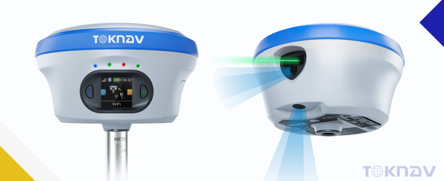
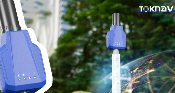
Home TOKNAV Unveils the T40 and T40 Pro GNSS Receivers: Elevating Precision Surveying with Swappable Batteries and Visual Laser Technology 2025-05-06 TOKNAV T40 & T40Pro GNSS Receivers | Swappable Battery & Visual Laser Surveying The importance of high precision in surveying cannot be overstated. Professionals in the field require tools that not only meet but exceed current standards of accuracy and reliability. The Toknav T40 and T40Pro GNSS receivers have been developed with feedback from industry experts, ensuring that they meet the needs of modern surveyors. TOKNAV leads innovation in high-precision geospatial tech. We’re proud to launch our new GNSS receivers, the T40 and T40Pro.These next-gen devices meet surveyors’ changing needs. They combine top-tier positioning features with user-focused upgrades.Notably, they include hot-swappable batteries and laser visual technology. This blend boosts usability for geospatial pros. Key Upgrades: Swappable Batteries for Better Field Efficiency The T40 series builds on the success of earlier models. It makes big jumps in function and work efficiency.A key upgrade is the dual removable battery system. Users can change batteries without turning off the device.This cuts down on downtime and greatly boosts field productivity. It solves a common pain point for on-site work. Laser Visualization: Clear Precision in Real Time Another major upgrade is laser visualization. Users can see laser measurement points clearly on the controller screen.This feature ends guesswork for real-time precision. It links digital coordinates to the real world visibly.Furthermore, it boosts accuracy and gives users more confidence in the field. Every measurement feels tangible and reliable. Moreover, these devices are engineered with user experience in mind, featuring intuitive interfaces and easy-to-navigate menus. Surveyors can spend less time learning how to use the equipment and more time focusing on their actual work. This shift increases overall productivity and satisfaction among users. T40: Precision with Laser Dual-Camera and AR In the realm of geospatial technology, the T40’s laser dual-camera system is particularly noteworthy. This system not only provides accurate measurements but also allows for real-time data visualization, significantly reducing the chances of error during surveying operations. The integration of augmented reality with laser technology is a game-changer, giving users the ability to visualize their measurements directly on-site. The Toknav T40 features a sophisticated laser dual-camera system designed for high-precision applications. This system offers millimeter-grade laser ranging accuracy (≤2.5 cm within a 5 m distance), making it ideal for precise surveying tasks.In addition to laser ranging, it includes high-definition augmented reality (AR) staking capabilities, allowing for real-world accuracy that enhances the user experience. This device is engineered to support full-system, multi-frequency GNSS reception, which is essential for varied surveying tasks.The T40 is compatible with multiple GNSS systems including GPS, GLONASS, BDS, Galileo, QZSS, SBAS, and NavIC, ensuring broad applicability. With an impressive 1408 channels, it guarantees robust signal reception even in challenging environments.Its tough magnesium-aluminum body and IP68 protection rating offer exceptional durability, allowing it to withstand harsh field conditions without compromising performance. This rugged design makes it suitable for use in diverse environments, from urban settings to remote terrains. T40Pro: Photogrammetry-Ready Survey Tool For the T40Pro, the photogrammetry-ready features enhance its versatility even further. This model is designed to accommodate a wider range of surveying tasks, from traditional land surveying to advanced imaging for construction projects. The ability to capture high-definition images along with precise coordinates allows for comprehensive data collection and analysis. The T40Pro takes geospatial work to the next level. It adds photogrammetric survey features for more versatility.It captures high-def images with a large-sensor system. It then pulls precise coordinates from these images.Like the T40, it has AR staking, IMU-based tilt measurement, and multi-frequency GNSS support.Specifically, it is optimized for image-based surveys. It suits professionals needing advanced visual data. As surveying technology evolves, so does the necessity for tools that can adapt to various conditions and requirements. The T40Pro, with its enhanced capabilities, empowers professionals to tackle more complex projects efficiently, making it an essential tool for anyone serious about precision in surveying. Redefining Surveying Efficiency with the T40 Series Additionally, the advancements in the T40 series are not only about technology but also about enhancing workflow. By integrating features such as hot-swappable batteries, users can maintain productivity levels without the interruptions typically associated with battery changes. This is particularly beneficial during extensive fieldwork where time and efficiency are critical. With the T40 series, TOKNAV aims to set new standards. It delivers high-precision tools that are easy to use.These tools are durable and ready for future needs. They work well in tight urban spaces or large topographic mapping projects.Laser visibility, long battery life, and multi-sensor fusion offer unbeatable reliability. They also improve the user experience. Get More Information For details, visit www.toknav.cn. Alternatively, contact us at info@toknav.cn. Thank You for Your Interest We appreciate everyone who visited our booth at SFMA 2025. We value your attention and curiosity.If you want to learn more or explore partnerships, please reach out to us. Contact Information info@toknav.cn | www.toknavgnss.com Join TOKNAV in Shaping the Future Work with us to redefine precision marking and surveying. TOKNAV’s innovative solutions lead the way. In conclusion, the TOKNAV T40 and T40Pro GNSS Receivers represent a significant leap forward in surveying technology. With their combination of innovative features, reliability, and ease of use, they are set to redefine how professionals approach their work. The careful consideration of user feedback in the design process ensures these devices meet the real-world challenges faced by surveyors today. As we continue to move toward a future where precision and efficiency are paramount, the TOKNAV T40 T40Pro GNSS Receivers stand out as leaders in their field. By investing in these advanced tools, surveyors can enhance their capabilities and remain competitive in an increasingly demanding industry. For further information regarding the features and applications of the TOKNAV T40 T40Pro GNSS Receivers, potential users are encouraged to research and reach out directly to TOKNAV for personalized consultations and demonstrations. Ultimately, the investment in the TOKNAV T40 T40Pro GNSS Receivers is not merely a purchase; it is a commitment

أجهزة استقبال TOKNAV T40 و T40Pro GNSS | بطارية قابلة للتبديل والمسح بالليزر البصري قراءة المزيد »

TOKNAV هي علامة تجارية راقية للأنظمة العالمية لسواتل الملاحة مملوكة لشركة قوانغتشو توكسيرفي لتكنولوجيا المعلومات المحدودة.
جميع الحقوق محفوظة © 2025 شركة قوانغتشو توك سورفي لتكنولوجيا المعلومات المحدودة سياسة الخصوصية

كن من موزعي TOKNAV العالميين!

نحن نبحث الآن عن موزعين متحمسين للانضمام إلى قصة نجاحنا العالمية بفضل سجلنا الحافل في مجال المسح.