
GNSS RTK Receiver: The Complete Guide for High‑Precision Surveying
2026-3-5
In the world of professional surveying, accuracy is non-negotiable. Whether you’re mapping construction sites, surveying agricultural land, or conducting topographic surveys, the difference between centimeter-level precision and meter-level approximation can make or break a project.
That’s where the GNSS RTK receiver comes in—a powerful tool that has revolutionized high-precision surveying. As a leading GNSS supplier, TOKNAV offers a range of high precision GNSS solutions, including the reliable TOKNAV RTK receiver, designed to meet the demands of European survey professionals.

Toknav GNSS Factoy / Company
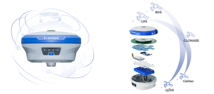
First, let’s break down the basics: What is a GNSS RTK receiver? GNSS (Global Navigation Satellite System) refers to a network of satellites that provide positioning, navigation, and timing data. RTK (Real-Time Kinematic) is a technique that enhances GNSS accuracy by using a base station to correct data in real time.
A GNSS RTK receiver works by receiving signals from satellites and combining them with correction data from a base station, delivering centimeter-level accuracy—far superior to standard GNSS receivers. For surveyors, this level of precision is essential for tasks like setting out construction boundaries, mapping land parcels, and monitoring structural deformations.
Understanding how RTK surveying works is key to maximizing the value of your GNSS RTK receiver.The process begins with a base station, which is set up at a known location. The base station continuously receives satellite signals and calculates its own position. Any discrepancies between the calculated position and the known position are converted into correction data, which is then transmitted to the rover—your GNSS RTK receiver.
The rover uses this correction data to adjust its own satellite readings, eliminating errors and delivering precise, real-time positioning. This seamless collaboration between base and rover is what makes RTK surveying so efficient and reliable.
Toknav T30 base+ rover
When choosing a GNSS RTK receiver, there are several key specs to consider.
First, satellite compatibility: Look for receivers that support multiple GNSS constellations (GPS, GLONASS, Galileo, BeiDou) to ensure reliable signal reception even in challenging environments. Second, accuracy: A high-quality survey GNSS receiver should deliver horizontal accuracy of ±1cm + 1ppm and vertical accuracy of ±2cm + 1ppm.
Third, communication options: UHF, 4G, and NTRIP (Networked Transport of RTCM via Internet Protocol) are essential for transmitting correction data quickly and reliably. Battery life, durability (IP rating), and ease of use are also critical factors, especially for field surveyors who work in harsh conditions.
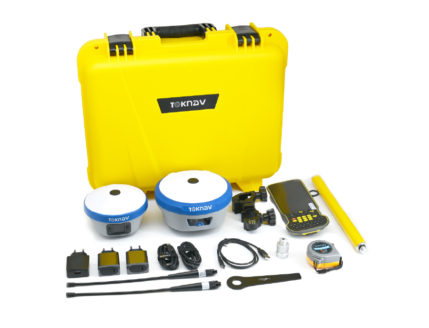
The TOKNAV RTK receiver stands out among high precision GNSS solutions for European surveyors. Designed with the EU market in mind, TOKNAV’s RTK receivers are built to meet strict quality and certification standards, ensuring compatibility with European surveying practices. Our receivers support multiple GNSS constellations, offer long battery life (up to 16 hours), and feature a rugged, IP67-rated design that can withstand dust, water, and extreme temperatures. Additionally, TOKNAV’s RTK receivers are compatible with our GNSS base rover kit, creating a complete RTK surveying solution that streamlines fieldwork and improves efficiency.
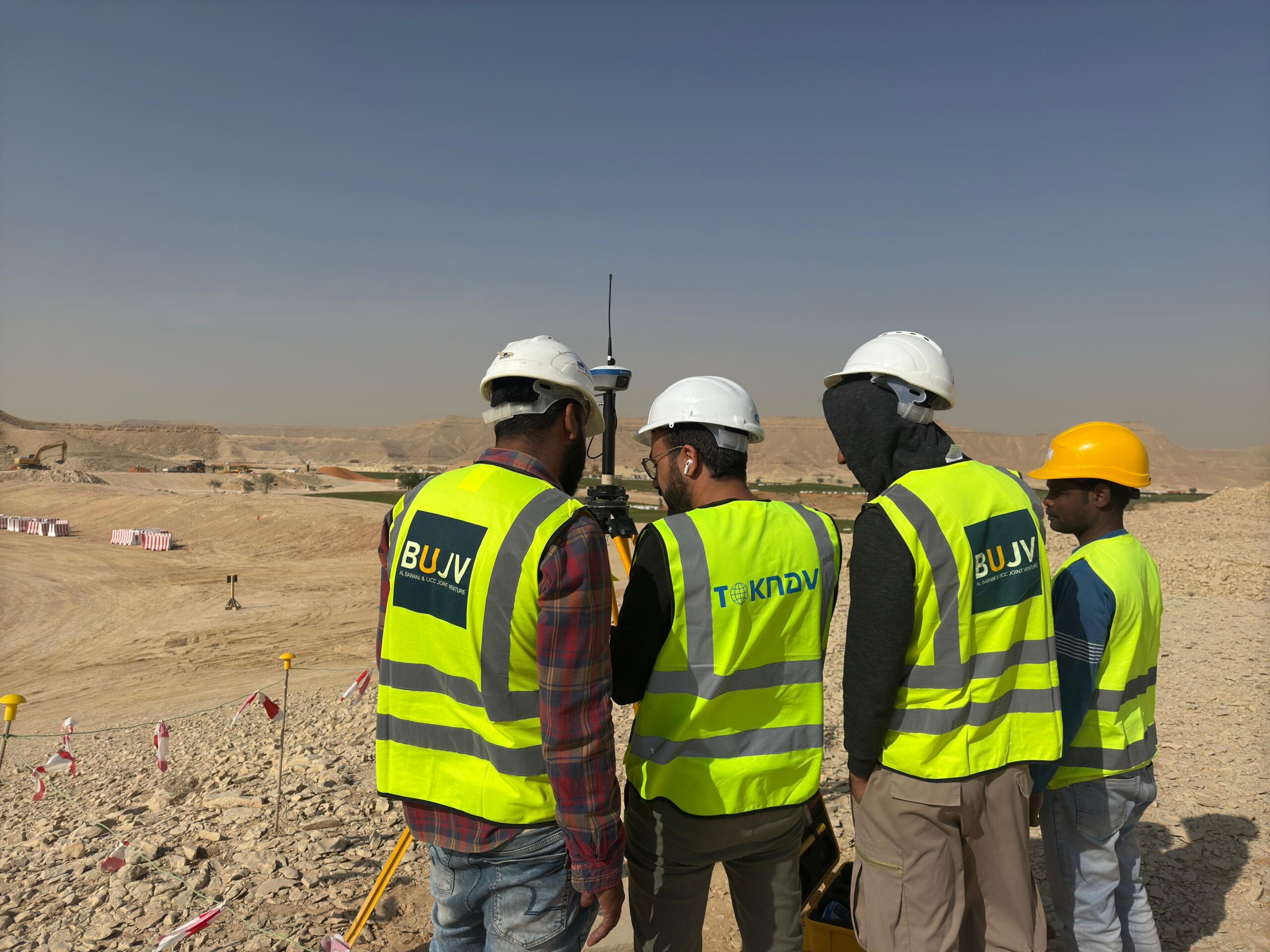
Typical use cases for a GNSS RTK receiver include construction, mapping, and agriculture. In construction, surveyors use RTK receivers to set out foundations, walls, and other structural elements with precise accuracy, reducing errors and avoiding costly rework. In mapping, RTK surveying enables the creation of detailed topographic maps, contour lines, and elevation models, which are essential for urban planning and environmental monitoring. In agriculture, RTK receivers help farmers with precision planting, fertilization, and harvesting, improving crop yields and reducing waste.
Customers in the Saudi Arabia region are using the toknav T20Pro GNSS Receiver
Let’s address some common FAQs about GNSS RTK receivers.
Q: What is the maximum accuracy of a TOKNAV RTK receiver?
A: Our receivers deliver horizontal accuracy of ±1cm + 1ppm and vertical accuracy of ±2cm + 1ppm, making them ideal for high-precision surveying tasks.
Q: How long does the battery last?
A: The TOKNAV RTK receiver has a 6000mAh battery that lasts up to 16 hours of continuous use, with a fast-charging option for quick top-ups.
Q: How many satellite channels does it support?
A: Our receivers support up to 800+ channels, ensuring reliable signal reception even in urban canyons or dense vegetation.
In conclusion, a high-quality GNSS RTK receiver is an essential tool for any professional surveyor looking to achieve centimeter-level accuracy. TOKNAV’s RTK receivers, part of our comprehensive surveying instruments lineup, are designed to meet the needs of European survey professionals, offering reliability, durability, and ease of use. Whether you’re working on a construction site, mapping a remote area, or managing agricultural land, the TOKNAV RTK receiver will help you complete your projects efficiently and accurately.
Ready to upgrade your surveying equipment? Visit our RTK product page to learn more about the TOKNAV RTK receiver, or contact our team for personalized advice. Don’t forget to explore our homepage for our full range of high precision GNSS solutions.