
How the TOKNAV TR10 Road Pre-Marking Robot Turns CAD Designs into Field Layout
Bring CAD DXF files, road-design data, control points and task execution into one organised pre-marking workflow.
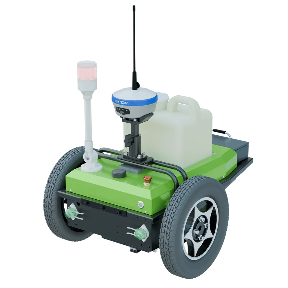
Road marking starts long before permanent paint is applied. Before a road can be finished, crews need a reliable way to transfer approved geometry from the design file to the worksite: establishing reference points, checking offsets, setting out line segments and creating clear guidance for the next construction stage.
Сайт TOKNAV TR10 Road Pre-Marking Robot supports that transition from digital road design to organised field layout. It combines an RTK/GNSS positioning workflow, on-site point collection, CAD DXF and road-design file import, coordinate calibration, and task-based robot operation.
What is a road pre-marking robot?
A road pre-marking robot is a mobile, positioning-guided machine used to place preliminary line guidance on a prepared site. It does not replace engineering review, traffic management or the final marking specification. Its role is to help teams turn approved layout information into clear, repeatable field tasks before the permanent-marking stage.
For road contractors, that matters because manual layout can require repeated measuring, point setting and visual alignment over long distances. TR10 supports a workflow in which the project data, control points and line tasks are prepared digitally, then checked and carried out on site.
From drawing file to site task: the TR10 workflow
- Create the project and define coordinate settings.
The operator creates a project in the control application and enters the location and coordinate-system settings required for the job. The operating workflow supports WGS84 and Gaussian projection configuration, with the central meridian entered according to road-design information. - Import road-design data or CAD DXF drawings.
TR10 supports road straight-line, curve and corner-table data imported from Excel, as well as CAD drawings imported in DXF format. The operator can review the selected drawing or road section in the application before creating tasks. - Collect field points with a GNSS receiver.
Before creating line tasks, the team collects relevant on-site points with the GNSS receiver. Digital drawings do not replace site control: the field workflow still starts with verified points and a correct project reference. - Calculate and calibrate project coordinates.
For drawing-based tasks, the coordinate transformation and calibration steps are essential. TR10 includes four-parameter and seven-parameter calculation options, together with a calibration check using project control points. - Build the pre-marking task.
Once the reference is ready, the operator can create a task from collected points, an imported road table or a CAD drawing. Options include line segments, offsets, path direction, line type and directional arrow icons where required. - Execute, supervise and pause safely when needed.
TR10 supports automatic and manual operating modes. Operators can pause a task from the controller or application, and the operating workflow includes emergency-stop and power-off actions for abnormal conditions.
Why CAD-based road pre-marking is valuable
The value is not simply that a machine can move along a path. It is the connected workflow between design information, field control and task execution. With TR10, road teams can work toward:
- Better design-to-field continuity: bring approved road tables or DXF drawings into the same workflow used for point collection and task creation.
- More organised section planning: build tasks for selected line segments, offsets and directions rather than managing every instruction informally.
- Clearer on-site verification: use control points, coordinate calculations and calibration as checkpoints before drawing-based work begins.
- Reduced repetitive layout work: use guided pre-marking tasks while skilled personnel focus on verification, site management and the next construction stage.
- Traceable work preparation: keep projects, drawings, collected points and created tasks within one operational process.
Actual benefit depends on site conditions, design quality, correction availability, crew procedures and the contractor’s marking specification. Evaluate every project for its own surface condition, GNSS correction method, control network and traffic-control arrangements.
Typical applications for the TR10 pre-marking workflow
TR10 is relevant wherever a road or paved-area project needs digital layout information translated into visible, supervised field guidance.
- New-road and road-upgrade projects working from design tables and CAD drawings.
- Municipal road corridors requiring organised lane, edge or directional-layout preparation.
- Paved areas using project-specific line segments, offsets or arrow markings.
- Contractors standardising the handoff between survey control, design data and pre-marking tasks.
A practical checklist before task execution
- Check that the approved design table or DXF file is imported correctly.
- Confirm project coordinate settings match the approved design information.
- Verify control points and complete the required coordinate calculation and calibration.
- Check GNSS status, controller connection and robot operating condition.
- Review the task path, offsets, line type and direction.
- Control the work area under the project’s traffic and site-safety procedures.
- Prepare and clean the nozzle and paint path in line with the operating manual.
Discuss your TR10 road-layout project with TOKNAV
Share your project location, road type, design-file format, control-point method and expected operating process. Our team can help you discuss the practical route from design data to on-site pre-marking preparation.
Contact TOKNAV about a TR10 project
For RTK workflow hardware, explore the TOKNAV GNSS receiver range.
FAQ: TOKNAV TR10 Road Pre-Marking Robot
What does the TR10 road pre-marking robot do?
TR10 supports a road-layout workflow that combines GNSS point collection, project coordinate setup, CAD DXF or road-design-data import, calibration and task-based pre-marking operation.
Can the TR10 use CAD road drawings?
Yes. The operating workflow supports DXF CAD drawing import. It also supports road straight-line, curve and corner-table data imported from Excel files.
Why is coordinate calibration required before a CAD task?
Calibration aligns the project design reference with the measured site reference. The applicable coordinate calculation and calibration should be completed before CAD-based task creation and execution.
Can operators pause the TR10 during work?
Yes. The workflow includes task-pausing options through the controller and application, plus an emergency-stop function. Work should be paused if GNSS status or another operating condition is unsuitable.
Is TR10 a final road-marking specification solution?
TR10 is intended for the pre-marking workflow described in its operating manual. Final marking materials, geometry, inspection requirements and site-safety controls remain the responsibility of the project team and its approved specification.