
RTK GNSS Receiver Guide
How to Choose an RTK GNSS Receiver for Surveying, Construction and Base-Rover Work
An RTK GNSS receiver should match the job: rover surveying, construction layout, base station correction, photogrammetry, GIS data collection, CORS infrastructure or dealer package design. This guide turns the buyer’s search into a clear model-selection checklist.
Author: TOKNAV GNSS Solution Team. Last updated: July 2026.
Use this guide when you need to compare RTK GNSS receiver options for field surveying, construction layout, base-rover work, CORS/VRS infrastructure or distributor packages. It focuses on the workflow details that make a recommendation useful.
Download the RTK Receiver PDF Checklist
Get a printable receiver-selection checklist for application, correction method, IMU/visual workflow, accessories, quantity and quote preparation.
Step 1: Choose by Workflow
Many buyers start with a broad query like “RTK GNSS receiver” or “GNSS RTK”. That search can mean different things. A survey crew may need a rugged rover with IMU tilt. A contractor may need a base-rover kit. A system integrator may need a CORS receiver. A distributor may need a product range that covers entry-level, professional and infrastructure needs.
Start by defining the workflow. The receiver model should follow the workflow, not the other way around.
| Workflow | Receiver priority | TOKNAV path |
|---|---|---|
| Daily RTK surveying | Reliable rover, IMU tilt, field software, battery life and rugged field operation. | T20Pro, T10Pro |
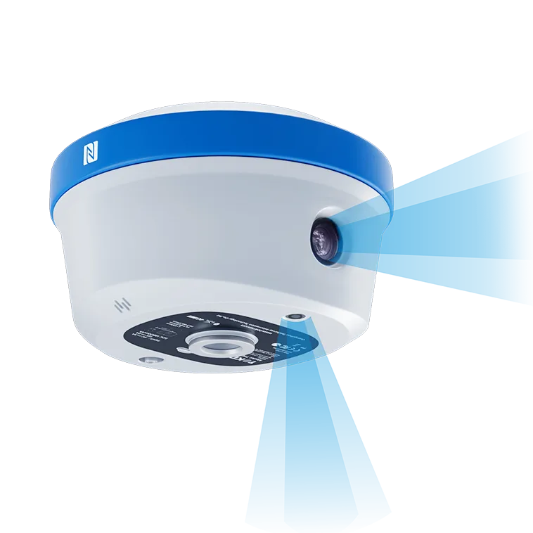
| Visual or photogrammetric RTK work | Image-based measurement, AR/stakeout support and advanced rover workflow. | T50Pro, T40Pro |
| Local base-rover correction | Base station receiver, rover receiver, radio or network correction plan. | tBase plus rover receiver |
| CORS or VRS infrastructure | Permanent reference station receiver, antenna, communication and correction workflow. | NET660i, NET660 |
Step 2: Compare the Features That Affect Field Productivity
Accuracy is important, but buyers should not choose an RTK receiver by accuracy language alone. Field productivity often depends on the complete receiver package: signal tracking, correction method, IMU tilt, radio, controller, software, accessories and support.
Correction workflow
Confirm whether the project uses local base, radio, network RTK, CORS/VRS or a mixed workflow. This affects receiver, antenna and accessory selection.
IMU tilt and visual work
For difficult points, poles, corners and construction layout, tilt compensation or visual measurement can reduce field time and improve operator efficiency.
Software and deliverables
Confirm data collection, stakeout, CAD/GIS export, localization, coordinate system and team training needs before finalizing the package.
Which TOKNAV RTK GNSS Receiver Should a Buyer Review First?
If you already know the project type, use the table below to choose the most relevant TOKNAV receiver path before requesting a quotation or technical recommendation.
| Buyer need | Recommended starting model | Why review it |
|---|---|---|
| Advanced rover surveying, photogrammetry and AR stakeout | T50Pro | Best fit when the buyer wants a higher-end rover workflow and visual measurement support. |
| Photogrammetric GNSS receiver comparison | T40Pro | Relevant for teams comparing image-based RTK and AR field workflows. |
| Professional survey rover with tilt and radio | T20Pro | Useful for surveying, construction layout and base-rover packages. |
| Practical engineering RTK receiver | T10Pro | Good starting point for daily survey and distributor bundles. |
| Local RTK correction package | tBase | Relevant when the team needs its own base station instead of relying only on network RTK. |
Step 3: Decide Whether You Need Rover, Base or Infrastructure Equipment
A single rover may be enough for network RTK surveying. A base-rover kit is better when network coverage is weak or the buyer wants local correction control. CORS and VRS projects require a different design path: reference station receivers, GNSS antennas, site planning, communication and long-term operation.
Use this article to direct readers to the correct next page. A buyer comparing field rovers should go to the GNSS receiver category. A buyer planning correction infrastructure should go to the VRS/CORS content. A buyer unsure about antennas should go to the antenna selection guide.
Continue planning
Before you request a quote
Prepare your application, accuracy target, correction method, country, quantity and preferred accessories. These details help TOKNAV recommend a receiver package more quickly.
What to Send for an RTK Receiver Recommendation
- Application: surveying, construction, mapping, GIS, machine control, CORS/VRS or distributor package.
- Expected correction method: local base, radio, network RTK, CORS/VRS or mixed workflow.
- Required accessories: controller, software, tripod, pole, radio, antenna, battery and carrying case.
- Quantity and buyer type: end user, dealer, integrator or project contractor.
- Country or region, coordinate system needs and field environment.
- Whether visual measurement, IMU tilt or photogrammetry workflow is required.
FAQ
What is an RTK GNSS receiver?
An RTK GNSS receiver uses GNSS signals and correction data to support high-precision positioning for surveying, construction, mapping and related field workflows.
What is the difference between a rover and a base station?
A rover is used in the field to measure points. A base station provides correction data from a known or controlled position. Some projects use a local base-rover kit, while others use network RTK.
Do I need IMU tilt compensation?
IMU tilt can improve field efficiency when measuring hard-to-reach points, corners, obstacles or construction points where keeping the pole perfectly vertical is difficult.
Can TOKNAV recommend a full RTK package?
Yes. Send the application, correction method, quantity, country and accessory needs so TOKNAV can recommend a model and package.
Request an RTK GNSS Receiver Package Recommendation
Send your project workflow, correction method, quantity, country and accessory needs. TOKNAV can help compare rover, base station and infrastructure receiver paths.