
Machine Control and Precision Agriculture
What Is GNSS Guidance? A Practical Guide for Machine Control and Precision Agriculture
GNSS guidance uses satellite positioning, correction data, software, displays, sensors and sometimes machine-control hardware to guide a machine, vehicle or operator along a planned path or target surface.
Author: TOKNAV GNSS Solution Team. Last updated: July 2026.
Download the GNSS Guidance Project Checklist
Use the GNSS hardware checklist to collect application, correction, receiver, antenna, display, machine and support requirements before asking TOKNAV for a solution.
For B2B buyers, this topic usually appears in practical projects: land leveling, precision agriculture, dozer guidance, excavator guidance, machine positioning and automation. The buyer is not only asking “what is GNSS guidance?” They are asking how to build a reliable workflow that can be quoted, installed and supported.
Quick Answer: What Is GNSS Guidance?
GNSS guidance is a positioning workflow that helps a machine, vehicle or operator follow a planned path, target grade, field line or construction model. It usually combines GNSS positioning with RTK correction, a controller or display, software logic and application-specific hardware.
In agriculture, GNSS guidance may support steering, land leveling or field passes. In construction, it may guide dozers and excavators using design surfaces. In custom equipment projects, it may become part of a broader positioning and control workflow.
GNSS Navigation, RTK Surveying and GNSS Guidance: What Is the Difference?
| Workflow | Main purpose | Typical decision |
|---|---|---|
| GNSS navigation | Find location or route at general navigation accuracy. | Device, map, antenna and basic positioning environment. |
| RTK surveying | Measure points, stake out locations and collect survey data with high precision. | Rover, base/network correction, controller, software and accessories. |
| GNSS guidance | Guide a machine, vehicle or operator along a planned task. | Receiver, antenna, correction, display, sensors, machine interface, software and support. |
| Automatic machine control | Use positioning and control logic to assist or automate machine movement. | Machine type, hydraulic or control interface, design files, safety workflow and installation. |
Main Components of a GNSS Guidance System
Positioning hardware
GNSS receiver, GNSS antenna and correction source decide the positioning foundation.
Guidance interface
Controller, display and software show paths, grades, design data, maps or task templates.
Machine workflow
Sensors, machine inputs, communication, power, installation and training decide field usability.
Where GNSS Guidance Is Used
Precision Agriculture and Land Leveling
Precision agriculture projects often use GNSS guidance to improve field passes, land leveling, machinery operation and repeatable positioning. For land leveling, the system must understand the target surface, machine position, field condition and operation workflow.
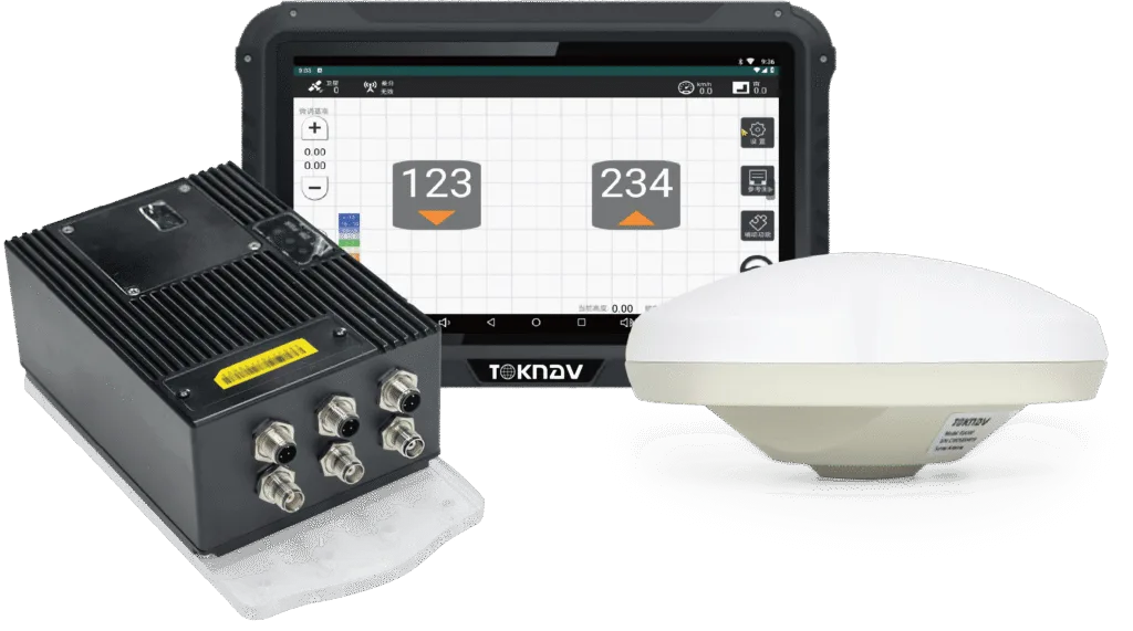
TOKNAV TAG88 Système automatisé de nivellement des terres par GNSS is a relevant starting point for buyers planning satellite-based land leveling. Buyers comparing steering or field guidance workflows can also review TAG66 Volant électrique Système de conduite autonome.
Dozer and Excavator Machine Control
Construction machine-control projects use GNSS guidance to help operators follow design surfaces, reduce staking dependency and improve earthwork control. The decision is not only a receiver choice. It includes machine type, design files, display, sensor fusion, operator workflow, installation and jobsite support.
For dozer workflows, review TOKNAV TMC10 Dozer 3D Guidance System. For excavator guidance, review TOKNAV TMC20 Excavator Guidance System.
Custom Machine Positioning and Integration
Some buyers need GNSS guidance for a custom vehicle, robot, agricultural implement or industrial machine. In these cases, TOKNAV should review the machine, target accuracy, correction workflow, data interface, antenna placement and operating environment before recommending a receiver or integration path.
How to Choose the Right GNSS Guidance Path
| Buyer situation | Recommended starting point | Inquiry CTA |
|---|---|---|
| Farm or contractor needs automated land leveling. | TAG88 Land Leveling | Send field size, machine type, target grade and correction condition. |
| Dealer wants precision agriculture portfolio. | TAG66 Steering and TAG88 | Send target market, common tractors, support plan and expected volume. |
| Construction team needs dozer guidance. | TMC10 Dozer Guidance | Send machine model, design file type, jobsite environment and operator workflow. |
| Contractor needs excavator guidance. | TMC20 Excavator Guidance | Send machine model, bucket and boom details, target task and site condition. |
Correction Source: Local Base, Network RTK or CORS/VRS?
GNSS guidance often needs a correction source to reach the required precision. The right correction plan depends on area size, job duration, network coverage, user count, terrain, communication and whether the buyer controls local infrastructure.
- Local base station: useful for a jobsite, farm area or project where the team wants local correction control.
- Network RTK: useful when a reliable service already covers the project area.
- CORS/VRS infrastructure: relevant when the buyer wants long-term correction coverage for many machines, rovers or users.
For correction-system planning, read VRS vs RTK Base Station and the CORS Station Setup Checklist. For hardware selection, compare TOKNAV GNSS receivers et TOKNAV GNSS antennas.
Project Checklist Before Asking for a GNSS Guidance Quote
A useful quote depends on project details. Before contacting TOKNAV, prepare:
- Application: land leveling, steering, dozer, excavator, machine control or custom integration.
- Machine model, implement type, field or jobsite size and working environment.
- Required accuracy, operating speed, working hours and expected productivity goal.
- Correction method: local base, radio, network RTK, CORS/VRS or existing site infrastructure.
- Software or design-file workflow: maps, field lines, grade design, 3D model or task templates.
- Operator workflow: manual guidance, assisted operation, automatic adjustment or project-specific control.
- Region, communication condition, power condition, installation photos and support requirements.
- Buyer type: end user, contractor, distributor, integrator, agriculture service provider or equipment dealer.
Related TOKNAV Resources
- TAG88 Système automatisé de nivellement des terres par GNSS
- TAG66 Volant électrique Système de conduite autonome
- Système de guidage 3D pour le bouteur TMC10
- Système de guidage de la pelle TMC20
- INS/GNSS Integration Guide
FAQ: GNSS Guidance
Is GNSS guidance the same as GPS guidance?
GPS is one satellite system, while GNSS can include GPS, BDS, Galileo, GLONASS and other constellations. In professional guidance projects, buyers usually evaluate multi-GNSS positioning, correction data, software and machine installation together.
Does GNSS guidance always need RTK?
Not always, but high-precision guidance for land leveling, construction machine control and repeatable machine paths often needs RTK or another correction workflow. The required correction depends on accuracy target and application risk.
Can one GNSS guidance setup work for agriculture and construction?
Usually no. Agriculture, dozer guidance, excavator guidance and custom machine positioning have different machines, displays, sensors, software and installation needs. The receiver may be similar, but the system design should match the workflow.
What should I send before requesting a TOKNAV GNSS guidance solution?
Send the application, machine model, field or jobsite size, target accuracy, correction source, software/design-file needs, installation photos, region and buyer type.
Discuss a GNSS Guidance Project
If you are planning land leveling, precision agriculture steering, machine control or a custom positioning workflow, share the project details with TOKNAV before requesting a formal quotation.