jeffreyrtk@gmail.com

Hola, soy Jeffrey, el fundador de toknavgnss.com, llevo 8 años dirigiendo una fábrica en China que fabrica GNSS RTK, y el propósito de este artículo es compartir con vosotros los conocimientos relacionados con GNSS desde la perspectiva de un proveedor chino.

TOKNAV 1a3f47bf68f65704832db732d45c8272
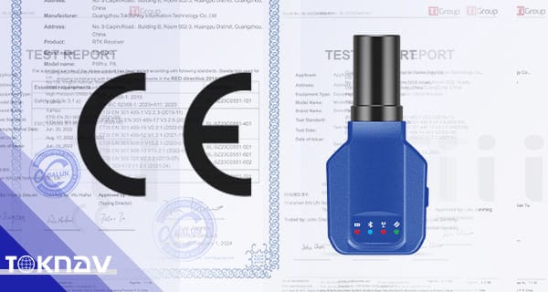
Certificación CE de TOKNAV P8 y P8Pro

TOKNAV P8 & P8Pro Certificación CE | Línea RTK completa certificada 2024

Home TOKNAV P8 & P8Pro CE Certification Was Approved 2024-01-16 TOKNAV P8 & P8Pro CE Certification On January 16, 2024, TOKNAV celebrated a pivotal moment with the CE certification of our P8 and P8Pro models. This accomplishment follows the earlier certifications of our T5, T5Lite, T10Pro, and T20Pro models, showcasing our comprehensive approach to product quality and safety. Each product in our RTK receiver line is designed to meet the most stringent standards, ensuring reliability and performance for all users. This CE certification not only highlights our success but also reinforces our commitment to providing high-quality, reliable solutions. Customers can trust that our products adhere to the highest safety and performance standards, ensuring their investment is sound. TOKNAV has achieved a remarkable milestone, demonstrating our commitment to excellence and customer satisfaction. We proudly announce that our entire RTK receiver product line, including the P8 and P8Pro, has received CE certification. This certification is a significant achievement, affirming our dedication to quality and innovation in the field of navigation technologies. Specifically, the P8 and P8Pro models earned CE certification in January 2024, following the earlier certification of our flagship models: T5, T5Lite, T10Pro, and T20Pro.This comprehensive certification underscores TOKNAV’s commitment to delivering high-quality, reliable solutions for our customers, ensuring that they receive the best in technology and service. The Impact of Earlier CE Certification on TOKNAV’s Success The CE certification of models T5, T5Lite, T10Pro, and T20Pro significantly drove TOKNAV’s growth and market presence. Customer reception was overwhelmingly positive, with many praising the reliability and performance of these products.Clients expressed high levels of satisfaction with these models, and the CE certification validated not only our products’ quality but also their safety standards, which are paramount in the technology industry.The certification also played a pivotal role in expanding TOKNAV’s market presence, particularly in Europe, where customers are increasingly demanding certified products. In turn, clients benefited from increased trust and market expansion, capitalizing on the growing interest in GNSS solutions.They also experienced enhanced sales, making TOKNAV a reliable partner in the global GNSS industry, and contributing to our reputation as a leader in the field.The certification process involved rigorous testing and evaluation, reflecting our continuous pursuit of excellence in product development. Our dedicated team worked tirelessly to ensure that both the P8 and P8Pro models met all necessary criteria for certification. Earlier CE Certification: A Catalyst for TOKNAV’s Success The earlier CE certification of our T5, T5Lite, T10Pro, and T20Pro models significantly contributed to TOKNAV’s reputation in the industry. Customer reception was overwhelmingly positive as these products offered advanced features and reliable performance.Clients expressed high levels of satisfaction with these products, noting the enhanced functionality and user-friendly features. Additionally, the CE certification validated our products’ quality and safety, reinforcing customer confidence in our brand.This positive reception played a pivotal role in expanding TOKNAV’s market presence. By establishing trust with our clients, we fostered long-term relationships and encouraged repeat business.The successful sales trajectory of our products not only boosted revenues but also established TOKNAV as a reliable partner in the GNSS industry. Our strategic approach to quality assurance has set us apart from competitors. P8 & P8Pro CE Certification: A Testament to Excellence The recent CE certification of P8 and P8Pro reflects TOKNAV’s pursuit of excellence. This achievement is the result of the hard work and dedication of our entire organization, from research and development to manufacturing and quality assurance.Moreover, it showcases our dedication to continual improvement and innovation. We are committed to remaining focused on delivering high-quality solutions tailored to our customers’ unique needs.This recognition reinforces our commitment to cutting-edge technology, helping us meet the evolving needs of our diverse client base, whether they are in agriculture, surveying, or construction.It also positions TOKNAV as a reliable partner in the highly competitive GPS market, where quality and trust are essential for success. The Importance of CE Certification for Customers and TOKNAV CE certification holds a prominent place in the global market, especially within the European Union. It signifies that products meet stringent quality and safety standards, which are critical for consumer confidence.TOKNAV’s full RTK line CE certification reaffirms our commitment to excellence and reliability. We are dedicated to delivering top-caliber products that meet and exceed industry expectations.Furthermore, this recognition assures customers of our products’ reliability, which is vital for applications requiring high precision and accuracy. It also highlights our dedication to adhering to industry best practices, ensuring that customers receive the best solutions available. Conclusion: TOKNAV’s Commitment to Quality and Innovation Moving Forward TOKNAV takes immense pride in this complete RTK line certification, which not only showcases our products but also reflects our unwavering dedication to quality and innovation in navigation technology.Moreover, it showcases our commitment to continual improvement and innovation. We remain focused on delivering high-quality solutions that meet the evolving demands of our customers.This recognition reinforces our commitment to cutting-edge technology, ensuring that we meet the evolving needs of our clients. We understand that our customers require not just products but solutions that enhance their operations.It also positions TOKNAV as a reliable partner in the GPS market, where our products can be trusted for accuracy and performance in critical applications. The Importance of CE Certification for TOKNAV CE certification holds a prominent place in the global market, signifying that products meet stringent quality and safety standards. This certification is crucial for gaining customer trust and expanding our reach in international markets.TOKNAV’s full RTK line CE certification reaffirms our commitment to quality. We continuously strive to deliver top-caliber products that meet and exceed customer expectations.Furthermore, this recognition assures customers of our products’ reliability and durability, which are essential for their success in the field. Our dedication to industry best practices ensures that we remain at the forefront of technological advancements. Conclusion: TOKNAV’s Commitment Moving Forward TOKNAV takes immense pride in this complete RTK line certification. This achievement reflects our unwavering dedication to quality and innovation, setting a benchmark for the industry.

TOKNAV P8 & P8Pro Certificación CE | Línea RTK completa certificada 2024 Leer más »
TOKNAV GEOWEEK 2024 | Innovación geoespacial líder y soluciones GNSS sostenibles

Home Leading the Geospatial Revolution: Our Experience at GEOWEEK 2024 2024-02-13 TOKNAV at GEOWEEK 2024 TOKNAV is a pioneer in GNSS receiver technology. Our participation in this year’s GEOWEEK had a profound impact on us.GEOWEEK 2024 is the premier geospatial industry event. It was held from February 11-13, 2024. TOKNAV’s Showcase at GEOWEEK 2024 Today, precision and sustainability are paramount. At GEOWEEK 2024, TOKNAV showcased its latest GNSS receiver innovations.This underlines our commitment to advancing geospatial solutions. The event took place at the Colorado Convention Center in Denver, Colorado.Furthermore, it drew professionals, experts, and enthusiasts worldwide. It offered an unparalleled platform for geospatial discussion and development. Innovation at the Forefront: TOKNAV’s Exhibition Highlights At the heart of GEOWEEK, TOKNAV stood out with cutting-edge GNSS receivers. These receivers are designed to meet evolving industry needs.They cater to fields ranging from agriculture to urban planning. Our booth featured live demonstrations for attendees.This allowed them to experience our technology’s precision and reliability firsthand. Additionally, we mentioned our upcoming new models at the booth. TOKNAV’s Focus: Technology for Sustainable Development Jeffrey, TOKNAV’s sales manager, shared our focus: “We’re not just advancing GNSS technology.”He added, “We’re ensuring it becomes a catalyst for sustainable development.” GEOWEEK, he noted, was perfect to highlight our solutions.These solutions support deformation monitoring, CORS Network with VRS service, and efficient resource utilization. Engaging with the Future of Geospatial Technology GEOWEEK 2024’s theme was “Innovating for a Sustainable Future.” This resonated deeply with TOKNAV’s mission.We aim to contribute positively to the planet through technological advancements. The event’s sessions and panels offered valuable insights. Key Insights from GEOWEEK Sessions The sessions focused on the future of geospatial technologies, including GNSS data’s growing importance. GNSS data helps make informed environmental sustainability decisions.Our team attended various sessions and engaged in meaningful discussions. They talked about integrating GNSS into new applications.They also discussed accurate data’s role in solving global challenges. Moreover, these insights will guide our R&D efforts.This ensures TOKNAV continues to lead in innovation and application. Networking and Collaboration Opportunities at GEOWEEK GEOWEEK also served as a great platform for networking. It allowed us to connect with potential clients, partners, and industry leaders.These interactions opened new avenues for collaboration. Specifically, they focused on projects using geospatial data for social good.Jeffery added, “We’re excited about the potential partnerships from GEOWEEK.”He emphasized, “The future of geospatial technology is collaborative—and TOKNAV is at the forefront.” Looking Forward: TOKNAV’s Commitment to Innovation As we reflect on GEOWEEK 2024, we’re inspired by the geospatial community. Their enthusiasm and dedication motivate us.TOKNAV remains committed to pushing GNSS technology boundaries. We’ll drive innovations that empower industries.Additionally, we’ll contribute to building a more sustainable future. Stay Connected with TOKNAV Stay tuned for updates on our products and projects. Join us as we navigate the exciting geospatial technology landscape.For more information about TOKNAV and our GNSS solutions, visit our website: www.toknavgnss.com.

TOKNAV GEOWEEK 2024 | Innovación geoespacial líder y soluciones GNSS sostenibles Leer más »

Receptor GNSS Toknav P8Global

Receptor GNSS TOKNAV P8Global | Tecnología PPP avanzada para una precisión centimétrica

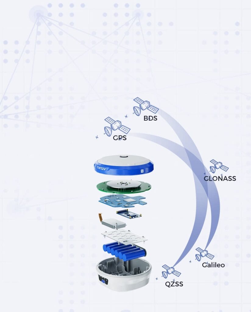
Inicio TOKNAV lanza el receptor GNSS P8Global con tecnología PPP avanzada 9 de mayo de 2024 Receptor GNSS P8Global de TOKNAV Guangzhou, mayo de 2024 — TOKNAV se enorgullece de presentar el nuevo receptor GNSS P8Global. Cabe destacar que ofrece una precisión ultraalta para los trabajos de medición sobre el terreno. Alcanza una precisión a nivel centimétrico sin necesidad de ninguna estación base ni estación CORS. Este enfoque revolucionario simplifica el trabajo de campo, lo que permite una recopilación de datos más eficiente y reduce el tiempo de inactividad. Se diferencia de los modelos P8 y P8Pro al prescindir de la conexión 4G y de la radio. Además, ofrece un seguimiento de la señal y un procesamiento de datos mucho mejores, lo cual es crucial para aplicaciones como la construcción de carreteras y el levantamiento topográfico de líneas eléctricas. Esta innovación consolida la reputación de TOKNAV como líder en tecnología de precisión, permitiendo a los profesionales lograr resultados sobresalientes en sus proyectos. P8Global: un nuevo estándar para la medición de precisión Para obtener más información sobre el receptor GNSS TOKNAV P8Global, incluidas sus especificaciones y características, visita nuestra página web. El P8Global establece un nuevo listón para los receptores GNSS del mercado. Supera a los receptores convencionales y a sus predecesores, el P8 y el P8Pro, en todos los aspectos. La clave de su ventaja es la conectividad 4G de banda completa, que garantiza una cobertura de señal estable. Además, utiliza la tecnología de posicionamiento de punto preciso (PPP). Esta tecnología elimina por completo la necesidad de las estaciones base tradicionales. Naturalmente, se convierte en la mejor opción para todas las tareas de medición de alta precisión. Para ilustrar la capacidad del P8Global, consideremos el caso de un proyecto de infraestructura reciente en el que la precisión era fundamental. Los topógrafos pudieron utilizar el P8Global para recopilar datos en un terreno complicado en el que los receptores GNSS tradicionales tenían dificultades. El procesamiento de datos en tiempo real permitió realizar ajustes inmediatos in situ, lo que, en última instancia, supuso un ahorro de tiempo y recursos, al tiempo que garantizó el cumplimiento de las especificaciones del proyecto. Este ejemplo pone de manifiesto no solo la fiabilidad del producto, sino también su potencial para transformar el proceso de topografía en diversos sectores. Conociendo las características del receptor GNSS TOKNAV P8Global: precisión inigualable e integración inteligente. El P8Global combina un hardware resistente con el sistema inteligente FreeRTOS para garantizar un funcionamiento fluido. Esto se traduce en un rendimiento óptimo en todas las condiciones de campo, ya sea en entornos urbanos densos o en zonas rurales remotas. Además, es compatible con todas las principales constelaciones de satélites mundiales, incluidos GPS, GLONASS, Galileo y BeiDou. Esta compatibilidad con múltiples constelaciones aumenta la fiabilidad del posicionamiento, lo que proporciona a los profesionales la tranquilidad que necesitan. Gracias al PPP, mantiene de forma estable una precisión de posicionamiento a nivel centimétrico de manera continua durante toda la jornada laboral. Las herramientas GNSS tradicionales requieren conexiones a estaciones base para alcanzar una alta precisión, lo que puede plantear retos logísticos. Sin embargo, con el P8Global, los usuarios se benefician de un flujo de trabajo más flexible y eficiente. Utiliza redes globales de estaciones de referencia para generar datos de corrección, que luego se envían directamente al receptor vía satélite, lo que garantiza un servicio ininterrumpido incluso en ubicaciones remotas. Funciones de conectividad mejoradas El P8Global incorpora funciones 4G CAT4 y Bluetooth. A través de servidores en la nube, los usuarios pueden supervisarlo y configurarlo de forma remota. A diferencia del P8 y el P8Pro, utiliza 4G de banda completa para la conectividad. Esto supone una gran ventaja para un acceso a la señal más amplio y estable. Los trabajadores pueden gestionar el dispositivo y obtener datos desde cualquier lugar. Esto reduce en gran medida la necesidad de realizar operaciones y comprobaciones in situ. Las alertas y los ajustes remotos también aumentan la eficiencia del trabajo, ahorrando tiempo y recursos. Por ejemplo, durante un proyecto reciente de cartografía de una nueva autopista, la capacidad de conectarse a través de 4G CAT4 permitió al equipo cargar datos en tiempo real, lo que facilitó la retroalimentación inmediata por parte de los jefes de proyecto. Esta capacidad no solo agilizó la comunicación, sino que también dio lugar a procesos de toma de decisiones más rápidos, algo fundamental en proyectos de infraestructura en los que el tiempo es un factor crítico. Al minimizar la necesidad de operaciones in situ, el P8Global mejora significativamente la productividad del equipo y reduce los costes operativos. Diseño ligero y resistente El P8Global solo pesa 141 gramos y cuenta con una batería de larga duración de 1800 mAh. Esta impresionante autonomía permite que el dispositivo funcione durante largos periodos sobre el terreno sin necesidad de recargas constantes. Su peso ligero y su bajo consumo lo hacen muy fácil de transportar, lo que garantiza que los técnicos de campo puedan llevarlo cómodamente durante largas jornadas de trabajo. Además, cuenta con una carcasa de aleación de magnesio y cumple con los estándares de protección IP67, lo que garantiza que pueda soportar condiciones climáticas adversas y un manejo brusco. Es mucho más resistente que los receptores GNSS convencionales, lo que ofrece a los usuarios la tranquilidad de saber que puede soportar las exigencias del uso diario sobre el terreno. Este diseño robusto lo protege del polvo, el agua y los golpes, lo que lo convierte en una herramienta ideal para los profesionales que trabajan en entornos adversos. Redefiniendo las posibilidades de la medición de precisión El receptor GNSS P8Global no es solo una herramienta; representa un cambio en la forma en que la medición de precisión puede mejorar el flujo de trabajo y la ejecución de proyectos. Por ejemplo, pensemos en el impacto en los estudios medioambientales, donde la precisión es crucial para garantizar el cumplimiento de la normativa. El P8Global ayuda a reducir los errores durante la recopilación de datos, lo que no solo ahorra tiempo, sino que también minimiza la necesidad de volver a realizar el trabajo debido a imprecisiones. De este modo, permite a los profesionales centrarse más en el análisis y la toma de decisiones, en lugar de dedicar un tiempo excesivo a medir y volver a medir. En conclusión, el receptor GNSS TOKNAV P8Global no solo cumple con las exigencias de la medición de precisión, sino que las supera, ofreciendo características que dan soporte a una amplia gama de aplicaciones en diversos sectores. Su tecnología avanzada, su diseño robusto y su integración intuitiva lo convierten en la opción ideal para los profesionales que buscan mejorar la precisión en su trabajo. A medida que el sector sigue evolucionando, herramientas como el P8Global serán esenciales para mantener altos estándares de calidad y eficiencia en los procesos de medición. El P8Global es un ejemplo perfecto de la innovación tecnológica y la calidad de TOKNAV. Ofrece a los profesionales una herramienta que redefine el trabajo de medición de precisión. Ideal para la construcción de infraestructuras y la topografía de campo detallada, es la mejor opción para los profesionales del sector. Estos pueden confiar en su rendimiento óptimo y su fiabilidad constante en todo momento. Sus funciones avanzadas y su diseño resistente lo hacen destacar en el mercado. Ofrece una precisión, conectividad, portabilidad y durabilidad inigualables, todo en un solo dispositivo. Acerca de TOKNAV Information Technology Co., Ltd. TOKNAV es líder mundial en soluciones de medición de precisión. En constante innovación, la empresa amplía los límites de la tecnología para establecer nuevos estándares globales en el sector. Todos sus productos están diseñados para ofrecer la máxima precisión y fiabilidad, lo que garantiza que se conviertan en herramientas esenciales para los profesionales de diversos campos, como la construcción, la agricultura y las ciencias ambientales.

Receptor GNSS TOKNAV P8Global | Tecnología PPP avanzada para una precisión centimétrica Leer más »

TOKNAV FIG 2024, Ghana

TOKNAV FIG 2024 Ghana | Nuevo T30Pro RTK y tecnología topográfica de vanguardia

Home TOKNAV Shines at FIG 2024 in Ghana, Showcasing Cutting-Edge Surveying Technology 2024-05-24 TOKNAV FIG 2024 Ghana | New T30Pro RTK & Cutting-Edge Survey Tech Accra, Ghana – TOKNAV is a top provider of advanced surveying tools. We proudly joined the FIG 2024 exhibition in Accra, Ghana.The event ran from May 19th to 24th. It is a key gathering for the geospatial and surveying community.Furthermore, it drew professionals and distributors from all over Africa. This includes Ghana, Nigeria, and South Africa. TOKNAV’s Product Showcase at FIG 2024 During the exhibition, TOKNAV displayed its flagship products. These are the T10Pro and T20Pro RTK systems.They are well-known for being reliable and highly precise. The main highlight was the launch of the new T30Pro RTK. The New T30Pro RTK: A Game-Changer for Surveying This innovative product has laser measurement and AR stake-out features. It is a new addition to TOKNAV’s product line.Moreover, it shows the company’s commitment to using advanced tech in surveying tools. It offers unmatched accuracy and efficiency for field work. Comprehensive Solutions Presented by TOKNAV Besides these new products, TOKNAV offered a range of full solutions. This includes Continuously Operating Reference Stations (CORS).It also includes deformation monitoring systems. These solutions highlight TOKNAV’s expertise in strong, scalable infrastructure. Key Applications of TOKNAV’s Solutions This infrastructure is key for collecting and analyzing geospatial data. It supports many uses like construction, mining, and environmental checks. Attendee Response and Feedback Attendees reacted very positively to TOKNAV’s showcase. Our booth drew a large number of visitors.They showed strong interest in our products and solutions. Surveyors and distributors from the region were especially impressed.They liked the advanced features of the T30Pro RTK. They noted it could greatly boost surveying efficiency and accuracy.Additionally, many attendees talked in detail with TOKNAV’s team. They wanted to know how to use these technologies in their daily work. TOKNAV’s Takeaways from FIG 2024 We are thrilled with the feedback from FIG 2024. The strong interest in our products—especially the T30Pro RTK—proves our belief.There is growing demand for high-precision, innovative surveying tools in Africa. This exhibition gave us valuable insights and connections.These will guide our future product development and market plans. A Milestone for TOKNAV’s African Market Expansion Our successful participation in FIG 2024 is a key milestone. It helps TOKNAV expand its presence in the African market.The talks and feedback from the event will shape our future work. This includes product development and strategic plans.Furthermore, TOKNAV is committed to supporting Africa’s surveying community. We will deliver top-tier technologies to meet their changing needs. TOKNAV’s Future Goals and Vision TOKNAV is excited about future opportunities in Africa. We focus closely on innovation and customer satisfaction.In addition, we aim to stay at the top of the surveying technology industry. Our goal is to provide tools that help professionals work more accurately and efficiently.

TOKNAV FIG 2024 Ghana | Nuevo T30Pro RTK y tecnología topográfica de vanguardia Leer más »

TOKNAV GeoBusiness 2024

TOKNAV GeoBusiness 2024 | P8Global y T30 Modelos Lanzamiento y Tecnología Geoespacial

Home TOKNAV Shines at GeoBusiness 2024 with the Launch of P8Global and T30 Models 2024-06-06 TOKNAV GeoBusiness 2024 | P8Global & T30 Models Launch & Geospatial Tech London, June 5-6, 2024 – TOKNAV made a big impact at GeoBusiness 2024. The event took place at ExCeL London, focusing on navigation and geospatial tech.GeoBusiness 2024 is the top geospatial gathering of the year. It drew over 130 exhibitors and 4,000 attendees.Moreover, it gave TOKNAV the perfect platform to launch its cutting-edge P8Global and T30 models. Discovering Innovations at TOKNAV GeoBusiness 2024 GeoBusiness 2024 offered an excellent venue for TOKNAV. The team showed off the new models’ key capabilities to attendees.The P8Global wowed visitors with advanced features and strong performance. It’s built for precision and flexibility in global navigation.Additionally, the T30 stood out for its top-tier geospatial data collection tech. Its easy-to-use interface and high accuracy caught much attention. P8Global: A Leap in Global Navigation The P8Global reflects TOKNAV’s focus on innovation. This portable receiver uses Precise Point Positioning (PPP) technology.It achieves centimeter-level accuracy without needing a base station. It also boosts GPS accuracy and processes data in real time.Notably, it works for many tasks—from urban planning to environmental monitoring. T30: Revolutionizing Geospatial Data Collection The T30 sets new standards for geospatial data collection. It comes with the latest tech to boost work efficiency.It has laser measurement and a bottom camera for AR stakeout. These features make tasks faster and more precise.Furthermore, the T30 offers unbeatable accuracy. Both pros and new users can easily make the most of it. Industry Impact of Toknav’s Showcase TOKNAV’s presence at GeoBusiness 2024 was more than a product launch. It showed the company’s commitment to advancing the geospatial industry.Live demos and expert talks at the booth helped attendees understand the solutions. They learned how TOKNAV’s tools solve current navigation and data management challenges. Positive Customer Feedback Visitors gave overwhelmingly positive feedback. Many praised the new models’ intuitive design and strong performance.They noted the models could transform sectors like transportation, agriculture, and urban development. The P8Global and T30 are set to set new industry benchmarks.Additionally, they will drive innovation and improve work efficiency for users worldwide. TOKNAV’s Commitment to Innovation Joining GeoBusiness 2024 underscored TOKNAV’s dedication to tech leadership. The company keeps investing in research and development.This ensures products meet customers’ changing needs and industry demands. TOKNAV stays ahead of trends to deliver top-tier solutions.  Get More Information Learn more about the P8Global, T30, and TOKNAV’s innovative tools. Visit the official website at https://www.toknav.cn/.For details on the event, go to https://www.geobusinessshow.com/.  A Milestone for TOKNAV in the Geospatial Sector TOKNAV’s successful showcase at GeoBusiness 2024 is another key milestone. It reinforces the company’s reputation for innovation and excellence in geospatial tech.

TOKNAV GeoBusiness 2024 | P8Global y T30 Modelos Lanzamiento y Tecnología Geoespacial Leer más »

Funcionalidad PPP de GNSS de TOKNAV

Función TOKNAV GNSS PPP | Línea completa de receptores con posicionamiento preciso de puntos

Home TOKNAV Introduces PPP Feature Across Its GNSS Receiver Lineup 2024-06-03 TOKNAV GNSS PPP Feature | Full Receiver Lineup with Precise Point Positioning TOKNAV has always been at the forefront of technological advancements and innovation in the field of global navigation satellite systems (GNSS). With the introduction of the PPP feature, we are setting a new standard for precision in positioning applications. This new capability is essential for professionals who depend on accurate positioning information for their projects. This update will allow users to access cutting-edge technology, ensuring that they remain competitive in their respective industries. We recognize that precision is paramount, and the new firmware will help to elevate the performance of all TOKNAV devices. TOKNAV leads the way in precision positioning tech. We’re proud to add Precise Point Positioning (PPP) to all our GNSS receivers.This big update gives every TOKNAV device the latest firmware. It boosts performance and sets new accuracy and reliability standards.Furthermore, it works well for many different uses across industries. The addition of this feature reflects our commitment to enhancing user experience and operational efficiency. In various sectors, precise positioning can significantly impact outcomes, whether in agriculture, construction, or surveying. By incorporating the PPP feature, TOKNAV aims to empower our users with tools that provide them with the highest level of accuracy. PPP and RTK: A Comparative Overview TOKNAV GNSS PPP Feature: Revolutionizing Precision Positioning The evolution of GNSS technology continues to shape how industries operate. With the latest advancements, users can expect improvements not only in accuracy but also in speed and reliability. The PPP feature is designed to meet the diverse needs of various sectors, making it a versatile solution for all. Knowing the differences between PPP and RTK helps choose the right tool. Each has unique strengths for positioning tasks. What Is PPP? PPP works independently worldwide. It uses satellite data for centimeter-accurate positioning.It doesn’t need local base stations to function. This makes it flexible for use across the globe.However, it may take longer to set up initially. What Is RTK? RTK performs best where local base stations exist. It offers fast, real-time fixes for centimeter precision.Its main strength is quick setup. Notably, it can’t work outside a base station’s range. Understanding both PPP and RTK is crucial for selecting the right system for specific applications. For instance, in agriculture, where GPS precision can affect yield outcomes, using the right positioning system can lead to increased productivity and efficiency. Moreover, PPP is particularly beneficial for applications in remote areas where RTK systems might not be feasible due to the lack of base stations. This flexibility allows for greater accessibility and use of GNSS technology across different geographic locations. Key Distinctions Between PPP and RTK Base Station Reliance RTK needs nearby base stations for differential data. In contrast, PPP works on its own globally. Coverage Range RTK only works where base stations cover the area. PPP, however, provides global positioning ability. Initialization Speed RTK gets up and running quickly. PPP may need extra time to process satellite data. Best Use Cases RTK is great for fast precision in covered areas. PPP is ideal for wide-ranging projects, especially without base stations. Base stations play a critical role in the performance of RTK systems. Having a solid understanding of the infrastructure available in your area can inform your choice between PPP and RTK. For example, construction projects that are urban-centric may benefit more from RTK due to the availability of local base stations, ensuring rapid and reliable data transmission. On the other hand, PPP’s autonomous nature is an advantage in large-scale projects like land surveying in rural or undeveloped areas, allowing for extensive coverage without the need for additional infrastructure. Embracing Innovation with the PPP Feature Adding PPP to our lineup strengthens TOKNAV’s commitment to innovation. It becomes a standard feature in key models.These models include T5, T5Lite, T10Pro, T20Pro, T30, T30Pro, and P8 Global. PPP is a big step forward in GNSS tech.Moreover, it gives users unbeatable accuracy and easy operation. Enhancing Precision in Diverse Fields The PPP update is more than just tech improvement. It changes the game for industry professionals.It transforms work for surveyors, farmers, and unmanned vehicle operators. It also helps those in construction and deformation monitoring.Users get centimeter-level accuracy without extra infrastructure. This lets them take on projects with more confidence and speed. The introduction of the PPP feature is also a game-changer for unmanned vehicle operations. In industries such as agriculture, the autonomy and precision provided by PPP enable farmers to optimize their operations and reduce costs significantly. With accurate positioning, tasks such as planting, fertilization, and harvesting can be performed more efficiently. Similarly, for surveyors, having access to centimeter-level accuracy without the need for complex setups or additional infrastructure allows for faster project completion and increased productivity. The implications of this technology are vast and transformative. A Message from TOKNAV’s Leadership TOKNAV’s CMO shared excitement about the new feature. “We’re thrilled to bring PPP to our valued customers,” he said.This update doesn’t just improve our products. It helps users achieve more with fewer resources.He added, “PPP shows our drive to push the limits of GNSS tech.” About TOKNAV As we delve deeper into the story of TOKNAV, it’s important to highlight how our growth has been fueled by a commitment to innovation and excellence. From our humble beginnings in Guangzhou to becoming a leading name in the GNSS industry, our focus has always been on delivering high-quality, reliable solutions that meet the evolving needs of our customers. By investing in research and development, we ensure that our products remain cutting-edge, allowing users to take full advantage of advancements in GNSS technology. This commitment not only supports our customers’ goals but also fosters a culture of continuous improvement within our organization. TOKNAV started in Guangzhou, China, and grew quickly. It’s now a trusted name in GNSS technology.We have international offices in the US and serve customers worldwide. We focus on making high-performance RTK devices.These tools combine precision positioning

Función TOKNAV GNSS PPP | Línea completa de receptores con posicionamiento preciso de puntos Leer más »

Toknav TR10

Toknav TR10 | Robot de Precisión de Premarcado de Líneas para Ingeniería de Carreteras y Topografía

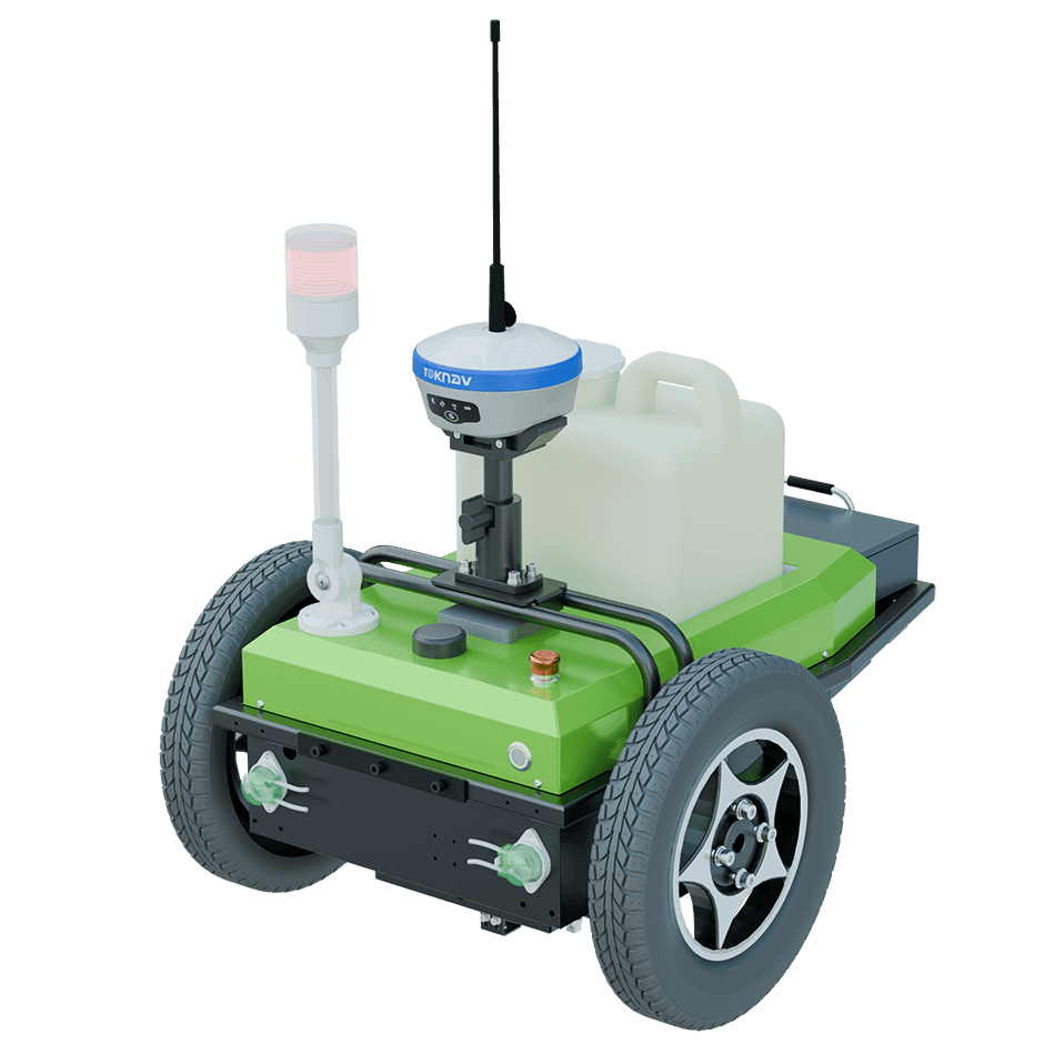
Inicio: Una revolución en el marcado previo de líneas con el Toknav TR10 4 de septiembre de 2024 Toknav TR10 | Robot de marcado previo de líneas de precisión para ingeniería vial y topografía En la ingeniería vial y la topografía, a menudo resulta difícil lograr un marcado de líneas preciso y eficiente. Los métodos manuales obsoletos son lentos, imprecisos y difíciles de poner en marcha, sobre todo en terrenos irregulares o con mal tiempo. Además, el sector necesita una solución mejor: rápida, muy precisa y fácil de usar, que aumente la velocidad de trabajo y reduzca los costes. Aquí es donde entra en juego el Toknav TR10. Toknav TR10: una solución revolucionaria para el trazado de líneas El Toknav TR10 es una nueva solución que cambia las reglas del juego. Redefine la eficiencia, la precisión y la flexibilidad en las tareas de trazado de líneas.Lo hemos diseñado con tecnología de vanguardia y un diseño intuitivo. Además, cuenta con numerosas funciones que lo hacen perfecto para los profesionales de la topografía y la ingeniería vial. El Toknav TR10 no es solo una herramienta; es una solución integral diseñada para hacer frente a los retos de la ingeniería vial y la topografía modernas. Gracias a su tecnología de vanguardia, el TR10 mejora no solo la calidad del trazado de líneas, sino también la eficiencia general de los proyectos. En un mundo en el que el tiempo y la precisión son fundamentales, este robot destaca por ofrecer funciones que ahorran tiempo al tiempo que garantizan una precisión superior. Configuración y funcionamiento más rápidos: El TR10 facilita y agiliza la configuración. Su sencilla interfaz de software te permite ponerte a trabajar rápidamente. Además, la velocidad máxima del robot es de 2 metros por segundo, lo que le permite cubrir grandes superficies con rapidez. También cuenta con dirección in situ con un radio de giro mínimo de 0°, lo que significa que puede moverse con precisión incluso en espacios reducidos. El TR10 utiliza una batería de litio de 24 V/20 Ah. Con una carga completa, puede recorrer hasta 15 kilómetros. Además, solo tarda cuatro horas en cargarse al 95%. Además de su rápida configuración, el TR10 ofrece controles intuitivos que requieren una formación mínima. Los usuarios pueden familiarizarse rápidamente con la interfaz, lo que permite a los equipos iniciar proyectos sin necesidad de una formación exhaustiva. Este enfoque centrado en el usuario resulta especialmente beneficioso para las empresas que operan en entornos de alta presión, donde el tiempo es dinero. Mayor precisión En lo que respecta a la precisión de marcado, el TR10 es el mejor del sector. Cuenta con un módulo GNSS avanzado.Este módulo es compatible con los sistemas GPS, GLONASS, BDS, GALILEO y QZSS. Consigue un posicionamiento RTK con gran precisión: la precisión horizontal alcanza los ±8 mm + 1 ppm, mientras que la vertical llega a los ±15 mm + 1 ppm. Cabe destacar que su compensación de inclinación mantiene esta precisión.Funciona incluso en pendientes de hasta 20 grados. Esto garantiza líneas rectas y sin errores, con un margen inferior a 2 cm. La precisión es fundamental en el trazado de líneas, especialmente cuando se trabaja en proyectos complejos en los que intervienen diversas partes interesadas. El módulo GNSS del TR10 garantiza que incluso los diseños más intrincados se ejecuten a la perfección. Por ejemplo, al trazar una nueva autopista o una intersección compleja, la precisión que ofrece el Toknav TR10 puede reducir significativamente la necesidad de volver a trabajar en la misma tarea, lo que ahorra tanto tiempo como recursos. Funcionalidades avanzadas para una productividad máxima El TR10 combina funciones inteligentes con una gran flexibilidad práctica. Cuenta con una herramienta de importación de dibujos con un solo clic.Esta herramienta permite utilizar fácilmente planos prediseñados. Además, admite diferentes estilos de señalización, entre los que se incluyen puntos, líneas, curvas, números y letras. En general, esto aumenta la productividad en todos los proyectos. Por otra parte, la capacidad del TR10 para importar archivos de dibujo directamente permite a los equipos trabajar a partir de planos existentes, lo que reduce el riesgo de errores derivados de la introducción manual de datos. Imagina una situación en la que los urbanistas necesiten marcar varios carriles con patrones diferentes; el TR10 puede adaptarse fácilmente a estos requisitos, lo que lo convierte en un recurso inestimable para cualquier jefe de proyecto. Diseñado para destacar en condiciones difíciles El TR10 está diseñado para entornos exigentes. Cuenta con un diseño robusto que pesa 28 kg (con una carga útil de 85%). Además, dispone de dos motores en el buje de 200 W. Estos le permiten desplazarse por terrenos accidentados sin perder precisión. Asimismo, cuenta con una tolva de pintura de 7,5 L, compatible con látex y blanco de titanio líquido. Se adapta fácilmente a las diferentes necesidades de los proyectos. El TR10 también ofrece un buen rendimiento a temperaturas extremas: funciona de forma fiable entre -10 °C y 60 °C. Su clasificación IP3X garantiza un uso constante en todas las condiciones de campo. Diseñado para ofrecer durabilidad, el TR10 destaca incluso en condiciones adversas, lo que lo hace adecuado para diversos climas y terrenos. Su construcción robusta y sus componentes de alto rendimiento garantizan que pueda soportar las exigencias del trabajo al aire libre, lo que resulta especialmente beneficioso para proyectos a largo plazo que pueden abarcar varias estaciones. Tu socio en el marcado de precisión. Lo que distingue al TR10 de otras soluciones de marcado de líneas es su integración de tecnología de vanguardia con utilidad práctica. Sus sensores avanzados y su interfaz intuitiva funcionan en tándem, lo que permite realizar ajustes en tiempo real durante el funcionamiento. Esta adaptabilidad es crucial para el trazado de líneas en entornos dinámicos, como durante la construcción de carreteras, donde pueden producirse cambios inesperados. El TR10 está diseñado para satisfacer las necesidades de los profesionales modernos del trazado. Ofrece una forma más rápida, nítida e inteligente de realizar un trazado de precisión.Con una precisión, facilidad de uso y durabilidad inigualables, el TR10 establece un nuevo estándar en el sector. Además, es tu herramienta imprescindible para cualquier tarea de señalización. Descubre el futuro de la señalización con el TR10. Descubre cómo Toknav está impulsando la innovación. Somos pioneros en tecnología de posicionamiento y topografía. Elige el TR10 y revoluciona hoy mismo tu proceso de premarcado de líneas. Además, a medida que aumenta la demanda de soluciones respetuosas con el medio ambiente, el uso eficiente de materiales y energía del TR10 encaja a la perfección con las prácticas sostenibles. La capacidad de minimizar los residuos durante el proceso de señalización no solo conserva los recursos, sino que también mejora el perfil ecológico general de los proyectos viarios. En conclusión, el Toknav TR10 es más que un simple robot de señalización; representa un importante avance en la tecnología a disposición de los ingenieros de carreteras y topógrafos. Al combinar velocidad, precisión y adaptabilidad, da respuesta a los retos a los que se enfrentan desde hace tiempo los profesionales del sector. De cara al futuro de la ingeniería viaria, el TR10 encarna las innovaciones que darán forma a unas prácticas de señalización vial eficientes y eficaces.

Toknav TR10 | Robot de Precisión de Premarcado de Líneas para Ingeniería de Carreteras y Topografía Leer más »

TOKNAV T30 y T30Pro: Precisión inigualable con replanteo AR para profesionales geoespaciales y de la construcción

Home TOKNAV T30 & T30Pro GNSS Receivers: Unmatched Precision with AR Stakeout for Geospatial & Construction Professionals Published: 2024-09-02 | Category: GNSS Technology, Surveying Innovation Guangzhou, November 2024 — TOKNAV, a global leader in precision measurement tools, is proud to announce the launch of its latest flagship GNSS receivers: the T30 and T30Pro. These cutting-edge devices embody TOKNAV’s unwavering commitment to precision, reliability, and user-centric design, setting new industry benchmarks for speed, accuracy, and operational efficiency across infrastructure, construction, and land development projects. Shared Features: Ultra-Fast Precision & AR Stakeout Both the T30 and T30Pro are engineered with advanced processing technology, enabling ultra-fast real-time GNSS calculations that deliver centimeter-level positioning data. This accelerated processing drastically reduces field wait times and amplifies workflow efficiency, making them ideal for projects with tight deadlines.Key shared features include:  Blazing Speed: Instant GNSS data calculation eliminates delays during on-site operations, keeping projects on track. Industry-Leading Accuracy: ±8mm horizontal and ±15mm vertical accuracy guarantees precise measurements for every task. 1408 Multi-Channel Support: Full multi-system, multi-frequency GNSS tracking ensures reliable signal coverage even in complex, challenging environments. AR Stakeout System: An integrated augmented reality (AR) real-time stakeout tool overlays stakeout points directly onto the physical world, simplifying site layout and boundary marking while boosting operational accuracy. TOKNAV T30 & T30Pro T30Pro: Advanced Photogrammetry & 3D Imaging The T30Pro elevates performance with specialized photogrammetry capabilities, featuring high-resolution image capture to generate detailed 3D models and orthophotos. This makes it an indispensable tool for topographic mapping, infrastructure documentation, and complex geospatial projects that demand multi-dimensional data insights. Close-up of T30Pro camera module T30: Laser Measurement Innovation  Designed for versatility, the T30 integrates centimeter-level laser measurement functionality, enabling precise field measurements in hard-to-reach locations—such as points across rivers or beneath structures. This feature extends TOKNAV’s mission to make high-precision surveying accessible and efficient for professionals worldwide. T30 GNSS Reciever demostrating laser measurement capability Seamless Connectivity & Rugged Durability Both receivers offer seamless 4G, Bluetooth, and Wi-Fi connectivity, empowering remote data monitoring and access from any location. Built to withstand the harshest field conditions, they feature an IP68-rated magnesium alloy casing and a 13800mAh high-capacity battery that delivers up to 48 hours of continuous operation. At just 1.5 kg, their lightweight design ensures portability for extended field assignments, perfectly balancing power, durability, and ease of use. Redefining Professional Surveying The T30 and T30Pro represent TOKNAV’s dedication to pushing the boundaries of precision, speed, and innovation. By combining ultra-fast GNSS computation, intuitive AR stakeout, and specialized features like photogrammetry (T30Pro) and laser measurement (T30), these receivers redefine what’s possible in fieldwork, giving construction, land management, and infrastructure professionals a decisive competitive edge. About TOKNAV TOKNAV is dedicated to advancing geospatial technology, setting new standards for accuracy, speed, and reliability in precision measurement tools. Trusted by professionals worldwide, TOKNAV delivers innovative, high-performance solutions that drive efficiency and excellence across industries. For more information on the T30, T30Pro, and other offerings, visit www.toknavgnss.com or contact us at info@toknav.cn.

TOKNAV T30 y T30Pro: Precisión inigualable con replanteo AR para profesionales geoespaciales y de la construcción Leer más »

TOKNAV tBase GNSS Receiver

Receptor GNSS TOKNAV tBase | Batería de larga duración 12+ horas Alta precisión

Home TOKNAV Unveils tBase GNSS Receiver: Over 12 Hours of Unmatched Battery Life for Robust Applications 2024-09-02 TOKNAV tBase GNSS Receiver | 12+ Hours Long Battery Life and High Precision for Professionals Guangzhou, November 2024— TOKNAV proudly announces the launch of the tBase GNSS receiver, a high-precision positioning device that redefines battery performance. With over 12 hours of continuous operation, the tBase sets a new industry standard, giving professionals unprecedented freedom in the field. This receiver is particularly beneficial for land surveying, agriculture, and construction, where reliable positioning is critical. Reliable Battery Performance: A Game Changer The tBase features a powerful 13800mAh battery, providing reliable performance for long-duration surveying and monitoring tasks. For instance, in remote locations, surveyors can utilize the tBase GNSS receiver for extensive mapping projects without interruptions. Users can focus on their work without worrying about power issues, even in extreme weather conditions. This long-lasting battery ensures that professionals can complete their tasks efficiently, making it an essential tool for those in the field. Comprehensive GNSS Support: Unmatched Accuracy This receiver supports all major global satellite navigation systems—BeiDou, GPS, GLONASS, Galileo, and QZSS—ensuring accurate positioning wherever you are. Powered by a Linux+ARM Cortex-A7 platform, it offers high efficiency and scalability to meet evolving work demands. By integrating multiple GNSS systems, users can achieve enhanced accuracy and reliability, making it suitable for various applications, including precision agriculture and geological surveying. Robust and Durable Design: Built for the Elements Designed to IP68 standards and housed in a robust magnesium alloy casing, the tBase ensures durability in harsh environments. Integrated VPN support enables remote configuration for flexible operation in complex settings. Additionally, it includes an electronic fence system and area code restrictions for compliant use, crucial for applications requiring strict adherence to geographical boundaries. This robust design ensures that the tBase can withstand the rigors of outdoor use, making it a reliable choice for professionals in challenging environments. About TOKNAV: Innovating Precision Positioning TOKNAV is a leading provider of high-precision positioning solutions, dedicated to delivering reliable and accurate positioning services through innovative technology. Our products are engineered to deliver unmatched accuracy and reliability, making them essential tools for professionals across various industries. As we continue to push the boundaries of technology, we remain focused on providing dependable, cutting-edge positioning services to meet the needs of our global customers. Our commitment to innovation ensures that our customers receive the most advanced solutions available, enabling them to achieve their objectives effectively.

Receptor GNSS TOKNAV tBase | Batería de larga duración 12+ horas Alta precisión Leer más »

Toknav Intergeo 2024

TOKNAV INTERGEO 2024 | Soluciones geoespaciales avanzadas y tecnología GNSS de precisión

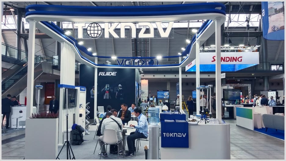
Home TOKNAV Showcases Advanced Geospatial Solutions at INTERGEO 2024 2024-09-26 TOKNAV INTERGEO 2024 | Advanced Geospatial Solutions & Precision GNSS Tech Stuttgart, Germany – September 24-26, 2024 – TOKNAV drew big attention at INTERGEO 2024. This is the world’s top trade fair for geospatial technology, held in Stuttgart this year.INTERGEO focuses on solving global issues like urban growth and climate resilience. It brought thousands of industry pros together.Furthermore, it gave TOKNAV the perfect stage to show its innovative geospatial tools. Explore Innovations at TOKNAV INTERGEO 2024 TOKNAV displayed a range of advanced geospatial products. These products highlight its focus on precision, automation, and efficiency in surveying and marking. P8 Global (PPP RTK): Base Station-Free Precision This GNSS receiver delivers centimeter-level accuracy. It doesn’t need base stations or CORS stations to work.It uses Precise Point Positioning (PPP) for global high-precision location data. Unlike traditional systems, it works without 4G or radio.Notably, this makes it perfect for remote or tough environments. T30 (Laser Survey RTK): Powerful for Intensive Tasks This high-precision laser measurement tool has RTK technology. It also features AR real-time stakeout and advanced IMU for positioning.It supports full GNSS reception, 4G, and 5W radio connectivity. Its 13800mAh battery lasts up to 3 days on one charge.This makes it ideal for heavy surveying workloads. T30Pro (Photogrammetry RTK): For Complex Projects The T30Pro combines image surveying with advanced RTK. It enables accurate, AR-assisted real-time stakeout.It has the latest IMU tech, full GNSS reception, and built-in 4G with 5W radio.With a 13800mAh battery, it runs nonstop for up to 3 days. It suits complex mapping and surveying projects that need precision and long battery life. TR10 (Pre-Marking Robot): Safer Highway Pre-Marking The TR10 is made for highway pre-marking tasks. It automates line drawing to boost safety and efficiency in roadwork prep. How Solutions Serve Different Sectors The T30 and T30Pro offer high-precision tools for urban planning. They also work well for environmental monitoring.The TR10 improves safety and efficiency in highway marking. Additionally, the P8 Global enables remote positioning without base stations.This is a big plus for projects in isolated areas. Networking and Future Collaborations Joining INTERGEO 2024 helped TOKNAV build key industry connections. It held meaningful talks with international partners and stakeholders.The company explored potential collaborations. It also expanded its influence into new markets.Moreover, these talks let TOKNAV learn about new global demands in geospatial tech. Driving the Future of Geospatial Technology By showing at INTERGEO 2024, TOKNAV reconfirms its commitment to advancing the geospatial industry.These solutions promise better accuracy, efficiency, and safety for pros in many sectors. They highlight TOKNAV’s role in shaping high-tech geospatial tools of the future.

TOKNAV INTERGEO 2024 | Soluciones geoespaciales avanzadas y tecnología GNSS de precisión Leer más »

Conviértase en distribuidor mundial de TOKNAV

Con una trayectoria probada en el sector de la topografía, ahora buscamos distribuidores apasionados que se unan a nuestra historia de éxito mundial.