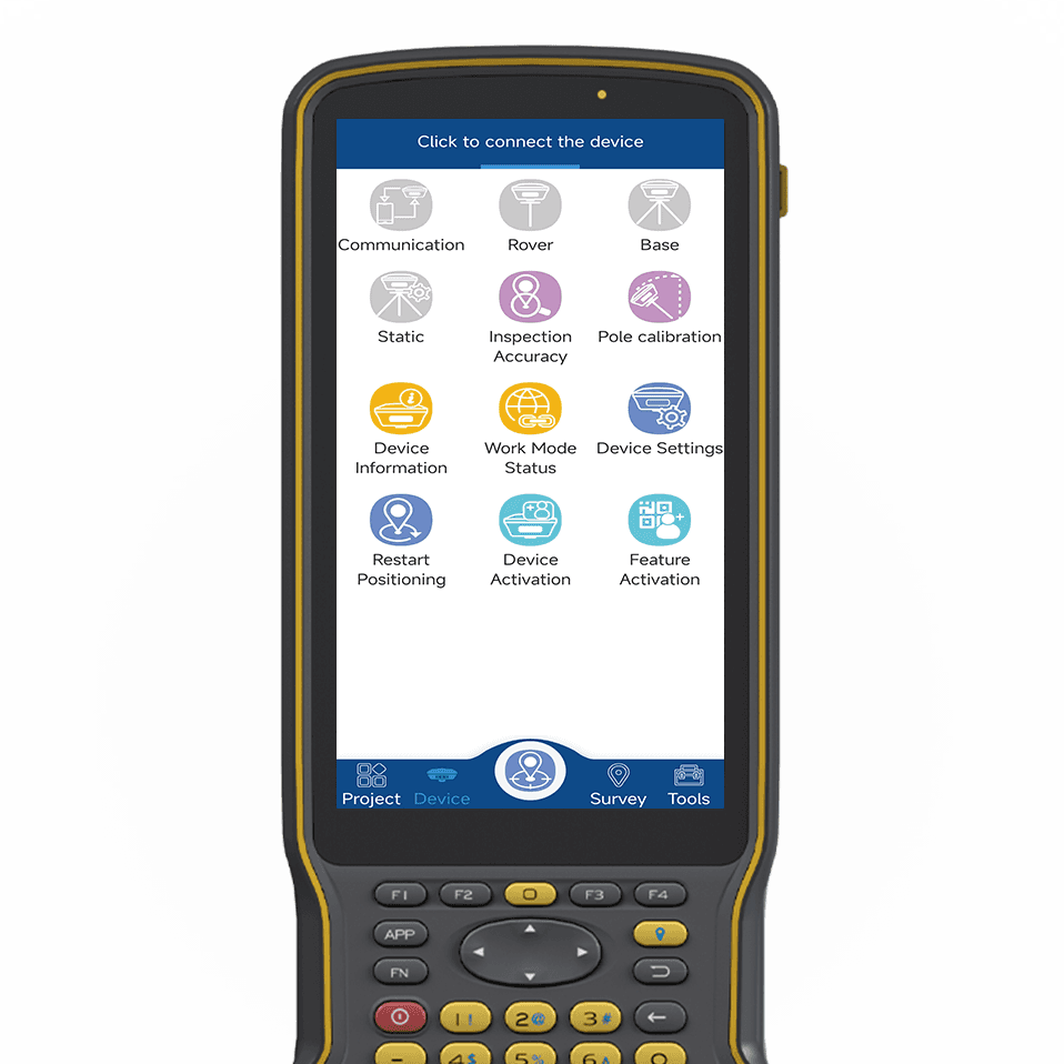
Built for Android and powered by high‑precision GNSS positioning, this professional surveying solution brings intuitive operation and industry‑proven stability to field work. It centers on project‑based management, supporting quick project creation, data sharing, coordinate system setup, and localization calibration. It seamlessly connects to mainstream GNSS receivers, supporting base, rover, and static modes, delivering reliable performance for daily survey tasks and long‑term field projects.
This all‑in‑one tool covers point survey, stakeout, CAD mapping, line stakeout, road design, and power line & tower stakeout. It offers flexible data collection for points, polylines, and polygons, plus on‑site calculation for distance, area, volume, intersection, and resection. It imports and exports multiple file formats, fitting surveying, municipal, transportation, and electric power engineering with high accuracy and strong compatibility.
tSurvey ensures centimeter‑level positioning and stable data output. It supports customizable interfaces, shortcut keys, and multiple differential links including CORS. With easy deployment and professional functions, tSurvey simplifies field workflows and improves efficiency. It is the ideal choice for on-site survey, stakeout, and data management, bringing safe, smart, and efficient performance to digital engineering construction.