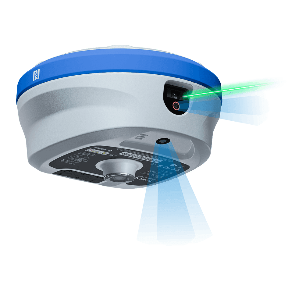
It is a full-featured, high-precision GNSS receiver engineered for surveying and mapping professionals. It integrates a 1408-channel multi-frequency satellite module with an inertial navigation system (INS), delivering centimeter-level RTK accuracy. Beyond traditional positioning, its standout feature is the fusion of AR stakeout and a millimeter-grade laser, enabling visual measurement without physically placing the rod on every point. Encased in a rugged magnesium alloy body, it offers up to 48 hours of continuous operation, making it a versatile tool for demanding field work.
Built on a robust Linux + ARM Cortex-A7 platform, the T30 supports all major satellite systems (GPS, BDS, GLONASS, Galileo). It achieves RTK horizontal accuracy of ±(8mm + 1ppm) and maintains a fast 20Hz update rate for dynamic applications. The device is equipped with 4G cellular connectivity and a powerful 5W data radio, ensuring stable differential data links in diverse environments. With 32GB of internal storage and Bluetooth/WiFi, it efficiently handles large data logs and peripheral connections.
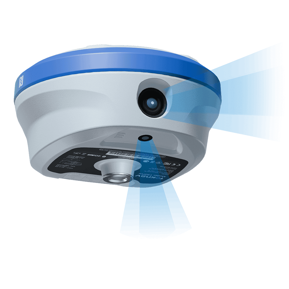
The T 30 transforms complex stakeout tasks through visualization. Its high-definition laser camera allows for precise non-contact distance measurement with an accuracy of 2.5cm within 5 meters. Coupled with the ultra-wide-angle AR camera, surveyors can perform real-time augmented reality plotting directly on the screen. This “see-what-you-survey” capability significantly boosts efficiency in layout and as-built verification, reducing the need for repetitive walking and manual recording.
Designed for all-day fieldwork, the T30 houses a massive 13800mAh battery that lasts over two days on a single charge, supporting USB-PD fast charging. It meets IP68 standards for dust and water resistance and operates reliably in extreme temperatures from -20°C to +60°C. Whether for construction, cadastral surveying, or engineering inspection, the T30 combines durability with intelligent features to streamline your workflow.
T30
Lazer Ölçümü RTK
T30 is a full-featured GNSS receiver designed for long battery life and high precision. It includes an advanced positioning module supporting full-system and multi-frequency satellite signal tracking. Equipped with 4G universal connectivity, Bluetooth, WiFi, a 5W data radio, and a large-capacity battery, it can operate continuously for up to two days on a single charge. The device integrates a high-precision inertial navigation system combined with AR and laser camera technology for AR stakeout and laser measurement, and augmented reality plotting, making surveying tasks more efficient and convenient.
Tam Sistem GNSS Alımı
This product supports all global navigation systems (GPS, BDS, GLONASS, Galileo, QZSS, SBAS, NavIC) via 1408 channels, delivering complete multi-frequency signals.
Integrated 4G and 5W radio enable simultaneous network and radio differential transmission
The rtk features an integrated 4G module and a 5W data radio, enabling simultaneous reception of network and terrestrial RTK corrections for reliable operation.
Built in 13800mAh battery, works for 2 days on a single charge
The rtk’s built-in 13800mAh battery delivers over 48 hours (2+ days) of continuous, high-performance operation on a single charge.
The latest generation IMU technology
The document does not specify the generation of its IMU. It states the product integrates a high-precision inertial navigation system for AR stakeout and tilt correction.
Laser Measurement & AR Real-Time Stakeout
Ürün Parametreleri
Boyut
Φ174.9mm*104.9mm
Ağırlık
1500g
İşletim Sistemi
Kanal
GNSS İzleme
Veri İletişimi
Veri Depolama
Koruma
Çalışma Süresi
Linux
1408
GPS, GLONASS, BDS, GALILEO, QZSS, SBAS ve IRNSS
4G, Bluetooth, WiFi, Radyo
32GB depolama alanı
IP68
48 saat
Elektronik çit sistemi ile donatılmış Toknav ürününün alan kodu kısıtlamaları vardır. Herhangi bir sorun olursa, lütfen belirli ayrıntıları doğrulamak için Toknav veya yerel bayilerle iletişime geçin.