
Unmanned Survey Boat: Efficient Hydrographic Survey with USV
2025-11-06
Unmanned Survey Boat: Efficient Hydrographic Survey with USV
Hydrographic surveying is the core foundation of marine engineering, water conservancy construction, port operation and environmental monitoring, but traditional manual survey methods have long restricted industry efficiency. Manual small vessel surveying exposes staff to extreme weather, rough water and shallow reef risks, with a 30% higher safety hazard rate in complex waters; manual operation efficiency is only 1/4 of unmanned equipment, and labor, vessel maintenance and depreciation costs account for over 60% of the total project budget. Meanwhile, large manual vessels cannot access waters shallower than 0.5m, leaving 20%-35% of key survey areas uncovered. Nowadays, unmanned survey boats have become the optimal replacement for manual methods, and TOKNAV’s hydrographic survey USV relies on high-precision performance and intelligent design, becoming the first choice for efficient marine and inland water survey projects.
Core Advantages of Unmanned Survey Boats
Compared with manual hydrographic survey, marine USV for survey has four irreplaceable core advantages, solving industry pain points with data-backed efficiency and safety:
1. Zero On-Site Risk, 100% Personnel Safety
Unmanned survey boats realize full remote control, keeping surveyors ashore to avoid drowning, capsizing and collision risks. Even in level 5 wind offshore waters or narrow inland tributaries, the USV can complete tasks independently, reducing safety accidents to zero and cutting equipment loss caused by misoperation by 90%.
2. 70% Higher Efficiency, Shortened Project Cycle
TOKNAV unmanned survey boats support 6-7 hours of continuous operation at 1.5m/s economical speed, with a maximum speed of 7m/s. Equipped with intelligent route planning, it covers 15km² water areas in 8 hours, completing manual 5-day tasks in 1.5 days, improving overall survey efficiency by over 70% and compressing project cycles effectively.
3. 40% Cost Reduction, Optimized Budget
Traditional manual survey needs professional vessels and full-time crews, with annual maintenance costs exceeding $8000. TOKNAV USV features low power consumption and minimal maintenance, eliminating labor costs and reducing vessel depreciation, cutting total survey costs by over 40% for long-term projects without sacrificing data accuracy.
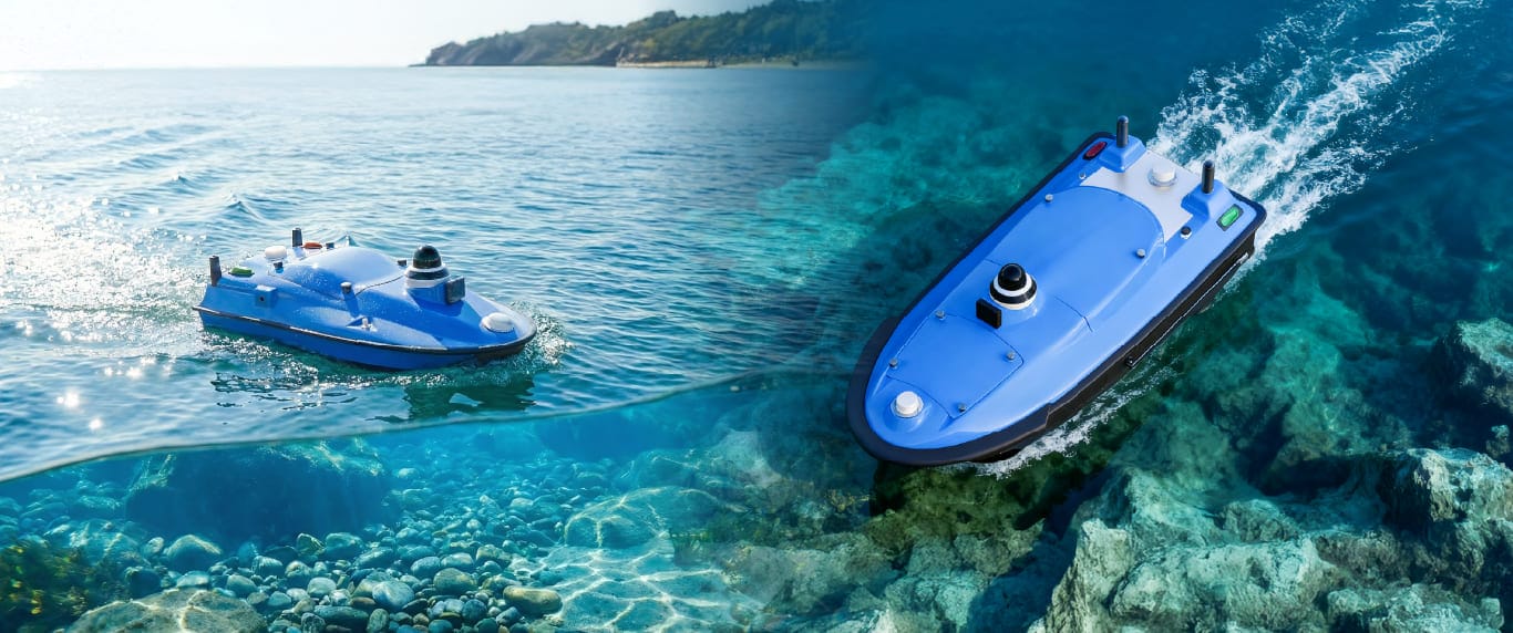
4. Ultra-Shallow Draft, Full-Coverage Survey
Manual vessels fail to navigate waters shallower than 0.5m, while TOKNAV Tboat10 has an 8.5cm ultra-shallow draft, Tboat20 a 10cm draft, smoothly accessing shallow lakes, tidal flats and port shallow areas. It realizes 100% full-coverage survey, eliminating blind spots in restricted water environments.
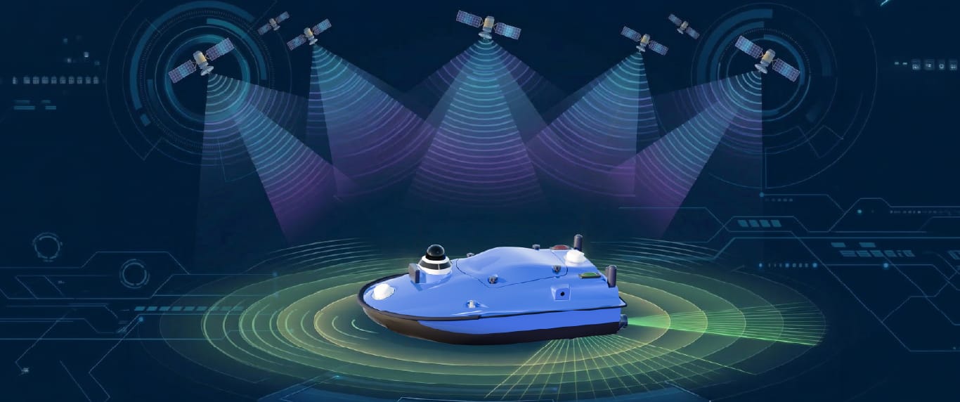
High-Precision Positioning: USV + GNSS RTK Working Principle
High-precision hydrographic survey relies on centimeter-level positioning, and TOKNAV unmanned survey boat integrates advanced GNSS RTK technology to lock data accuracy. The USV is equipped with dual multi-frequency GNSS antennas, supporting BDS, GPS, GLONASS and GALILEO full-system tracking, with RTK horizontal accuracy of ±8mm +1ppm and vertical accuracy of ±15mm +1ppm.
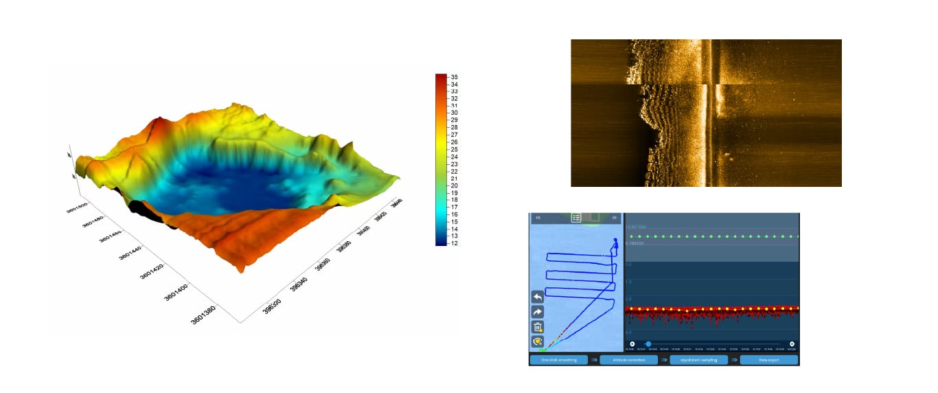
Paired with 0.01m resolution echo sounders, the USV synchronizes positioning and underwater topographic data in real time, collecting 120 sets of data per second. Even in signal-shielded bridge areas, the built-in inertial navigation maintains stable operation, ensuring continuous and reliable data output for high-precision survey reports.
TOKNAV Unmanned Survey Boat: Core Technical Features
TOKNAV Tboat10 and Tboat20 series hydrographic survey USV are tailored for survey scenarios, with hard-core data to support efficient work: Tboat10 adopts carbon fiber hull with 35kg payload, Tboat20 uses composite hull with 50kg payload and IP67 waterproof rating; dual lithium batteries support hot-swap, 3 hours at 2m/s and 7 hours at 1.5m/s endurance; 0.1-20m radar obstacle avoidance, tSail software supports one-key route planning and homing, realizing easy intelligent operation.
Image Caption: TOKNAV USV Core Parameter & Hull Structure Detail Display – Present the close-up of the USV reinforced hull, anti-collision strips and battery compartment, and list key technical parameters in a visual form for quick reading.
Wide Applications of TOKNAV Marine USV for Survey
TOKNAV unmanned survey boats adapt to diversified survey scenarios, covering core industry demands with practical performance:
- Dredging Survey: Monitor water depth changes before and after dredging, control error within ±0.02m, ensure construction compliance;
- Lake & Reservoir Survey: Conduct topographic and sedimentation survey for 10km²+ water areas, support long-term ecological monitoring;
- Port & Waterway Monitoring: Daily channel patrol, obstacle detection, guarantee 24/7 navigation safety;
- Underwater Terrain Mapping: Cooperate with sonar equipment to draw high-precision underwater topographic maps for engineering construction.
Practical Case: Inland River Hydrographic Survey
A water conservancy bureau needed to survey a 15km² inland river with 0.1-0.3m shallow sections. Manual vessels couldn’t access shallow areas, and the 5-day planned cycle was tight. After deploying TOKNAV Tboat10, the 8.5cm draft navigated all waters smoothly; the USV operated continuously for 6 hours, collecting 50000+ valid data sets with centimeter-level accuracy. The project was completed in 1.5 days, with 100% coverage and zero safety risks, providing reliable data for river management.
Conclusion & Call to Action
Unmanned survey boats have revolutionized hydrographic surveying, replacing manual methods with safety, efficiency and cost advantages. TOKNAV unmanned survey boat series integrates high-precision positioning, intelligent control and strong adaptability, meeting all-round demands of marine and inland water survey.
For dredging, lake survey, port monitoring and other projects, TOKNAV USV delivers efficient and accurate survey services. Explore more models: Check Out TOKNAV USV Series
Contact TOKNAV now to upgrade your survey workflow, and enjoy smarter, more precise hydrographic survey solutions!