
TOKNAV TSR20 El Tipi LiDAR Tarayıcı Derinlemesine İnceleme
2026'da Yüksek Hassasiyetli Haritalama için Nihai Çözüm
Hantal geleneksel anket araçları, yetersiz veri doğruluğu ve iç ve dış mekan çalışmaları arasındaki zayıf uyumluluk sizi yavaşlatıyor mu?
Üç aylık titiz saha testlerine dayanan TOKNAV TSR20 El Tipi LiDAR Tarayıcı, taşınabilir 3D haritalamayı yeniden tanımlıyor. Bu inceleme, ultra hafif 1,0 kg tasarımı, ≤3 cm bağıl doğruluğu ve çok modlu haritalama özelliklerinin kritik endüstri zorluklarının üstesinden nasıl geldiğini ayrıntılarıyla anlatıyor. Ayrıca, karar verme sürecinizi desteklemek için yeraltı tesislerinin tespiti için Yeraltına Nüfuz Eden Radarın entegre edilmesinden enerji hattı araştırmaları için GPS RTK'dan yararlanmaya kadar özel uygulama örneklerine yer veriyoruz.
Üç aylık titiz saha testlerine dayanan TOKNAV TSR20 El Tipi LiDAR Tarayıcı, taşınabilir 3D haritalamayı yeniden tanımlıyor. Bu inceleme, ultra hafif 1,0 kg tasarımı, ≤3 cm bağıl doğruluğu ve çok modlu haritalama özelliklerinin kritik endüstri zorluklarının üstesinden nasıl geldiğini ayrıntılarıyla anlatıyor. Ayrıca, karar verme sürecinizi desteklemek için yeraltı tesislerinin tespiti için Yeraltına Nüfuz Eden Radarın entegre edilmesinden enerji hattı araştırmaları için GPS RTK'dan yararlanmaya kadar özel uygulama örneklerine yer veriyoruz.

TSR20 Sektörün Temel Sorun Noktalarını Nasıl Ele Alıyor?
Sorun Noktası 1: Hantal Ekipmanlardan Kaynaklanan Düşük Verimlilik
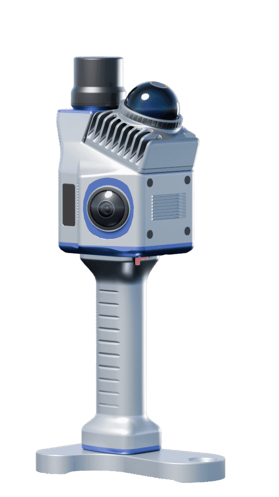
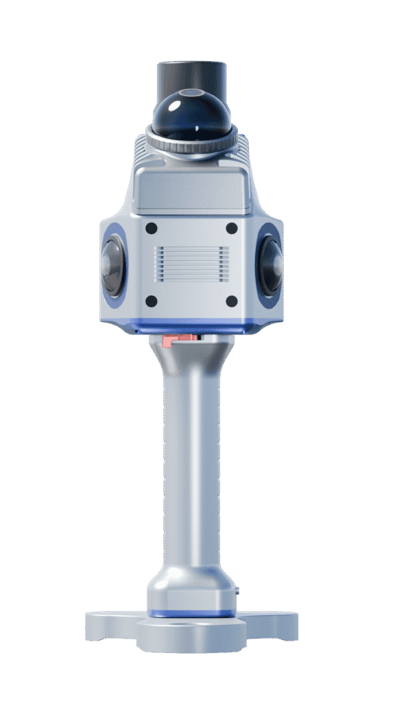
Genellikle 10 kg'ı aşan ve tripod gerektiren geleneksel statik tarayıcıların aksine, TSR20 kompakt boyutlarıyla (16,5×12,0×32,4 cm) yalnızca 1,0 kg ağırlığındadır ve gerçek anlamda tek elle kullanıma olanak sağlar. Bu taşınabilirlik, verimli otomatik taramayı kolaylaştırır. Sonuç olarak, testlerimiz tek kişilik günlük çıktıda 50%'lik bir artış kaydetti. Özellikle, test katılımcıları merdiven boşluklarında iki saatlik sürekli kullanımdan sonra bile sıfır yorgunluk bildirdiler.
Sorun Noktası 2: Karmaşık Ortamlarda Eksik Veri Yakalama
Livox Mid-360 LiDAR sensörü, 40 m menzil ve 200.000 pts/sn alım hızı ile donatılan TSR20, düşük ışıklı veya karmaşık sahnelerde kapsamlı ayrıntı yakalama sağlar. Örneğin, ormancılık araştırmaları sırasında, yoğun kanopiler altında nokta bulutu kayıp oranı 5%'nin altında kalmıştır.
Sorun Noktası 3: Doğruluk ve Hız Arasındaki Ödünleşme
Tarayıcının çok modlu haritalaması (SLAM/RTK-SLAM/PPK-SLAM), hassasiyet ve hızı dengelemek için sorunsuz geçiş sağlar:
- SLAM Modu:İç mekanlar gibi GNSS'den mahrum alanlarda ≤5 cm mutlak doğruluğu korur.
- RTK-SLAM Modu:TOKNAV Net660i baz istasyonu ile eşleştirildiğinde ≤2 cm dış mekan doğruluğu elde eder.Gerçek dünyadaki bir bina cephesi araştırmasında hata payı sadece ±1,5 cm'dir - sektör ortalaması olan ±5 cm'yi önemli ölçüde aşmaktadır
Temel Özellikleri Yorumlama: Veri Odaklı Profesyonel Rehber
TSR20’nin teknik özellikleri ölçülebilir, gerçek dünya güvenilirliğine dönüşür. İşte önemli çıkarımlar:
Güvenebileceğiniz Doğruluk
Bir BIM projesinde, ≤3cm bağıl doğruluğu LOD 300 (ayrıntılı tasarım) gereksinimlerini karşılamıştır. Ayrıca, ISO 17123-5 uyarınca yapılan üçüncü taraf testleri 98%'ye kadar yüksek bir hata dağılımı konsantrasyonu göstermiştir.
Hareket Halinde Üstün Stabilite
200Hz POS güncelleme hızı, yüksek dinamik tutum doğruluğu sağlar (Pitch: 0,05°, Heading: 0,03°). TSR20, 100Hz sistem kullanan rakipleriyle karşılaştırıldığında hareket titreşim hatasını yaklaşık 60% azaltır.
Zorlu İşler için Daha Uzun Dayanıklılık
25W düşük güç tasarımıyla 4 saatlik çalışma süresini destekler ve çift pilli bir paketle 8 saate kadar uzatılabilir. 10°C'lik bir testte bile nokta bulutu kare kaybı oranı <0,1%'dir ve çoğu rakipten daha iyi performans gösterir (ortalama 3%).
Profesyonel ipucu:Yeni başlayanlar SLAM modu ile başlamalı, santimetre düzeyinde sonuçlar arayan profesyoneller ise RTK-SLAM'a öncelik vermelidir.
Uygulama Örnekleri: Gerçek Dünya Problemlerini Çözme
Bu vakalar, veriler ve operasyonel ipuçları ile birlikte aktif projelerden gelmektedir.
- Vaka 1: Maden Güvenliği için Yeraltı Alan Araştırması
- Meydan okuma:GPS sinyali arızası, tünel deformasyonunun izlenmesinde kritik veri boşluklarına neden olmuştur.
- Çözüm:Yüksek penetrasyonlu lazerlerle SLAM modunun kullanılması, yer değiştirme analizi için ayrıntılı bir 3D model oluşturdu.
- Sonuç:100 metrelik bir tünel segmenti 30 dakika içinde taranarak erken tehlike uyarıları için 95% hassasiyet elde edildi.


Örnek 2: Daha Güvenli, Daha Verimli Enerji Hattı Denetimi
- Meydan okuma:Geleneksel yüksek irtifa manuel denetimleri hem maliyetli hem de risklidir.
- Teknik:Çift 20MP kamera senkronize görüntü yakalama ve otomatik hasar tespiti sağlar.
- Etki:Bir 2025 Yeşil Şebeke projesinde 70% daha düşük işçilik maliyeti ve üç kat daha fazla denetim verimliliği rapor edilmiştir.
Vaka 3: Mirasın Korunması için Dijitalleşmenin Oluşturulması
- İnovasyon:TSR20 nokta bulutlarının tarihi arşivlerle birleştirilmesi, mimari evrimin yeniden yapılandırılmasına yardımcı olur.
- Sonuç:Hangzhou'daki bir Qing Hanedanlığı konutunda yapılan taramalar gizli yapısal çatlakları ortaya çıkararak restorasyon planları için sağlam bir temel oluşturdu.

Başlarken: Pratik, Tekrarlanabilir Bir İş Akışı
Optimal Mod Seçim Stratejisi
- Kapalı Alanlar/Yeraltı için:SLAM modunu kullanın (GNSS gerekmez).
- Açık Hava İçin:Maksimum doğruluk için RTK-SLAM'ı etkinleştirin.
- Önemli Kaçınma:Veri atlamalarını önlemek için sinyal engellenmiş alanlarda RTK modunu zorlamayın.
Etkili Veri Toplama Teknikleri
- Yaklaşık 0,5 m/s'lik sabit bir yürüme hızını koruyun ve engellerin etrafından dikkatlice dolaşın.
- Hedefin tam olarak kapsandığından emin olmak için gerçek zamanlı önizleme için bir telefon yuvası kullanın.
İşlem Sonrası Optimizasyon İpuçları
- Gürültüyü etkili bir şekilde azaltmak için otomatik filtreleme için PointCloudCreator gibi bir yazılım kullanın.
- Ana akım BIM platformlarıyla sorunsuz uyumluluk sağlamak için verileri .las formatında dışa aktarın.
Ölçme Zorluklarınızı Birlikte Çözüyoruz
TSR20 bir araçtan daha fazlasıdır; akıllı ölçme için bir katalizördür. Taşınabilirlik, çevresel uyarlanabilirlik ve entegre bir iş akışını uyumlu hale getirerek, aşağıdaki kritik üçgeni dengeler doğruluk, verimlilik ve maliyet.
Ekipmanı değerlendiriyorsanız, yorumlarda özel senaryonuzu paylaşın (örneğin, “Maden izleme için en iyi mod hangisidir?”) ve size özel tavsiyelerde bulunalım.