
Software
Software
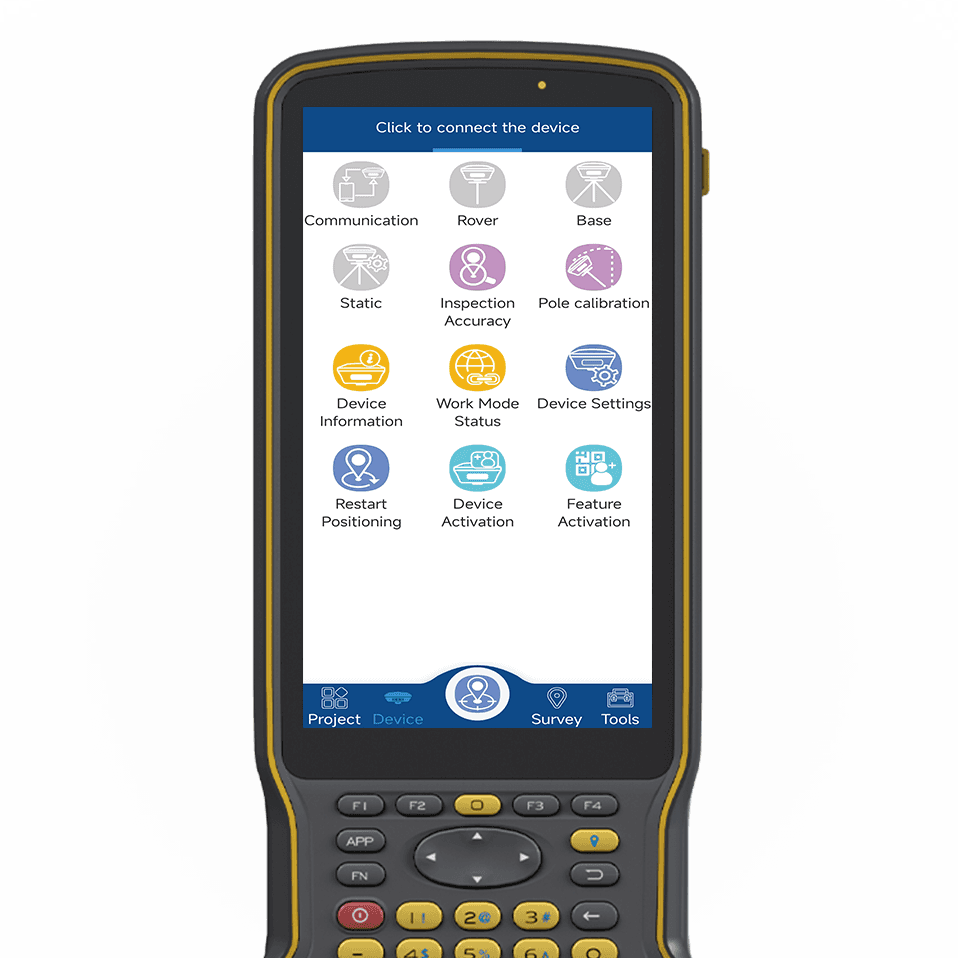
GNSS surveying and mapping software based on years of market experience, it combines the functions of surveying and mapping data acquisition with the functions of RTK control and acquisition, road design and lofting. The software has humanized operation flow, more excellent graphical interaction and more powerful functions.

tSurvey Software
Software de engenharia topográfica
tSurvey2.0 Software
Software de topografia industrial
tInquérito
Software de engenharia topográfica
tSurvey2.0
Software de topografia industrial
Software FieldGenius
Recolha de dados fácil de utilizar
Apglos Software
The Ultimate Land Survey App
FieldGenius
Recolha de dados fácil de utilizar
Apglos
The Ultimate Land Survey App