TMC20
Excavator Guidance System
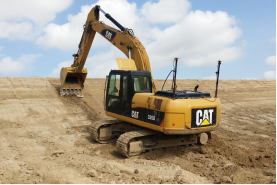
TMC20 is an efficient excavator guidance system using BeiDou satellite positioning to provide real-time graphical and numerical information. It is suitable for projects like underwater riverbed excavation, riverbed dredging, riverbank slope trimming, and high-speed track construction. The system reduces on-site personnel, achieves one-person-one-machine operation, lowers labor costs, and enhances construction quality and efficiency.
TMC20
Excavator Guidance System
TMC20 is an efficient excavator guidance system using BeiDou satellite positioning to provide real-time graphical and numerical information. It is suitable for projects like underwater riverbed excavation, riverbed dredging, riverbank slope trimming, and high-speed track construction. The system reduces on-site personnel, achieves one-person-one-machine operation, lowers labor costs, and enhances construction quality and efficiency.
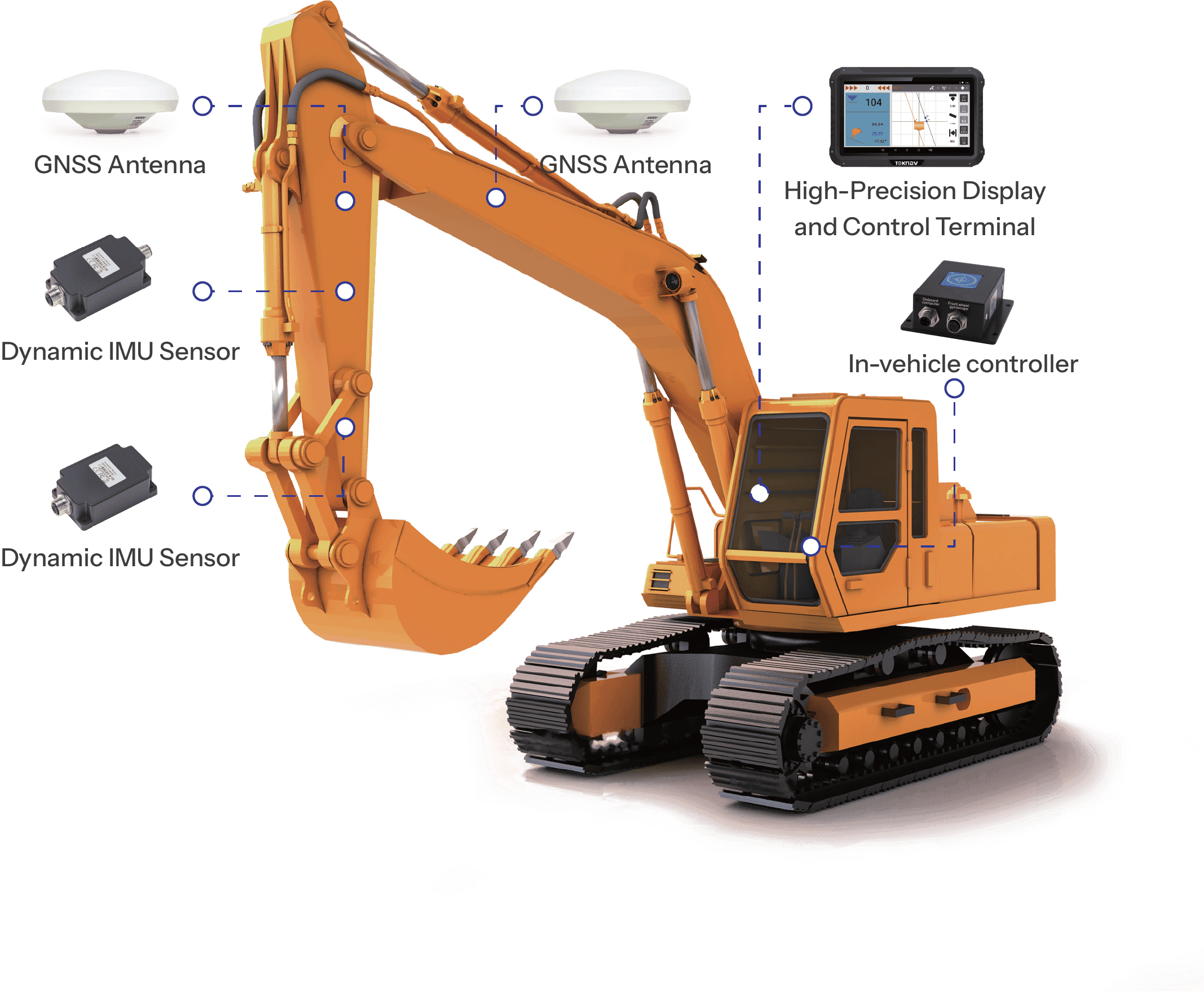
Architettura del sistema
Caratteristiche del sistema

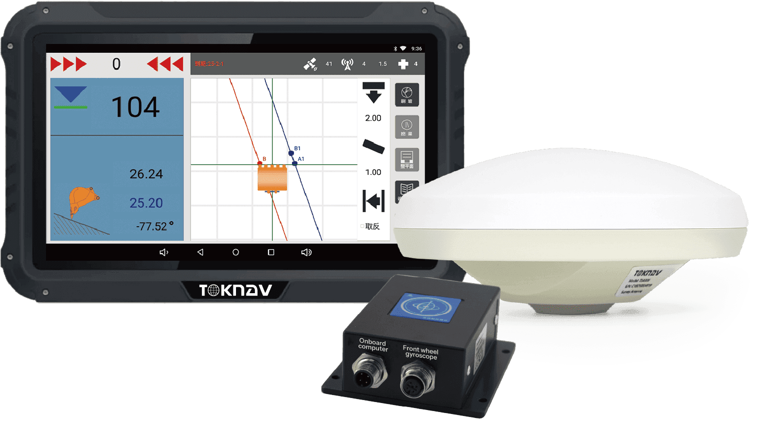
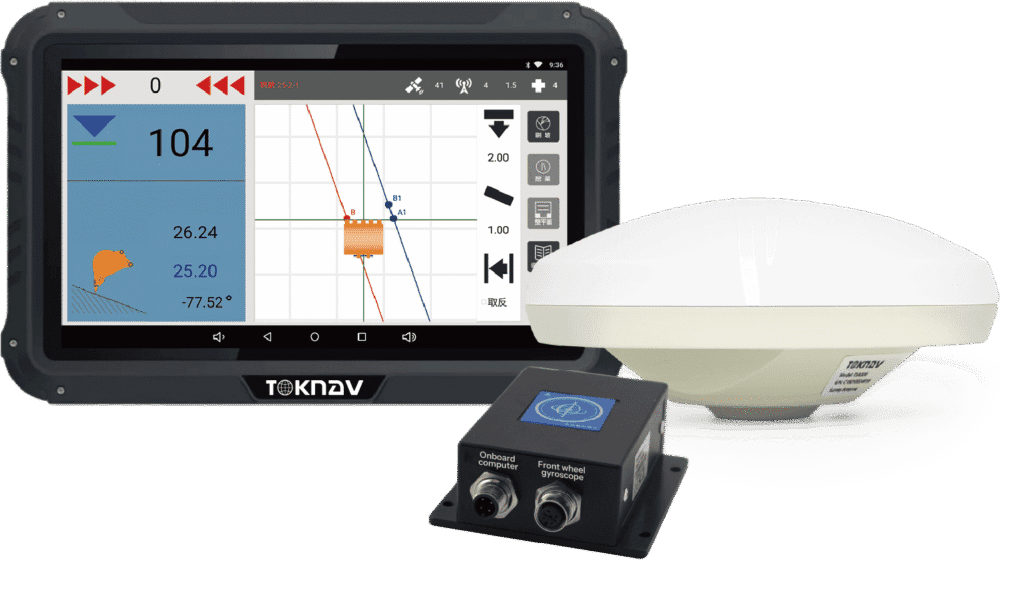
Schermo intelligente ad alta precisione
Il suo schermo ad alta risoluzione e luminosità garantisce una chiara visibilità, rendendolo perfetto per diversi ambienti di lavoro.

Dynamic IMU Sensor

Alta precisione
The high-precision guidance system reduces the risk of rework caused by under-digging or over-digging.

Multi-Scenario Application
Using inertial navigation, tilt sensing, and centimeter-level positioning, it provides precise construction guidance in various conditions.

Simple and Efficient

Intelligence
The system can automatically calculate the area, making the working area clear at a glance.
Schermo intelligente ad alta precisione
Il suo schermo ad alta risoluzione e luminosità garantisce una chiara visibilità, rendendolo perfetto per diversi ambienti di lavoro.
Multi-Scenario Application
Using inertial navigation, tilt sensing, and centimeter-level positioning, it provides precise construction guidance in various conditions.
Dynamic IMU Sensor
This sensor offers high precision and consistency in motion sensing, along with an ultra-wide temperature range.
Simple and Efficient
Excavator operators can complete fill and dig operations with real-time guidance of the system.
Alta precisione
The high-precision guidance system reduces the risk of rework caused by under-digging or over-digging.
Intelligence
The system can automatically calculate the area, making the working area clear at a glance.
Area di applicazione

Trench Excavation

Operazioni di costruzione
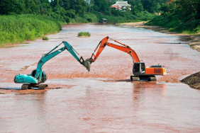
River Channel Excavation

Slope Trimming
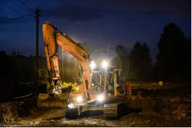
Operazioni notturne