
TOKNAV Hydrographic Survey Equipment: Professional Solutions for Precise Underwater Mapping
2026-03-16
Introduction: Core Value of Hydrographic Survey & Equipment
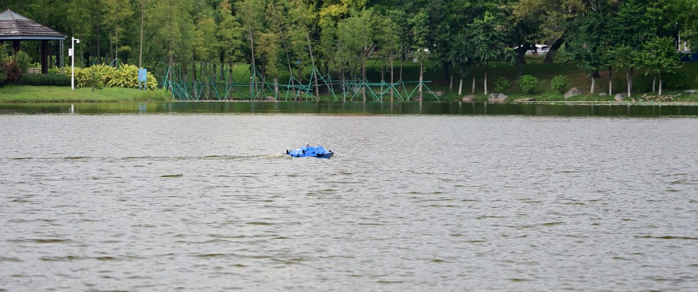
TOKNAV hydrographic survey equipment in field operation for precise water mapping
Core Hydrographic Survey Equipment & TOKNAV Applications
1. Marine Survey USV: TOKNAV Tboat10 & Tboat20 Series
2. Echo Sounder: High-Precision Depth Measurement
3. GNSS RTK Receiver: Centimeter-Level Positioning Core
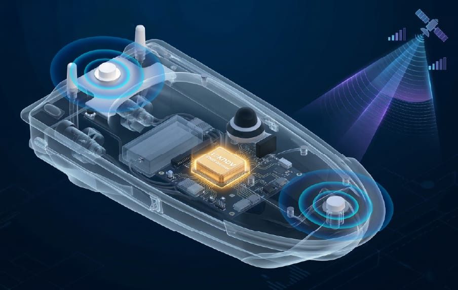
TOKNAV GNSS RTK receiver – centimeter-level positioning core for hydrographic survey equipment
Build a Professional Hydrographic Survey Kit
Build a tailored kit by matching gear to project scale and environment: choose Tboat10 for small inland surveys, Tboat20 for large offshore projects. Integrate factory-calibrated echo sounders and RTK receivers for seamless compatibility, add 4G/2.4G communication modules, long-endurance remote batteries and IP67 enclosures for harsh conditions. TOKNAV’s plug-and-play design simplifies deployment, and dedicated software converts raw data into actionable charts and 3D models, eliminating compatibility gaps and boosting efficiency.
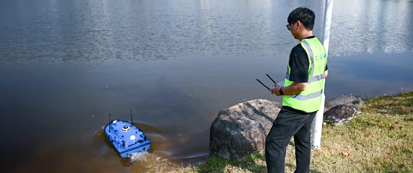
Complete TOKNAV hydrographic survey equipment kit assembly guide
TOKNAV Integrated Hydrographic Survey Solutions
TOKNAV integrated hydrographic survey equipment solution for practical water mapping projects
TOKNAV provides fully integrated, plug-and-play hydrographic survey solutions, merging USVs, echo sounders and RTK receivers into a unified workflow. Pre-calibrated and pre-configured, the systems cut deployment time and training costs, with intelligent features like one-touch control and hot-swap batteries for nonstop operation. Compliant with global standards and backed by professional support, TOKNAV equipment helps teams deliver high-quality, compliant data efficiently, making it a trusted choice for survey professionals worldwide.
European Compliance & Standards
European hydrographic projects adhere to strict IHO S-44 bathymetric standards, EU maritime safety rules and environmental directives, requiring centimeter-level positioning, high-resolution measurement and low-impact design. TOKNAV hydrographic survey equipment meets and exceeds these standards: RTK receivers hold certified precision, echo sounders pass rigorous calibration, and Tboat USVs feature IP67 waterproofing, low noise and eco-friendly materials. Full compliance ensures smooth project approval and avoids costly reworks for European surveys.
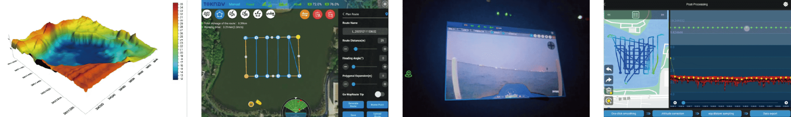
Complete Hydrographic Survey Workflow
1. Pre-Survey Planning: Define project scope, survey area, and accuracy requirements; select TOKNAV hydrographic survey equipment(Tboat10 for small projects, Tboat20 for large-scale); calibrate GNSS RTK and echo sounder; program USV routes via tSail software.
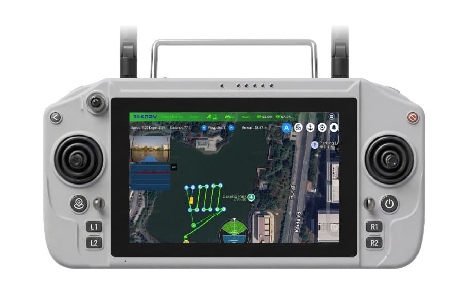
2. Field Deployment & Data Collection: Launch the TOKNAV marine USV, activate autonomous mode; collect real-time depth data via echo sounder and RTK positioning; monitor operations via 360° night vision camera and remote control (1200-nit sunlight-readable display).
3. Data Processing & Validation: Transfer raw data to TOKNAV software; filter noise, correct tide levels, and integrate datasets; validate against IHO S-44 and EU standards to ensurehydrographic survey equipmentdata compliance.
4. Reporting & Deliverables: Generate high-precision hydrographic charts, 3D seabed models, and depth contour maps; compile compliance reports and project documentation for client submission.
TOKNAV hydrographic survey project workflow with professional hydrographic survey equipment
Conclusion