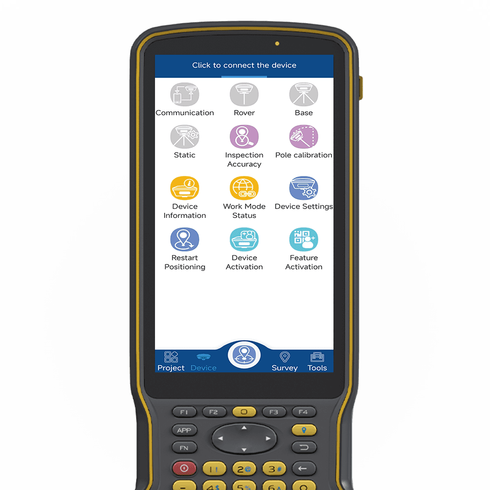
tSurvey ist eine modulare, anpassbare, einfach zu bedienende Vermessungssoftware, die auf Basis von Android entwickelt wurde. Sie integriert eine Reihe praktischer Mess- und Absteckfunktionen aus verschiedenen Branchen, darunter Passpunktvermessung, Vermessung und Kartierung, CAD-Kartierung, Punktabsteckung, Linienabsteckung, Polygonabsteckung, Straßenabsteckung, Absteckung elektrischer Leitungen, Absteckung von Strommasten, GIS-Datenerfassung und mehr. Mit einer leistungsstarken Grafik-Engine und einem hochoptimierten Koordinatentransformationssystem bietet es dem Anwender ein unvergleichliches Vermessungserlebnis.
tSurvey
Software für Ingenieurvermessung
tSurvey ist eine modulare, anpassbare, einfach zu bedienende Vermessungssoftware, die auf Basis von Android entwickelt wurde. Sie integriert eine Reihe praktischer Mess- und Absteckfunktionen aus verschiedenen Branchen, darunter Passpunktvermessung, Vermessung und Kartierung, CAD-Kartierung, Punktabsteckung, Linienabsteckung, Polygonabsteckung, Straßenabsteckung, Absteckung elektrischer Leitungen, Absteckung von Strommasten, GIS-Datenerfassung und mehr. Mit einer leistungsstarken Grafik-Engine und einem hochoptimierten Koordinatentransformationssystem bietet es dem Anwender ein unvergleichliches Vermessungserlebnis.
Ein umfassender Koordinatenrahmen mit verschiedenen Projektionsmethoden ermöglicht den Einsatz auf der ganzen Welt
Leistungsstarke und umfassende Funktionen wie Punktvermessung, Polygonvermessung, Punktabsteckung, Linienabsteckung, GIS-Datenerfassung, CAD-Kartierung und mehr.
Hochgradig optimierte Grafik-Engine und schnelles Laden für CAD-Zeichnungen
Mit exklusiver interaktiver Erfahrung versteht es jeden Ihrer Schritte und ist immer Ihre Hilfe
Ausgezeichnete Kompatibilität, jedes Android-Gerät kann problemlos installiert und ausgeführt werden
Mit einer bewährten Erfolgsbilanz in der Vermessungsbranche suchen wir jetzt nach leidenschaftlichen Vertriebsmitarbeitern, die an unserer globalen Erfolgsgeschichte teilhaben möchten.